Basilicata · Matera
Stigliano
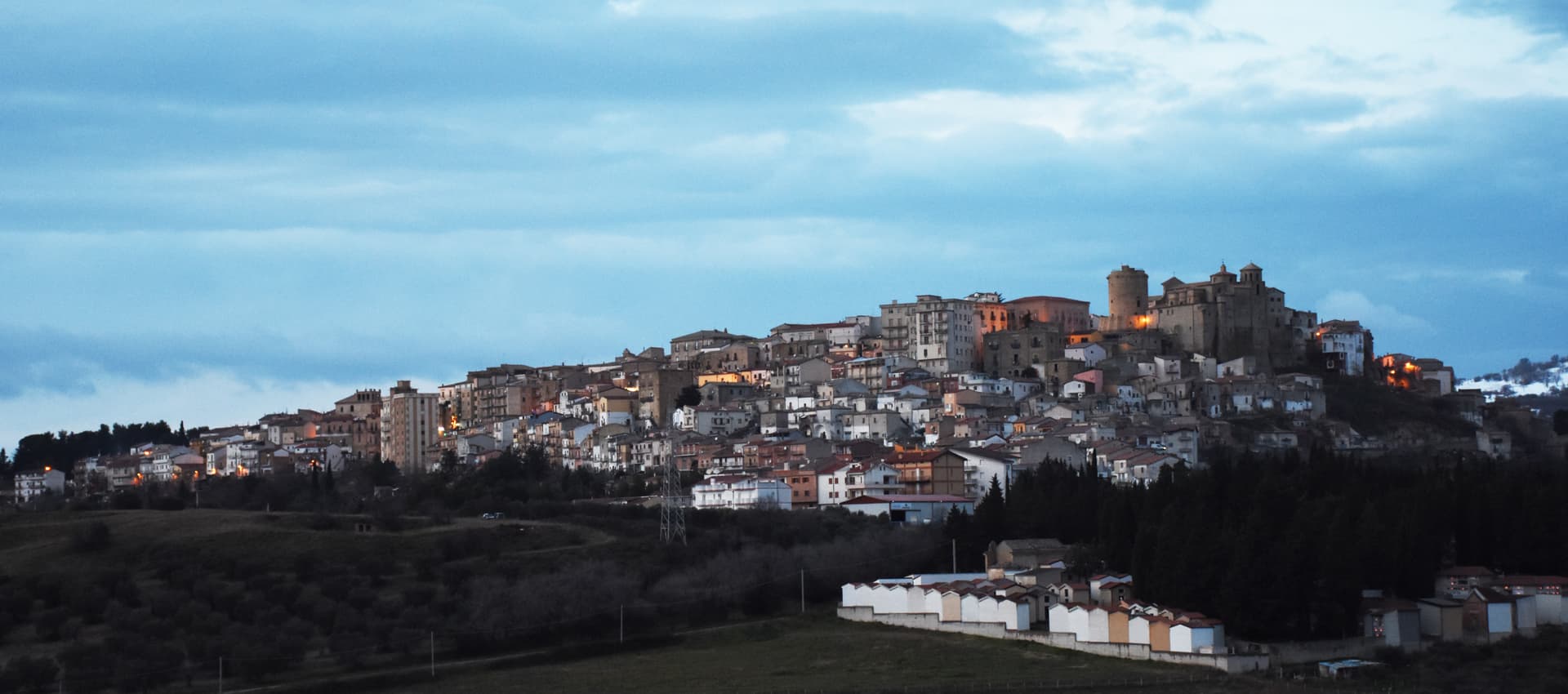
At 909 meters on the northern edge of the Lucanian calanchi, the highest commune in Matera province, Basilicata's capital under the Spanish Medina from 1556.
Known for
CALANCHI
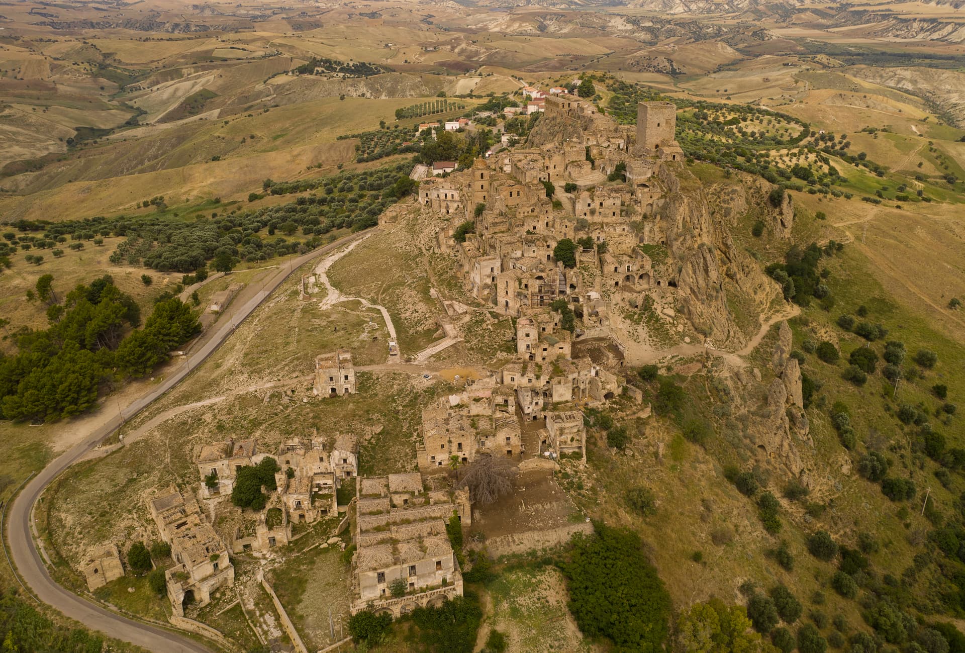
Northern wall of the Lucanian clay badlands, lunar eroded ridges running south to Aliano, Craco and the Cavone.
MEDINA CAPITAL
Made capital of the Basilicata province by the Spanish Dukes of Medina from 1556, after passing from the Carafa fief in the sixteenth century.
HIGHEST IN MATERA
At 909 meters, the highest commune in the province of Matera, ridge town with 209 km² of territory across the calanchi.
When to visit
Best · May–Oct
- J
- F
- M
- A
- M
- J
- J
- A
- S
- O
- N
- D
- Best
- Hot or crowded
- Quiet
- Mostly closed
The festa: Antonio di Padova, 13 June
Why come
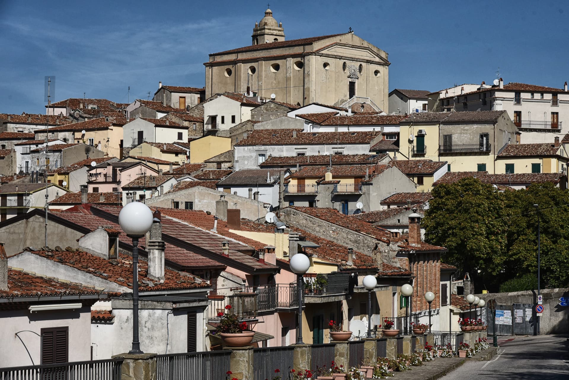
Stigliano sits at 909 meters on a ridge in the Collina Materana, the highest commune in the province and the northern wall of the Lucanian calanchi, the lunar clay badlands that run south through Aliano and Craco to the Cavone. The town was founded by the Lucani, taken by Greek Metaponto, owned in the imperial period by the Roman Hostilii. The Carafa of Naples acquired it in 1289.
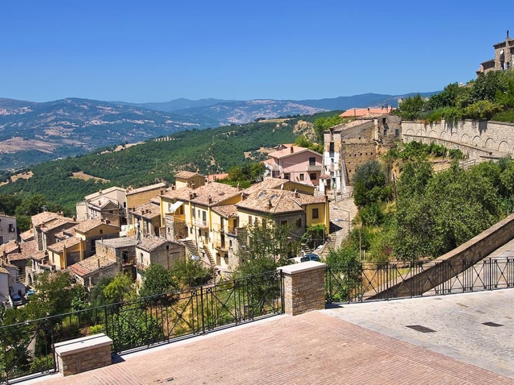
In 1556 the fief passed to the Spanish Dukes of Medina, who made Stigliano the capital of the Basilicata province for a time. The Chiesa Madre dell'Assunta, with a seventeenth-century nucleus, holds a 1520 polyptych by Simone da Firenze and an early-fifteenth-century Sant'Anna by a Neapolitan master. Stigliano sits on the Via dei Calanchi cycle and walking circuit, linked to Aliano (the Carlo Levi village), Cirigliano and Ferrandina along the eroded clay ridges.
The Sunday letter
We haven’t written Stigliano’s letter yet.
One town every Sunday, with the photo, the food, the festa. Be there when this one comes up. Free, by Peter & Sophia from Pietrasanta.
By subscribing you agree to Substack’s Terms of Use, our Privacy Policy and our Information collection notice.


What to see
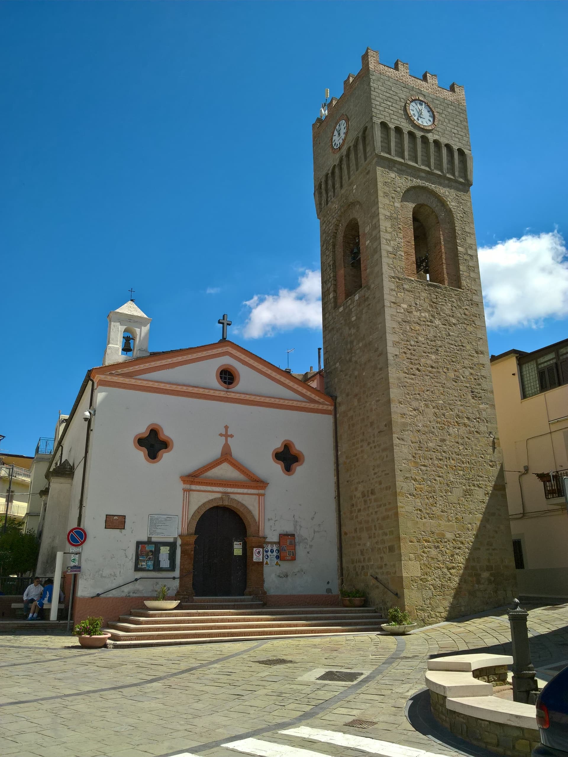
Chiesa Madre dell'Assunta
Mother church with seventeenth-century nucleus, houses a 1520 polyptych by Simone da Firenze and an early-fifteenth-century Sant'Anna by a Neapolitan master.
Convento di Sant'Antonio
Seventeenth-century Baroque façade with an unusual Arabic-style dome, anchor of the upper centro storico above the Lucanian calanchi.
Castello e mura
Ruins of the historic castle and surviving stretches of the medieval town walls, anchor of the Carafa, then Medina period of the fief.
Centro storico
Stone-built medieval and early-modern core at 909 meters, narrow alleys and small piazze on the ridge above the calanchi.
Via dei Calanchi
Cycling and walking circuit through the Lucanian clay badlands linking Stigliano with Cirigliano, Aliano and Ferrandina along the eroded ridges.
The slow-trip planner
Building a trip? Find where Stigliano fits in a slow Italy circuit.
Answer five questions. We will shape a geographically coherent slow trip from the 1,000 Italian towns most travelers skip. Yours to save and share.
Living here
- Population 3,584
- Very remotei
- Pharmacy in town
- High school within a 30-minute drive
- Nearest airport Bari / Brindisi, 2 h 16 min drive
- Regional capital Potenza, 1 h 29 min drive
Tags & datadesignations · numbers · sources
The numbers
- Elevation: 909 m
- Population: 3,584
- Surface area: 211.15 km²
These figures were compiled from public directories — ISTAT, OpenStreetMap, Wikidata — and from the official listings of the guides named on this page. Town details change; verify with official sources before you travel.
Close by
More towns near Stigliano
Craco
Province: Matera
A medieval ghost town on a 391-meter clay cliff, abandoned after the 1963 landslide and the 1980 Irpinia earthquake, filming location of Gibson and Bond.
Accettura
Province: Matera
A 770-meter village in the Gallipoli Cognato park where, each Pentecost, a Turkey oak is married to a holly tree.
Aliano
Province: Matera
The clay-hill village at 555 meters above the Agri valley where Carlo Levi served his 1935 exile and is buried in the cemetery.
San Mauro Forte
Province: Matera
A 540-meter Lucanian hill town built around a surviving Norman tower, where the Sagra dei Campanacci on 16 January wakes the village with cowbells.
Guardia Perticara
Province: Potenza
The stone village at 678 meters above the Sauro valley, rebuilt block by block in Gorgoglione sandstone after the 1980 earthquake.