
Sicily · Palermo
Gangi
A Madonie hill town stacked down Monte Marone at 1,011 meters, RAI's Borgo dei Borghi 2014 and the launching pad for the one-euro-house programme.
Known for
BORGO DEI BORGHI 2014
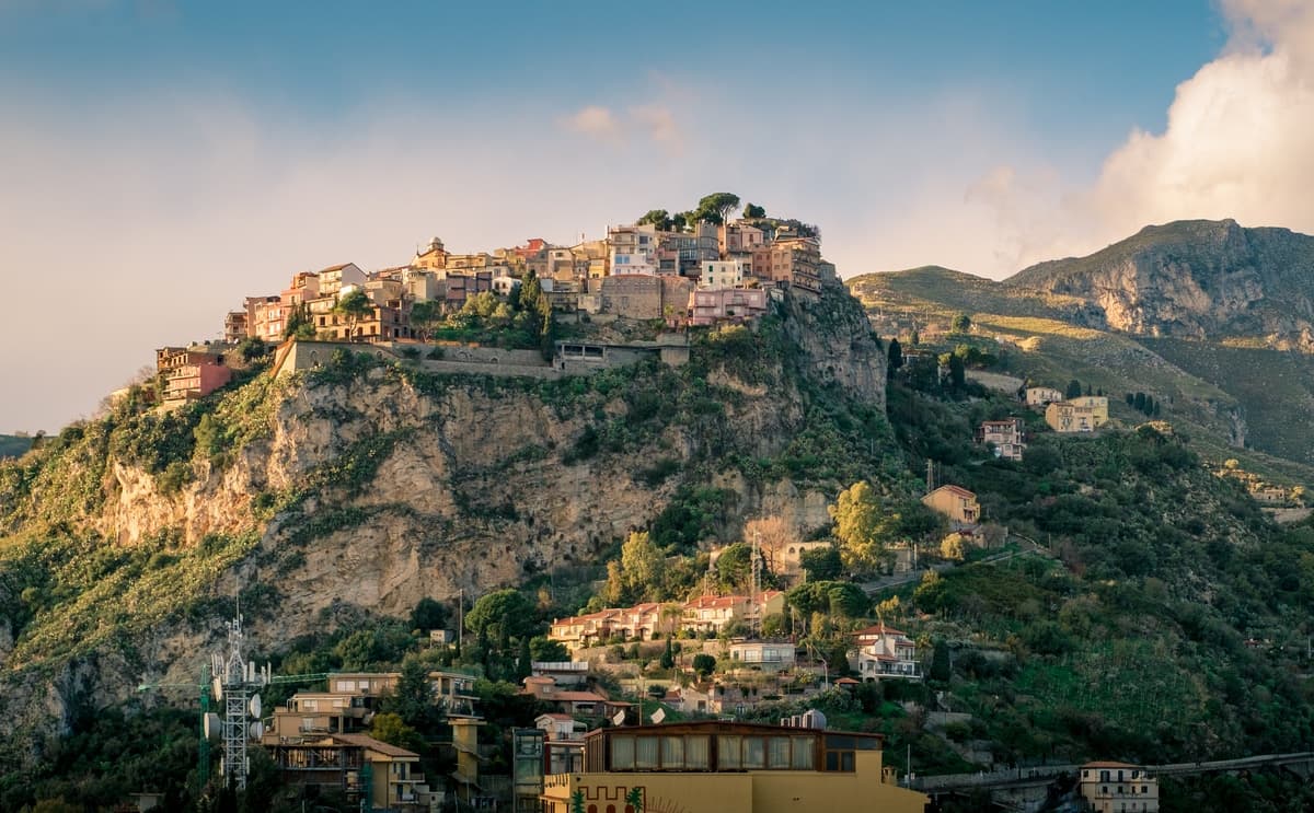
Won the first RAI Borgo dei Borghi competition in 2014, the silhouette of houses spilling down Monte Marone now the canonical Madonie image.
VENTIMIGLIA
The Ventimiglia counts of Geraci rebuilt Gangi after 1300 and built the castle and tower that still anchor the upper town.
MADONIE TRUFFLE
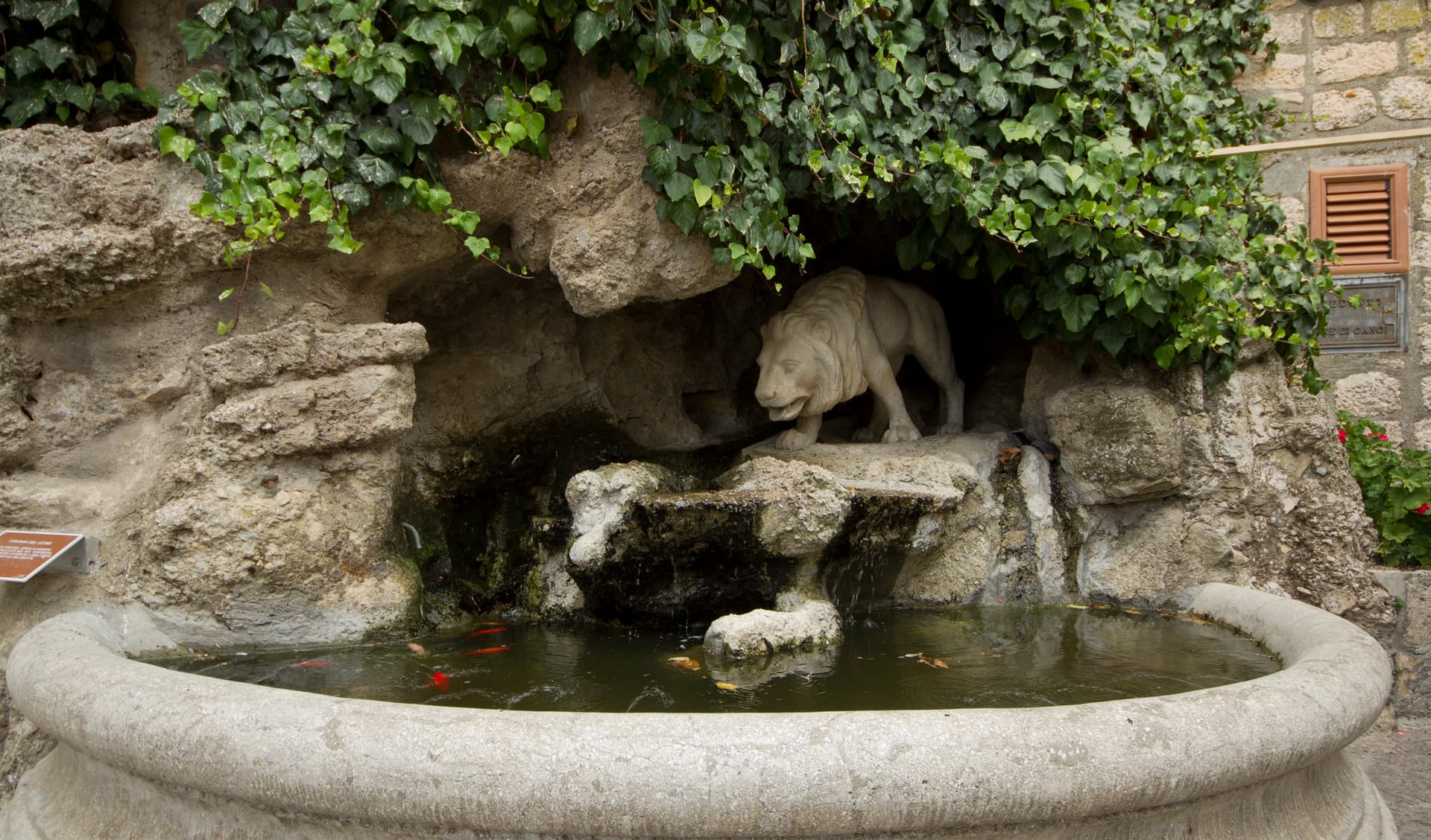
Black truffles harvested in the Madonie woodlands, paired with local pecorino, wild fennel sausage and Castelbuono manna in the regional cuisine.
When to visit
Best · Jun–Sep, Dec–Mar
- J
- F
- M
- A
- M
- J
- J
- A
- S
- O
- N
- D
- Best
- Hot or crowded
- Quiet
- Mostly closed
The festa: San Cataldo, 10 May
Why come
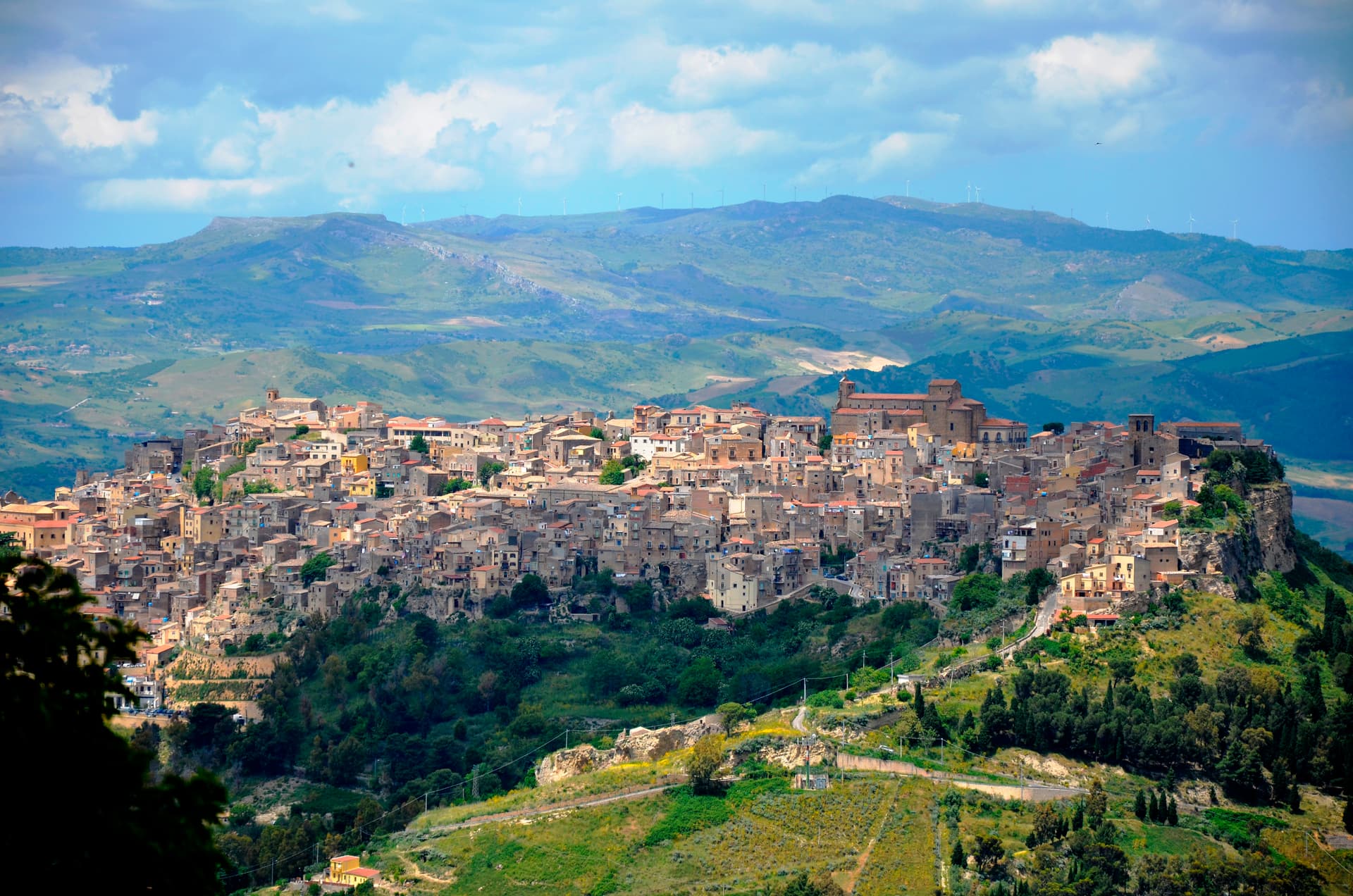
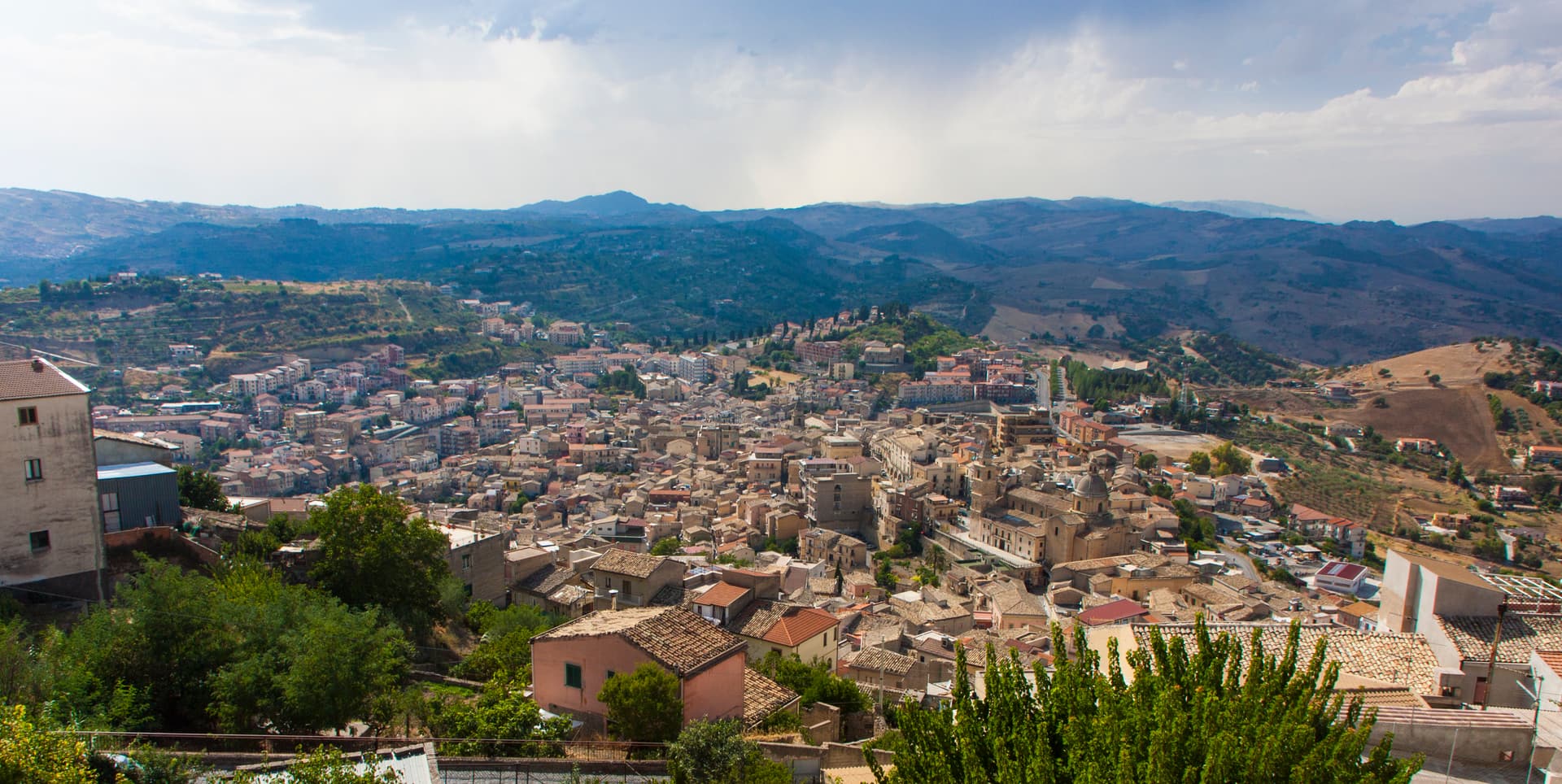
Gangi sits at 1,011 meters on the southern slope of Monte Marone, the easternmost edge of the Madonie, eighty kilometers southeast of Palermo. The current settlement dates to 1300, rebuilt after its earlier town was destroyed in the Sicilian Vespers war, as part of the Ventimiglia county of Geraci. The Castello dei Ventimiglia rises over the rooftops, built in the late thirteenth and early fourteenth century by Enrico Ventimiglia, count of Geraci.
Below the castle, the houses descend in tight stone tiers toward the Salso valley, photographed often enough to land Gangi the RAI Borgo dei Borghi title in 2014. The municipal council launched a one-euro-house scheme the following year and stuck with it longer than most. The territory is Città del Tartufo, with black truffles from the Madonie woodlands, and the local sausage with wild fennel travels as far as the manna and ricotta from neighboring Castelbuono.
The Sunday letter
We haven’t written Gangi’s letter yet.
One town every Sunday, with the photo, the food, the festa. Be there when this one comes up. Free, by Peter & Sophia from Pietrasanta.
By subscribing you agree to Substack’s Terms of Use, our Privacy Policy and our Information collection notice.

What to see
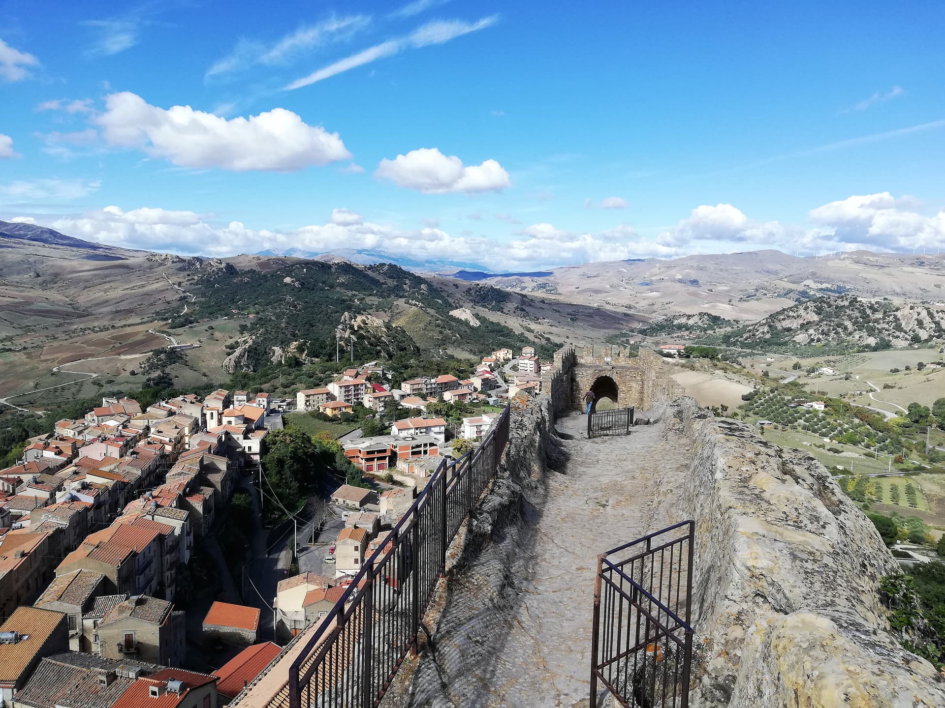
Castello dei Ventimiglia
Late thirteenth to early fourteenth-century fortress at the top of the town, built by Enrico Ventimiglia, lord of Gangi and count of Geraci.
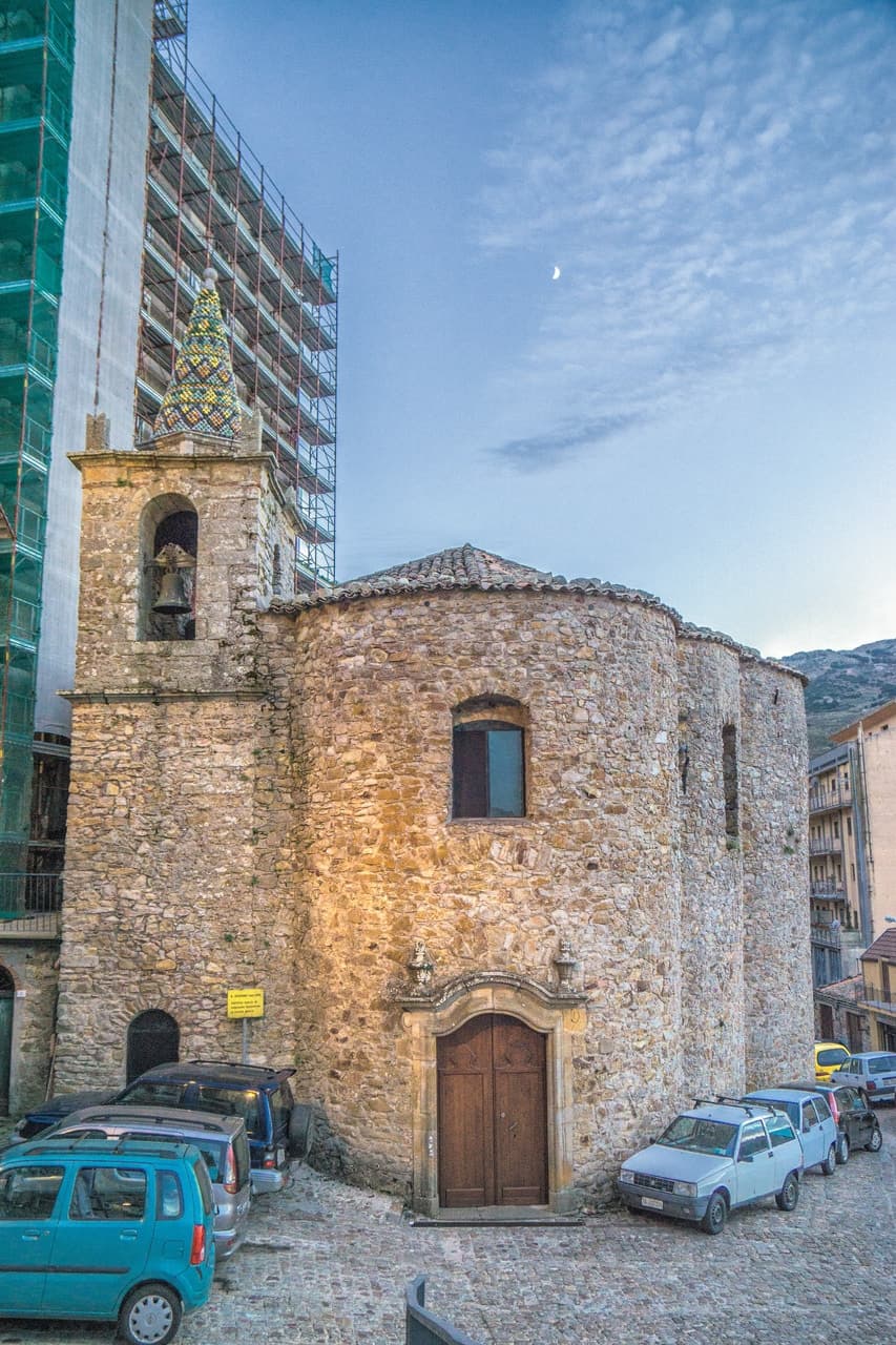
Torre dei Ventimiglia
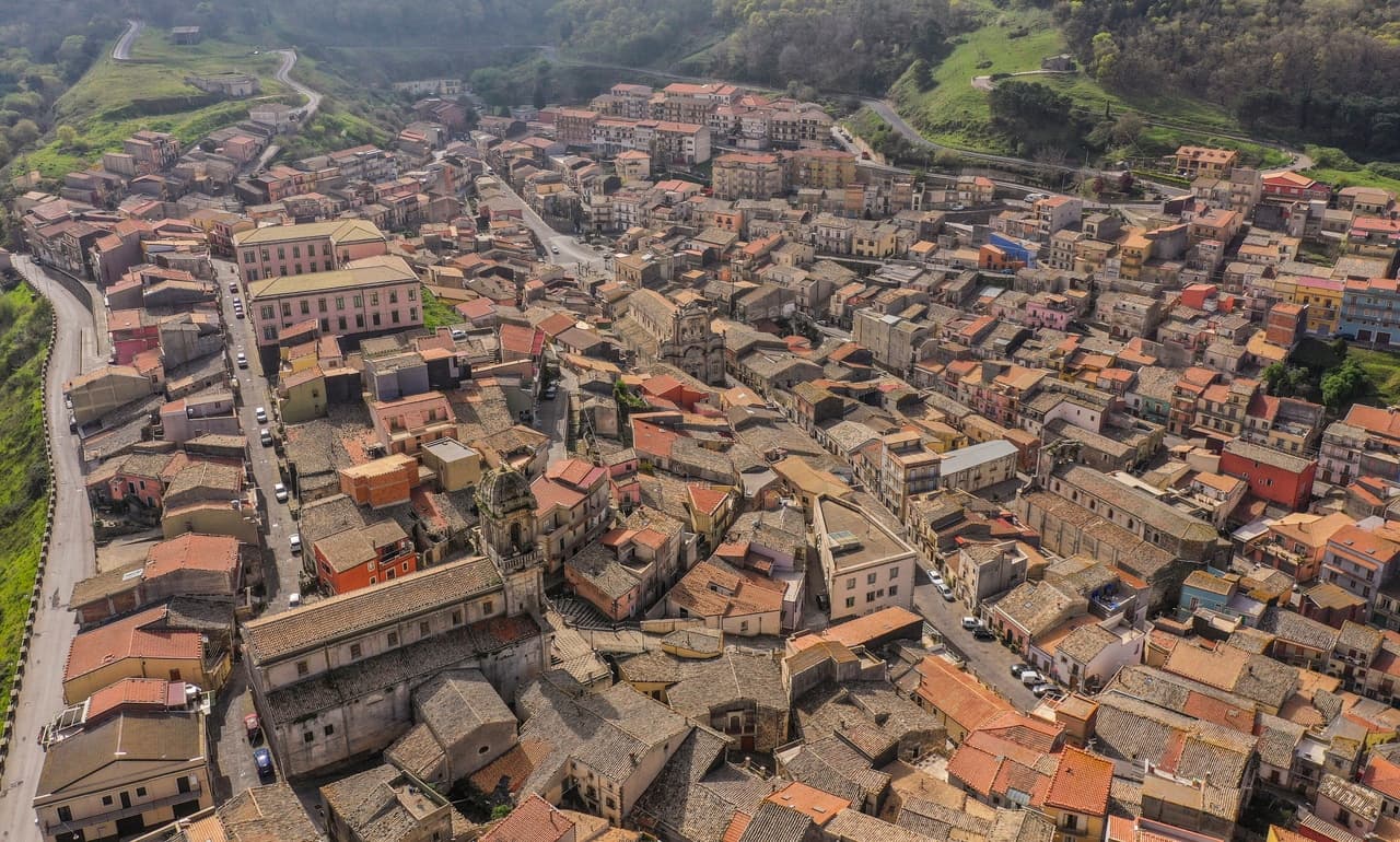
Square stone tower attached to the Chiesa Madre, second piece of the Ventimiglia defensive system, dominating the Gangi skyline alongside the castle.
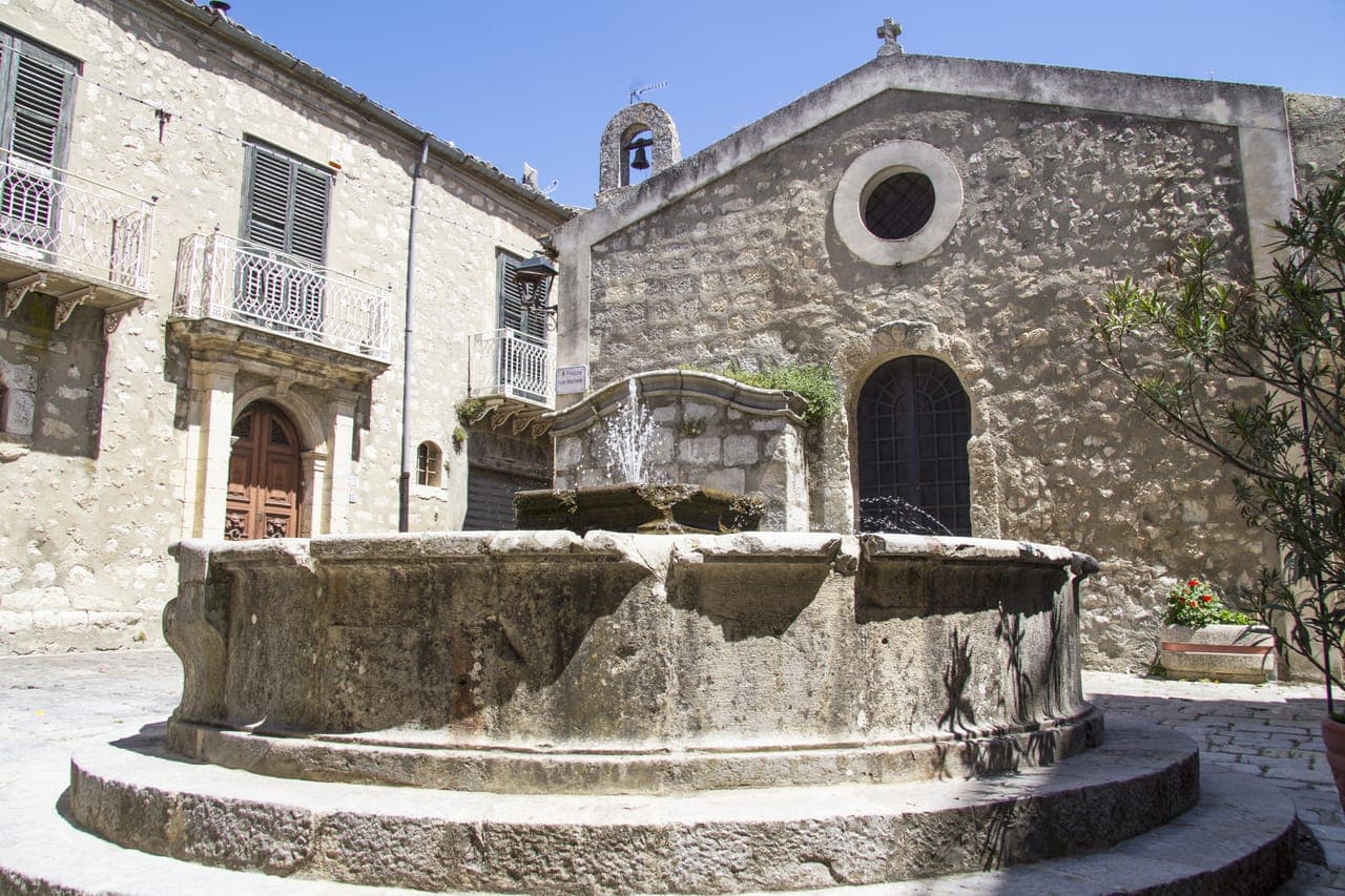
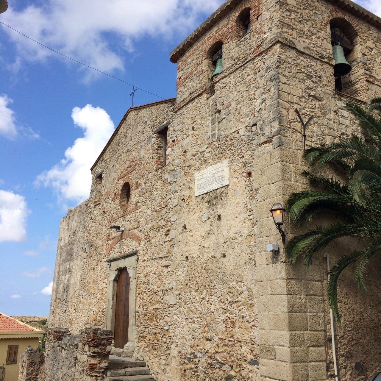
Chiesa Madre di San Nicolò
Fourteenth-century mother church with a Giuseppe Salerno altarpiece and the Camposanto, an underground crypt with mummified clergy.
Centro storico stacked on Monte Marone
Concentric rings of stone houses descending the southern slope of Monte Marone, the silhouette that won the 2014 Borgo dei Borghi vote.
Parco delle Madonie
Regional park surrounding the town, beech and ash forests, truffle ground and the highest peaks of central Sicily including Pizzo Carbonara.
The slow-trip planner
Building a trip? Find where Gangi fits in a slow Italy circuit.
Answer five questions. We will shape a geographically coherent slow trip from the 1,000 Italian towns most travelers skip. Yours to save and share.
Living here
- Population 6,110
- Off the beaten pathi
- Pharmacy in town
- High school within a 30-minute drive
- Nearest airport Sicily, 2 h 0 min drive
- Regional capital Palermo, 1 h 58 min drive
Tags & datadesignations · numbers · sources
The numbers
- Elevation: 1011 m
- Population: 6,110
- Surface area: 127.47 km²
These figures were compiled from public directories — ISTAT, OpenStreetMap, Wikidata — and from the official listings of the guides named on this page. Town details change; verify with official sources before you travel.
Close by
More towns near Gangi
Petralia Soprana
Province: Palermo
The highest village in the Madonie at 1,147 meters, RAI Borgo dei Borghi 2018 winner, sitting above 80 kilometers of salt tunnels.
Geraci Siculo
Province: Palermo
A Madonie ridge village at 1,077 meters, capital of the Ventimiglia marquisate from 1258 and the first marquisate granted in Sicily.
Nicosia
Province: Enna
A Byzantine-Norman royal city at 720 meters on four hills, one of Sicily's principal Gallo-Italic centres where the Lombard dialect nkoukkà still survives.
Calascibetta
Province: Enna
A promontory town at 691 meters facing Enna across a ravine, founded in the ninth century as a Muslim camp to besiege Byzantine Henna.
Sperlinga
Province: Enna
A sandstone borgo at 750 meters in the Nebrodi foothills where a Norman castle and dwellings are carved into the rock as one continuous mass.
🎨 Borghi più belli d'Italia
More Borghi più belli d'Italia towns in Sicily
Agira
Province: Enna
On the slopes of Monte Teja at 650 meters, birthplace of the Greek historian Diodorus Siculus and burial site of 490 Canadian soldiers of the 1943 campaign.
Buccheri
Province: Siracusa
The highest village in the province of Syracuse at 820 meters on Monte Lauro, world capital of Tonda Iblea olive oil at the 2015 Sol d'Oro.
Castelmola
Province: Messina
A rock village at 529 meters directly above Taormina, the upper acropolis of ancient Tauromenium with a Norman castle and a 1947 almond-wine bar.
Castiglione di Sicilia
Province: Catania
A hill town on the north flank of Etna at 621 meters, base camp for the Alcantara valley and the volcano's most serious red wines.
Castroreale
Province: Messina
A ridge town at 394 meters above the Milazzo plain, rebuilt by Frederick II of Aragon in 1324 as a royal demesne and second in the 2018 Borgo dei Borghi.