
Sicily · Enna
Agira
On the slopes of Monte Teja at 650 meters, birthplace of the Greek historian Diodorus Siculus and burial site of 490 Canadian soldiers of the 1943 campaign.
Known for
DIODORUS SICULUS
Birthplace around 90 BC of the Greek historian who wrote the forty-book Bibliotheca historica, of which fifteen books survive intact.
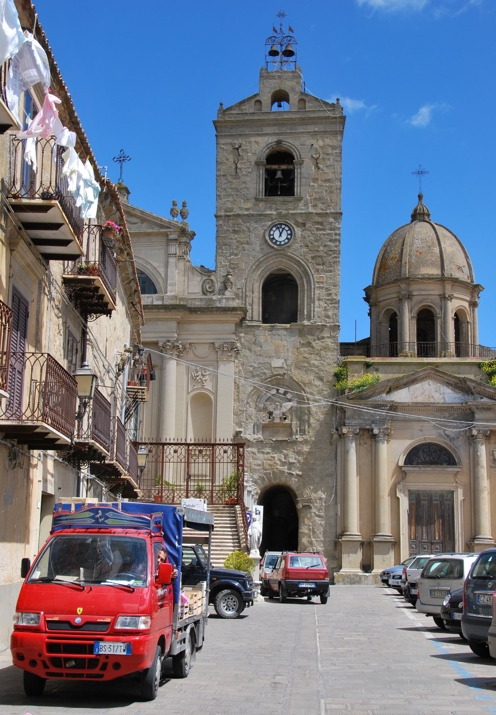
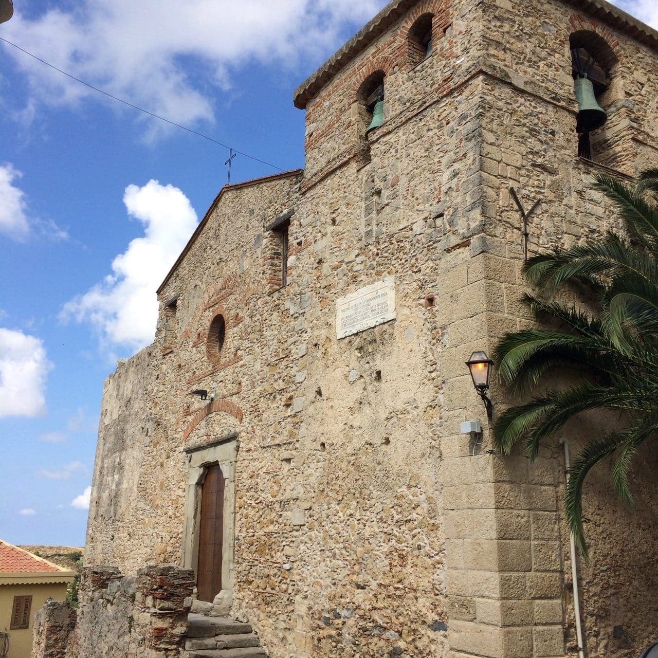
SAN FILIPPO
Royal Abbey founded by Basilian monks in the seventh or eighth century, rebuilt by Roger I after 1095; patron saint buried beneath the church.
CANADIAN CEMETERY
Only Canadian war cemetery in Italy holds the 490 graves of soldiers killed taking Agira in five days of July 1943 fighting, the largest Canadian battle of the Sicilian campaign.
When to visit
Best · Apr–Jun, Sep–Nov
- J
- F
- M
- A
- M
- J
- J
- A
- S
- O
- N
- D
- Best
- Hot or crowded
- Quiet
- Mostly closed
The festa: Filippo di Agira, 11 May
Why come
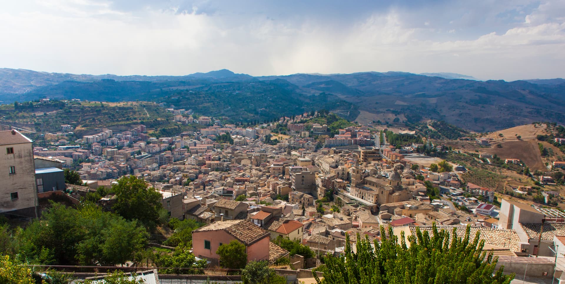
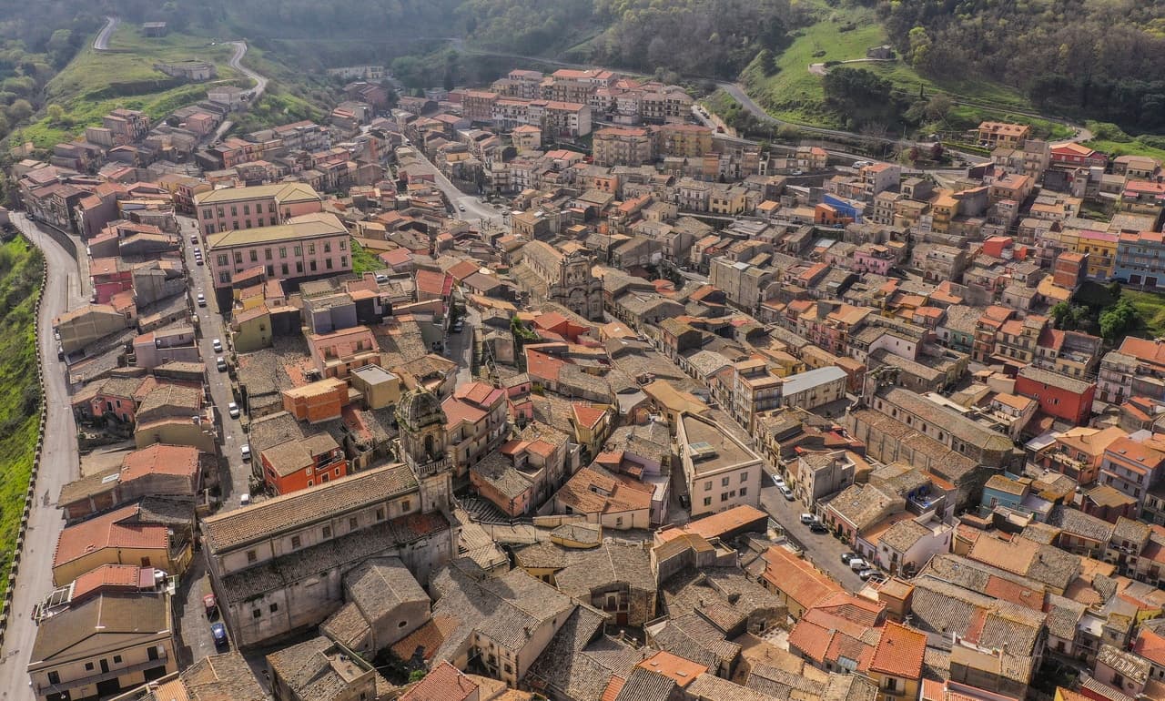
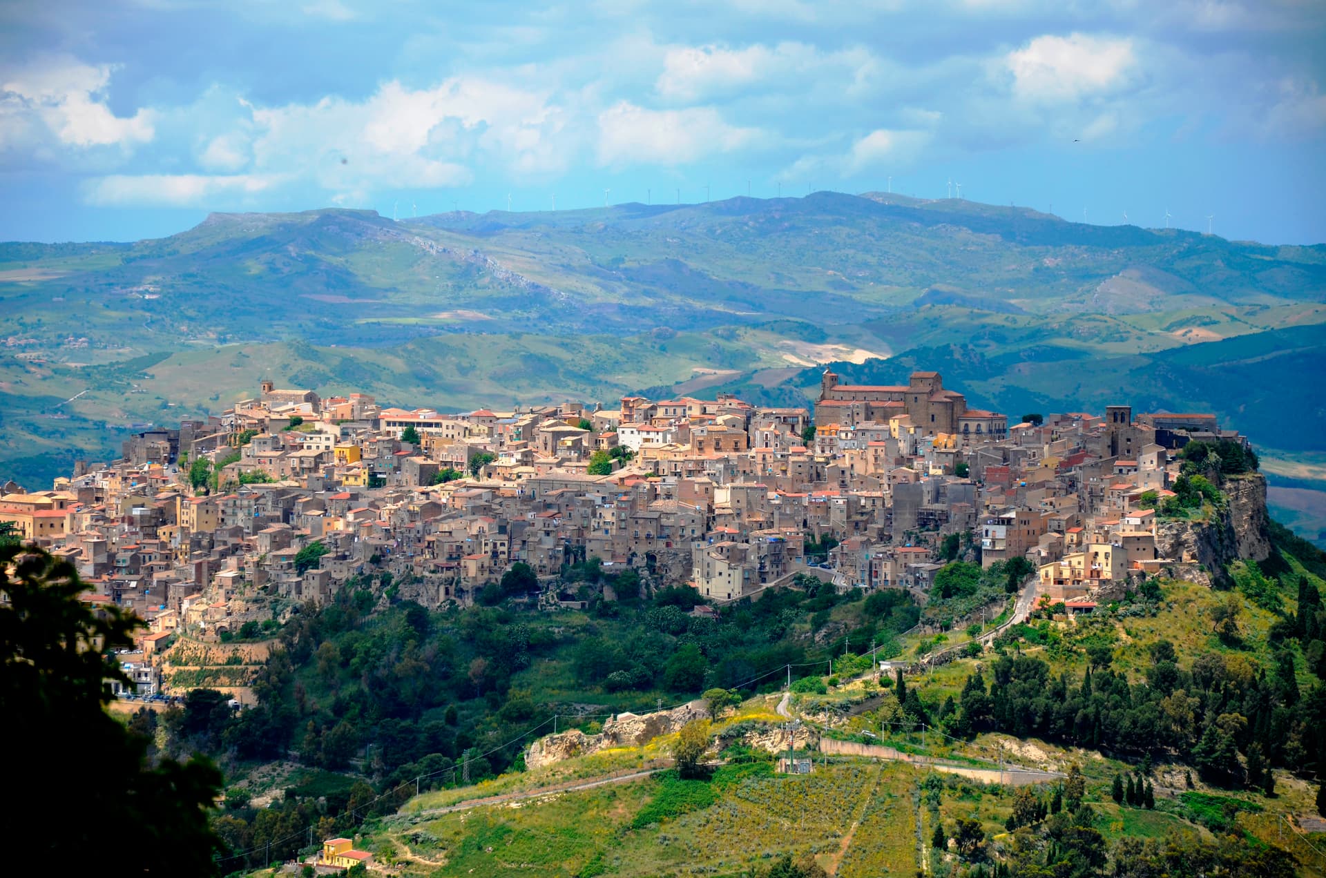
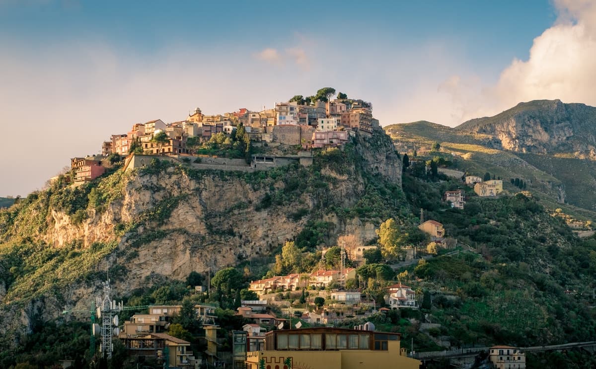
Agira sits on the summit and slopes of Monte Teja at 650 meters in the mid-valley of the Salso river, thirty-five kilometers east of Enna. The town stands on the site of the Sicel city of Agyrion, where the Greek general Timoleon settled ten thousand colonists in 339 BC and where the historian Diodorus Siculus was born around 90 BC. Diodorus wrote the Bibliotheca historica, a forty-book universal history of which fifteen books survive intact.
The Royal Abbey Church of San Filippo, founded by Basilian monks in the seventh or eighth century, was refurbished into a Benedictine abbey by Roger I between 1095 and 1101 and remains the central monument of the town. In July 1943 Agira fell to the Canadians after five days of fighting, the largest Canadian battle of the Sicilian campaign; the Canadian War Cemetery on a hill outside the town holds the graves of 490 soldiers, the only Canadian war cemetery in Italy.
The Sunday letter
We haven’t written Agira’s letter yet.
One town every Sunday, with the photo, the food, the festa. Be there when this one comes up. Free, by Peter & Sophia from Pietrasanta.
By subscribing you agree to Substack’s Terms of Use, our Privacy Policy and our Information collection notice.

What to see
Reale Abbazia di San Filippo
Basilian monastery founded in the seventh or eighth century, refurbished into a Benedictine abbey by Roger I between 1095 and 1101; the patron saint Philip of Agira is buried beneath the church.
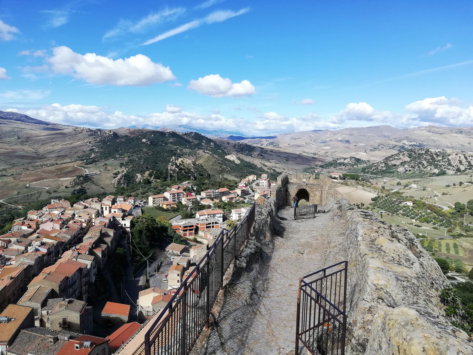
Castello di Agira
Medieval fortress on the summit of Monte Teja above the town, with surviving walls and towers; the strategic outpost that controlled the central Sicilian interior.
Agira Canadian War Cemetery
Only Canadian war cemetery in Italy, on a hill outside the town, holding 490 graves of soldiers killed in the July 1943 Sicilian campaign.
Centro storico medievale
Steep stone lanes climbing Monte Teja from the lower town to the castle, layered with Greek, Byzantine, Norman and Aragonese remains.
The slow-trip planner
Building a trip? Find where Agira fits in a slow Italy circuit.
Answer five questions. We will shape a geographically coherent slow trip from the 1,000 Italian towns most travelers skip. Yours to save and share.
Living here
- Population 7,671
- Off the beaten pathi
- Pharmacy in town
- High school within a 30-minute drive
- Nearest airport Sicily, 54 min drive
- Regional capital Palermo, 2 h 5 min drive
Tags & datadesignations · numbers · sources
Recognised as
The numbers
- Elevation: 650 m
- Population: 7,671
- Surface area: 164.08 km²
These figures were compiled from public directories — ISTAT, OpenStreetMap, Wikidata — and from the official listings of the guides named on this page. Town details change; verify with official sources before you travel.
Featured on
Agira appears on this themed pick from our Collections:
Close by
More towns near Agira
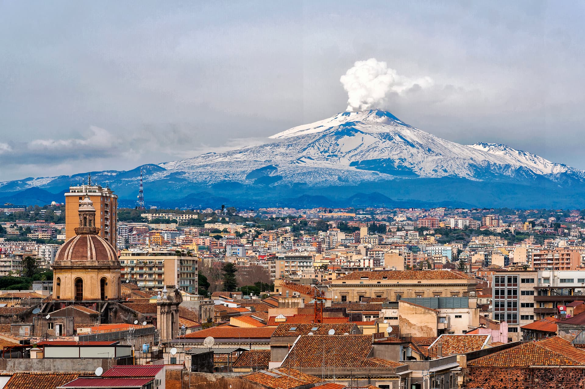
Catania
Province: Catania
Sicily's second city and the cultural anchor of the Ionian coast — a UNESCO late-Baroque centro storico rebuilt in lava-black stone after the 1693 earthquake, sitting at the foot of Etna with a 17th-century elephant fountain (U Liotru) as its civic symbol.
Troina
Province: Enna
At 1,121 meters on the Nebrodi ridge, the first capital and first bishopric the Normans set up in Sicily after taking it from the Arabs.
Nicosia
Province: Enna
A Byzantine-Norman royal city at 720 meters on four hills, one of Sicily's principal Gallo-Italic centres where the Lombard dialect nkoukkà still survives.
Aci Castello
Province: Catania
A coastal town just north of Catania on the Riviera dei Ciclopi, where the basalt headland holds the 1076 Norman Castello d'Aci and the seven volcanic Faraglioni dei Ciclopi rise from the sea — the rocks the Cyclops threw at Odysseus in Homer's Odyssey.
Sperlinga
Province: Enna
A sandstone borgo at 750 meters in the Nebrodi foothills where a Norman castle and dwellings are carved into the rock as one continuous mass.
🎨 Borghi più belli d'Italia
More Borghi più belli d'Italia towns in Sicily
Buccheri
Province: Siracusa
The highest village in the province of Syracuse at 820 meters on Monte Lauro, world capital of Tonda Iblea olive oil at the 2015 Sol d'Oro.
Calascibetta
Province: Enna
A promontory town at 691 meters facing Enna across a ravine, founded in the ninth century as a Muslim camp to besiege Byzantine Henna.
Castelmola
Province: Messina
A rock village at 529 meters directly above Taormina, the upper acropolis of ancient Tauromenium with a Norman castle and a 1947 almond-wine bar.
Castiglione di Sicilia
Province: Catania
A hill town on the north flank of Etna at 621 meters, base camp for the Alcantara valley and the volcano's most serious red wines.
Castroreale
Province: Messina
A ridge town at 394 meters above the Milazzo plain, rebuilt by Frederick II of Aragon in 1324 as a royal demesne and second in the 2018 Borgo dei Borghi.