
Sicily · Enna
Troina
At 1,121 meters on the Nebrodi ridge, the first capital and first bishopric the Normans set up in Sicily after taking it from the Arabs.
Known for
FIRST NORMAN CAPITAL
Chosen by Roger I in 1061 as the political base of the Norman conquest of Sicily, and the seat of the first Sicilian bishopric founded in 1082.
NEBRODI
Southern gateway to the Parco dei Nebrodi, Sicily's largest natural park, with beech forests and the protected San Fratello horse breed.
OLIO E PANE
Città dell'Olio at altitude; Nebrodi extra virgin oil, mountain bread, and pecorino dei Nebrodi sustain a thin upland economy.
When to visit
Best · Jun–Sep, Dec–Mar
- J
- F
- M
- A
- M
- J
- J
- A
- S
- O
- N
- D
- Best
- Hot or crowded
- Quiet
- Mostly closed
Why come
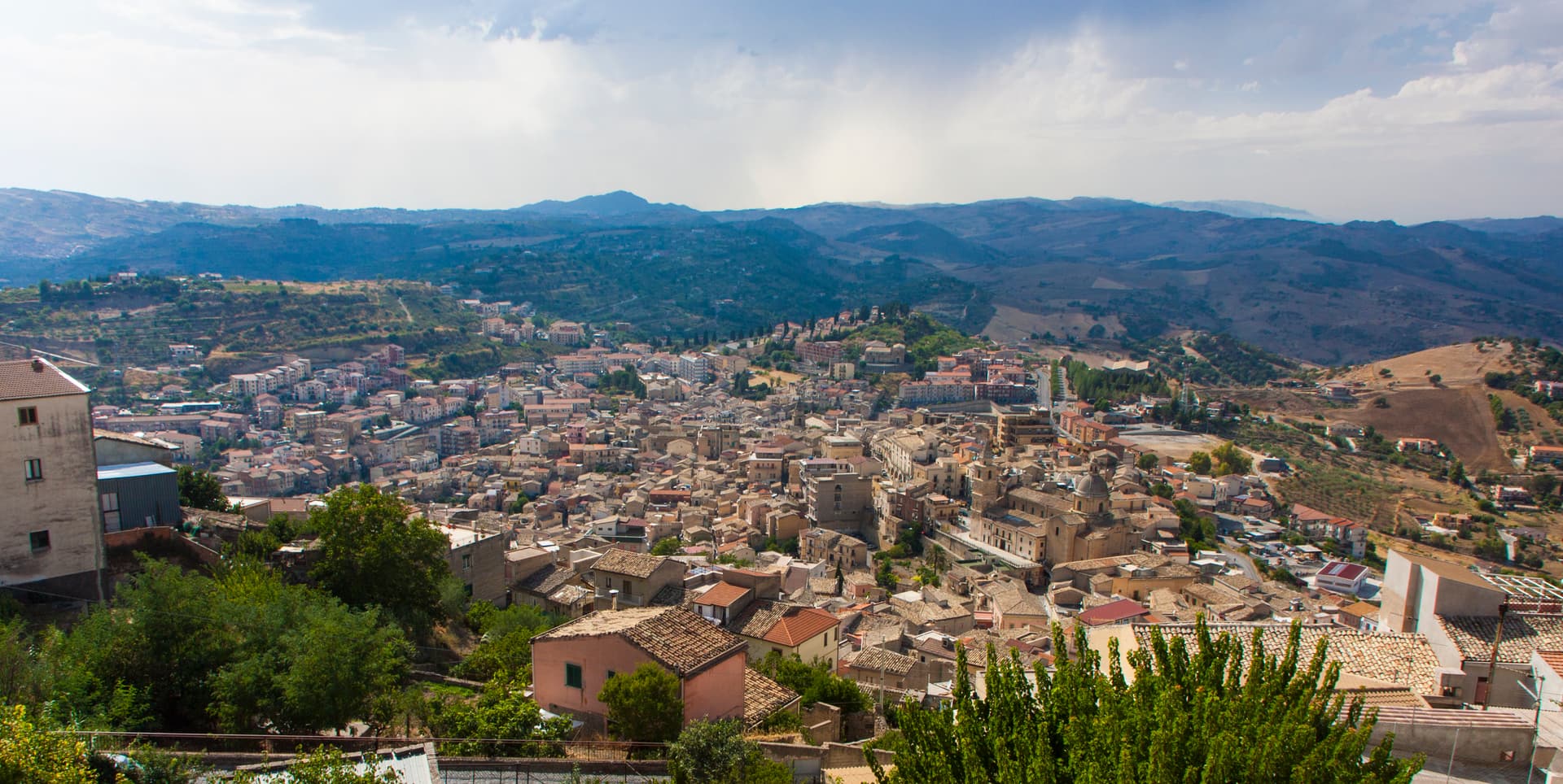
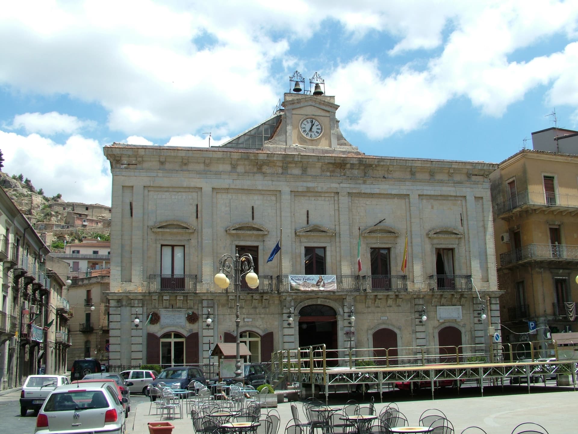
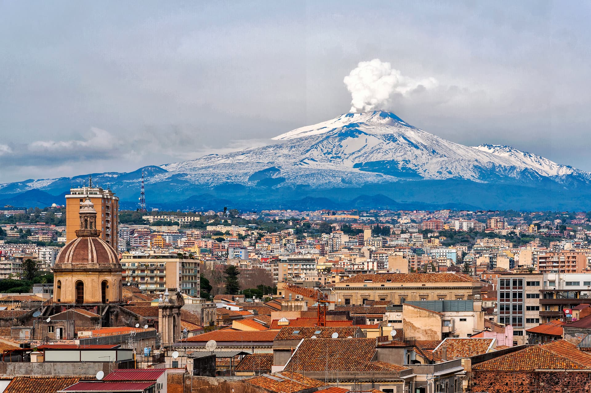
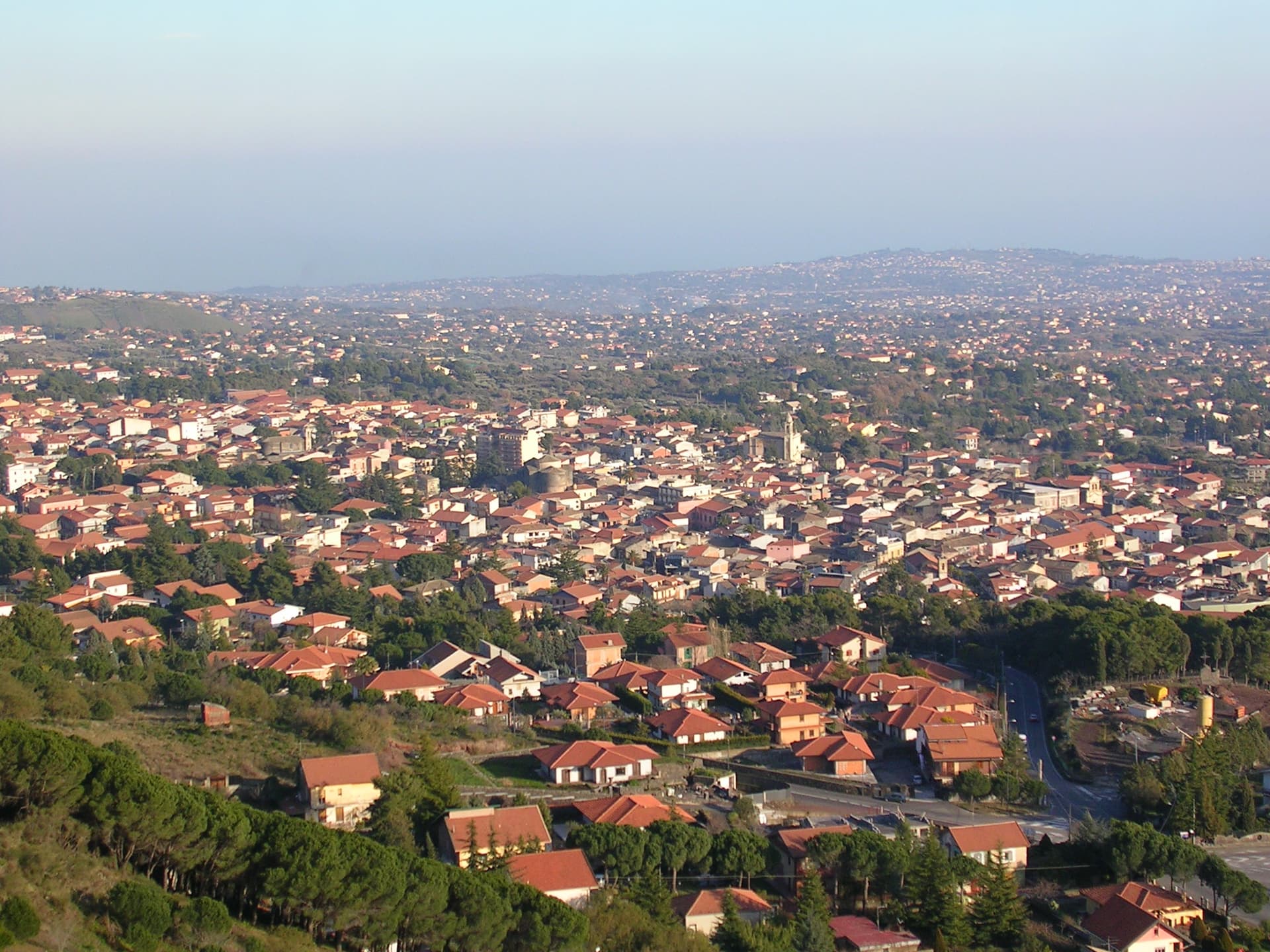
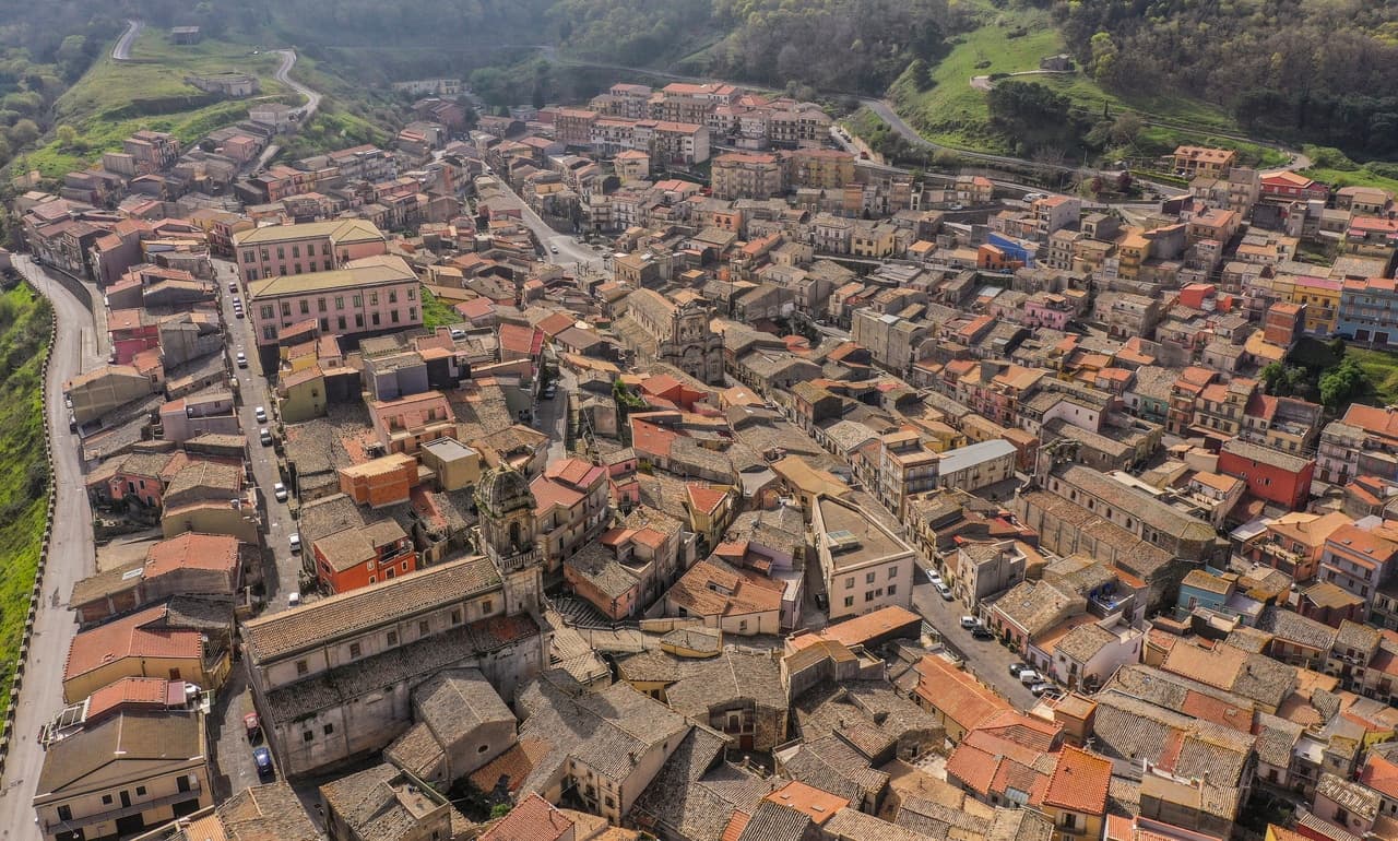
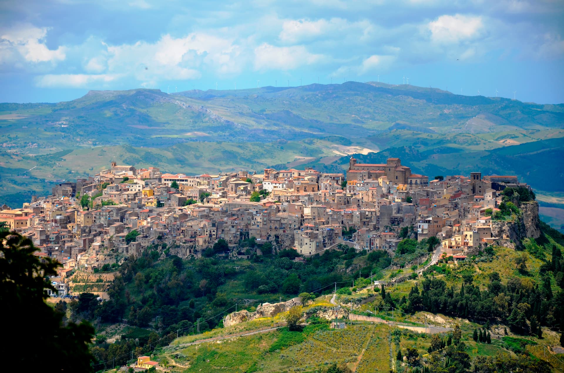
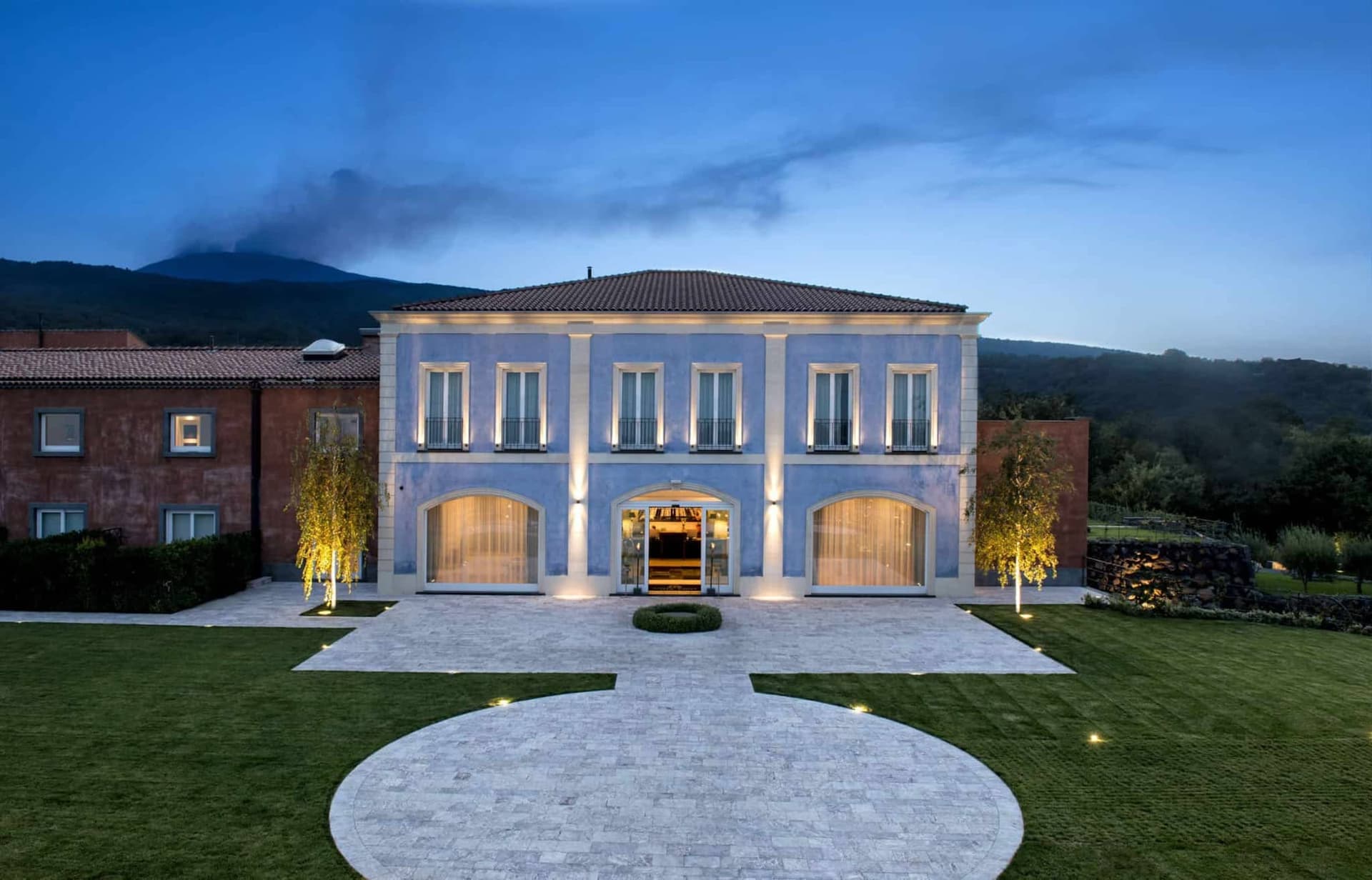
Troina sits at 1,121 meters on the southern edge of the Nebrodi, one of the highest commune centers in Sicily, with Etna visible to the east on clear days. The area was settled in the seventh millennium BC and the urban core dates to the fourth century BC. In 1061 Roger I took the Saracen castle here and made the town the first political and military base of the Norman conquest of the island.
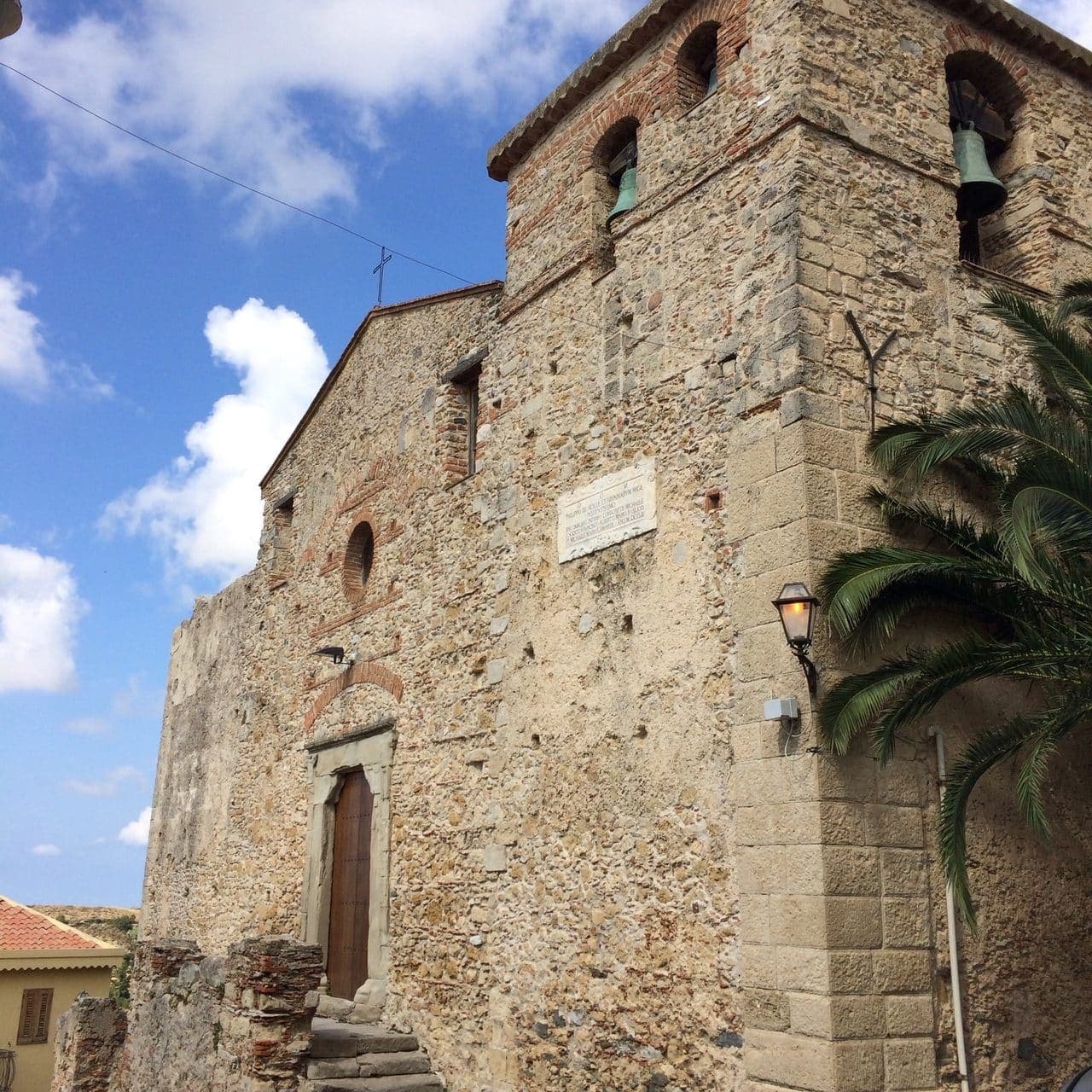
The Diocese of Troina, established in 1082, was the first Sicilian bishopric founded after centuries of Arab rule. The Chiesa Madre, dedicated to Maria Santissima Assunta, stands at the highest point of the town with its Norman tower still intact, the earliest Norman cathedral built in Sicily. Below the centro storico, the ruins of the Basilian monastery of San Michele Arcangelo, endowed by Count Roger, sit on an outcrop above the Fiume sotto di Troina valley. The Nebrodi Park surrounds the commune on three sides.
The Sunday letter
We haven’t written Troina’s letter yet.
One town every Sunday, with the photo, the food, the festa. Be there when this one comes up. Free, by Peter & Sophia from Pietrasanta.
By subscribing you agree to Substack’s Terms of Use, our Privacy Policy and our Information collection notice.


What to see
Chiesa Madre (Maria Santissima Assunta)
First Norman cathedral built in Sicily, founded under Roger I after 1061, with its original Norman bell tower still standing at the highest point of the centro storico.
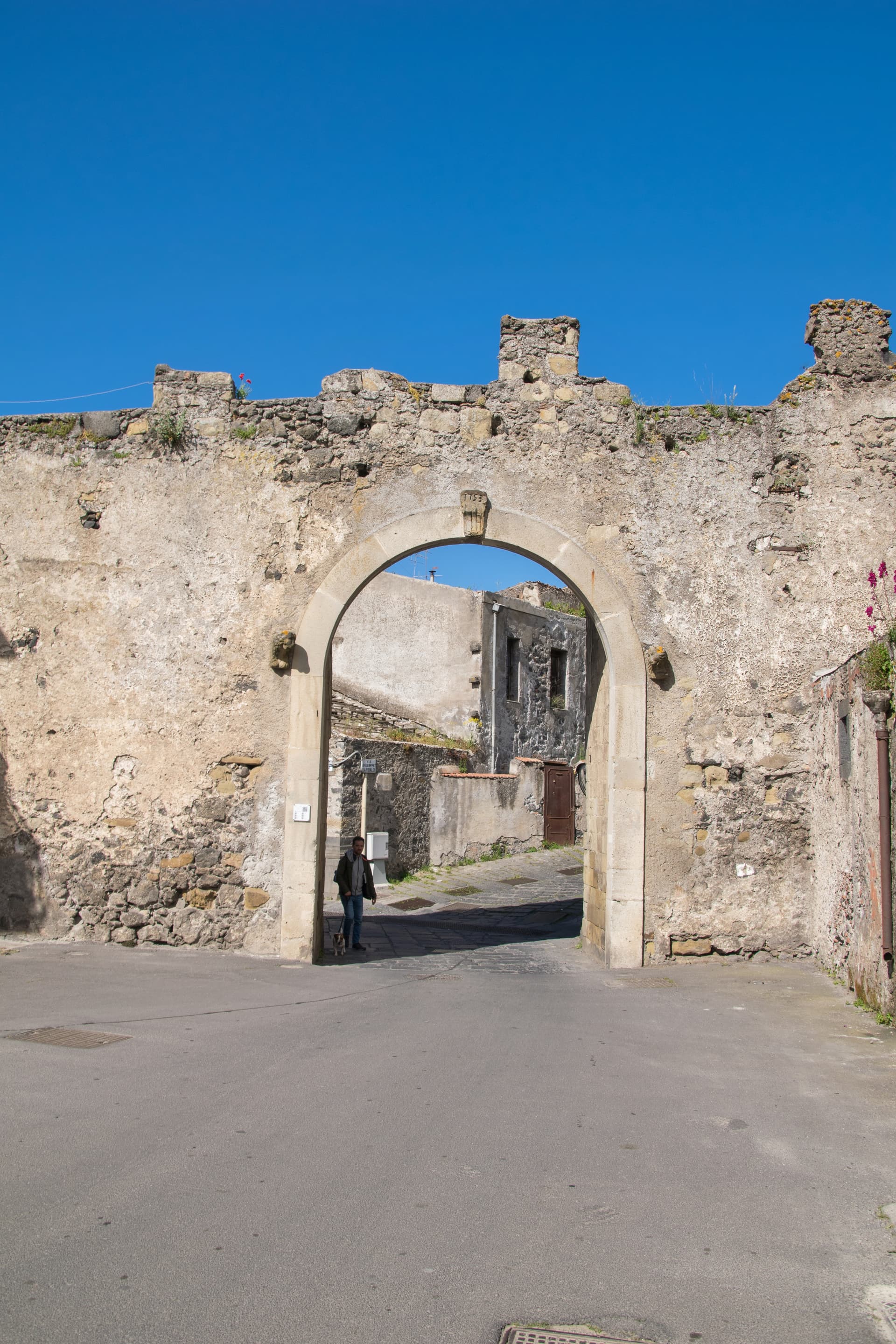
Castello di Troina
Medieval fortress taken from the Saracens by Roger I in 1061 and used as the political and military base of the Norman conquest of Sicily; partial walls and towers survive.
Monastero di San Michele Arcangelo
Ruined Basilian monastery on a rocky outcrop below the town, endowed by Count Roger after the conquest and one of the oldest Norman monastic foundations on the island.
Parco dei Nebrodi
Sicily's largest protected area surrounds the commune; beech and oak forests, San Fratello horses, and ridge trails between Troina and Cesarò.
Belvedere sull'Etna
Eastern viewpoint from the centro storico looking across the Simeto valley to Mount Etna, 40 kilometers away.
The slow-trip planner
Building a trip? Find where Troina fits in a slow Italy circuit.
Answer five questions. We will shape a geographically coherent slow trip from the 1,000 Italian towns most travelers skip. Yours to save and share.
Living here
- Population 8,550
- Very remotei
- Pharmacy in town
- High school within a 30-minute drive
- Nearest airport Sicily, 1 h 9 min drive
- Regional capital Palermo, 2 h 29 min drive
Tags & datadesignations · numbers · sources
The numbers
- Elevation: 1121 m
- Population: 8,550
- Surface area: 168.28 km²
These figures were compiled from public directories — ISTAT, OpenStreetMap, Wikidata — and from the official listings of the guides named on this page. Town details change; verify with official sources before you travel.
Close by
More towns near Troina
Agira
Province: Enna
On the slopes of Monte Teja at 650 meters, birthplace of the Greek historian Diodorus Siculus and burial site of 490 Canadian soldiers of the 1943 campaign.
Nicosia
Province: Enna
A Byzantine-Norman royal city at 720 meters on four hills, one of Sicily's principal Gallo-Italic centres where the Lombard dialect nkoukkà still survives.
Randazzo
Province: Catania
A medieval town in black lava stone at 750 meters on Etna's north foot, with three quarter churches for Latins, Greeks and Lombards.
Catania
Province: Catania
Sicily's second city and the cultural anchor of the Ionian coast — a UNESCO late-Baroque centro storico rebuilt in lava-black stone after the 1693 earthquake, sitting at the foot of Etna with a 17th-century elephant fountain (U Liotru) as its civic symbol.
Nicolosi
Province: Catania
The southern gateway to Etna at 698 meters, twice destroyed by the 1669 eruption, base camp for the volcano cable car at Rifugio Sapienza.
🎨 Borghi più belli d'Italia
More Borghi più belli d'Italia towns in Sicily
Buccheri
Province: Siracusa
The highest village in the province of Syracuse at 820 meters on Monte Lauro, world capital of Tonda Iblea olive oil at the 2015 Sol d'Oro.
Calascibetta
Province: Enna
A promontory town at 691 meters facing Enna across a ravine, founded in the ninth century as a Muslim camp to besiege Byzantine Henna.
Castelmola
Province: Messina
A rock village at 529 meters directly above Taormina, the upper acropolis of ancient Tauromenium with a Norman castle and a 1947 almond-wine bar.
Castiglione di Sicilia
Province: Catania
A hill town on the north flank of Etna at 621 meters, base camp for the Alcantara valley and the volcano's most serious red wines.
Castroreale
Province: Messina
A ridge town at 394 meters above the Milazzo plain, rebuilt by Frederick II of Aragon in 1324 as a royal demesne and second in the 2018 Borgo dei Borghi.