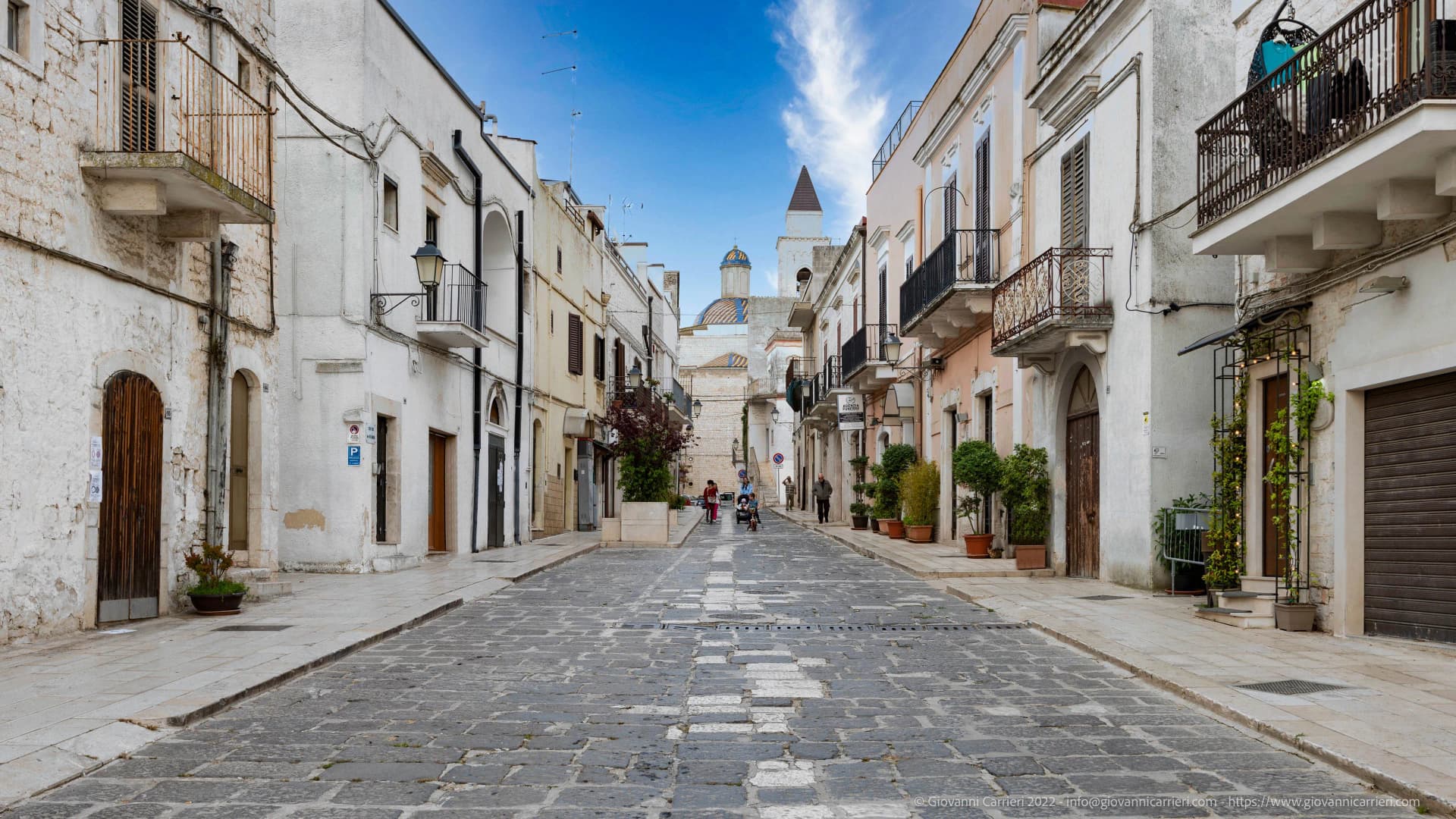
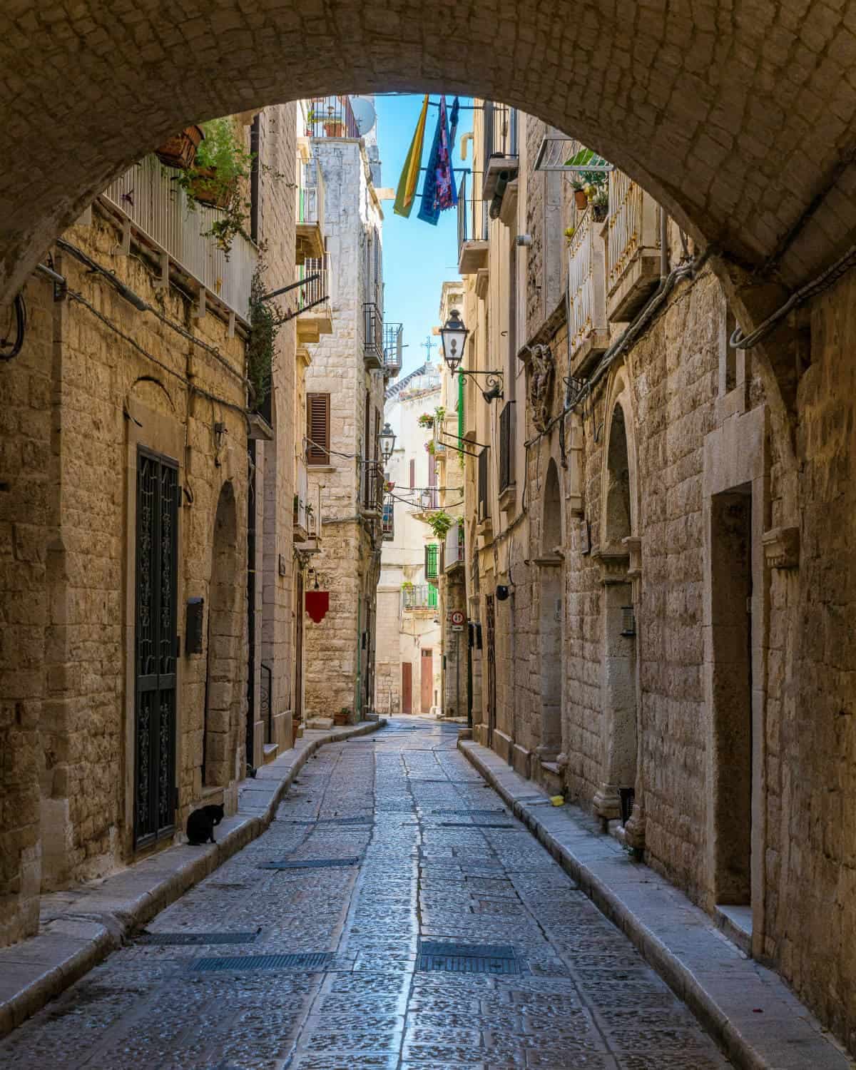
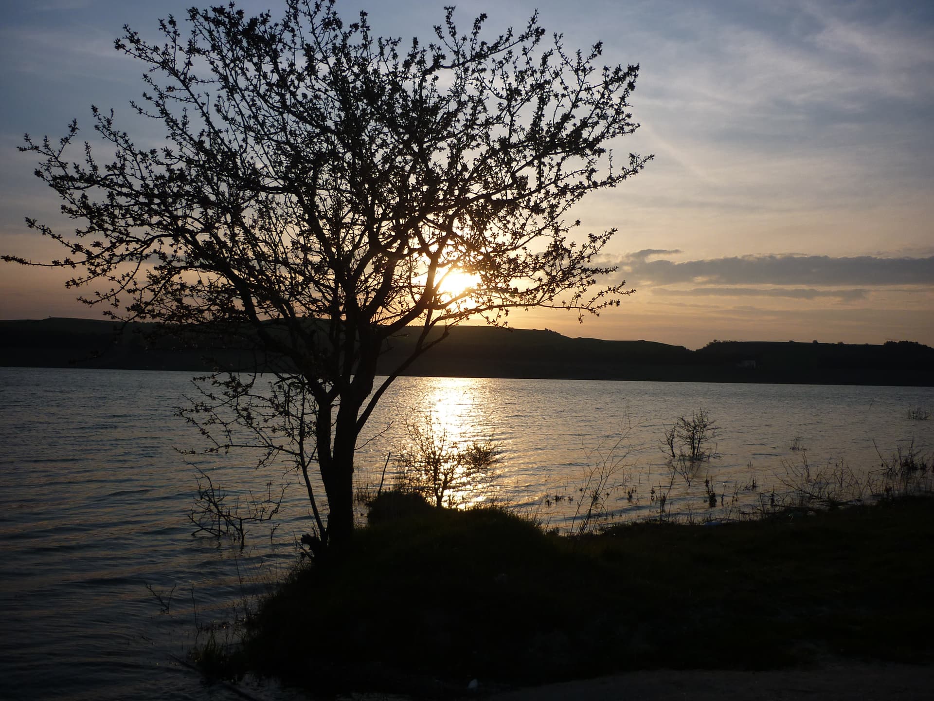
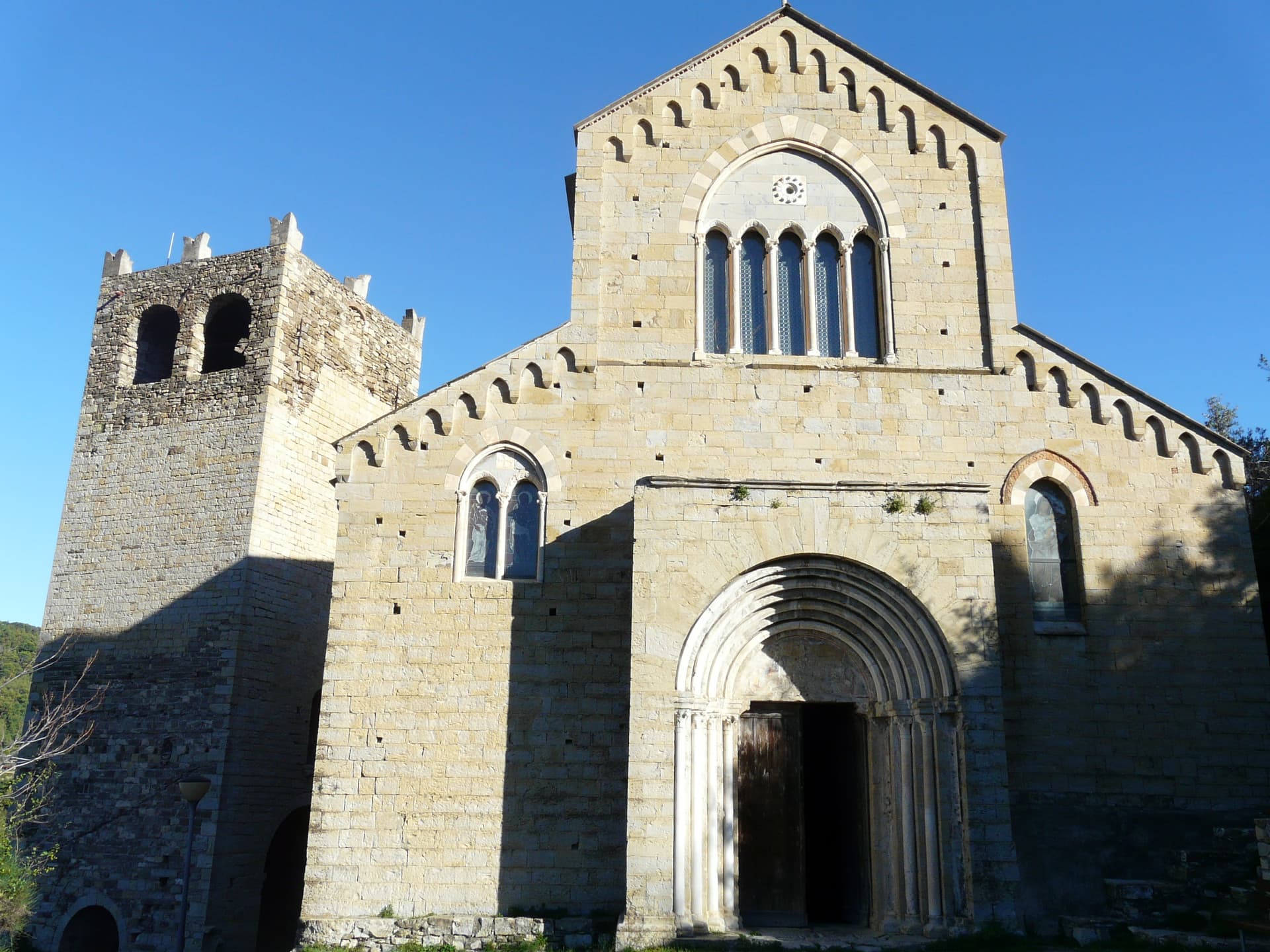
Designation
Città dell'Olio
178 towns across 18 regions
Browse by region
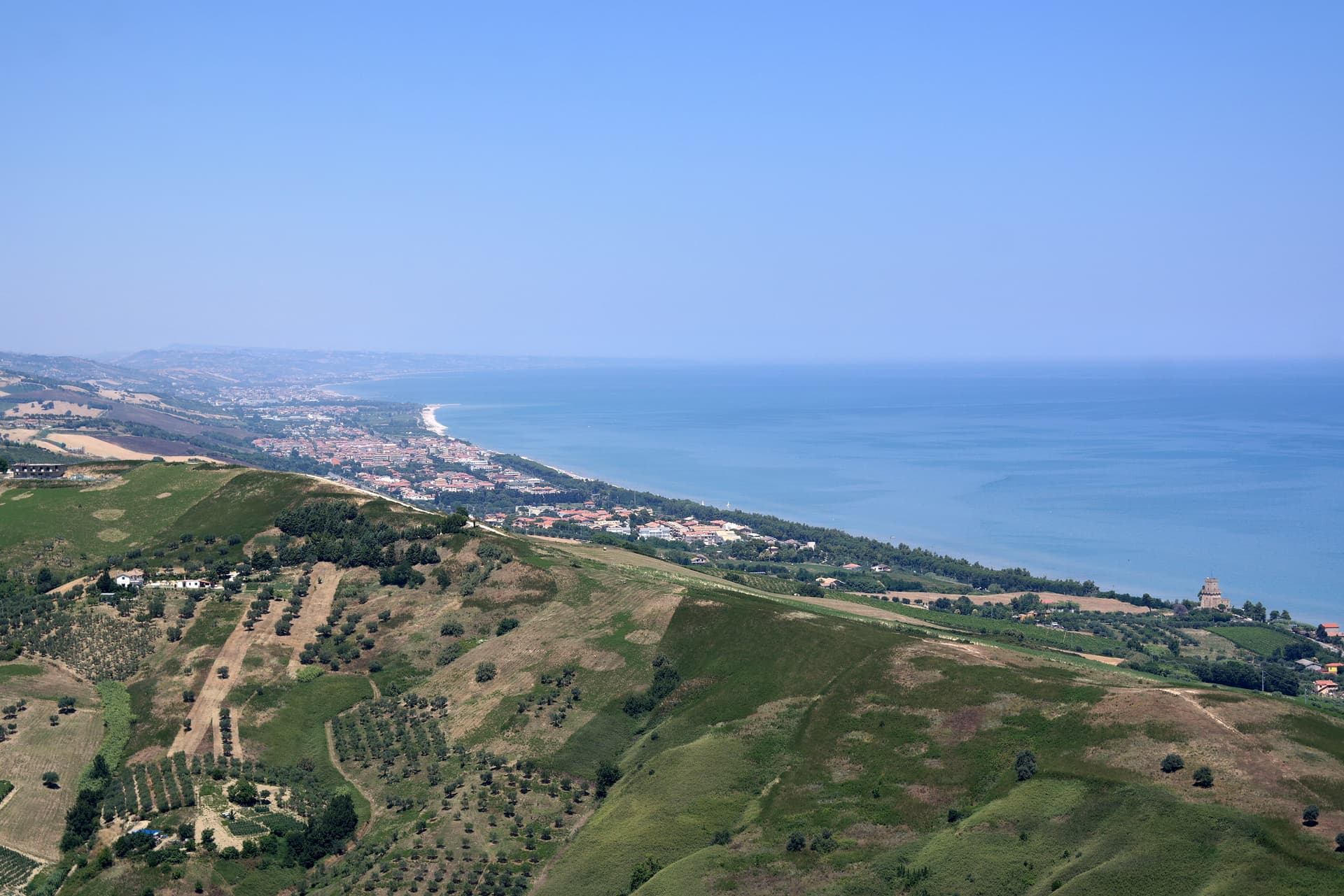
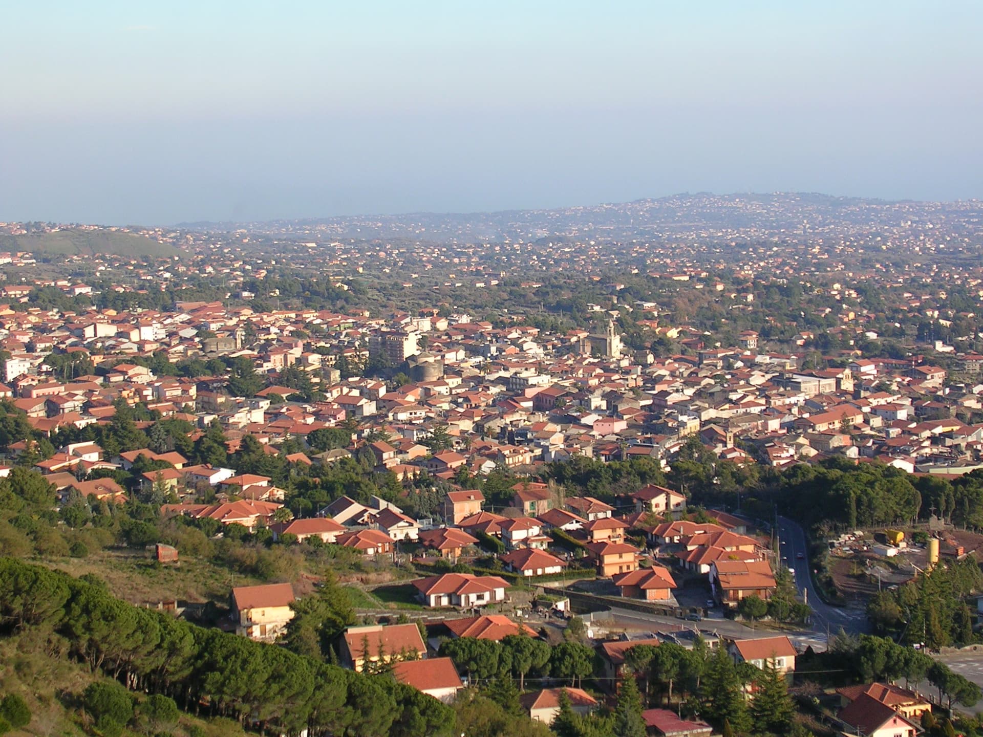
Abruzzo11

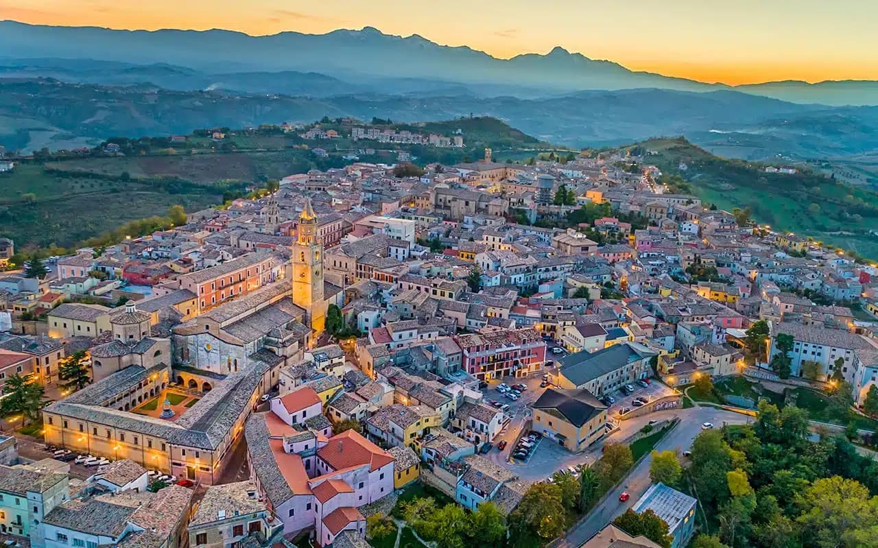
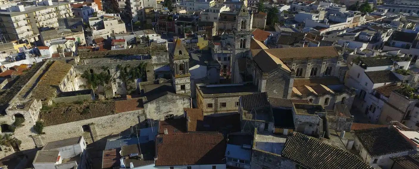
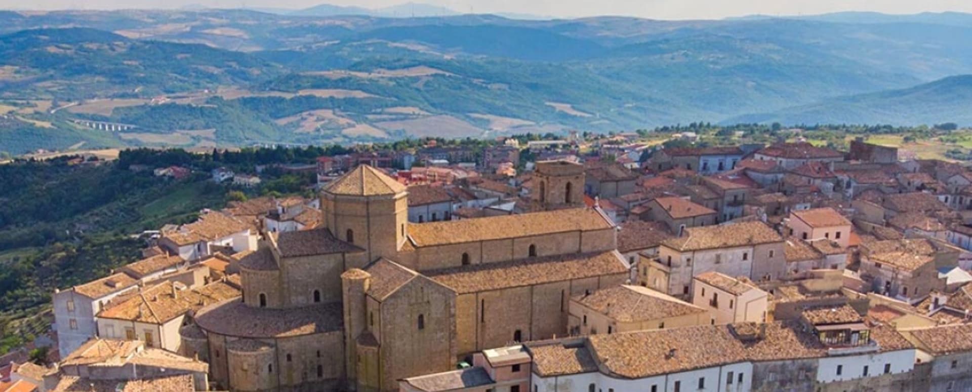
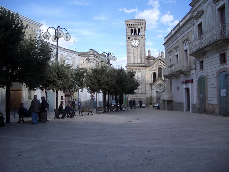
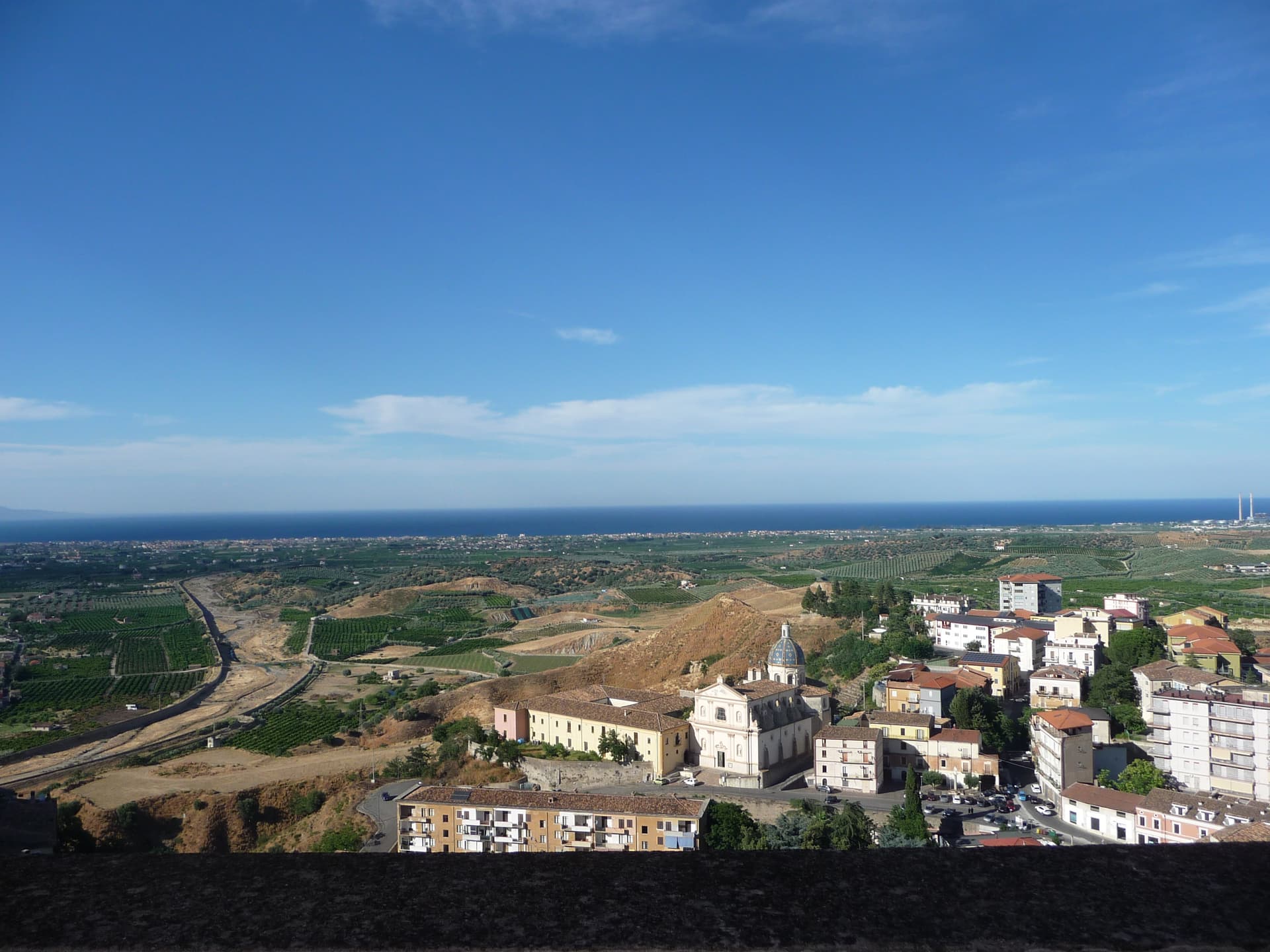
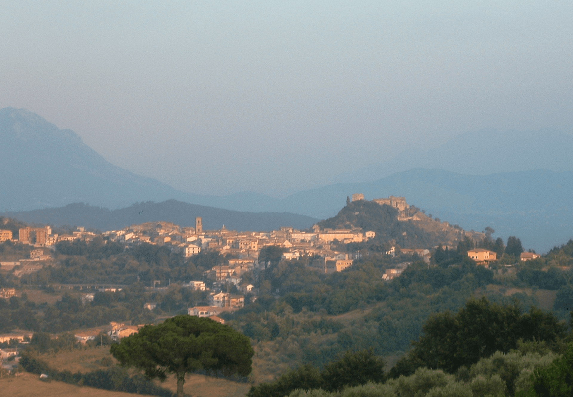
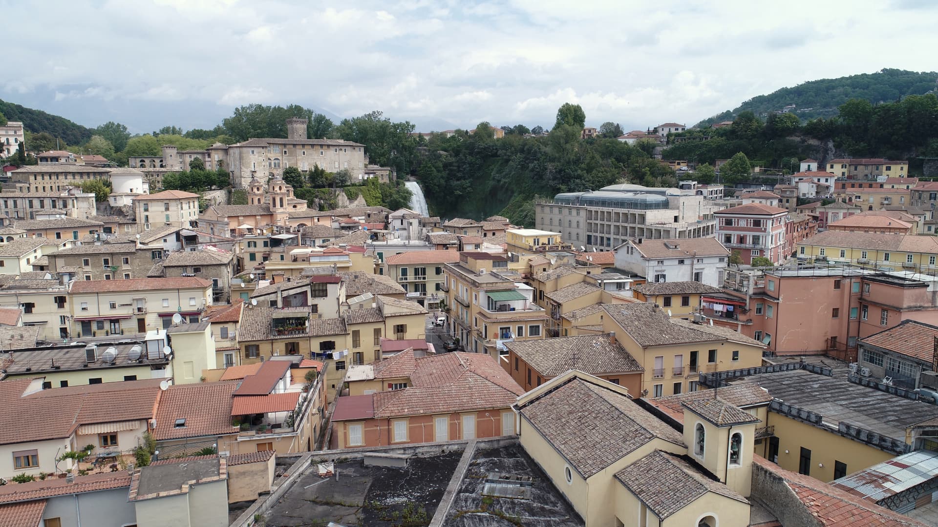
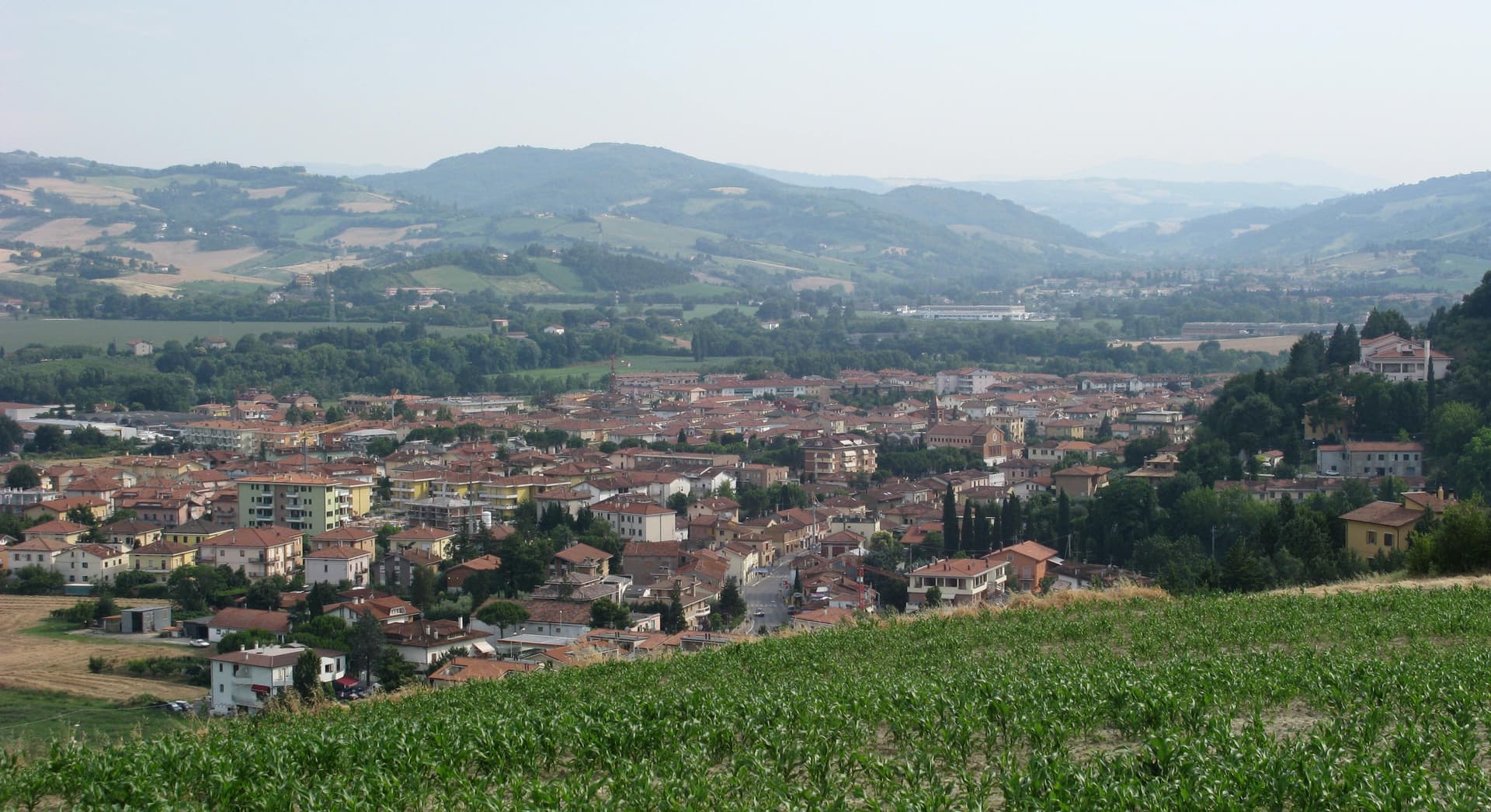
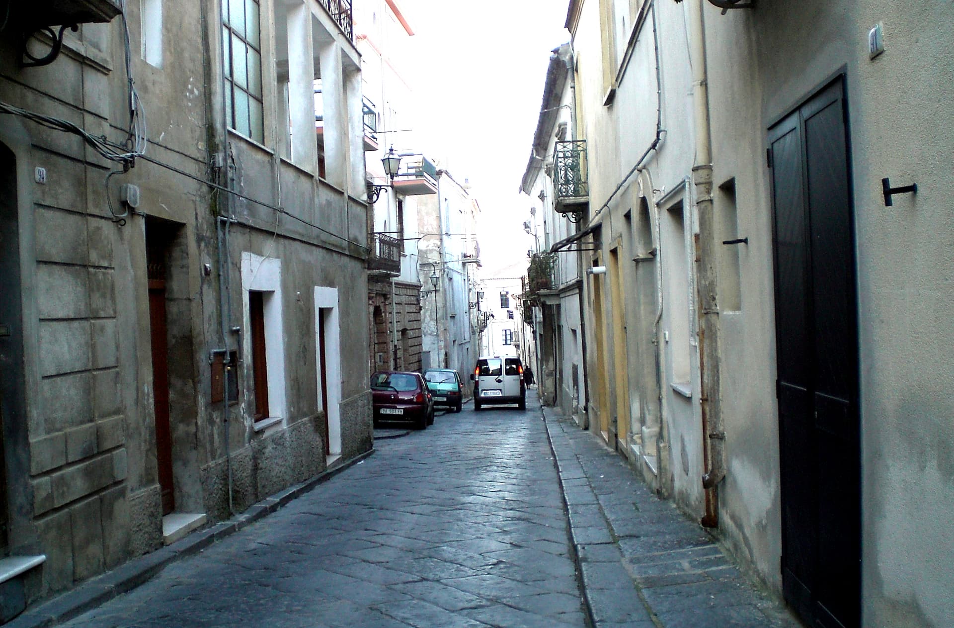
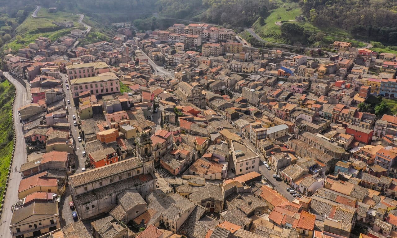
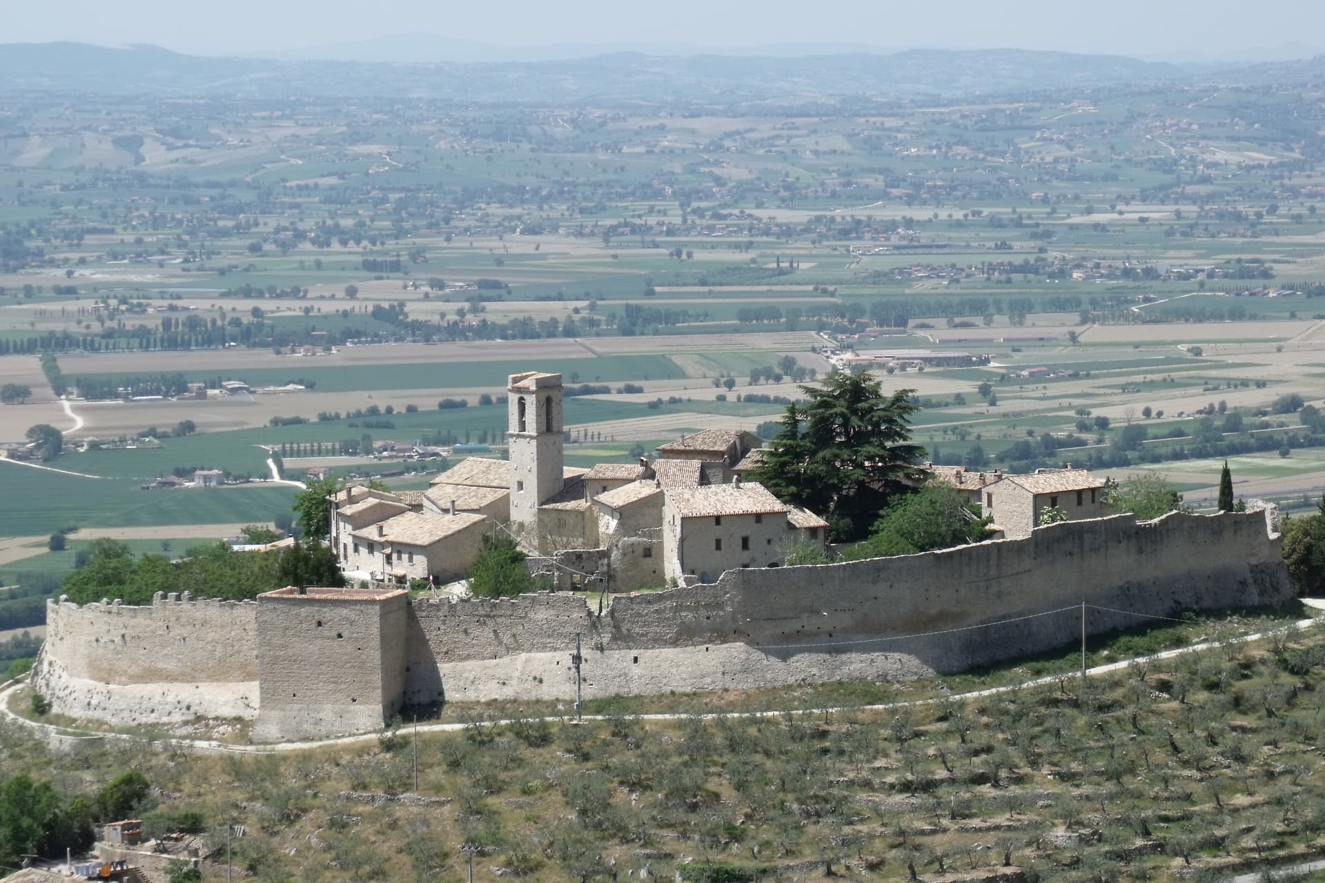
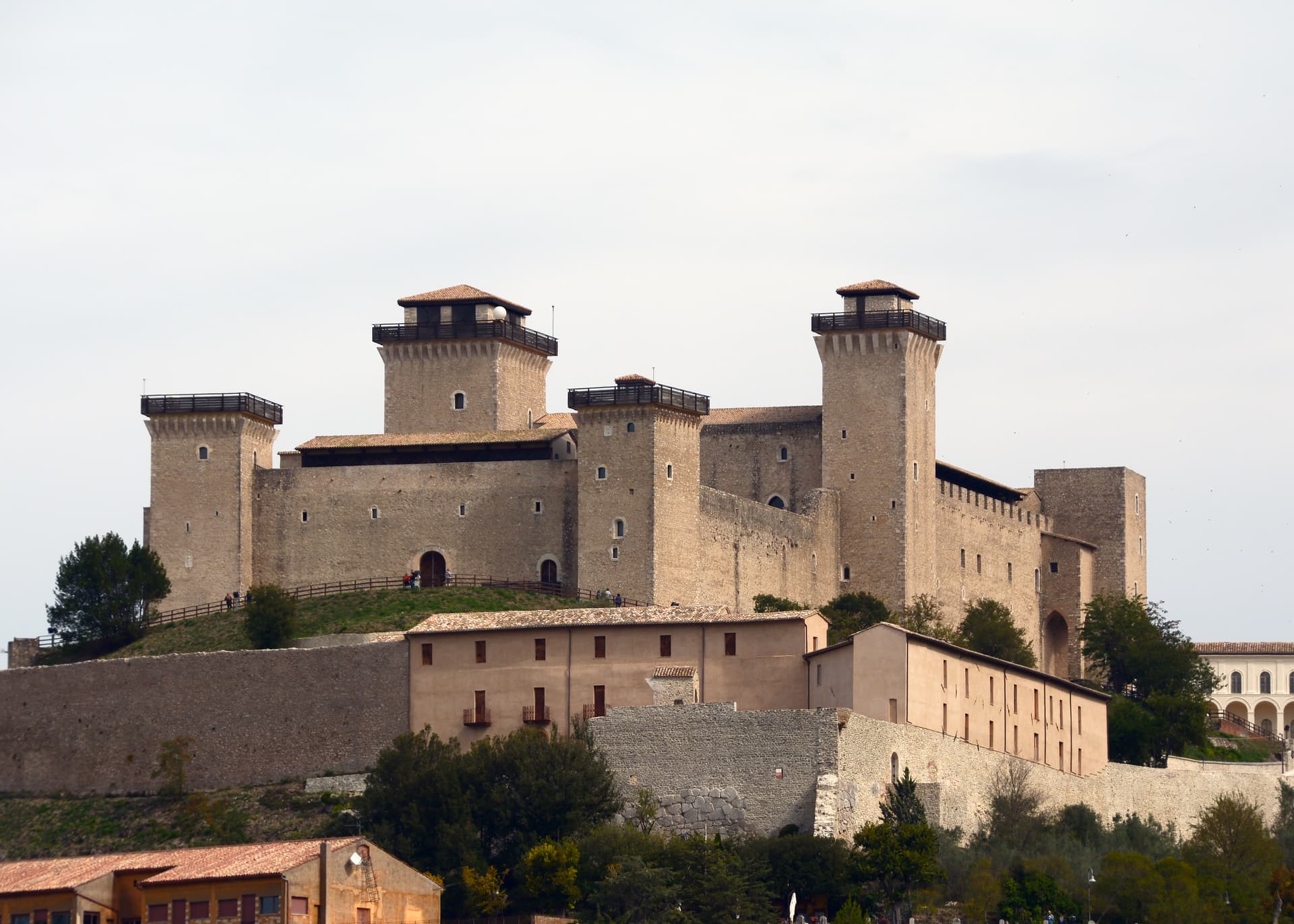
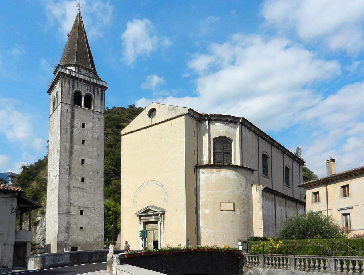
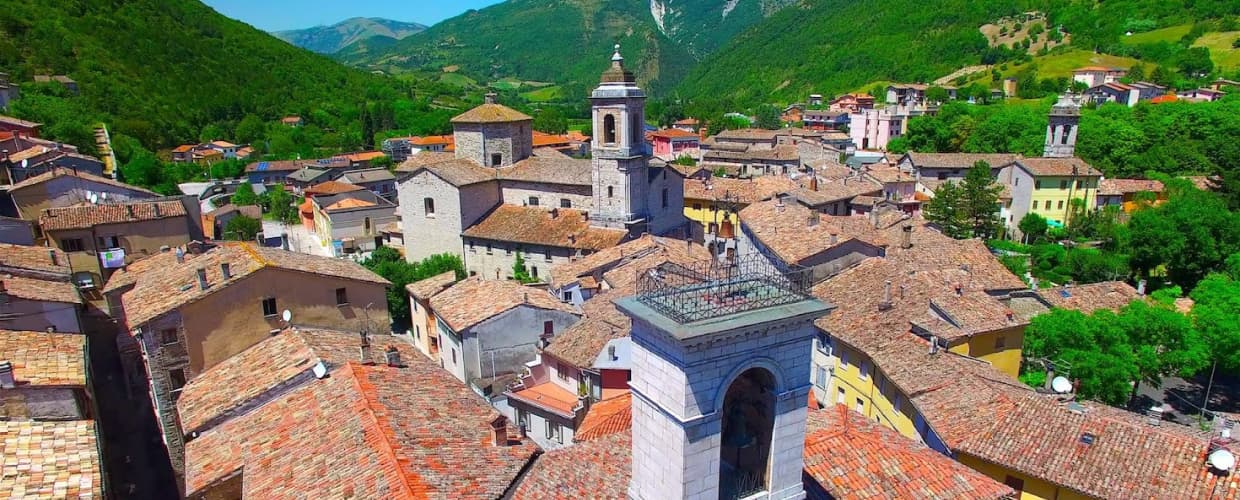
Archi
Province: Chieti · 492 m
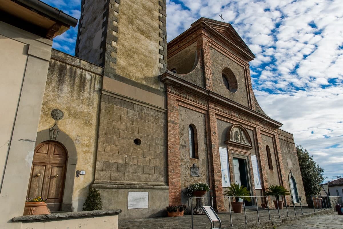
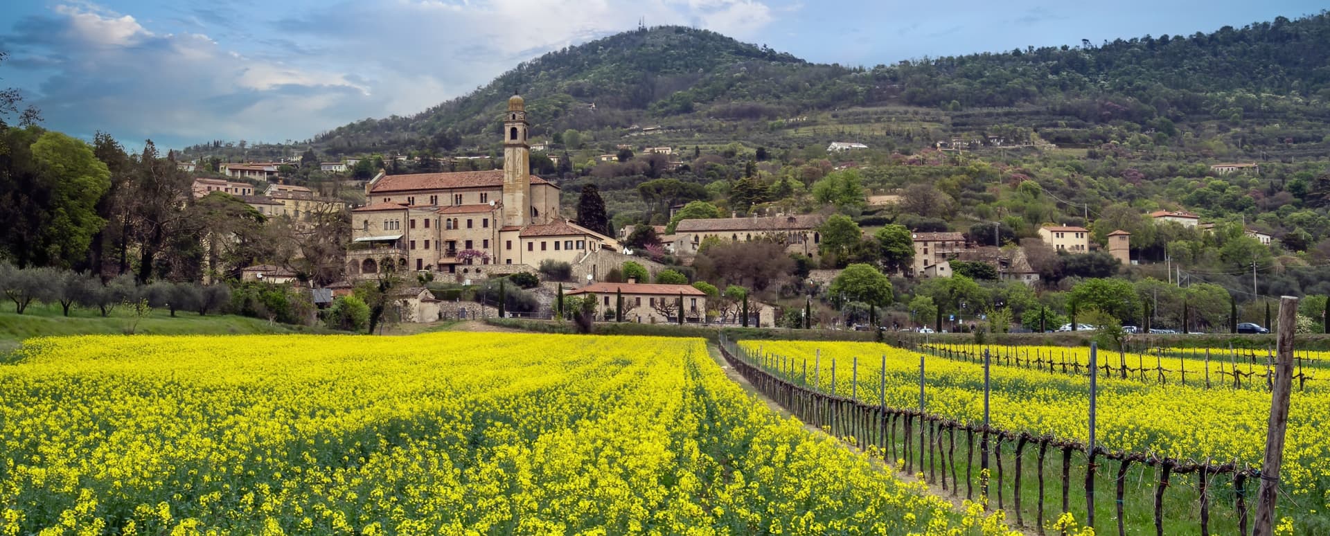
A 492-meter rocky spur called the Terrazza sul Sangro, fief of del Balzo, Cantelmo, Colonna and Carafa, now Città del Tartufo and Città dell'Olio.
Atri
Province: Teramo · 442 m
At 442 meters on three hills ten kilometers from the Adriatic, ancient Hadria, source of the emperor Hadrian's family name and the Adriatic's.
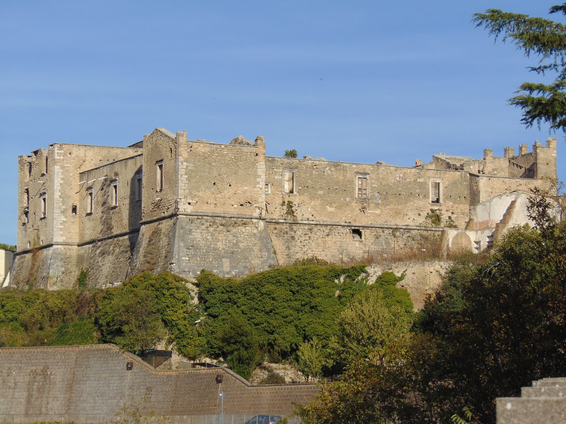
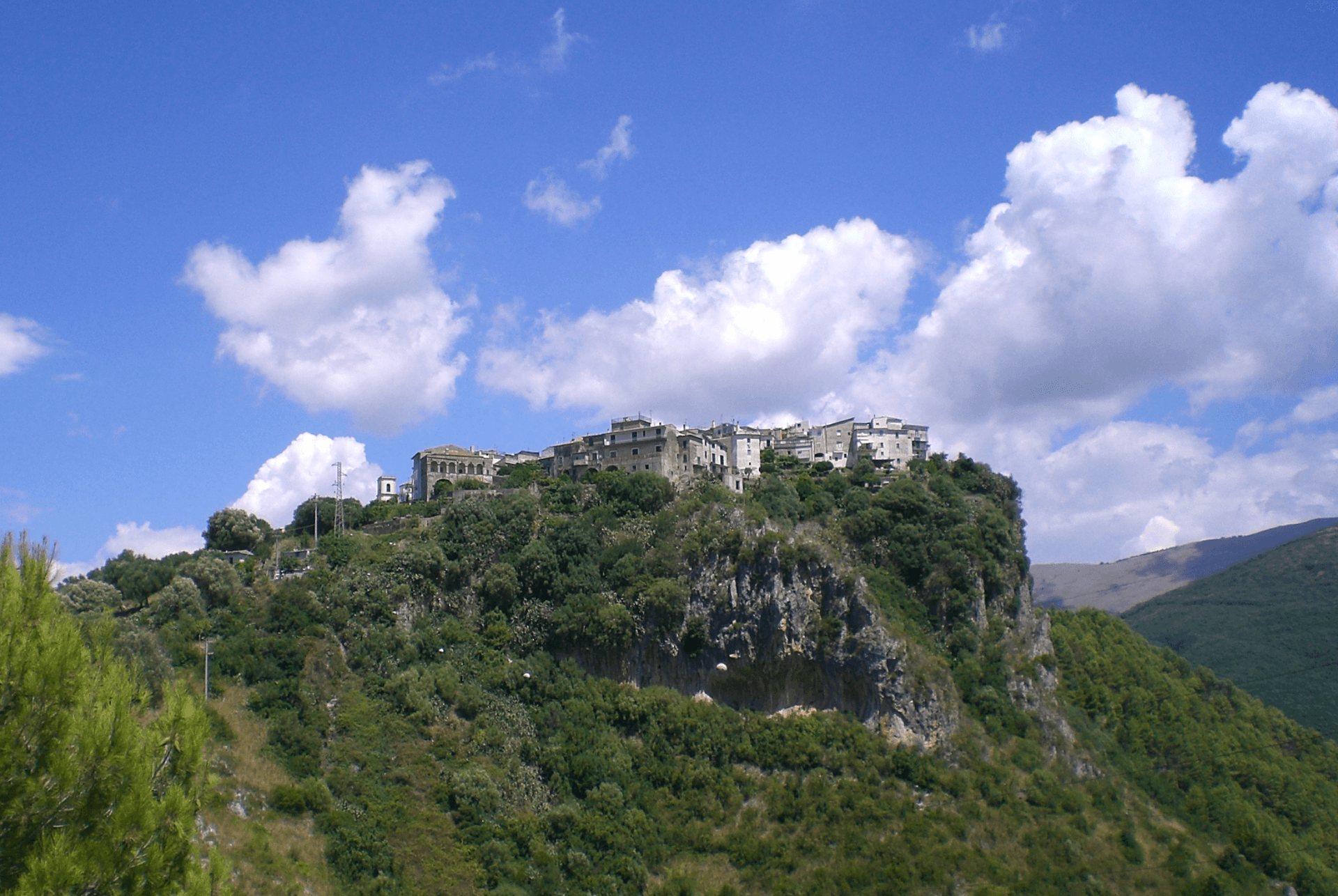
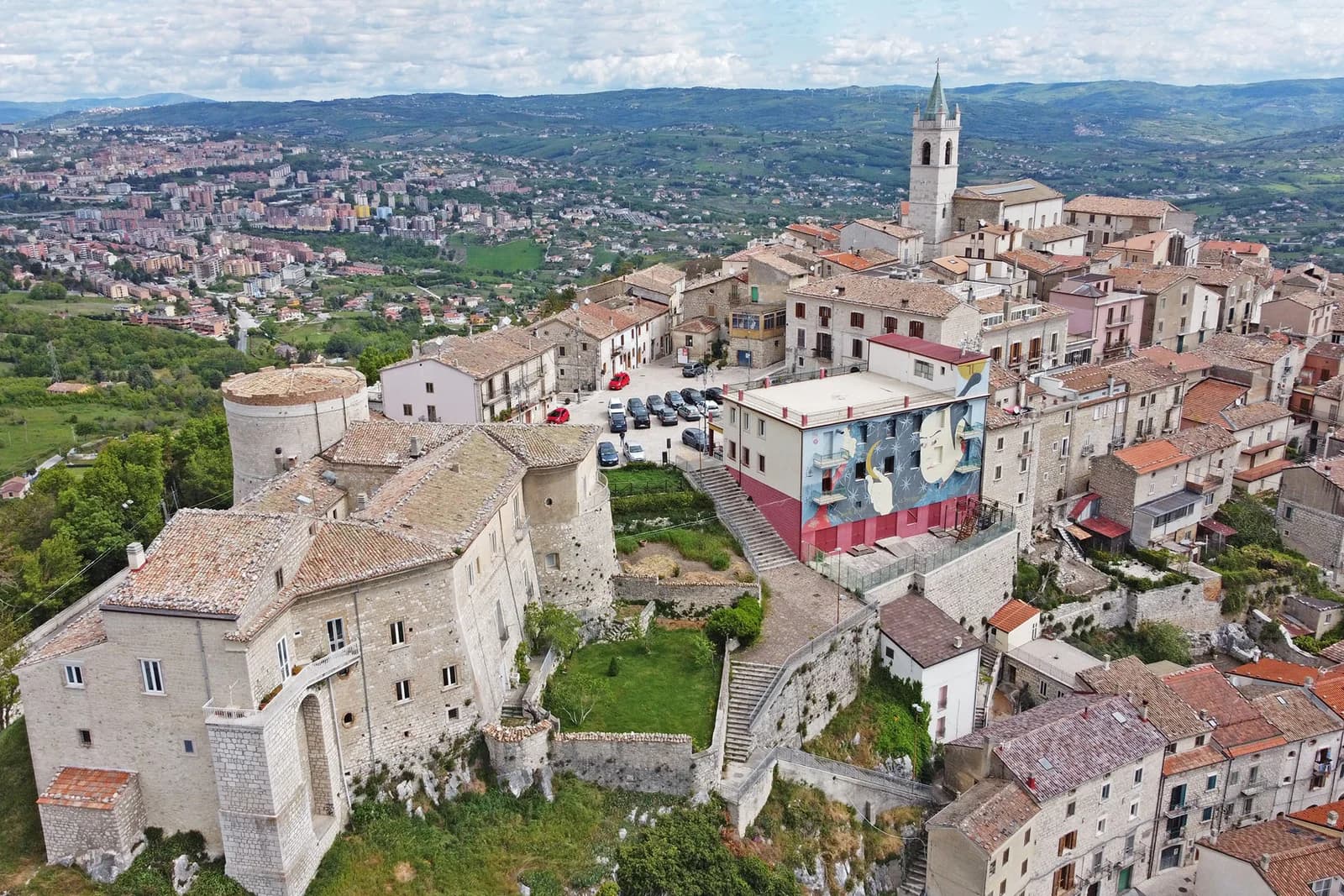
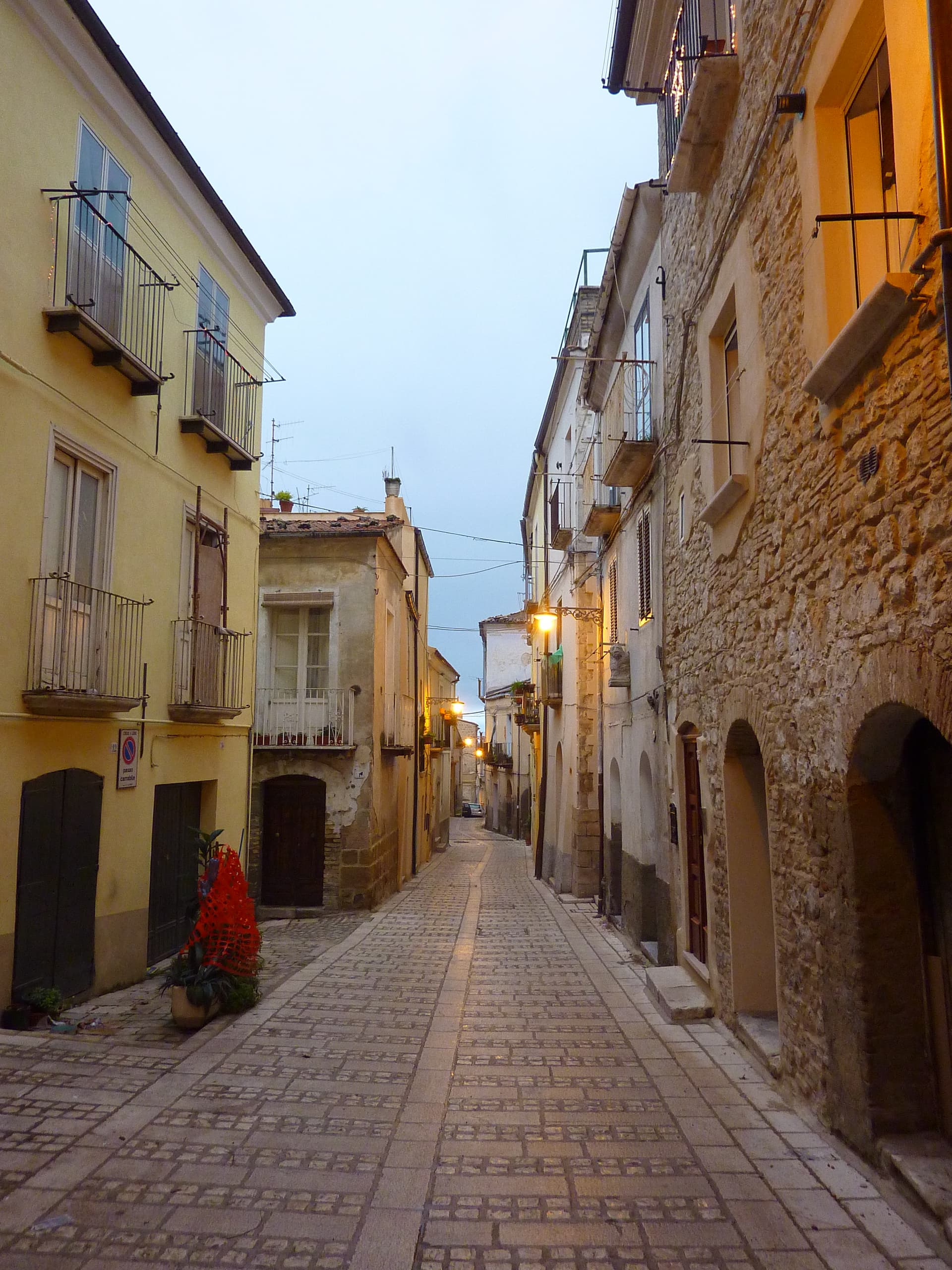
Casoli
Province: Chieti · 378 m
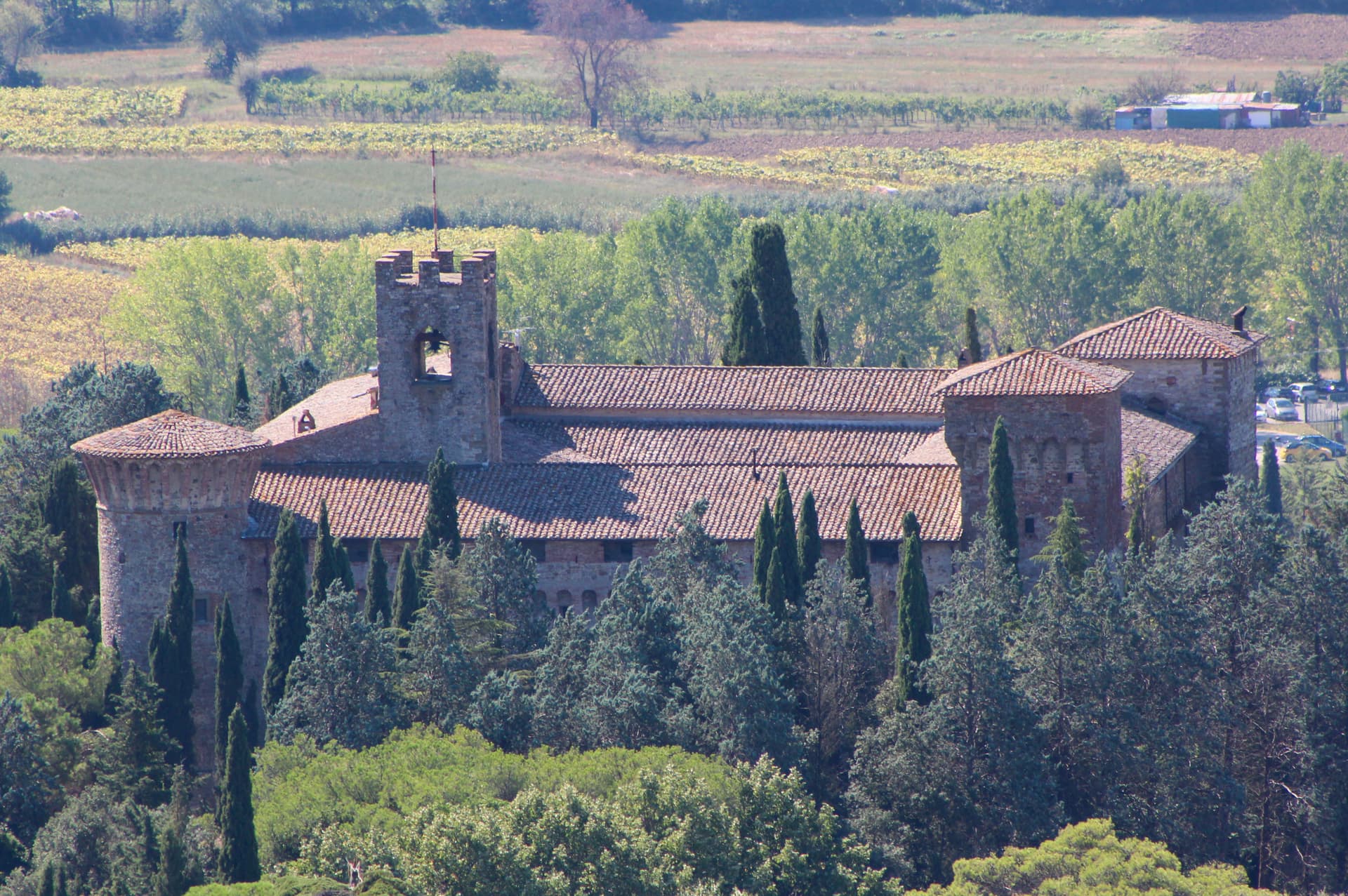
A 378-meter hill town above the Aventino under the Maiella, with a pentagonal Norman tower where Gabriele D'Annunzio held a Renaissance court of artists.
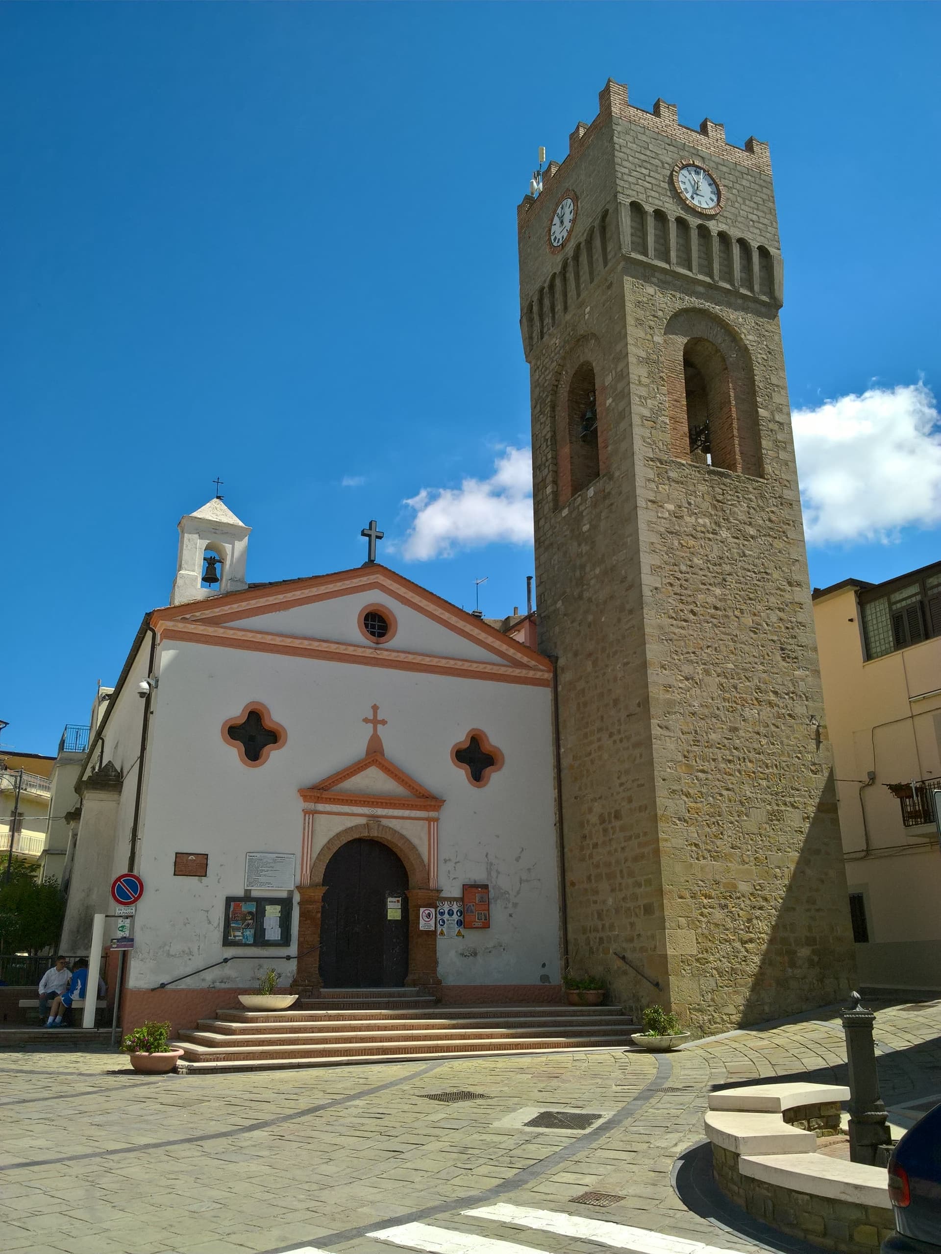
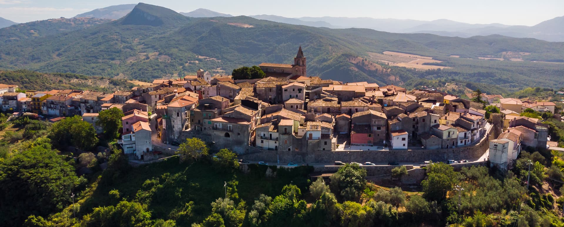
Città Sant'Angelo
Province: Pescara · 320 m
A hilltop borgo at 320 meters between the Vestina hills and the Adriatic, named for the Archangel and known since 1352 as a Collegiata seat.
Controguerra
Province: Teramo · 267 m
A 267-meter Val Vibrata wine village, seat of the Controguerra DOC since 1996, and a founding Cittaslow of the Teramo hills.
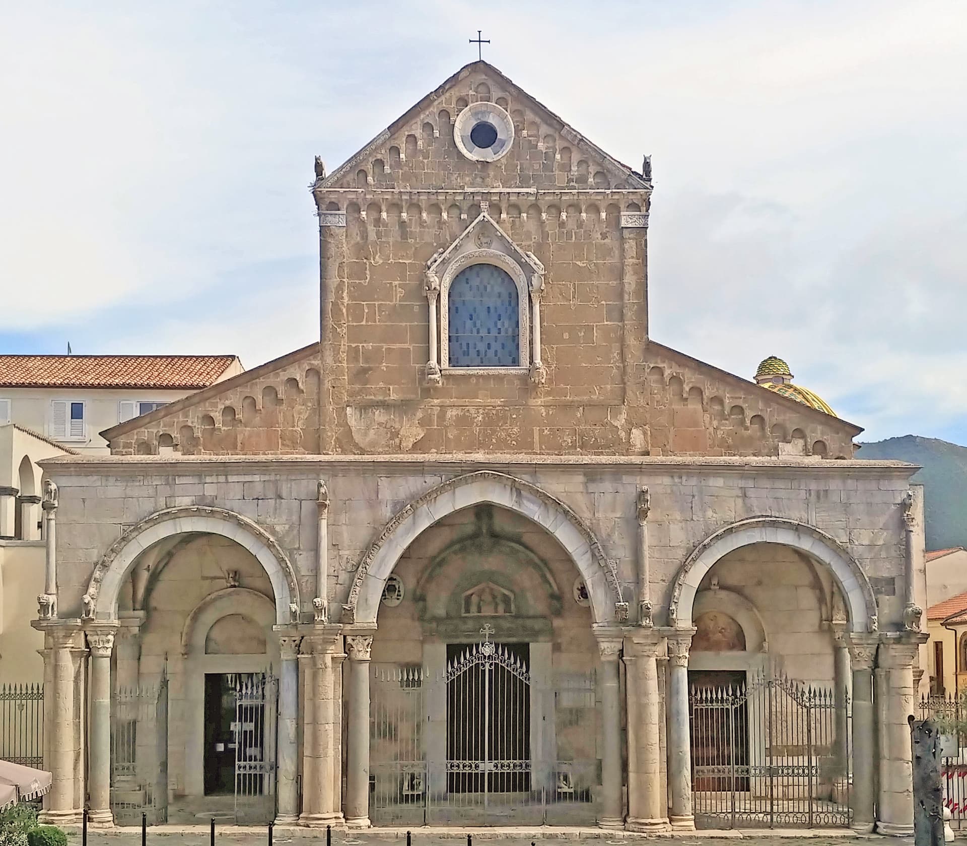
Loreto Aprutino
Province: Pescara · 290 m
A hilltop town at 290 meters in the Aprutino olive country, with a fourteenth-century Judgment fresco and a Castelli majolica collection.
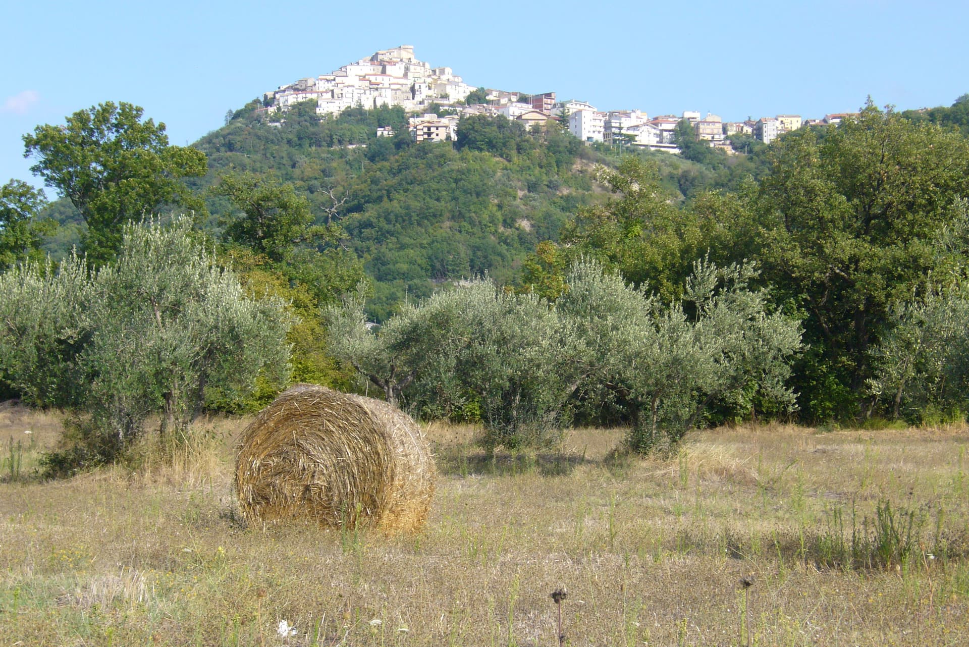
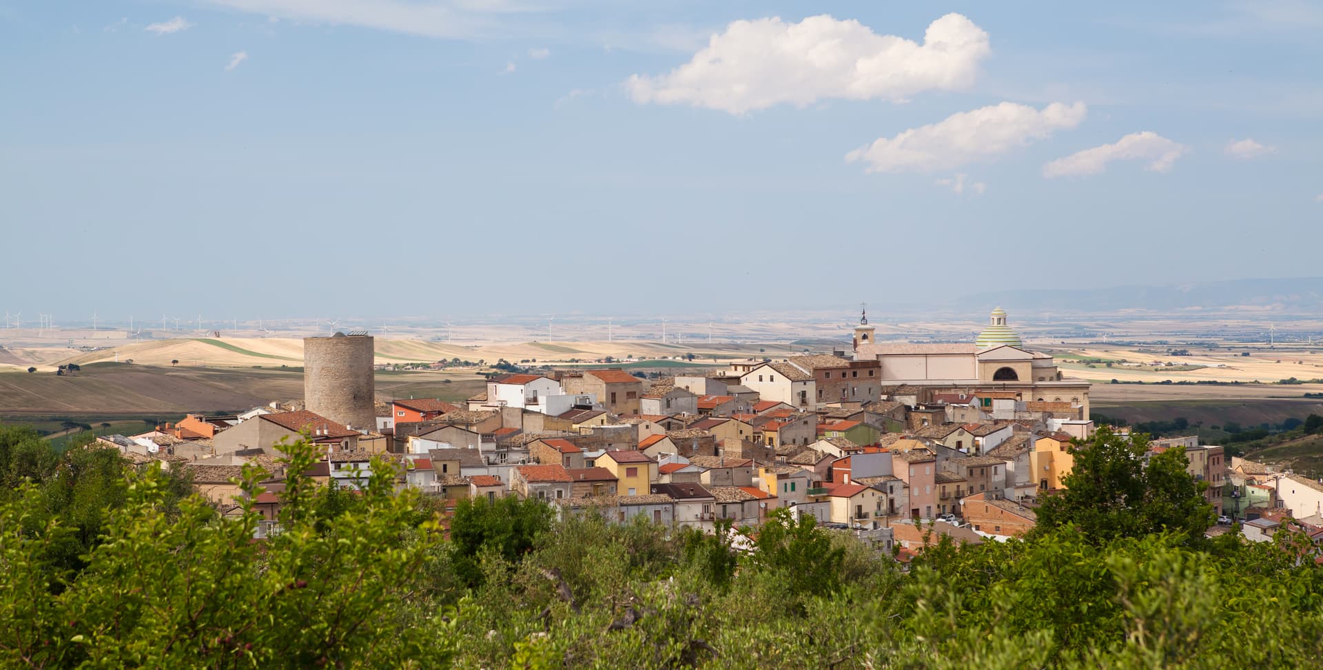
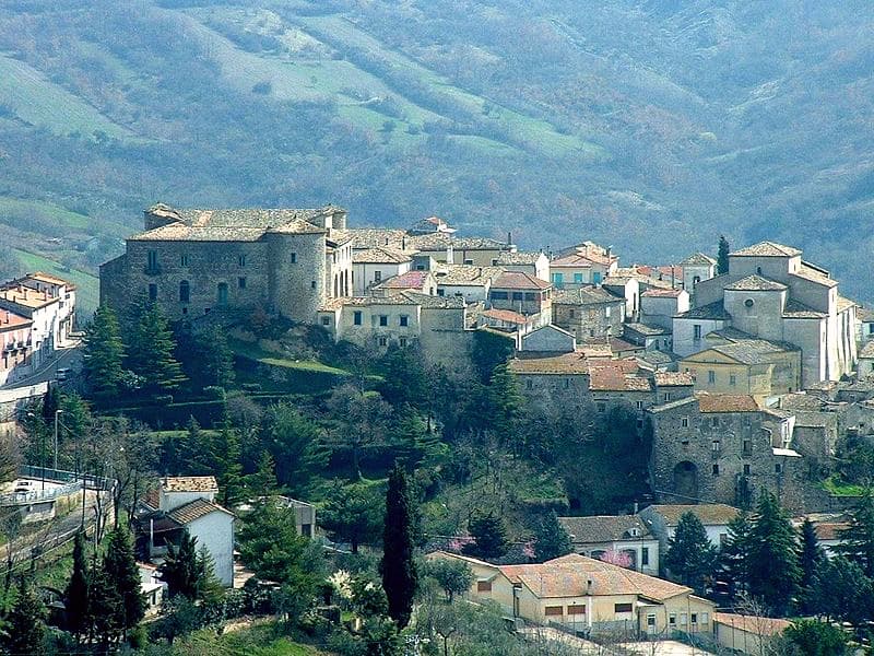
Ofena
Province: L'Aquila · 531 m
A 531-meter Vestian basin called the Forno d'Abruzzo, sealed by the Gran Sasso wall, where Montepulciano ripens on what may be the oldest of its slopes.
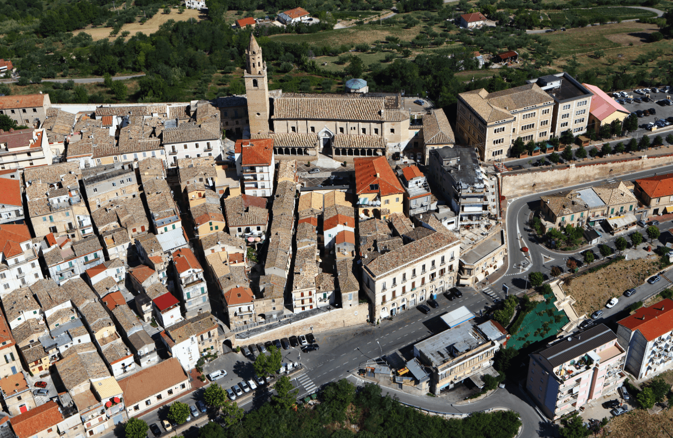
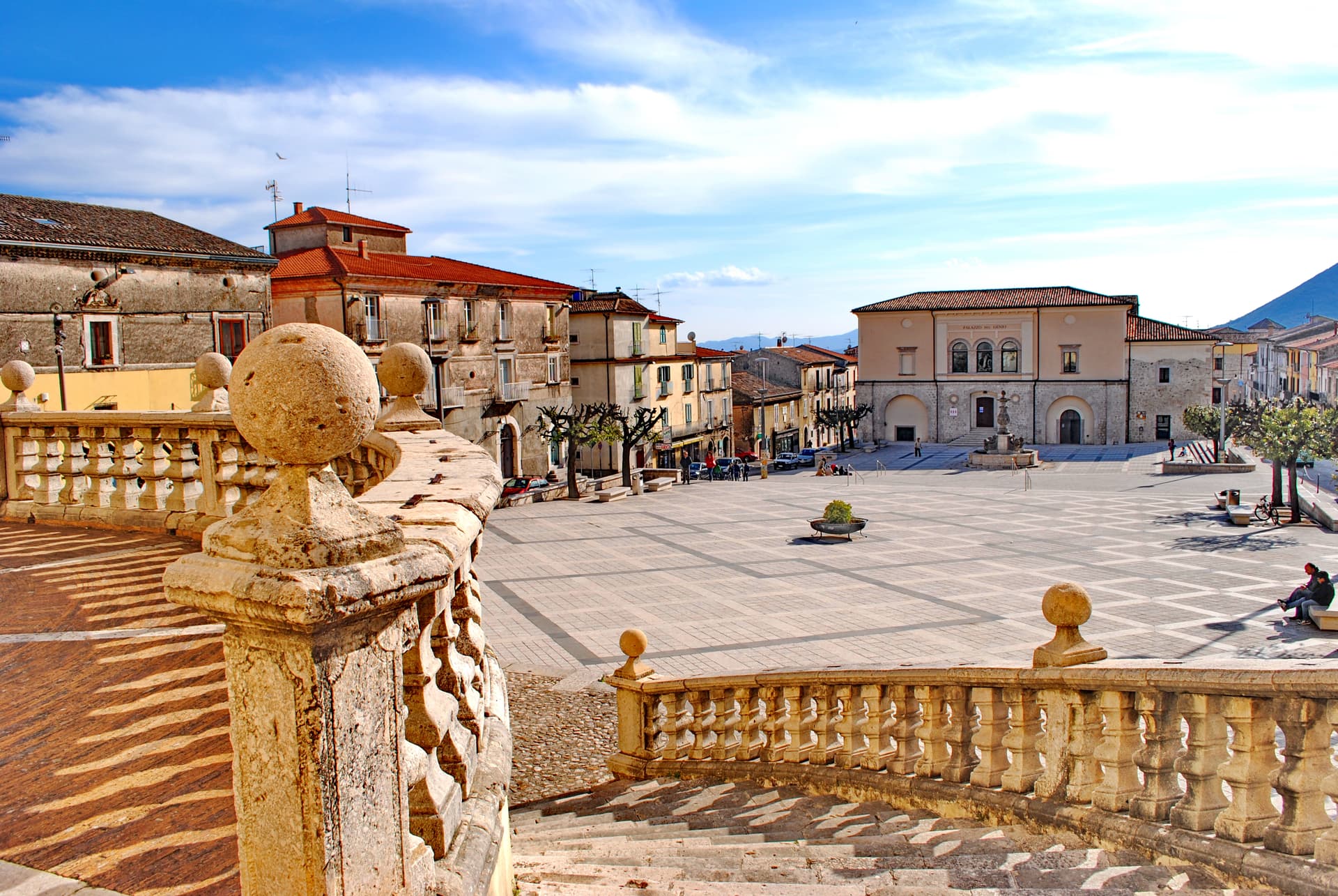
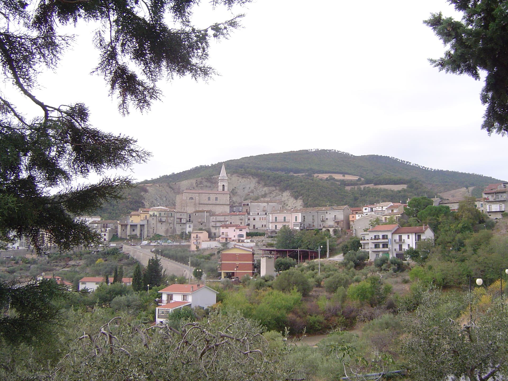
Penne
Province: Pescara · 438 m
The brick city at 438 meters between the Tavo and Fino, ancient capital of the Vestini, rebuilt after Allied bombing and awarded the Silver Medal of Civic Merit.
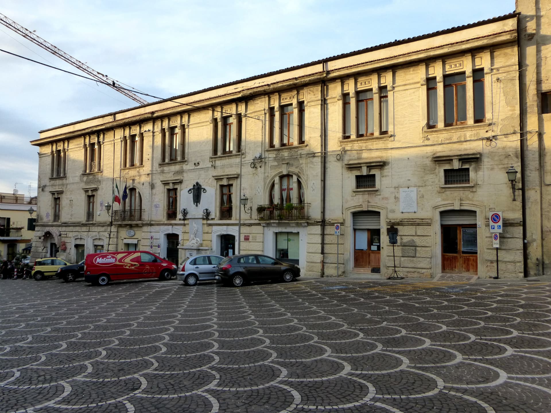
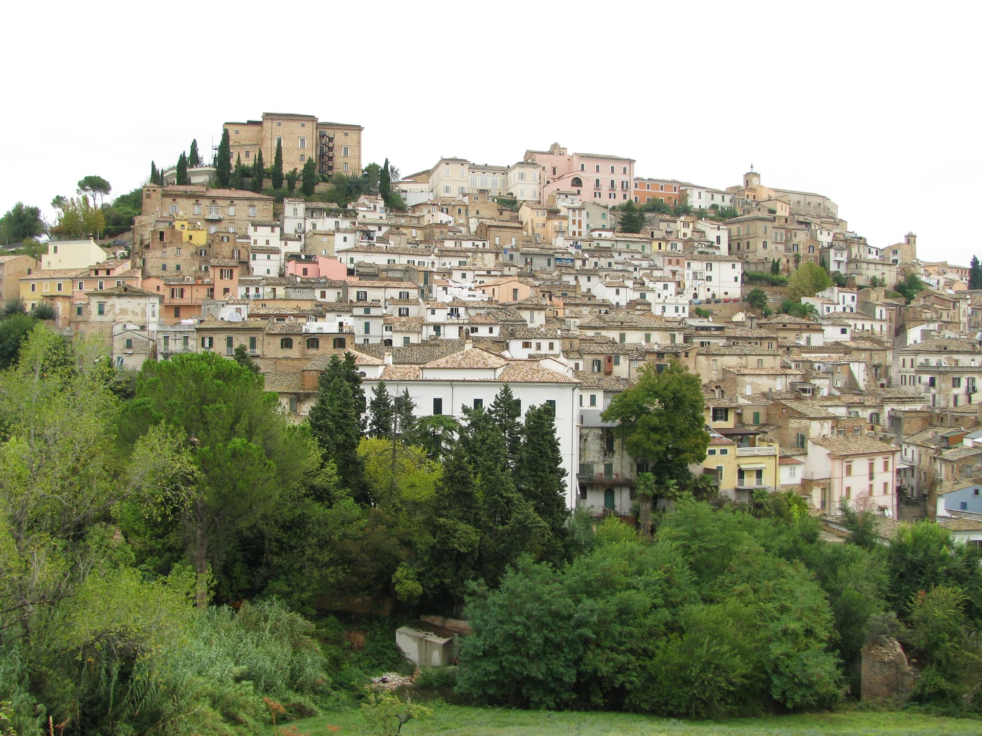
Pianella
Province: Pescara · 236 m
A Cittaslow hill town at 236 meters between the Tavo and Pescara rivers, anchor of the Aprutino oil triangle and home of the dritta olive.
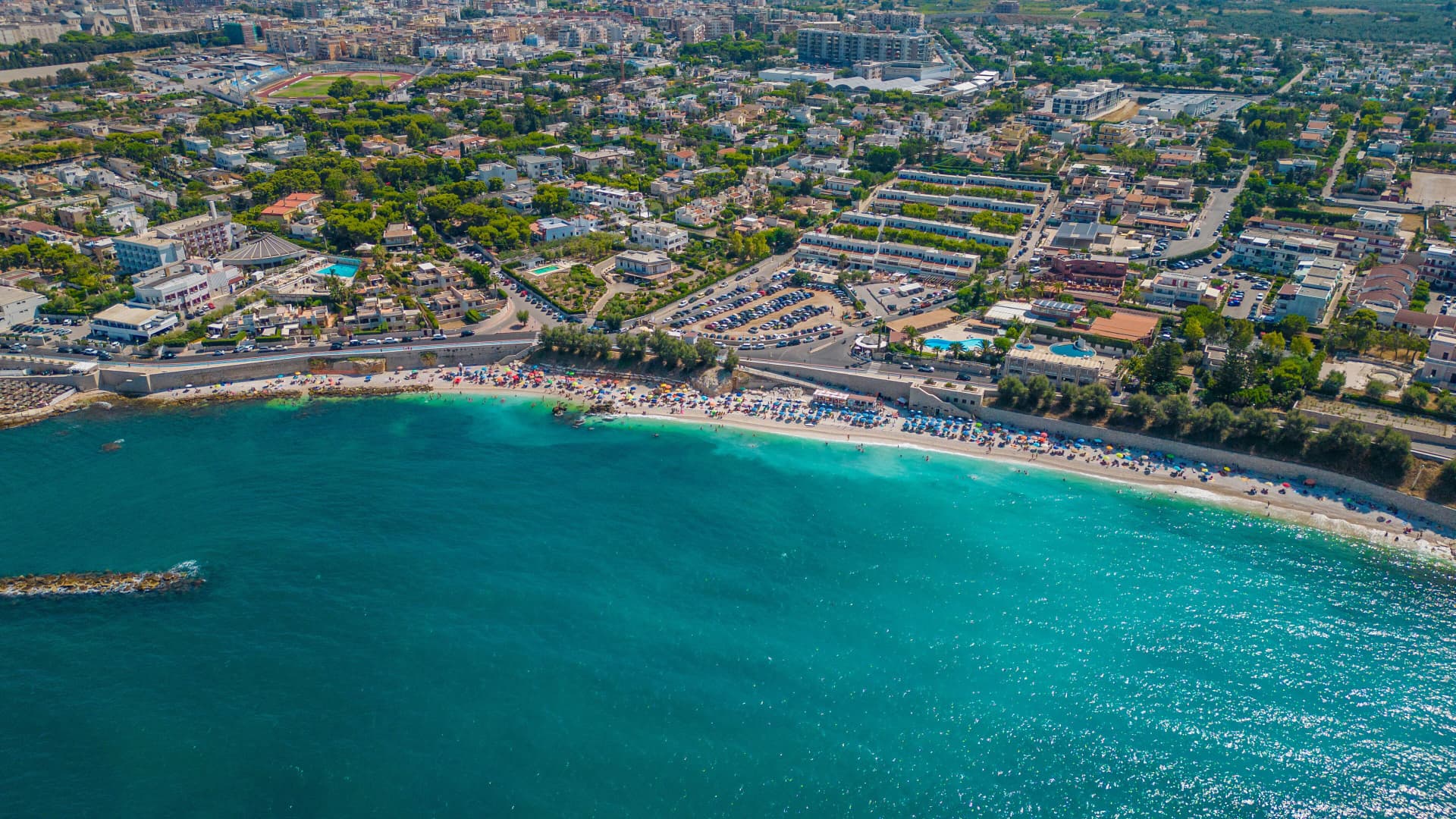
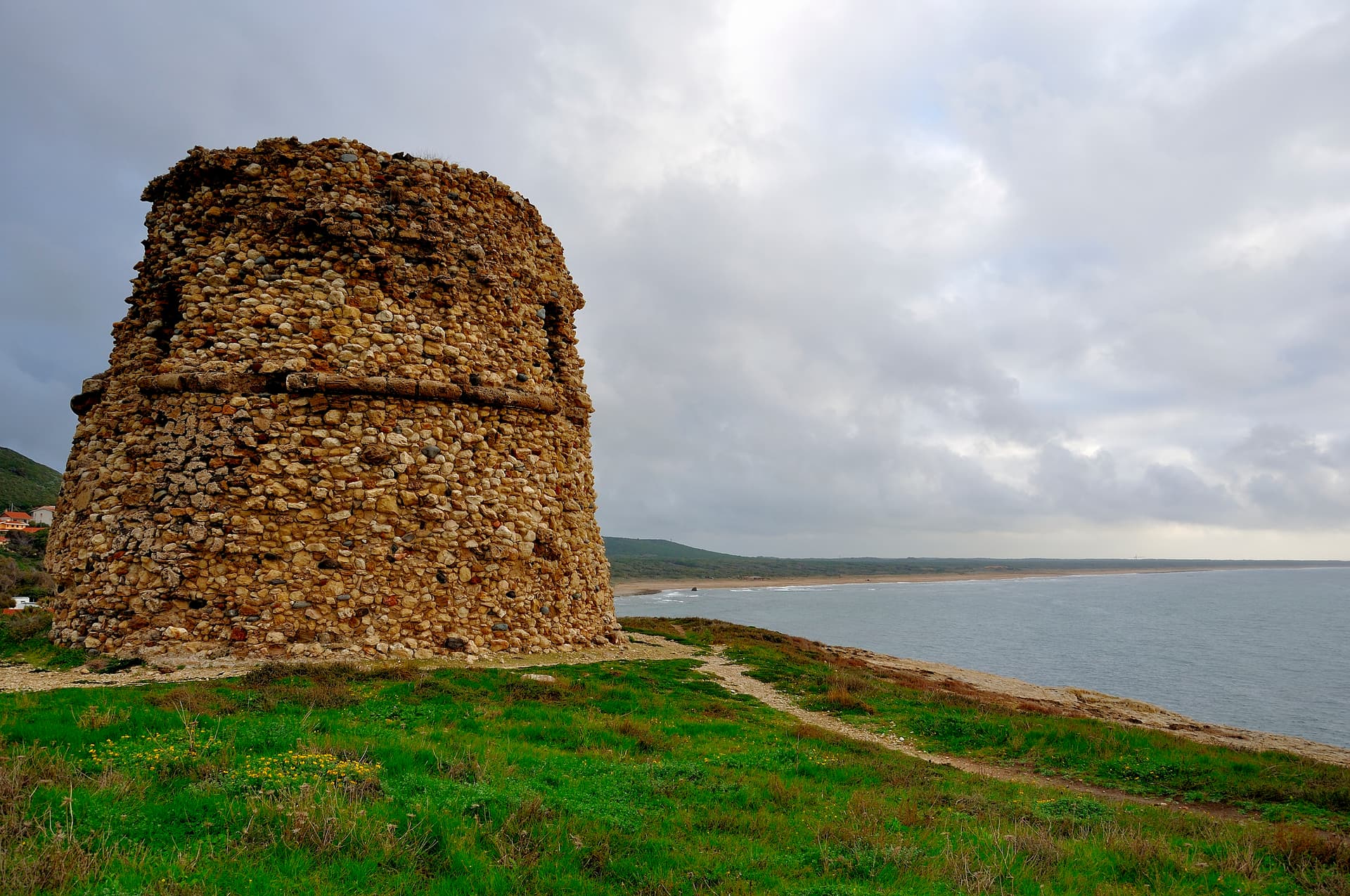
Pineto
Province: Teramo · 4 m
A planned twentieth-century beach town named for D'Annunzio's poem, with the sixteenth-century Cerrano tower anchoring Abruzzo's first marine protected area.
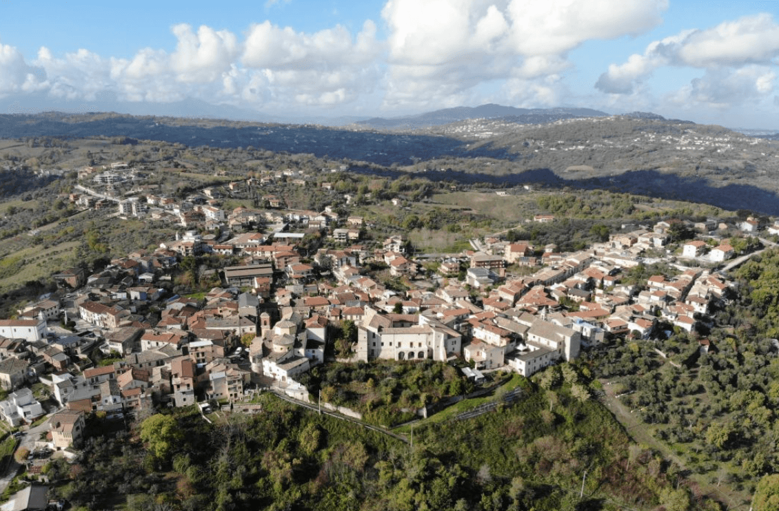
Tocco da Casauria
Province: Pescara · 356 m
A 356-meter hill town between the Pescara river and the Maiella, built around a Carolingian abbey and an herb liqueur called Centerba.
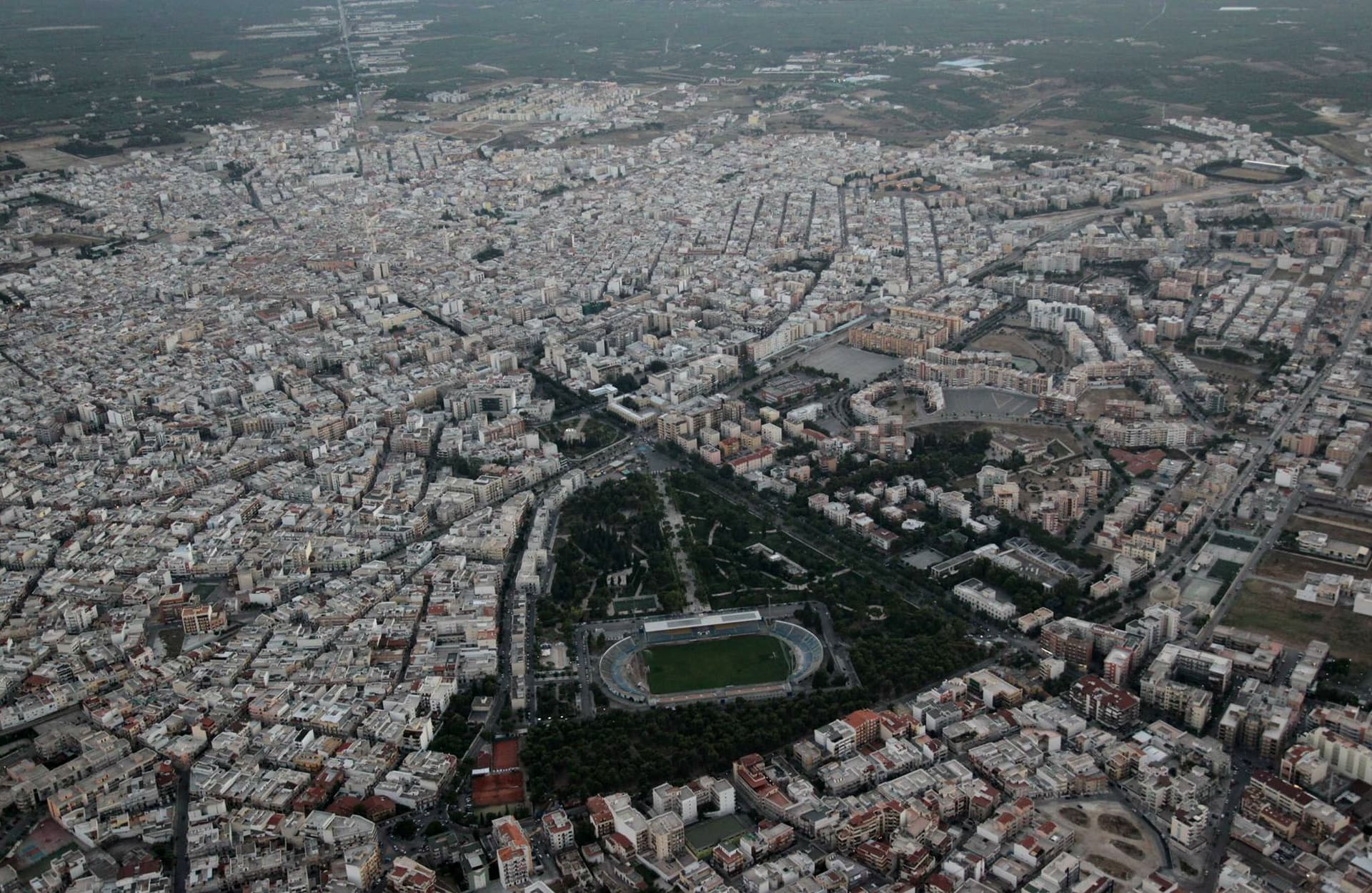
Apulia22
Acquaviva delle Fonti
Province: Bari · 300 m
A Murge town at 300 meters between Bari and the Itria valley, named for its springs and a DOP red onion.
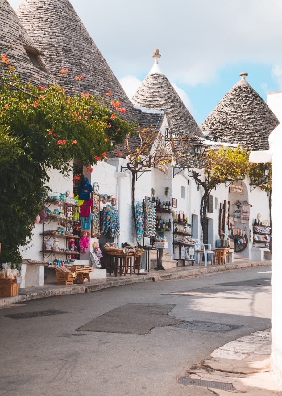
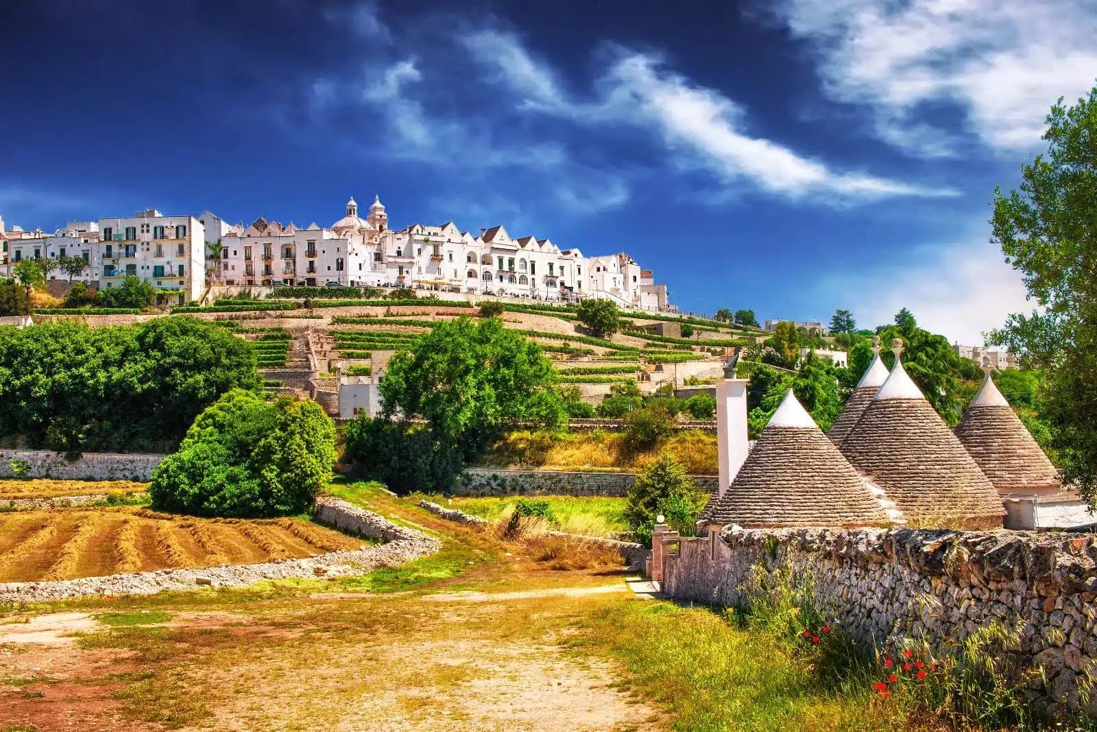
Alberobello
Province: Bari · 402 m
The Itria valley town built entirely of trulli, 1,500 corbelled limestone cones in two quarters, UNESCO since 1996.
Andria
Province: Barletta-Andria-Trani · 151 m
Frederick II's favourite Apulian city, the birthplace of burrata, with the octagonal Castel del Monte rising 540 meters above the Murge eighteen kilometers south.
Biccari
Province: Foggia · 450 m
A Subappennino Dauno borgo at 450 meters under Monte Cornacchia, the highest peak in Puglia at 1,151 meters, with a Byzantine tower at its core.
Bisceglie
Province: Barletta-Andria-Trani · 16 m
An Adriatic port town between Trani and Molfetta, named for Roman watchtowers, with five dolmens around it and a Norman cathedral begun in 1073.
Carovigno
Province: Brindisi · 161 m
An upper Salento town between Brindisi and Ostuni, built on the Messapian Carbina destroyed in 473 BC, with the Torre Guaceto marine reserve offshore.
Casamassima
Province: Bari · 230 m
The blue town of the Murge, twenty kilometers south of Bari, its centro storico painted with copper-blue lime after the 1658 plague spared its residents.
Cassano delle Murge
Province: Bari · 341 m
A Murge foothills town at 341 meters at the gate of the Alta Murgia park, with the 1,300-hectare Foresta Mercadante mostly inside its territory.
Castellana Grotte
Province: Bari · 290 m
A Murge town at 290 meters above the karst cave system discovered in 1938, with a 3-kilometer subterranean route 60 meters deep.

Conversano
Province: Bari · 219 m
A pre-Murge hill town at 219 meters, three centuries seat of the Acquaviva counts, with the abbey-monastery once called the Wonder of Puglia.
Fasano
Province: Brindisi · 118 m
A Brindisi-province town from the Adriatic up to the Itria escarpment, holding the Roman ruins of Egnazia, the Selva, and Europe's second-largest safari park.
Giovinazzo
Province: Bari · 7 m
An Adriatic fishing port twenty kilometers northwest of Bari, with a Norman cathedral and a Bronze Age dolmen in the agro inland.
Locorotondo
Province: Bari · 410 m
The round white town on the Itria valley ridge at 410 meters, with cummerse roofs the rest of Puglia does not have.
Mattinata
Province: Foggia · 75 m
The only Apulian town that faces south on the Adriatic, the white amphitheater of the eastern Gargano with the Zagare sea stacks below.
Melendugno
Province: Lecce · 36 m
Salento's archaeological-beach capital — a 10,000-resident Lecce-province comune covering 17 km of Adriatic coast with three Bandiera Blu beaches (Torre dell'Orso, San Foca, Sant'Andrea), the Grotta della Poesia karst pool (one of the world's most beautiful natural pools per National Geographic), and the Bronze-Age-to-Messapian-to-medieval Roca Vecchia archaeological site.
Minervino Murge
Province: Barletta-Andria-Trani · 445 m
The Balcone di Puglia at 445 meters on the Alta Murgia, between the Ofanto valley and Monte Vulture, inside the national park.
Monopoli
Province: Bari · 9 m
An Adriatic walled town forty kilometers south of Bari, the Charles V castle on the headland, 156 square kilometers of coastline behind it.

Sammichele di Bari
Province: Bari · 280 m
A Murge town at 280 meters founded in 1609, anchored by the Caracciolo castle and famous for the zampina pork sausage.

San Severo
Province: Foggia · 86 m
The Daunia wine capital on the Tavoliere, home to Puglia's first DOC of 1968 and a Carnevale of fanoia explosions known across the south.
Trinitapoli
Province: Barletta-Andria-Trani · 5 m
A Tavoliere town between the Saline di Margherita and the Ofanto, sitting on a Bronze Age sanctuary that still surprises archaeologists.
Vico del Gargano
Province: Foggia · 445 m
A Gargano hill town at 445 meters with a Norman castle, a kiss alley, and DOP citrus groves stepping down to the Adriatic.

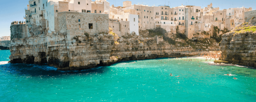
Vieste
Province: Foggia · 43 m
The Gargano headland of whitewashed alleys on a white limestone cliff, with the Pizzomunno sea stack standing 26 meters offshore.
Basilicata7
Acerenza
Province: Potenza · 833 m
A walled ridge town at 833 meters in the north Lucanian hills, archbishopric since 1068 under a Romanesque cathedral begun in 1080.
Aliano
Province: Matera · 555 m
The clay-hill village at 555 meters above the Agri valley where Carlo Levi served his 1935 exile and is buried in the cemetery.
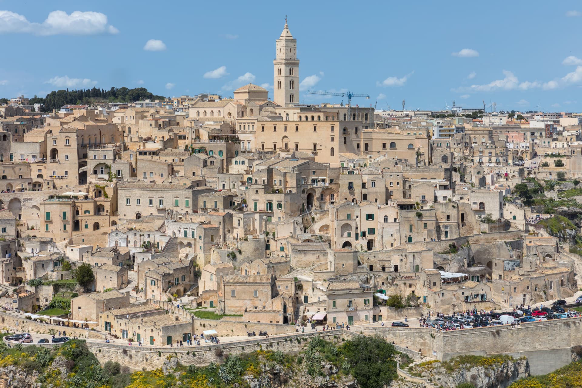
Matera
Province: Matera · 401 m
Cave dwellings carved into limestone since the Paleolithic, called the shame of Italy in the 1950s and made European Capital of Culture in 2019.
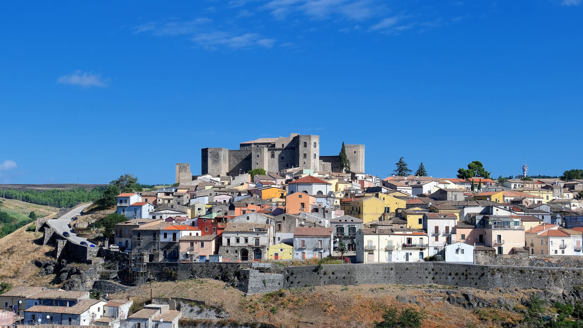
Melfi
Province: Potenza · 530 m
At 530 meters on the slopes of Monte Vulture, first Norman capital of the south and the seat of Frederick II's 1231 Constitutions of Melfi.
Miglionico
Province: Matera · 461 m
A hilltop borgo at 461 meters above the Bradano, the seven-tower castle that gave the 1485 Conspiracy of the Barons its hall.
Rotondella
Province: Matera · 576 m
The 'Balcony of the Ionian' — a 2,400-resident Lucanian borgo on a 576m hilltop overlooking the Metapontino plain and the Ionian Sea, with intact medieval streets, the Chiesa di Santa Maria della Neve, and a high-quality DOP olive oil from the surrounding terraced groves.
San Mauro Forte
Province: Matera · 540 m
A 540-meter Lucanian hill town built around a surviving Norman tower, where the Sagra dei Campanacci on 16 January wakes the village with cowbells.
Calabria4
Altomonte
Province: Cosenza · 455 m
The highest Gothic-Angevin church in Calabria, a Simone Martini panel commissioned in 1326, and a hill of 455 meters in the Esaro valley.
Corigliano-Rossano
Province: Cosenza · 219 m
The Sibari plain city merged in 2018, home of the UNESCO-listed sixth-century Codex Purpureus and the 1731 Amarelli liquorice dynasty.
Gerace
Province: Reggio di Calabria · 470 m
A 470-meter conglomerate rock above Locri, founded by Locri Epizefiri refugees, with Calabria's largest cathedral on Roman columns from Magna Graecia temples.

Saracena
Province: Cosenza · 606 m
A 606-meter Pollino borgo named for its Saracen souk and protected by Slow Food for a passito Moscato traced to the sixteenth century.
Campania9
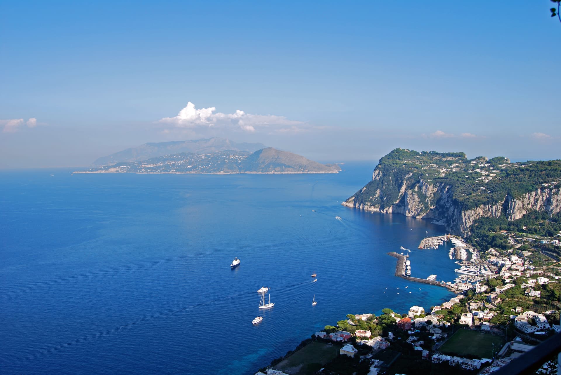
Anacapri
Province: Napoli · 275 m
The upper half of Capri, 150 meters above its famous twin, where Axel Munthe built Villa San Michele on a Tiberian ruin.
Ariano Irpino
Province: Avellino · 788 m
The City of the Three Hills at 788 meters, where Roger II promulgated the Assizes of 1140 and majolica kilns still fire.
Caiazzo
Province: Caserta · 200 m
A Cittaslow hill above the Volturno, turned by Franco Pepe's pizza into a destination for 800 covers a day in eighteenth-century rooms.
Camerota
Province: Salerno · 422 m
A Cilento hill of 422 meters above the Costa degli Infreschi, with prehistoric caves documenting Neanderthal occupation along the southern Tyrrhenian.
Cerreto Sannita
Province: Benevento · 290 m
A Sannio ceramics town at 290 meters, rebuilt from scratch by royal engineer Giovanni Battista Manni after the 1688 earthquake leveled the old hill.
Lapio
Province: Avellino · 590 m
The heart of Fiano di Avellino DOCG country — a 1,428-resident Irpinia borgo at 590m in the hills east of Avellino, with the medieval Castello Filangieri anchoring an intact centro and a rare four-signal combination (Città del Vino + Olio + Miele + Nocciola) recognising the whole local agricultural ecosystem.

Massa Lubrense
Province: Napoli · 121 m
The Sorrentine Peninsula's largest commune by area, stretching from Sorrento across Punta Campanella to the Gulf of Salerno, Capri three miles offshore.
Sessa Aurunca
Province: Caserta · 203 m
Ancient Suessa Aurunca on the south slope of an extinct volcano, with a Romanesque cathedral of Cosmatesque mosaics built in 1103.
Zungoli
Province: Avellino · 657 m
An Irpinia ridge at 657 meters between the Ufita valley and the Daunian hills, with Norman walls above and Byzantine tuff caves below the houses.
Emilia-Romagna4
Brisighella
Province: Ravenna · 115 m
A Lamone-valley borgo at 115 meters under three selenite hills crowned by a fortress, a clock tower, and a sanctuary.
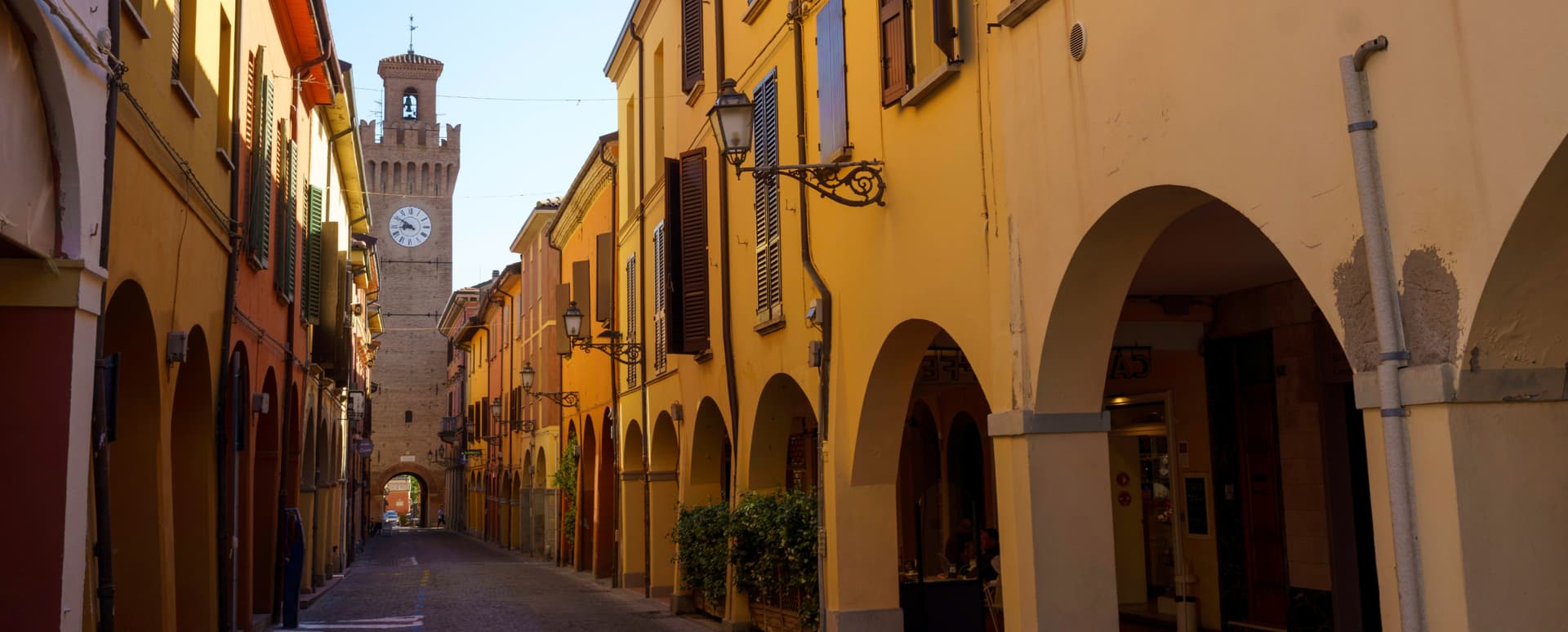
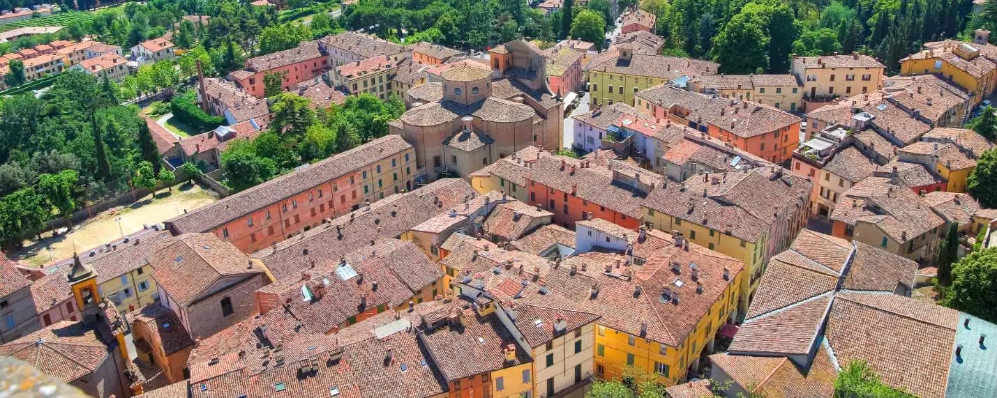
Castel San Pietro Terme
Province: Bologna · 75 m
A 75-meter thermal town on the Via Emilia east of Bologna, with sulphurous waters in use since 1137 and a 1200-built Cassero.
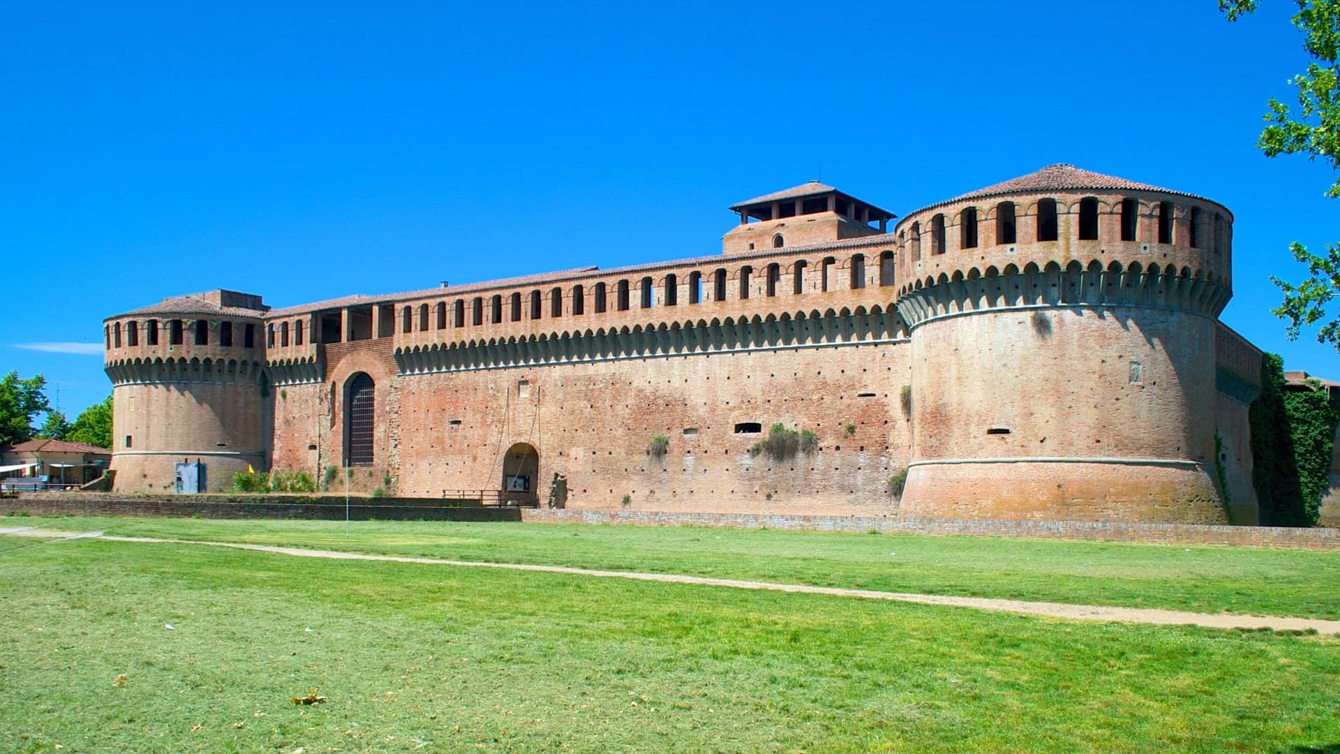
Imola
Province: Bologna · 47 m
Bologna's Romagna twin — a medieval brick centro anchored by the Caterina Sforza-fortified Rocca, with the Autodromo Enzo e Dino Ferrari (the Imola F1 circuit) wrapping the Santerno river at the southern edge of town.
Montegridolfo
Province: Rimini · 290 m
A walled borgo of fewer than a thousand residents on the Romagna-Marche border, held alternately by the Malatesta and the Montefeltro through the fifteenth century.
Friuli-Venezia Giulia3
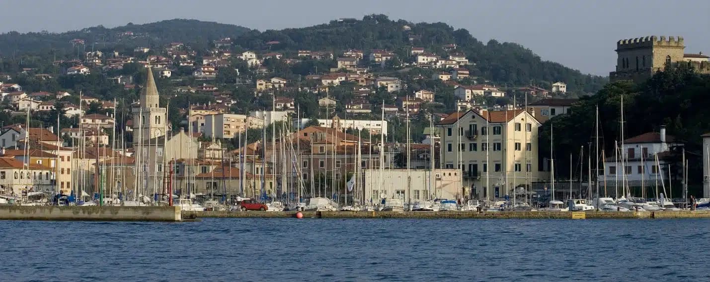
Muggia
Province: Trieste · 13 m
The only town on the Istrian peninsula still inside Italy, a small Venetian port on the Gulf of Trieste five kilometers from the Slovenian border.
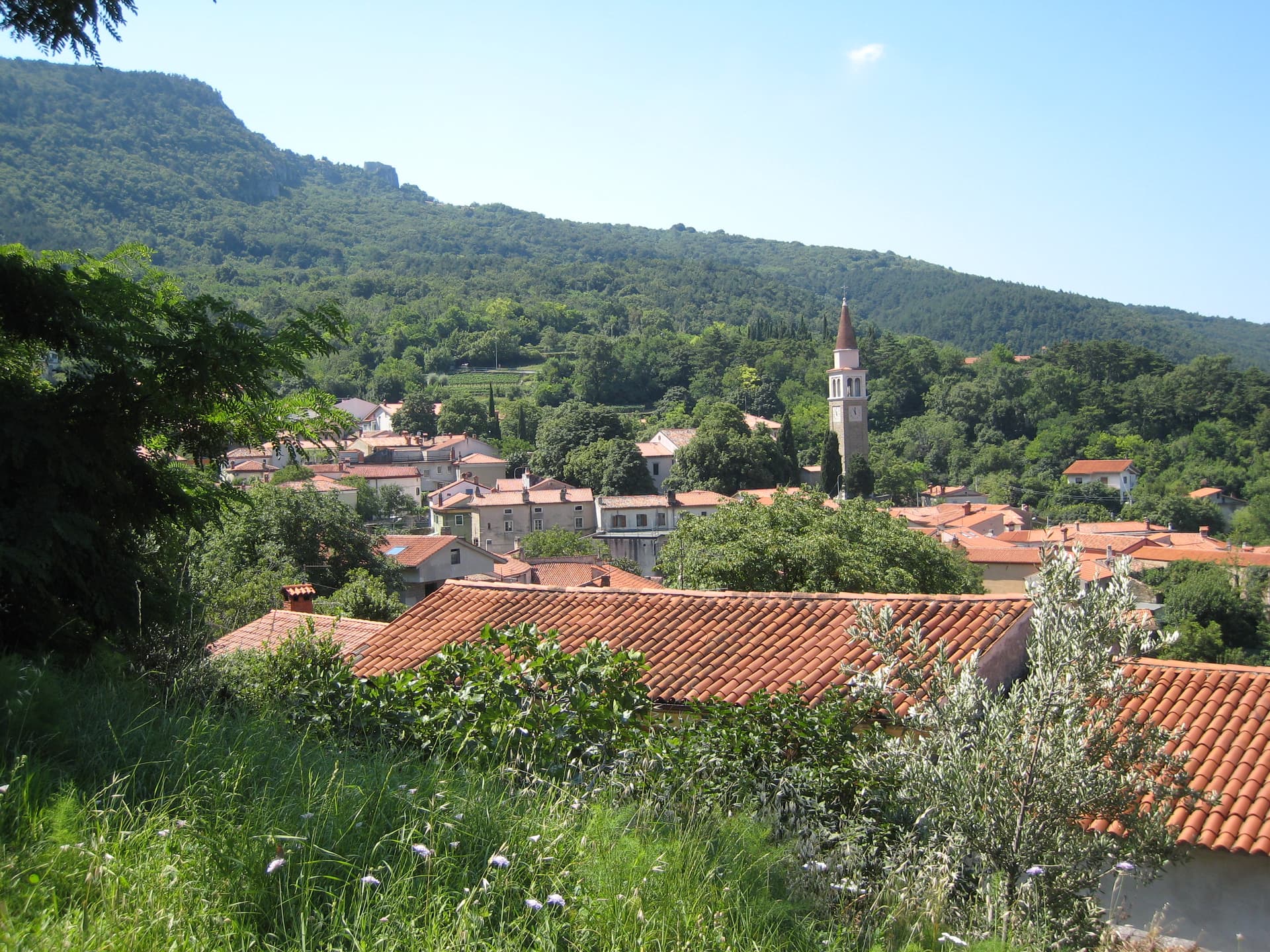
San Dorligo della Valle-Dolina
Province: Trieste · 84 m
A Slovene-speaking Karst commune ten kilometers from Trieste, with its own valley, its own wine, and a canyon Roman aqueducts once crossed.
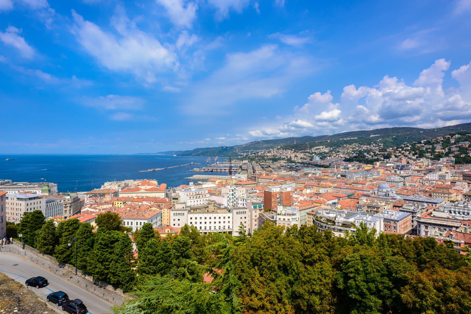
Trieste
Province: Trieste · 2 m
The Adriatic port the Habsburgs built as their window on the sea, an Italian regional capital still arguing in four languages on the Slovenian border.
Lazio8
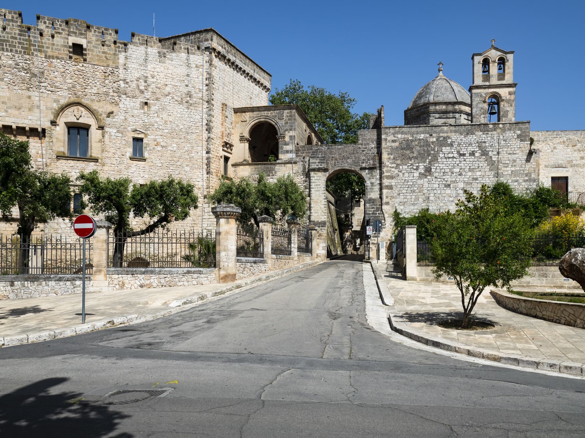
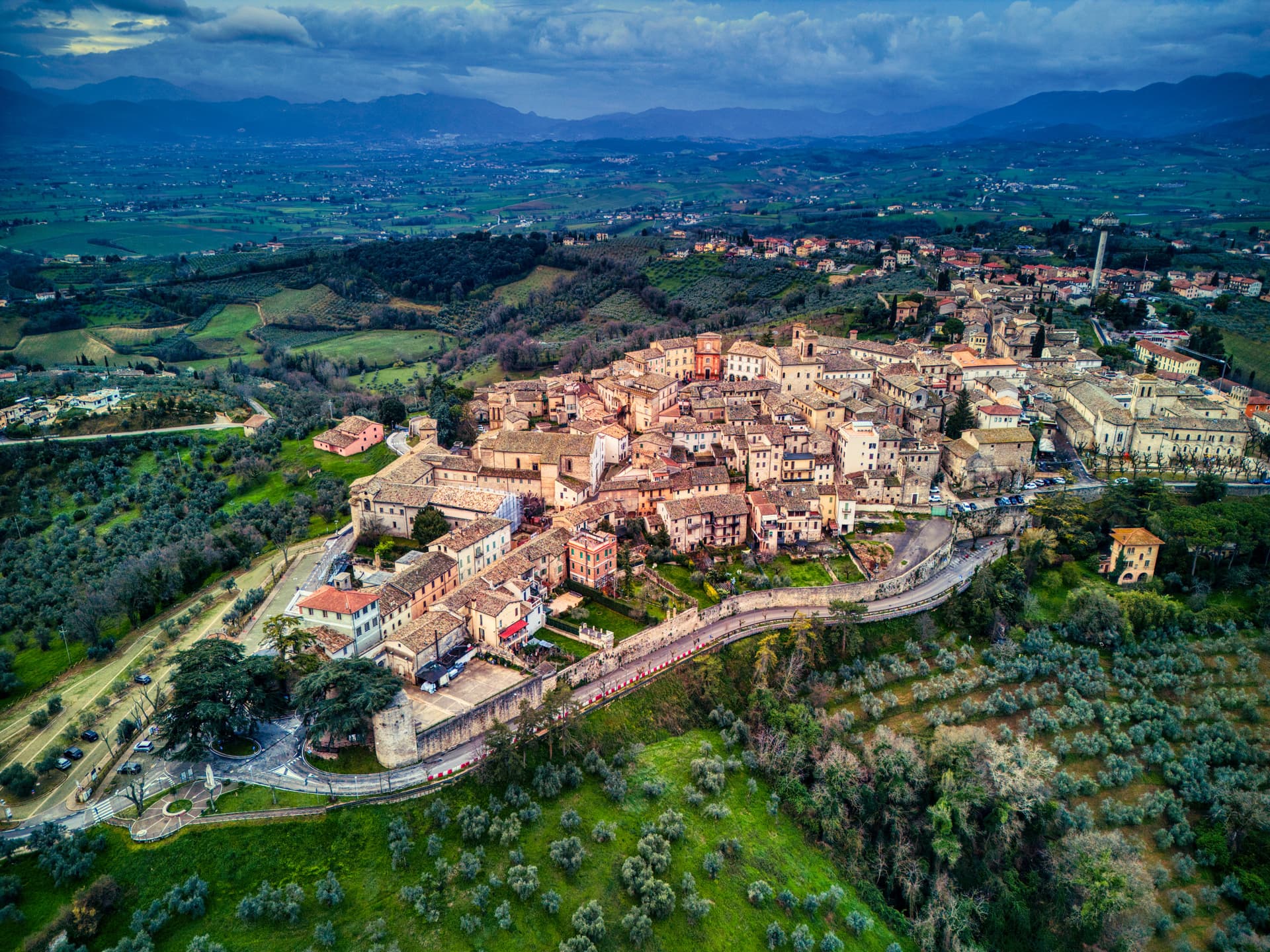
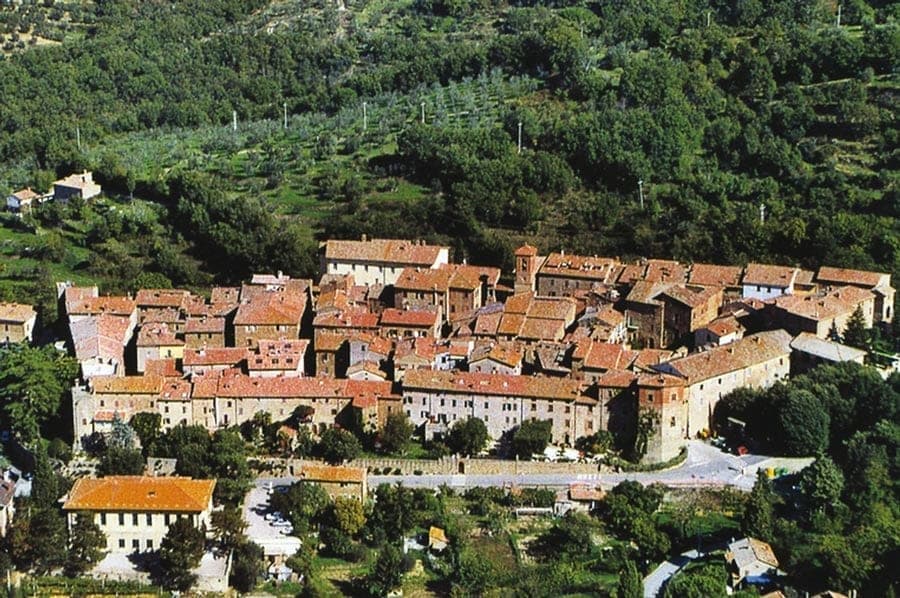
Boville Ernica
Province: Frosinone · 450 m
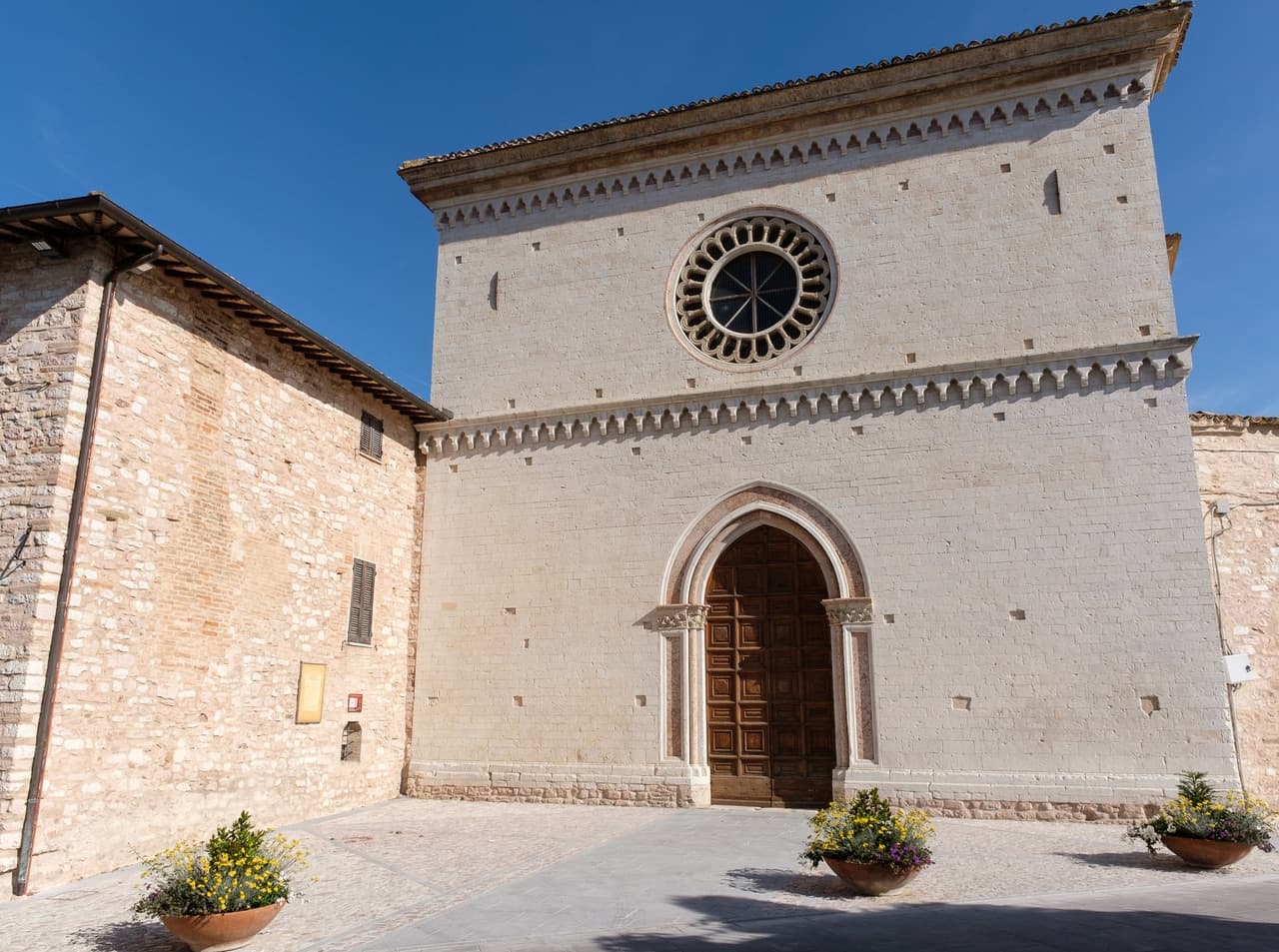
A Ciociaria hilltop town with eighteen intact medieval towers and Giotto's only surviving mosaic, the Angelo del Navicella, in San Pietro Ispano.
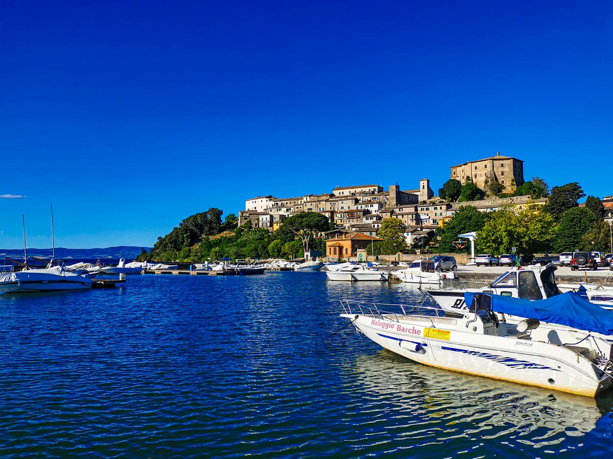
Capodimonte
Province: Viterbo · 364 m
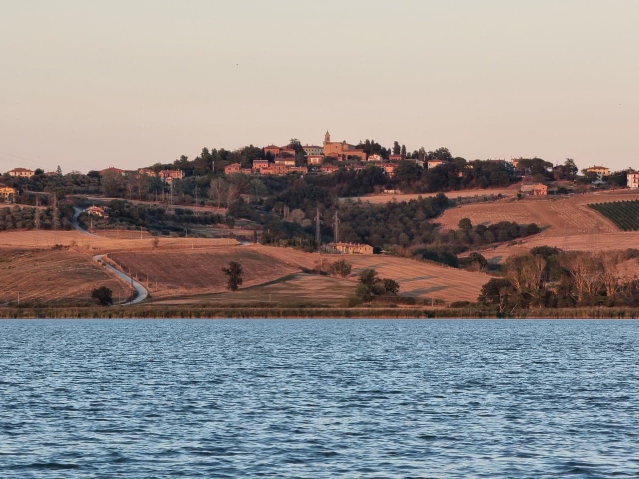
The lakefront Farnese stronghold on Lago di Bolsena — a small Tuscia borgo on a peninsula jutting into Europe's largest volcanic crater lake, with Antonio da Sangallo's octagonal Rocca Farnese, an extra-virgin olive oil tradition (Città dell'Olio), and views across the water to the inhabited Isola Bisentina.

Casperia
Province: Rieti · 397 m
A Sabina hill village named Aspra in Virgil's Aeneid, called that until 1947, ringed by walls from 1282 and Sabina DOP olive groves below.
Castro dei Volsci
Province: Frosinone · 385 m
A Ciociaria hilltop borgo at 385 meters in the Sacco valley, named for the pre-Roman Volsci and birthplace of actor Nino Manfredi.
Isola del Liri
Province: Frosinone · 217 m
The Ciociaria town with a 27-meter waterfall in its centro storico and a paper-mill past once called the Manchester of Italy.
Minturno
Province: Latina · 140 m
A coastal comune at the mouth of the Garigliano, built on the Roman colony of Minturnae, five-time Bandiera Blu through Scauri and Marina.
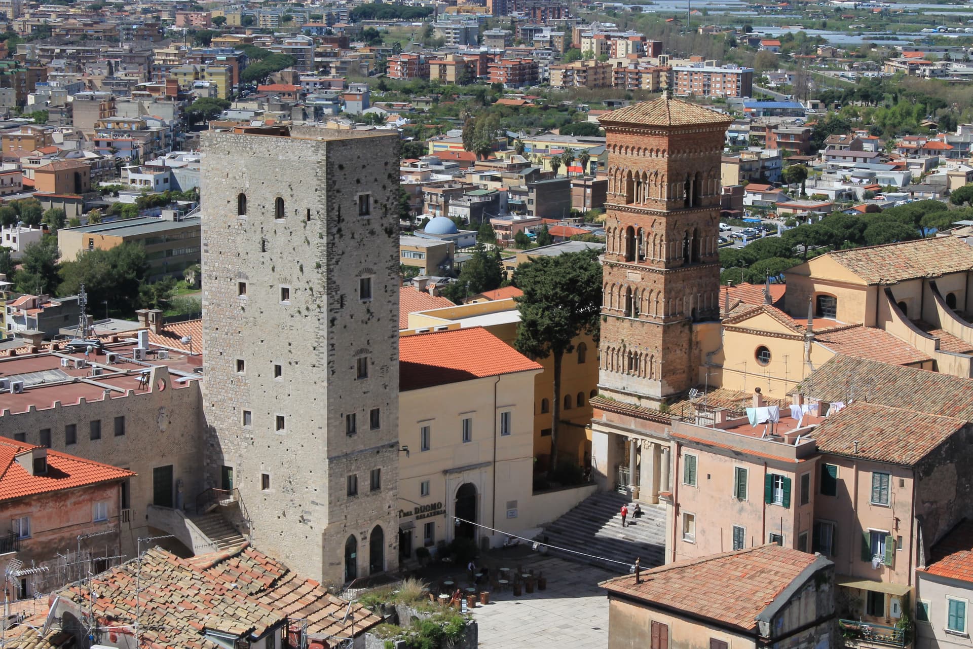
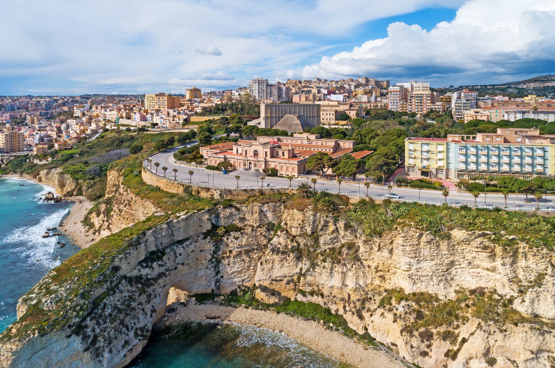
Terracina
Province: Latina · 24 m
The Volscian Anxur on the Via Appia, where Jupiter's temple sits 227 meters above a port Trajan cleared through stone.
Velletri
Province: Roma · 332 m
The Castelli Romani town where Augustus grew up, now the largest wine commune in the Alban Hills.
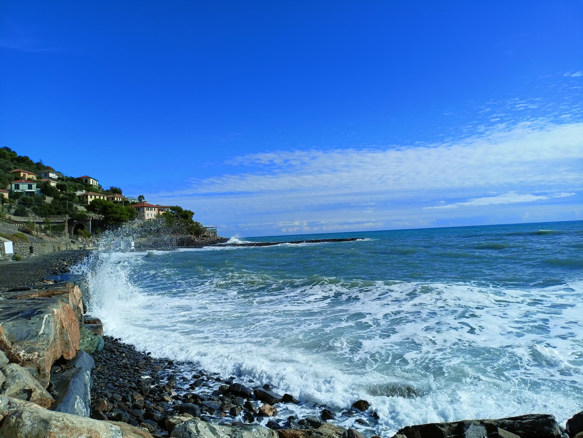
Liguria14
Andora
Province: Savona · 10 m
A Riviera town with two faces, two kilometers of sandy beach on the Aurelia and a ruined twelfth-century castle hidden on a hill behind it.
Apricale
Province: Imperia · 273 m
A medieval hill village in the Nervia Valley, named for the Latin apricus, sunny, with a tenth-century castle shaped like a lizard on the rock.
Badalucco
Province: Imperia · 179 m
A medieval village wrapped in a bend of the Argentina torrent, with murals on its caruggi and a Slow Food bean on its terraces.
Ceriana
Province: Imperia · 369 m
A medieval village at 369 meters above the Valle Armea, inland from Sanremo, built on the Roman castrum that gave it its name.
Cervo
Province: Imperia · 66 m
A hilltop village on the Riviera di Ponente built by coral fishermen, named for the Roman mansio on the Via Julia Augusta.
- ✷ We've been

Chiavari
Province: Genova · 3 m
The Tigullio capital between Portofino and the Cinque Terre, a 27,000-person Genoese trading town built around a thirteenth-century grid of porticoed streets.

Diano
Province: Imperia · 70 m
A twin destination on the Riviera dei Fiori — the medieval hilltop borgo of Diano Castello above and the palm-fronted beach resort of Diano Marina below — sharing one Bay of Diano, one Taggiasca olive valley, and the longest Bandiera Blu beach in western Liguria.
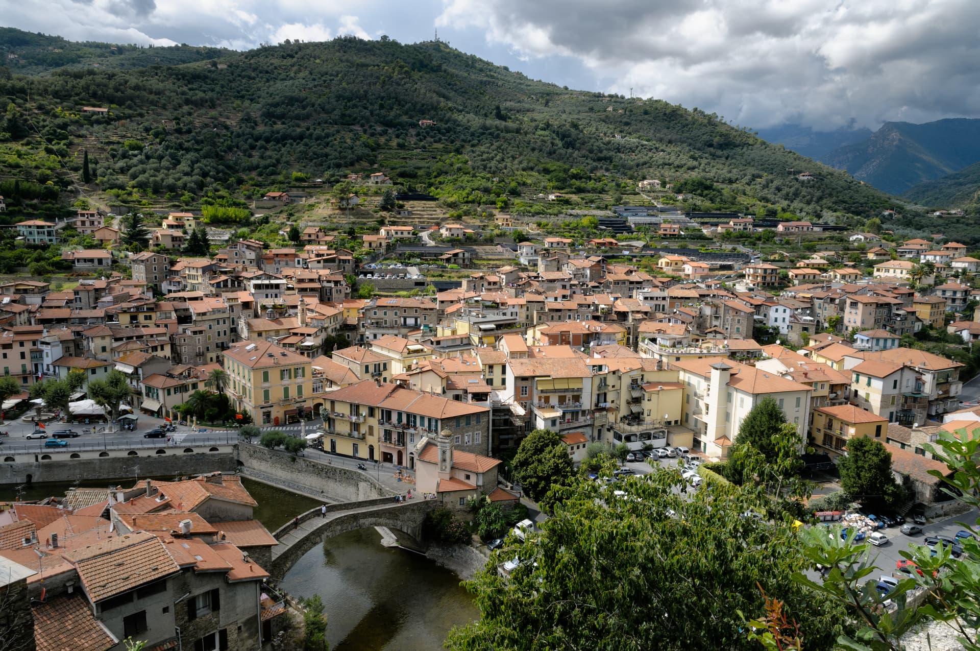
Dolceacqua
Province: Imperia · 51 m
A two-banked medieval village in the Val Nervia split by a single-arch bridge from 1400, the one Monet came to paint in 1884.
Lavagna
Province: Genova · 6 m
The Tigullio town that gave its name to slate and to Pope Innocent IV, host each 14 August of the Torta dei Fieschi pageant.

Levanto
Province: La Spezia · 5 m
The sixth Cinque Terre, a beach town and Cittaslow at the gateway of the national park, with a surf break and a striped Gothic church.
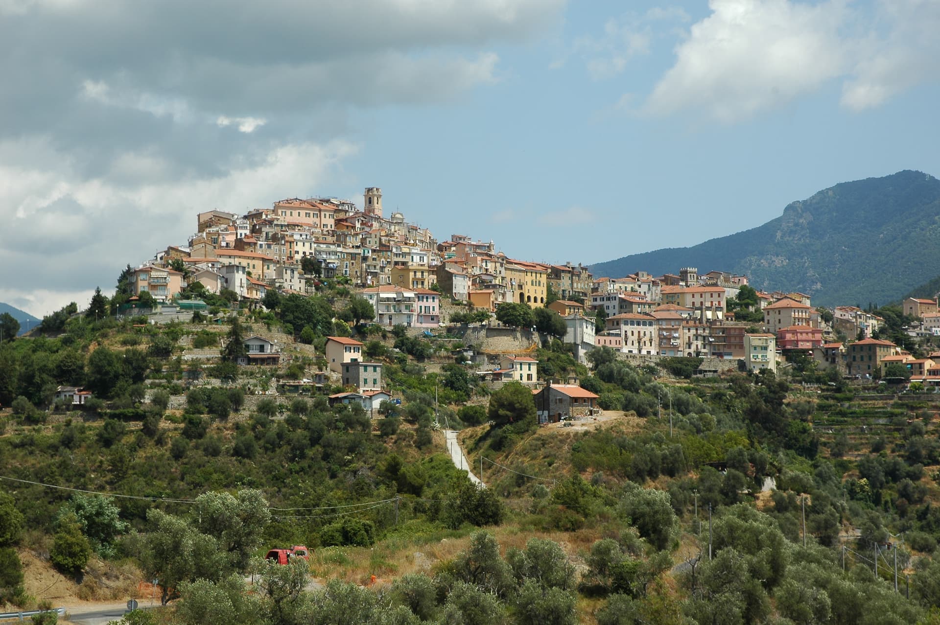
Perinaldo
Province: Imperia · 572 m
A ridge village at 572 meters above the Val Nervia, birthplace of Giovanni Domenico Cassini and home to a working astronomical observatory in his name.
Pieve di Teco
Province: Imperia · 240 m
A planned market town founded in 1233 in the middle Arroscia valley, with porticoed Corso Ponzoni and the second-smallest theater in Italy.
- ✷ We've been

Sestri Levante
Province: Genova · 10 m
The Tigullio town of two bays, where Hans Christian Andersen stayed in 1833 and Guglielmo Marconi ran his shortwave radio experiments.
Taggia
Province: Imperia · 40 m
The Argentina valley's medieval seat above the Riviera dei Fiori, the town that gave its name to the Taggiasca olive grown across western Liguria.
Lombardy3
Limone sul Garda
Province: Brescia · 65 m
The northernmost lemon-growing town in the world, at 46 degrees north on the western shore of Lake Garda, reached by road only in 1932.
Monte Isola
Province: Brescia · 600 m
The largest lake island in southern and central Europe, 4.5 square kilometers in Lake Iseo, with no cars and eleven fishing villages on its shore.
Monzambano
Province: Mantova · 88 m
A Mincio commune at 88 meters in the moraine hills west of Mantova, whose frazione Castellaro Lagusello sits on a heart-shaped lake inside fortified walls.
Marche8

Ascoli Piceno
Province: Ascoli Piceno · 154 m
The travertine city at 154 meters where the Tronto meets the Castellano, capital of the Piceni and host of the Quintana joust.
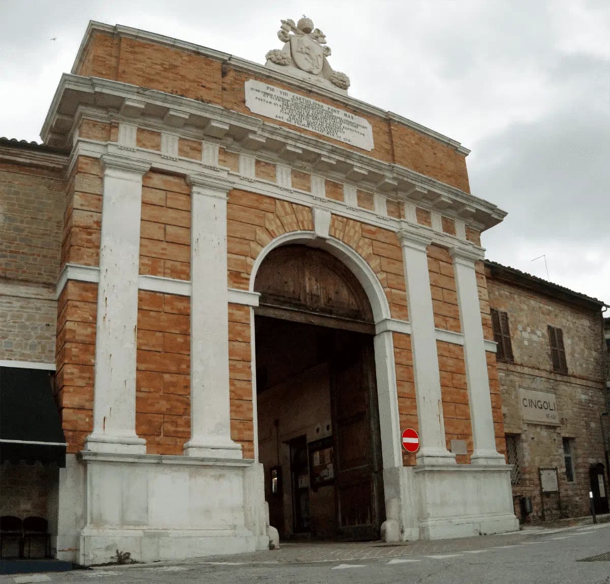
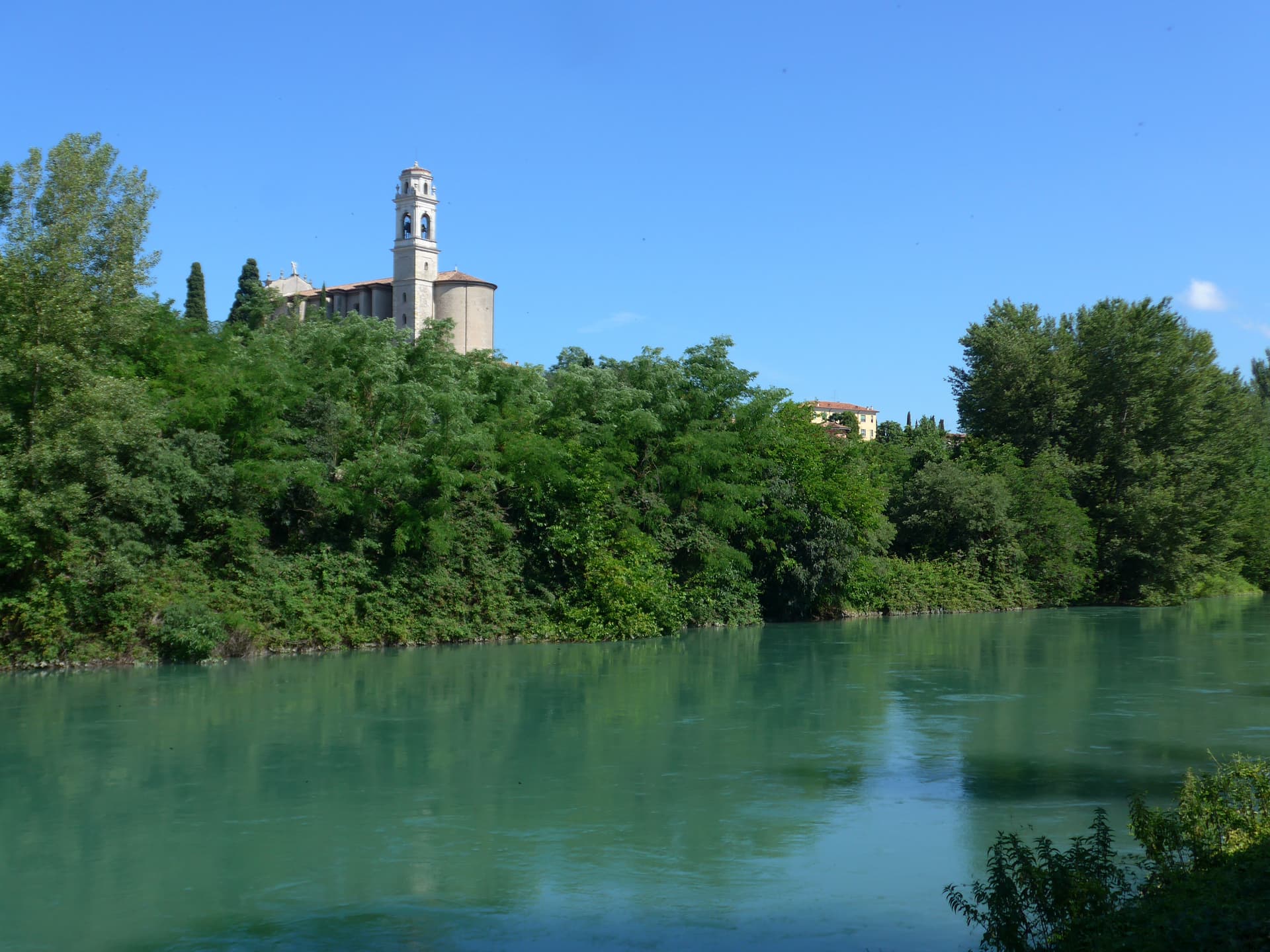
Cingoli
Province: Macerata · 631 m
The Balcone delle Marche at 631 meters, a hilltop borgo where on clear days the view runs from the Sibillini to the Croatian coast.

Gradara
Province: Pesaro e Urbino · 142 m
The walled hill borgo at 142 meters above the Adriatic where Dante set the deaths of Paolo and Francesca, with one of Italy's best-preserved castles.
Pesaro
Province: Pesaro e Urbino · 11 m
The Adriatic port at the mouth of the Foglia, founded as Roman Pisaurum in 184 BC and given to the world by Rossini in 1792.

Ripatransone
Province: Ascoli Piceno · 494 m
The Belvedere del Piceno at 494 meters, ridgetop borgo with views to the Adriatic and the narrowest alley in Italy at 43 centimeters.

Senigallia
Province: Ancona · 5 m
Thirteen kilometers of fine sand on the Adriatic that earned the Spiaggia di Velluto name, hometown of photographer Mario Giacomelli and chef Mauro Uliassi.
Serra San Quirico
Province: Ancona · 409 m
A stone borgo on Monte Murano at the entrance to the Gola della Rossa, ringed by 1300 walls with covered passageways called copertelle.
Vallefoglia
Province: Pesaro e Urbino · 295 m
A 2014 merger commune at 295 meters in the Foglia valley, born from Colbordolo, birthplace of Raffaello's father, and Sant'Angelo in Lizzola.
Molise9
Ferrazzano
Province: Campobasso · 872 m
A hilltop borgo at 872 meters above Campobasso, called the Sentinel of Molise, where Robert De Niro's great-grandparents lived before sailing in 1887.
Fornelli
Province: Isernia · 530 m
A walled medieval borgo at 530 meters with seven towers and the birthplace of Nancy Pelosi's mother, eight kilometers west of Isernia.
Guardialfiera
Province: Campobasso · 285 m
A hilltop village at 285 meters above the largest artificial lake in Molise, the home ground of the writer Francesco Jovine.
Guglionesi
Province: Campobasso · 369 m
A 369-meter hill town between the Biferno and Trigno valleys, founded by the Frentani in the fifth century BC and looking out toward the Adriatic.
Larino
Province: Campobasso · 341 m
A 341-meter Frentani and Roman town in the lower Biferno valley, with a 12,000-seat amphitheatre and a Gothic cathedral consecrated in 1319.

Petacciato
Province: Campobasso · 225 m
A hilltop village at 225 meters on the Adriatic, with a Romanesque church in tuff and sandstone and a long sand beach below.
Roccavivara
Province: Campobasso · 652 m
A 652-meter village above the Trigno river valley, home to the Romanesque Santuario della Madonna del Canneto with its 1223 ambone and 14th-century gothic Madonna del Sorriso.
Termoli
Province: Campobasso · 15 m
Molise's only port, a walled promontory of fishermen's houses on the Adriatic with a Frederick II castle and the ferry pier for the Tremiti islands.
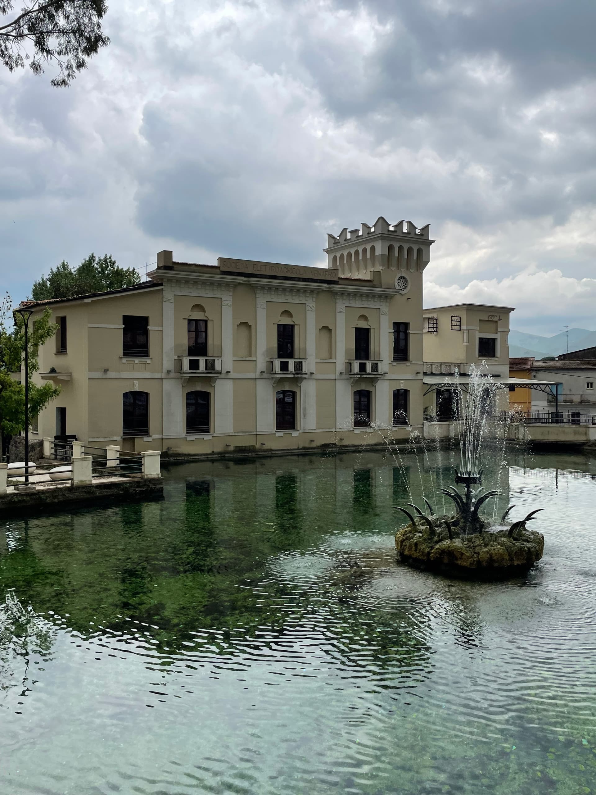
Venafro
Province: Isernia · 222 m
A 222-meter town near the Lazio border where Augustus founded a colony and Pliny called the olive oil the best in the Roman Empire.
Sardinia8
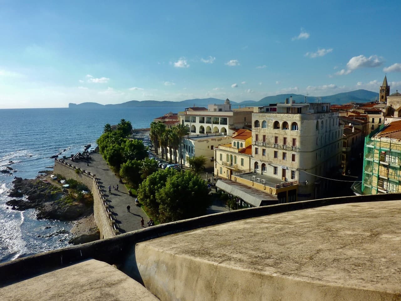
Alghero
Province: Sassari · 7 m
The Catalan city of northwest Sardinia, repopulated by Peter IV of Aragon in 1354 and still speaking Algherese Catalan today.
Bolotana
Province: Nuoro · 472 m
A Marghine hill village at 472 meters between mountain and Tirso valley, with a Welsh railway engineer's villa hidden in a four-hectare exotic garden.
Bosa
Province: Oristano · 10 m
A colour-washed riverside town on Sardinia's only navigable river, with a Malaspina castle on the hill and the tanneries of Sas Conzas along the Temo.
Cuglieri
Province: Oristano · 428 m
A Montiferru town at 428 meters, with the first minor basilica in Sardegna above it and the ruins of Punic Cornus below.
Oliena
Province: Nuoro · 380 m
A Supramonte village at the foot of Monte Corrasi, source of Cannonau Nepente, base camp for Tiscali and the Lanaitto valley.

Oristano
Province: Oristano · 5 m
The old capital of the Giudicato di Arborea, city of Eleonora and the Carta de Logu, host of Sa Sartiglia equestrian joust at Carnival.
Orosei
Province: Nuoro · 19 m
A small Baroque town at 19 meters in the Cedrino valley, two kilometers from the limestone gulf whose southern coves are reached only by boat.
Seneghe
Province: Oristano · 305 m
An olive-oil village on the eastern slope of Montiferru, 25 km from Oristano, that doubles as Sardegna's poetry capital each September.
Sicily9
Buccheri
Province: Siracusa · 820 m
The highest village in the province of Syracuse at 820 meters on Monte Lauro, world capital of Tonda Iblea olive oil at the 2015 Sol d'Oro.
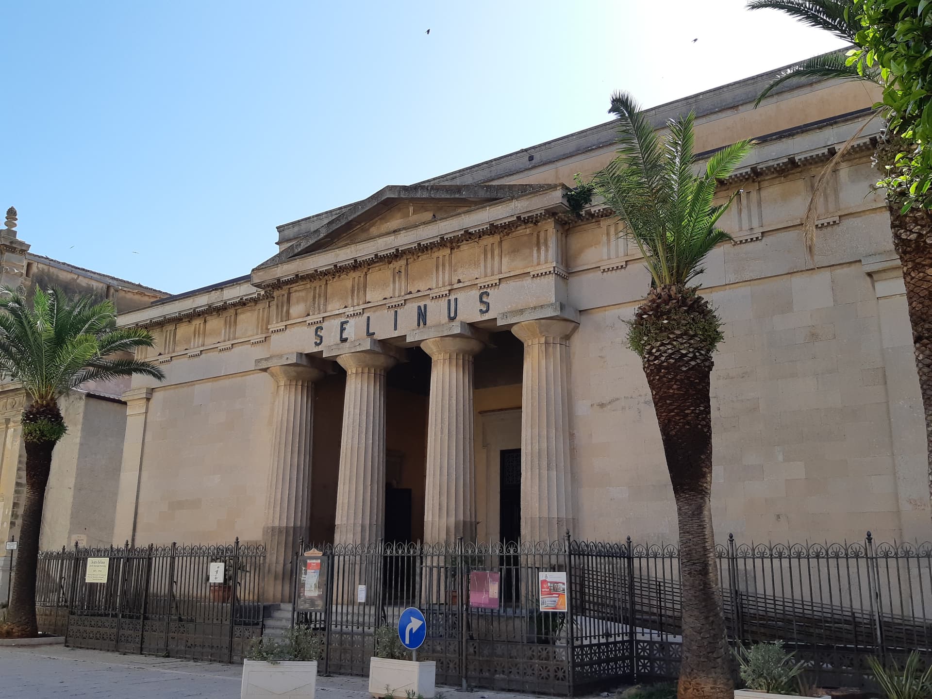
Castelvetrano
Province: Trapani · 187 m
The Belice valley town that owns Selinunte, the largest archaeological park in Europe, and bakes black bread from grain found in its tombs.
Castiglione di Sicilia
Province: Catania · 621 m
A hill town on the north flank of Etna at 621 meters, base camp for the Alcantara valley and the volcano's most serious red wines.
Menfi
Province: Agrigento · 119 m
Sicily's triple-signal western coast town — 11,800 residents on a low ridge above 9 km of Bandiera Blu sand at Porto Palo, with the Federico II tower, the Cantine Settesoli cooperative (Italy's largest by volume, 2,000 grower-members), and the rare Bandiera Blu + Città del Vino + Città dell'Olio combination.
Nicolosi
Province: Catania · 698 m
The southern gateway to Etna at 698 meters, twice destroyed by the 1669 eruption, base camp for the volcano cable car at Rifugio Sapienza.

Realmonte
Province: Agrigento · 153 m
The Agrigento coast commune with the white marl cliff of the Scala dei Turchi and a salt mine carved into 5-million-year-old halite.
San Vito Lo Capo
Province: Trapani · 5 m
A three-kilometer white-sand beach under Monte Monaco at Sicily's northwest tip, the town that turned cous cous into a September festival.
Sciacca
Province: Agrigento · 60 m
A terraced fishing harbor on Sicily's southwestern coast, Selinunte's thermal spa in the fifth century BC and a ceramics city since the fourteenth.
Troina
Province: Enna · 1,121 m
At 1,121 meters on the Nebrodi ridge, the first capital and first bishopric the Normans set up in Sicily after taking it from the Arabs.
Trentino-Alto Adige/Südtirol2
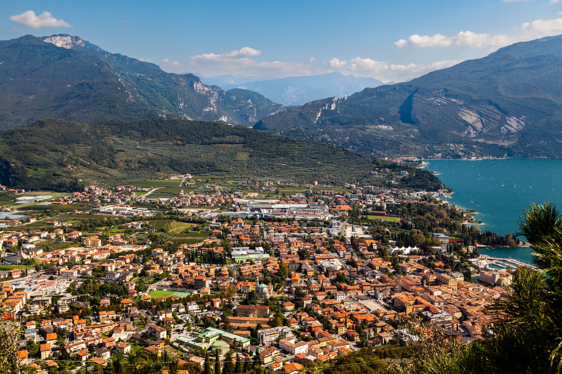
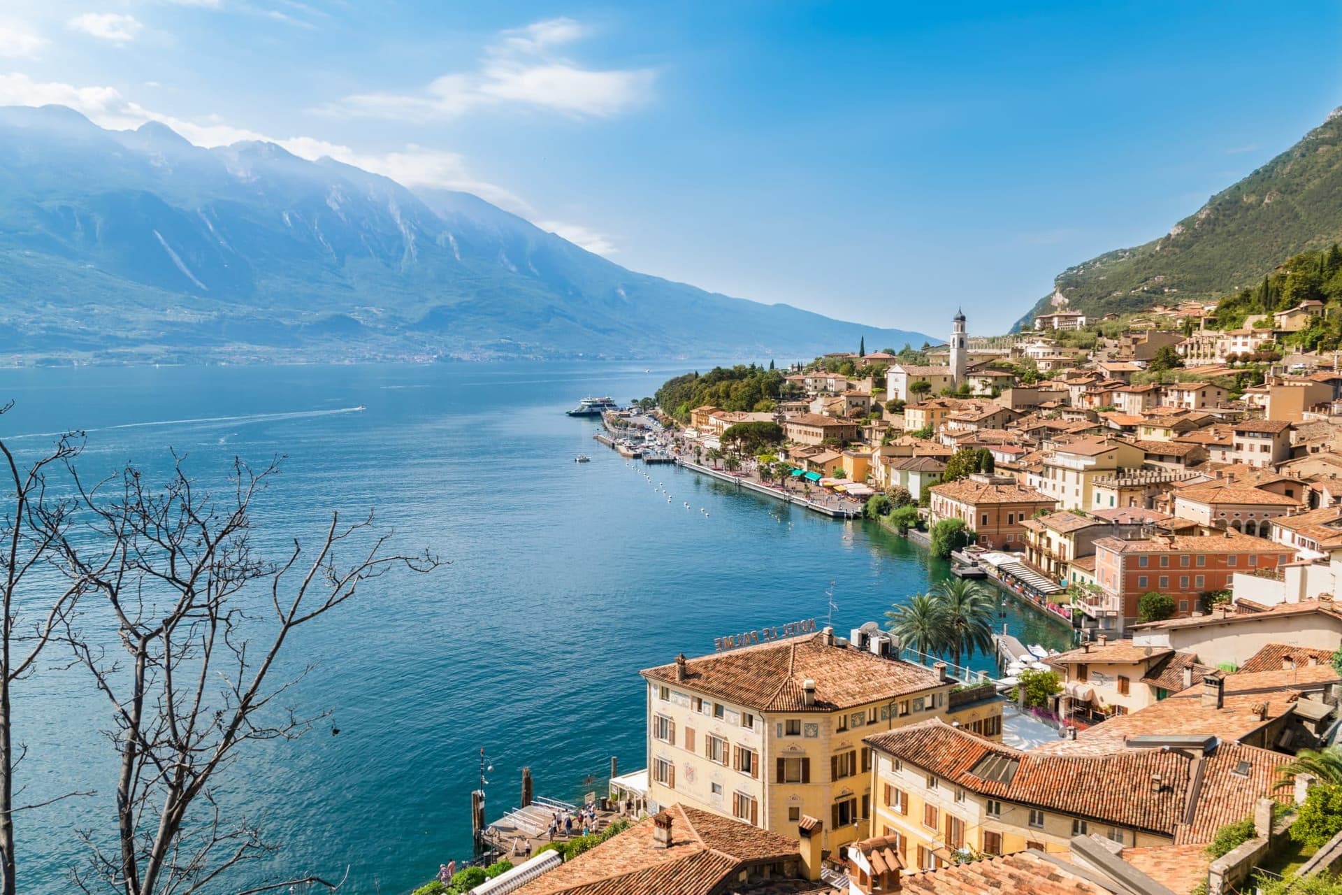
Riva del Garda
Province: Trento · 73 m
The north tip of Lake Garda at 73 metres, where the Trentino mountains close in on the water and a Habsburg port town stayed bilingual into the twentieth century.
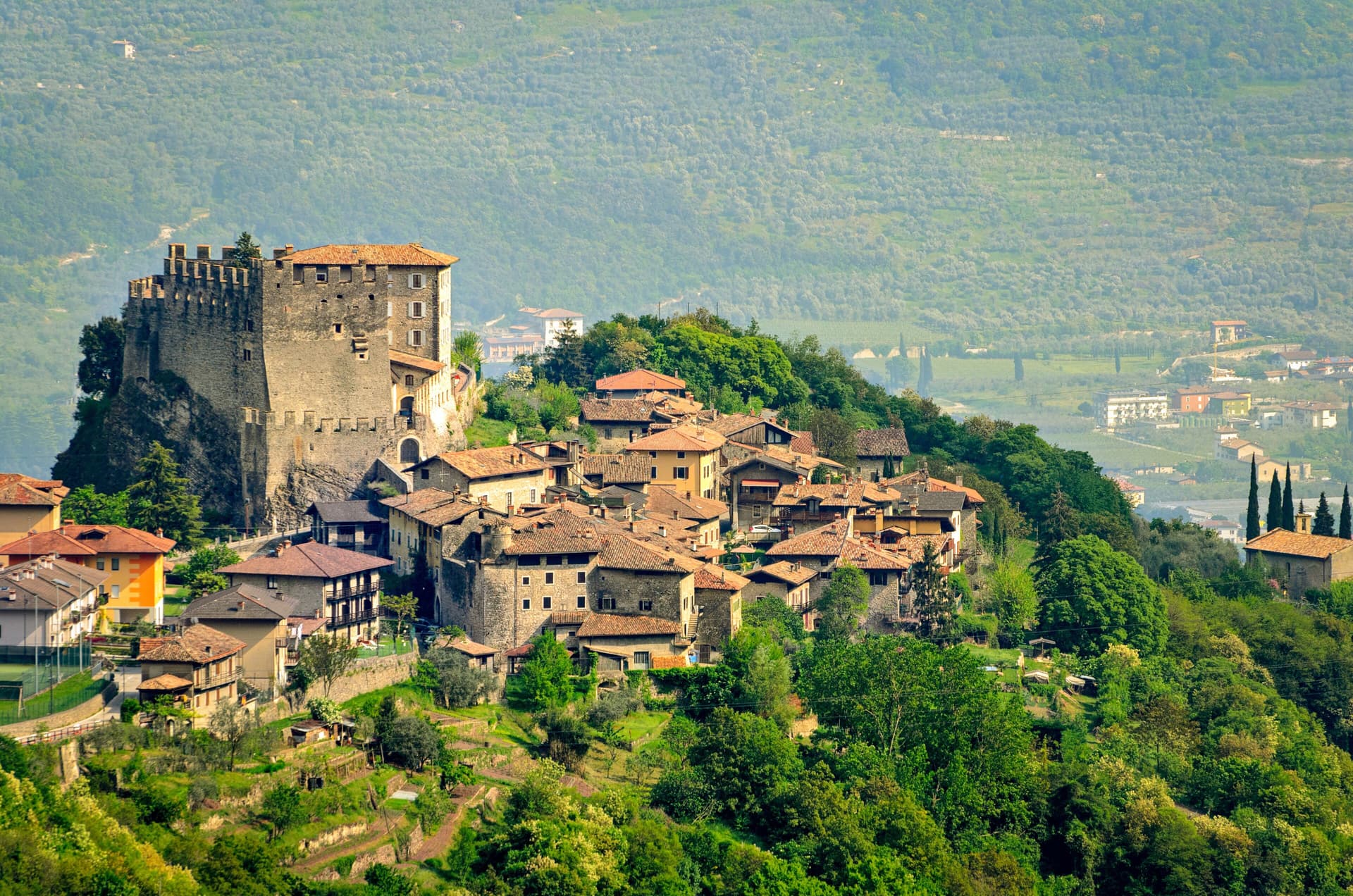
Tenno
Province: Trento · 428 m
A hillside commune at 428 metres above Lake Garda, with a medieval stone hamlet, a turquoise lake, and the northernmost olive groves in Europe.
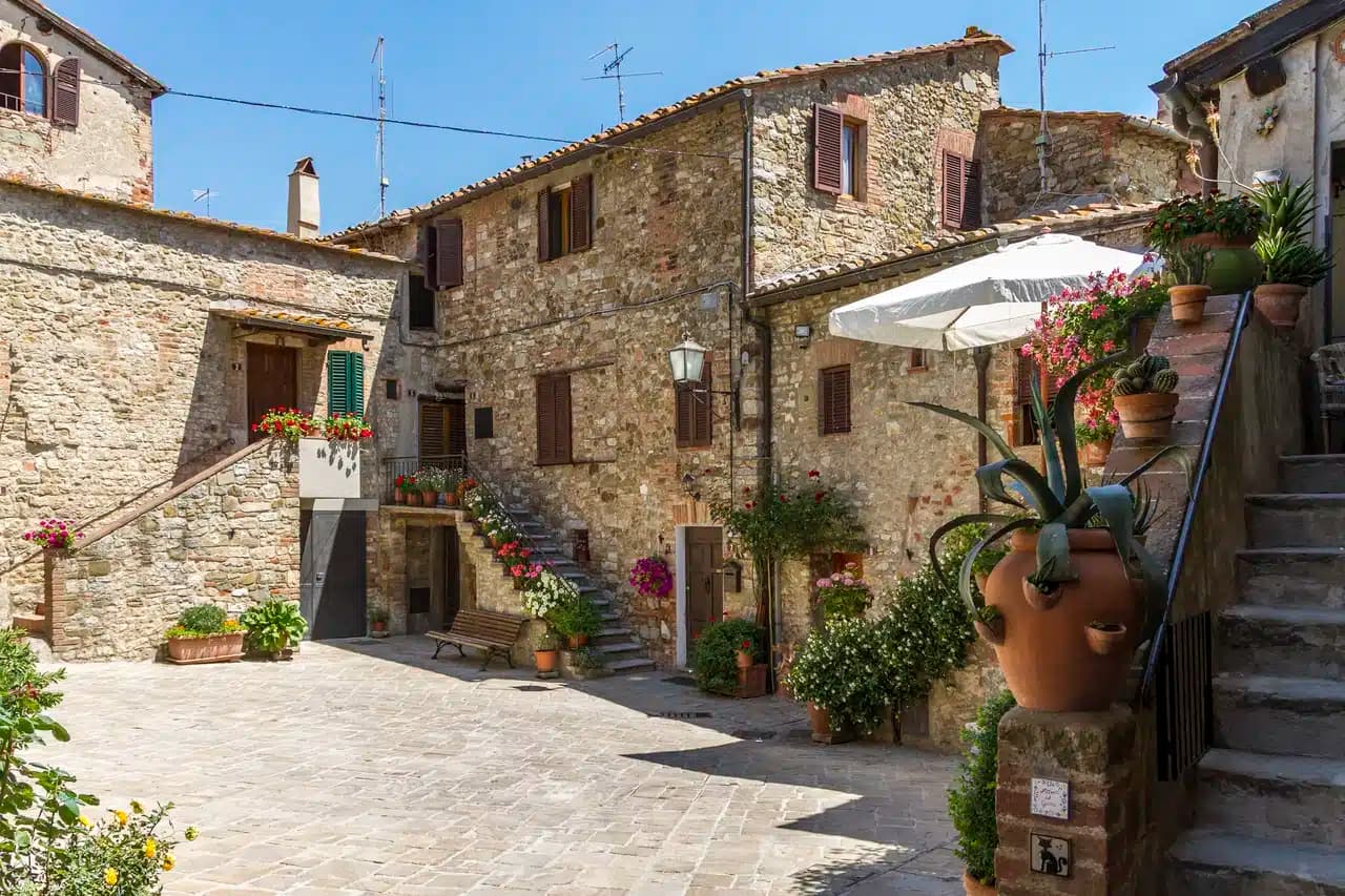
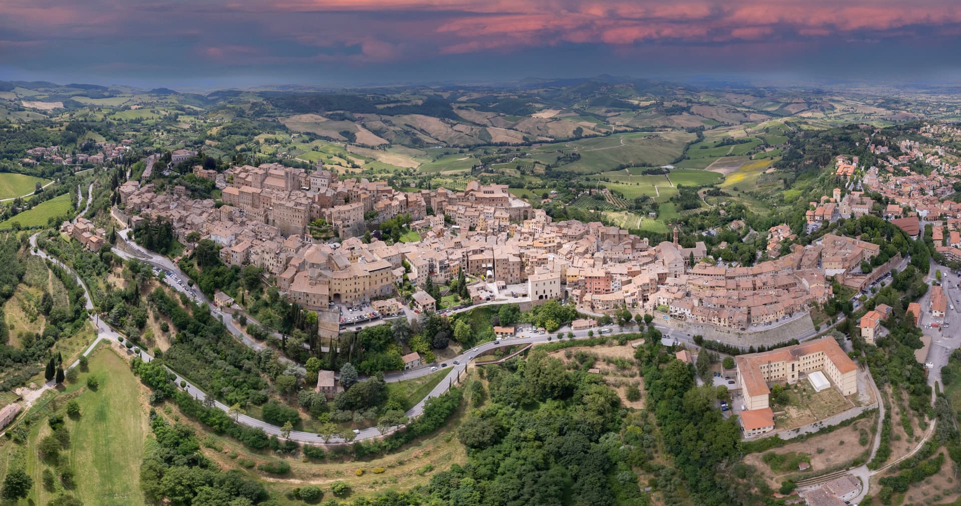
Tuscany33
- ✷ We've been
Capalbio
Province: Grosseto · 217 m
A walled hilltop borgo at 217 meters in the southern Maremma, donated to the Abbey of Tre Fontane by Charlemagne and home of Niki de Saint Phalle's Tarot Garden.
- ✷ We've been

Castagneto Carducci
Province: Livorno · 194 m
A hilltop borgo at 194 meters above the Costa degli Etruschi, renamed for the poet Carducci in 1907 and the home of Bolgheri and Sassicaia.
- ✷ We've been
Castellina in Chianti
Province: Siena · 578 m
A Chianti hill town at 578 meters on the watershed between the Arno and the Ombrone, with an Etruscan tumulus, a Brunelleschi-reinforced wall and a covered medieval walkway around its edge.
- ✷ We've been
Castelnuovo Berardenga
Province: Siena · 351 m
A Chianti Classico commune at 351 meters between the Ombrone and the Crete Senesi, the last castle Siena built against Florence, in 1366.
Castiglion Fiorentino
Province: Arezzo · 342 m
A walled hill town at 342 meters between Arezzo and Cortona, where Etruscan walls support the medieval Cassero and Vasari's loggia frames the Val di Chiana below.
- ✷ We've been
Castiglione d'Orcia
Province: Siena · 540 m
A stone borgo at 540 meters in the UNESCO Val d'Orcia, first recorded in 714, with two fortresses guarding the road from Amiata to the Via Francigena.
Cetona
Province: Siena · 384 m
A medieval borgo at 384 meters below Monte Cetona, sold by Cosimo I to the Vitelli in 1556 and the centro storico still shaped by their fortress reconstruction.

Chiusdino
Province: Siena · 564 m
A medieval village at 564 meters in the Val di Merse where Galgano Guidotti plunged his sword into a rock in 1180 and the roofless Cistercian abbey grew up below.
Chiusi
Province: Siena · 398 m
The Etruscan city of King Porsenna at 398 meters above the Val di Chiana, with one of Italy's major Etruscan museums and tunnels carved beneath the streets.
Cortona
Province: Arezzo · 494 m
An Etruscan lucumonia at 494 meters with two kilometers of walls older than Rome, looking down on the Val di Chiana and Lake Trasimeno.
Fiesole
Province: Firenze · 295 m
An Etruscan hilltop at 295 meters above Florence, founded in the ninth century BC and conquered by Rome in 283 BC, still looking down on what later replaced it.
- ✷ We've been
Greve in Chianti
Province: Firenze · 236 m
The market town of the Chianti Classico zone on the Greve river, with a triangular piazza arcaded since the sixteenth century.
Lucignano
Province: Arezzo · 400 m
A walled elliptical hill town at 400 meters between Siena and Arezzo, planned in medieval concentric rings around the goldsmith's reliquary called the Tree of Life.
- ✷ We've been
Manciano
Province: Grosseto · 444 m
A market town at 444 meters in the southern Maremma, with a Sienese fortress of 1424 and the thermal frazione of Saturnia in its territory.

Massa Marittima
Province: Grosseto · 380 m
A medieval mining town at 380 meters in the Colline Metallifere, free commune from 1255 to 1337, whose cathedral holds the relics of San Cerbone.
Montaione
Province: Firenze · 341 m
A medieval glassmaking and truffle borgo at 341 meters above the Valdelsa, with a Franciscan replica of Jerusalem in the woods at San Vivaldo.
- ✷ We've been
Montalcino
Province: Siena · 564 m
A walled hill town at 564 meters above the Val d'Orcia, the last fortress to hold out for the Sienese Republic and the birthplace of Brunello.
Montepulciano
Province: Siena · 605 m
A Renaissance hill town at 605 meters on a limestone ridge, where Vino Nobile is aged in vaulted cellars beneath the palazzi of Piazza Grande.
- ✷ We've been

Monteriggioni
Province: Siena · 274 m
A circular Sienese fortress built between 1213 and 1219 on a natural hill, fourteen towers on a 570-meter wall, intact and unbroken.
Montescudaio
Province: Pisa · 242 m
A fortified hill borgo at 242 meters above the Val di Cecina, named for a mountain of shields, with DOC wine since 1977 and bread, oil and grape all stamped in its identity.

Murlo
Province: Siena · 314 m
A medieval bishops' fief twenty kilometers south of Siena, with an Etruscan princely palace on Poggio Civitate and the Cappellone statue as its symbol.

Piancastagnaio
Province: Siena · 772 m
A chestnut-belt borgo at 772 meters on the southern slope of Monte Amiata, where four contrade still race for the Palio delle Contrade each August.
- ✷ We've been

Pienza
Province: Siena · 491 m
The first Renaissance ideal city, built from 1459 by Bernardo Rossellino for Pope Pius II on the Val d'Orcia ridge.
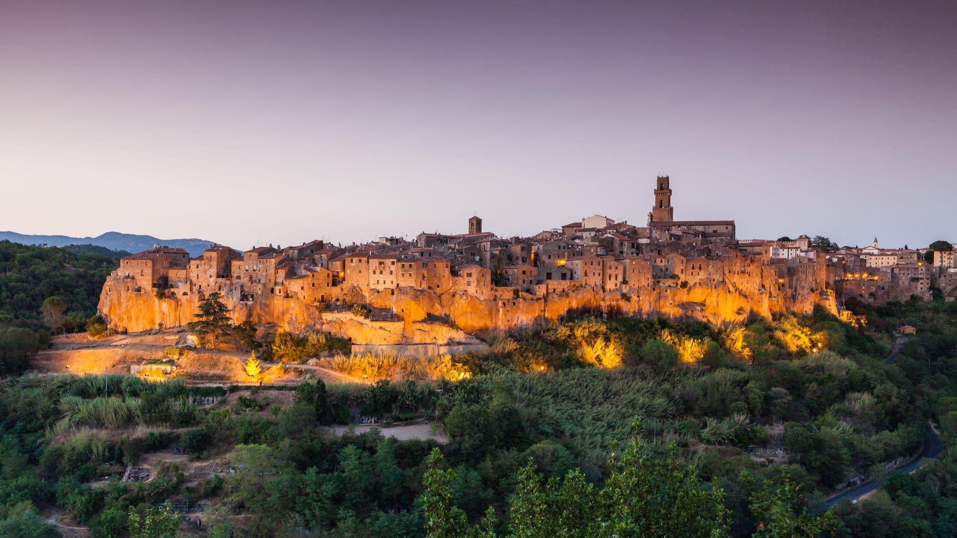
Pitigliano
Province: Grosseto · 313 m
The Little Jerusalem of southern Tuscany, carved into a tuff spur in the Maremma, where the houses, the synagogue and the streets are all cut from the same volcanic rock.
Rapolano Terme
Province: Siena · 334 m
A Sienese thermal town in the Crete Senesi, 38-degree calcium-sulphur waters and travertine quarries that supplied the Pienza Duomo and Montepulciano's San Biagio.

San Casciano dei Bagni
Province: Siena · 582 m
A hilltop borgo at 582 meters above 42 hot springs that produced the largest Etruscan bronze hoard of the last fifty years.
- ✷ We've been
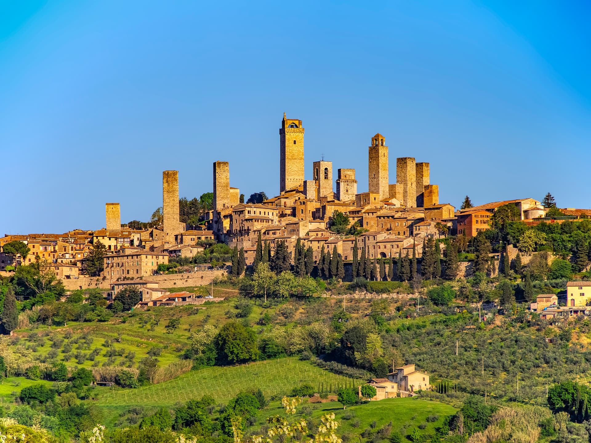
San Gimignano
Province: Siena · 334 m
A walled hill town at 334 meters with 14 surviving medieval towers, UNESCO listed since 1990 and the home of Vernaccia.
- ✷ We've been
San Quirico d'Orcia
Province: Siena · 409 m
A walled stop on the Via Francigena at 409 meters in the UNESCO Val d'Orcia, where a twelfth-century Collegiata, a Renaissance garden and the Bagno Vignoni thermal pool sit within fifteen kilometers of each other.
- ✷ We've been

Siena
Province: Siena · 322 m
The medieval rival of Florence at 322 meters on three hills, with a shell-shaped piazza where seventeen contrade race bareback horses twice a year.
- ✷ We've been
Suvereto
Province: Livorno · 127 m
A stone borgo at 127 meters above the Val di Cornia, named for the cork oaks of its forests and ruled from the Rocca Aldobrandesca since 973.

Trequanda
Province: Siena · 453 m
A village of 1,166 in three hilltop borghi between Crete Senesi and Val di Chiana, with the terracotta workshops of Petroio holding to a five-hundred-year craft.
Vicopisano
Province: Pisa · 12 m
A medieval river port on the southern slope of Monte Pisano, rebuilt by Brunelleschi in 1434 after Florence took the town from Pisa.
Vinci
Province: Firenze · 97 m
The hill town on Montalbano where Leonardo was born in 1452, with a ship-shaped castle that now holds his machines.
Umbria16
Arrone
Province: Terni · 243 m
Medieval castle village on the left bank of the Nera at 243 meters, upstream from the largest man-made waterfall in the world.
Bettona
Province: Perugia · 353 m
A hill town at 353 meters between the Topino and Chiascio rivers, the only Etruscan settlement ever built east of the Tiber.
Bevagna
Province: Perugia · 225 m
Roman Mevania on the Umbrian plain at 225 meters, four medieval quarters that compete every June in a reconstructed market of the 13th century.
Campello sul Clitunno
Province: Perugia · 290 m
Springs of the Clitunno and the Lombard Tempietto on the valley floor at 290 meters, the temple inscribed by UNESCO in 2011.
Foligno
Province: Perugia · 235 m
A valley town at 235 meters on the Topino, where Dante's Divine Comedy was first printed in 1472.
Giano dell'Umbria
Province: Perugia · 547 m
A hill commune at 547 meters between Foligno, Spoleto and Todi, anchored by a Romanesque abbey founded over the tomb of a fourth-century martyr.
Lugnano in Teverina
Province: Terni · 441 m
A ridge town at 441 meters above the lower Tiber valley, with a 1230 Romanesque collegiata and a late-Roman infant cemetery on the hill below.
Magione
Province: Perugia · 299 m
A hill town east of Trasimeno where the Knights Hospitaller built their twelfth-century maison and Machiavelli later foiled the Conspiracy of Magione against Cesare Borgia.

Montecchio
Province: Terni · 377 m
A small hill commune at 377 meters above the Tiber, sitting on top of one of Umbria's largest Etruscan-tied necropolises.
Montefalco
Province: Perugia · 472 m
The hilltop wine capital of Umbria at 472 meters, where Sagrantino is grown almost nowhere else and Benozzo Gozzoli painted Francis in 1452.
Paciano
Province: Perugia · 391 m
Walled hill town of 957 people at 391 meters above Lake Trasimeno, three parallel streets, eight towers and three medieval gates intact.
Spello
Province: Perugia · 280 m
Augustan Hispellum at 280 meters on Monte Subasio, where streets carry flower petals each Corpus Domini and Pinturicchio frescoed the Baglioni Chapel in 1501.
Spoleto
Province: Perugia · 396 m
Lombard ducal capital at 396 meters under the Rocca Albornoziana, where a 230-meter aqueduct bridge crosses to Monteluco and Menotti founded the Festival in 1958.
Torgiano
Province: Perugia · 219 m
A walled river town at 219 meters at the confluence of the Tiber and the Chiascio, the first DOC and DOCG zone in Umbria.
Trevi
Province: Perugia · 412 m
A walled town at 412 meters above the Spoleto valley, ringed by 200,000 olive trees that make it the Umbrian capital of olive oil.
Vallo di Nera
Province: Perugia · 467 m
Castle village of 345 people at 467 meters in the upper Valnerina, granted by Spoleto in 1217 and barely changed since.
Veneto8
Arquà Petrarca
Province: Padova · 56 m
The Euganean Hills village where Francesco Petrarca spent his last four years and died in 1374, renamed in his honor in 1868.

Asolo
Province: Treviso · 205 m
A walled hill town at 205 meters that Caterina Cornaro ran as her court after trading Cyprus to Venice in 1489.
Bassano del Grappa
Province: Vicenza · 129 m
The Brenta River town at 129 meters where Palladio drew the covered bridge in 1569 and Nardini has been distilling grappa since 1779.

Brenzone sul Garda
Province: Verona · 75 m
Sixteen lakeside hamlets strung along Lake Garda's east shore under Monte Baldo, where olive trees still outnumber the year-round residents.
Malcesine
Province: Verona · 89 m
The northernmost Veneto town on Lake Garda, where Goethe was nearly arrested for sketching the Castello Scaligero in September 1786.
Marostica
Province: Vicenza · 103 m
The walled chess town below Vicenza, where two castles linked by a hill rampart stage a costumed reenactment of a 1454 match every two years.

Susegana
Province: Treviso · 76 m
The Collalto castle town at 76 meters on the left bank of the Piave, with one of the largest medieval fortresses in northern Italy.
Vittorio Veneto
Province: Treviso · 138 m
Two old towns fused at 138 meters under the Cansiglio, where the October 1918 battle ended the First World War on the Italian front.
Subscribe — free
Get the best guides on hidden Italian towns.
One letter on Sundays. The week’s town, with the photo, the food, the festa. Free, by Peter & Sophia from Pietrasanta.
Substack sends a confirmation link to your inbox. The signup finishes when it’s clicked.
From elsewhere in Italy
Five more towns to discover
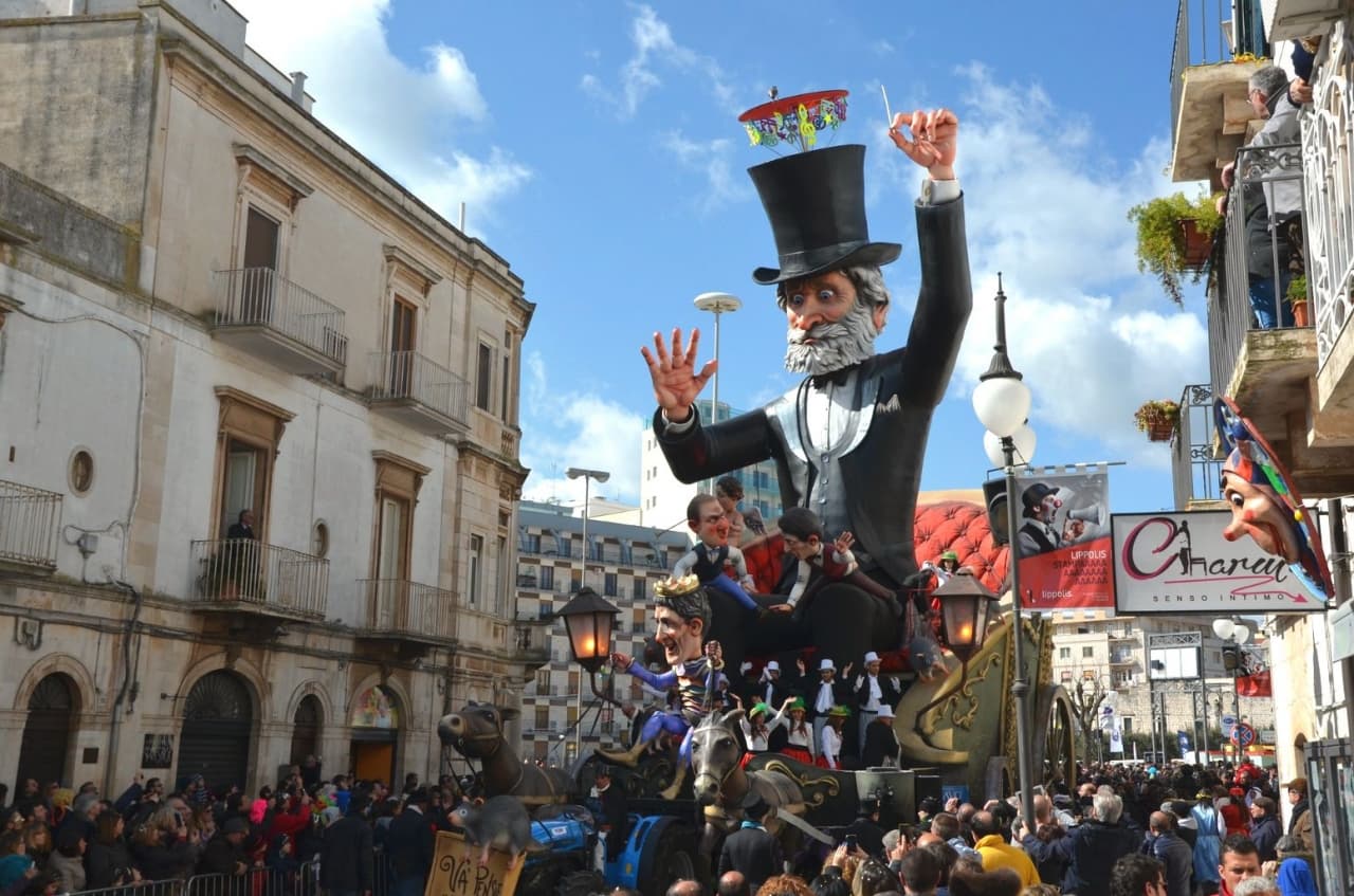
Putignano
Province: Bari
Europe's longest-running carnival — Putignano Carnevale has run continuously since 1394, with 631 years of cartapesta papier-mâché floats, a 26,000-resident Murgia town on the Bari–Lecce plateau, and the Grotta del Trullo karst cave inside the centro.

Pistoia
Province: Pistoia
Italy's nursery capital and the medieval Tuscan rival that gave its name to the pistol — a quietly extraordinary centro storico of zebra-striped Romanesque churches, Andrea della Robbia's polychrome frieze on the Ospedale del Ceppo, and Italy's Capital of Culture 2017, all 30 minutes from Florence by train.
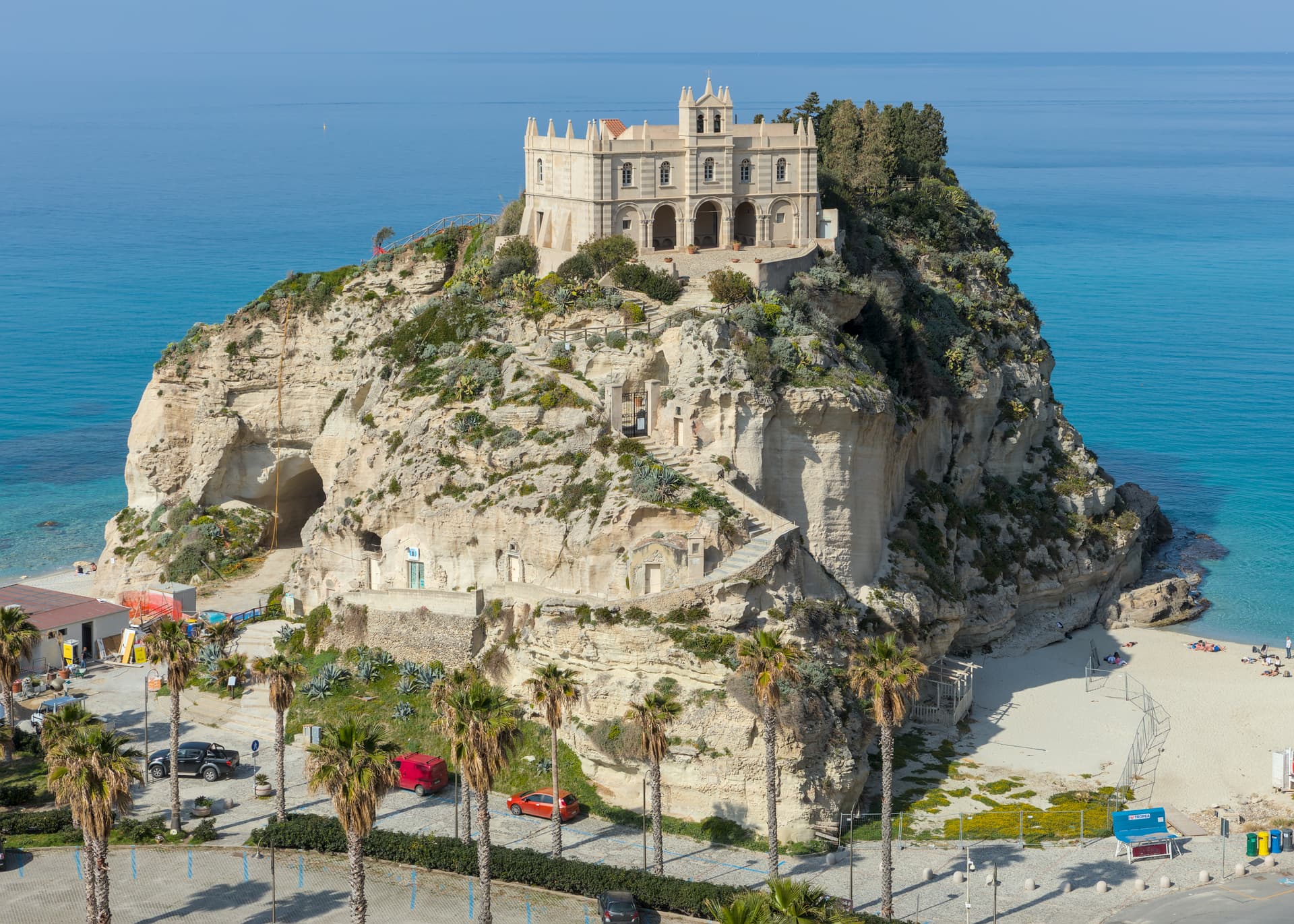
Tropea
Province: Vibo Valentia
Cliff town on a tufa headland over the Tyrrhenian Coast of the Gods, with a Norman monastery on a sea rock.
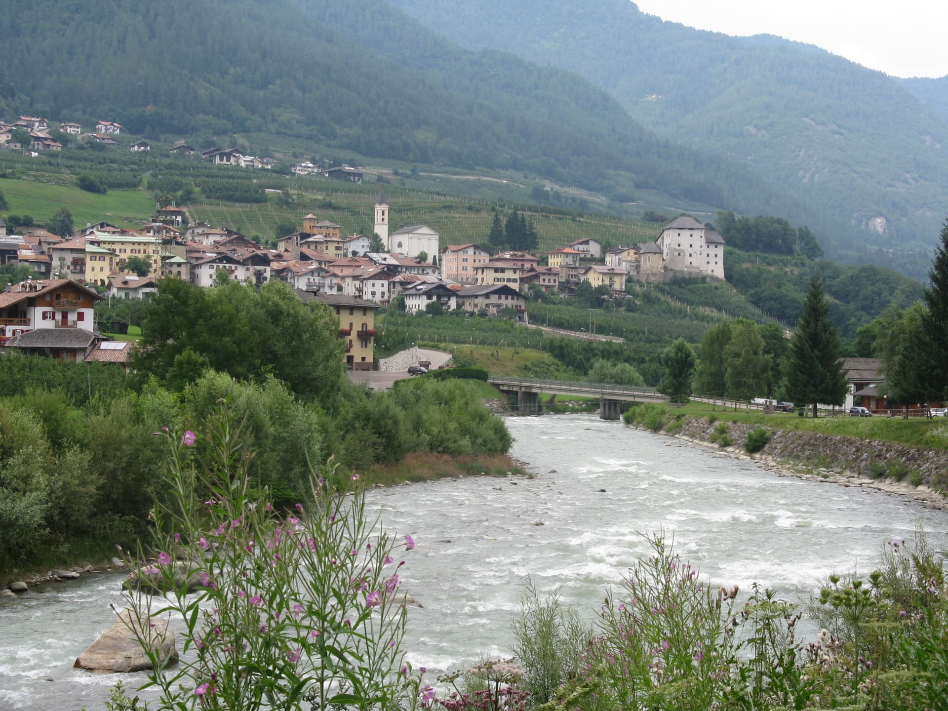
Caldes
Province: Trento
A scattered Val di Sole commune on the Noce, six hamlets gathered around a thirteenth-century tower-house castle that once belonged to the Thun family.
Cantiano
Province: Pesaro e Urbino
A border borgo at 374 meters under Monte Catria on the old Via Flaminia, known for the Good Friday Turba and the sour-cherry visciola harvest.