Umbria · Perugia
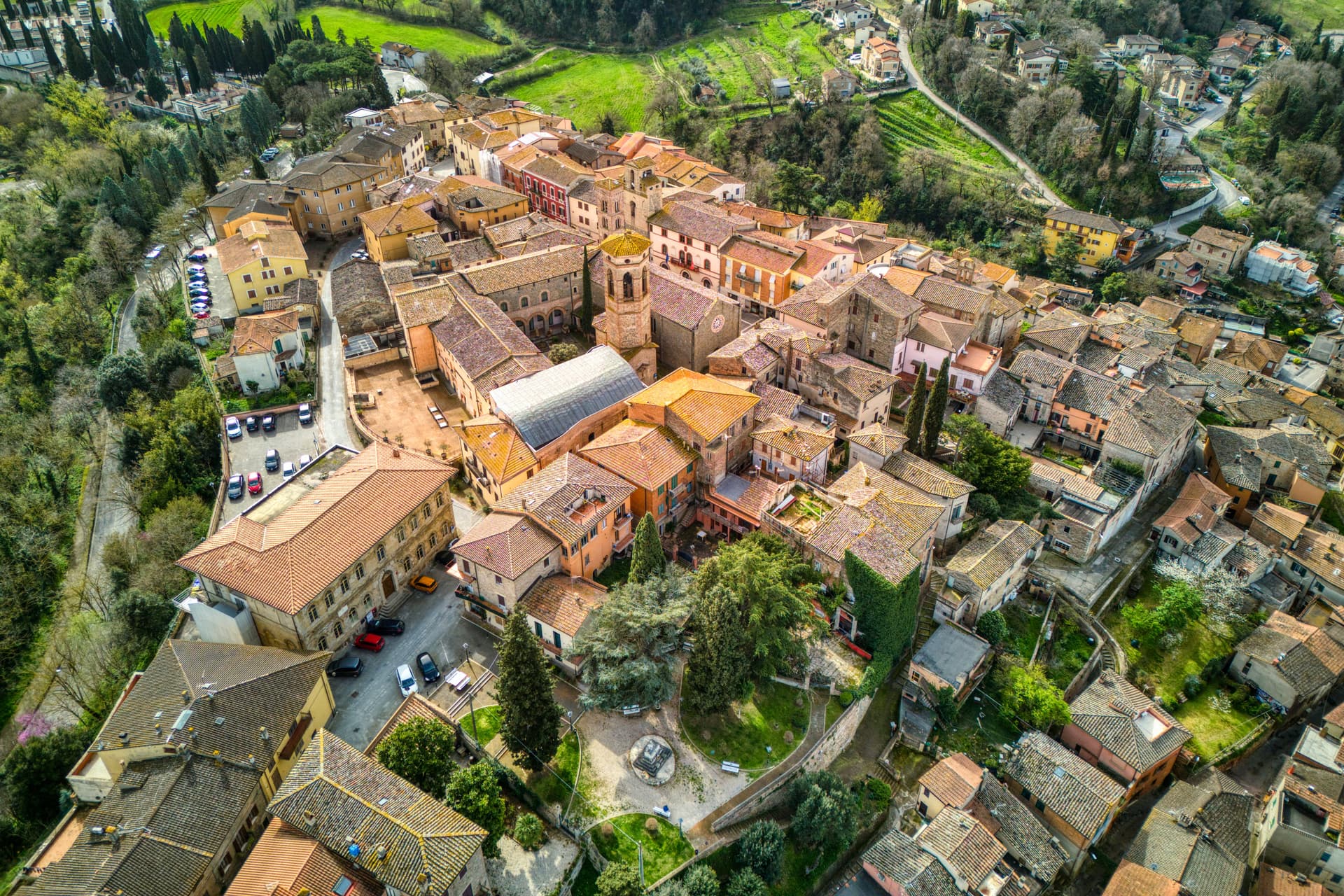
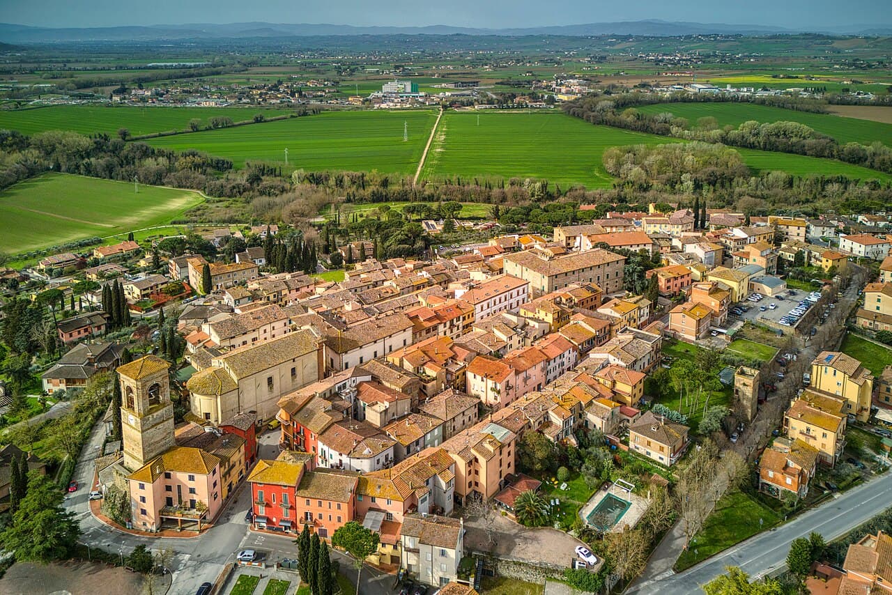
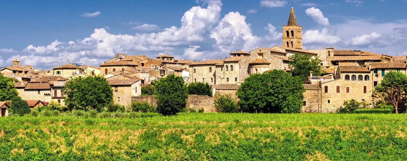
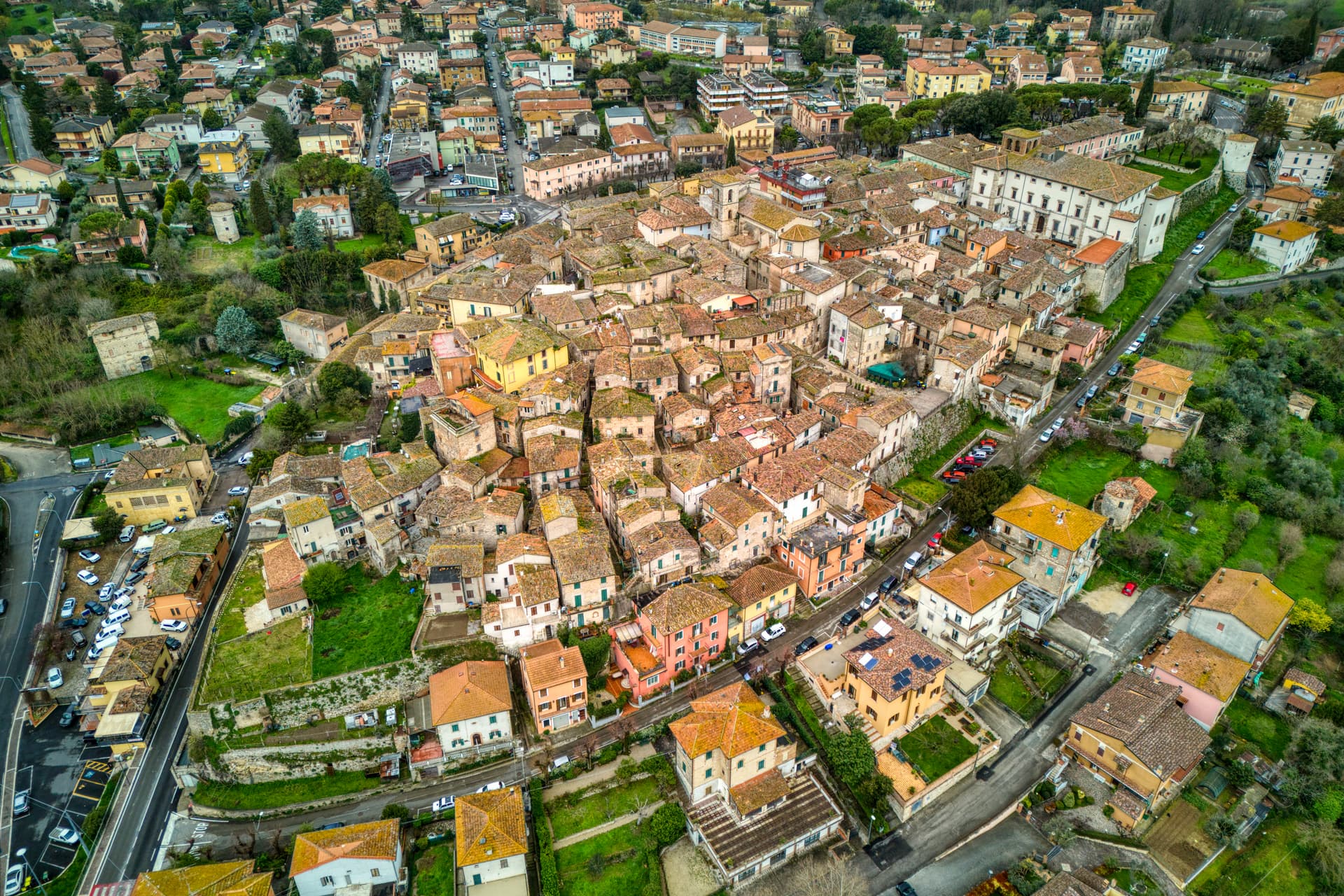
Bettona
A hill town between the Topino and Chiascio rivers, the only Etruscan settlement ever built east of the Tiber.
Known for
ETRUSCAN OUTLIER
The only known Etruscan settlement east of the Tiber, with polygonal walls and tular boundary stones from the seventh century BC.
PERUGINO
Two paintings by Pietro Vannucci in the Pinacoteca: Sant'Antonio da Padova and the Madonna della Misericordia with Saints.
OLIVE OIL
Carries the Città dell'Olio designation; the Bettonese olive groves cover the hills sloping down toward the Chiascio valley.
When to visit
Best · Apr–Oct
- J
- F
- M
- A
- M
- J
- J
- A
- S
- O
- N
- D
- Best
- Hot or crowded
- Quiet
- Mostly closed
Why come
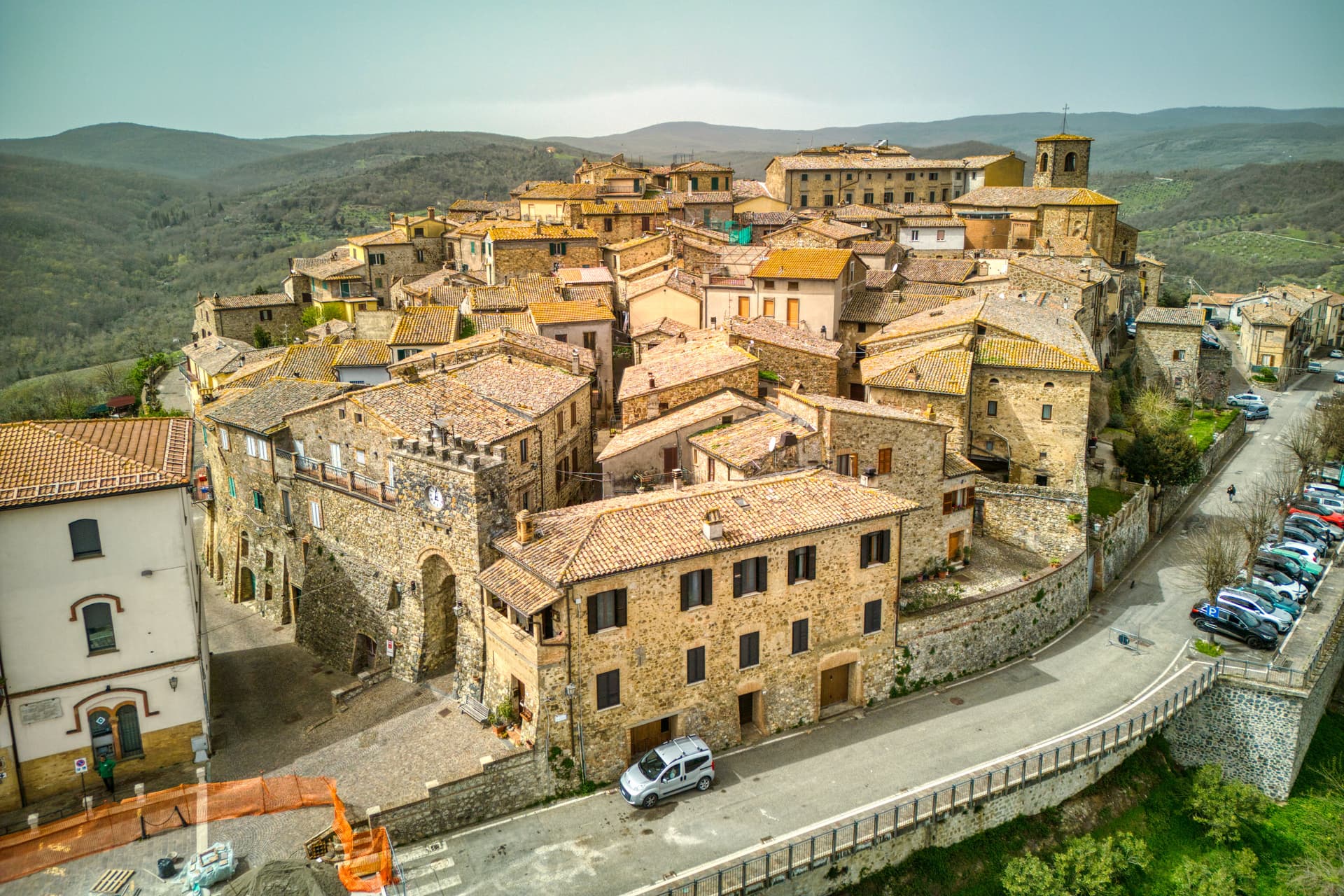
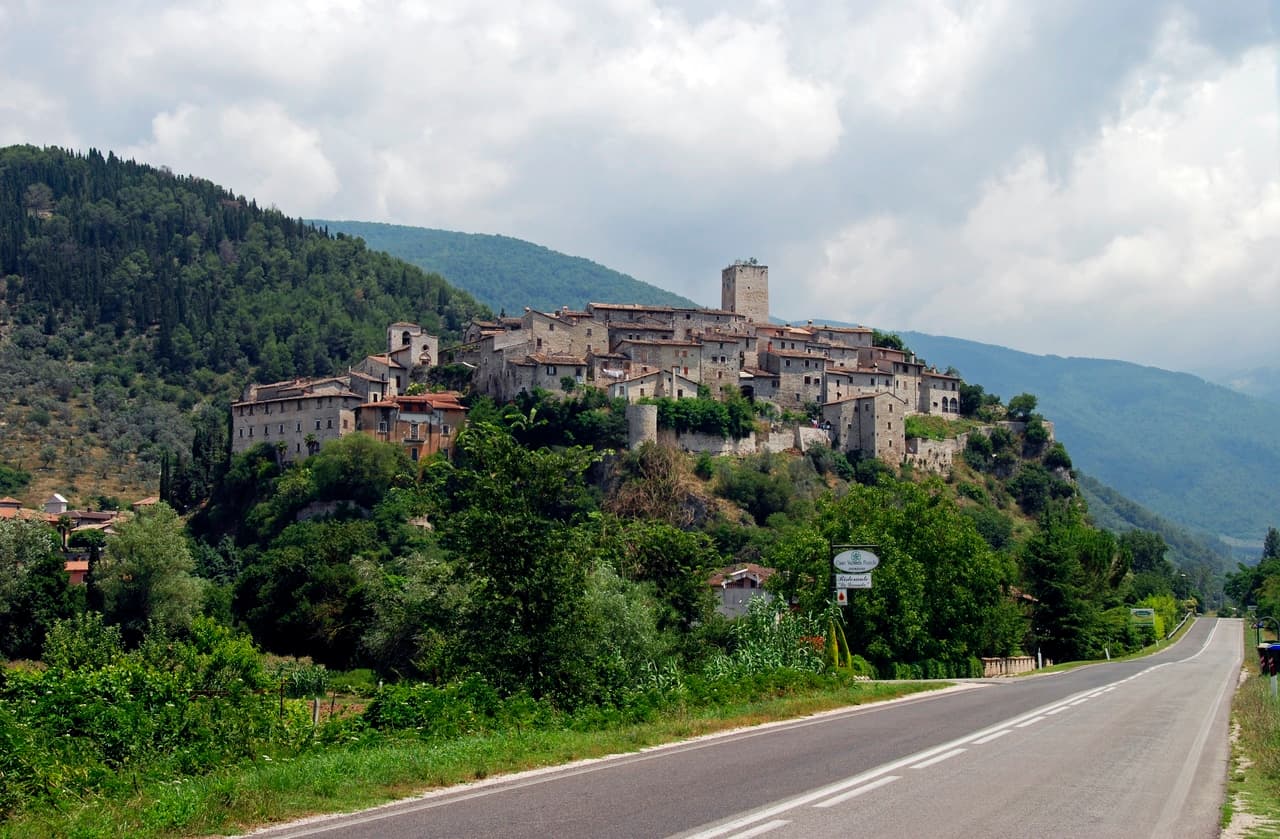
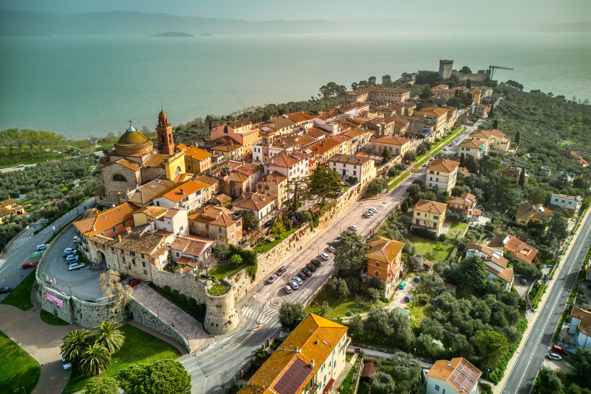
Bettona sits on a hill north of the Colli Martani, looking across the cultivated plain toward Perugia. The Etruscans built here in the seventh century BC, and Bettona remains the only known Etruscan settlement east of the Tiber. Stretches of polygonal walls from that period are still visible at the base of the medieval circuit, mixed with later Roman blocks.
The town became a municipium under Augustus, declined during the barbarian invasions, was sacked by Totila in 548, and rebuilt as a self-governing commune by the late twelfth century. Papal rule held from 1648 to unification. The Pinacoteca Civica, housed in the Palazzetto del Podestà on Piazza Cavour, keeps two paintings by Pietro Perugino (Sant'Antonio da Padova and Madonna della Misericordia), tabernacle panels attributed to El Greco, and Etruscan funerary stones and architectural terracottas from the territory. The olive groves below town carry the Città dell'Olio designation.
The Sunday letter
We haven’t written Bettona’s letter yet.
One town every Sunday, with the photo, the food, the festa. Be there when this one comes up. Free, by Peter & Sophia from Pietrasanta.
By subscribing you agree to Substack’s Terms of Use, our Privacy Policy and our Information collection notice.


What to see
Mura etrusche
Stretches of polygonal Etruscan walls visible at the base of the medieval circuit, from the seventh and sixth centuries BC.
Pinacoteca Civica
Civic art gallery in the Palazzetto del Podestà holding two Perugino paintings, tablets attributed to El Greco and Etruscan finds.
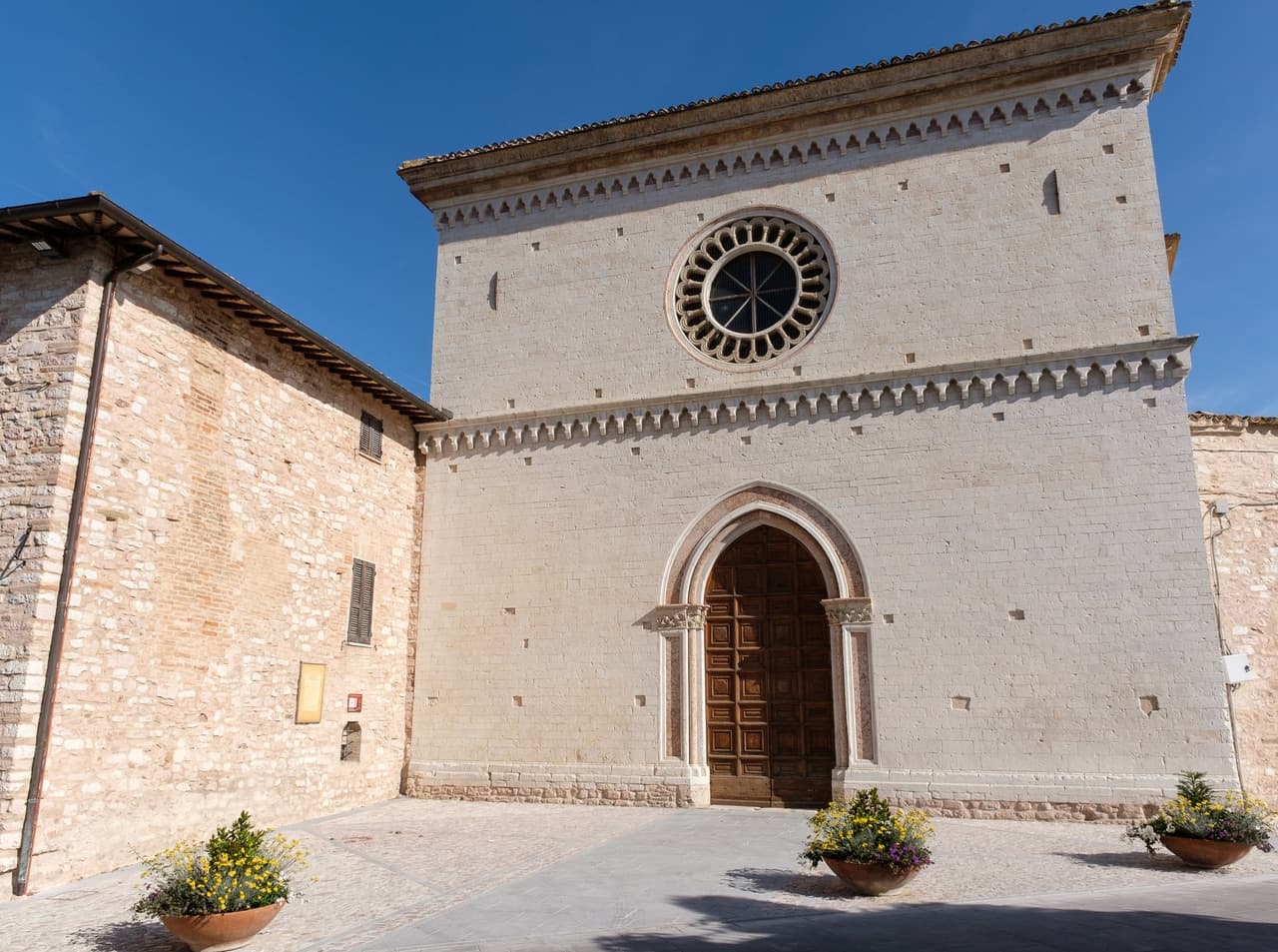
Chiesa di Santa Maria Maggiore
Main parish church on Piazza Cavour, with a reordered interior holding altarpieces and a Crocifissione fresco.
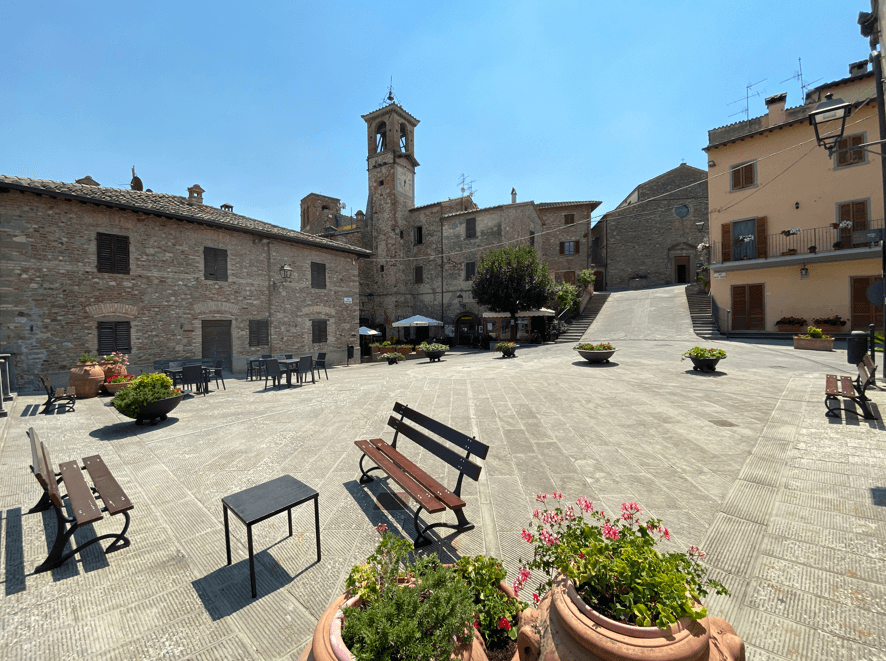
Piazza Cavour
Small central square framed by the Palazzetto del Podestà and the parish church, the social heart of the borgo.
Chiesa di San Crispolto
Romanesque church on the edge of the centro storico, dedicated to the first bishop and patron of the town.
The slow-trip planner
Building a trip? Find where Bettona fits in a slow Italy circuit.
Answer five questions. We will shape a geographically coherent slow trip from the 1,000 Italian towns most travelers skip. Yours to save and share.
Living here
- Population 4,224
- Commuter belti
- Pharmacy: none mapped
- High school within a 30-minute drive
- Nearest airport Ancona / Pescara, 1 h 50 min drive
- Regional capital Perugia, 25 min drive
Tags & datadesignations · numbers · sources
The numbers
- Elevation: 353 m
- Population: 4,224
- Surface area: 45.08 km²
These figures were compiled from public directories — ISTAT, OpenStreetMap, Wikidata — and from the official listings of the guides named on this page. Town details change; verify with official sources before you travel.
Close by
More towns near Bettona
Deruta
Province: Perugia
A hill town at 218 meters on the left bank of the Tiber, the maiolica capital of central Italy since the late thirteenth century.
Torgiano
Province: Perugia
A walled river town at 219 meters at the confluence of the Tiber and the Chiascio, the first DOC and DOCG zone in Umbria.
Bevagna
Province: Perugia
Roman Mevania on the Umbrian plain at 225 meters, four medieval quarters that compete every June in a reconstructed market of the 13th century.
Spello
Province: Perugia
Augustan Hispellum at 280 meters on Monte Subasio, where streets carry flower petals each Corpus Domini and Pinturicchio frescoed the Baglioni Chapel in 1501.

Assisi
Province: Perugia
A pink limestone town at 424 meters on the western flank of Monte Subasio, the birthplace of Francis and a UNESCO site since 2000.
🎨 Borghi più belli d'Italia
More Borghi più belli d'Italia towns in Umbria
Acquasparta
Province: Terni
A hill town at 350 meters above the Naia valley, where Federico Cesi convened the first Accademia dei Lincei in his Palazzo Cesi in 1603.
Allerona
Province: Terni
A stone borgo at 472 meters between the Paglia valley and the Valdichiana, an Orvieto outpost whose Monaldeschi castle fell to Charles V.
Arrone
Province: Terni
Medieval castle village on the left bank of the Nera at 243 meters, upstream from the largest man-made waterfall in the world.
Castiglione del Lago
Province: Perugia
Trasimeno's western promontory, once the lake's fourth island, fortified by Federico II in 1247 and frescoed by Pomarancio for the Corgna marquises.
Citerna
Province: Perugia
A medieval borgo at 480 meters above the upper Tiber valley, holding the only sculpture by Donatello in Umbria.