
Umbria · Terni
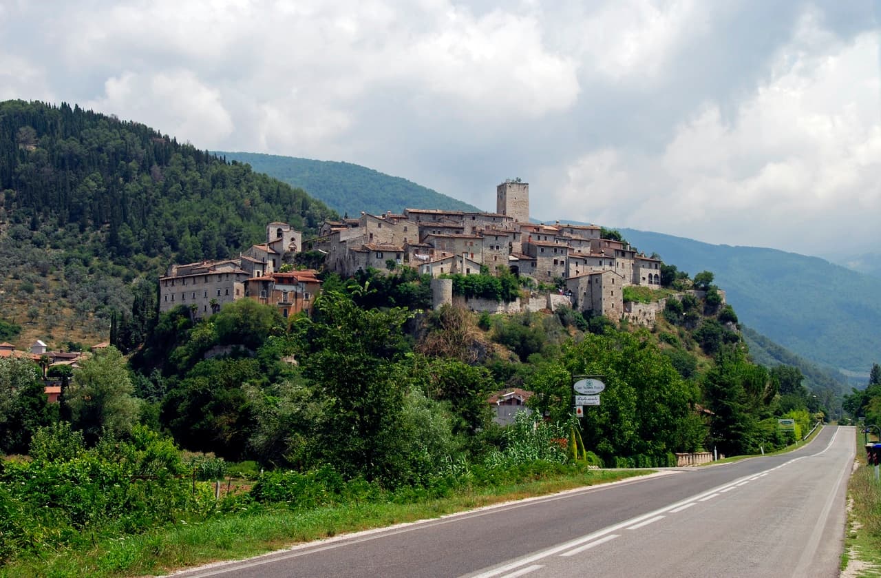
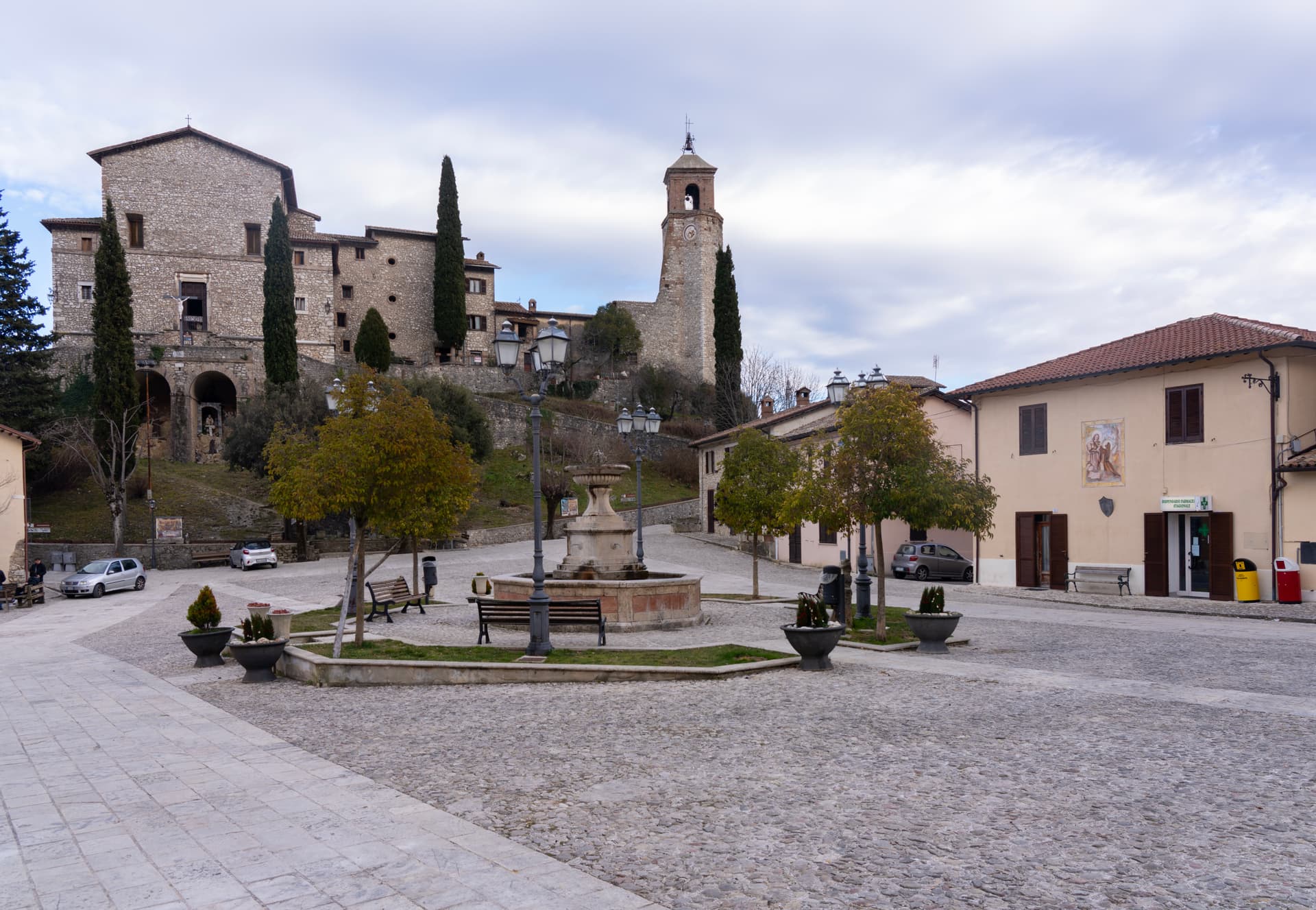
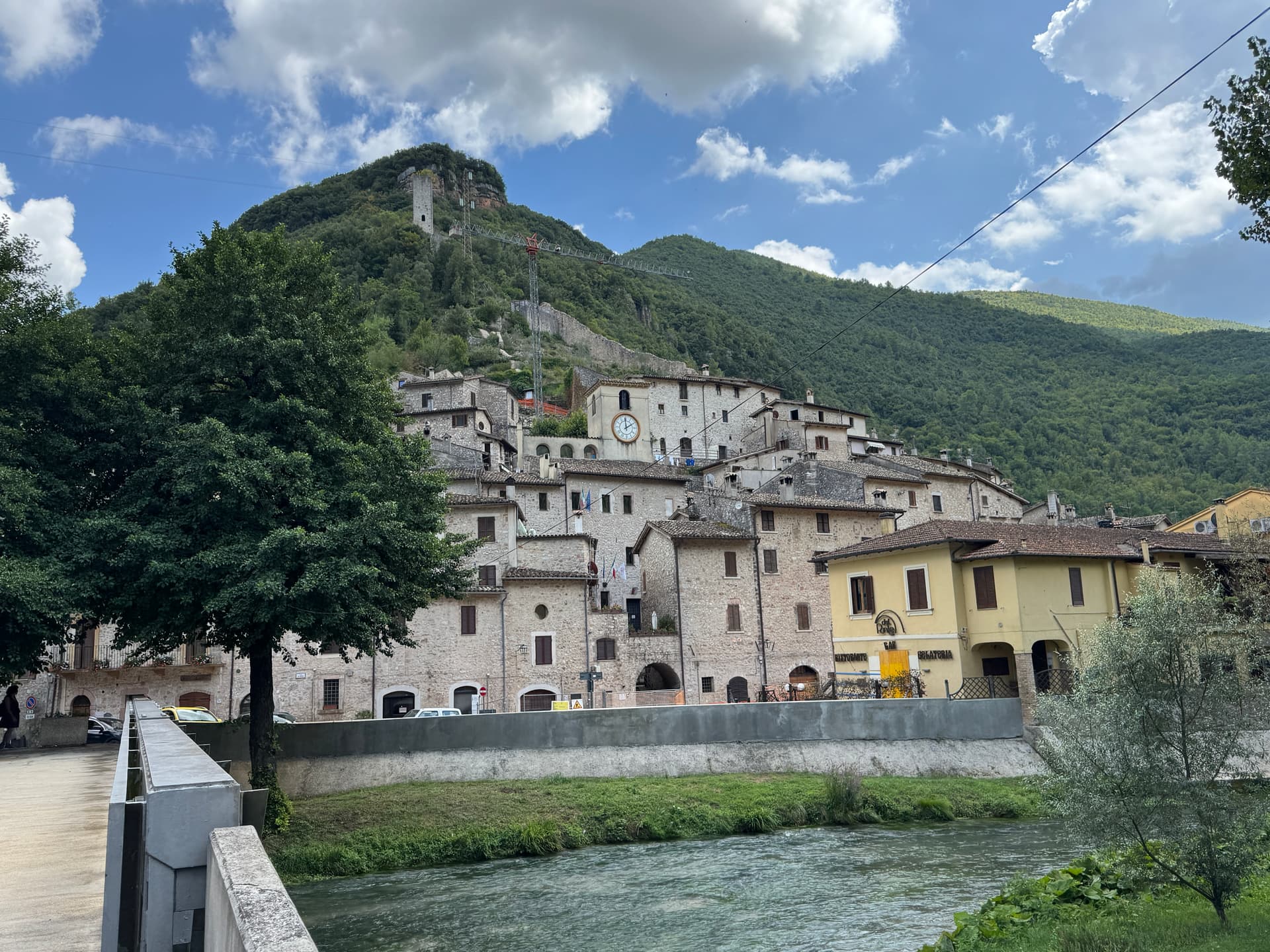
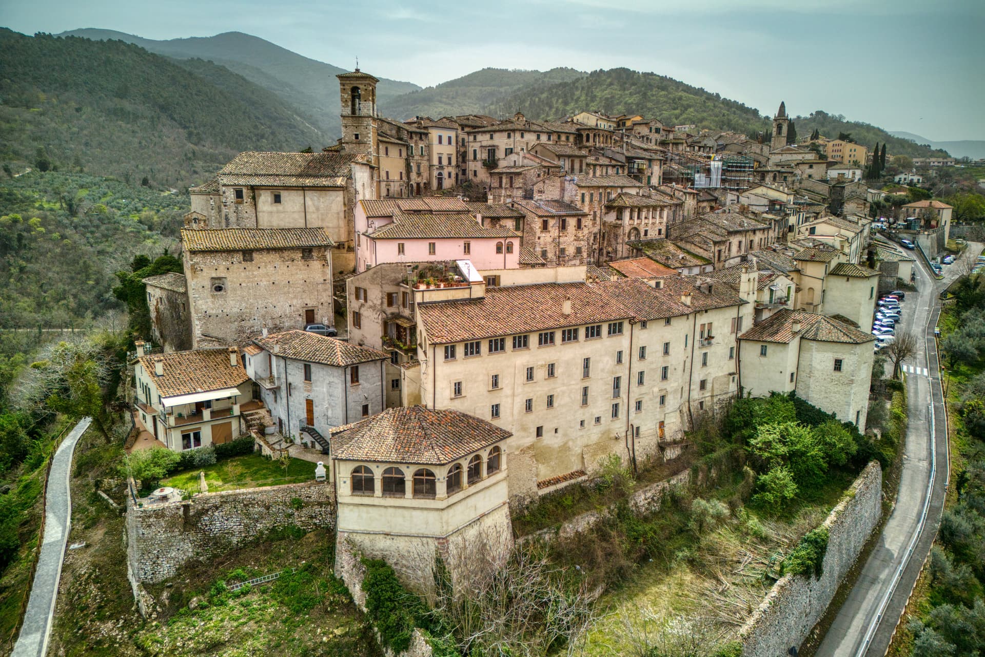
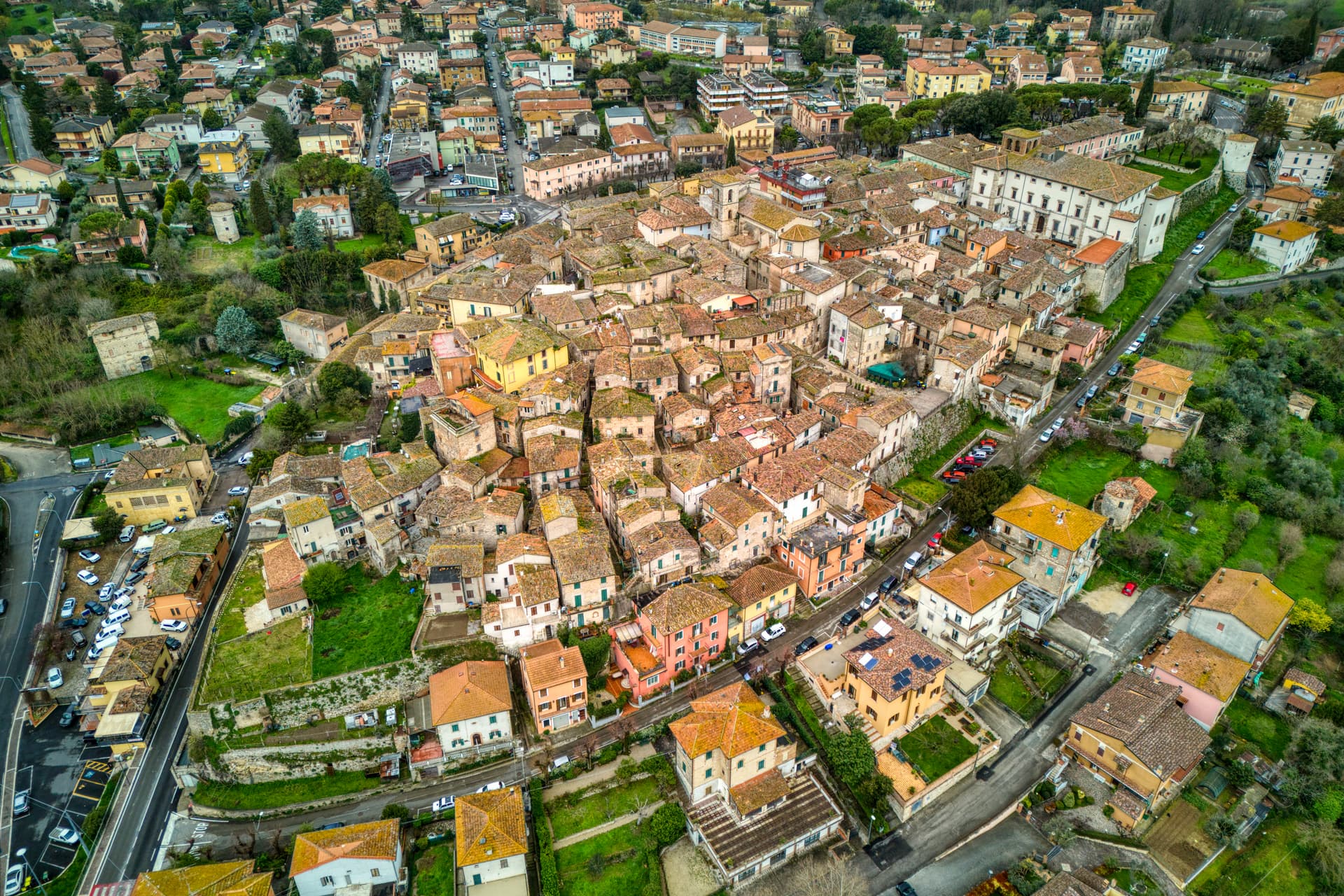
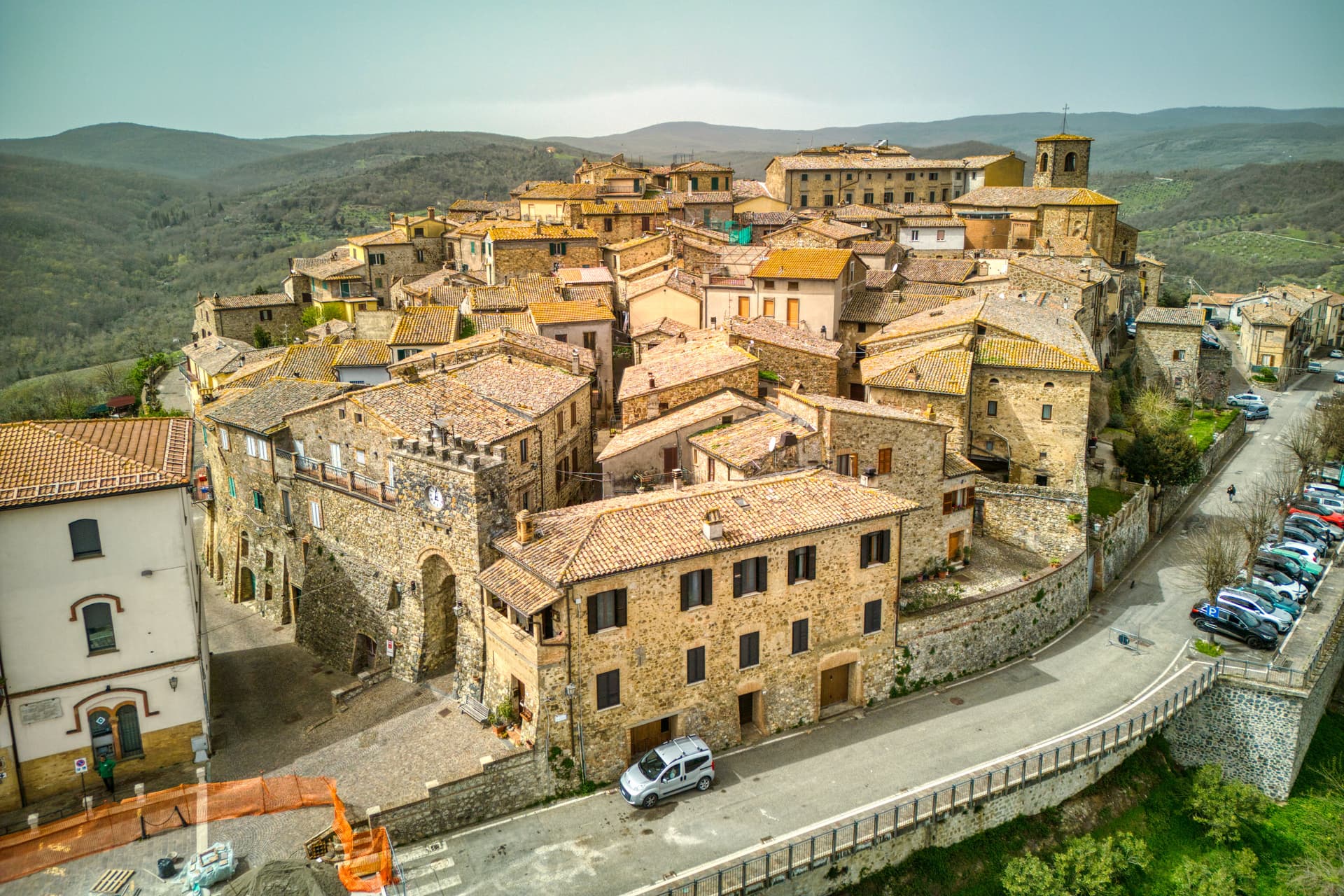
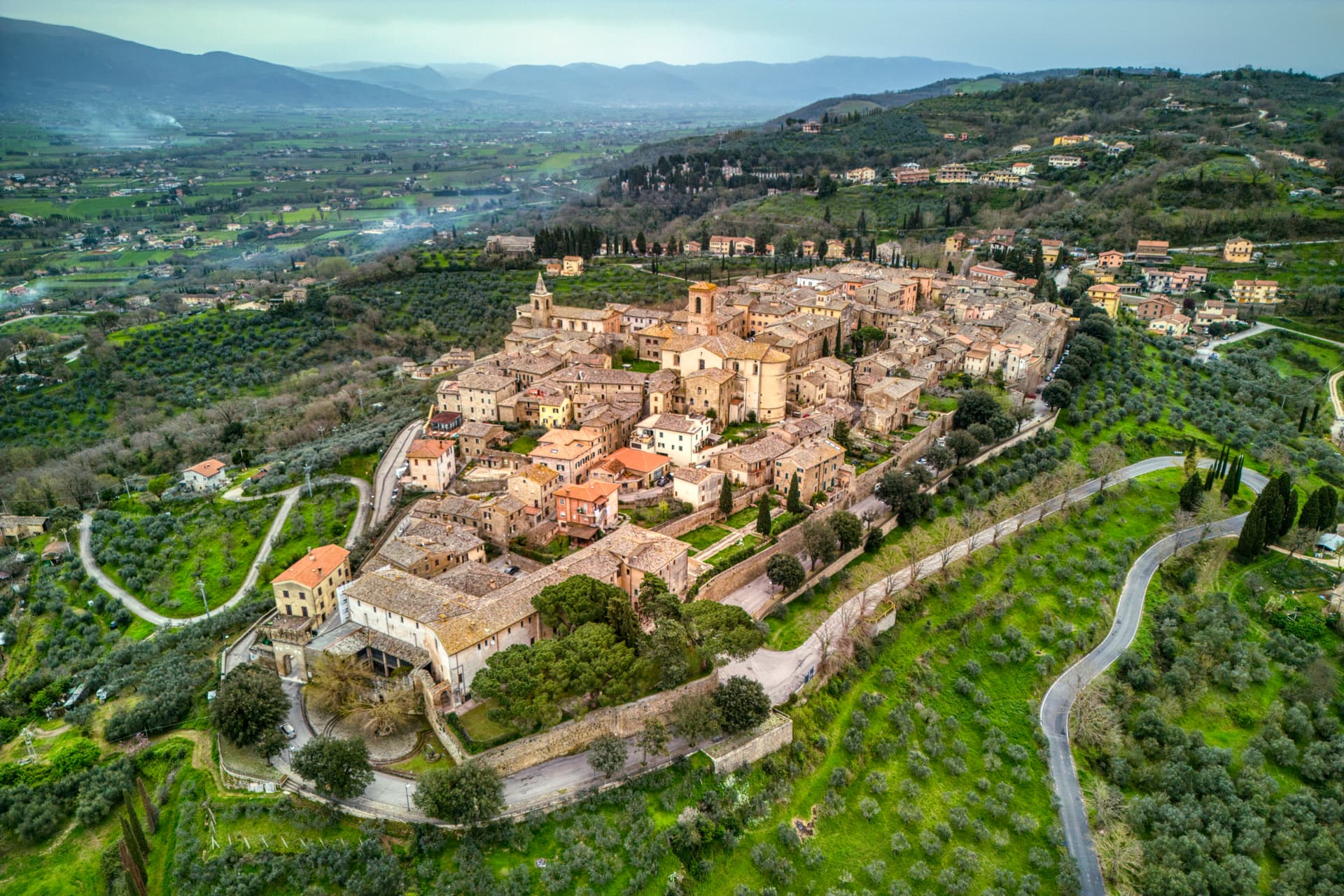
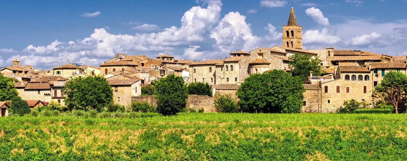
Arrone
Medieval castle village on the left bank of the Nera, upstream from the largest man-made waterfall in the world.
Known for
CASCATA DELLE MARMORE
165-meter three-tier waterfall five kilometers downstream, cut by the Romans in 271 BC, the largest man-made falls in the world.
MEDIEVAL CASTLE
Ninth- or tenth-century noble castle on the upper hill, with walls, towers and stone alleys preserved to the original layout.
NERA RIVER
Base for kayaking, rafting and the Cammino di San Francesco on the lower Nera, between Marmore and Ferentillo.
When to visit
Best · Apr–Oct
- J
- F
- M
- A
- M
- J
- J
- A
- S
- O
- N
- D
- Best
- Hot or crowded
- Quiet
- Mostly closed
The festa: Giovanni Battista, 24 June
Why come
Arrone sits on the left bank of the Nera in the lower Valnerina, the upper part of the village a 9th- or 10th-century noble castle with its walls and alleys still in their medieval layout. The town grew up around the fortified hill and spread along the river as the danger faded. The Cascata delle Marmore, the largest man-made waterfall in the world across three tiers, is five kilometers downstream; the Romans cut the original channel in 271 BC to drain the marshes around Rieti, and successive interventions through the 16th century gave the falls their present form.
The Cammino di San Francesco passes through, and the village is the base for kayaking and rafting on the lower Nera. The Chiesa di San Giovanni Battista in the upper castle holds 15th-century frescoes of the Umbrian school, and the collegiate Chiesa di Santa Maria in the lower village was rebuilt in the 16th century on Romanesque foundations.
The Sunday letter
We haven’t written Arrone’s letter yet.
One town every Sunday, with the photo, the food, the festa. Be there when this one comes up. Free, by Peter & Sophia from Pietrasanta.
By subscribing you agree to Substack’s Terms of Use, our Privacy Policy and our Information collection notice.

What to see
Castello di Arrone
Upper part of the village, the 9th-10th century castle, walls and steep medieval alleys preserved to the original layout.
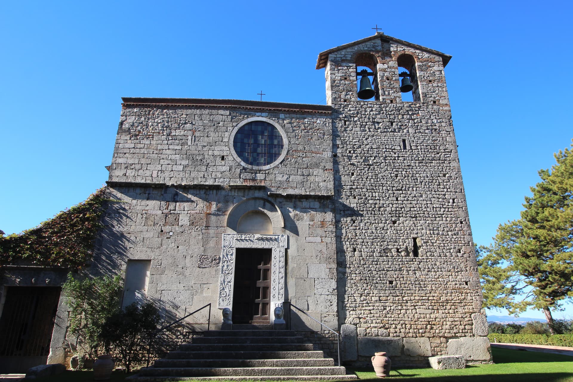
Chiesa di San Giovanni Battista
Fourteenth-century church inside the upper castle, with 15th-century frescoes of the Umbrian school, including a Madonna and saints.
Chiesa Collegiata di Santa Maria
Sixteenth-century collegiate church in the lower village, rebuilt on Romanesque foundations, with frescoes by Vincenzo Tamagni.
Cascata delle Marmore
Largest man-made waterfall in the world, 165 meters across three tiers, cut by the Romans in 271 BC, five kilometers downstream from Arrone.
Casteldilago
Frazione of Arrone, a medieval hilltop hamlet preserved almost intact, with its own walls and parish church above the Nera.
The slow-trip planner
Building a trip? Find where Arrone fits in a slow Italy circuit.
Answer five questions. We will shape a geographically coherent slow trip from the 1,000 Italian towns most travelers skip. Yours to save and share.
Living here
- Population 2,555
- Commuter belti
- Pharmacy in town
- Nearest high school over ~30 minutes away
- Nearest airport Rome, 2 h 30 min drive
- Regional capital Perugia, 1 h 37 min drive
Tags & datadesignations · numbers · sources
The numbers
- Elevation: 243 m
- Population: 2,555
- Surface area: 41.04 km²
These figures were compiled from public directories — ISTAT, OpenStreetMap, Wikidata — and from the official listings of the guides named on this page. Town details change; verify with official sources before you travel.
Close by
More towns near Arrone

Labro
Province: Rieti
A 355-person stone borgo at 628 meters above Lake Piediluco, restored since the 1960s by a Belgian architect and his descendants.
Greccio
Province: Rieti
A 705-meter borgo above the Rieti valley where Francis of Assisi staged the first living nativity scene in a cliff cave on Christmas Eve 1223.
Scheggino
Province: Perugia
Triangular castle village on the banks of the Nera at 280 meters, where the first commercial Italian truffle company was founded in 1928.
Stroncone
Province: Terni
A walled medieval borgo at 451 meters eight kilometers south of Terni, with a Franciscan convent traditionally founded by Francis himself in 1213.
San Gemini
Province: Terni
A medieval borgo at 337 meters above the Via Flaminia, four kilometers below the ruins of Roman Carsulae.
🎨 Borghi più belli d'Italia
More Borghi più belli d'Italia towns in Umbria
Acquasparta
Province: Terni
A hill town at 350 meters above the Naia valley, where Federico Cesi convened the first Accademia dei Lincei in his Palazzo Cesi in 1603.
Allerona
Province: Terni
A stone borgo at 472 meters between the Paglia valley and the Valdichiana, an Orvieto outpost whose Monaldeschi castle fell to Charles V.
Bettona
Province: Perugia
A hill town at 353 meters between the Topino and Chiascio rivers, the only Etruscan settlement ever built east of the Tiber.
Bevagna
Province: Perugia
Roman Mevania on the Umbrian plain at 225 meters, four medieval quarters that compete every June in a reconstructed market of the 13th century.
Castiglione del Lago
Province: Perugia
Trasimeno's western promontory, once the lake's fourth island, fortified by Federico II in 1247 and frescoed by Pomarancio for the Corgna marquises.