
Lazio · Rieti
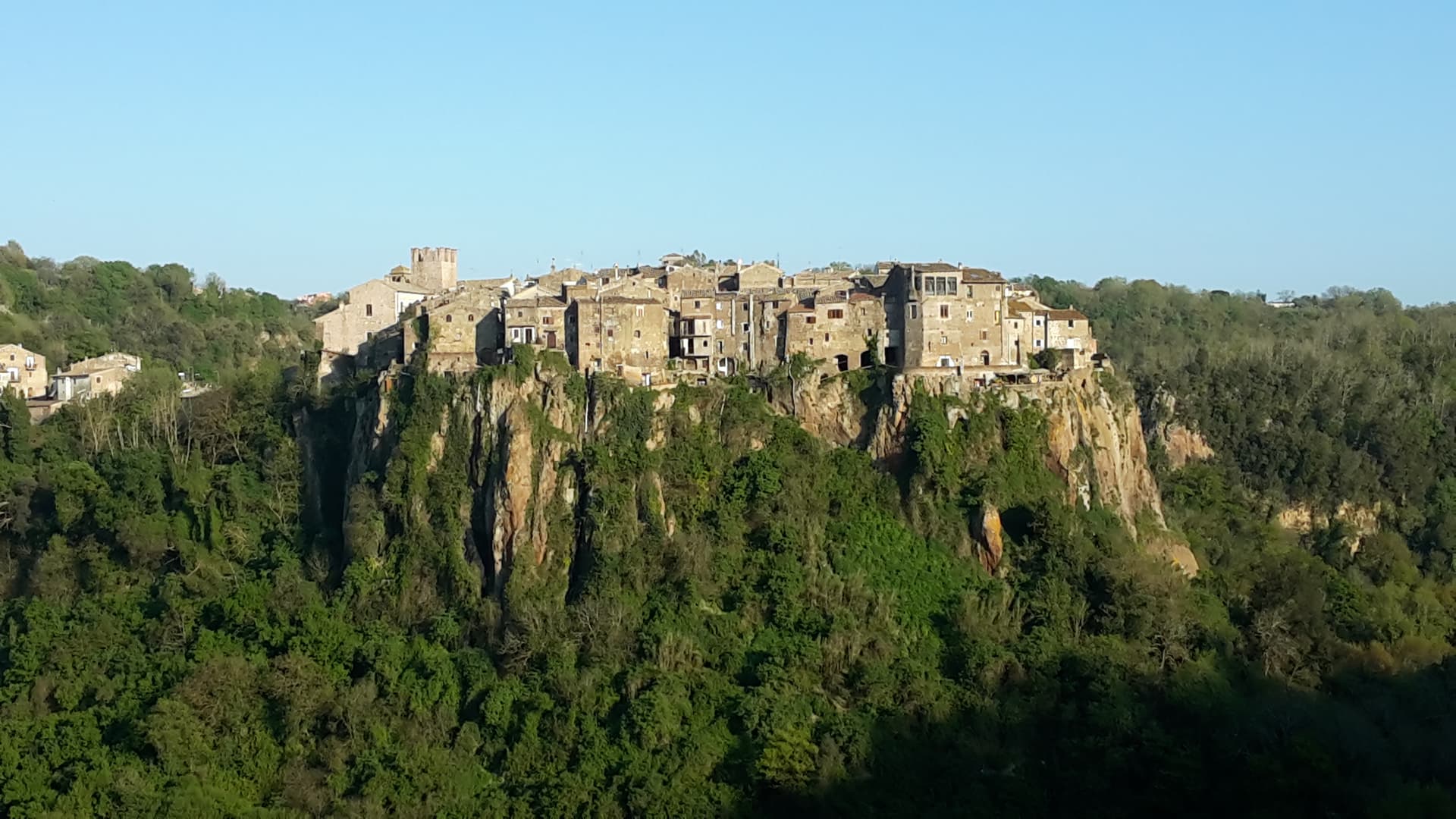
Labro
A 355-person stone borgo at 628 meters above Lake Piediluco, restored since the 1960s by a Belgian architect and his descendants.
Known for
NOBILI-VITELLESCHI
The same family has held the castle since 956 AD, when King Otto I granted the territory with twelve nearby castles.
VAN MOSSEVELDE
Belgian architect Ivan Van Mossevelde began buying and restoring abandoned houses in the 1960s; his family still owns much of the centro.
PIEDILUCO
Lake straddling the Lazio-Umbria border 250 meters below the village, used for rowing competitions on its 1.58 square kilometers.
When to visit
Best · May–Oct
- J
- F
- M
- A
- M
- J
- J
- A
- S
- O
- N
- D
- Best
- Hot or crowded
- Quiet
- Mostly closed
The festa: San Pancrazio, 12 May
Why come
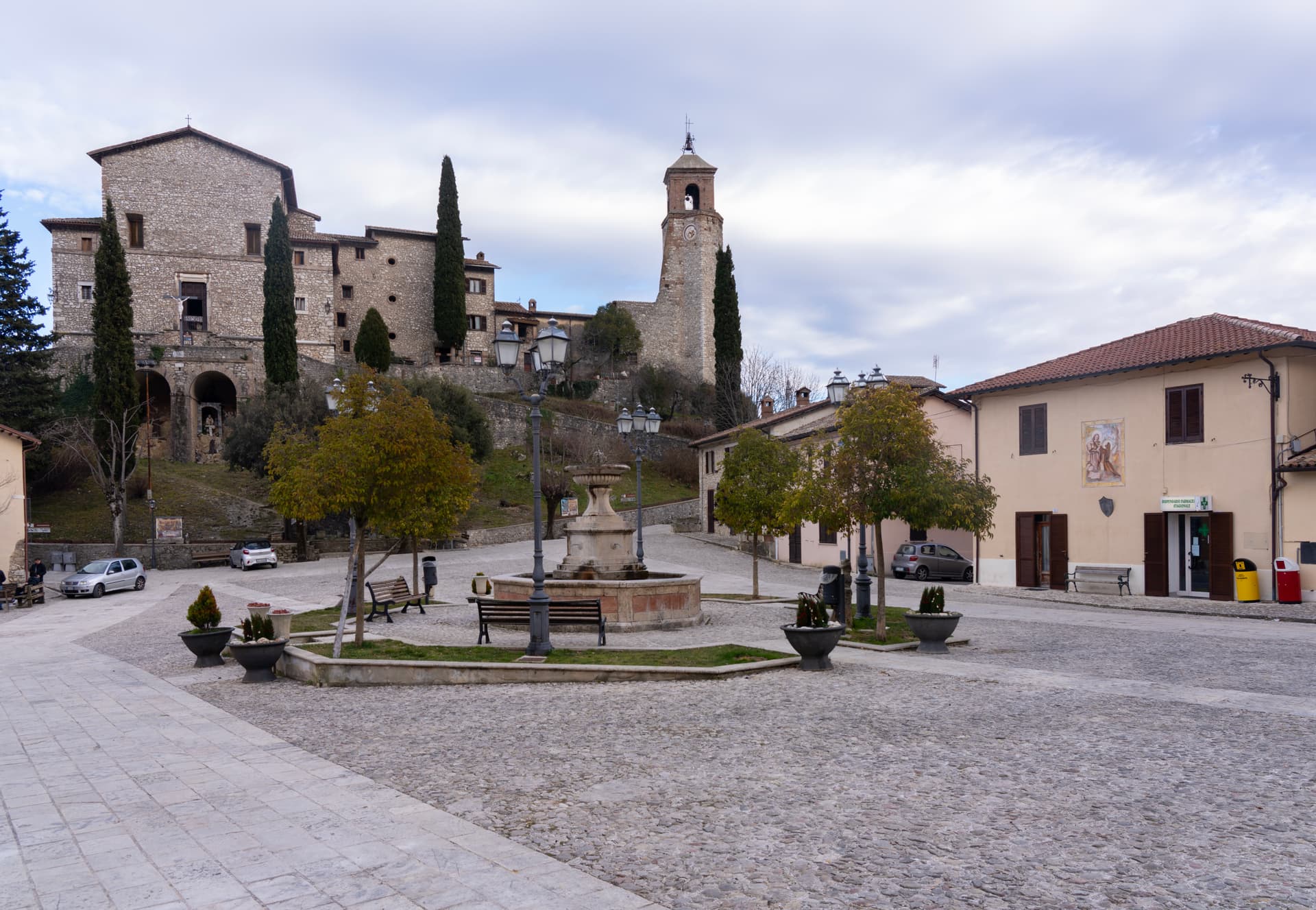
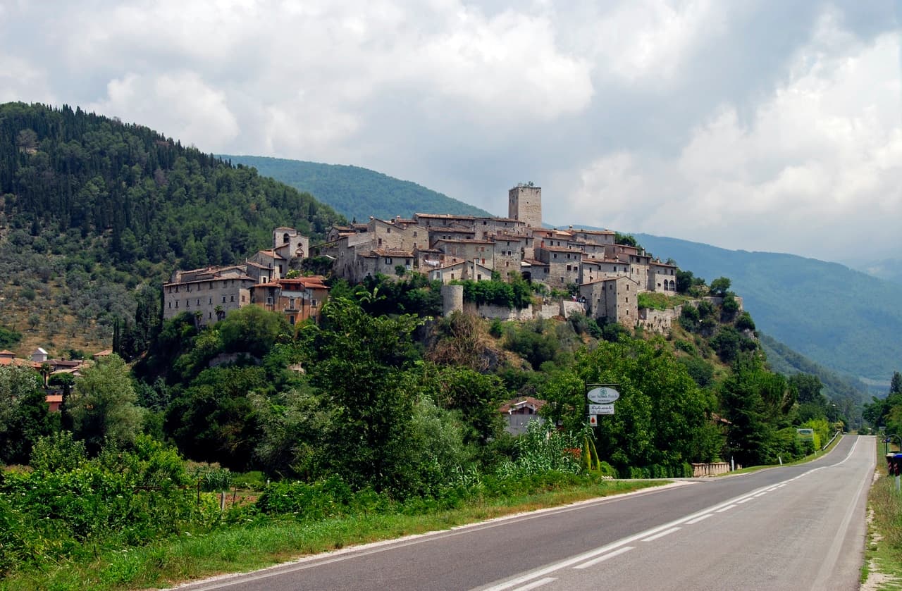
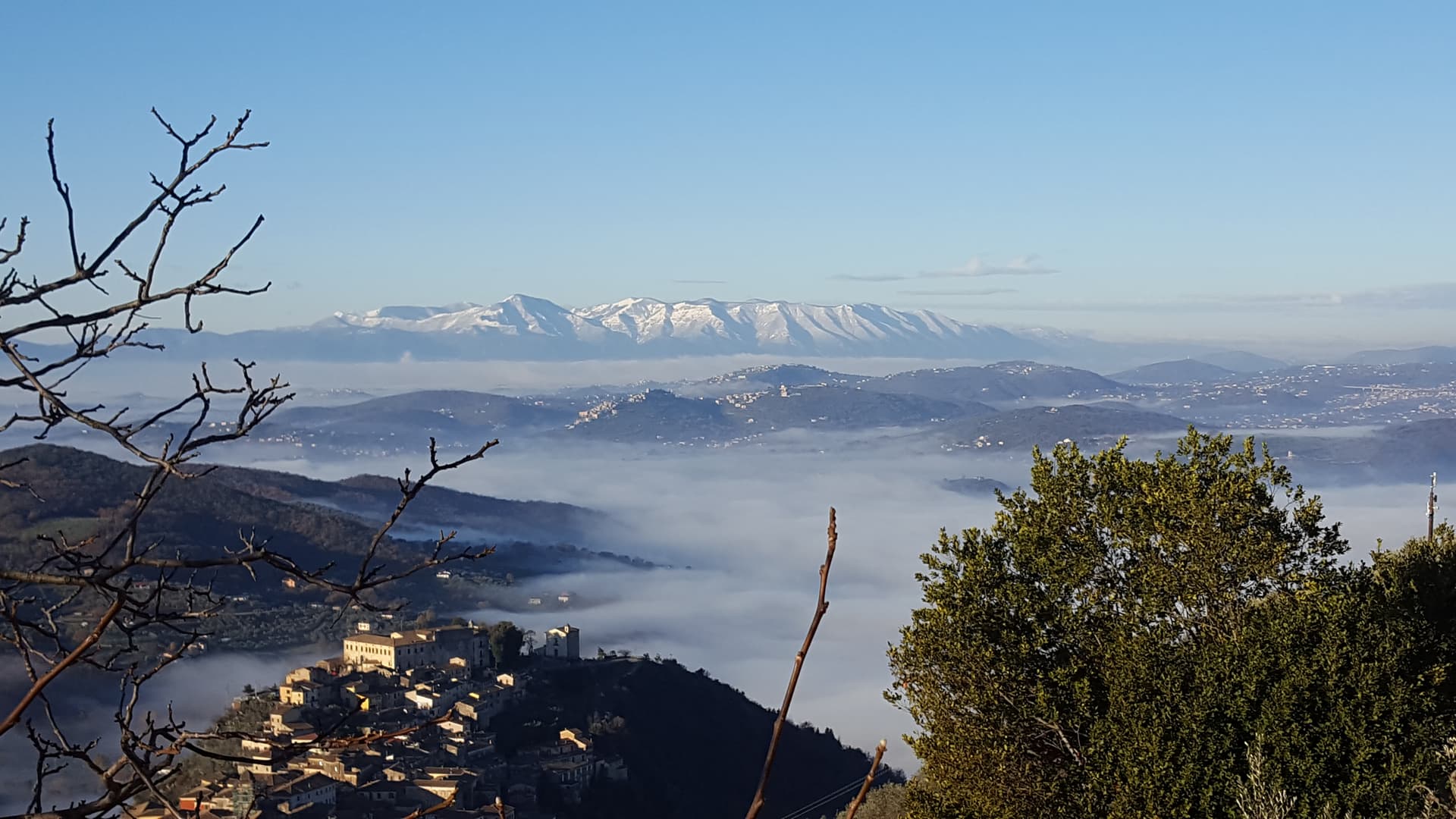
Labro is a stone village of 355 residents perched at 628 meters on the Lazio side of the Umbrian border, overlooking Lake Piediluco and the Reatini mountains. King Otto I granted the territory to the Nobili family in 956; the same family, with the later name Nobili-Vitelleschi, has held the central castle for more than a thousand years. By the 1960s most of the houses were empty.
The Belgian architect Ivan Van Mossevelde began buying and restoring them with his wife, and the project continues today: he and his children now own and run much of the centro storico, restoring stone houses while keeping the medieval street plan intact. The result is a borgo that survived depopulation by becoming, in part, a single coordinated restoration. The narrow stone alleys climb from the lower gate to the Castello Nobili-Vitelleschi at the top, and the views east drop straight down to Lake Piediluco.
The Sunday letter
We haven’t written Labro’s letter yet.
One town every Sunday, with the photo, the food, the festa. Be there when this one comes up. Free, by Peter & Sophia from Pietrasanta.
By subscribing you agree to Substack’s Terms of Use, our Privacy Policy and our Information collection notice.


What to see
Castello Nobili-Vitelleschi
Tenth-century castle at the top of the village, held by the same family since King Otto I's grant in 956, still privately owned.
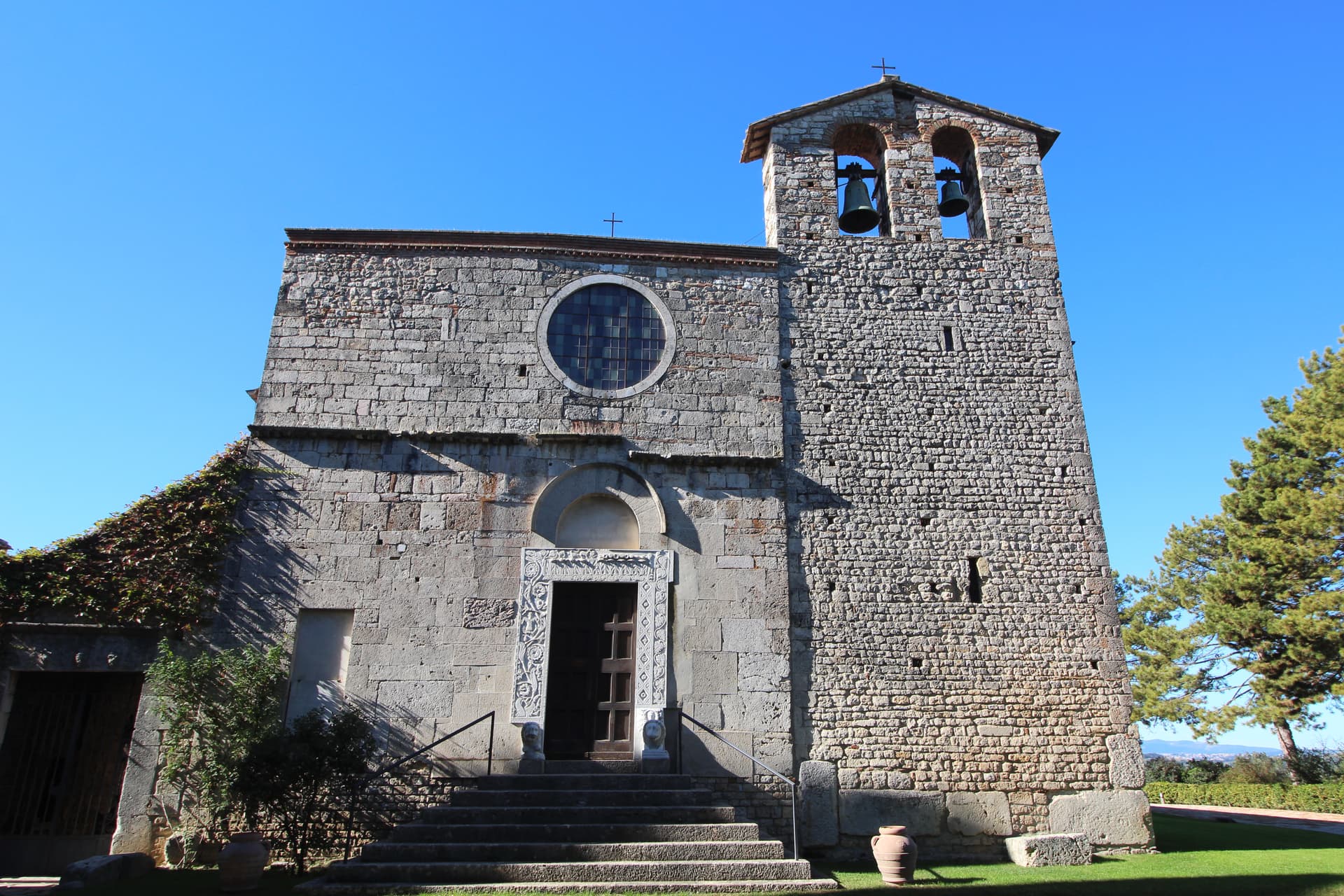
Chiesa di Santa Maria Maggiore
Parish church on the main square of the centro storico, with works of devotional art collected by the Nobili-Vitelleschi family.
Belvedere su Lago di Piediluco
Eastern viewpoint at 628 meters dropping to Lake Piediluco at 375 meters, with the Reatini and Sabini ranges in the background.
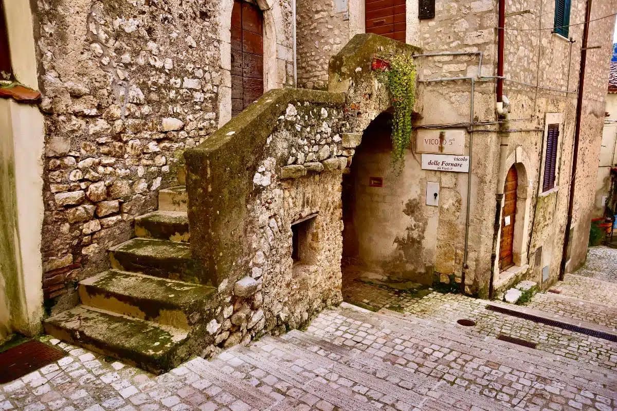
Centro storico
Roughly twelve hectares of stone houses along narrow streets, much of it restored since the 1960s under a single coordinated project.
The slow-trip planner
Building a trip? Find where Labro fits in a slow Italy circuit.
Answer five questions. We will shape a geographically coherent slow trip from the 1,000 Italian towns most travelers skip. Yours to save and share.
Living here
- Population 355
- Commuter belti
- Pharmacy: none mapped
- High school within a 30-minute drive
- Nearest airport Rome, 2 h 16 min drive
- Regional capital Roma, 1 h 41 min drive
Tags & datadesignations · numbers · sources
Recognised as
The numbers
- Elevation: 628 m
- Population: 355
- Surface area: 11.75 km²
These figures were compiled from public directories — ISTAT, OpenStreetMap, Wikidata — and from the official listings of the guides named on this page. Town details change; verify with official sources before you travel.
Close by
More towns near Labro
Greccio
Province: Rieti
A 705-meter borgo above the Rieti valley where Francis of Assisi staged the first living nativity scene in a cliff cave on Christmas Eve 1223.
Arrone
Province: Terni
Medieval castle village on the left bank of the Nera at 243 meters, upstream from the largest man-made waterfall in the world.

Monteleone di Spoleto
Province: Perugia
Where the 6th-century-BC Etruscan parade chariot now in the Met was found — a 555-resident Borghi più belli d'Italia borgo at 978m in the upper Nera valley, with a replica of the Monteleone Chariot (the original is in New York), the medieval Rocca dei Brancaleoni, and a stop on the Cammino di San Benedetto pilgrim route.
San Gemini
Province: Terni
A medieval borgo at 337 meters above the Via Flaminia, four kilometers below the ruins of Roman Carsulae.
Narni
Province: Terni
Italy's geographical centre and the etymological 'Narnia' — a 17,900-resident hilltop town on a travertine outcrop above the Nera valley, with the Rocca Albornoz papal fortress, a 30m Roman arch of the Ponte d'Augusto, a hidden underground complex containing a 13th-c Inquisition cell with original prisoner graffiti, and the documented Latin name (Narnia) that C.S. Lewis lifted for his fictional kingdom.
🟠 Bandiera Arancione
More Bandiera Arancione towns in Lazio
Arpino
Province: Frosinone
The Volscian-Roman hill town in the Liri valley that produced Marius and Cicero, with a pre-Roman acropolis above the modern center.
Bassiano
Province: Latina
The highest village in the province of Latina at 562 meters, birthplace of Aldo Manuzio, who shrank the book to pocket size.
Bolsena
Province: Viterbo
A medieval town at 350 meters on the eastern shore of Europe's largest volcanic lake, where a Bohemian priest reported a Eucharistic miracle in 1263.
Bomarzo
Province: Viterbo
The Tuscia village below the Sacro Bosco, the 16th-century stone-monster garden built by a grieving condottiero for his dead wife.
Calcata
Province: Viterbo
A tufa-cliff village forty kilometers north of Rome, condemned and abandoned in the 1930s, then occupied by artists and never left.