
Umbria · Perugia
Monteleone di Spoleto
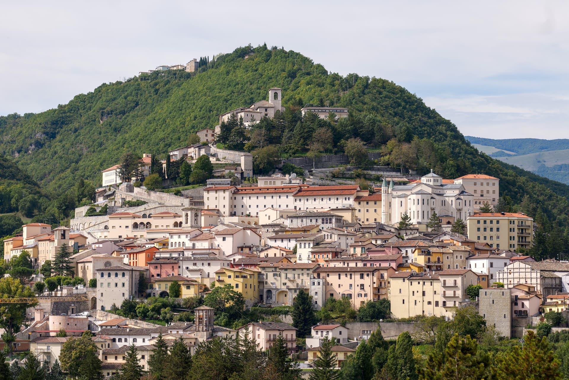
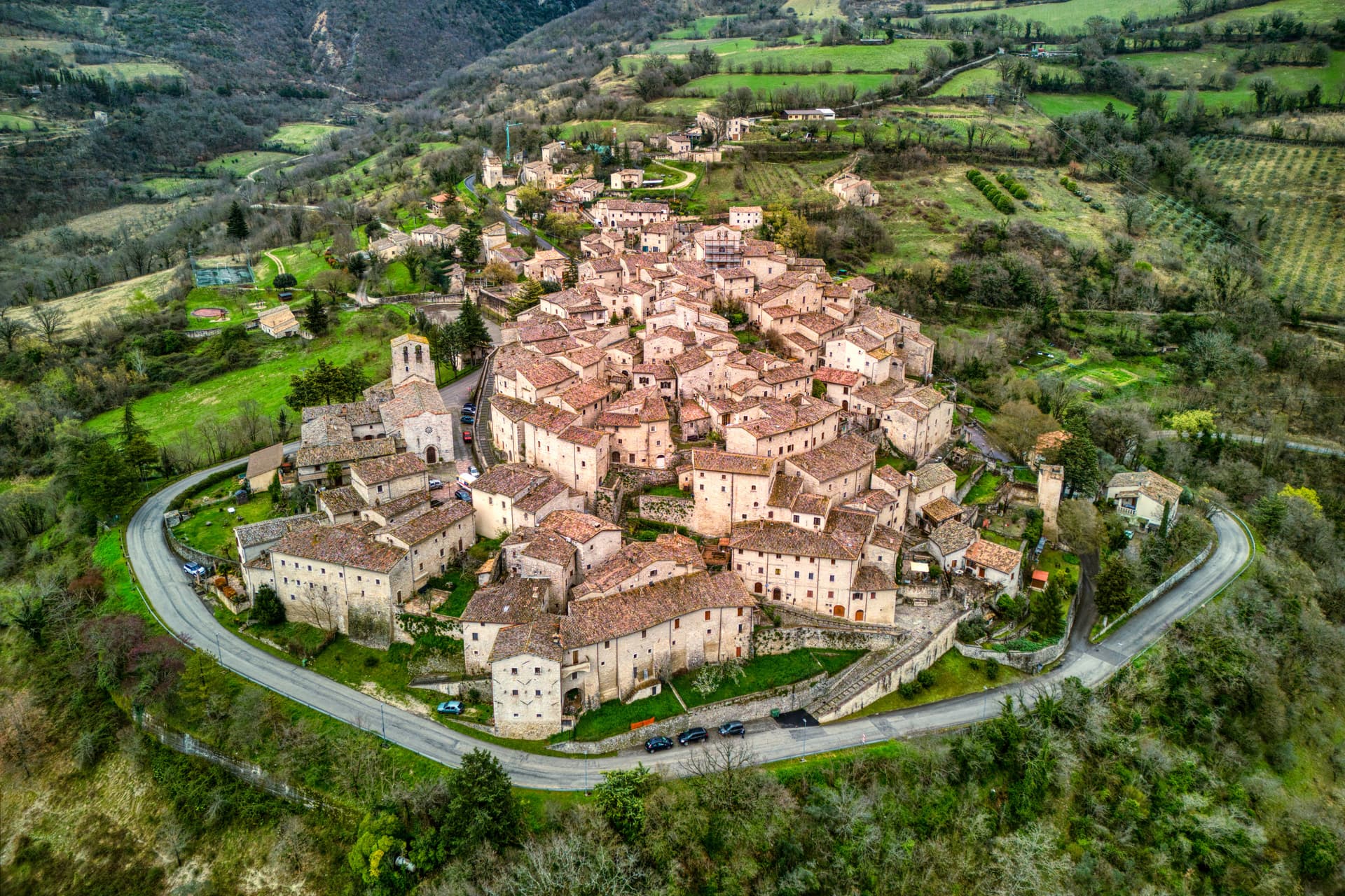
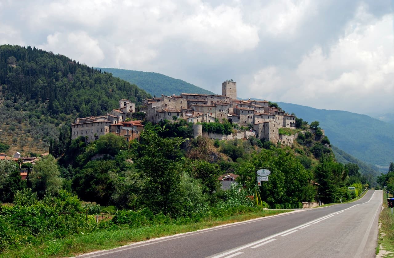
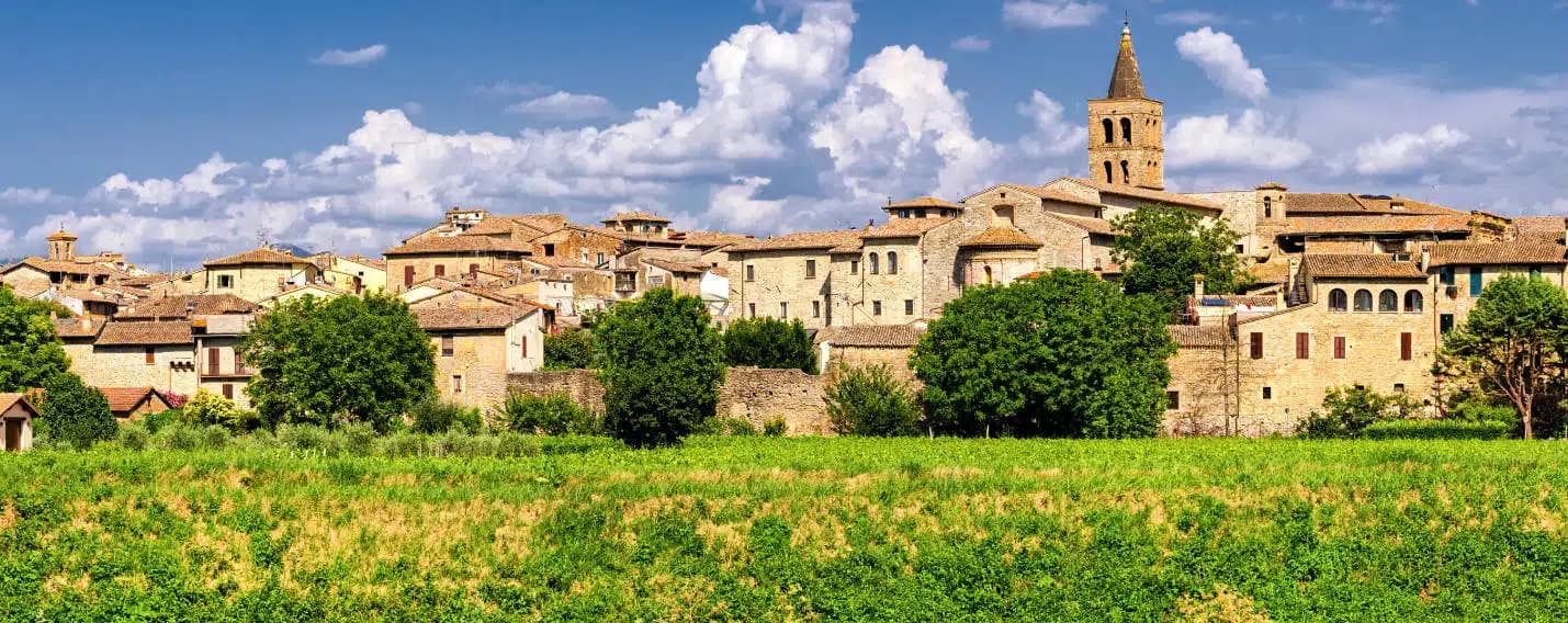
Where the 6th-century-BC Etruscan parade chariot now in the Met was found — a 555-resident Borghi più belli d'Italia borgo at 978m in the upper Nera valley, with a replica of the Monteleone Chariot (the original is in New York), the medieval Rocca dei Brancaleoni, and a stop on the Cammino di San Benedetto pilgrim route.
Known for
MET CHARIOT BIRTHPLACE
The 6th-c-BC Etruscan parade biga found here in 1902 — now the largest single bronze in the Met's Greek + Roman galleries. Replica + context at the local museum.
BORGHI PIÙ BELLI
Officially inscribed small-village quality mark. 555-resident hilltop borgo at 978m in the upper Nera valley.
CAMMINO DI SAN BENEDETTO
Stop on the 350-km pilgrim route from Norcia (Benedict's birthplace) via Monteleone to Montecassino. Pilgrim accommodation in town.
ROCCA DEI BRANCALEONI
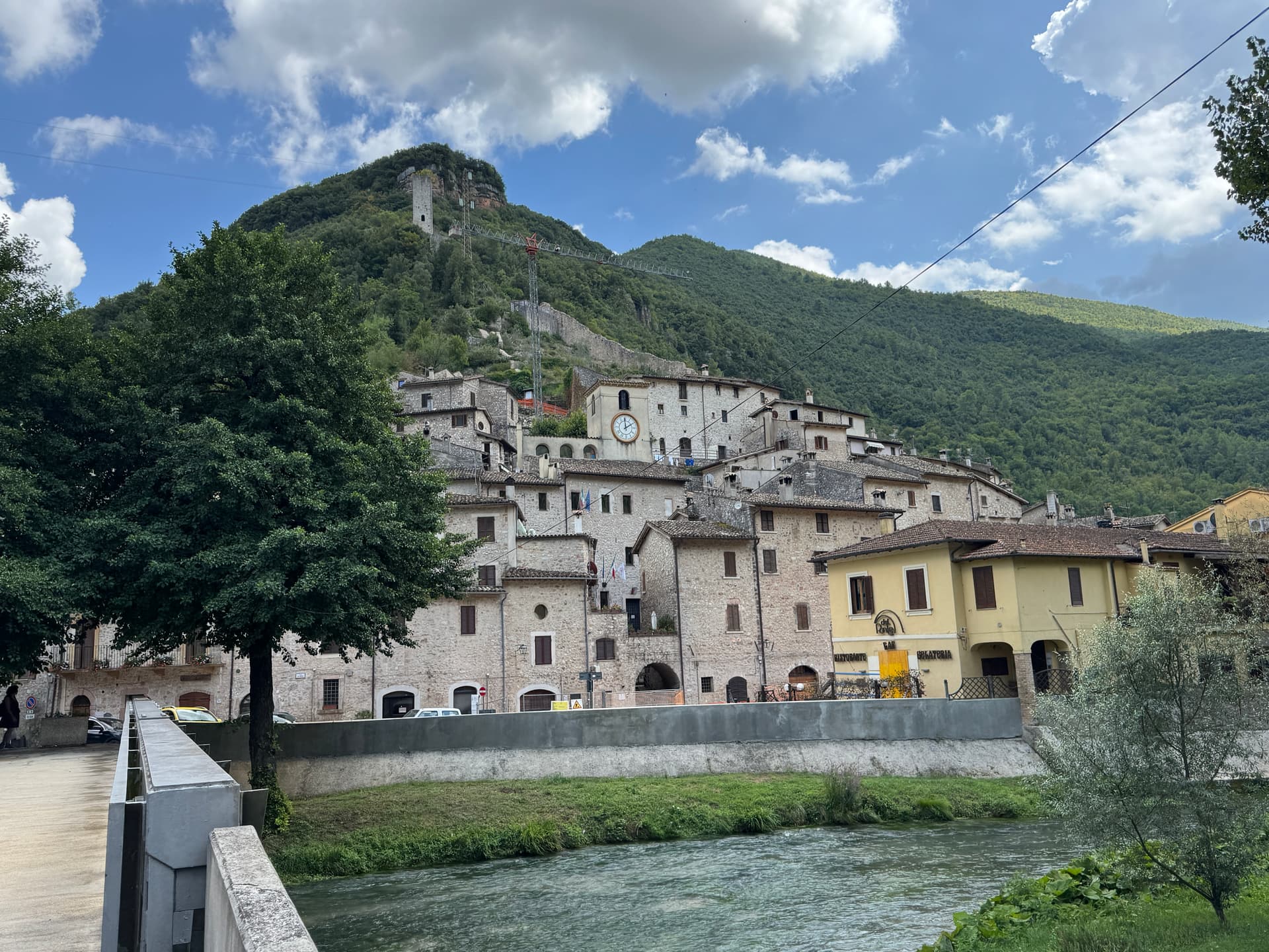
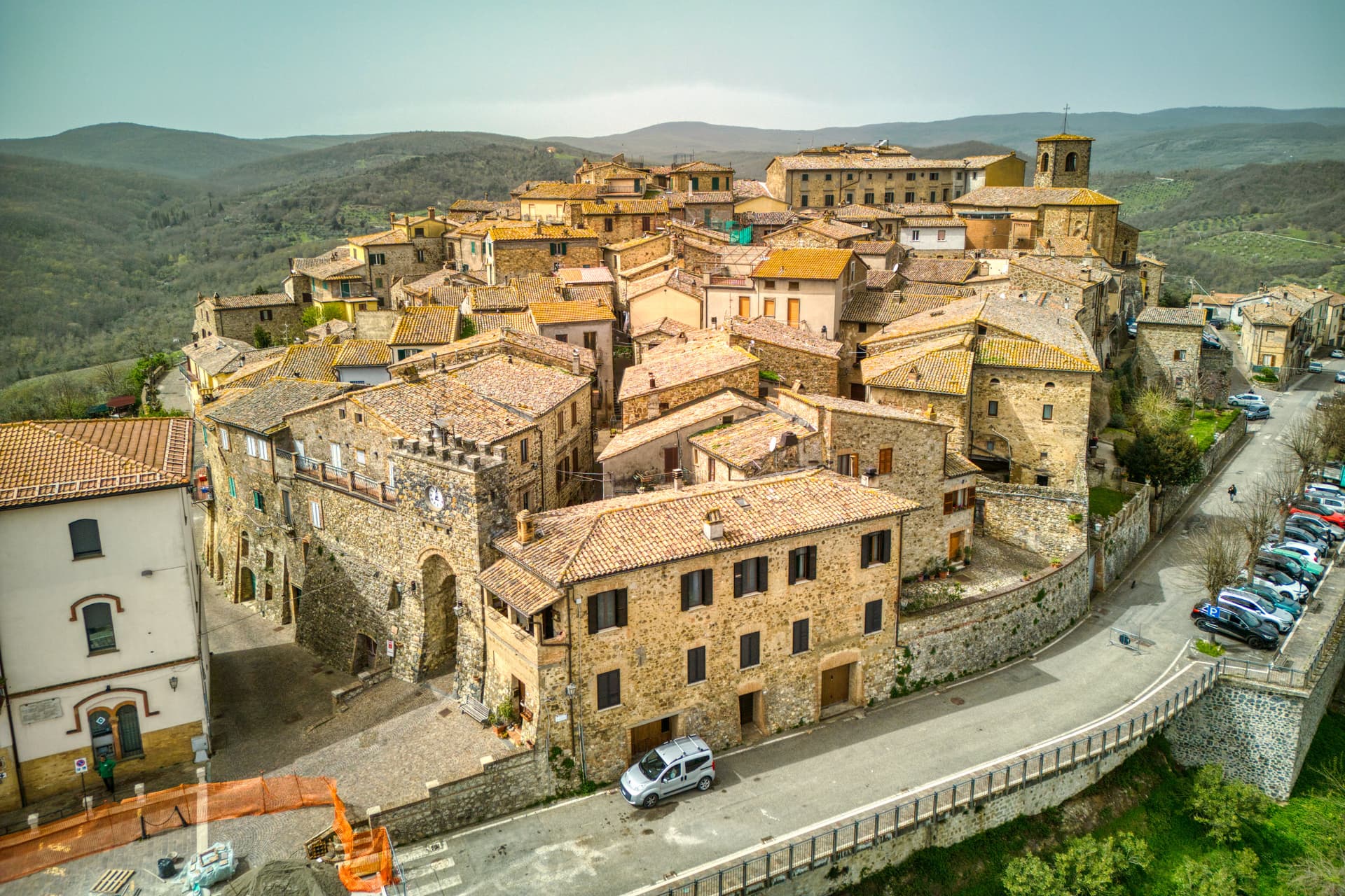
12th-c medieval castle on the summit, restored after the 2016 Norcia earthquake. Panoramic view + the village's defining silhouette.
When to visit
Best · May–Sep
- J
- F
- M
- A
- M
- J
- J
- A
- S
- O
- N
- D
- Best
- Hot or crowded
- Quiet
- Mostly closed
The festa: Nicola di Bari, 6 December
Why come
Monteleone di Spoleto is on the world's archaeology maps for one specific find: the Monteleone Chariot — a complete 6th-c-BC Etruscan bronze parade chariot (biga) found in 1902 by a local farmer ploughing a field at the Colle del Capitano, sold by his family to French dealers for the equivalent of 950 lire, transferred to the Metropolitan Museum of Art in New York in 1903 and now one of the centerpieces of the Met's Greek and Roman galleries (Gallery 170, the largest single bronze object in the Met's collection). The chariot is the most complete pre-Roman parade chariot anywhere — full bronze paneling depicting Achilles' birth, his combat with Memnon, and his apotheosis. Monteleone has been trying to repatriate it since 1990 (multiple legal proceedings, all unsuccessful — the Met's title is now considered definitive), and instead opened the Museo della Civiltà del Carro in 2002 with a full-scale replica + the original context of the find.
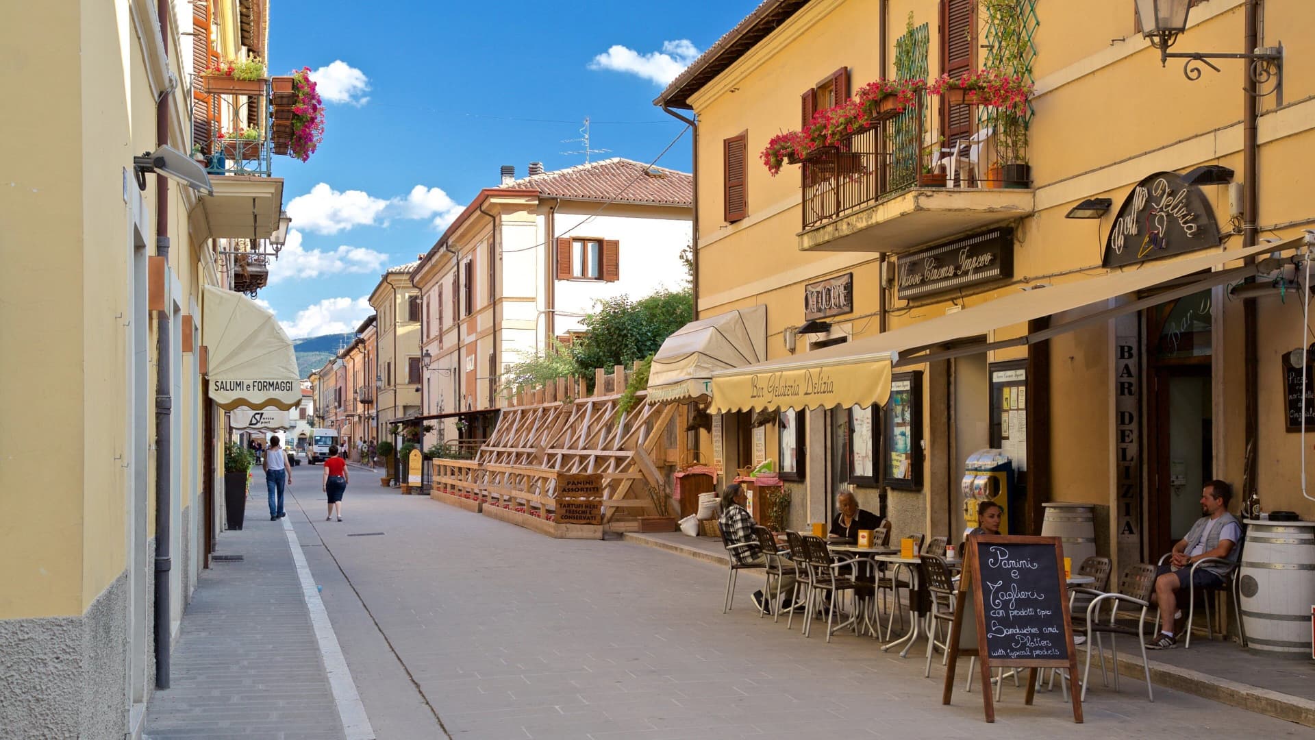
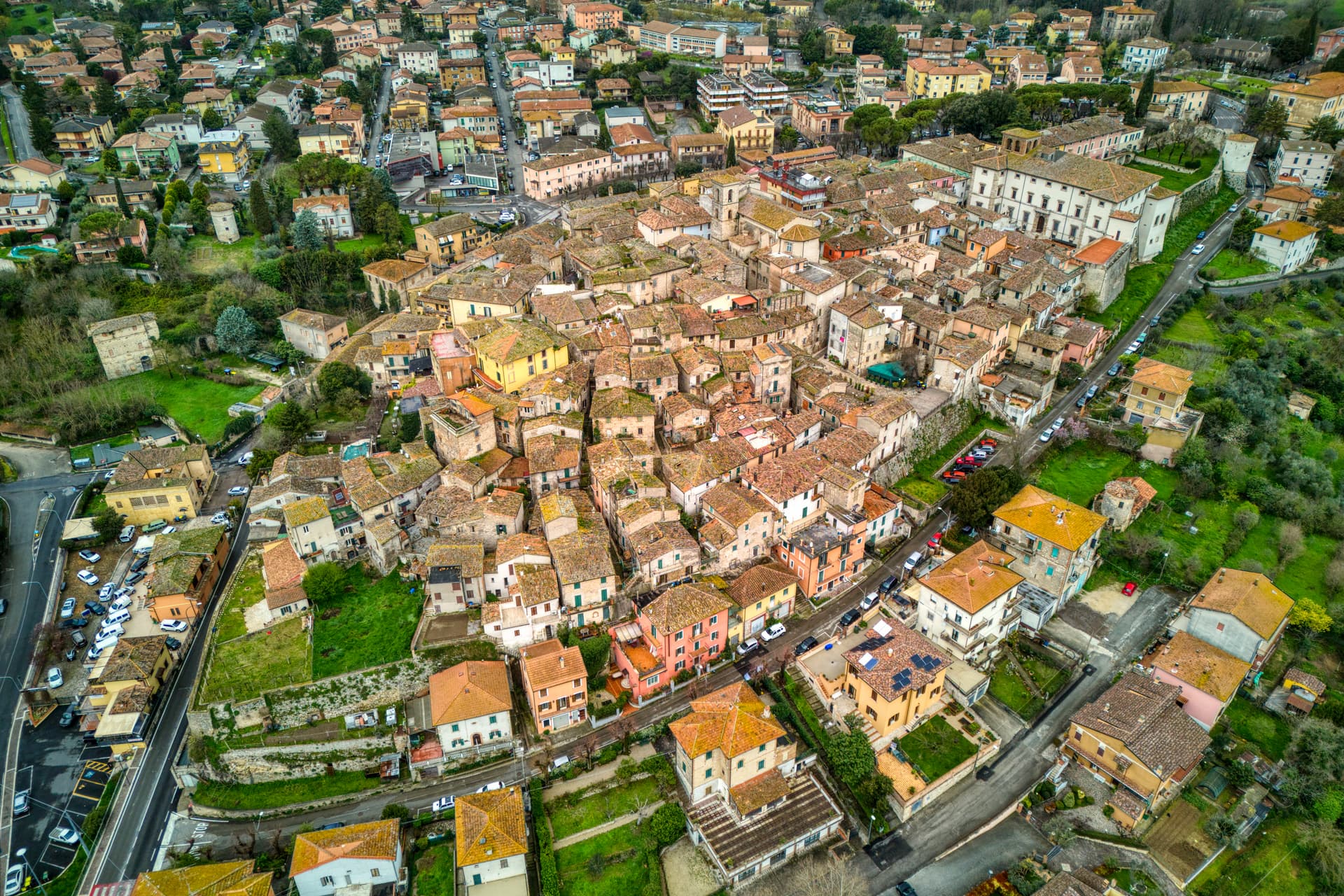
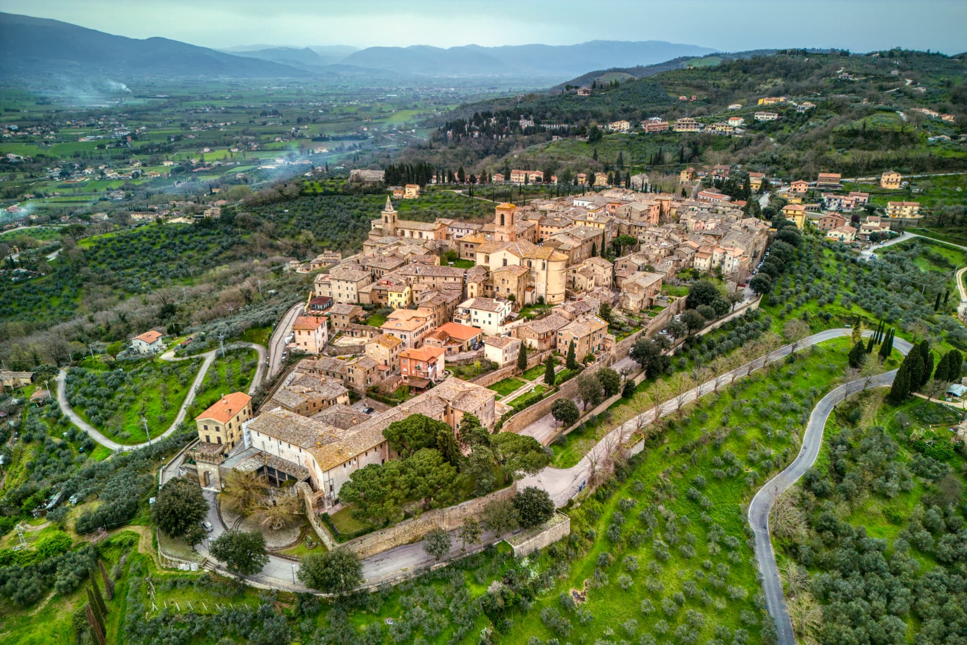
Beyond the chariot: Monteleone is a 555-resident Borghi più belli d'Italia inscribed borgo at 978m altitude on a hilltop in the upper Nera valley (the upper extension of the Valnerina, the Umbria/Lazio/Marche convergence), with the Rocca dei Brancaleoni medieval castle (12th-c origin, much-rebuilt) anchoring the high point, the Chiesa di San Francesco (13th-c with later restorations + a 16th-c Renaissance carved wooden ceiling), and the Convento di San Francesco. The town is also a stop on the Cammino di San Benedetto pilgrim walk (the 350-km route from Norcia, St Benedict's birthplace 30 km north, to Subiaco then Montecassino). The Norcia/Cascia earthquake of 2016 damaged several buildings; the Rocca + Chiesa di San Francesco have been restored, but reconstruction continues.
Surroundings: the Sibillini Mountains National Park east, the Cascia–Norcia route (St Benedict's birthplace + St Rita's home town) to the north, the Lago di Piediluco 30 km south. The food is Valnerina-Umbrian: strangozzi with truffle, lentils from neighbouring Castelluccio di Norcia, prosciutto + Norcineria meats, pecorino, the local Sagrantino di Montefalco from 60 km west. Like all upper-Valnerina villages, depopulation is heavy — 1,800 in 1951, 555 today.
The Sunday letter
We haven’t written Monteleone di Spoleto’s letter yet.
One town every Sunday, with the photo, the food, the festa. Be there when this one comes up. Free, by Peter & Sophia from Pietrasanta.
By subscribing you agree to Substack’s Terms of Use, our Privacy Policy and our Information collection notice.


What to see
Museo della Civiltà del Carro (replica chariot)
Full-scale replica of the Monteleone Chariot (original at the Met, NYC since 1903) with the context of the 1902 find. Documents the village's repatriation campaign.
Rocca dei Brancaleoni
12th-c medieval castle anchoring the high point of the borgo — restored after the 2016 Norcia earthquake. Panoramic view across the upper Nera valley.
Chiesa di San Francesco (Renaissance ceiling)
13th-c Franciscan church with later restorations and the 16th-c carved Renaissance wooden ceiling. Restored after 2016 earthquake damage.
Cammino di San Benedetto stop
Stop on the 350-km pilgrim route from Norcia (St Benedict's birthplace) via Monteleone to Subiaco + Montecassino. Marked route, pilgrim accommodation in town.
Sibillini + Valnerina
Eastern Sibillini National Park access. The Cascia-Norcia route (St Benedict + St Rita) immediately north. Lago di Piediluco 30 km south.
The slow-trip planner
Building a trip? Find where Monteleone di Spoleto fits in a slow Italy circuit.
Answer five questions. We will shape a geographically coherent slow trip from the 1,000 Italian towns most travelers skip. Yours to save and share.
Living here
- Population 555
- Off the beaten pathi
- Pharmacy: none mapped
- High school within a 30-minute drive
- Nearest airport Ancona / Pescara, 2 h 30 min drive
- Regional capital Perugia, 1 h 30 min drive
Tags & datadesignations · numbers · sources
Recognised as
The numbers
- Elevation: 978 m
- Population: 555
- Surface area: 62.18 km²
These figures were compiled from public directories — ISTAT, OpenStreetMap, Wikidata — and from the official listings of the guides named on this page. Town details change; verify with official sources before you travel.
Featured on
Monteleone di Spoleto appears on this themed pick from our Collections:
Close by
More towns near Monteleone di Spoleto
Cascia
Province: Perugia
Santa Rita's town at 653 meters in the upper Valnerina, in the seismic corner of Umbria that the 2016 earthquake reopened.

Labro
Province: Rieti
A 355-person stone borgo at 628 meters above Lake Piediluco, restored since the 1960s by a Belgian architect and his descendants.
Vallo di Nera
Province: Perugia
Castle village of 345 people at 467 meters in the upper Valnerina, granted by Spoleto in 1217 and barely changed since.
Norcia
Province: Perugia
Birthplace of San Benedetto at 604 meters on a Sibillini plateau, leveled by the 2016 earthquake and rebuilt stone by stone.
Scheggino
Province: Perugia
Triangular castle village on the banks of the Nera at 280 meters, where the first commercial Italian truffle company was founded in 1928.
🎨 Borghi più belli d'Italia
More Borghi più belli d'Italia towns in Umbria
Acquasparta
Province: Terni
A hill town at 350 meters above the Naia valley, where Federico Cesi convened the first Accademia dei Lincei in his Palazzo Cesi in 1603.
Allerona
Province: Terni
A stone borgo at 472 meters between the Paglia valley and the Valdichiana, an Orvieto outpost whose Monaldeschi castle fell to Charles V.
Arrone
Province: Terni
Medieval castle village on the left bank of the Nera at 243 meters, upstream from the largest man-made waterfall in the world.
Bettona
Province: Perugia
A hill town at 353 meters between the Topino and Chiascio rivers, the only Etruscan settlement ever built east of the Tiber.
Bevagna
Province: Perugia
Roman Mevania on the Umbrian plain at 225 meters, four medieval quarters that compete every June in a reconstructed market of the 13th century.