Themed picks · Pescara · Mountains
10 mountain comuni near Pescara
10 comuni · within 180 minutes of Pescara · drive times OSRM-computed
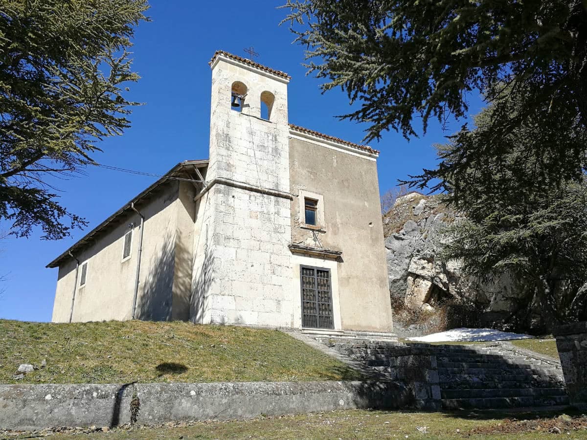
Abruzzo holds two of the three Apennine national parks (Gran Sasso e Monti della Laga, and Maiella) and a third of its protected land, which is the highest share of any Italian region. The mountain country starts about 20 kilometres inland from the Adriatic and rises quickly: the Gran Sasso massif tops out at 2,912 metres, the highest peak in the Apennines, and the Maiella sits at 2,793 metres just south of it. Between and around the two parks, the mountain comuni hold the food the region is known for: the Navelli saffron (the most expensive in Italy by weight), the Santo Stefano di Sessanio lentils, the Castel del Monte pecorino, the Sulmona confetti.
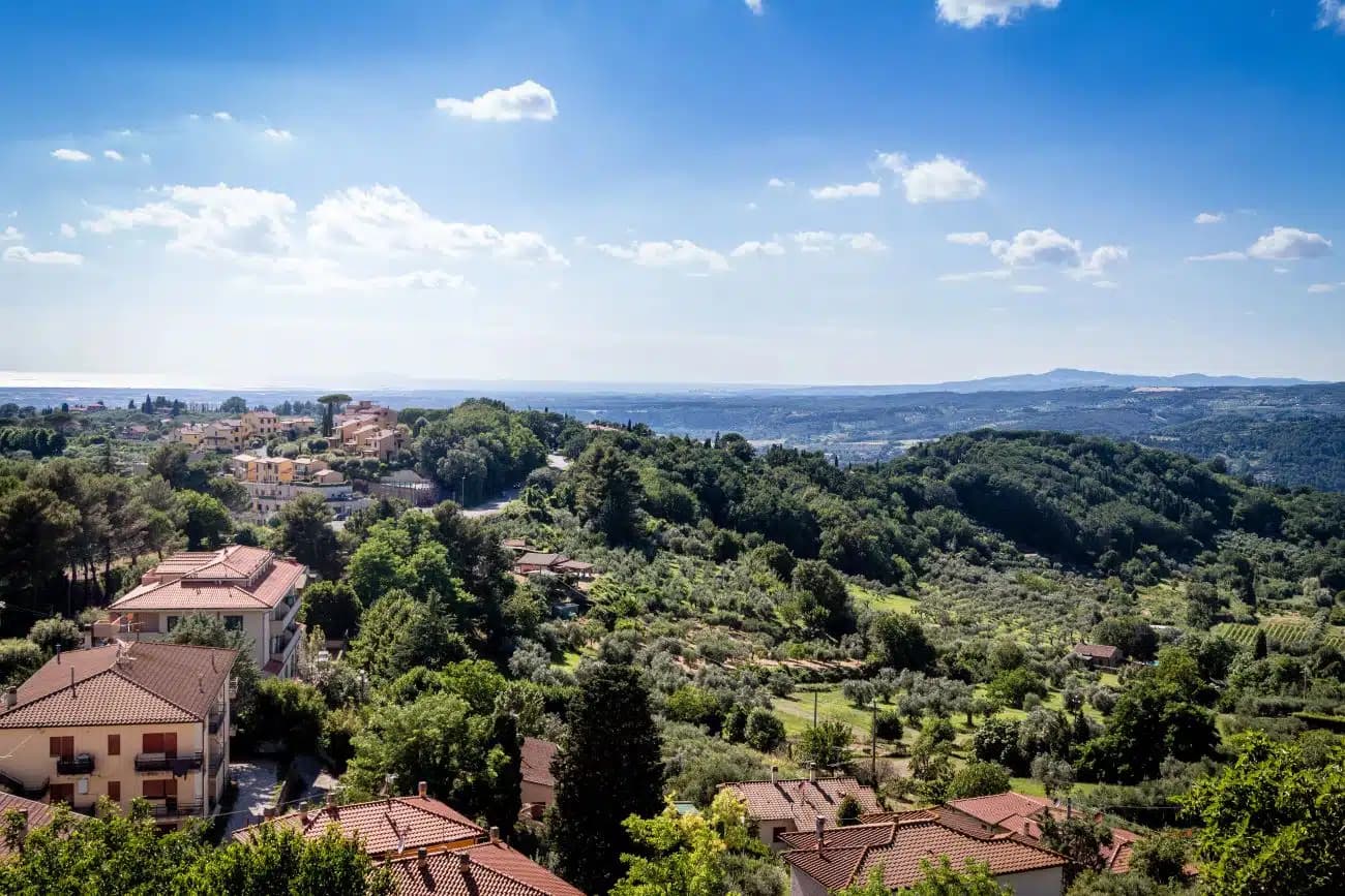
Pescara is the right base for this trip because it is the only Adriatic city with rail and motorway access running directly into both parks. The A24 runs west into the Gran Sasso. The A25 runs southwest into the Maiella. Driving in, the lower comuni come up first and the higher villages take two to three hours from the coast: the upper roads switch back hard and OSRM (the routing engine the drive times below use) does not credit the A24 tunnel speeds the way local drivers do. Pescara itself is not the city to base in for sightseeing (it was rebuilt postwar and reads as a beach town), but its rail, airport (PSR) and motorway position make it functional in a way that the prettier inland towns are not.
We picked ten mountain comuni that show the range, with a weight toward the highest-elevation Borghi più belli (Santo Stefano di Sessanio, Castel del Monte, Pacentro, Pescocostanzo) and a deliberate spread between the Gran Sasso and the Maiella. Drive times below are OSRM-computed from Pescara Centrale by car and run honest on the conservative side; the local A24 motorway and the well-paved provincial roads make the real-world times noticeably tighter. Some entries are reachable by regional rail (Sulmona is the rail hub for the southern Maiella) and we flag those on the per-town pages.
 1
1L'Aquila · Abruzzo · 175 min from Pescara
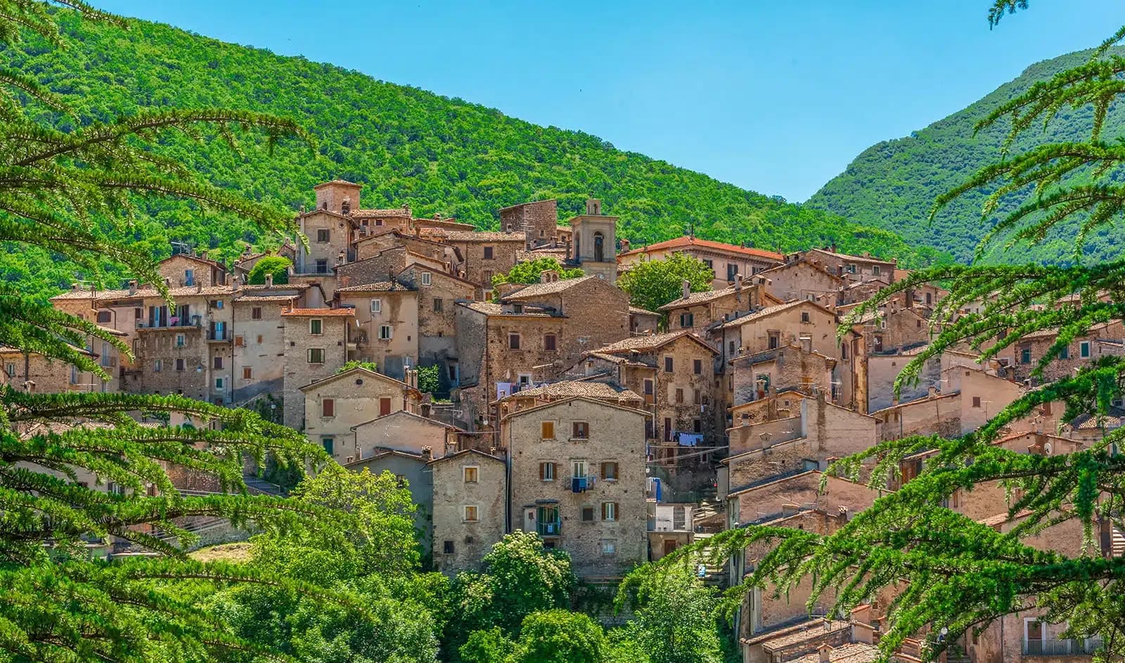
Scanno
A 1,057-meter Sagittario valley village photographed by Cartier-Bresson and Giacomelli, where women in black still walk the same alleys as the 1957 series.
Cartier-Bresson photographed Scanno in 1951, Giacomelli's series 1957-59 made the women in black one of the most reproduced Italian images.
Listed in I Borghi più belli, sitting at 1057 m.
 2
2L'Aquila · Abruzzo · 179 min from Pescara
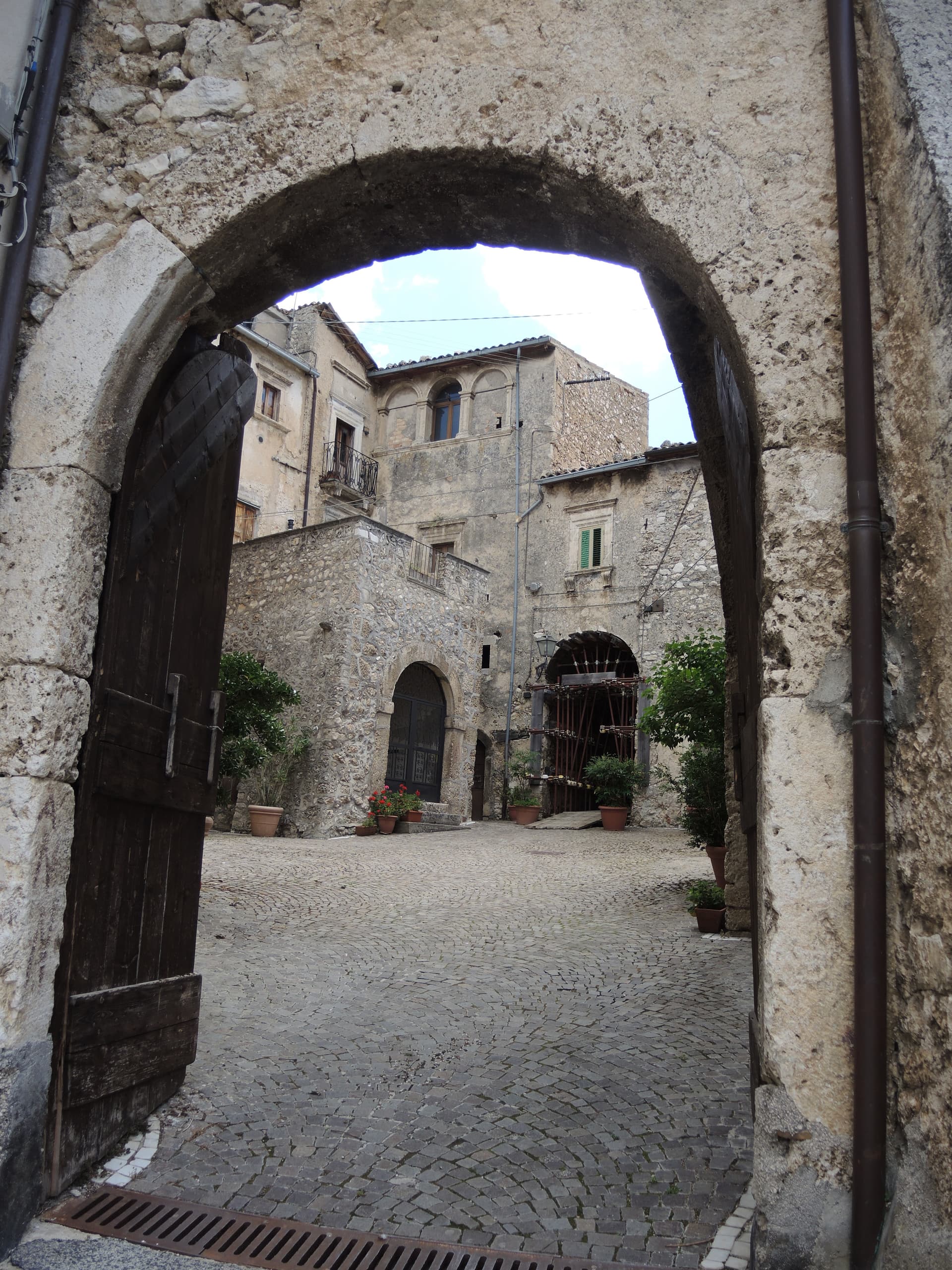
Pescocostanzo
A planned Renaissance town at 1,395 meters on the Quarto Grande plateau, with bobbin lace, wrought iron, and the wood ceilings of a five-nave church.
Merletto al tombolo, made here since the sixteenth century, taught and displayed at the museum in Palazzo Fanzago.
Listed in I Borghi più belli, sitting at 1395 m.
 3
3L'Aquila · Abruzzo · 174 min from Pescara
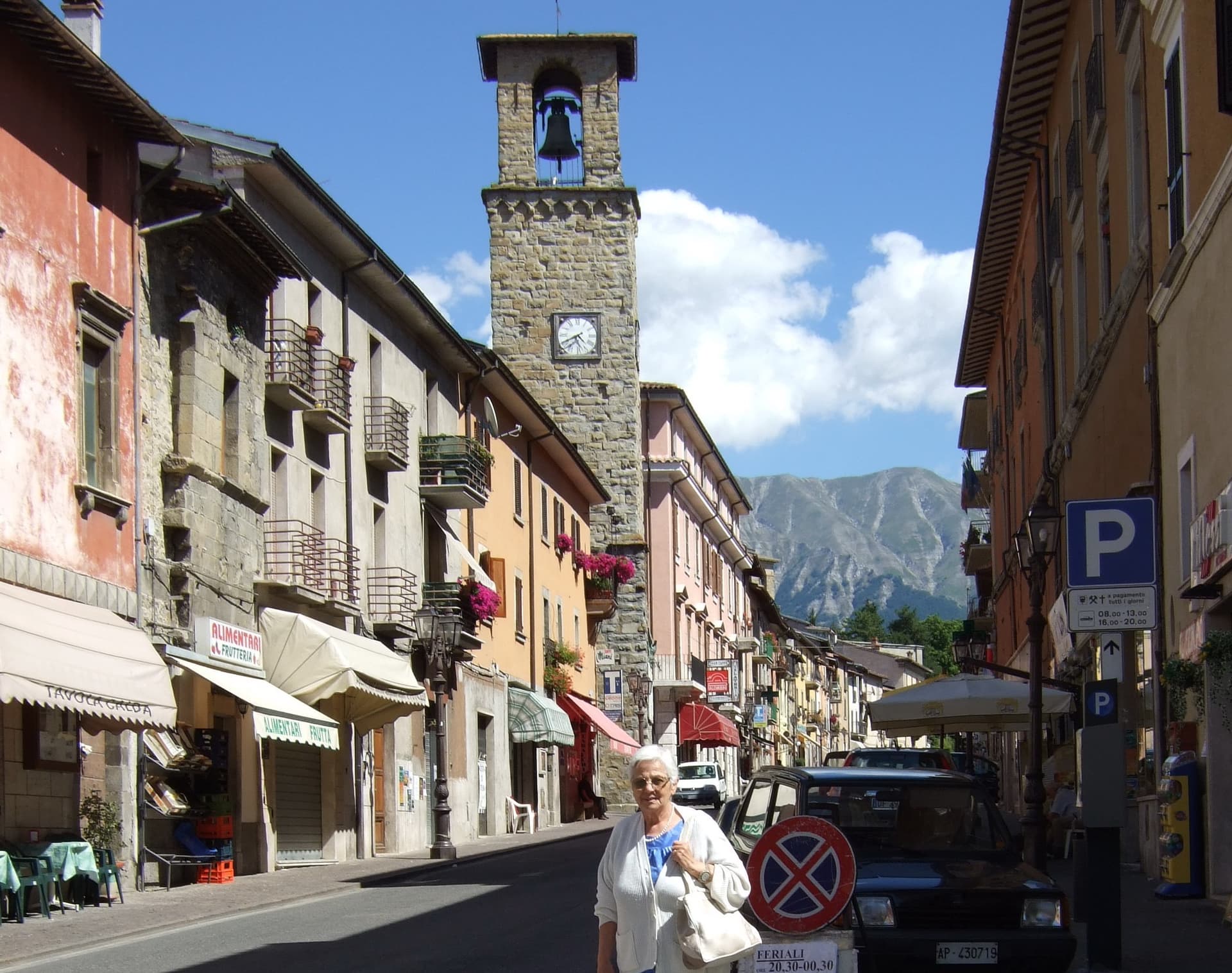
Calascio
At 1,200 meters under the highest castle in the Apennines, a village of 125 people that played the monk's refuge in Ladyhawke.
Highest fortress in the Apennines at 1,460 meters, watchtower for the Abruzzo-Puglia transhumance routes, film set for Ladyhawke and The Name of the Rose.
Inside one of Abruzzo's national parks.
 4
4L'Aquila · Abruzzo · 165 min from Pescara
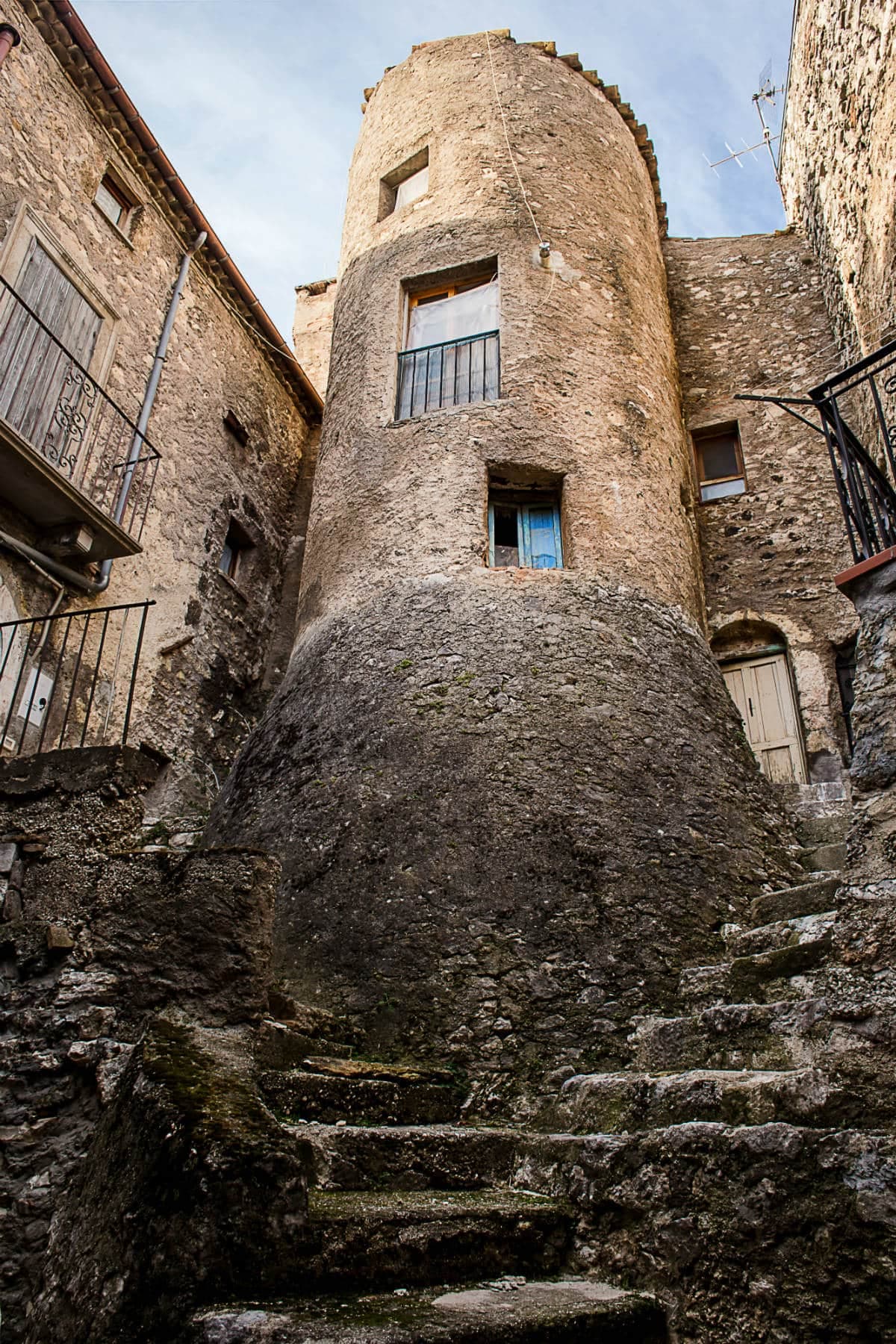
Castelvecchio Calvisio
118 people at 1,067 meters on a ridge above the Tirino, inside a fortified ellipse of stone walls with alleys orthogonal to its perimeter.
Fortified medieval ellipse with houses built into the perimeter walls, orthogonal alleys and external barbacani staircases, an unusual urban form.
 5
5L'Aquila · Abruzzo · 177 min from Pescara
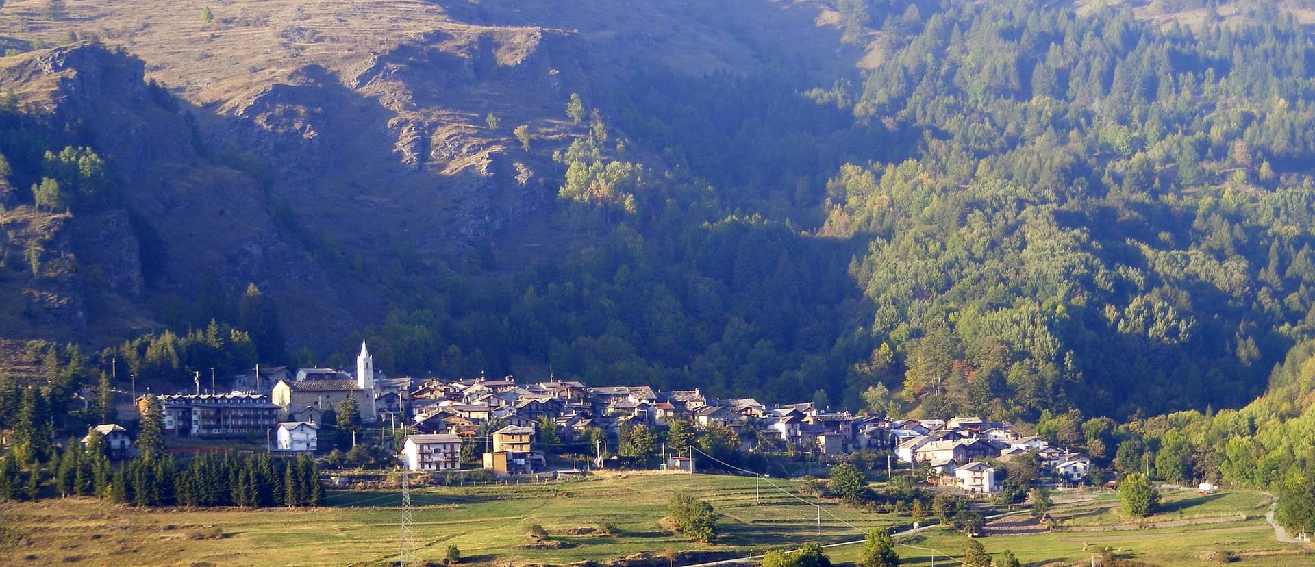
Campo di Giove
At 1,064 meters under the southwestern Maiella, the highest village in the park, named for a Roman temple to Jupiter.
Ski slopes climbing to 2,360 meters on the western Maiella, the highest piste in Abruzzo, with the village as base at 1,064 meters.
The slow-trip planner
Building a trip? Find where Pescara fits in a slow Italy circuit.
Answer five questions. We will shape a geographically coherent slow trip from the 1,000 Italian towns most travelers skip. Yours to save and share.
 6
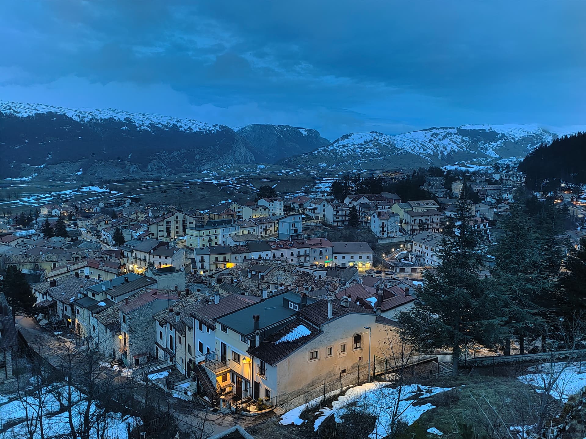
6Teramo · Abruzzo · 139 min from Pescara
Pietracamela
A village of 218 people clinging at 1,005 meters under the north wall of Corno Piccolo, birthplace of Italian Apennine climbing in 1925.
Founded here in 1925 by Ernesto Sivitilli, the first climbing club of the central Apennines, opened the first grade VI routes.
Listed in I Borghi più belli, sitting at 1005 m.
 7
7Rieti · Lazio · 137 min from Pescara
Amatrice
A 955-meter Apennine town leveled by the 24 August 2016 earthquake, slowly rebuilding the streets that gave amatriciana its name.
Sugo all'amatriciana, guanciale and pecorino and pepper with tomato added in the nineteenth century, the dish that carries the town's name.
Listed in I Borghi più belli, sitting at 955 m.
 8
8L'Aquila · Abruzzo · 173 min from Pescara
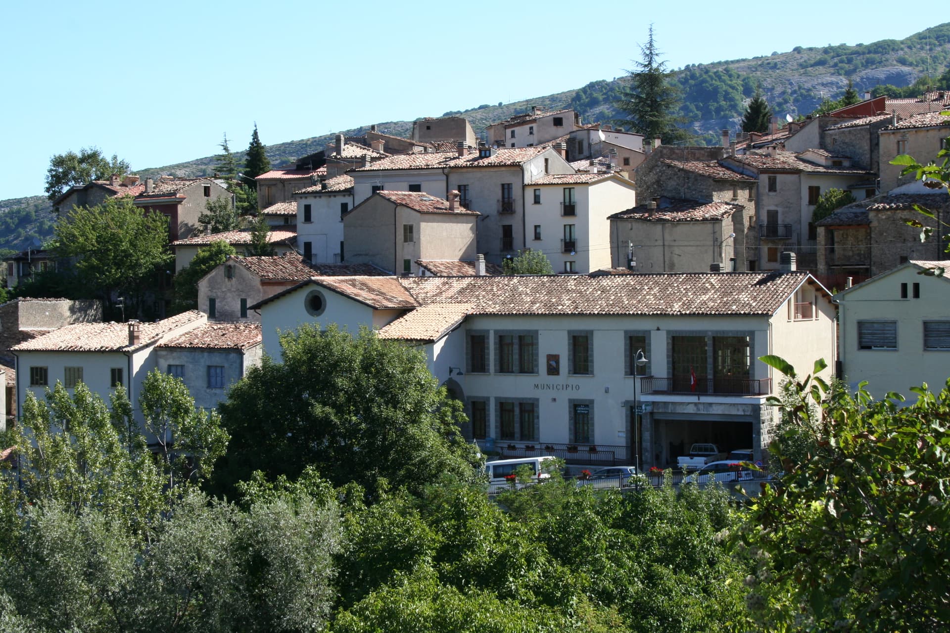
Ovindoli
At 1,375 meters on the Altopiano delle Rocche, the closest serious ski station to Rome, working since 1959 on the slopes of Monte Magnola.
Ski area from 1,413 to 2,056 meters with 30 km of downhill, the closest serious ski station to Rome.
Mountain comune at 1375 m.
 9
9Perugia · Umbria · 150 min from Pescara
Monteleone di Spoleto
Where the 6th-century-BC Etruscan parade chariot now in the Met was found — a 555-resident Borghi più belli d'Italia borgo at 978m in the upper Nera valley, with a replica of the Monteleone Chariot (the original is in New York), the medieval Rocca dei Brancaleoni, and a stop on the Cammino di San Benedetto pilgrim route.
The 6th-c-BC Etruscan parade biga found here in 1902 — now the largest single bronze in the Met's Greek + Roman galleries. Replica + context at the local museum.
Listed in I Borghi più belli, sitting at 978 m.
 10
10L'Aquila · Abruzzo · 170 min from Pescara
Villalago
A 930-meter village above three lakes, named for the nine that once filled the valley, with a hermit's cave on the water's edge.
Villalago sits above Lago Pio, Lago di San Domenico, and Lago di Scanno, the heart-shaped lake to the south. Hence the name.
Listed in I Borghi più belli, sitting at 930 m.
We write about towns like these every Sunday, one town a week, with the photo, the food, the festa. Free, from Pietrasanta.
By subscribing you agree to Substack’s Terms of Use, our Privacy Policy and our Information collection notice.
Why Pescara is the base
Pescara is the most under-rated transit hub in this list. The city itself is not a destination, but the airport (Abruzzo, IATA PSR), the rail (mainline to Bologna and Bari), and the two A-grade motorways (A14 along the coast, A24 and A25 inland) make it the only Abruzzo base from which both national parks are reachable for the day. The cooking on the coast (brodetto alla pescarese, the Adriatic fish stew) closes a loop with the heavier inland food (arrosticini, pecorino, the saffron-yellow chitarra pasta).
When to go
May through October for the mountain comuni: the snow clears late in the Gran Sasso (sometimes through April), the towns at 1,200+ metres only really open from late May, and the September lentil harvest and October chestnut sagre run into early November. July and August are the high mountain season (Campo Imperatore, Roccaraso) and the towns fill with Italian families. The Adriatic coast is at its summer peak then; combining a coast morning with an inland afternoon is the move.
Questions people ask
- What is the highest comune in Abruzzo?
- Rocca di Cambio at 1,433 metres, in the Sirente-Velino regional park west of L'Aquila. Within our list, Castel del Monte (1,346 m) and Santo Stefano di Sessanio (1,251 m) in the Gran Sasso are the highest. Pescocostanzo (1,395 m) in the Maiella is in the same range.
- Is the Gran Sasso accessible by car?
- Yes. The A24 motorway runs through the tunnel under the massif. From the Assergi exit, the Campo Imperatore plateau (the 'Little Tibet of Italy', 1,800 m, the highest plain in the Apennines) is reachable by paved road from June through October. In winter the upper road is closed but the lower comuni stay accessible.
- What is Navelli famous for?
- Saffron. The Navelli plain produces Italy's most expensive spice (the Zafferano dell'Aquila DOP), grown in a tight cluster of about a dozen comuni at 700 to 900 metres. The crocus blooms in late October; the picking and the drying happen in the first week of November.
- Are the Abruzzo national parks worth visiting if I do not hike?
- Yes. The Gran Sasso has the comuni at the edge of the park (Castel del Monte, Santo Stefano di Sessanio, Calascio with its rocca) which are walkable medieval towns at altitude. The Maiella has Pescocostanzo and Pacentro for the same kind of stay. The high plateaus and the harder hiking are optional, not mandatory.
How we picked these · We filtered every Abruzzo and adjacent town within driving range of Pescara, kept those with mountain geography (alpine_high primarily, plus comuni at elevation ≥800m), and ranked by signal density (Borghi più belli, Parco Nazionale, Bandiera Arancione) plus elevation. The Gran Sasso comuni get a slight weight up because the park has more recognised borghi inside it; the Maiella gets one or two of the high-elevation slots. The wider drive radius (up to three hours by car) is deliberate: the inner Gran Sasso villages sit two hours up the A24 from the coast, and the Maiella's upper comuni take just as long on the A25.

Subscribe — free
Get the best guides on hidden Italian towns.
One letter on Sundays. The week’s town, with the photo, the food, the festa. Free, by Peter & Sophia from Pietrasanta.
Substack sends a confirmation link to your inbox. The signup finishes when it’s clicked.
From elsewhere in Italy
Five more towns to discover
Putignano
Province: Bari
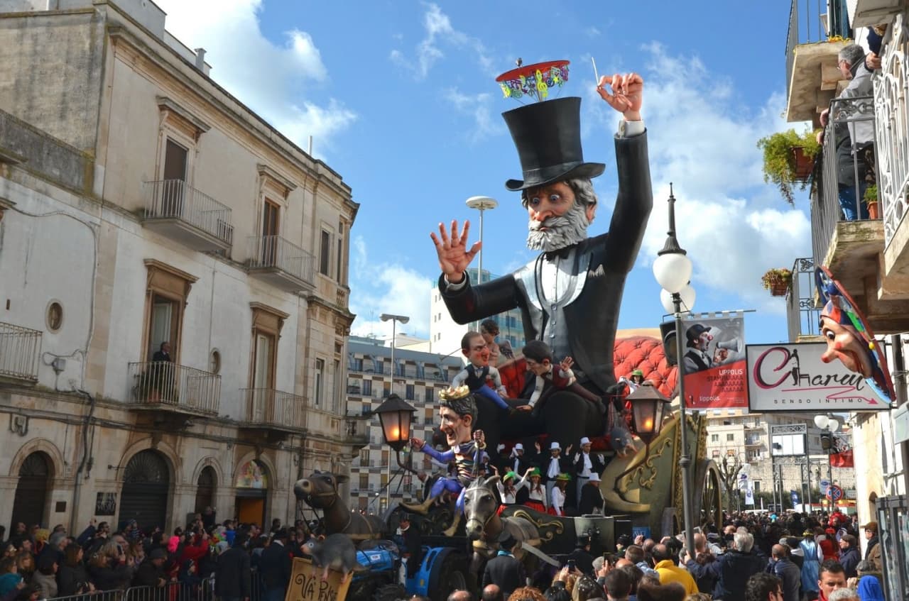
Europe's longest-running carnival — Putignano Carnevale has run continuously since 1394, with 631 years of cartapesta papier-mâché floats, a 26,000-resident Murgia town on the Bari–Lecce plateau, and the Grotta del Trullo karst cave inside the centro.

Pistoia
Province: Pistoia
Italy's nursery capital and the medieval Tuscan rival that gave its name to the pistol — a quietly extraordinary centro storico of zebra-striped Romanesque churches, Andrea della Robbia's polychrome frieze on the Ospedale del Ceppo, and Italy's Capital of Culture 2017, all 30 minutes from Florence by train.
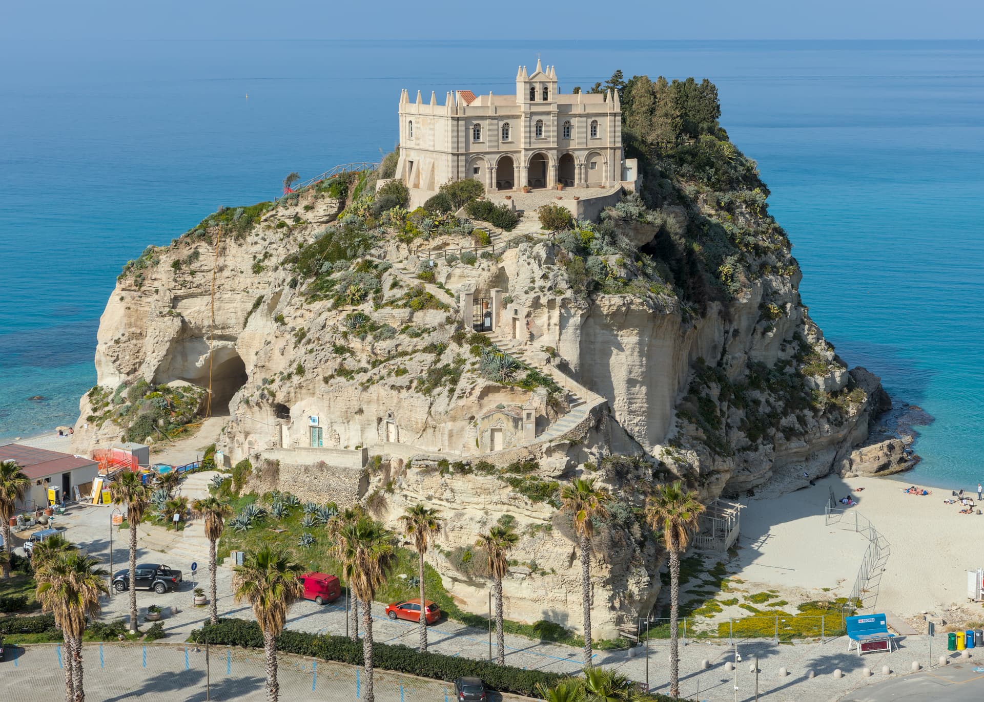
Tropea
Province: Vibo Valentia
Cliff town on a tufa headland over the Tyrrhenian Coast of the Gods, with a Norman monastery on a sea rock.
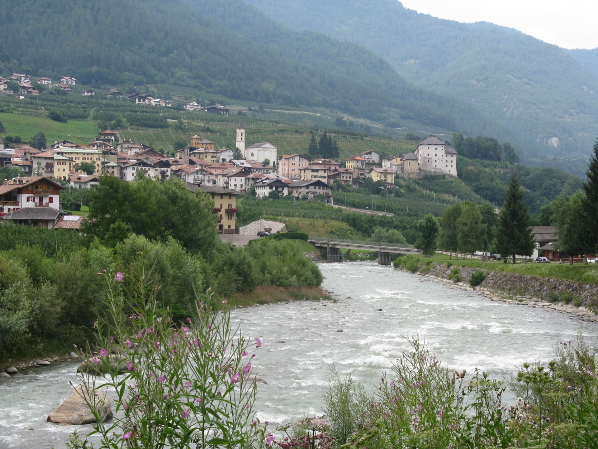
Caldes
Province: Trento
A scattered Val di Sole commune on the Noce, six hamlets gathered around a thirteenth-century tower-house castle that once belonged to the Thun family.
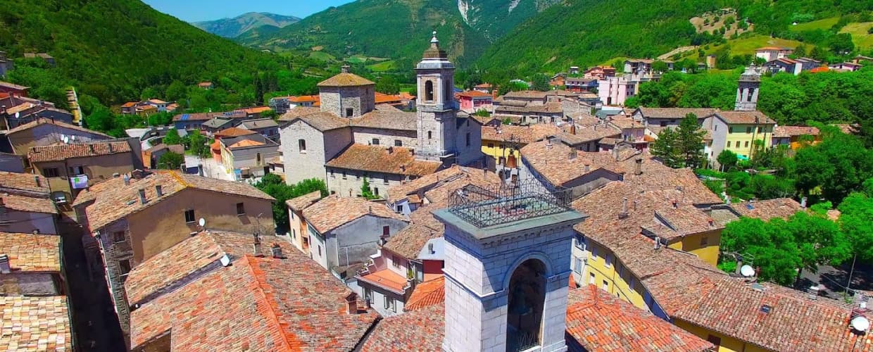
Cantiano
Province: Pesaro e Urbino
A border borgo at 374 meters under Monte Catria on the old Via Flaminia, known for the Good Friday Turba and the sour-cherry visciola harvest.