
Abruzzo · L'Aquila
Pescocostanzo
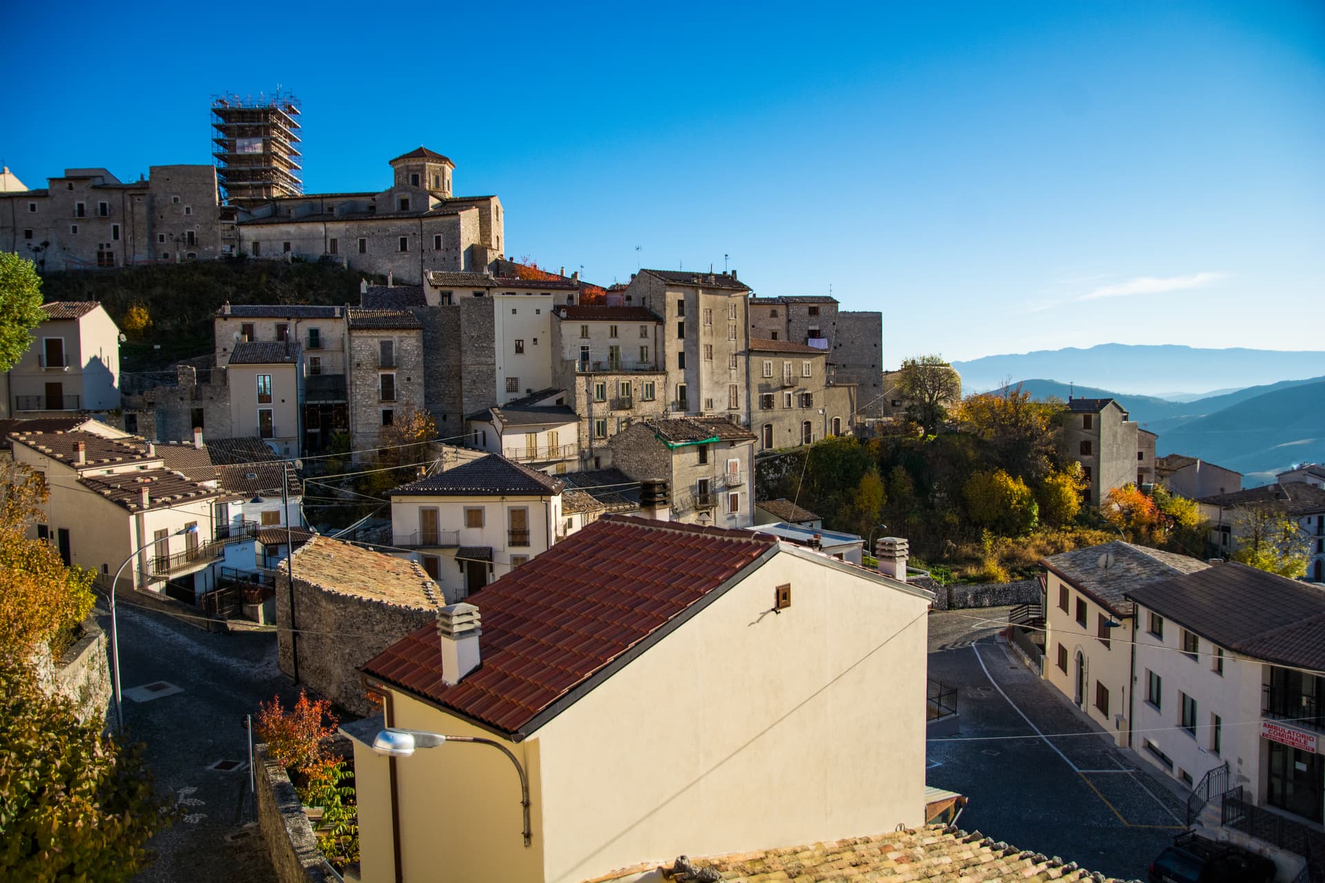
A planned Renaissance town at 1,395 meters on the Quarto Grande plateau, with bobbin lace, wrought iron, and the wood ceilings of a five-nave church.
Known for
BOBBIN LACE
Merletto al tombolo, made here since the sixteenth century, taught and displayed at the museum in Palazzo Fanzago.
WROUGHT IRON
The Chapel of the Sacrament gate at the Collegiata, made by Sante di Rocco between 1699 and 1707, is the local masterpiece.
RENAISSANCE GRID
Rebuilt from 1456 under the Capua family by Lombard masons, one of the few planned Renaissance mountain towns in Italy.
When to visit
Best · Jun–Sep, Dec–Mar
- J
- F
- M
- A
- M
- J
- J
- A
- S
- O
- N
- D
- Best
- Hot or crowded
- Quiet
- Mostly closed
Why come
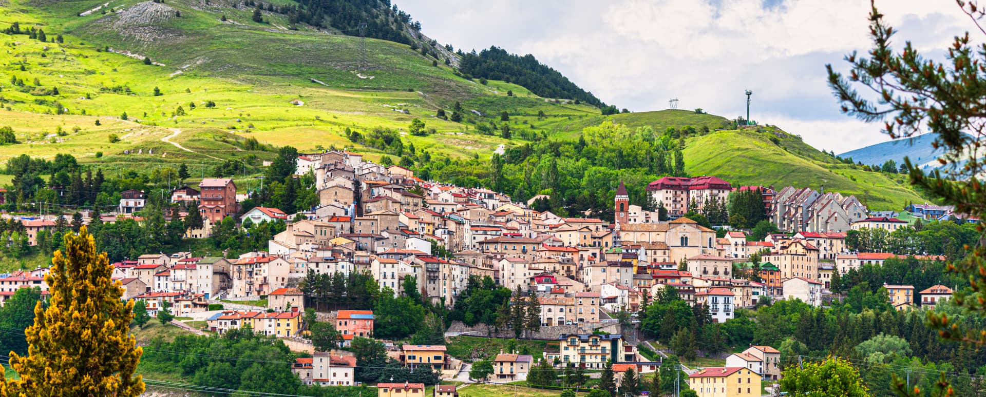
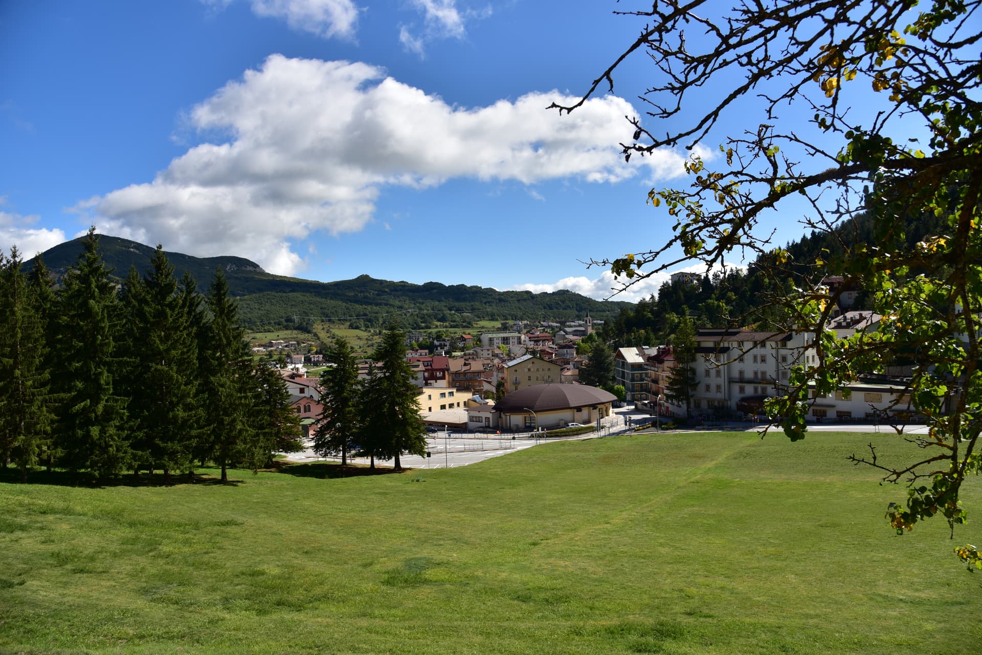
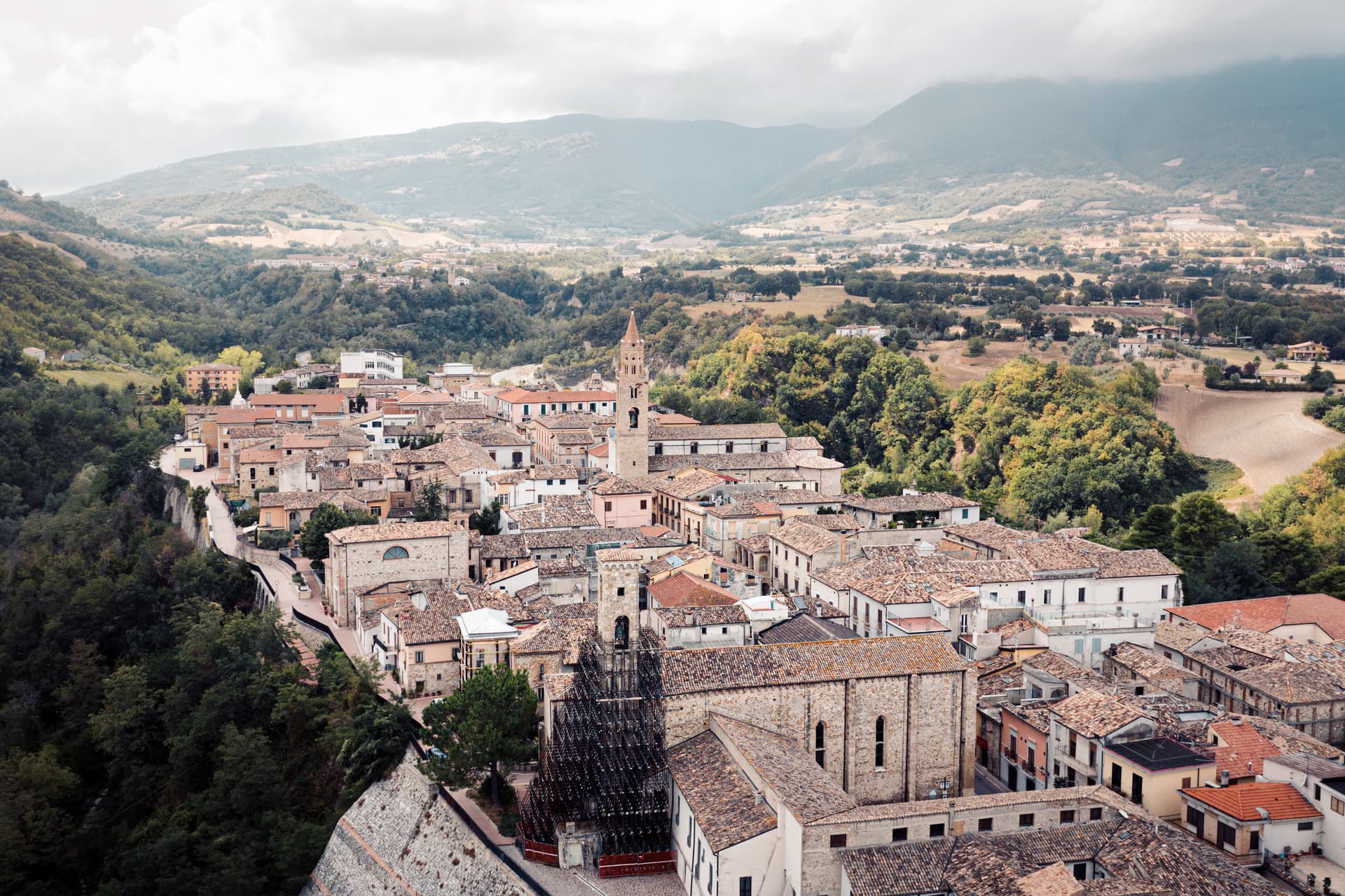
Pescocostanzo sits at 1,395 meters at the southern edge of the Quarto Grande plateau, the high karst basin above the Sangro valley. The town was reshaped between 1456 and the eighteenth century under the Capua family and a generation of Lombard masons who arrived to build for them. The plan is unusually regular for a mountain commune: a grid of stone houses oriented to the wind, surrounded by woods and pasture.
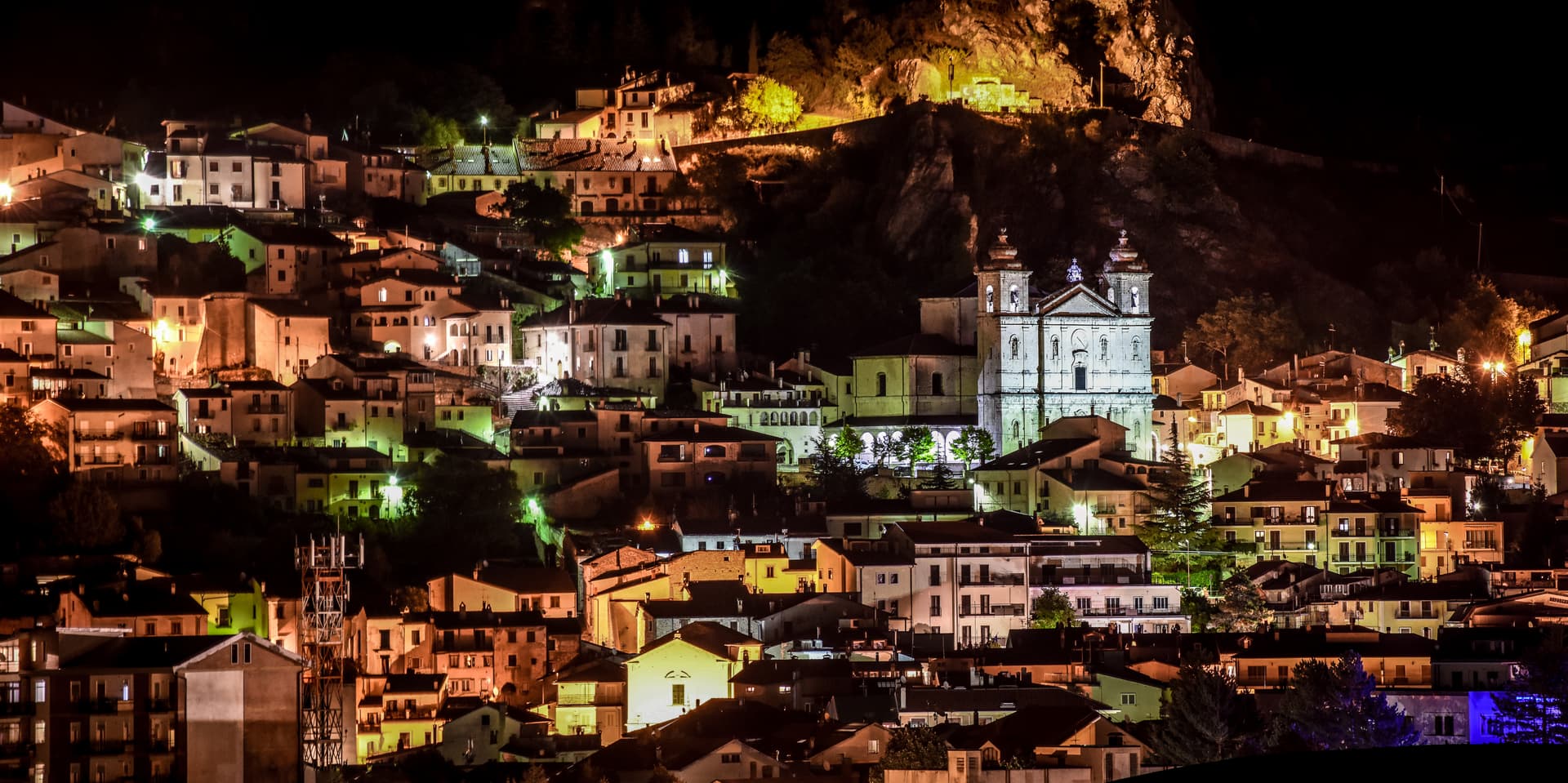
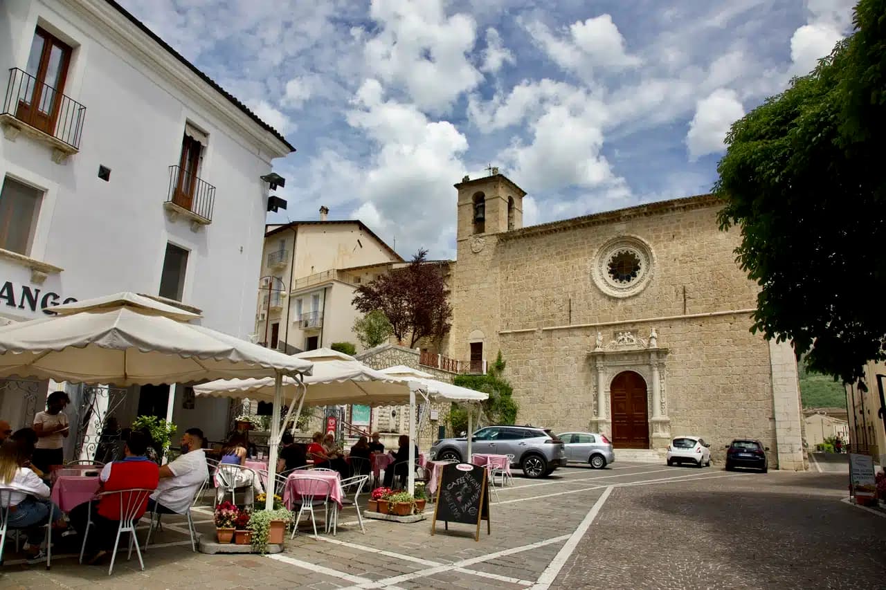
The Collegiata di Santa Maria del Colle, restructured by Cosimo Fanzago in the seventeenth century, is one of the rare five-nave churches in Abruzzo. Its wrought iron Chapel of the Sacrament gate, made by Sante di Rocco between 1699 and 1707, is the masterpiece of local ironwork. Bobbin lace, merletto al tombolo, is still made here.
The Museo del Merletto a Tombolo inside Palazzo Fanzago shows the technique and the patterns. Filigree gold, carved wood, and lace are still sold on the Corso Roma.
The Sunday letter
We haven’t written Pescocostanzo’s letter yet.
One town every Sunday, with the photo, the food, the festa. Be there when this one comes up. Free, by Peter & Sophia from Pietrasanta.
By subscribing you agree to Substack’s Terms of Use, our Privacy Policy and our Information collection notice.


What to see
Collegiata di Santa Maria del Colle
Five-nave church begun in the late Middle Ages and remodeled by Cosimo Fanzago in the seventeenth century.
Museo del Merletto a Tombolo
Inside Palazzo Fanzago, displays the local bobbin lace tradition with patterns, tools, and live demonstrations.
Palazzo Fanzago
Designed by the baroque architect Cosimo Fanzago in 1624, the seat of the lace museum and civic offices.
Piazza del Municipio
Heart of the planned Renaissance grid, surrounded by stone palazzi and the eighteenth-century town hall.
Bosco di Sant'Antonio
Centuries-old beech and maple forest 3 km from the town, with monumental trees protected since 1985.
Monte Calvario - Vetta d'Italia ski area
Small ski station above town connected to the Alto Sangro system at Roccaraso and Rivisondoli.
The slow-trip planner
Building a trip? Find where Pescocostanzo fits in a slow Italy circuit.
Answer five questions. We will shape a geographically coherent slow trip from the 1,000 Italian towns most travelers skip. Yours to save and share.
We recommend
Where to eat and stay
Not our picks, but places the guides put their name to — a Michelin star, a Gambero Rosso fork, a Slow Food snail, a Michelin Key for the hotels. Worth a table, a counter, or a night when you pass through.
La CorniolaRistorante
La Corniola has one Gambero Rosso fork (78/100) and a spot in the Michelin Guide.
EssentiaRistorante
A Gambero Rosso listing, at Essentia.
Living here
- Population 1,081
- Very remotei
- Pharmacy in town
- High school within a 30-minute drive
- Nearest airport Naples / Salerno, 2 h 25 min drive
- Regional capital L'Aquila, 1 h 41 min drive
Tags & datadesignations · numbers · sources
The numbers
- Elevation: 1395 m
- Population: 1,081
- Surface area: 55.06 km²
These figures were compiled from public directories — ISTAT, OpenStreetMap, Wikidata — and from the official listings of the guides named on this page. Town details change; verify with official sources before you travel.
Featured on
Pescocostanzo appears on this themed pick from our Collections:
Close by
More towns near Pescocostanzo
Rivisondoli
Province: L'Aquila
At 1,320 meters on the Cinque Miglia plateau, paired with Roccaraso in the Alto Sangro ski domain and known for its Epiphany living nativity.
Roccaraso
Province: L'Aquila
At 1,236 meters in the Alto Sangro, the south of Italy's largest ski resort, leveled by the Gustav Line in 1943 and rebuilt from rubble.

Campo di Giove
Province: L'Aquila
At 1,064 meters under the southwestern Maiella, the highest village in the park, named for a Roman temple to Jupiter.
Castel di Sangro
Province: L'Aquila
At 805 meters where the Sangro meets the Zittola, the Roman Aufidena and 1990s football miracle, liberated by the West Nova Scotia Regiment in 1943.
Lama dei Peligni
Province: Chieti
A 669-meter Majella village known for chamois, the Cavallone cave, and a prehistoric burial dug from Fonterossi dated 7000 to 5000 BC.
🎨 Borghi più belli d'Italia
More Borghi più belli d'Italia towns in Abruzzo
Anversa degli Abruzzi
Province: L'Aquila
At 604 meters above the Sagittario Gorges, the cliff village where D'Annunzio set La Fiaccola sotto il moggio in 1905.
Campli
Province: Teramo
A 393-meter town under the Monti della Laga, held by the Farnese for two centuries, with a Scala Santa carrying papal indulgence.
Caramanico Terme
Province: Pescara
A 650-meter Majella spa village at the confluence of the Orfento and Orta, with sulphurous springs whose properties were documented in 1576.
Casoli
Province: Chieti
A 378-meter hill town above the Aventino under the Maiella, with a pentagonal Norman tower where Gabriele D'Annunzio held a Renaissance court of artists.
Castel del Monte
Province: L'Aquila
At 1,346 meters under Monte Bolza facing Rocca Calascio, the capital of shepherds, whose wool reached the Medici and whose witches return each August.