
Abruzzo · L'Aquila
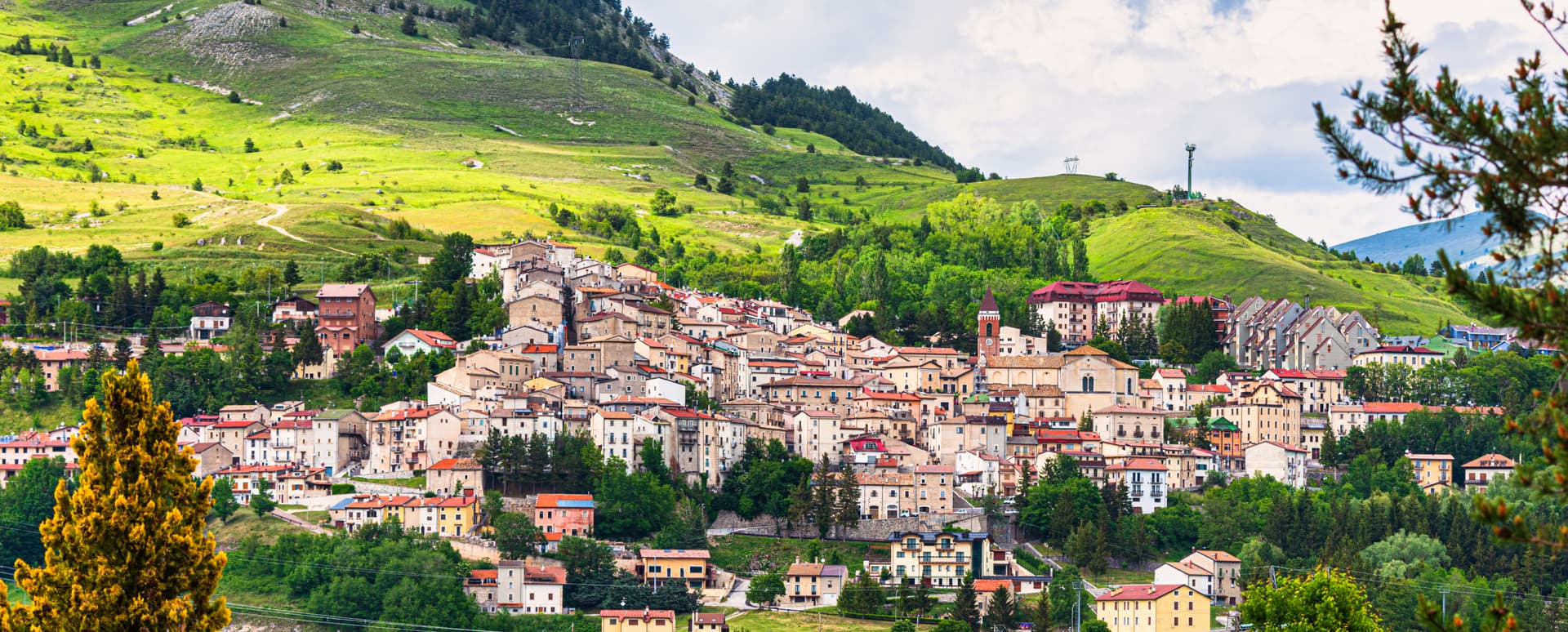
Campo di Giove
At 1,064 meters under the southwestern Maiella, the highest village in the park, named for a Roman temple to Jupiter.
Known for
HIGHEST PISTE
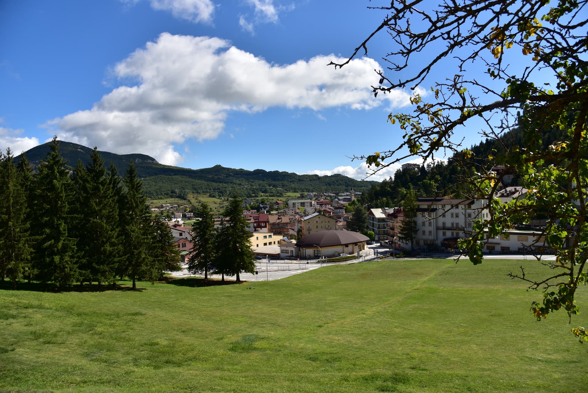
Ski slopes climbing to 2,360 meters on the western Maiella, the highest piste in Abruzzo, with the village as base at 1,064 meters.
CANTELMO STRONGHOLD
Stronghold of the Cantelmo family in the 14th century, then the Caldora, Belprato, Pignatelli, and Recupito until the abolition of feudalism.
MASTER OF CAMPO DI GIOVE
Anonymous 15th-century painter named for the polyptych he made for the village church, now in the Museo Nazionale d'Abruzzo in L'Aquila.
When to visit
Best · Jun–Sep, Dec–Mar
- J
- F
- M
- A
- M
- J
- J
- A
- S
- O
- N
- D
- Best
- Hot or crowded
- Quiet
- Mostly closed
The festa: Eustachio, 20 September
Why come
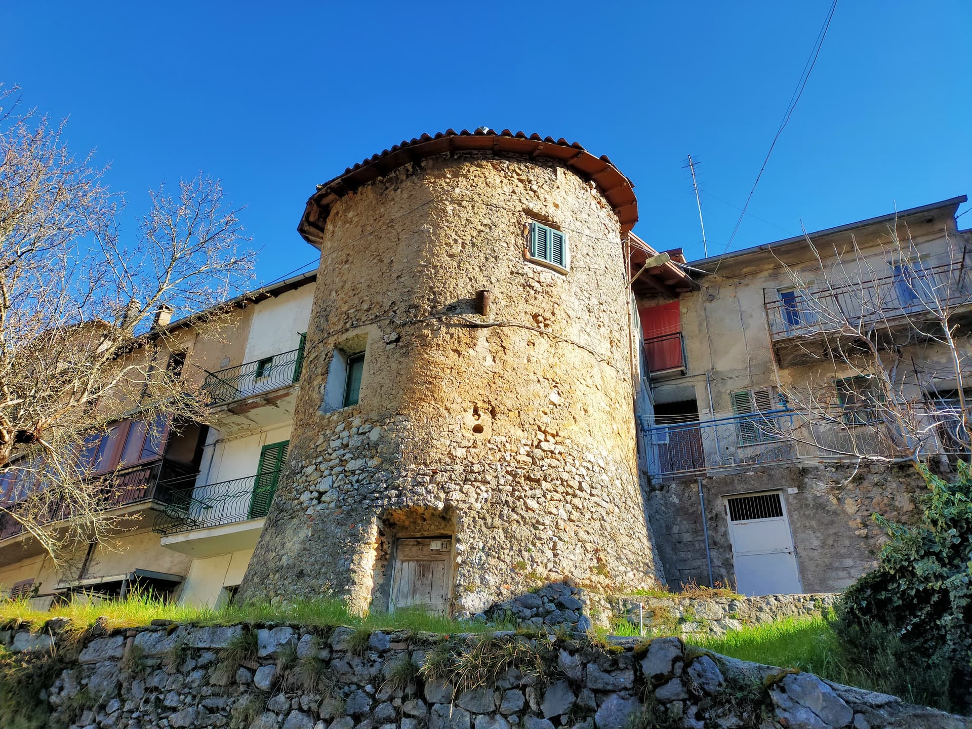
Campo di Giove sits at 1,064 meters at the foot of the southwestern Maiella, the highest commune inside the Maiella National Park. The name is documented as Campo Jovis from the 4th century AD, with local tradition claiming a Roman temple to Jupiter on the site after a victory over the Paeligni. A villager called Odorisio appears in a document from January 1136.
In the 14th century the village was a Cantelmo stronghold; it then passed to the Caldora, the Belprato, the Pignatelli, and finally the Recupito. Above the village, the ski station operates between 1,150 and 2,360 meters, the highest piste in Abruzzo. The mother church of Sant'Eustachio holds the statue of the patron saint.
Sant'Antonino was one of the sixteen convents founded by Fra Pietro da Morrone, the hermit who would become Pope Celestine V. The Master of Campo di Giove, an anonymous 15th-century painter named for the polyptych he made for the village church, is on display at the Museo Nazionale d'Abruzzo in L'Aquila.
The Sunday letter
We haven’t written Campo di Giove’s letter yet.
One town every Sunday, with the photo, the food, the festa. Be there when this one comes up. Free, by Peter & Sophia from Pietrasanta.
By subscribing you agree to Substack’s Terms of Use, our Privacy Policy and our Information collection notice.


What to see
Chiesa Madre di Sant'Eustachio
Parish church of the village patron, with the statue of Sant'Eustachio, the saint celebrated each September with the village feast.
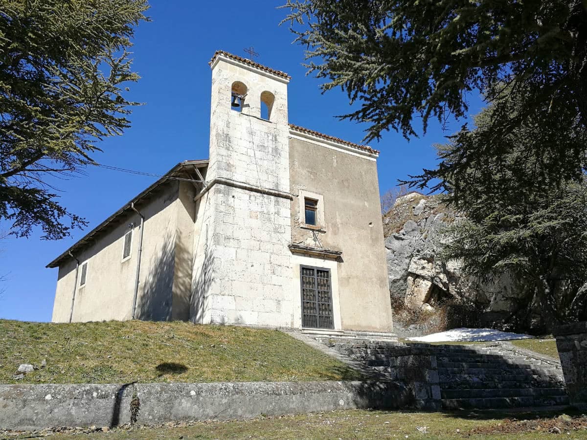
Convento di Sant'Antonino
One of the sixteen convents founded by Fra Pietro da Morrone, the hermit who became Pope Celestine V, documented in a 1274 papal bull.
Palazzo delle Logge
16th-century palazzo with arched loggia on the main piazza, one of several Renaissance buildings from the Caldora and Pignatelli periods.
Casa Quaranta
15th-century house, one of the oldest residential buildings in Campo di Giove, with original stone door frames intact.
Stazione sciistica Campo di Giove-Majella
Ski area between 1,150 and 2,360 meters, the highest piste in Abruzzo, with the cable car climbing the western flank of the Maiella.
The slow-trip planner
Building a trip? Find where Campo di Giove fits in a slow Italy circuit.
Answer five questions. We will shape a geographically coherent slow trip from the 1,000 Italian towns most travelers skip. Yours to save and share.
Living here
- Population 748
- Off the beaten pathi
- Pharmacy in town
- High school within a 30-minute drive
- Train station in the comune
- Nearest airport Naples / Salerno, 2 h 41 min drive
- Regional capital L'Aquila, 1 h 39 min drive
Tags & datadesignations · numbers · sources
Recognised as
The numbers
- Elevation: 1064 m
- Population: 748
- Surface area: 28.9 km²
These figures were compiled from public directories — ISTAT, OpenStreetMap, Wikidata — and from the official listings of the guides named on this page. Town details change; verify with official sources before you travel.
Featured on
Campo di Giove appears on this themed pick from our Collections:
Close by
More towns near Campo di Giove

Pacentro
Province: L'Aquila
A medieval village at 650 meters under the Caldora castle towers, where every September a barefoot race honors a Madonna and a pop singer's grandparents.
Rivisondoli
Province: L'Aquila
At 1,320 meters on the Cinque Miglia plateau, paired with Roccaraso in the Alto Sangro ski domain and known for its Epiphany living nativity.
Roccaraso
Province: L'Aquila
At 1,236 meters in the Alto Sangro, the south of Italy's largest ski resort, leveled by the Gustav Line in 1943 and rebuilt from rubble.
Pescocostanzo
Province: L'Aquila
A planned Renaissance town at 1,395 meters on the Quarto Grande plateau, with bobbin lace, wrought iron, and the wood ceilings of a five-nave church.
Sulmona
Province: L'Aquila
At 405 meters in the Valle Peligna, birthplace of Ovid in 43 BC and home of the sugared-almond confetti industry since the 14th century.
💎 Borghi Autentici
More Borghi Autentici towns in Abruzzo

Archi
Province: Chieti
A 492-meter rocky spur called the Terrazza sul Sangro, fief of del Balzo, Cantelmo, Colonna and Carafa, now Città del Tartufo and Città dell'Olio.

Balsorano
Province: L'Aquila
At 359 meters in the Valle Roveto, a Piccolomini castle that became the backdrop for half of 1970s Italian horror cinema.

Barrea
Province: L'Aquila
A 1,066-meter spur above an artificial lake at the heart of the Abruzzo National Park, with a Samnite necropolis and an 11th-century di Sangro castle.

Calascio
Province: L'Aquila
At 1,200 meters under the highest castle in the Apennines, a village of 125 people that played the monk's refuge in Ladyhawke.
Capistrello
Province: L'Aquila
At 734 meters where the upper Liri valley meets the Marsica, the village where Emperor Claudius's 52 AD tunnel emptied a lake into a river.