
Abruzzo · L'Aquila
Barrea
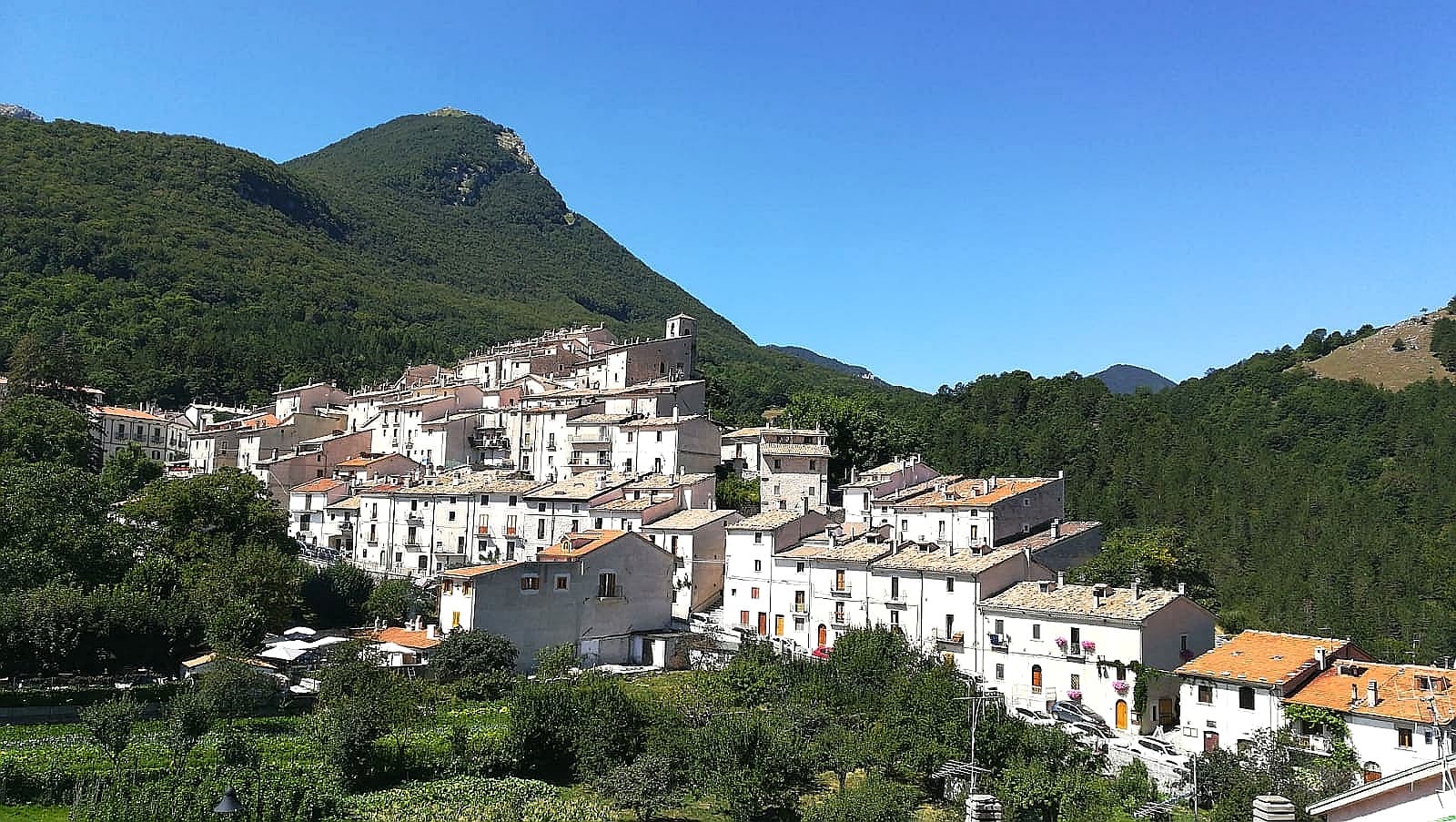
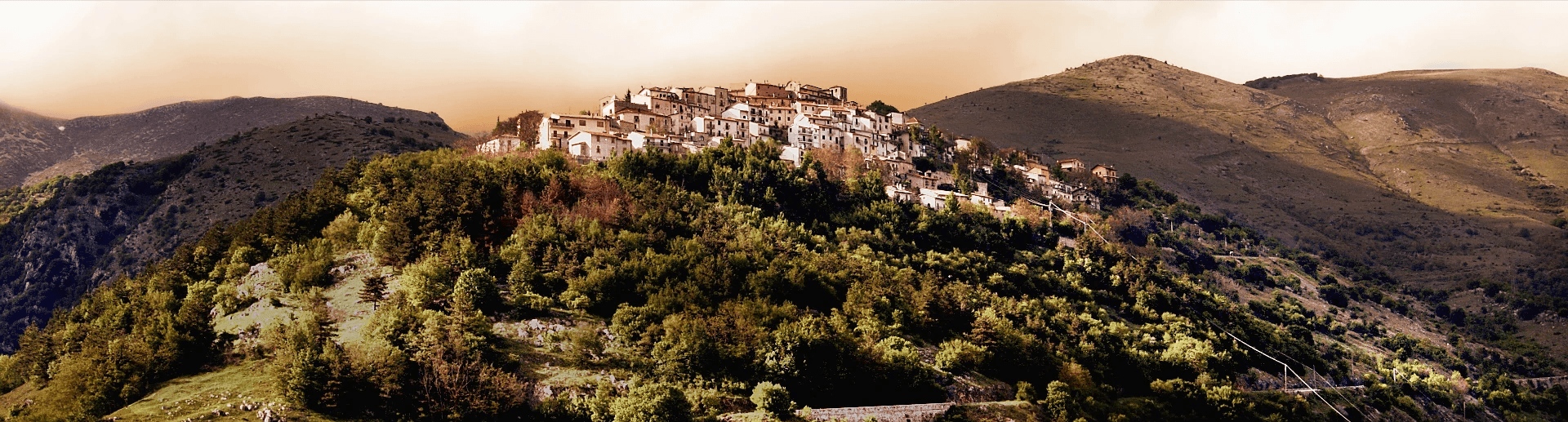
A 1,066-meter spur above an artificial lake at the heart of the Abruzzo National Park, with a Samnite necropolis and an 11th-century di Sangro castle.
Known for
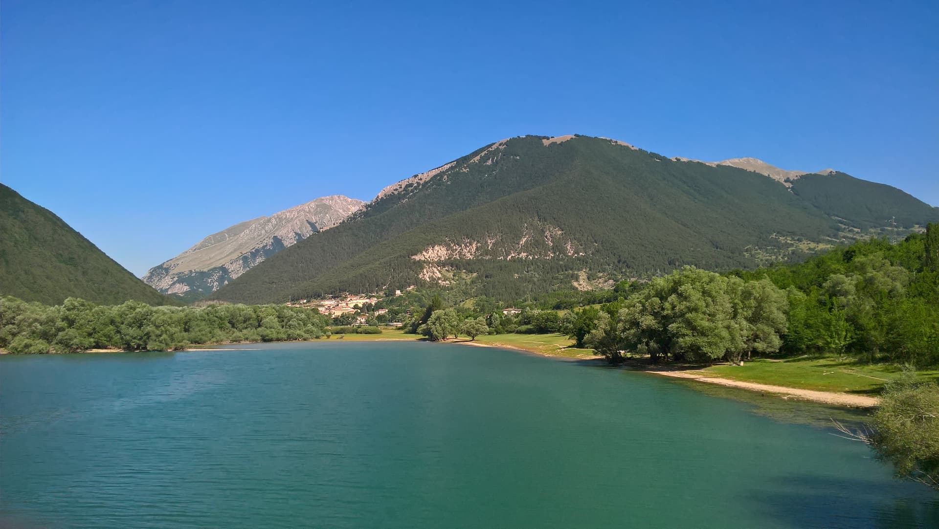
LAGO DI BARREA
Artificial lake formed in 1951 by damming the Sangro river, 5 km long at 980 meters, with the medieval village above it.
MARSICAN BEAR
The park around Barrea holds the largest remaining population of the Marsican brown bear, the endangered Apennine subspecies.
SAMNITE ROOTS
The Colleciglio necropolis outside the village holds funeral artifacts from the pre-Roman Samnite population, 6th-7th century BC.
When to visit
Best · Jun–Sep, Dec–Mar
- J
- F
- M
- A
- M
- J
- J
- A
- S
- O
- N
- D
- Best
- Hot or crowded
- Quiet
- Mostly closed
The festa: Tommaso, last Sunday of June
Why come
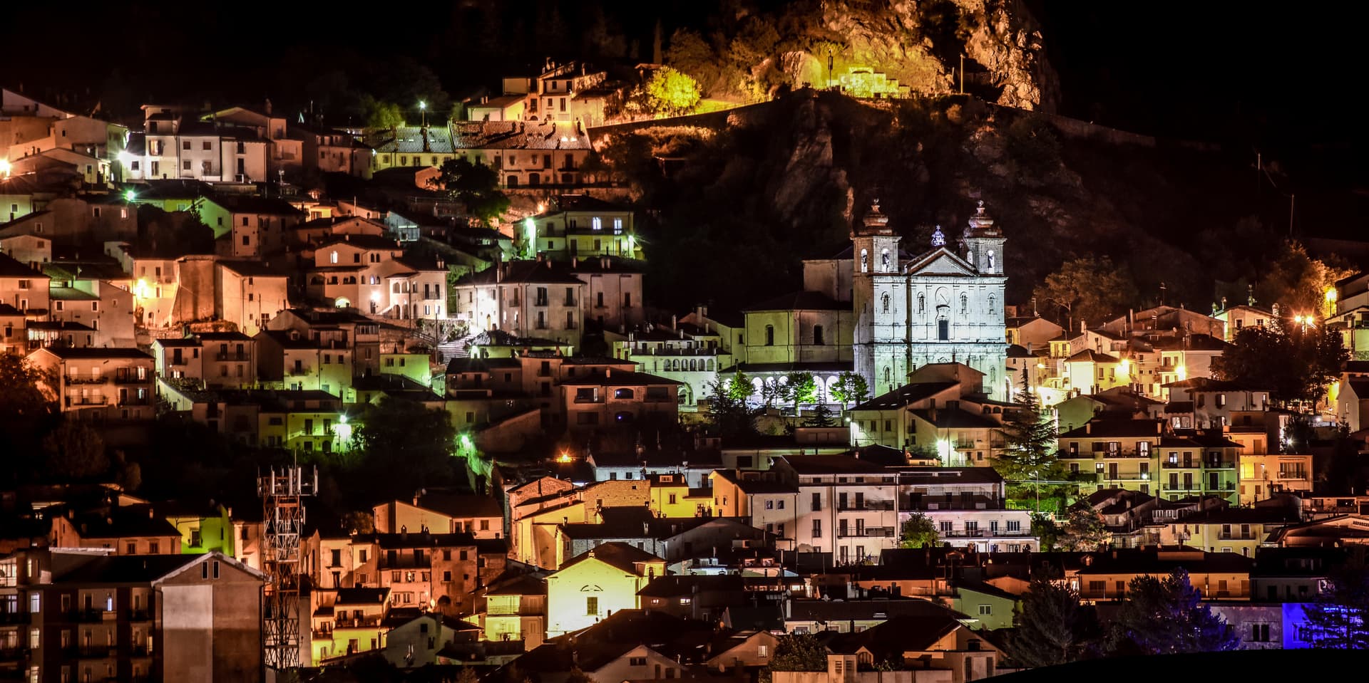
Barrea sits at 1,066 meters on a spur at the heart of the Parco Nazionale d'Abruzzo, Lazio e Molise, looking down on Lago di Barrea, the lake created in 1951 by damming the Sangro river. The lake is 5 kilometers long, 980 meters above sea level, and the most photographed body of water in inland Abruzzo. The village descends from the pre-Roman Samnites, whose Colleciglio necropolis just outside the town has produced funeral artifacts from the 6th-7th century BC, now in a small museum opened in 2007.
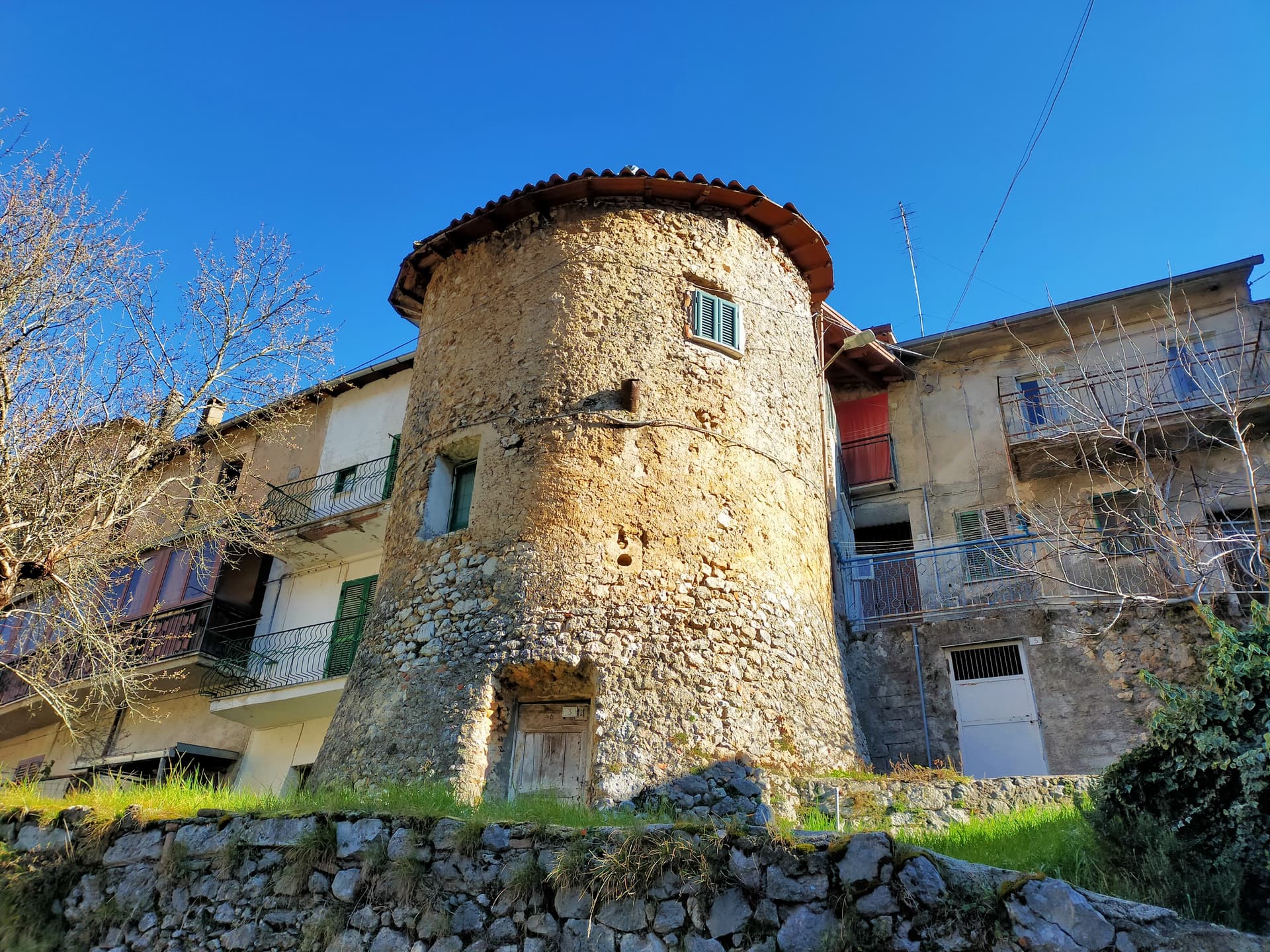
The medieval centro storico is a fortified knot of stone houses and narrow streets. The Chiesa di San Tommaso Apostolo was first built in the 13th century, repeatedly destroyed by earthquakes, fires, and war, and rebuilt with a baroque-stuccoed interior. The original castle, built in the 11th century by the di Sangro family who held the fief, stands just outside the village with towers and walls intact.
Roughly 700 people remain. The park around them holds the largest population of Marsican brown bear and Apennine wolf in Italy.
The Sunday letter
We haven’t written Barrea’s letter yet.
One town every Sunday, with the photo, the food, the festa. Be there when this one comes up. Free, by Peter & Sophia from Pietrasanta.
By subscribing you agree to Substack’s Terms of Use, our Privacy Policy and our Information collection notice.


What to see
Castello dei di Sangro
11th-century fortress built by the di Sangro family, first feudal lords of Barrea, with towers and connecting walls now used for cultural events.
Chiesa di San Tommaso Apostolo
13th-century parish church, repeatedly damaged by earthquake, fire, and war, with baroque stucco and gilding from the 1600s and 18th-century paintings.
Chiesa della Madonna delle Grazie
14th-century church, one of the oldest standing buildings of medieval Barrea, with a small portal of carved local stone.
Lago di Barrea
Artificial lake created in 1951 by damming the Sangro river, 5 km long at 980 meters, with kayak rental, walking trails, and bird hides.
Necropoli di Colleciglio
Pre-Roman Samnite necropolis on the slopes outside the village, with funeral artifacts from the 6th-7th century BC displayed in the town museum.
Parco Nazionale d'Abruzzo, Lazio e Molise
Italy's oldest national park, established 1923, with the largest populations of Marsican brown bear and Apennine wolf, and Barrea at its core.
The slow-trip planner
Building a trip? Find where Barrea fits in a slow Italy circuit.
Answer five questions. We will shape a geographically coherent slow trip from the 1,000 Italian towns most travelers skip. Yours to save and share.
Living here
- Population 710
- Very remotei
- Pharmacy in town
- High school within a 30-minute drive
- Nearest airport Naples / Salerno, 2 h 12 min drive
- Regional capital L'Aquila, 1 h 48 min drive
Tags & datadesignations · numbers · sources
The numbers
- Elevation: 1066 m
- Population: 710
- Surface area: 87.11 km²
These figures were compiled from public directories — ISTAT, OpenStreetMap, Wikidata — and from the official listings of the guides named on this page. Town details change; verify with official sources before you travel.
Close by
More towns near Barrea
Civitella Alfedena
Province: L'Aquila
At 1,123 meters above Lake Barrea, 285 residents, the trailhead for the Camosciara reserve and home of the Apennine Wolf Museum.
Villetta Barrea
Province: L'Aquila
At 975 meters on the shore of Lake Barrea, a village inside the Abruzzo National Park where red deer walk the streets alongside residents.
Pescasseroli
Province: L'Aquila
At 1,167 meters at the head of the Sangro valley, capital of Italy's oldest national park and birthplace of Benedetto Croce.
Scontrone
Province: L'Aquila
A 1,038-meter borgo above the Sangro gorge in the Alto Sangro, with two dozen emigration-themed murals and a paleontological site of European importance.
Castel di Sangro
Province: L'Aquila
At 805 meters where the Sangro meets the Zittola, the Roman Aufidena and 1990s football miracle, liberated by the West Nova Scotia Regiment in 1943.
💎 Borghi Autentici
More Borghi Autentici towns in Abruzzo

Archi
Province: Chieti
A 492-meter rocky spur called the Terrazza sul Sangro, fief of del Balzo, Cantelmo, Colonna and Carafa, now Città del Tartufo and Città dell'Olio.

Balsorano
Province: L'Aquila
At 359 meters in the Valle Roveto, a Piccolomini castle that became the backdrop for half of 1970s Italian horror cinema.

Calascio
Province: L'Aquila
At 1,200 meters under the highest castle in the Apennines, a village of 125 people that played the monk's refuge in Ladyhawke.

Campo di Giove
Province: L'Aquila
At 1,064 meters under the southwestern Maiella, the highest village in the park, named for a Roman temple to Jupiter.
Capistrello
Province: L'Aquila
At 734 meters where the upper Liri valley meets the Marsica, the village where Emperor Claudius's 52 AD tunnel emptied a lake into a river.