
Abruzzo · L'Aquila
Civitella Alfedena
At 1,123 meters above Lake Barrea, 285 residents, the trailhead for the Camosciara reserve and home of the Apennine Wolf Museum.
Known for
WOLF MUSEUM
Museo del Lupo Appenninico on the village square, with elevated viewing walkways over a wildlife enclosure for injured wolves.
CAMOSCIARA
Strict nature reserve south of town, the recolonization site for the Apennine chamois, observed reliably from the Val di Rose trail.
LAKE BARREA
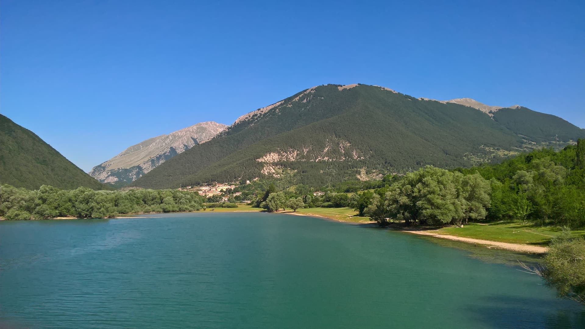
The 1951 artificial lake below the village, with the medieval houses of the centro storico arranged on the spur above it.
When to visit
Best · Jun–Sep, Dec–Mar
- J
- F
- M
- A
- M
- J
- J
- A
- S
- O
- N
- D
- Best
- Hot or crowded
- Quiet
- Mostly closed
Why come
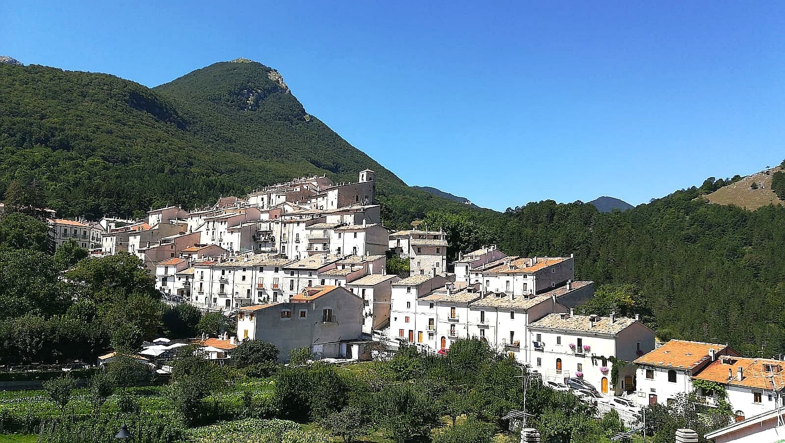
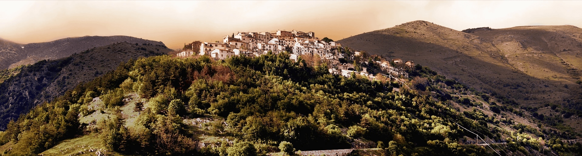
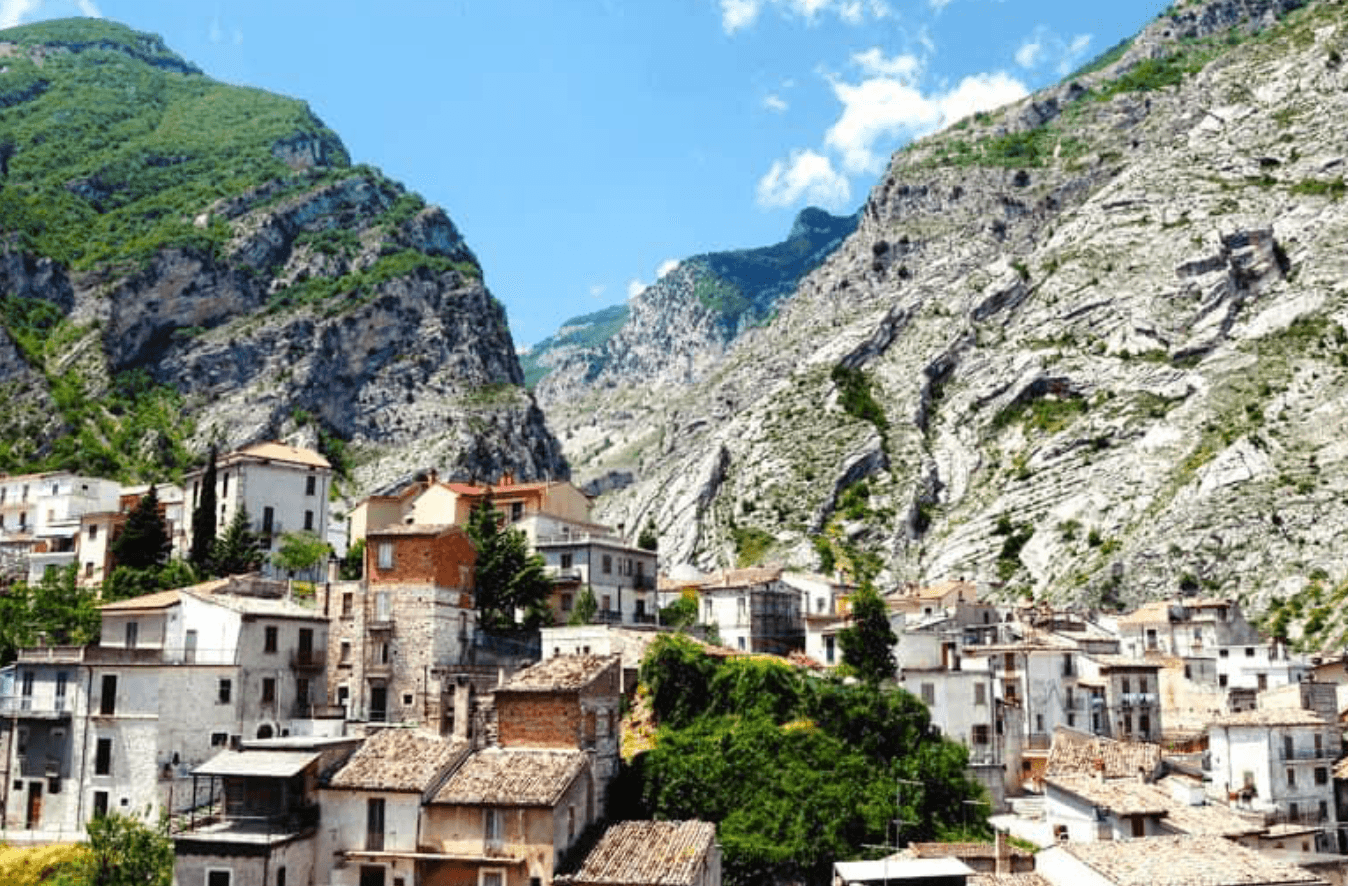
Civitella Alfedena sits at 1,123 meters on a spur above Lake Barrea, in the heart of the Abruzzo, Lazio and Molise National Park. The town has 285 residents and is among the smallest in the park, with a medieval grid of stone houses on a single hill. Behind it rises Monte Sterpi d'Alto at 1,966 meters, ahead opens the Camosciara strict nature reserve, named for the Apennine chamois that recolonized it in the late 20th century after near-extinction.
The Museo del Lupo Appenninico in the village is dedicated to the Apennine wolf, with displays on the recovery of the species and a Lupo wildlife enclosure where injured animals can be observed from walkways at distance. The village received the Bandiera Arancione for environmental quality and tourist services. The Val di Rose trail from town, with bookable daily slots in summer to limit numbers, is the most reliable spot in the central Apennines for sighting Abruzzo chamois.
The Sunday letter
We haven’t written Civitella Alfedena’s letter yet.
One town every Sunday, with the photo, the food, the festa. Be there when this one comes up. Free, by Peter & Sophia from Pietrasanta.
By subscribing you agree to Substack’s Terms of Use, our Privacy Policy and our Information collection notice.

What to see
Museo del Lupo Appenninico
Village museum on the Apennine wolf, with displays on the species recovery and a wildlife enclosure with elevated viewing walkways.
Riserva della Camosciara
Strict nature reserve south of the village, recolonized by the Apennine chamois after near-extinction, accessed by trail from the village.
Val di Rose
The most reliable chamois-sighting trail in the central Apennines, with bookable daily slots in summer to cap numbers.
Lago di Barrea
Artificial lake on the Sangro below the village, formed in 1951, with a footpath along its northern shore.
Centro storico
Medieval grid of stone houses on a single hill above the lake, recognized by the Bandiera Arancione for environmental quality.
The slow-trip planner
Building a trip? Find where Civitella Alfedena fits in a slow Italy circuit.
Answer five questions. We will shape a geographically coherent slow trip from the 1,000 Italian towns most travelers skip. Yours to save and share.
Living here
- Population 285
- Very remotei
- Pharmacy: none mapped
- Nearest high school over ~30 minutes away
- Nearest airport Naples / Salerno, 2 h 12 min drive
- Regional capital L'Aquila, 1 h 40 min drive
Tags & datadesignations · numbers · sources
Recognised as
The numbers
- Elevation: 1123 m
- Population: 285
- Surface area: 29.49 km²
These figures were compiled from public directories — ISTAT, OpenStreetMap, Wikidata — and from the official listings of the guides named on this page. Town details change; verify with official sources before you travel.
Close by
More towns near Civitella Alfedena

Barrea
Province: L'Aquila
A 1,066-meter spur above an artificial lake at the heart of the Abruzzo National Park, with a Samnite necropolis and an 11th-century di Sangro castle.
Pescasseroli
Province: L'Aquila
At 1,167 meters at the head of the Sangro valley, capital of Italy's oldest national park and birthplace of Benedetto Croce.
Villetta Barrea
Province: L'Aquila
At 975 meters on the shore of Lake Barrea, a village inside the Abruzzo National Park where red deer walk the streets alongside residents.
San Donato Val di Comino
Province: Frosinone
A medieval village at 728 meters at the gateway to Forca d'Acero, the pass into the Abruzzo National Park.
Scontrone
Province: L'Aquila
A 1,038-meter borgo above the Sangro gorge in the Alto Sangro, with two dozen emigration-themed murals and a paleontological site of European importance.
🟠 Bandiera Arancione
More Bandiera Arancione towns in Abruzzo
Fara San Martino
Province: Chieti
The pasta capital of Italy at 440 meters, where De Cecco was founded in 1886 and the Verde river runs out of a two-meter slot in the Majella wall.
Lama dei Peligni
Province: Chieti
A 669-meter Majella village known for chamois, the Cavallone cave, and a prehistoric burial dug from Fonterossi dated 7000 to 5000 BC.
Scanno
Province: L'Aquila
A 1,057-meter Sagittario valley village photographed by Cartier-Bresson and Giacomelli, where women in black still walk the same alleys as the 1957 series.