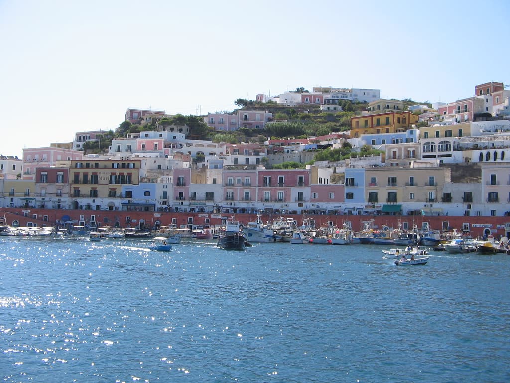
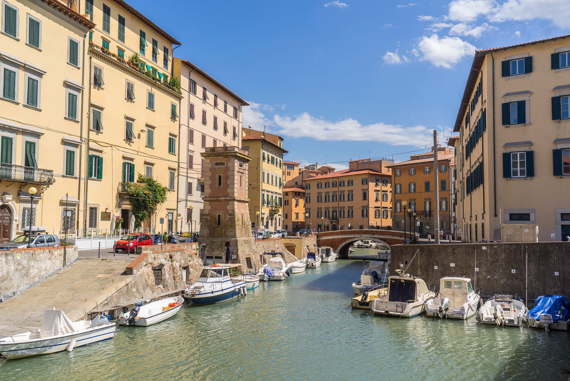
Designation
Parco Nazionale
154 towns across 19 regions
Browse by region
Abruzzo34
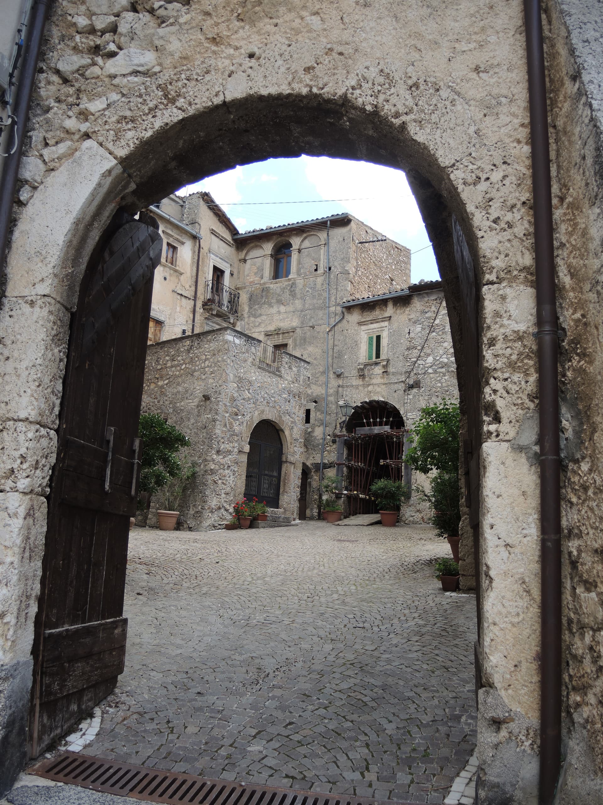
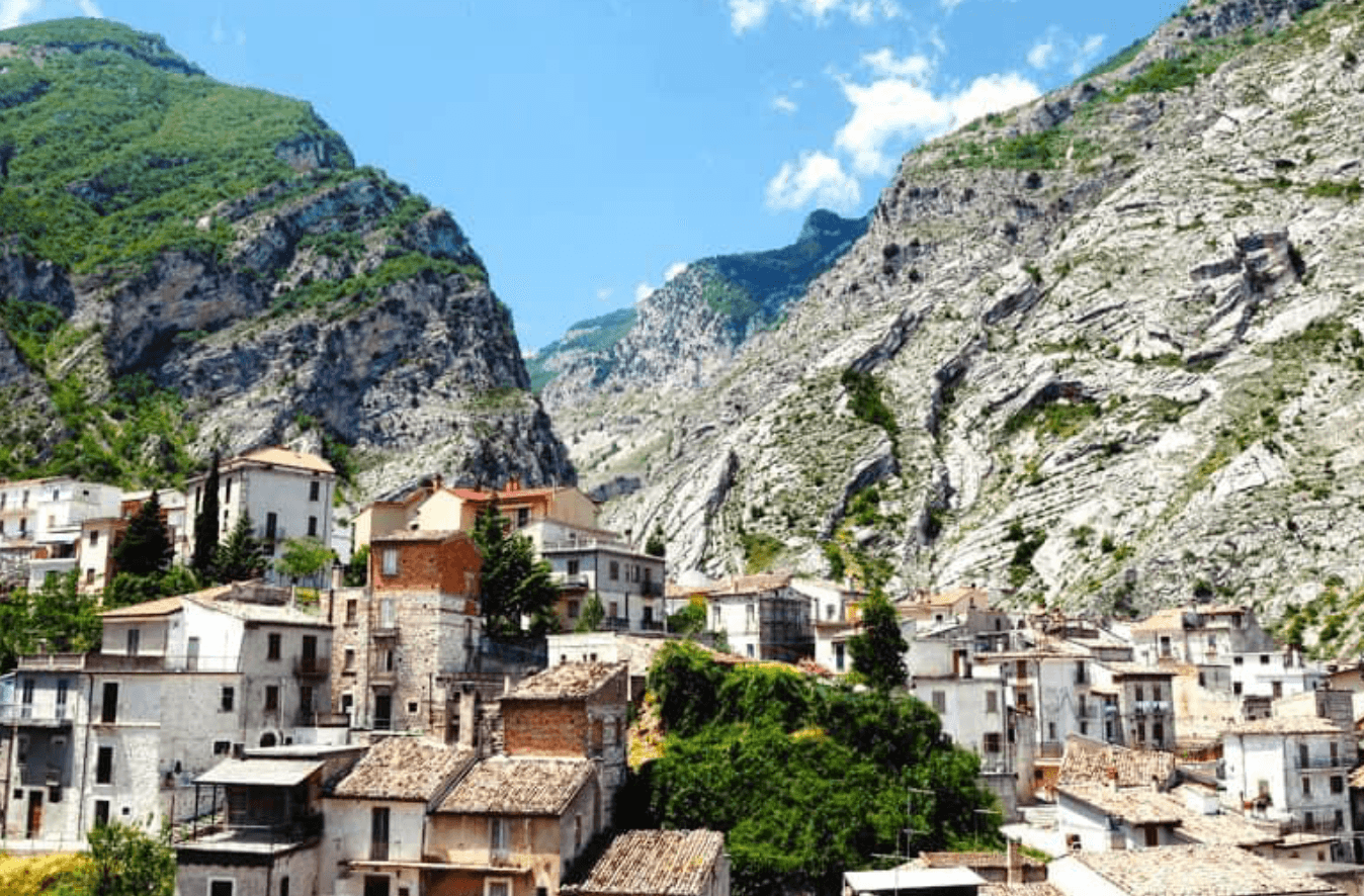
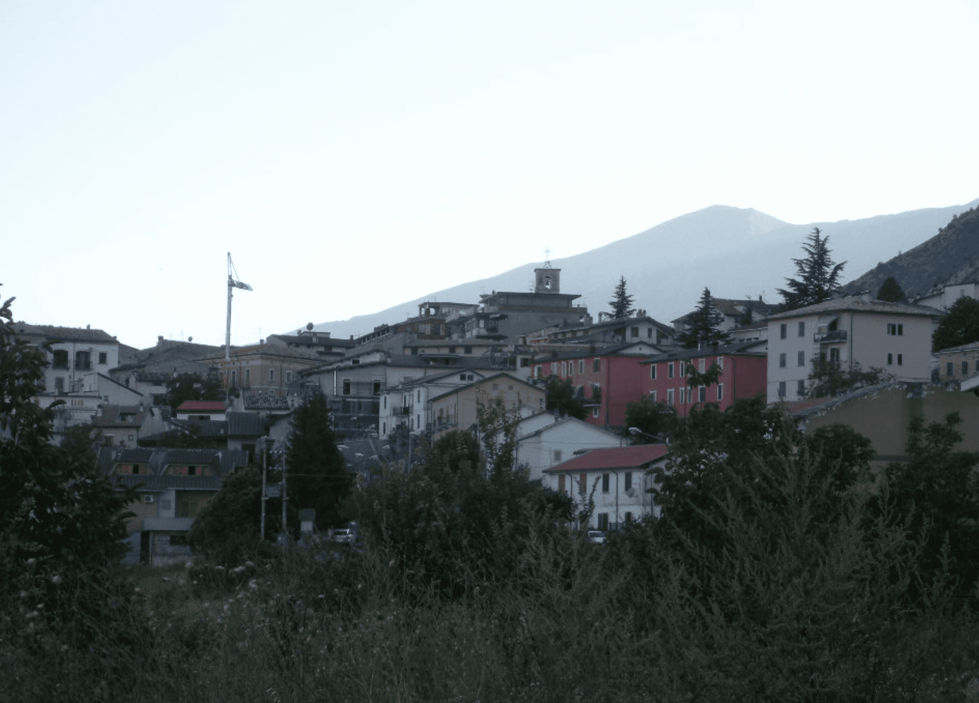
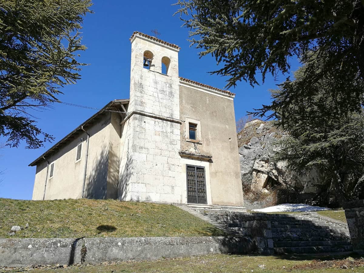
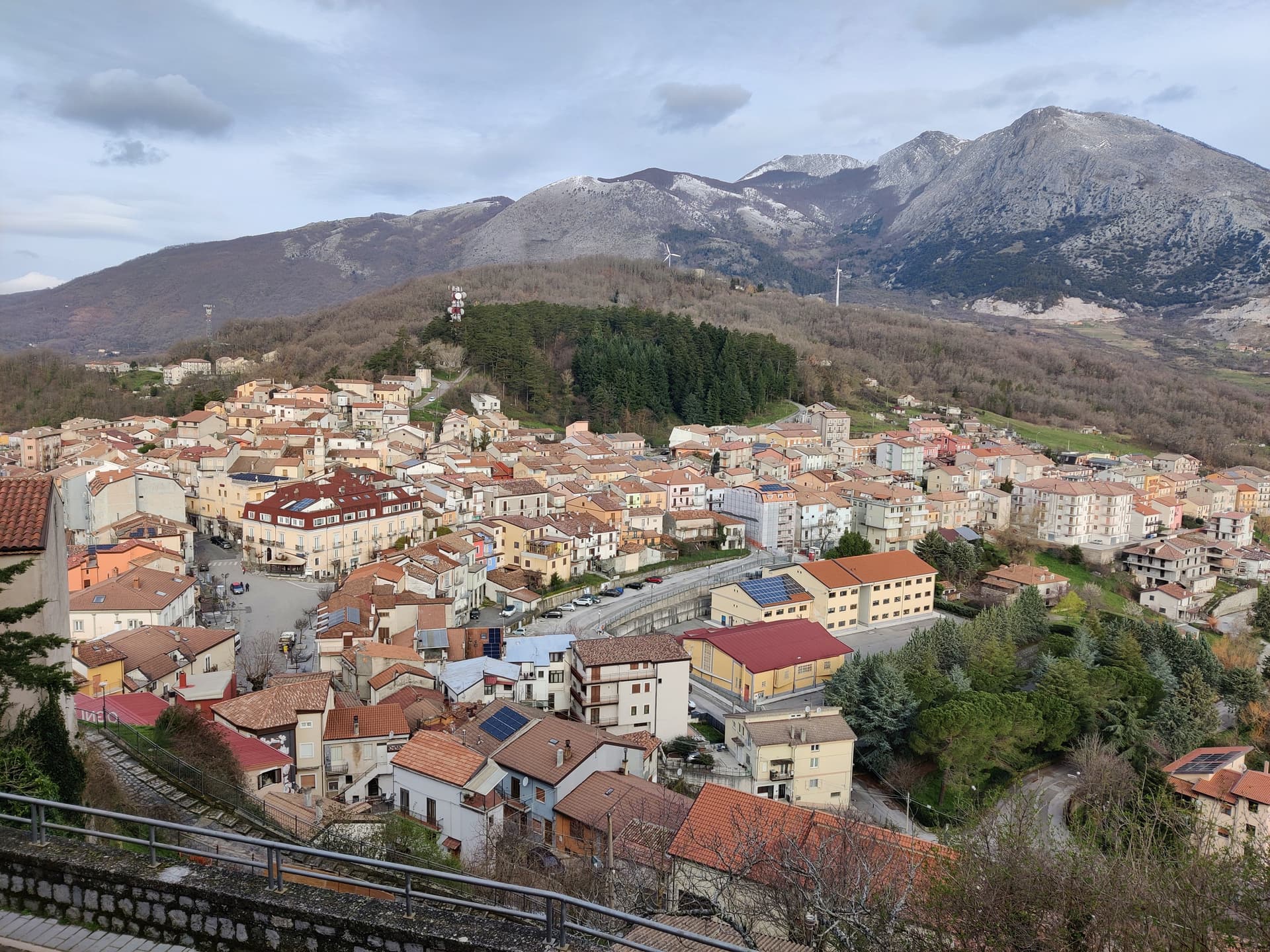
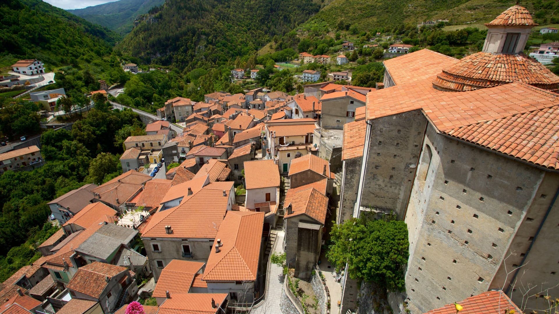
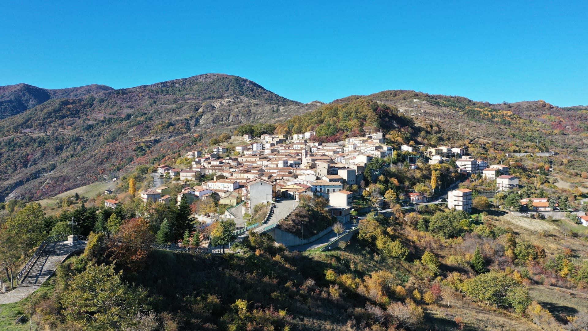
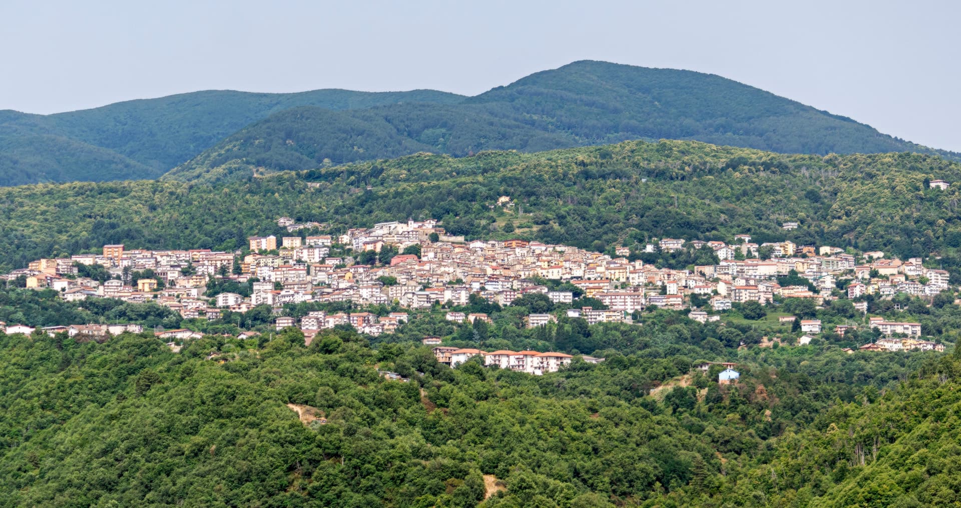
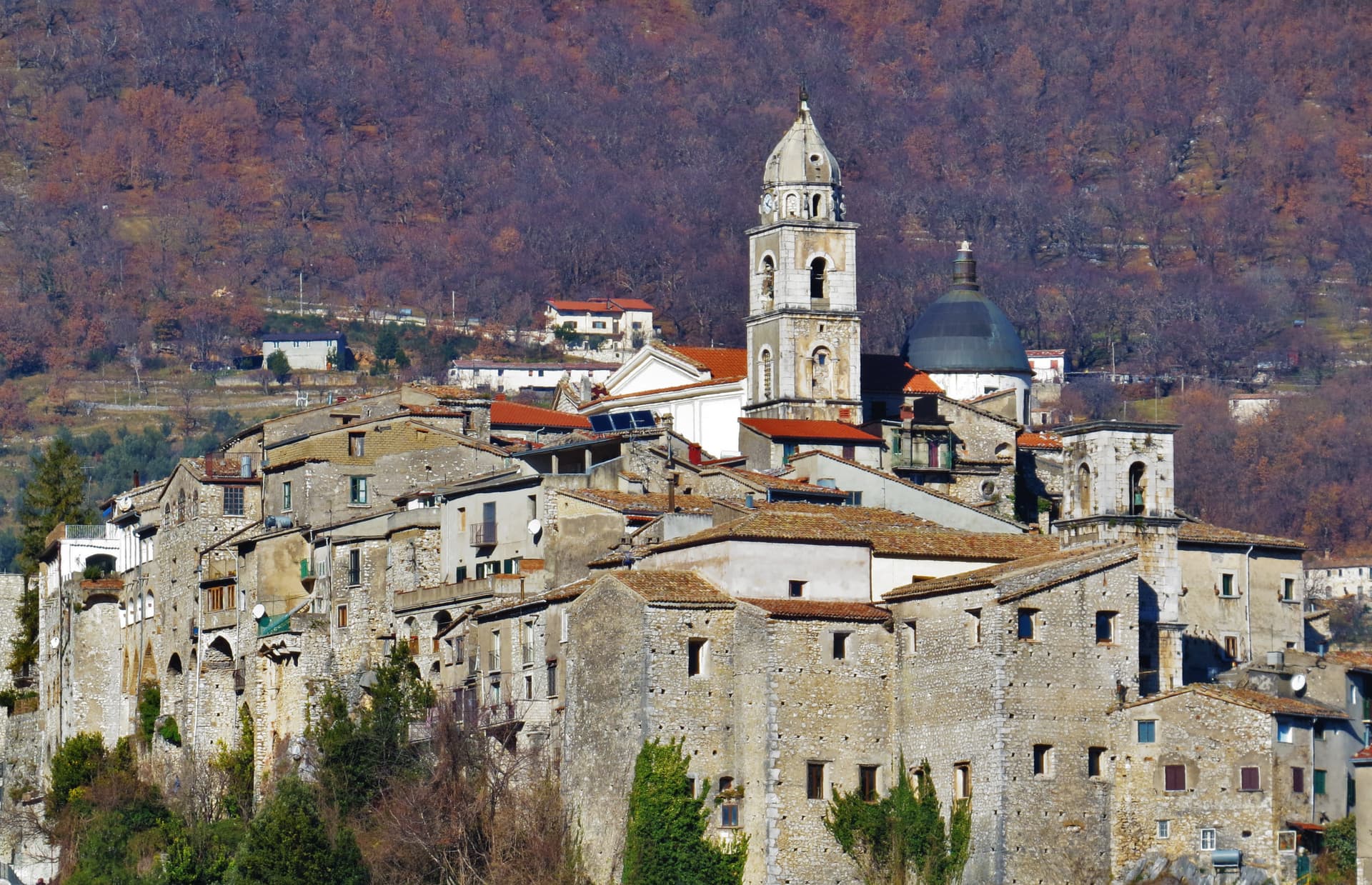
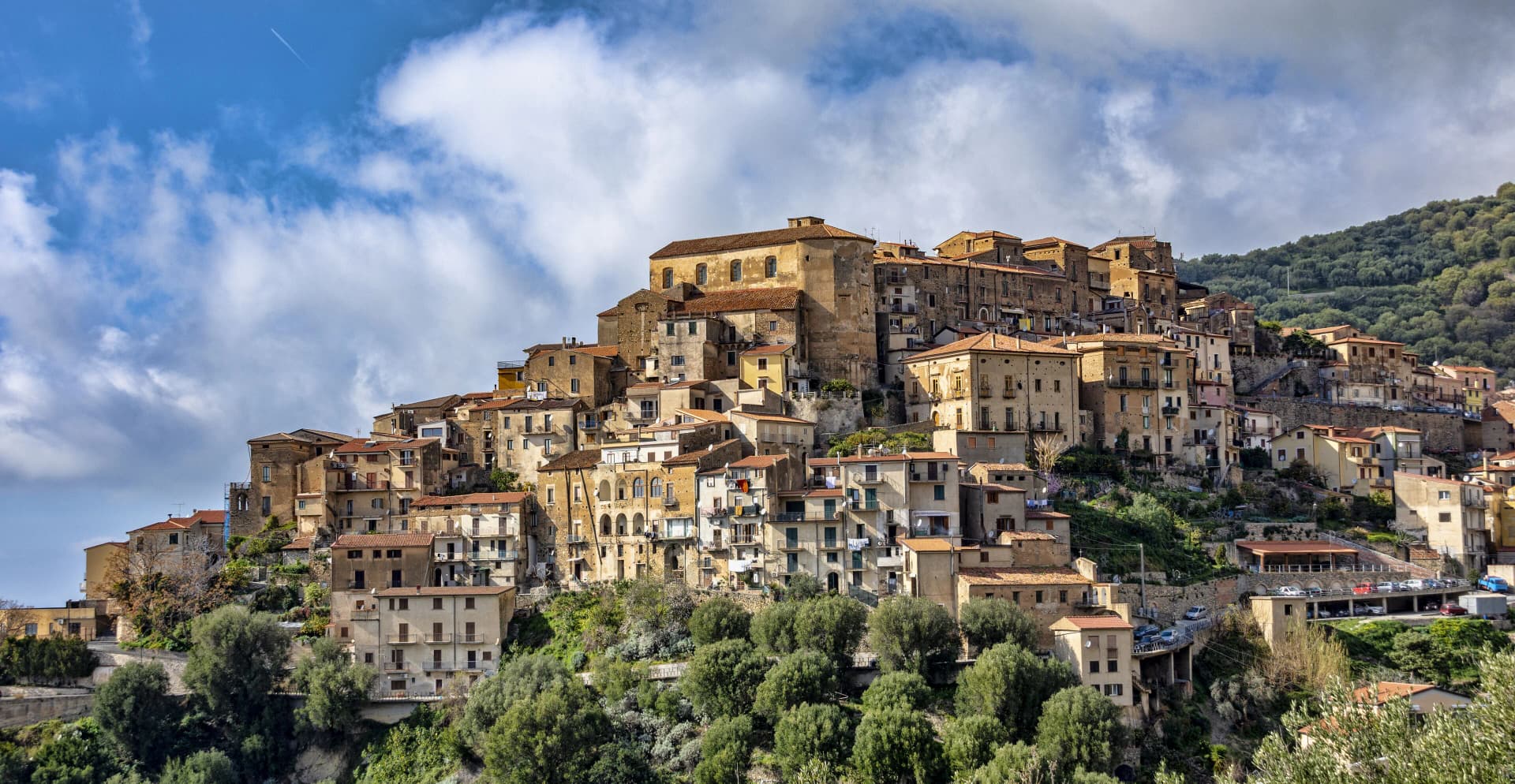
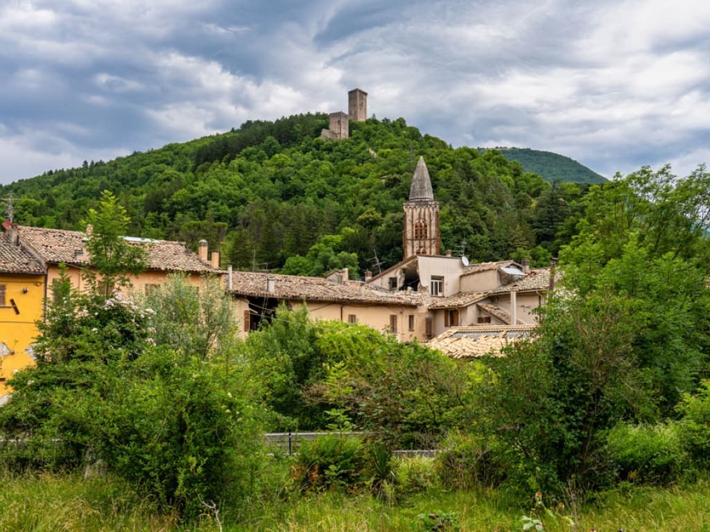
Alfedena
Province: L'Aquila · 914 m
At 914 meters at the head of the upper Sangro valley, the Samnite Aufidena, with a 15,000-tomb necropolis and a Roman conquest in 298 BC.

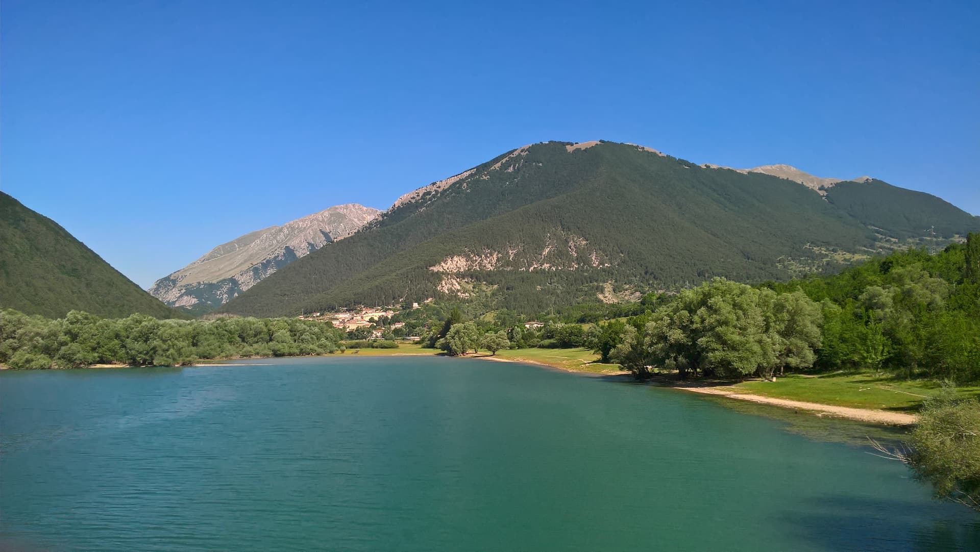
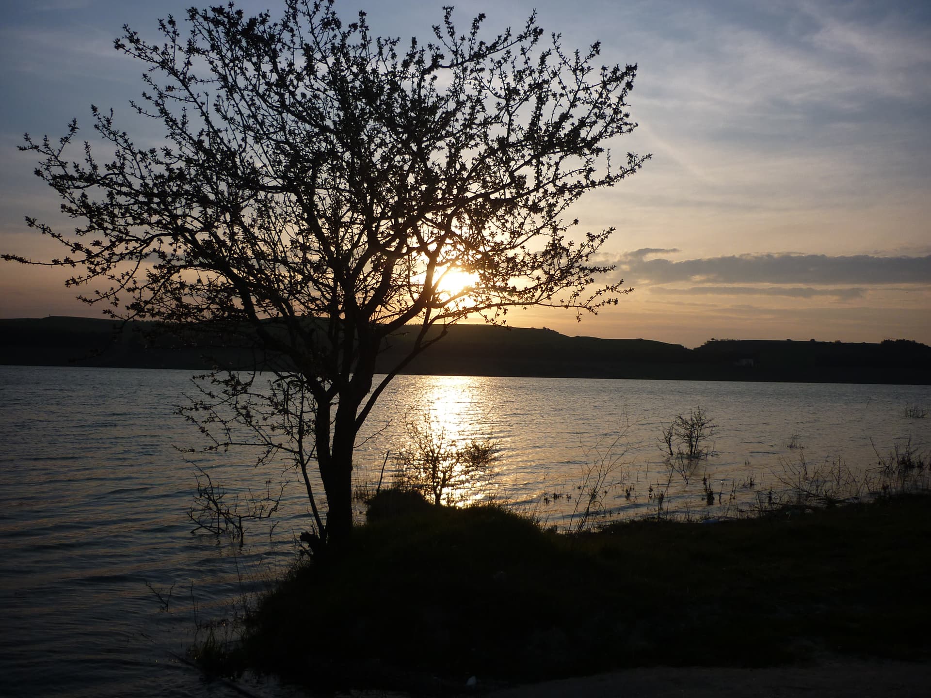
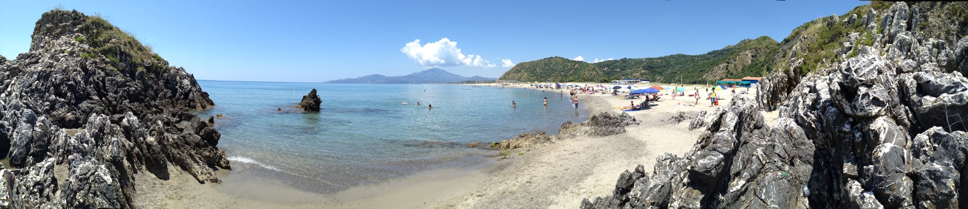
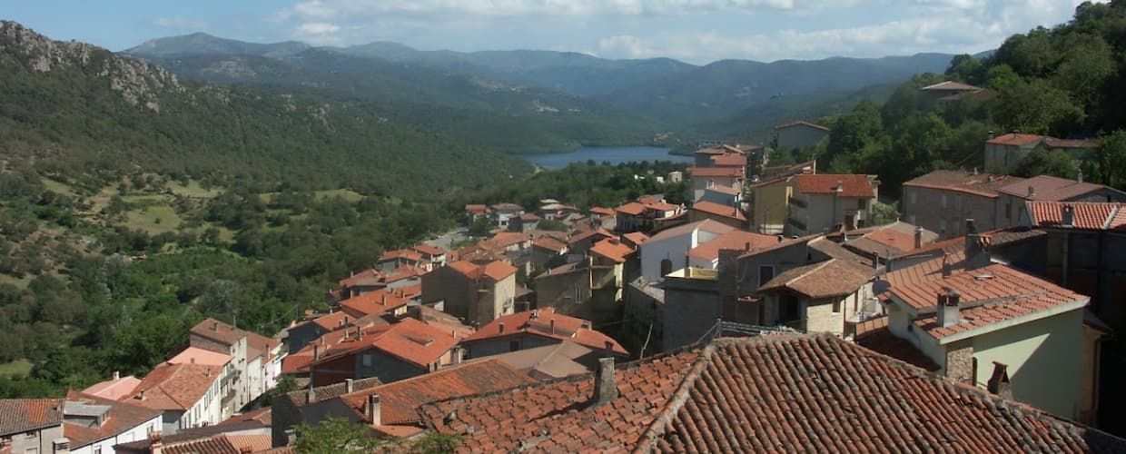
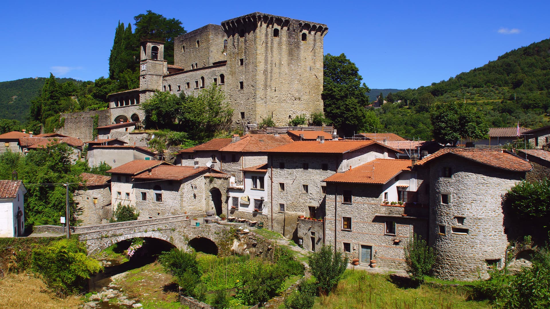
Barrea
Province: L'Aquila · 1,066 m
A 1,066-meter spur above an artificial lake at the heart of the Abruzzo National Park, with a Samnite necropolis and an 11th-century di Sangro castle.

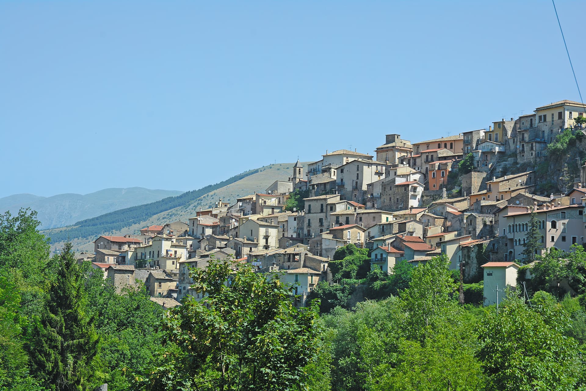
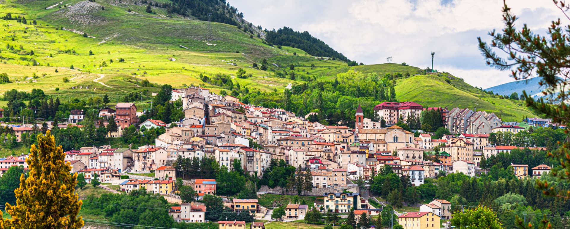
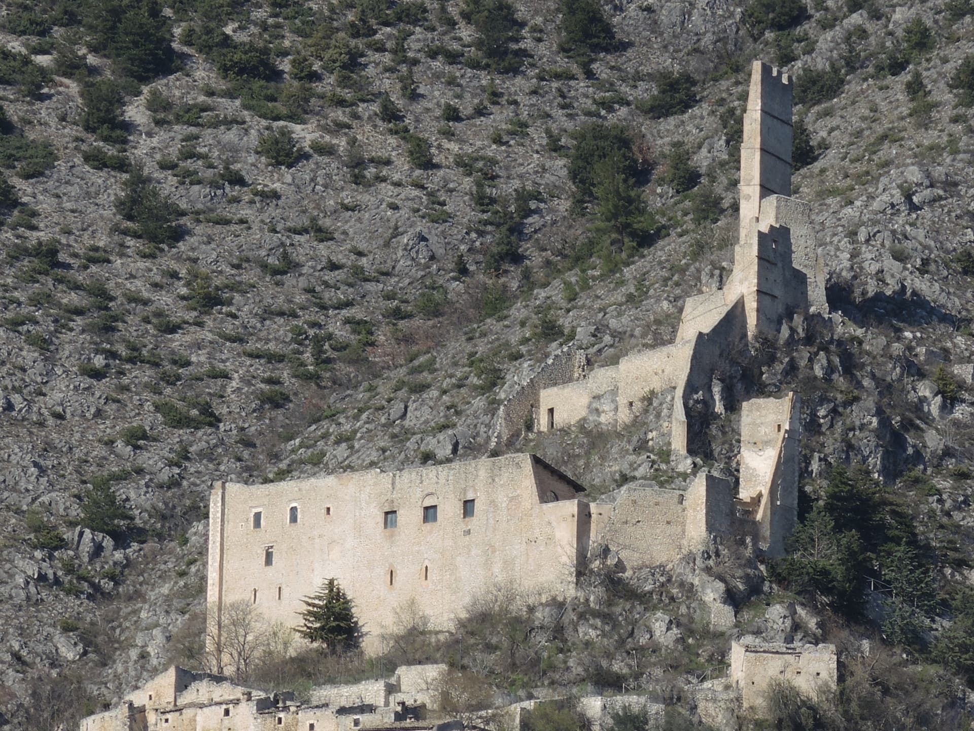
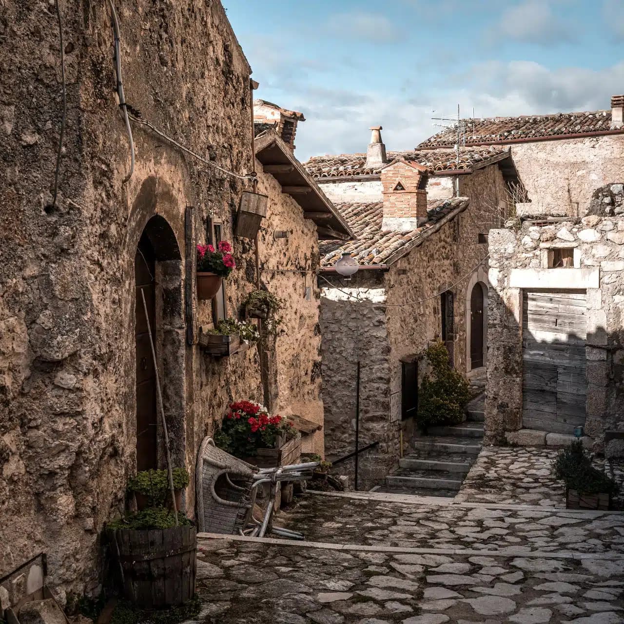
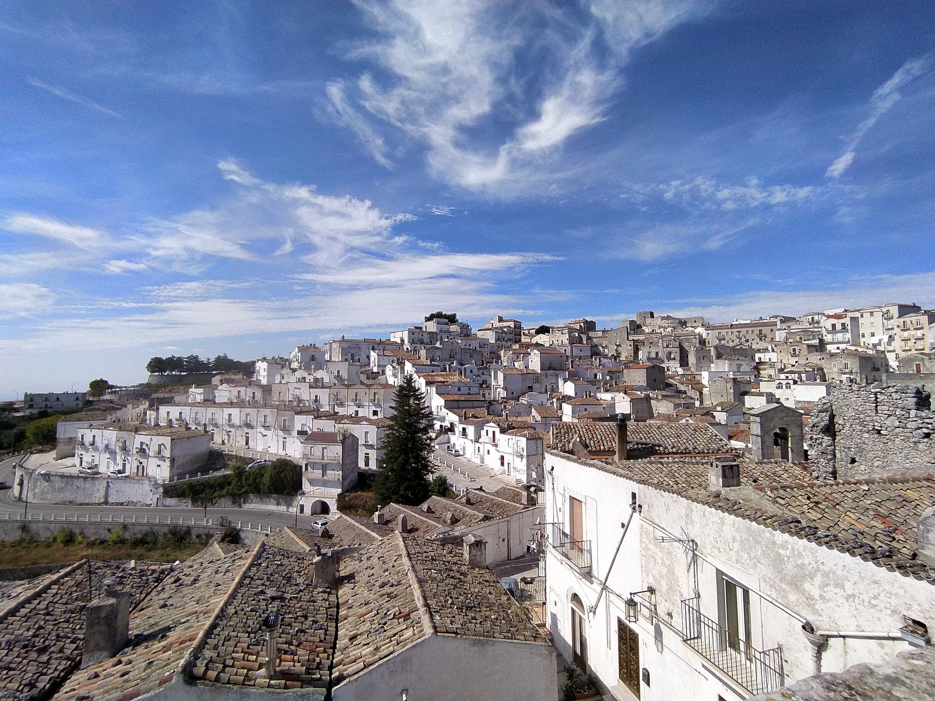
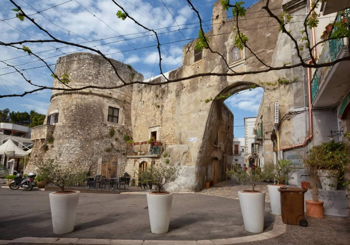
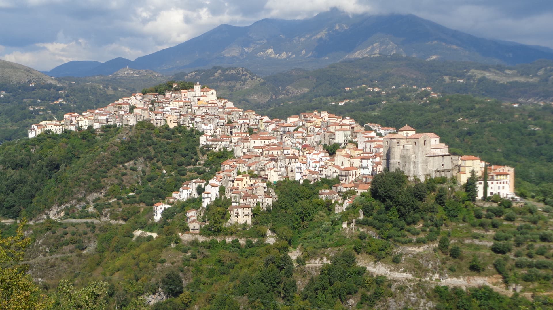
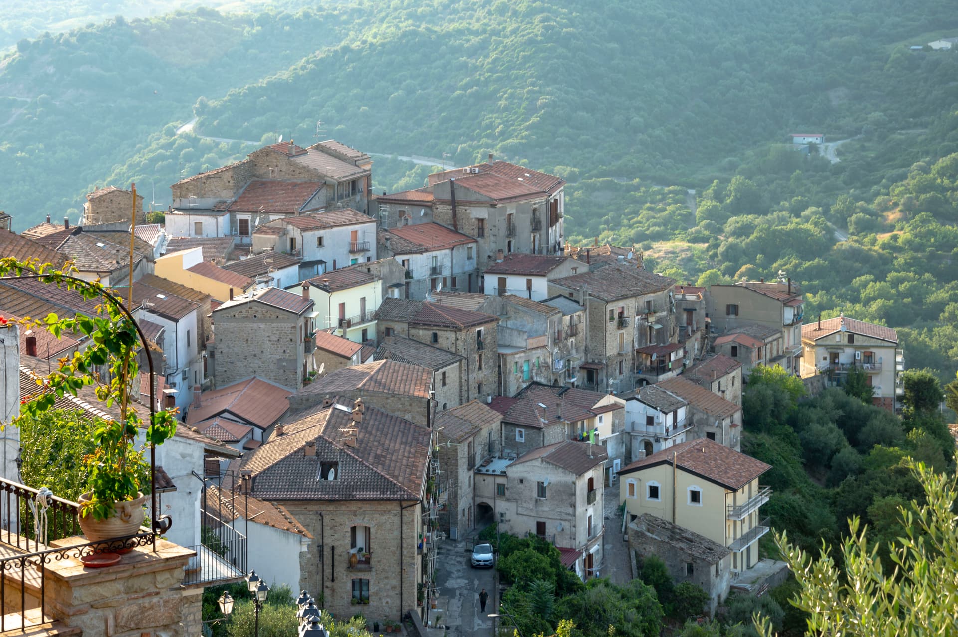
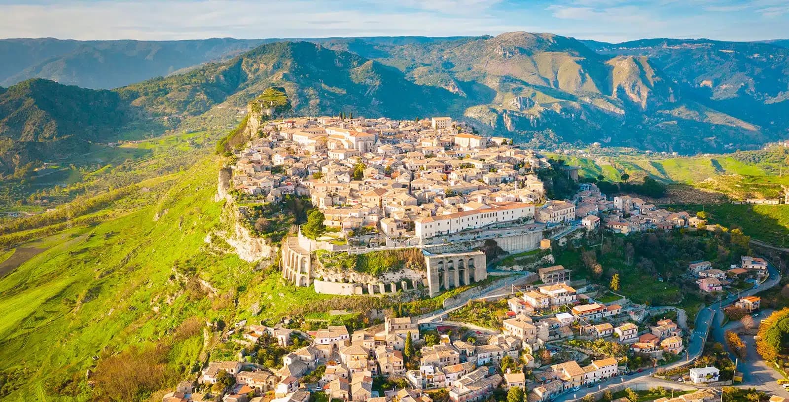
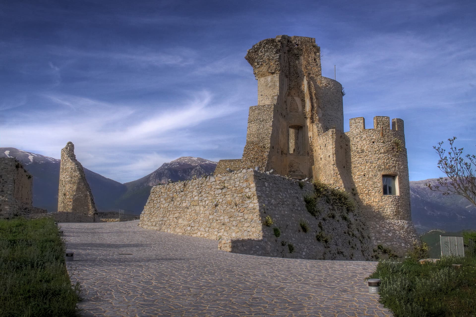
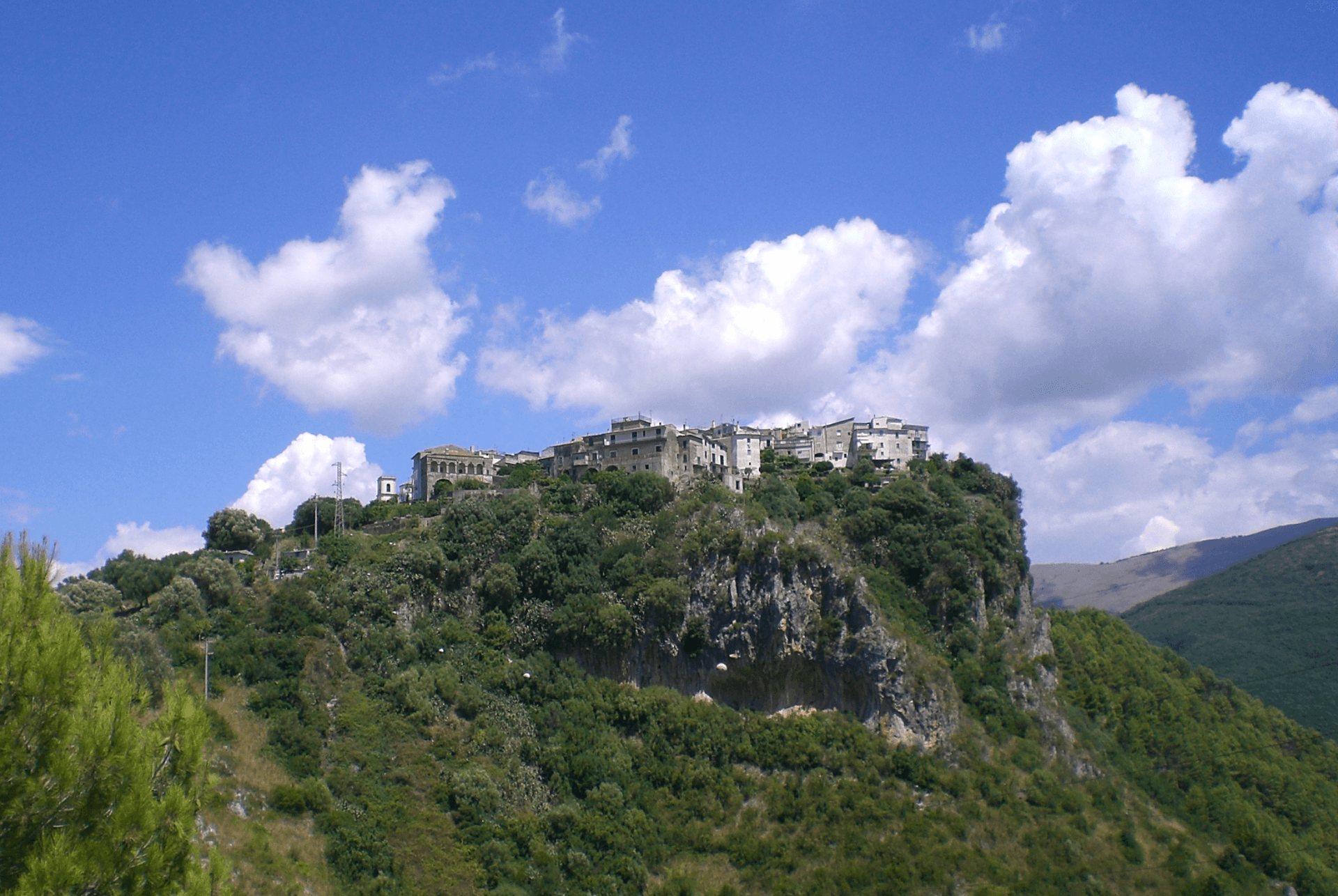
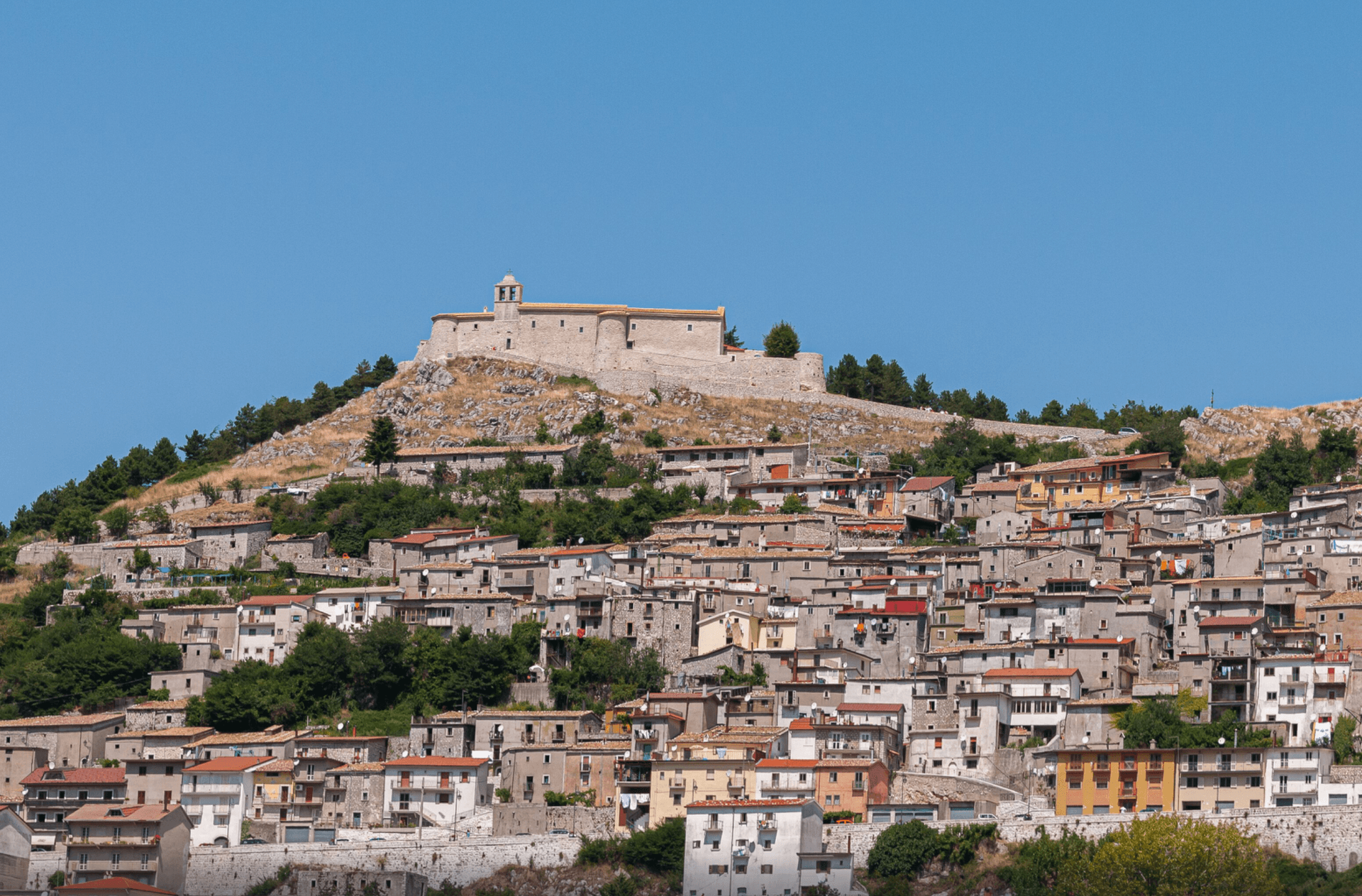
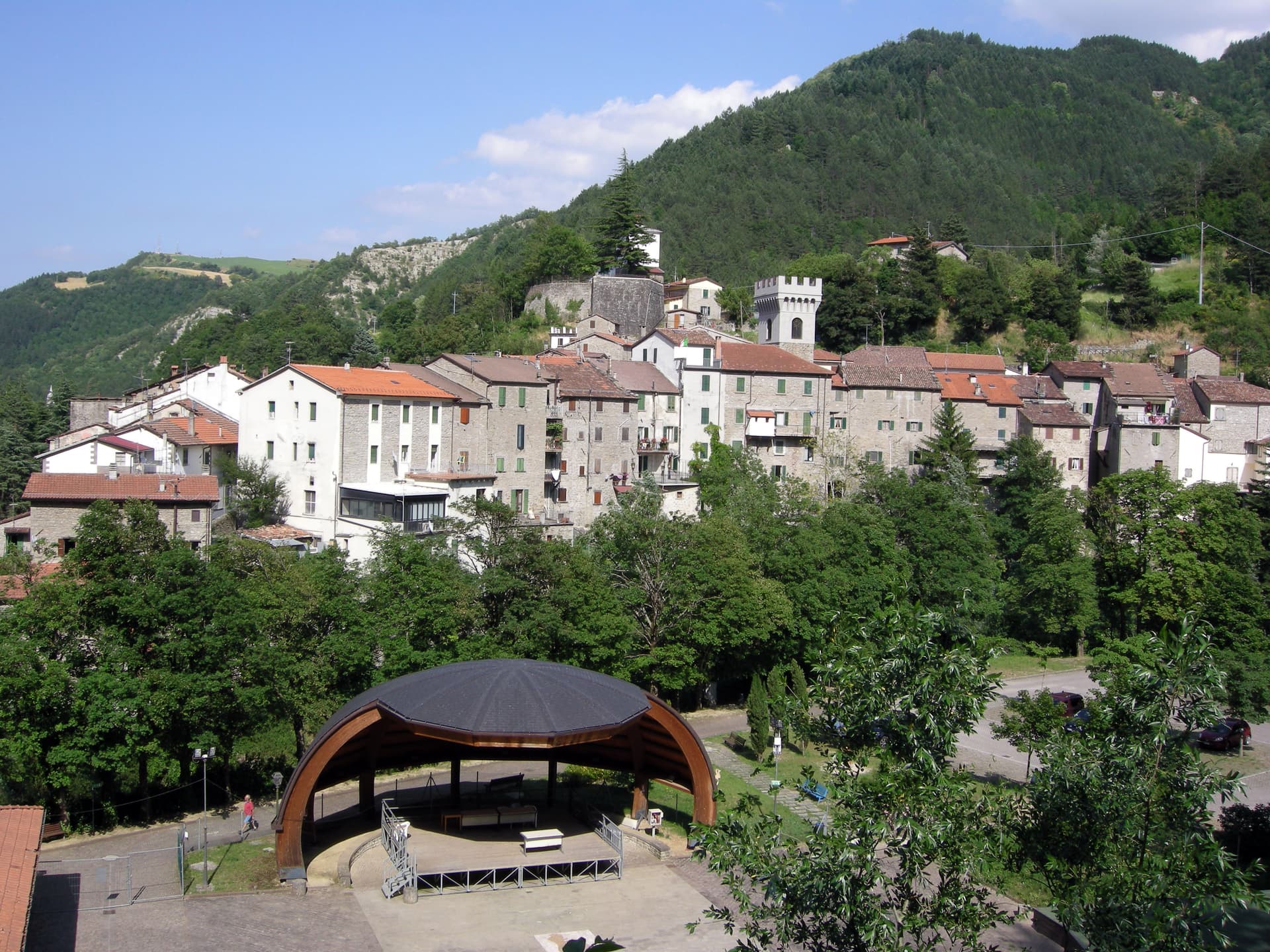
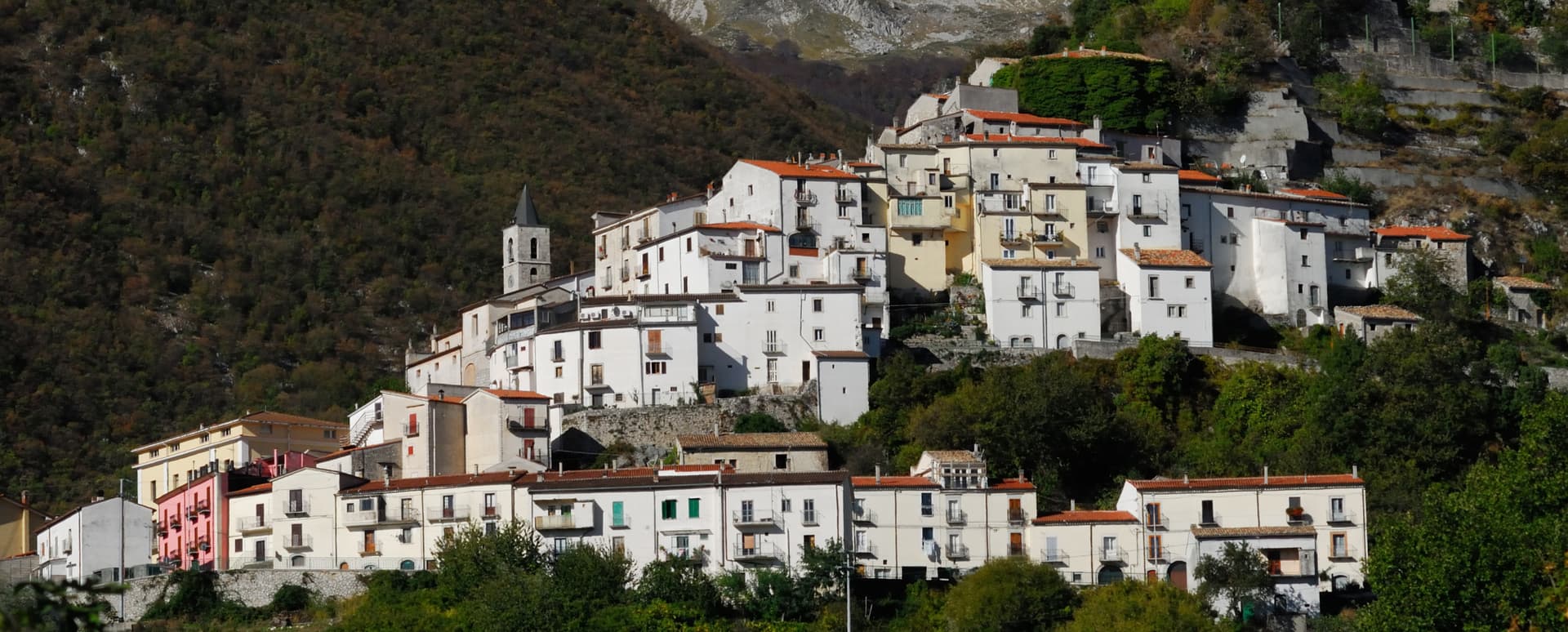
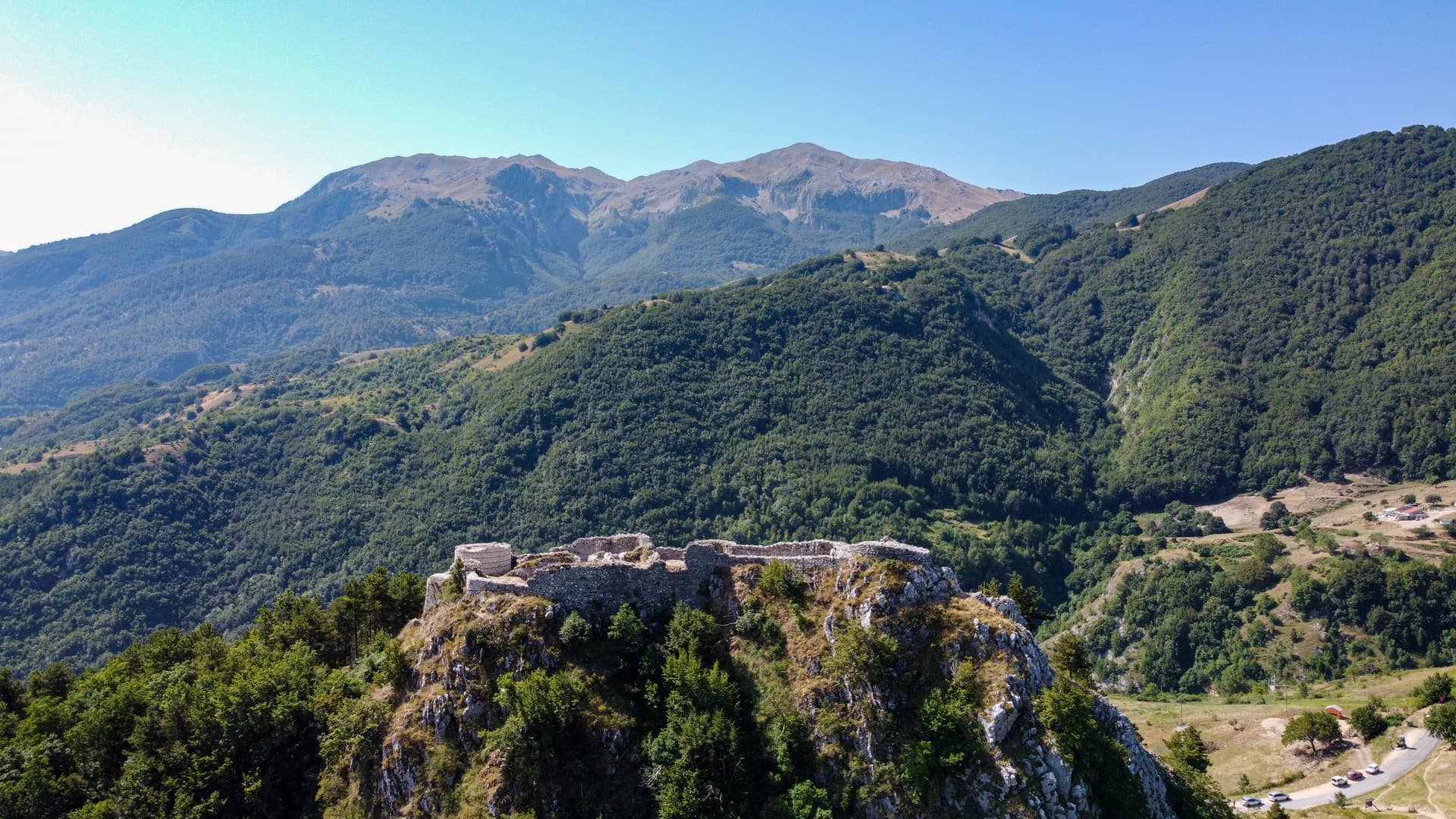
Calascio
Province: L'Aquila · 1,200 m
At 1,200 meters under the highest castle in the Apennines, a village of 125 people that played the monk's refuge in Ladyhawke.
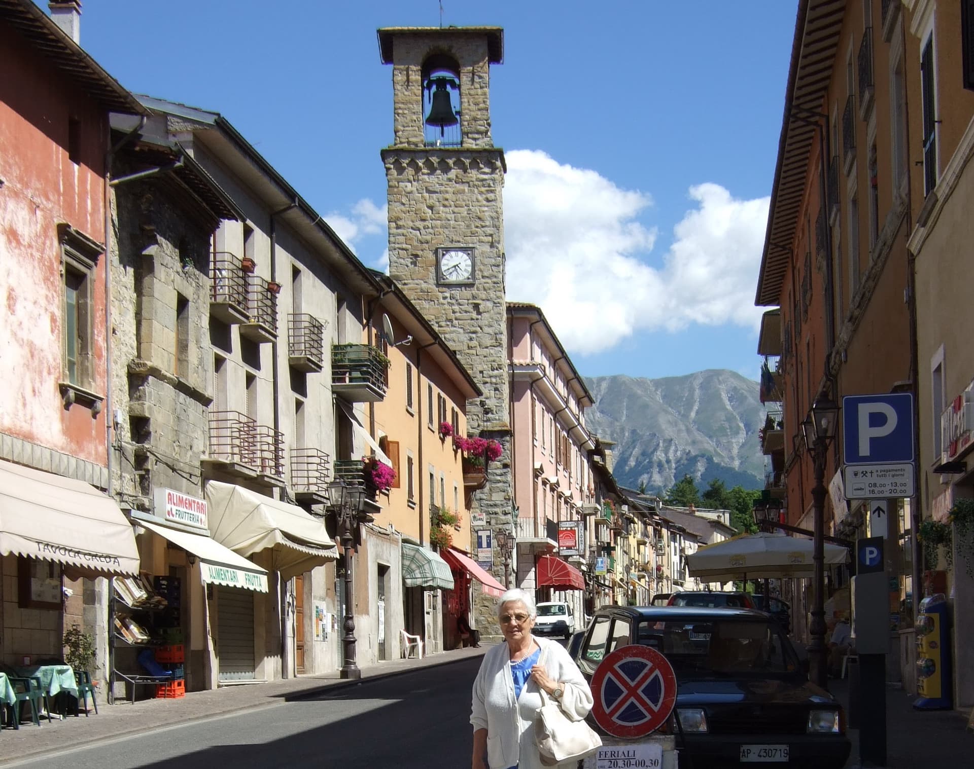
Campli
Province: Teramo · 393 m
A 393-meter town under the Monti della Laga, held by the Farnese for two centuries, with a Scala Santa carrying papal indulgence.

Campo di Giove
Province: L'Aquila · 1,064 m
At 1,064 meters under the southwestern Maiella, the highest village in the park, named for a Roman temple to Jupiter.

Capestrano
Province: L'Aquila · 465 m
A hilltop village at 465 meters above the Tirino valley, where in 1934 a farmer turned up the 6th-century BC limestone Warrior of Capestrano.
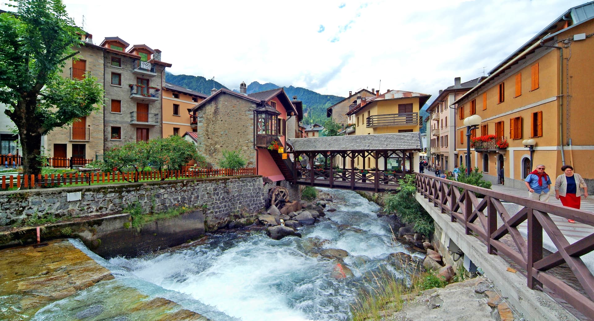
Caramanico Terme
Province: Pescara · 650 m
A 650-meter Majella spa village at the confluence of the Orfento and Orta, with sulphurous springs whose properties were documented in 1576.
Castel del Monte
Province: L'Aquila · 1,346 m
At 1,346 meters under Monte Bolza facing Rocca Calascio, the capital of shepherds, whose wool reached the Medici and whose witches return each August.
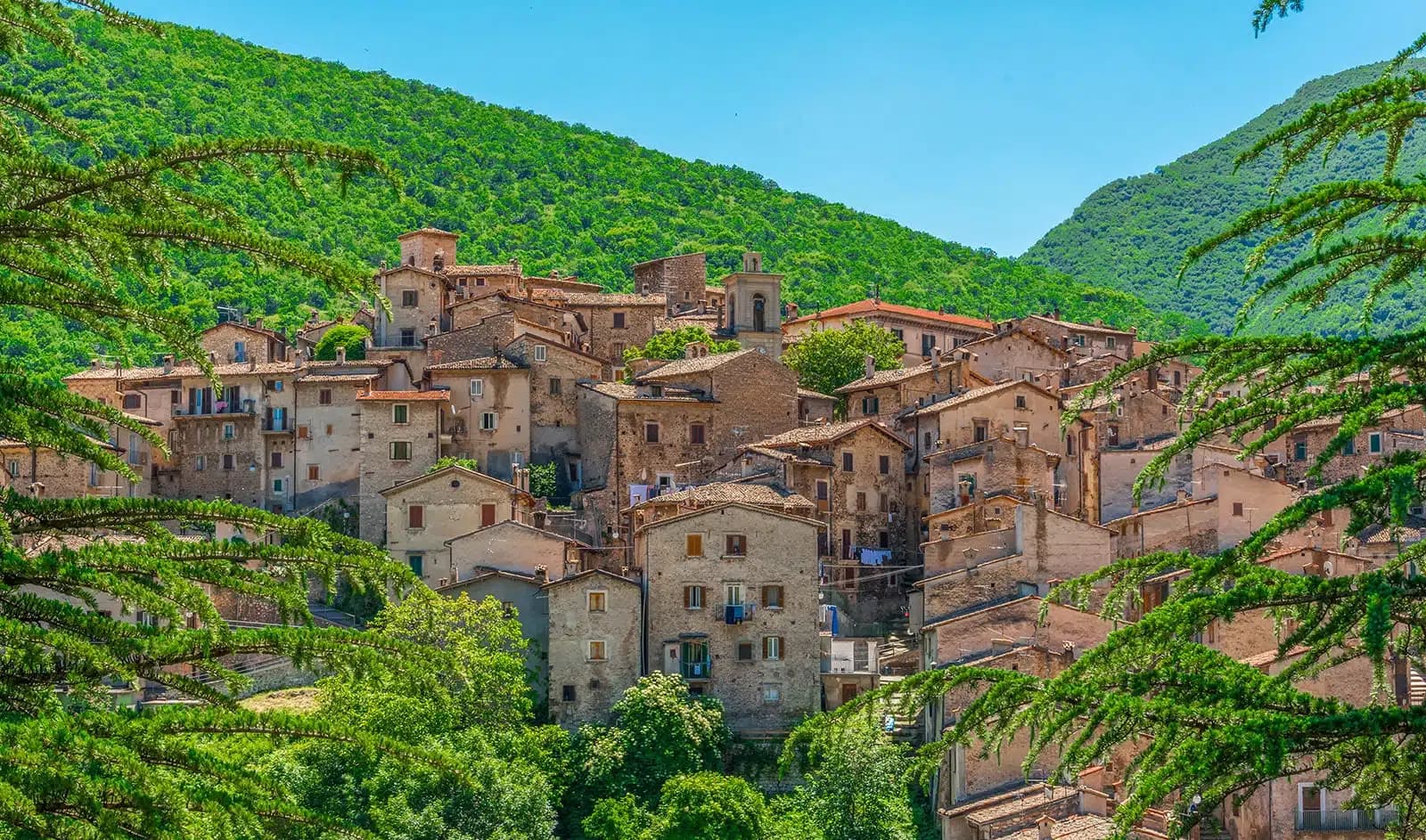
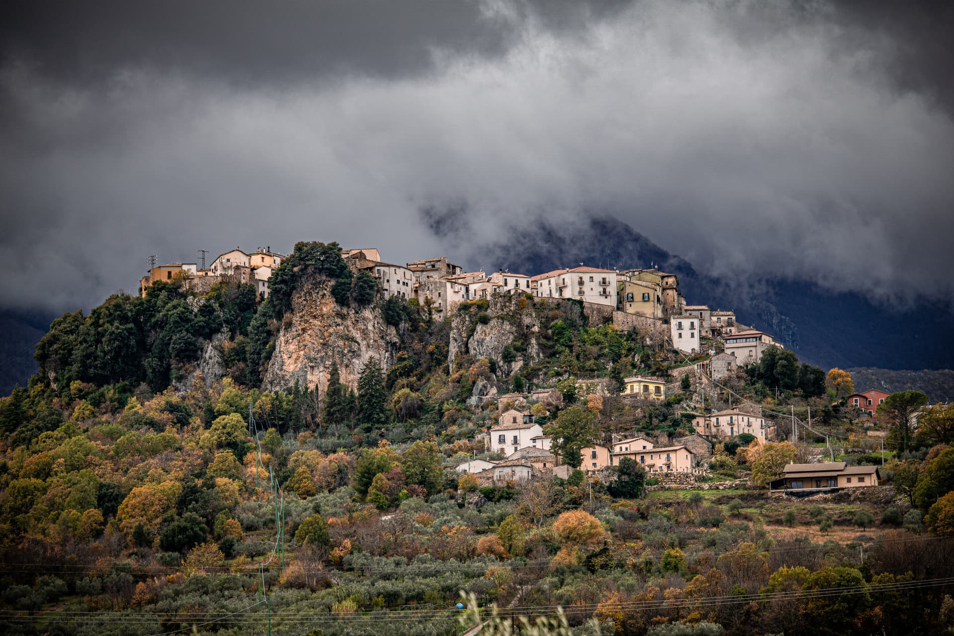
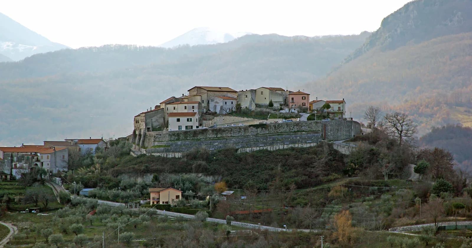
Castelvecchio Calvisio
Province: L'Aquila · 1,067 m
118 people at 1,067 meters on a ridge above the Tirino, inside a fortified ellipse of stone walls with alleys orthogonal to its perimeter.
Civitella Alfedena
Province: L'Aquila · 1,123 m
At 1,123 meters above Lake Barrea, 285 residents, the trailhead for the Camosciara reserve and home of the Apennine Wolf Museum.
Civitella del Tronto
Province: Teramo · 589 m
A rocky crest at 589 meters above the Tronto valley, crowned by the last Bourbon fortress to surrender to united Italy in March 1861.
Corfinio
Province: L'Aquila · 346 m
A village of under a thousand on the Peligna valley floor at 346 meters, sitting on the Italic League's would-be capital Italia.
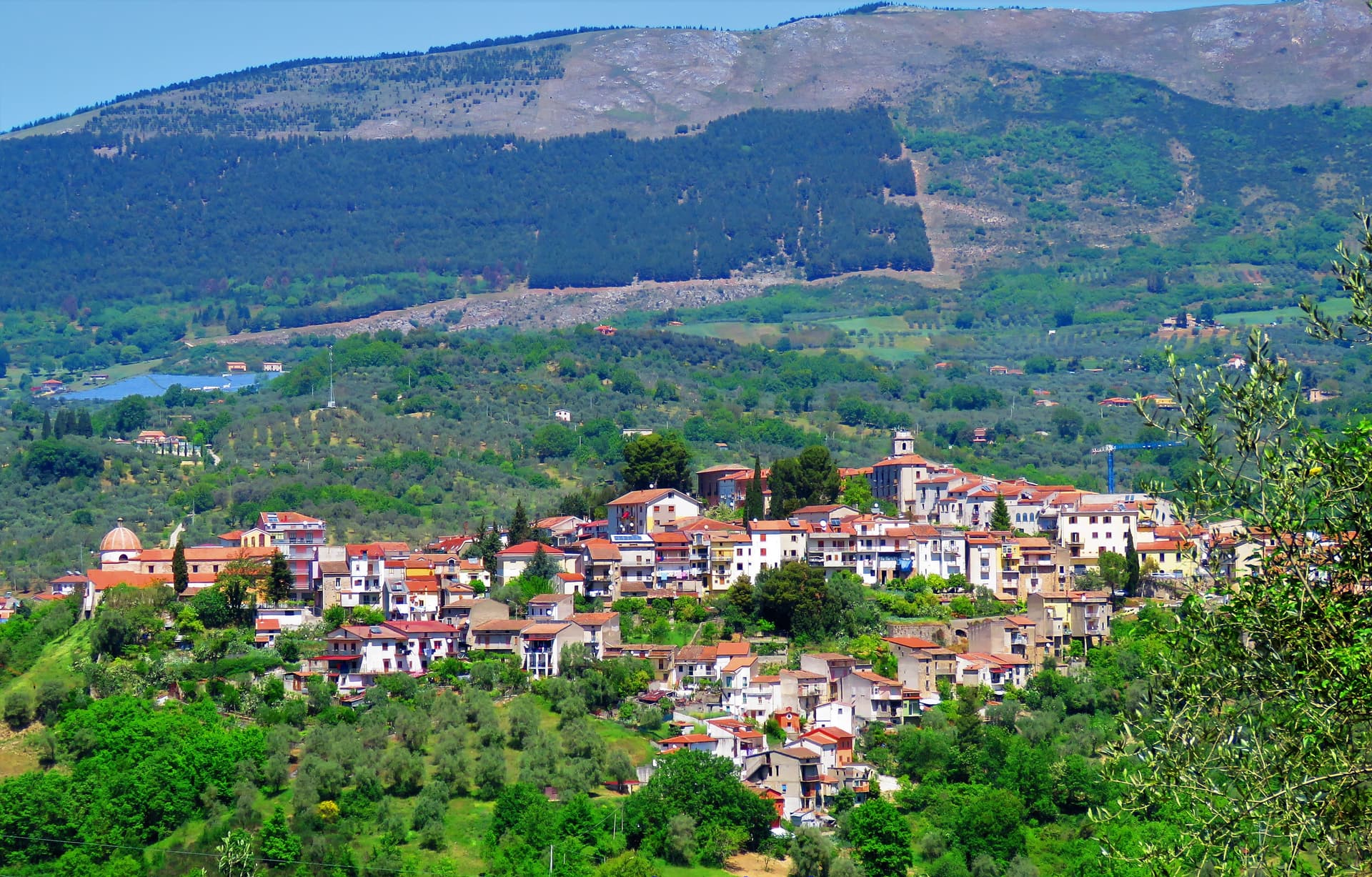
Fara San Martino
Province: Chieti · 440 m
The pasta capital of Italy at 440 meters, where De Cecco was founded in 1886 and the Verde river runs out of a two-meter slot in the Majella wall.
Guardiagrele
Province: Chieti · 576 m
The 576-meter terrazza d'Abruzzo on the Majella's foothills, hometown of fifteenth-century goldsmith Nicola da Guardiagrele and seat of the Majella park.
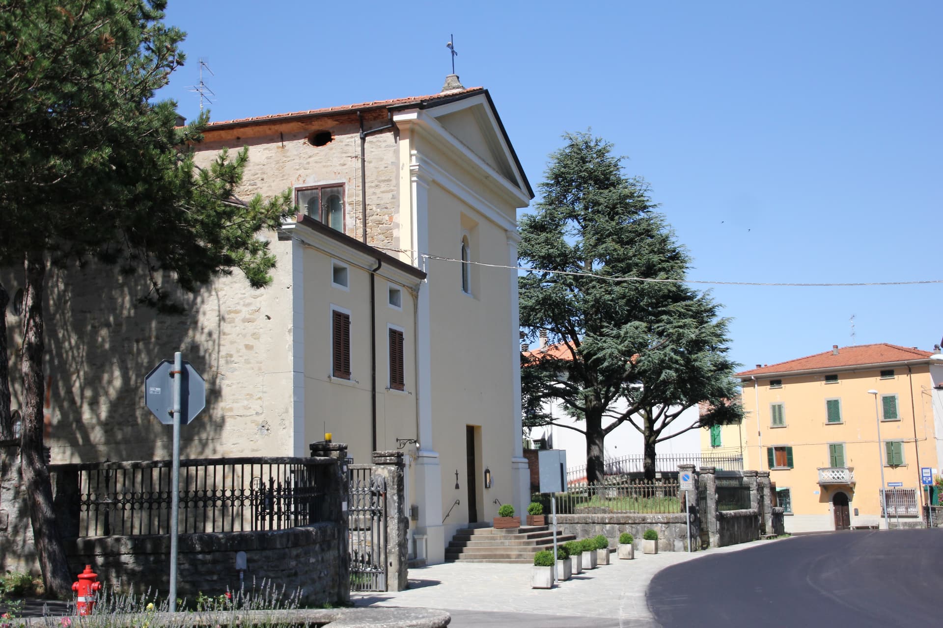
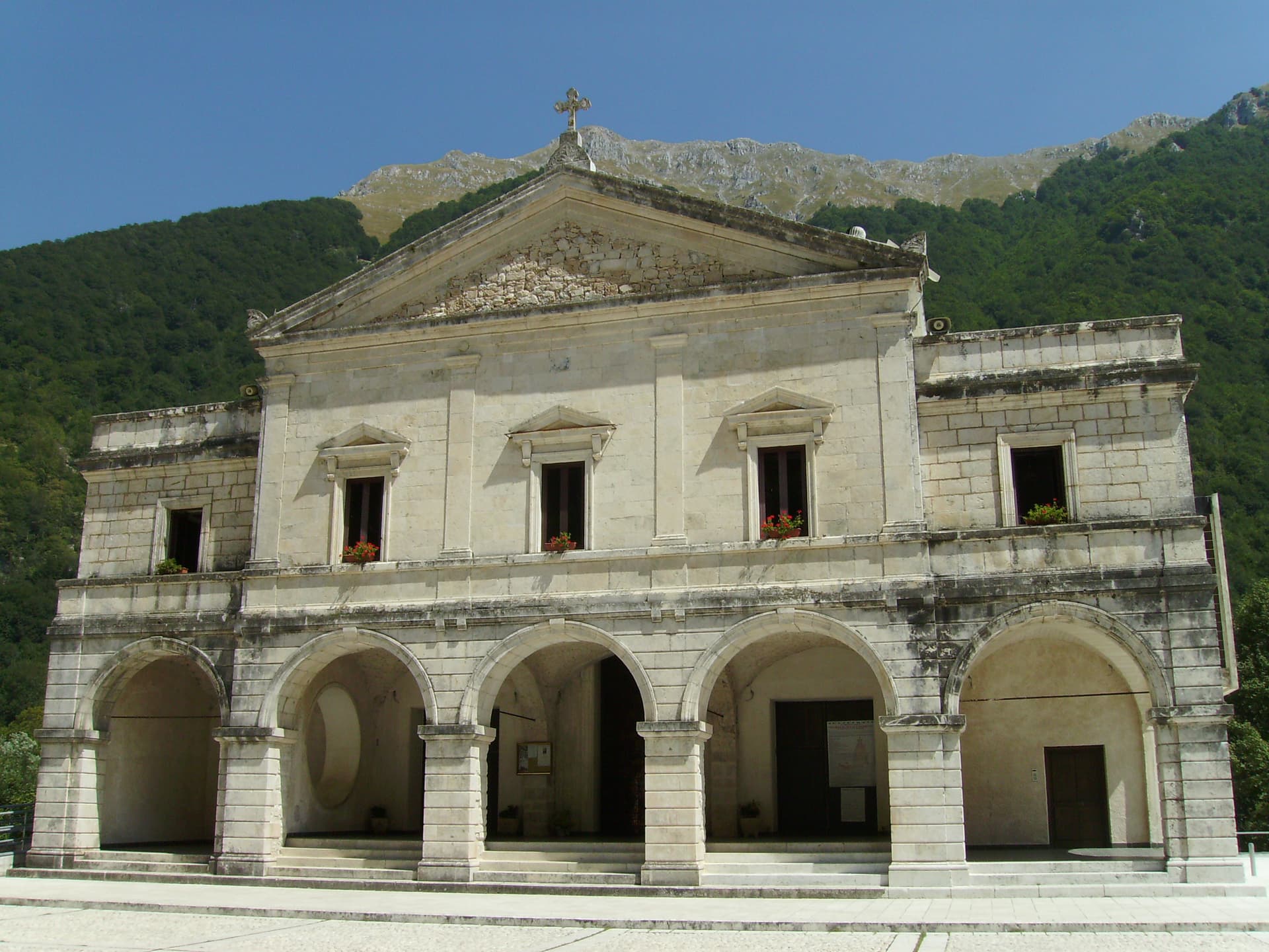
Isola del Gran Sasso d'Italia
Province: Teramo · 415 m
At 415 meters at the foot of the Gran Sasso massif, the commune holds one of the world's fifteen most-visited Catholic sanctuaries.
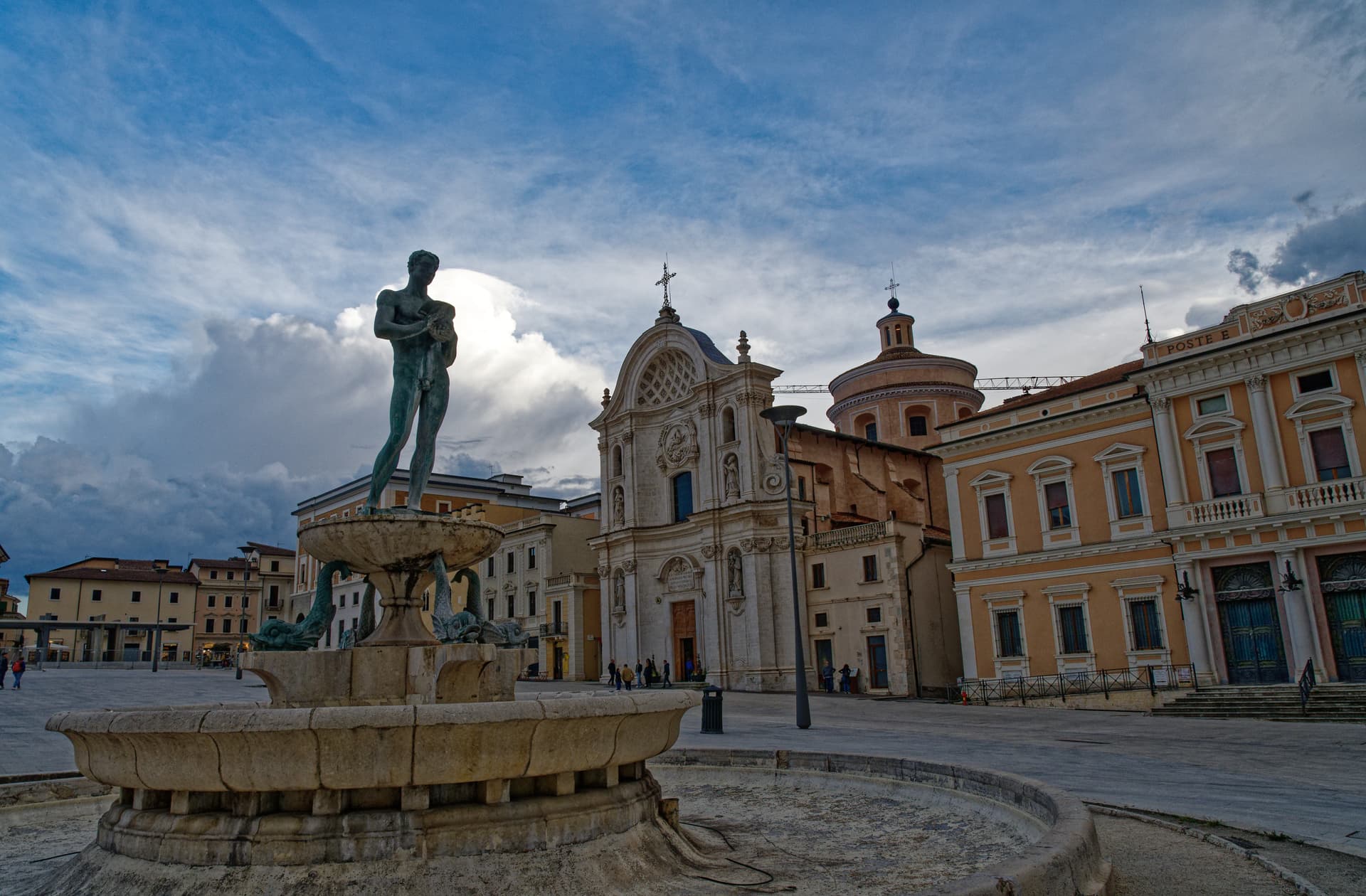
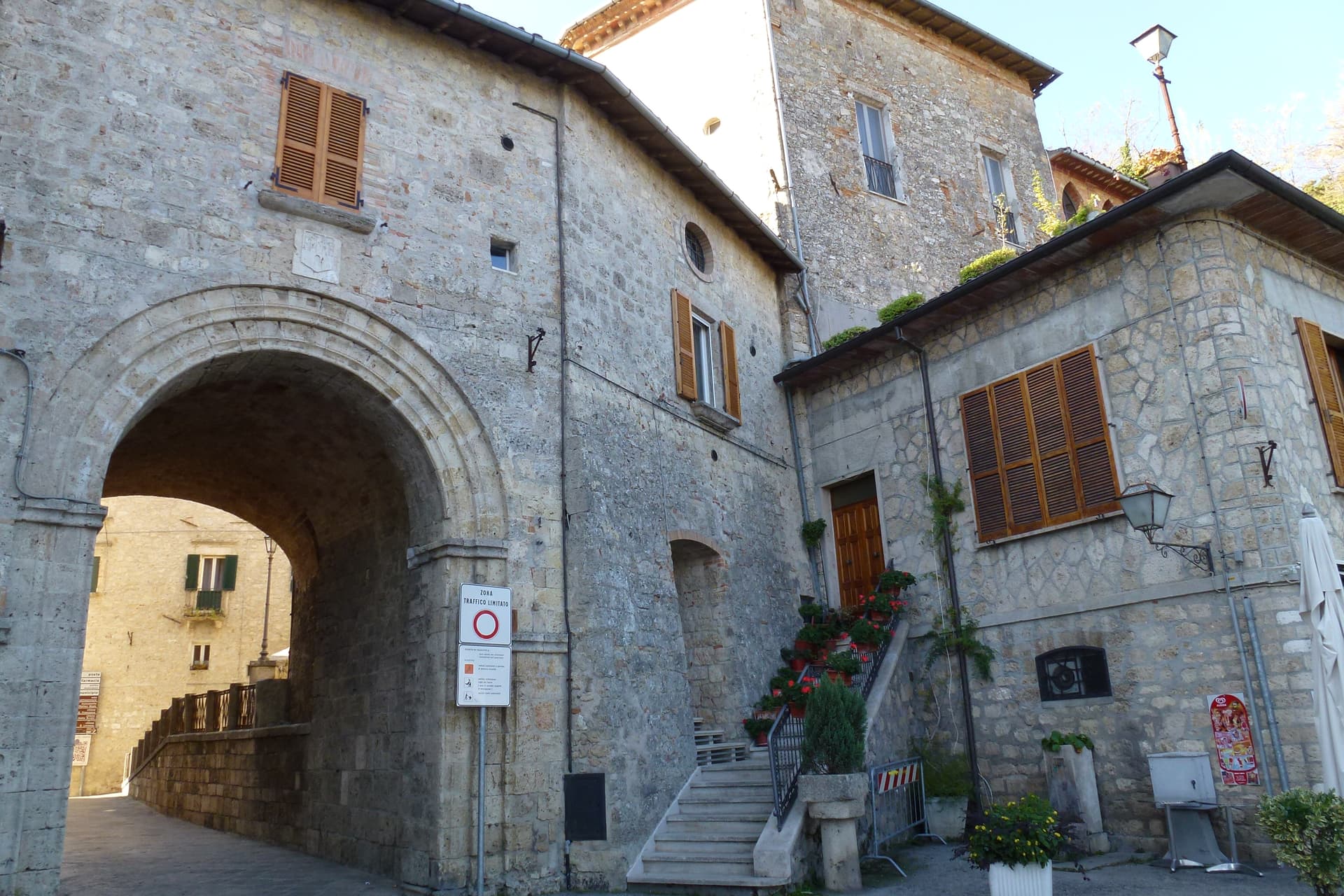
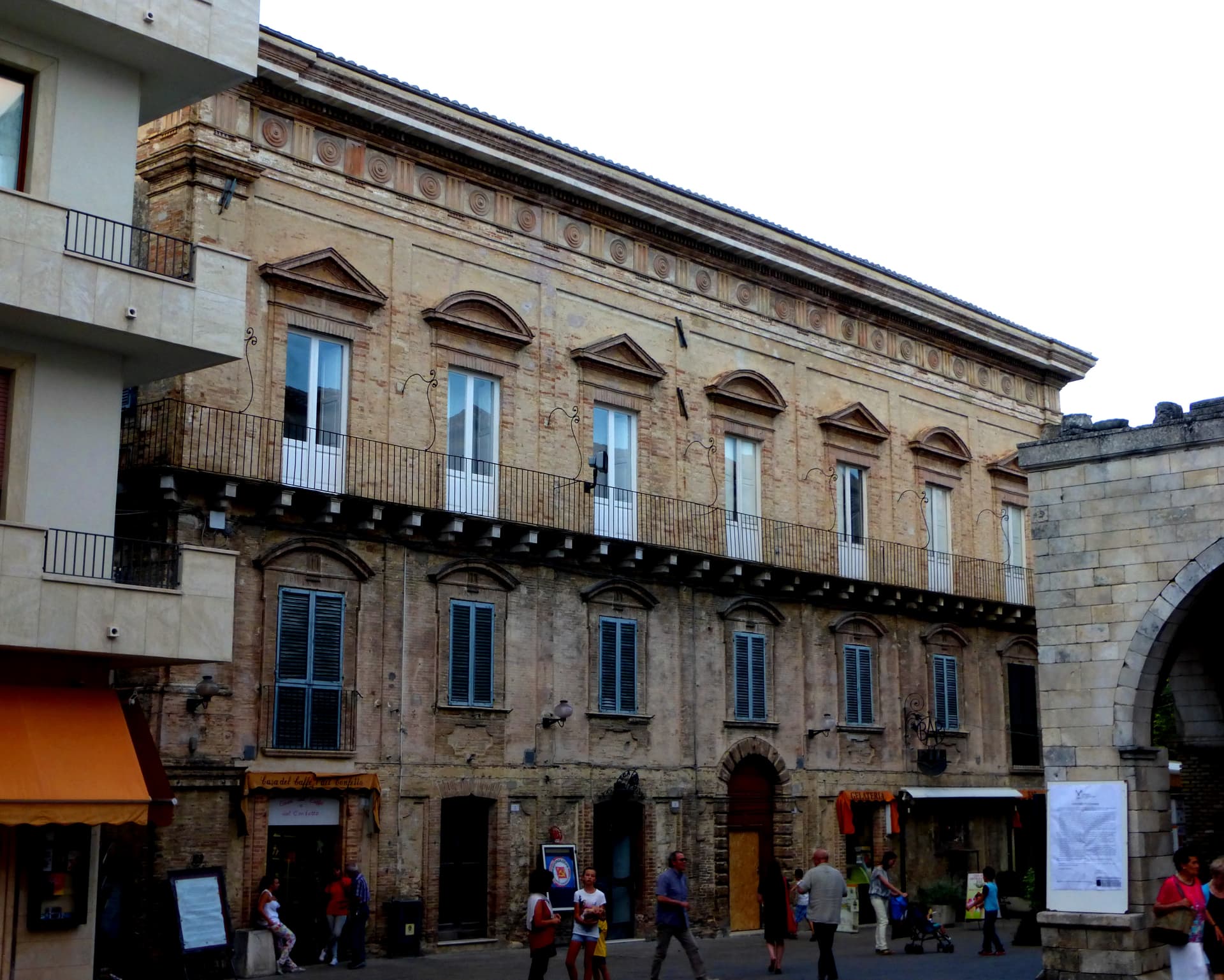
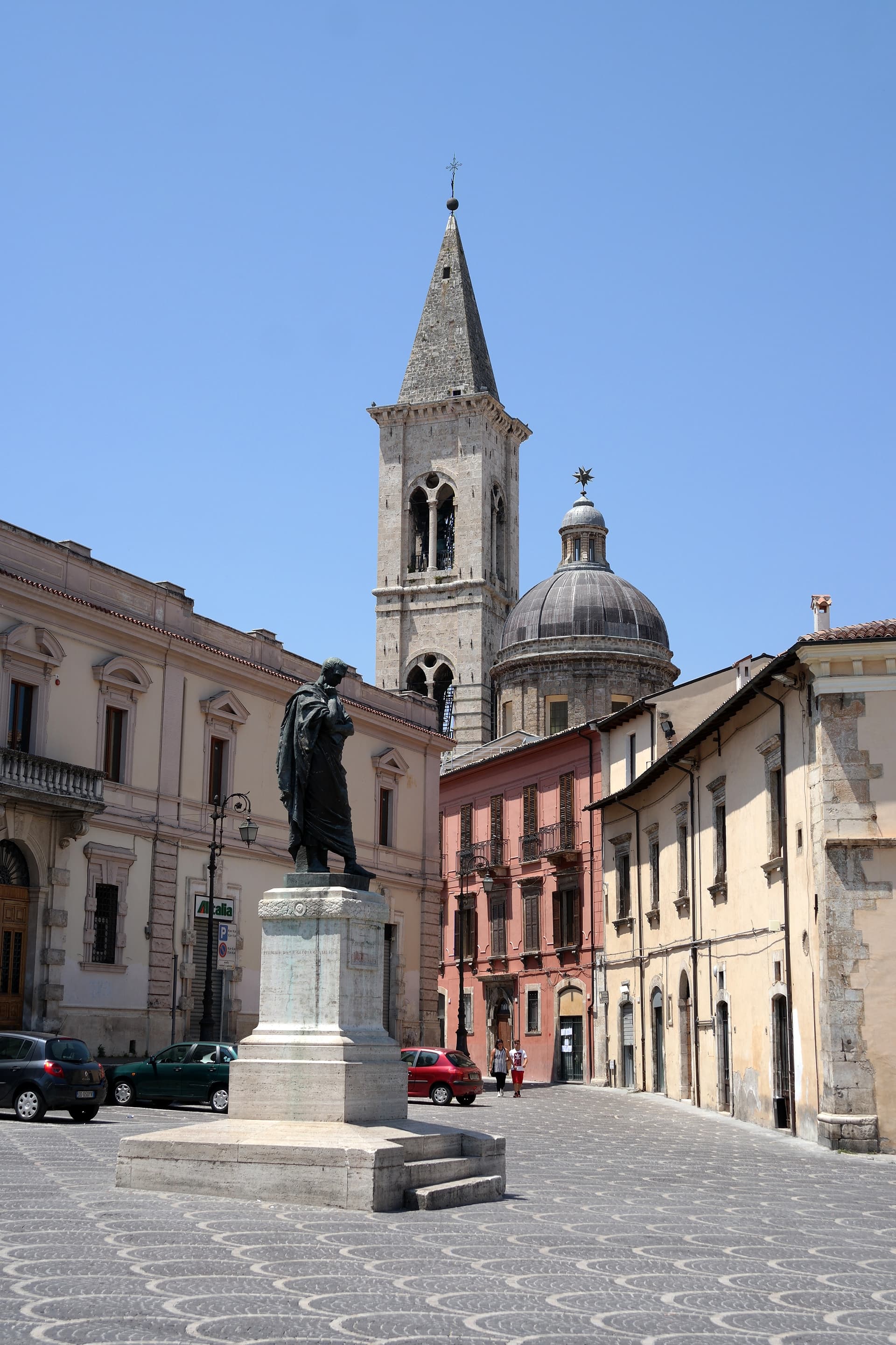
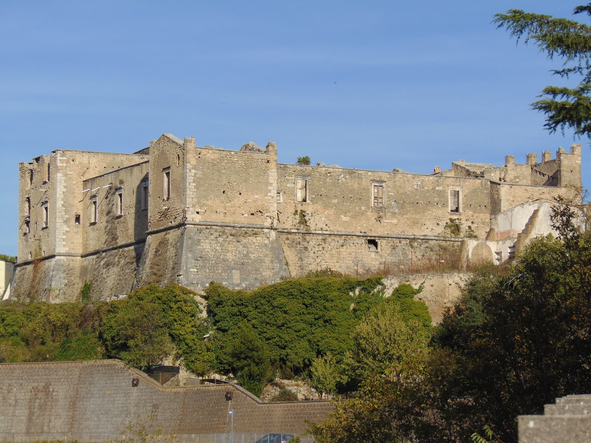
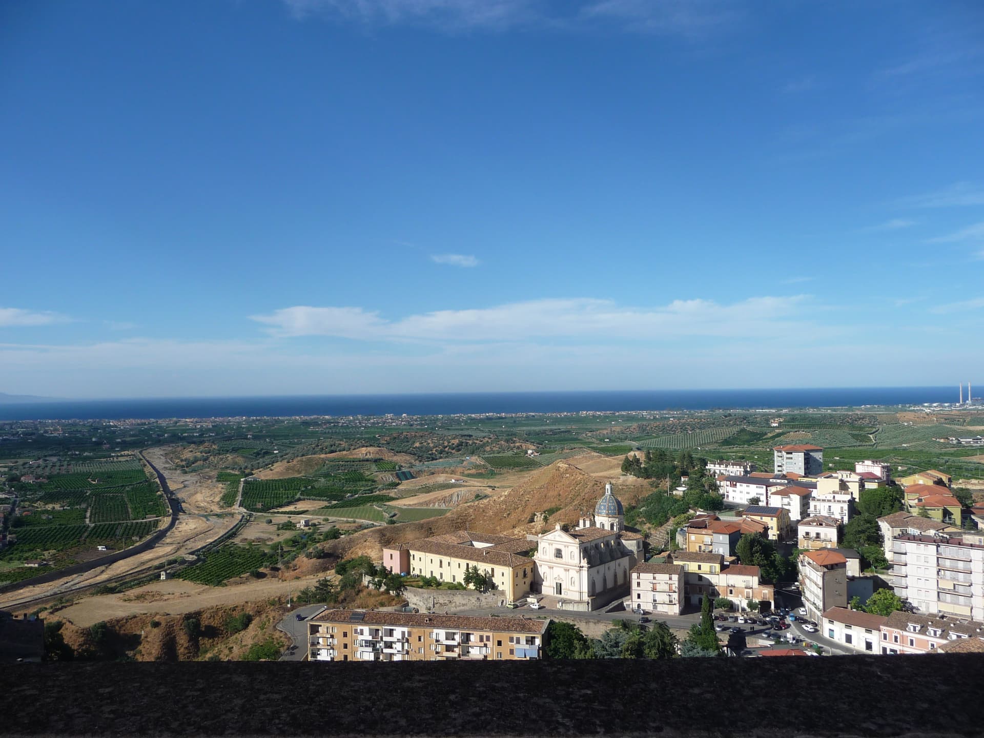
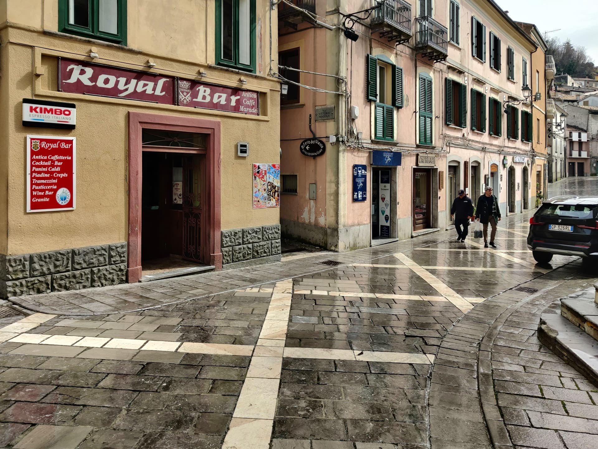
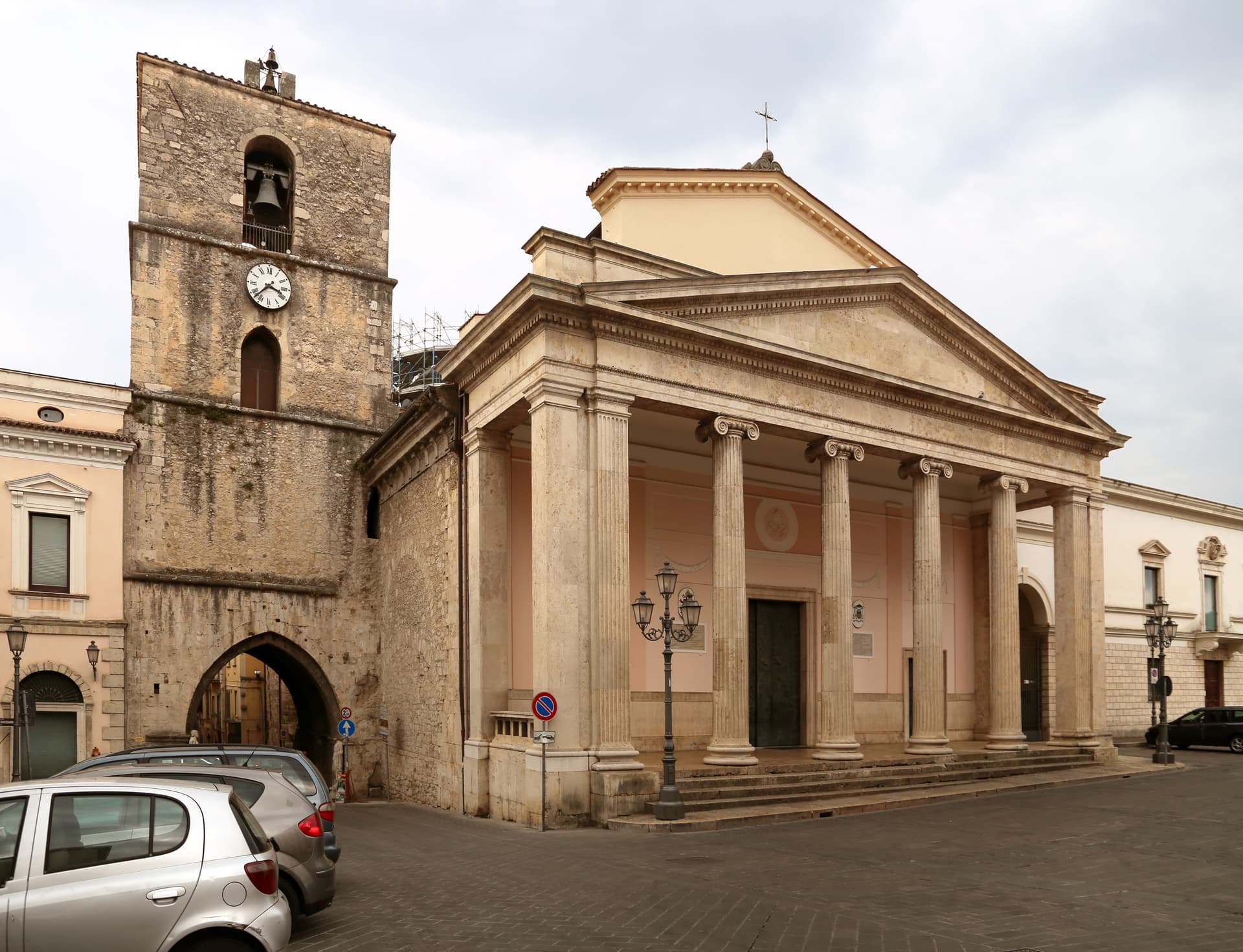
L'Aquila
Province: L'Aquila · 721 m
The regional capital at 721 meters under the Gran Sasso, founded by Frederick II around 1240 and still reconstructing after the 2009 earthquake.
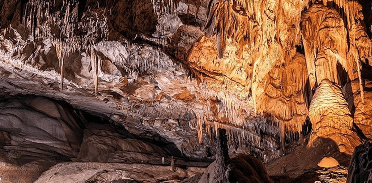
Lama dei Peligni
Province: Chieti · 669 m
A 669-meter Majella village known for chamois, the Cavallone cave, and a prehistoric burial dug from Fonterossi dated 7000 to 5000 BC.
Manoppello
Province: Pescara · 257 m
A hill town at 257 meters above the Pescara river, custodian since 1620 of the byssus veil known as the Volto Santo.
Ofena
Province: L'Aquila · 531 m
A 531-meter Vestian basin called the Forno d'Abruzzo, sealed by the Gran Sasso wall, where Montepulciano ripens on what may be the oldest of its slopes.

Pacentro
Province: L'Aquila · 650 m
A medieval village at 650 meters under the Caldora castle towers, where every September a barefoot race honors a Madonna and a pop singer's grandparents.
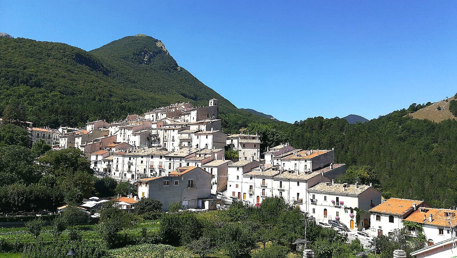
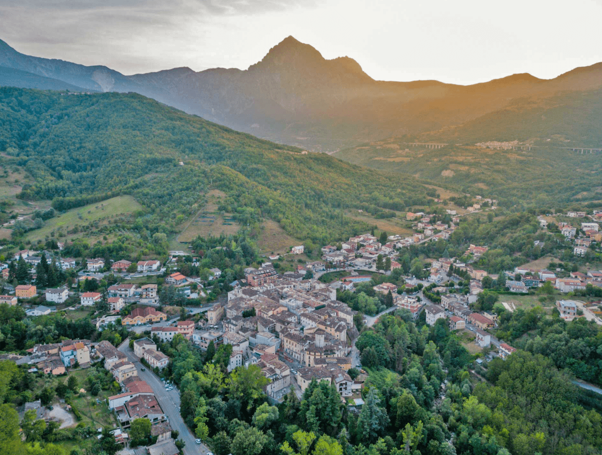
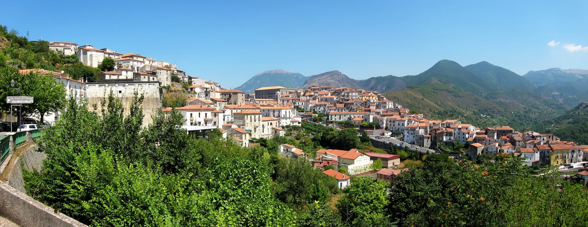
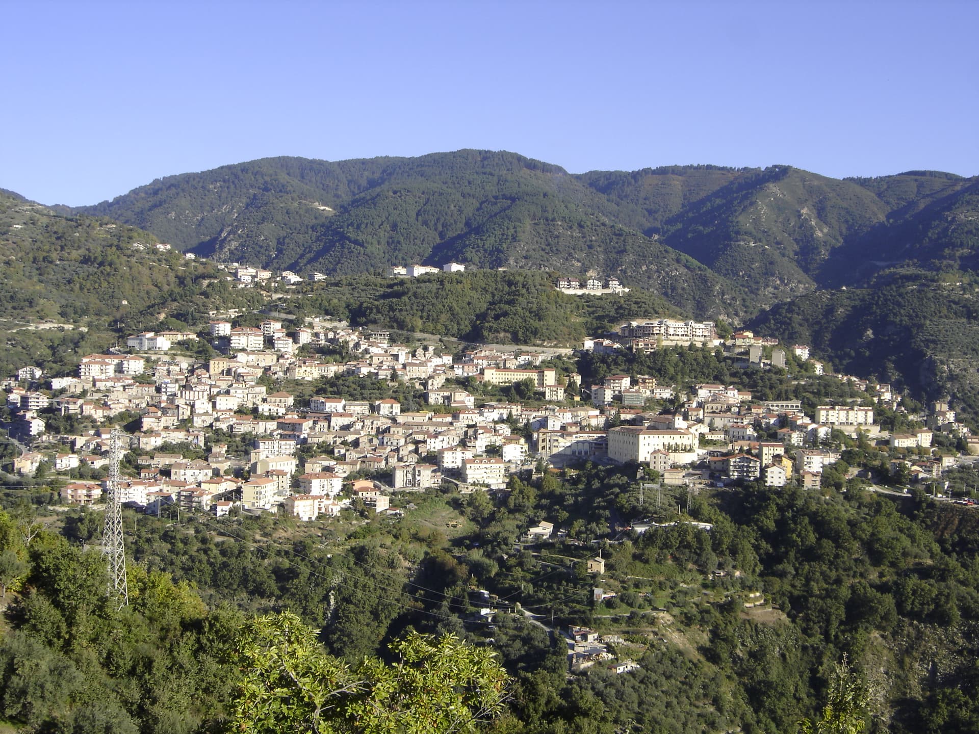
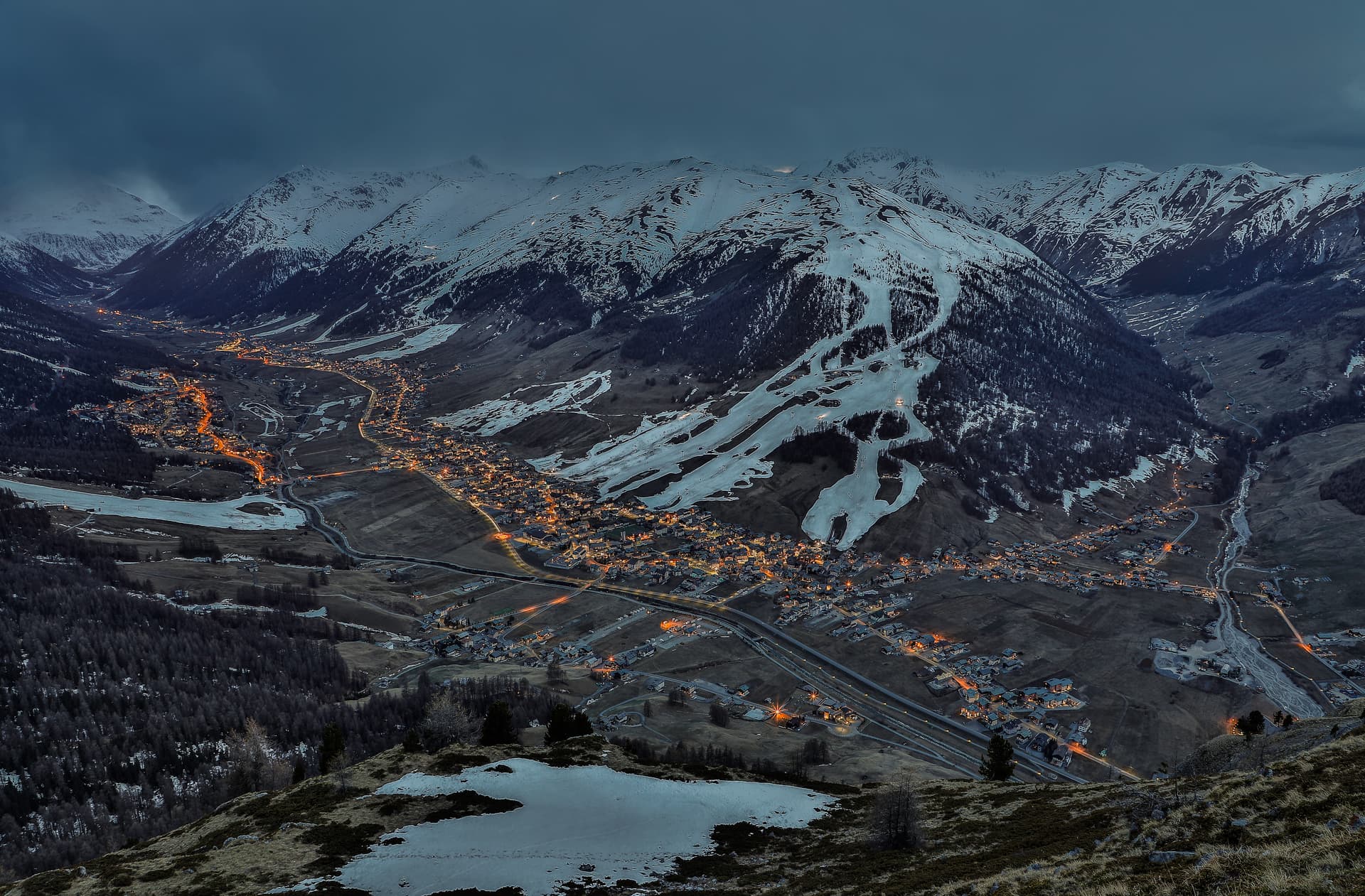
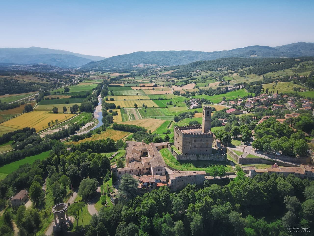
Pescasseroli
Province: L'Aquila · 1,167 m
At 1,167 meters at the head of the Sangro valley, capital of Italy's oldest national park and birthplace of Benedetto Croce.
Pescocostanzo
Province: L'Aquila · 1,395 m
A planned Renaissance town at 1,395 meters on the Quarto Grande plateau, with bobbin lace, wrought iron, and the wood ceilings of a five-nave church.
Pettorano sul Gizio
Province: L'Aquila · 656 m
At 656 meters above the Gizio river, a Cantelmo fortress town that guarded the gateway to the Peligna valley for four hundred years.
Pietracamela
Province: Teramo · 1,005 m
A village of 218 people clinging at 1,005 meters under the north wall of Corno Piccolo, birthplace of Italian Apennine climbing in 1925.
Pretoro
Province: Chieti · 530 m
A village of 856 stacked at 530 meters on the eastern Maiella, with wolves in a fenced enclosure and woodturners still working on Via Roma.
Rivisondoli
Province: L'Aquila · 1,320 m
At 1,320 meters on the Cinque Miglia plateau, paired with Roccaraso in the Alto Sangro ski domain and known for its Epiphany living nativity.
Roccacasale
Province: L'Aquila · 450 m
A village of 597 on the slopes of Monte Morrone, under the ruins of a Cantelmo-De Sanctis castle blown up by Napoleon's army in 1803.
Roccamorice
Province: Pescara · 520 m
A village at 520 meters in the Majella foothills, gateway to the rock-cut hermitages where Pietro da Morrone lived before becoming Pope Celestine V.
Roccaraso
Province: L'Aquila · 1,236 m
At 1,236 meters in the Alto Sangro, the south of Italy's largest ski resort, leveled by the Gustav Line in 1943 and rebuilt from rubble.
Santo Stefano di Sessanio
Province: L'Aquila · 1,250 m
A Medici outpost at 1,250 meters on the southern edge of Campo Imperatore, restored building by building since 1999 into Italy's first scattered hotel.
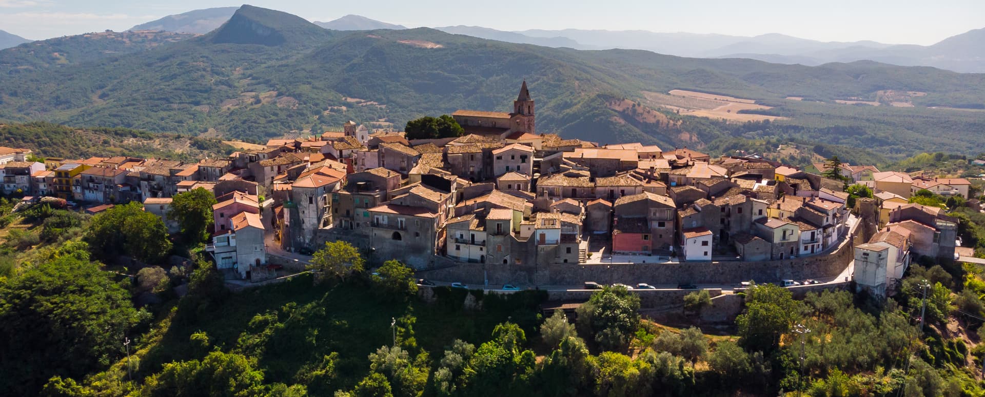
Scanno
Province: L'Aquila · 1,057 m
A 1,057-meter Sagittario valley village photographed by Cartier-Bresson and Giacomelli, where women in black still walk the same alleys as the 1957 series.
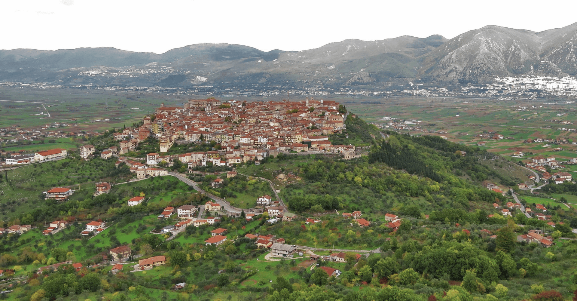
Sulmona
Province: L'Aquila · 405 m
At 405 meters in the Valle Peligna, birthplace of Ovid in 43 BC and home of the sugared-almond confetti industry since the 14th century.
Tocco da Casauria
Province: Pescara · 356 m
A 356-meter hill town between the Pescara river and the Maiella, built around a Carolingian abbey and an herb liqueur called Centerba.
Villetta Barrea
Province: L'Aquila · 975 m
At 975 meters on the shore of Lake Barrea, a village inside the Abruzzo National Park where red deer walk the streets alongside residents.
Aosta Valley2
Aymavilles
Province: Aosta Valley · 646 m
Gateway to the Gran Paradiso at 646 metres, with a four-towered Challant castle and a 3 BC Roman aqueduct above the Grand'Eyvia.
Cogne
Province: Aosta Valley · 1,534 m
The mining town turned capital of the Gran Paradiso, the Aosta Valley's largest commune with 95 percent of its land inside Italy's oldest park.
Apulia13
Andria
Province: Barletta-Andria-Trani · 151 m
Frederick II's favourite Apulian city, the birthplace of burrata, with the octagonal Castel del Monte rising 540 meters above the Murge eighteen kilometers south.
Cassano delle Murge
Province: Bari · 341 m
A Murge foothills town at 341 meters at the gate of the Alta Murgia park, with the 1,300-hectare Foresta Mercadante mostly inside its territory.
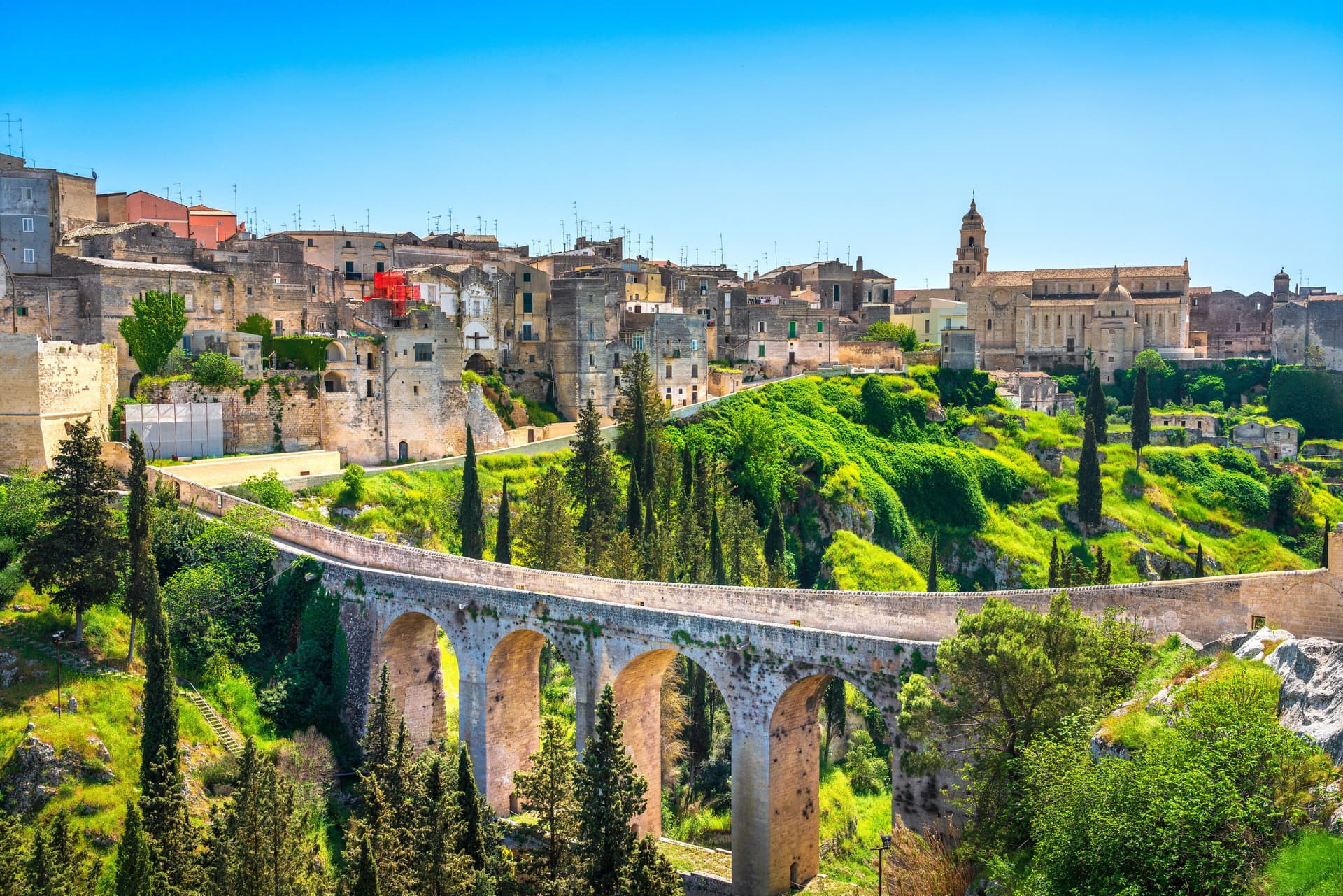
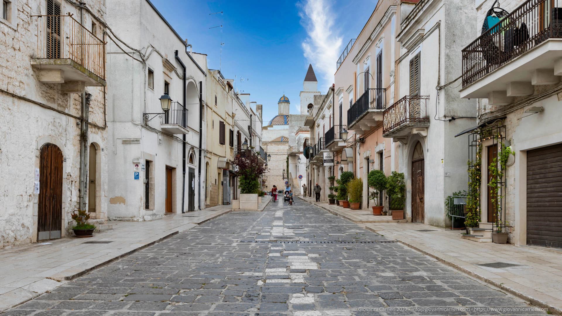
Gravina in Puglia
Province: Bari · 350 m
Puglia's deepest gravina — a 42,700-resident Bari-province town built on the lip of a 100m-deep limestone canyon, with the 18th-c Ponte Acquedotto walkway across the gorge that James Bond crossed in No Time to Die, a network of rupestrian cave churches in the cliff face, and the four-signal BPB + Cittaslow + Via Francigena + Parco Nazionale combination.
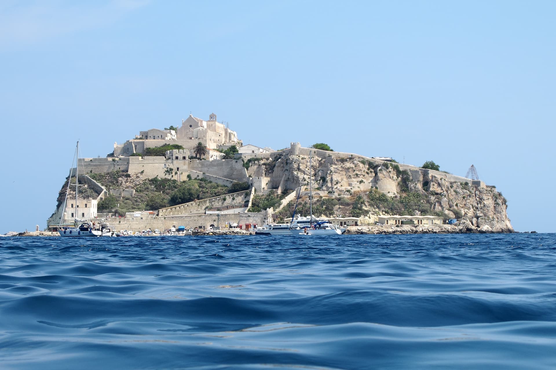
Isole Tremiti
Province: Foggia · 116 m
An Adriatic archipelago of five islands twenty-two kilometers off the Gargano, the only Italian commune scattered across an open-sea group.
Mattinata
Province: Foggia · 75 m
The only Apulian town that faces south on the Adriatic, the white amphitheater of the eastern Gargano with the Zagare sea stacks below.
Minervino Murge
Province: Barletta-Andria-Trani · 445 m
The Balcone di Puglia at 445 meters on the Alta Murgia, between the Ofanto valley and Monte Vulture, inside the national park.
Monte Sant'Angelo
Province: Foggia · 843 m
The Gargano peak at 843 meters where the Archangel Michael appeared in 490, the oldest western shrine to him, UNESCO since 2011.
Peschici
Province: Foggia · 91 m
A Gargano cliff-top village above the Adriatic with a Norman castle of 1023, white houses spilling toward the sea and trabucchi on the headlands.
Poggiorsini
Province: Bari · 461 m
The smallest commune in metropolitan Bari, an Orsini estate of 1609 that became an independent town only in 1957.
Rodi Garganico
Province: Foggia · 42 m
A Gargano promontory town above the Adriatic, citrus capital of the peninsula, with DOP oranges and lemons grown since the Middle Ages.

San Giovanni Rotondo
Province: Foggia · 565 m
The Gargano town where Padre Pio lived for fifty-two years, second-largest pilgrimage site in Italy, with a Renzo Piano sanctuary that seats 6,500.
Vico del Gargano
Province: Foggia · 445 m
A Gargano hill town at 445 meters with a Norman castle, a kiss alley, and DOP citrus groves stepping down to the Adriatic.

Vieste
Province: Foggia · 43 m
The Gargano headland of whitewashed alleys on a white limestone cliff, with the Pizzomunno sea stack standing 26 meters offshore.
Basilicata9
Calvello
Province: Potenza · 730 m
A 730-meter ceramic town at the foot of Monte Venturino, working clay since 1200 when Benedictines from Faenza brought the wheel south.
Lagonegro
Province: Potenza · 666 m
A 666-meter Valle del Noce town founded by Byzantine monks, where local legend places the burial of Lisa del Giocondo, Leonardo's Mona Lisa.
Latronico
Province: Potenza · 888 m
A mountain town at 888 meters on the northern edge of the Pollino, with two prehistoric thermal springs at the Calda hamlet below.
Rivello
Province: Potenza · 479 m
A 479-meter ridge above the Noce valley where Lombards and Byzantines lived side by side, holding Latin and Greek rites until the seventeenth century.
Rotonda
Province: Potenza · 626 m
The Pollino park's Lucanian gateway — a 3,171-resident borgo at 626m on the Basilicata/Calabria border, headquartered HQ for the Parco Nazionale del Pollino (Italy's largest national park), with the Fagiolo Bianco Poverello + Melanzana Rossa di Rotonda DOP slow-food products, the Borgo Autentico mark, and the Loricato pine forests immediately above town.
Sasso di Castalda
Province: Potenza · 949 m
A 949-meter village in the Lucanian Apennines whose emigrants produced the engineer who launched Apollo 11, now crossed by a 300-meter Tibetan footbridge.
Terranova di Pollino
Province: Potenza · 926 m
At 926 meters on the Lucanian side of the Pollino, the gateway into Italy's largest national park, home of the Sarmento red potato.
Valsinni
Province: Matera · 250 m
Isabella Morra's tragic castle — a 1,344-resident Lucanian borgo on a hilltop above the Sinni river, with the 11th-c Castello Morra where the 16th-c Renaissance poet Isabella Morra was murdered by her brothers in 1545, a Touring Club Bandiera Arancione + Pollino park signal, and the annual Parco Letterario festival reading her poems in the rooms where she wrote them.
Viggiano
Province: Potenza · 975 m
A 975-meter Val d'Agri ridge town, home of the Black Madonna of Lucania and the Italian folk harp, on Europe's largest onshore oil field.
Calabria16
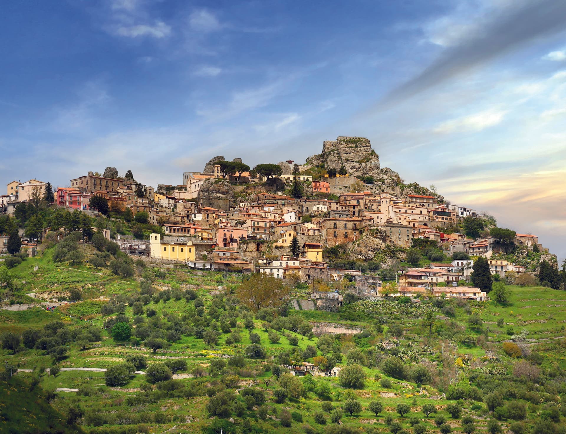
Aieta
Province: Cosenza · 524 m
An eagle's-nest village in the western Pollino, with one of the few sixteenth-century Renaissance palazzi standing in Calabria.
Alessandria del Carretto
Province: Cosenza · 1,043 m
The highest village in the Pollino at 1,043 meters, the only Italian commune carrying its founder's full name, with a fir-tree ritual every 3 May.
Belvedere Marittimo
Province: Cosenza · 150 m
A Riviera dei Cedri town on the Tyrrhenian, its Aragonese castle on the highest coastal hill and the relics of San Valentino in the Capuchin convent for three centuries.
Bova
Province: Reggio di Calabria · 820 m
The capital of the Bovesìa — a 416-resident Aspromonte hilltop borgo at 820m that is the cultural centre of the Grecanic minority, where the Calabrian-Greek dialect (a direct descendant of Byzantine-era Greek) is still spoken by elders, with the triple Borghi più belli + Bandiera Arancione + Parco Nazionale dell'Aspromonte signal.
Cerchiara di Calabria
Province: Cosenza · 650 m
A Città del Pane at 650 meters under Mount Sellaro, with a rock sanctuary at 1,015 meters and a sulphurous Cave of the Nymphs feeding the thermal springs.
Corigliano-Rossano
Province: Cosenza · 219 m
The Sibari plain city merged in 2018, home of the UNESCO-listed sixth-century Codex Purpureus and the 1731 Amarelli liquorice dynasty.
Gerace
Province: Reggio di Calabria · 470 m
A 470-meter conglomerate rock above Locri, founded by Locri Epizefiri refugees, with Calabria's largest cathedral on Roman columns from Magna Graecia temples.
Laino Borgo
Province: Cosenza · 582 m
Southern Italy's only Sacro Monte, sixteen pilgrimage chapels begun in 1557, on the Lao river canyon that made it Calabria's rafting capital.
Morano Calabro
Province: Cosenza · 694 m
A conical hill of stone houses stacked under a Norman-Swabian castle at the southern gate of the Pollino, called Italy's nativity village.
Mormanno
Province: Cosenza · 840 m
A Pollino mountain borgo at 840 meters between the Costa and Vernita ridges, known for lentils, white poverelli beans and the bocconotto pastry.
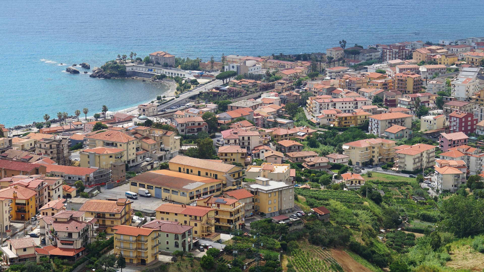
Praia a Mare
Province: Cosenza · 10 m
A Tyrrhenian beach town in the Gulf of Policastro, between the Pollino National Park and the 33-hectare Isola di Dino just offshore.
San Giovanni in Fiore
Province: Cosenza · 1,049 m
The capital of the Sila Grande at 1,049 meters, grown from the abbey Gioacchino da Fiore founded in 1188, Italy's most populated commune above a thousand.

Saracena
Province: Cosenza · 606 m
A 606-meter Pollino borgo named for its Saracen souk and protected by Slow Food for a passito Moscato traced to the sixteenth century.
Scilla
Province: Reggio di Calabria · 91 m
Homer's sea-monster headland on the Costa Viola, the Castello Ruffo on the cliff above Chianalea and the swordfish boats working the Strait below.
Spezzano della Sila
Province: Cosenza · 800 m
A Sila plateau borgo at 800 meters, the gateway to the national park and the Giants of the Sila above Lake Cecita.
Taverna
Province: Catanzaro · 530 m
The birthplace of Mattia Preti at the foot of the Sila Piccola, where the church of San Domenico holds eleven of the Cavaliere Calabrese's paintings.
Campania23
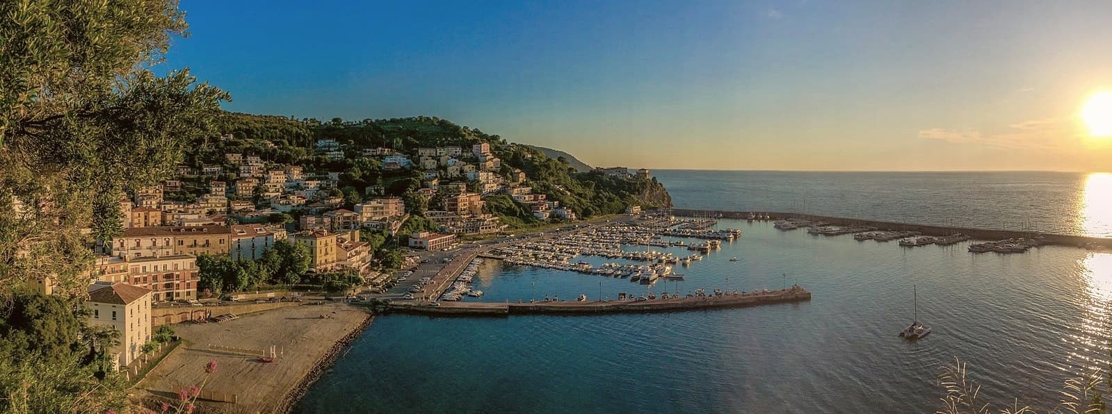
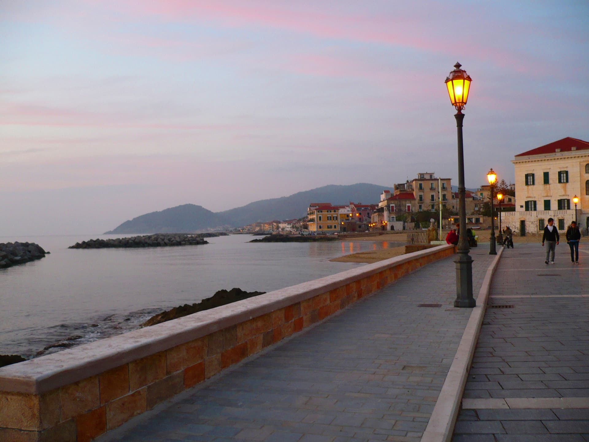
Agropoli
Province: Salerno · 24 m
The gateway commune of the Cilento, a Byzantine acropolis on a promontory taken by the Saracens in 882 as a base for raids on Salerno.
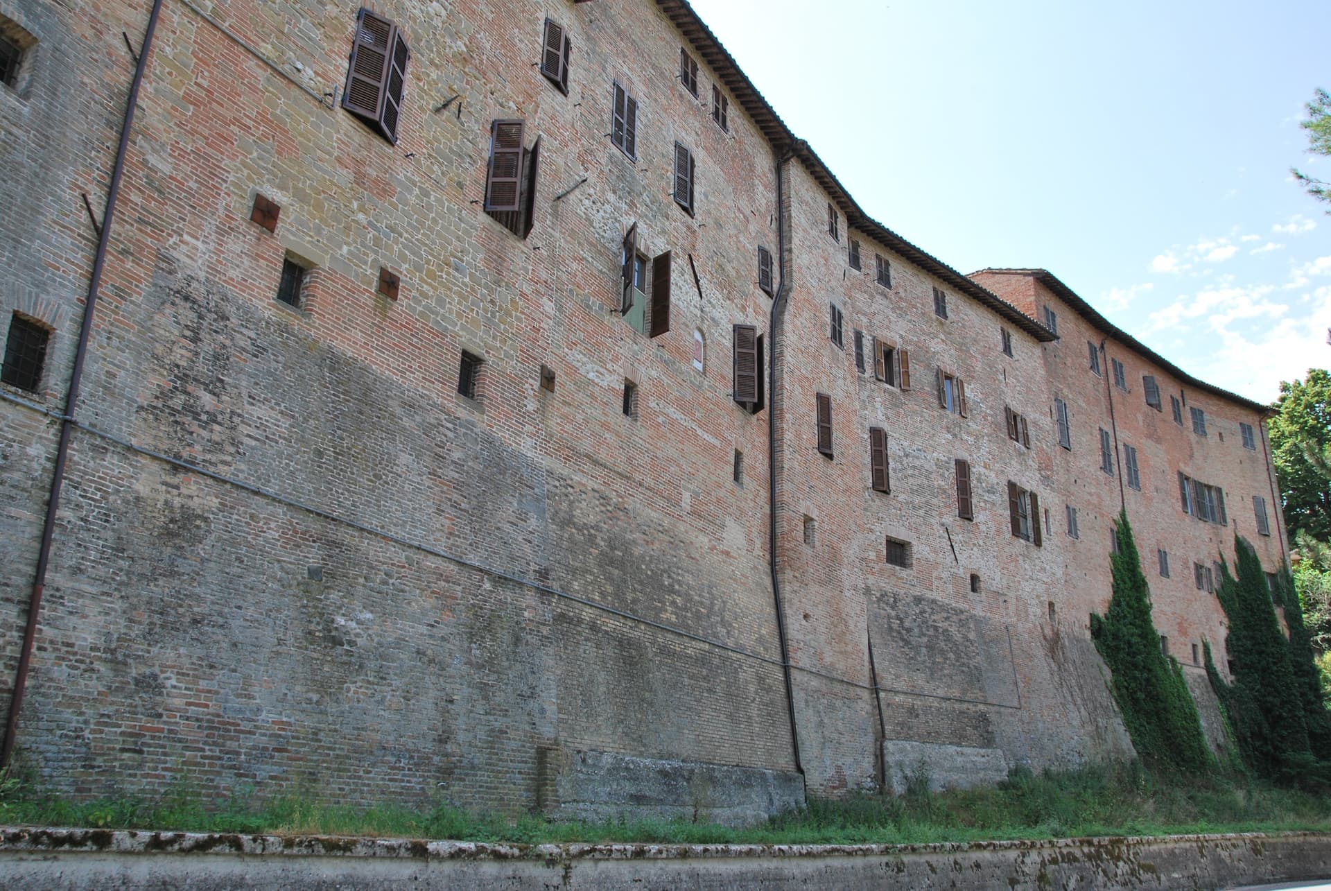
Alife
Province: Caserta · 110 m
A Roman walled town at the foot of the Matese, founded as a 326 BC oppidum, with Italy's fourth-largest amphitheatre still half-buried.
Ascea
Province: Salerno · 230 m
Two villages, a hilltown at 230 meters and a Cilento marina, with Parmenides and Zeno's Eleatic school in the ruins of Greek Velia below.
Auletta
Province: Salerno · 280 m
A Tanagro hill town above the Cilento-Vallo di Diano park, fortified by 1000 AD, scene of an 1861 anti-Piedmont massacre and an 1857 earthquake.
Camerota
Province: Salerno · 422 m
A Cilento hill of 422 meters above the Costa degli Infreschi, with prehistoric caves documenting Neanderthal occupation along the southern Tyrrhenian.
Capaccio Paestum
Province: Salerno · 419 m
Three Doric temples of 550 to 450 BC on the Sele plain, with mozzarella di bufala DOP on the buffalo flats below Monte Calpazio.
Castelcivita
Province: Salerno · 526 m
A small Alburni hill town at 526 meters in the Cilento national park, the surface entrance to a 4,800-meter karst cave inhabited 40,000 years ago.
Castellabate
Province: Salerno · 280 m
A 1123 abbot's castle on a 280-meter Cilento ridge, with a Bandiera Blu beach below and the Benvenuti al Sud film.
Centola
Province: Salerno · 336 m
A Cilento hill village at 336 meters whose seaside frazione, Palinuro, carries the helmsman of Aeneas and a Bandiera Blu coastline.
Cerreto Sannita
Province: Benevento · 290 m
A Sannio ceramics town at 290 meters, rebuilt from scratch by royal engineer Giovanni Battista Manni after the 1688 earthquake leveled the old hill.
Cusano Mutri
Province: Benevento · 475 m
A Sannio hill borgo at 475 meters on the south face of the Matese, the only town in the area spared by the 1688 earthquake.

Ercolano
Province: Napoli · 44 m
The smaller, denser, more intact Pompeii — Herculaneum was buried under 25m of pyroclastic mud (not ash) on 24 October AD 79, preserving wooden roofs, papyrus scrolls, and second-storey balconies that no other Roman site has, and the modern comune of Ercolano above it adds the Vesuvius National Park gateway and the 18th-c Bourbon Ville Vesuviane along the Miglio d'Oro.
Letino
Province: Caserta · 961 m
At 961 meters the highest commune in the province of Caserta, where in April 1877 anarchists declared a Republic of Letino in the village hall.

Morcone
Province: Benevento · 600 m
A Sannite hill town at 600 meters above the Tammaro valley, with 5th-century BC walls and the convent where Padre Pio took vows.
Morigerati
Province: Salerno · 340 m
A 608-person Cilento village above the Bussento gorge, the river surfacing from underground caves directly beneath the cliffs.
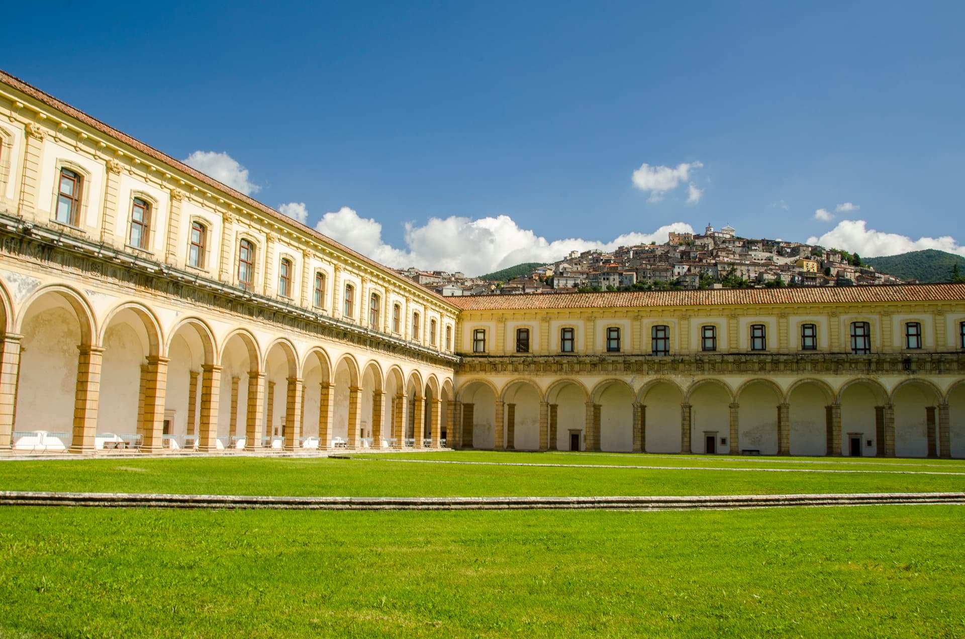
Padula
Province: Salerno · 699 m
A hill town at 699 meters above the Vallo di Diano, holding the Certosa di San Lorenzo and the world's largest cloister.

Perito
Province: Salerno · 480 m
A Cilento ridge town at 480 meters above the Alento valley, once a center of black-powder production for hunting, defense and brigands.
Pisciotta
Province: Salerno · 171 m
A Cilento hilltop town of olive terraces above the Tyrrhenian, where fishermen still pull anchovies with the medieval menaica net.
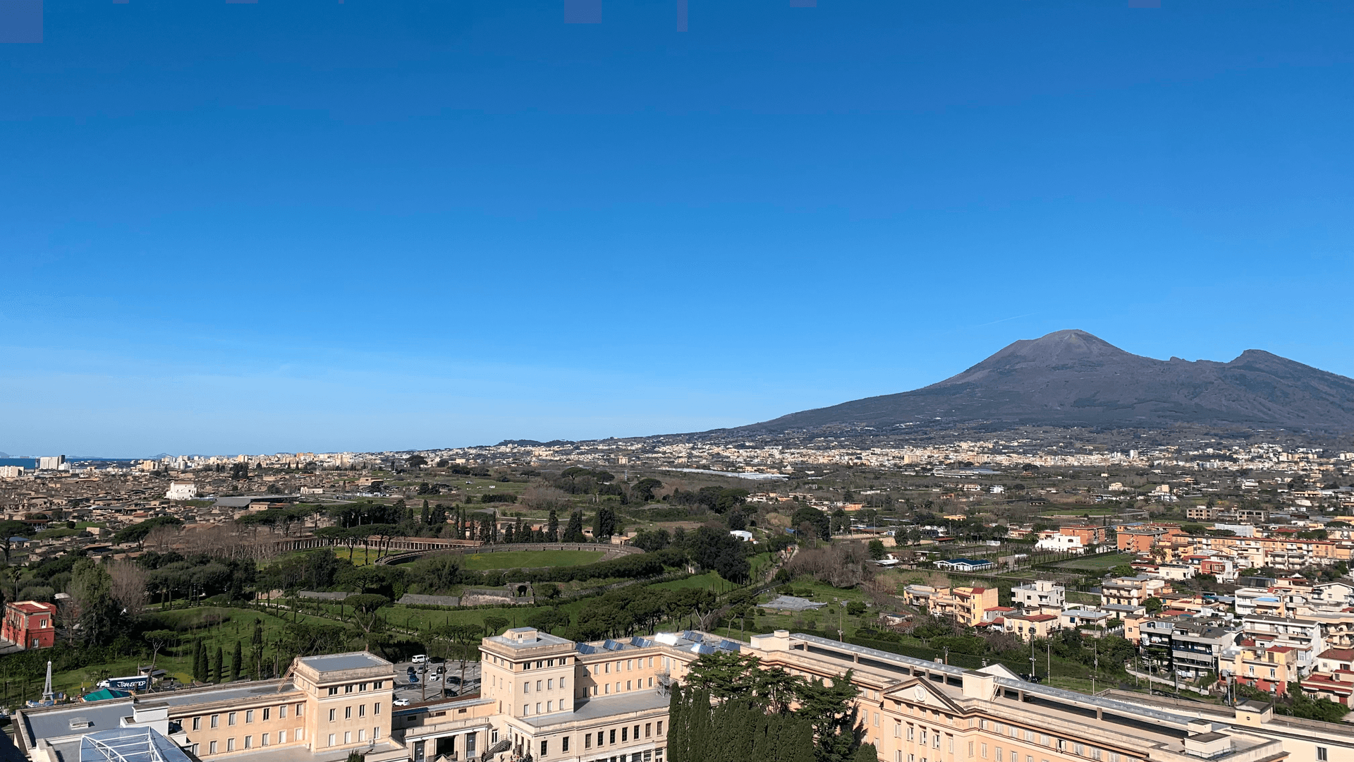
Pompei
Province: Napoli · 30 m
The Roman city buried by Vesuvius in 79 AD, dug back up since 1748, and a modern town around Bartolo Longo's 1876 sanctuary.
Roscigno
Province: Salerno · 570 m
A Cilento ghost town at 570 meters, emptied by a 1902 landslide and known as the Pompeii of the twentieth century.
Teggiano
Province: Salerno · 635 m
A ridge town at 635 meters above the Vallo di Diano, the ancient Tegianum that named the valley, held by the Sanseverino for three centuries.
Torre Annunziata
Province: Napoli · 15 m
Capital of Italian pasta in the interwar period and home of the Roman Villa di Poppea, on the bay at the foot of Vesuvius.
Trentinara
Province: Salerno · 606 m
A Cilento balcony at 606 meters on the Cantenna cliff, called the Terrazza del Cilento, with a 1,500-meter zipline that drops 170 meters toward Paestum.
Emilia-Romagna4
Bagno di Romagna
Province: Forlì-Cesena · 491 m
A 491-meter thermal town at the head of the Savio valley, drawing on springs that have run at 47 degrees since Roman times.
Corniglio
Province: Parma · 690 m
A 690-meter Parma-Apennine commune inside the Tosco-Emiliano park, with a thirteenth-century Rossi castle and the Lagdei plateau above.
Portico e San Benedetto
Province: Forlì-Cesena · 309 m
A three-tier medieval borgo at 309 meters on the Montone river, capital of Florence's Romagna territories from 1386.
Premilcuore
Province: Forlì-Cesena · 459 m
A 459-meter walled borgo on the Rabbi river, an entry point to the Foreste Casentinesi from the Romagna side.
Lazio6
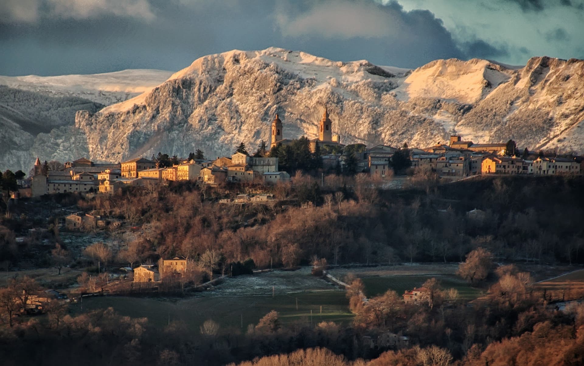
Amatrice
Province: Rieti · 955 m
A 955-meter Apennine town leveled by the 24 August 2016 earthquake, slowly rebuilding the streets that gave amatriciana its name.
Picinisco
Province: Frosinone · 725 m
A medieval village at 725 meters above the Val di Comino, the source of much of Italo-Scottish emigration and of Pecorino di Picinisco DOP.
Ponza
Province: Latina · 5 m
The main island of the Pontine archipelago — a volcanic crescent 40 km off Formia with the white tuff cliffs of Chiaia di Luna, the Roman fishpond tunnels at Pilato, Cala Feola's natural pools, and a 3,200-resident borgo curving around a horseshoe harbour painted in 18th-century Bourbon-pastel.
Sabaudia
Province: Latina · 17 m
A rationalist city built in 253 days on drained Pontine marshland, founded 15 April 1934 between Lago di Paola and the Tyrrhenian dunes.
San Donato Val di Comino
Province: Frosinone · 728 m
A medieval village at 728 meters at the gateway to Forca d'Acero, the pass into the Abruzzo National Park.
San Felice Circeo
Province: Latina · 100 m
A medieval borgo on the flank of Monte Circeo, the 540-meter promontory Homer made the home of Circe in the Odyssey.
Liguria4

Levanto
Province: La Spezia · 5 m
The sixth Cinque Terre, a beach town and Cittaslow at the gateway of the national park, with a surf break and a striped Gothic church.
- ✷ We've been

Monterosso al Mare
Province: La Spezia · 12 m
The westernmost and largest of the Cinque Terre, where Eugenio Montale spent the childhood summers that became Ossi di seppia in 1925.
- ✷ We've been

Riomaggiore
Province: La Spezia · 35 m
The easternmost of the Cinque Terre, 1,326 people stacked above a fishing inlet, terraced vineyards climbing 250 meters straight off the sea.
- ✷ We've been

Vernazza
Province: La Spezia · 3 m
The middle village of the Cinque Terre, the only one with a natural harbor, buried under four meters of mud in October 2011.
Lombardy3

Bormio
Province: Sondrio · 1,225 m
An Alpine spa town at 1,225 meters where three high passes meet and Roman thermal water has fed the baths for two thousand years.
Livigno
Province: Sondrio · 1,816 m
At 1,816 meters in the Italian Alps near the Swiss border, a duty-free ski valley that drains north into the Black Sea, not the Mediterranean.
Ponte di Legno
Province: Brescia · 1,257 m
The uppermost commune of Valle Camonica at 1,257 meters, where the two source streams of the Oglio meet under the Adamello range.
Marche6

Acquasanta Terme
Province: Ascoli Piceno · 392 m
A sulphur-spring spa at 392 meters in the upper Tronto valley, used for cures since the Roman consul Lucio Munazio Planco around 50 AD.
Amandola
Province: Fermo · 550 m
A Sibillini gateway at 550 meters on three hills above the Tenna valley, founded 1248 and damaged but not levelled in 2016.

Arquata del Tronto
Province: Ascoli Piceno · 777 m
At 777 meters between two national parks, the Marche commune levelled by the 2016 earthquakes and still rebuilding nine years on.
San Ginesio
Province: Macerata · 680 m
The Balcony of the Sibillini at 680 meters, with a 1295 pilgrim hospital and the only flowery gothic collegiate church in the Marche.

Valfornace
Province: Macerata · 441 m
A 909-resident Sibillini commune at 441 meters in the upper Chienti valley, born in 2017 from the merger of Pievebovigliana and Fiordimonte.
Visso
Province: Macerata · 607 m
The northern Sibillini gate at 607 meters where the Nera meets the Ussita, holding one of two surviving manuscripts of Leopardi's L'Infinito.
Molise8
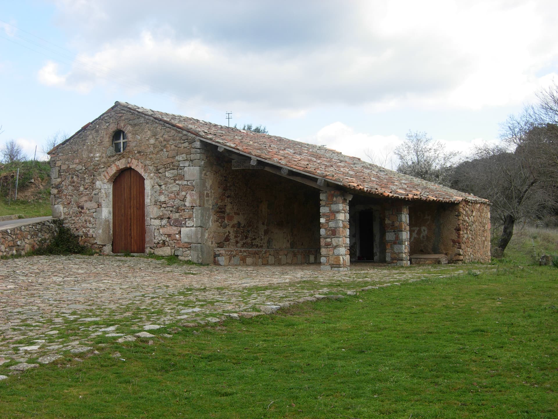
Castel San Vincenzo
Province: Isernia · 749 m
A 749-meter village near the Volturno source, sharing ground with one of medieval Europe's most powerful abbeys and a ninth-century frescoed crypt.
Fornelli
Province: Isernia · 530 m
A walled medieval borgo at 530 meters with seven towers and the birthplace of Nancy Pelosi's mother, eight kilometers west of Isernia.
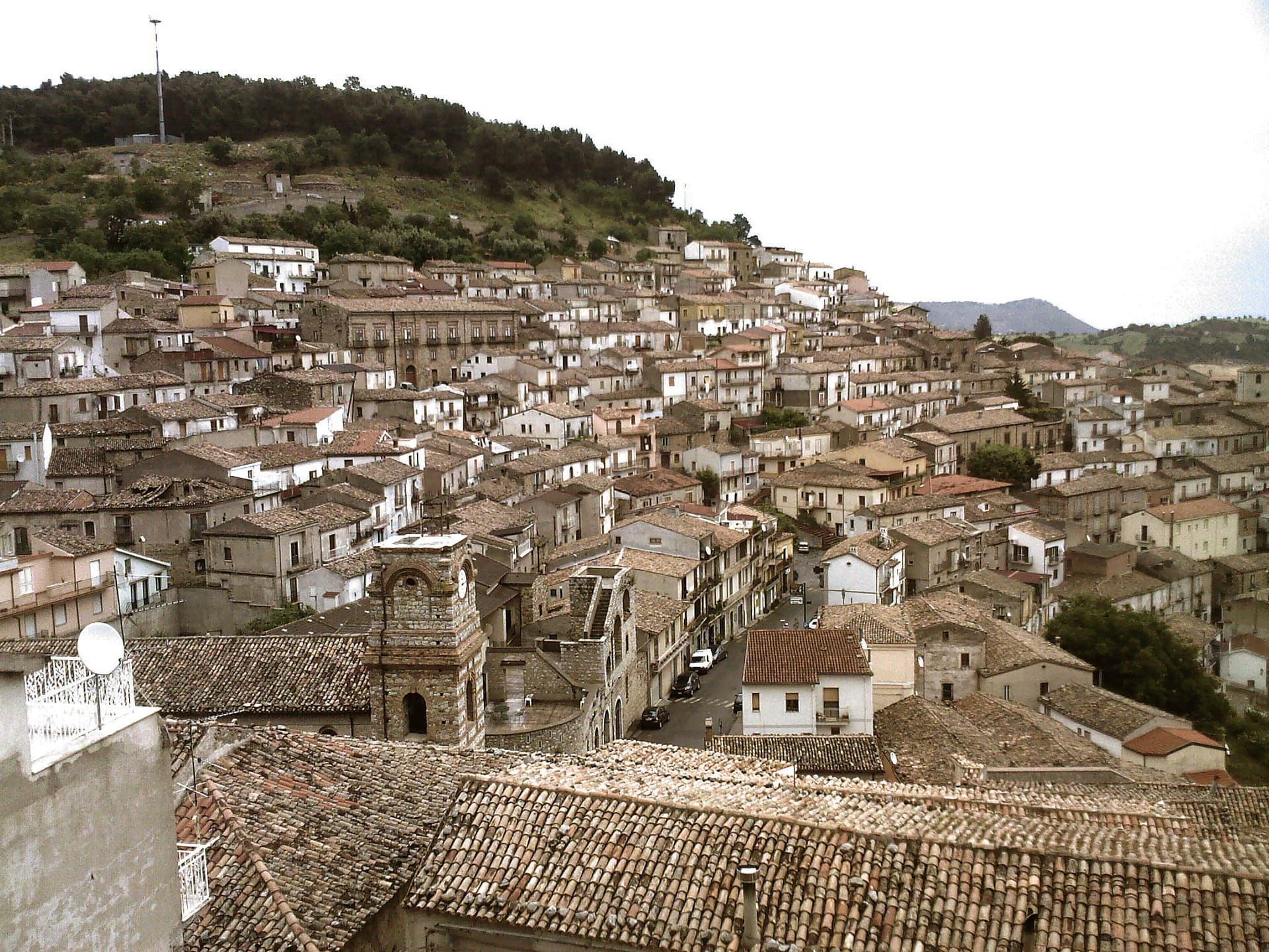
Isernia
Province: Isernia · 423 m
A provincial capital on a 423-meter rock spine, with a Paleolithic site dated 700,000 years and a thirteenth-century public fountain.
Pizzone
Province: Isernia · 724 m
A 313-person Mainarde village at 724 meters in the Molise sector of the Abruzzo, Lazio and Molise National Park, above the Volturno springs.
Roccamandolfi
Province: Isernia · 850 m
At 850 meters at the foot of Monte Miletto, a Matese village of brigand legends, Lombard ruins, and a Tibetan bridge over the Callora canyon.
Scapoli
Province: Isernia · 668 m
Italy's zampogna bagpipe capital — a 586-resident borgo in the Mainarde at 668m, with a centuries-old tradition of hand-building the zampogna (Italian bagpipe), an annual International Bagpipe Festival in July drawing players from Galicia, Scotland, Bulgaria, and 15+ other countries, and the Bandiera Arancione + Abruzzo, Lazio e Molise national park signals.
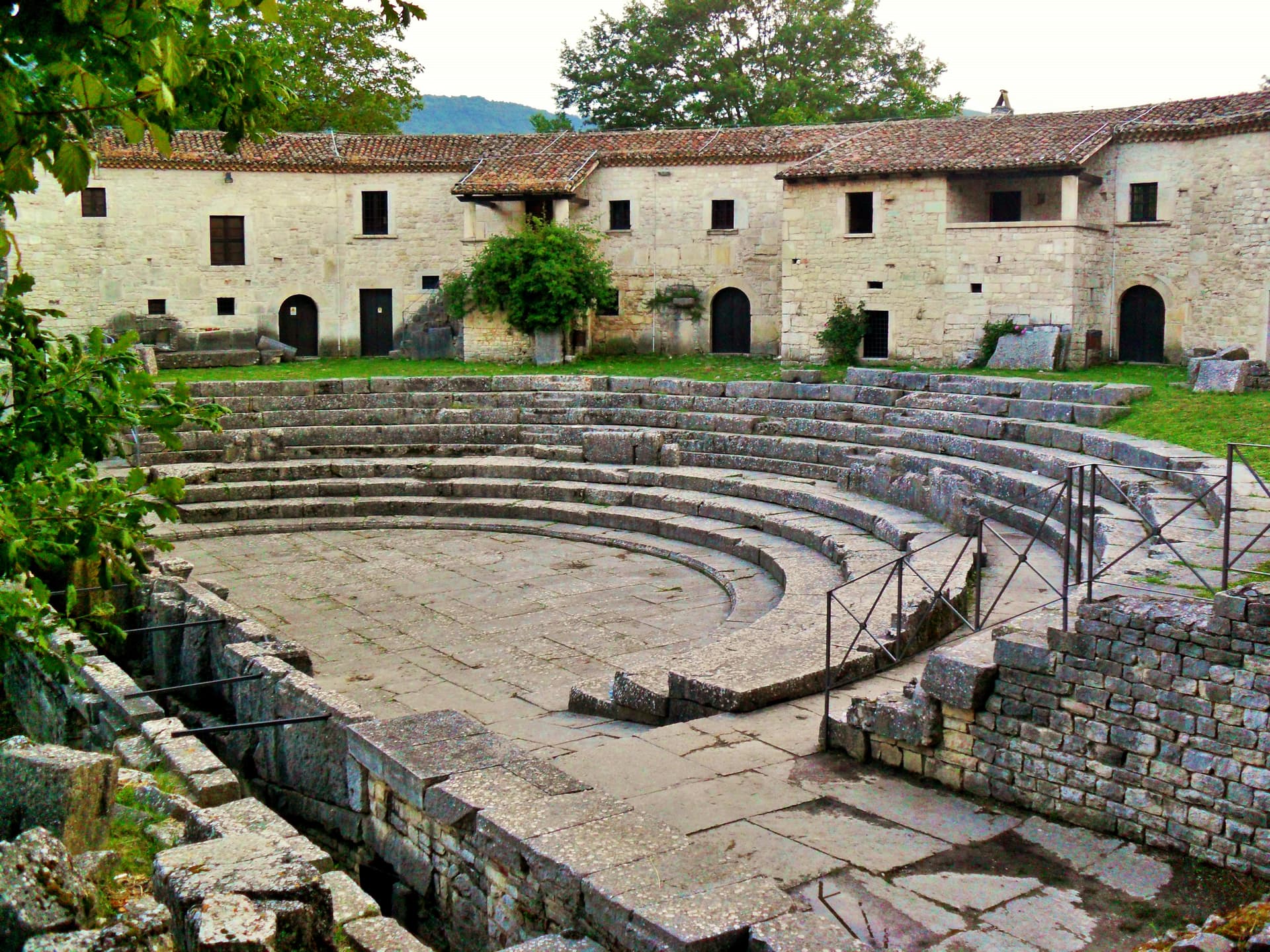
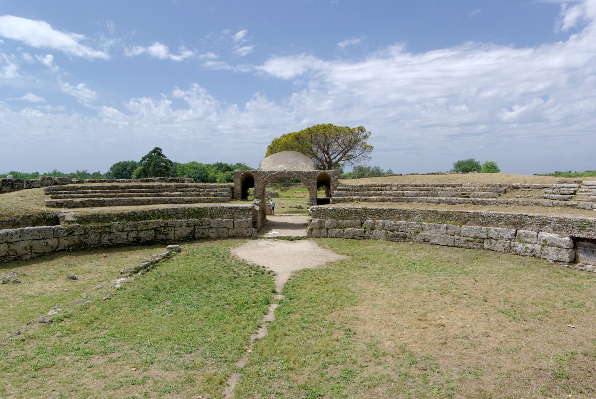
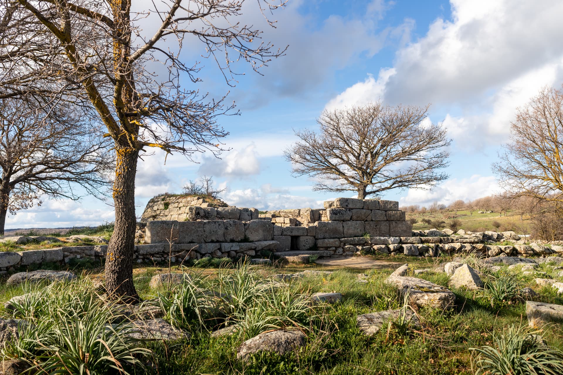
Sepino
Province: Campobasso · 698 m
A hilltop borgo at 698 meters at the foot of the Matese, two kilometers above the Roman Saepinum, the open-air city the sheep tracks built.
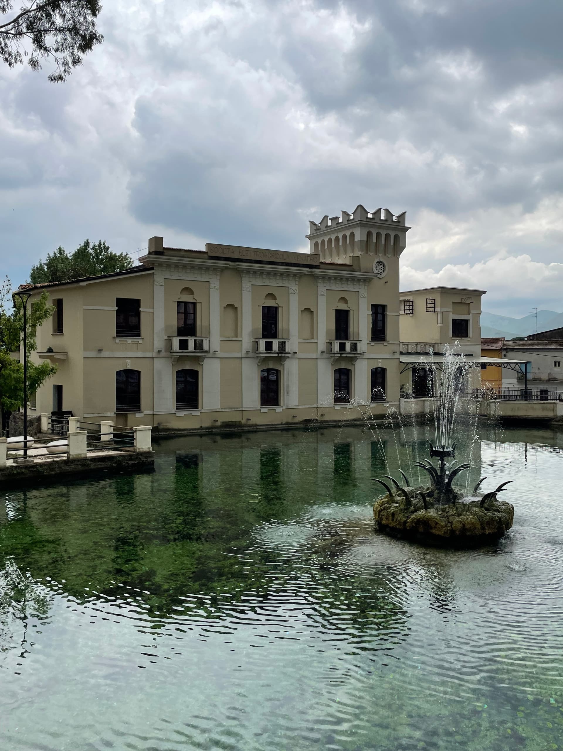
Venafro
Province: Isernia · 222 m
A 222-meter town near the Lazio border where Augustus founded a colony and Pliny called the olive oil the best in the Roman Empire.
Piedmont4
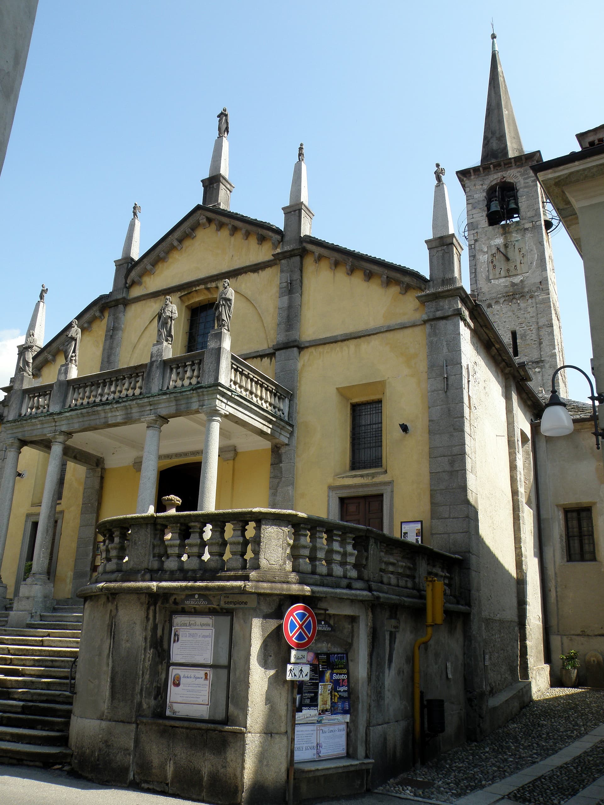
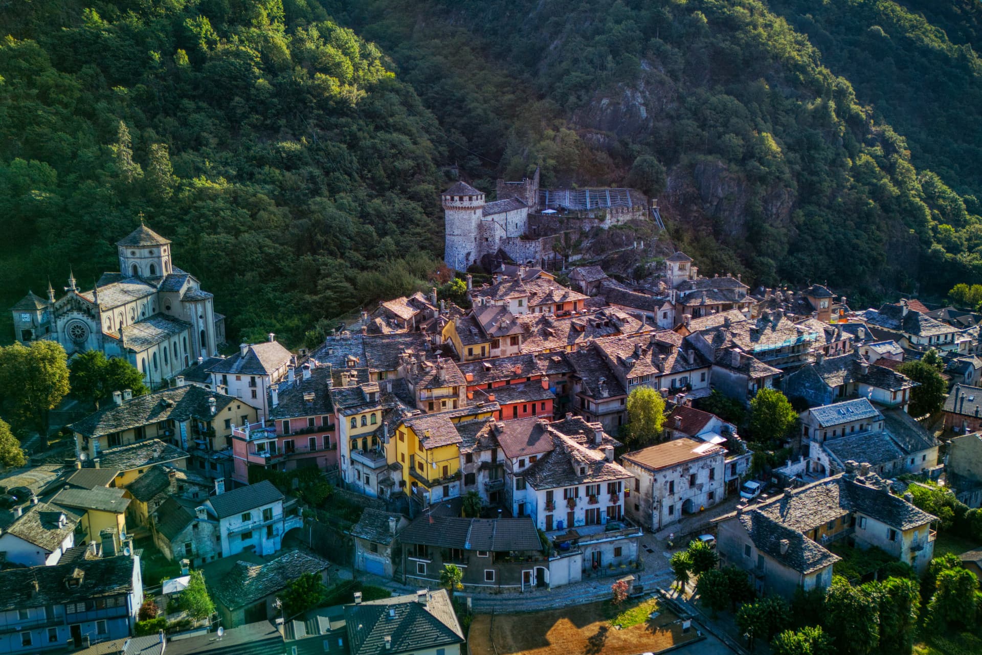
Mergozzo
Province: Verbano-Cusio-Ossola · 204 m
A 2.5-kilometer lake cut from Lago Maggiore by Toce flood sediments, with a centuries-old elm on its lakefront piazza.

Ornavasso
Province: Verbano-Cusio-Ossola · 215 m
A Toce-valley town at 215 meters, marble quarry for the Duomo di Milano and the southernmost Walser colony in the Ossola.

Ronco Canavese
Province: Torino · 956 m
A 271-inhabitant Francoprovenzale village at 956 meters in the Valle Soana, on the Piemonte side of the Gran Paradiso National Park.
Vogogna
Province: Verbano-Cusio-Ossola · 226 m
An Ossola medieval capital at 226 meters on the Toce, with a Visconti castle of 1348 and five centuries as seat of the Ossola Inferiore.
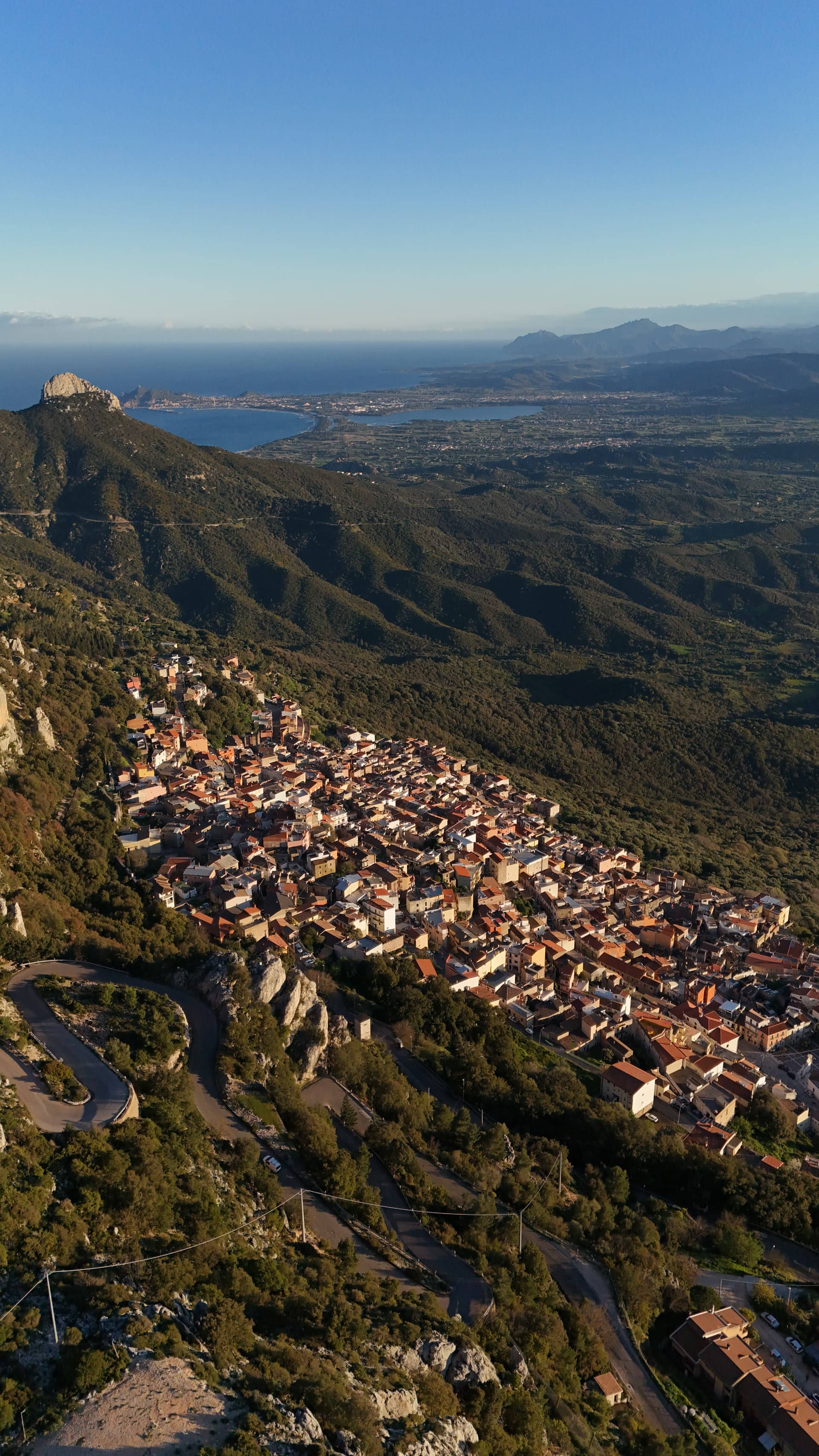
Sardinia9
Aritzo
Province: Nuoro · 800 m
A Mandrolisai mountain village at 800 meters in chestnut and hazelnut forest, where snow once travelled out in straw and came back as lemon sorbet.
Atzara
Province: Nuoro · 553 m
A Mandrolisai wine village on the western Gennargentu, painted in the early twentieth century by Spanish costumbristas and the Sardinian Scuola di Atzara.
Baunei
Province: Nuoro · 480 m
A village at 480 meters on the Monte Santo limestone ridge above the Gulf of Orosei, with Selvaggio Blu and Cala Goloritzé in its territory.

Dorgali
Province: Nuoro · 387 m
A Supramonte town at 387 meters with the coastal frazione Cala Gonone, the Tiscali Nuragic village, and the 400-meter walls of Su Gorropu.
Fonni
Province: Nuoro · 1,000 m
The highest village in Sardinia at 1,000 meters on the Gennargentu, with ski lifts to Bruncu Spina and the Madonna dei Martiri sanctuary.
Gavoi
Province: Nuoro · 777 m
A 777-meter Barbagia hilltop village above Lake Gusana with a Bandiera Arancione of the Touring Club, the country's most-attended summer literary festival (L'Isola delle Storie), and the PDO Fiore Sardo pecorino made here for at least three centuries.
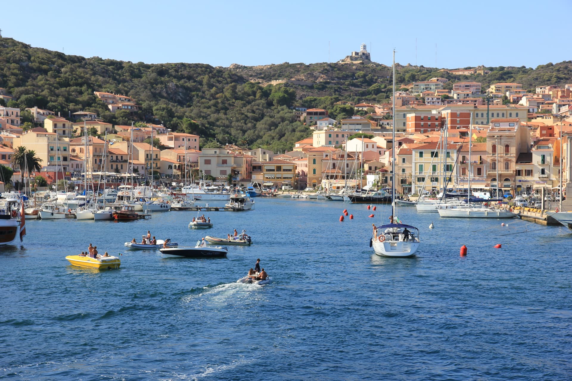
La Maddalena
Province: Sassari · 19 m
The only inhabited town of a sixty-island granite archipelago between Sardinia and Corsica, and the place Giuseppe Garibaldi chose to die.
Oliena
Province: Nuoro · 380 m
A Supramonte village at the foot of Monte Corrasi, source of Cannonau Nepente, base camp for Tiscali and the Lanaitto valley.

Orgosolo
Province: Nuoro · 620 m
A Barbagia village at 620 meters with over 150 political murals painted on its walls since the 1969 Pratobello revolt.

Trentino-Alto Adige/Südtirol1
Tuscany8

Capoliveri
Province: Livorno · 167 m
A medieval hill town at 167 meters on the eastern lobe of Elba, with 35 kilometers of coast and the iron mines of Monte Calamita below.
Capraia Isola
Province: Livorno · 19 m
A volcanic island of 370 residents and one village, the third largest of the Tuscan Archipelago, a penal colony from 1873 to 1986 and a national park since.
- ✷ We've been
Fivizzano
Province: Massa-Carrara · 373 m
Don't come for Fivizzano-the-town — come for the frazioni: Equi Terme with its thermal grotto-and-cave complex, Verrucola's intact Malaspina fortress, Gassano's mountain panorama, and a 264 km² Lunigiana commune covering 92 hamlets inside the Parco Nazionale dell'Appennino Tosco-Emiliano.
- ✷ We've been
Grosseto
Province: Grosseto · 10 m
The Maremma capital on the Ombrone river, ringed by hexagonal Medici walls of 1564 that now serve as the city's public park.
Isola del Giglio
Province: Grosseto · 405 m
A granite island in the Tyrrhenian Archipelago, walled village on the ridge, port below, where the Costa Concordia ran aground in January 2012.
Licciana Nardi
Province: Massa-Carrara · 215 m
A Lunigiana Malaspina village at 215 meters in the Apennine Tosco-Emiliano park, named in 1933 for the Risorgimento patriot Anacarsi Nardi.
Livorno
Province: Livorno · 3 m
Tuscany's working port and Medici-planned 'New City' — a 16th-century planned town built on reclaimed coast, with a Venice-like canal quarter, the Quattro Mori monument, and a 1.5-km seafront promenade that locals call the world's most beautiful balcony.
Poppi
Province: Arezzo · 437 m
The Casentino borgo at 437 meters whose castle sat above the field where Dante fought the Battle of Campaldino in June 1289.
Umbria2
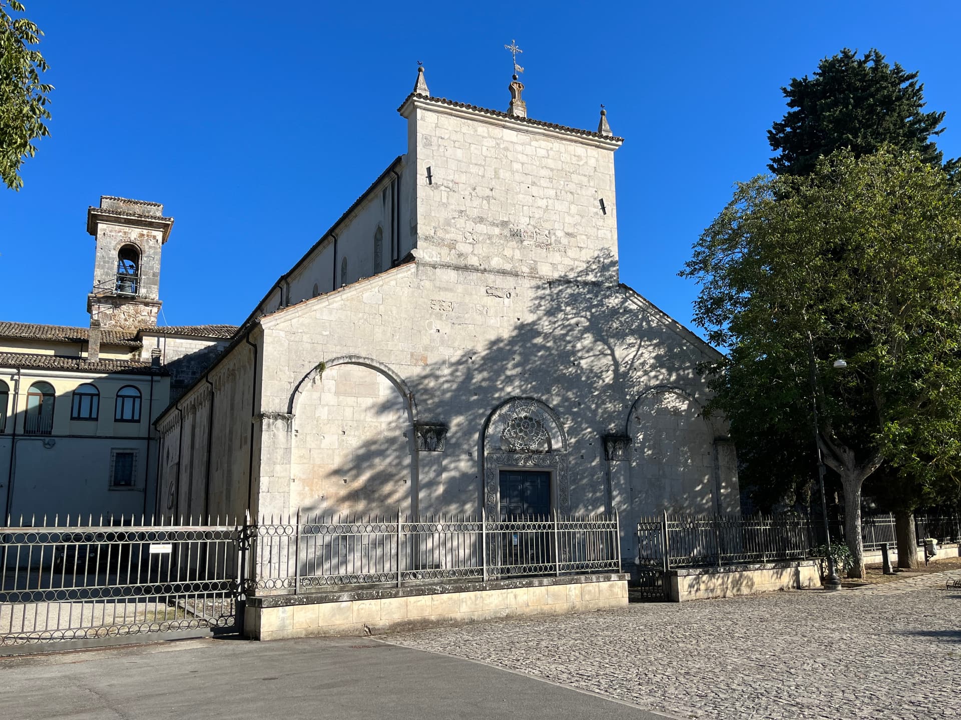
Norcia
Province: Perugia · 604 m
Birthplace of San Benedetto at 604 meters on a Sibillini plateau, leveled by the 2016 earthquake and rebuilt stone by stone.

Preci
Province: Perugia · 596 m
A walled Valnerina village at 596 meters that ran Europe's leading school of surgery for three centuries until the 2016 quake brought the borgo down.

Subscribe — free
Get the best guides on hidden Italian towns.
One letter on Sundays. The week’s town, with the photo, the food, the festa. Free, by Peter & Sophia from Pietrasanta.
Substack sends a confirmation link to your inbox. The signup finishes when it’s clicked.
From elsewhere in Italy
Five more towns to discover
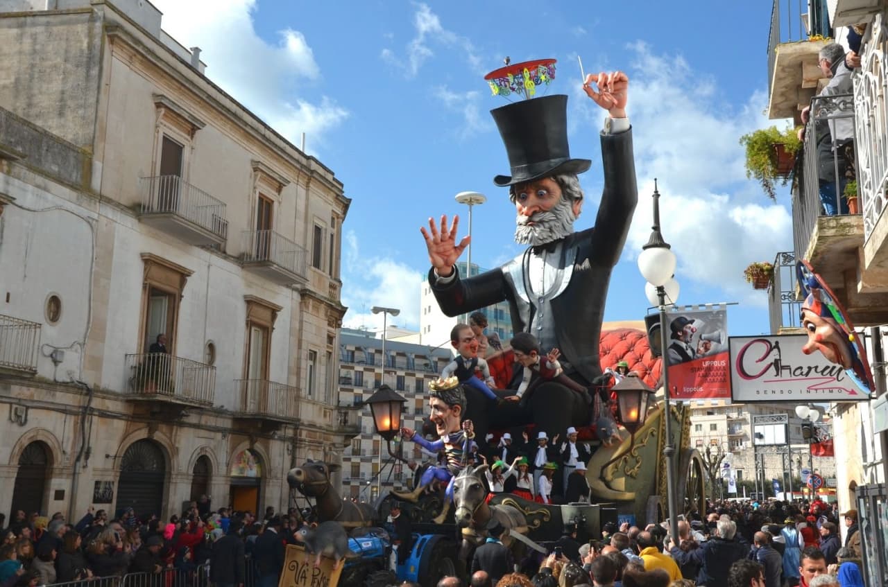
Putignano
Province: Bari
Europe's longest-running carnival — Putignano Carnevale has run continuously since 1394, with 631 years of cartapesta papier-mâché floats, a 26,000-resident Murgia town on the Bari–Lecce plateau, and the Grotta del Trullo karst cave inside the centro.

Pistoia
Province: Pistoia
Italy's nursery capital and the medieval Tuscan rival that gave its name to the pistol — a quietly extraordinary centro storico of zebra-striped Romanesque churches, Andrea della Robbia's polychrome frieze on the Ospedale del Ceppo, and Italy's Capital of Culture 2017, all 30 minutes from Florence by train.
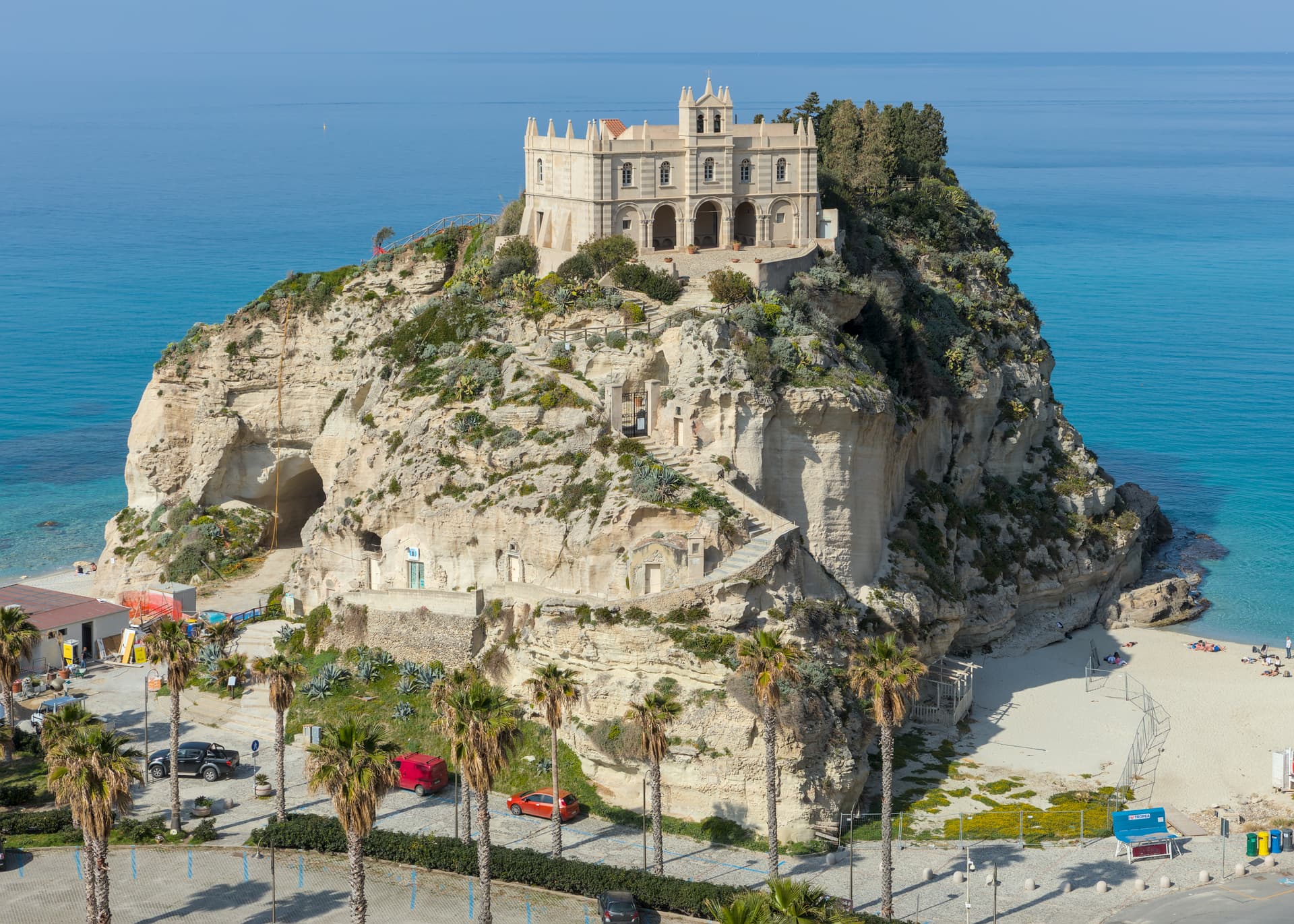
Tropea
Province: Vibo Valentia
Cliff town on a tufa headland over the Tyrrhenian Coast of the Gods, with a Norman monastery on a sea rock.
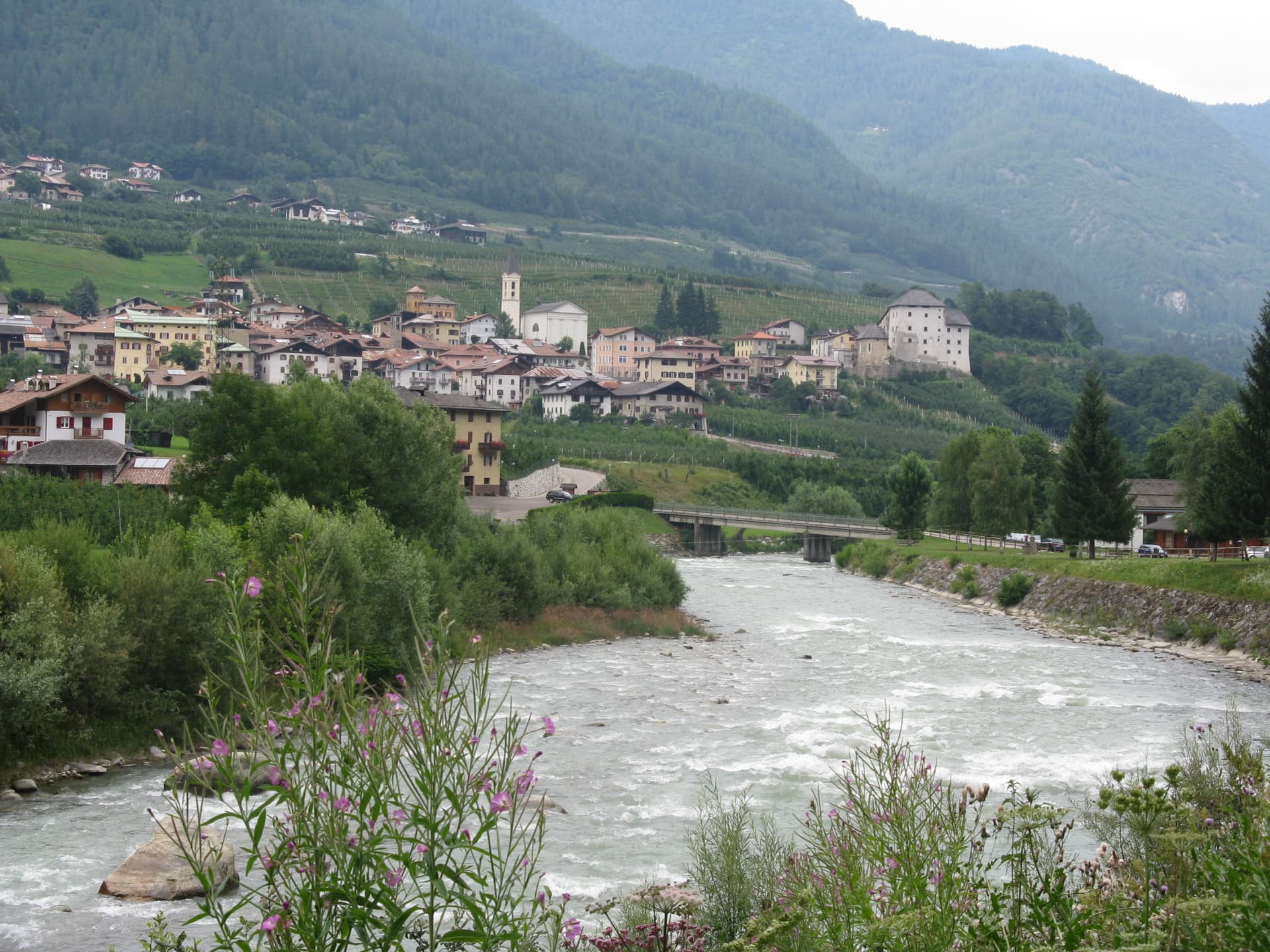
Caldes
Province: Trento
A scattered Val di Sole commune on the Noce, six hamlets gathered around a thirteenth-century tower-house castle that once belonged to the Thun family.
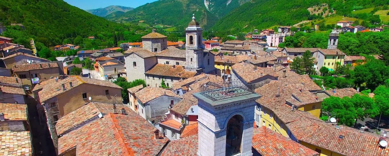
Cantiano
Province: Pesaro e Urbino
A border borgo at 374 meters under Monte Catria on the old Via Flaminia, known for the Good Friday Turba and the sour-cherry visciola harvest.