
Lombardy · Sondrio
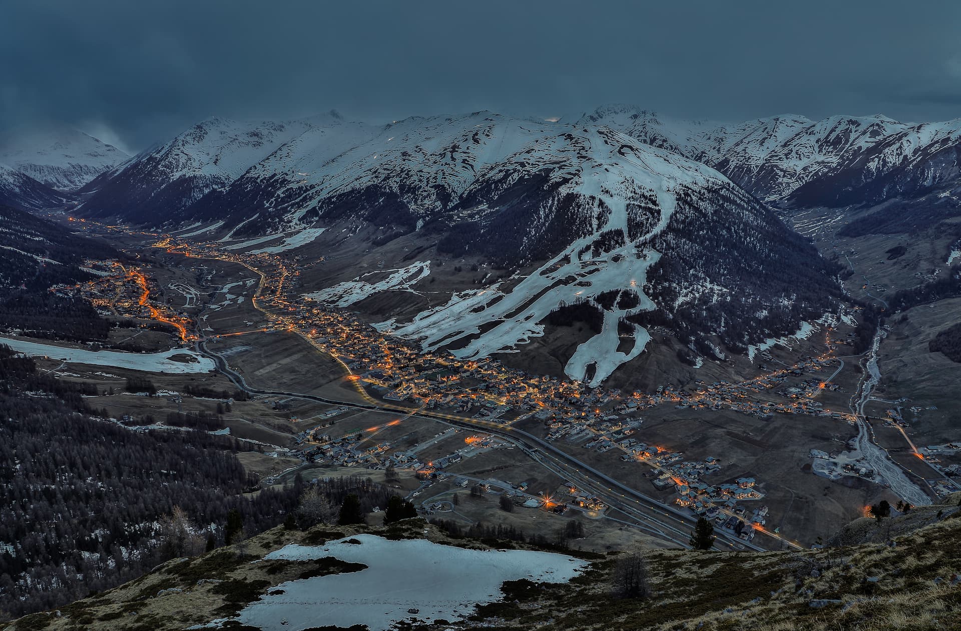
Livigno
At 1,816 meters in the Italian Alps near the Swiss border, a duty-free ski valley that drains north into the Black Sea, not the Mediterranean.
Known for
DUTY-FREE
VAT-exempt status since 1840, originally Austrian, confirmed by Italy in 1960; shops along Via Plan still run on it.
TWO SKI MOUNTAINS
Carosello 3000 on the west flank, Mottolino on the east, the valley itself flat enough to ski-bus between them.
BLACK SEA WATERSHED
One of the few Italian communes whose rivers drain north through the Inn and Danube rather than south to the Adriatic.
When to visit
Best · Jun–Sep, Dec–Mar
- J
- F
- M
- A
- M
- J
- J
- A
- S
- O
- N
- D
- Best
- Hot or crowded
- Quiet
- Mostly closed
The festa: natività della Beata Vergine Maria, 8 September
Why come
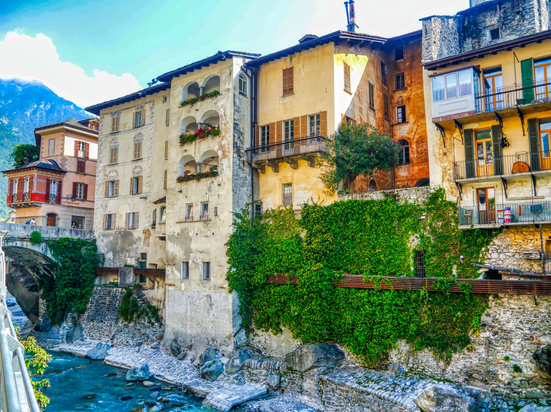
Livigno sits at 1,816 meters in a high valley between the Stelvio National Park and Switzerland's Engadine, one of the few Italian communes whose waters drain north to the Black Sea rather than south to the Mediterranean. The name probably comes from an old German word for avalanche; the last one to hit the village killed seven people in 1951. Until the 1970s this was a farming village of shepherds and small farms.
The duty-free status, first granted by Austria around 1840 and confirmed by Italy in 1960, is what changed it. Today the slopes of Carosello 3000 on one side of the valley and Mottolino on the other carry the ski traffic that arrives by the busload from Milan and the rest of Europe. Saint Mary's parish church, rebuilt at the end of the 19th century around its older predecessor, still anchors the centre. The duty-free shops along Via Plan handle the rest of the visitor economy.
The Sunday letter
We haven’t written Livigno’s letter yet.
One town every Sunday, with the photo, the food, the festa. Be there when this one comes up. Free, by Peter & Sophia from Pietrasanta.
By subscribing you agree to Substack’s Terms of Use, our Privacy Policy and our Information collection notice.

What to see
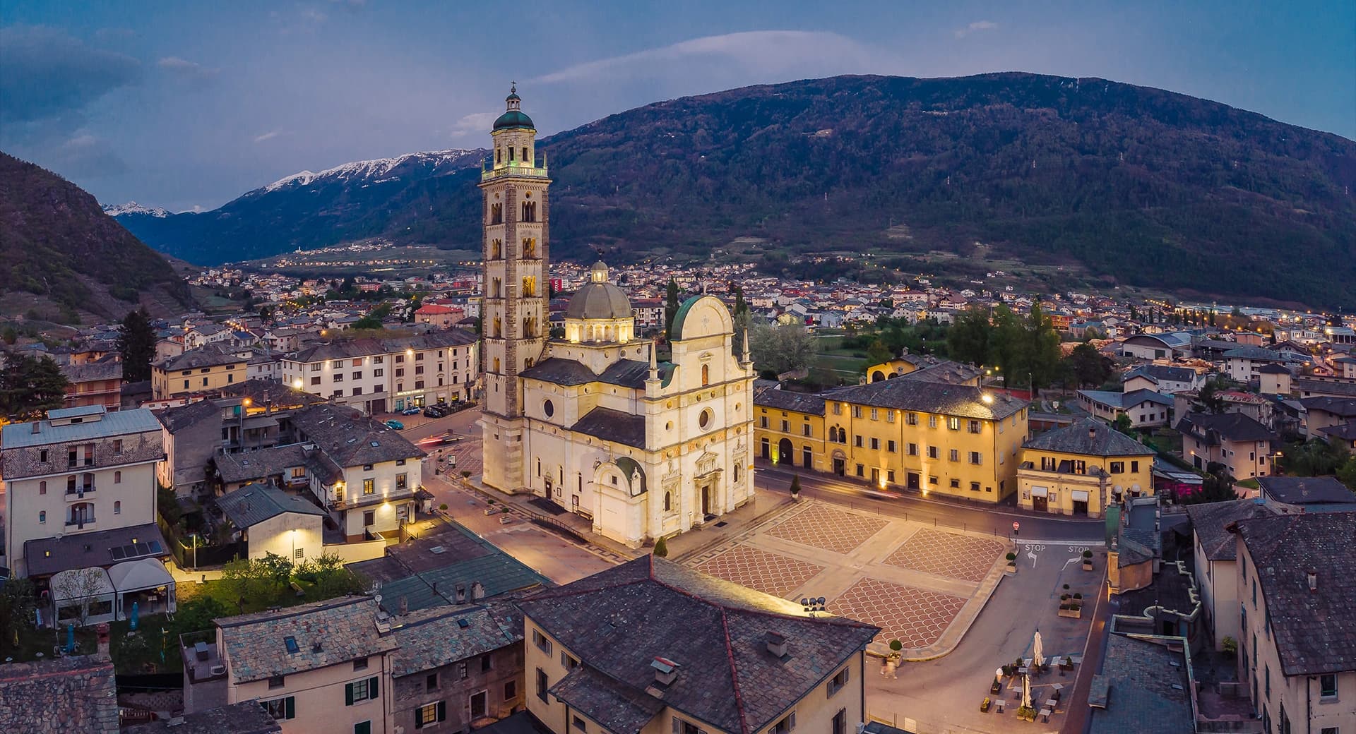
Chiesa di Santa Maria Nascente
Late 19th-century parish church built around the older church it replaced, so that services continued during construction.
Chiesa di San Rocco
Small votive church built at the start of the 16th century as protection against plague, on the edge of the historic settlement.
Chiesa della Madonna di Caravaggio
Country church holding ex voto paintings and a picture traditionally attributed to Caravaggio.
Carosello 3000
Ski area on the Costaccia and Vetta Blesaccia slopes, west side of the valley, summit at roughly 2,800 meters.
Mottolino
Ski area on the Monte della Neve flank, east side of the valley, bike park and gondola access from the town centre.
Parco Nazionale dello Stelvio
The Livigno side of the second-largest national park in Italy, reached by passes that close in winter.
The slow-trip planner
Building a trip? Find where Livigno fits in a slow Italy circuit.
Answer five questions. We will shape a geographically coherent slow trip from the 1,000 Italian towns most travelers skip. Yours to save and share.
We recommend
Where to eat and stay
Not our picks, but places the guides put their name to — a Michelin star, a Gambero Rosso fork, a Slow Food snail, a Michelin Key for the hotels. Worth a table, a counter, or a night when you pass through.
Al PersefRistorante
Al Persef holds a place in L'Espresso's Top 300 and a spot in the Michelin Guide.
Kosmo Taste the MountainBistrot
Kosmo Taste the Mountain holds two Gambero Rosso tables and a spot in the Michelin Guide.
Téa del KosmoRistorante
Téa del Kosmo holds two Gambero Rosso forks (83/100) and a spot in the Michelin Guide.
Camana VegliaRistorante
Camana Veglia carries a spot in the Michelin Guide.
Stua da Legn dell'Hotel Lac SalinRistorante
Stua da Legn dell'Hotel Lac Salin carries one Gambero Rosso fork (78/100).
Stua Noa Fine DiningRistorante
Stua Noa Fine Dining holds a spot in the Michelin Guide.
Eco & Wellness Boutique Hotel SonneHotel
Eco & Wellness Boutique Hotel Sonne carries a place in the Michelin hotel guide.
Living here
- Population 6,789
- Very remotei
- Pharmacy in town
- Nearest high school over ~30 minutes away
- Nearest airport Milan, 3 h 20 min drive
- Regional capital Milano, 3 h 42 min drive
Tags & datadesignations · numbers · sources
Recognised as
The numbers
- Elevation: 1816 m
- Population: 6,789
- Surface area: 227.3 km²
These figures were compiled from public directories — ISTAT, OpenStreetMap, Wikidata — and from the official listings of the guides named on this page. Town details change; verify with official sources before you travel.
Close by
More towns near Livigno

Bormio
Province: Sondrio
An Alpine spa town at 1,225 meters where three high passes meet and Roman thermal water has fed the baths for two thousand years.
Tirano
Province: Sondrio
A Valtellina town at 441 meters where the Bernina railway from St Moritz reaches Italy, beneath terraced Nebbiolo vineyards.
Glurns
Province: Bolzano
The smallest city in South Tyrol at 937 inhabitants, ringed by intact sixteenth-century walls in the Val Venosta near the Swiss border.
Sondrio
Province: Sondrio
The capital of Valtellina at 307 meters, where Castel Masegra watches over terraced vineyards that produce Sassella and Grumello Nebbiolo.
Chiavenna
Province: Sondrio
An Alpine town at 333 meters on the Mera river, the historical Splügen Pass crossroads named for its key position and its rock-cellar crotti.
🌲 Parco Nazionale
More Parco Nazionale towns
Alfedena
Province: L'Aquila
At 914 meters at the head of the upper Sangro valley, the Samnite Aufidena, with a 15,000-tomb necropolis and a Roman conquest in 298 BC.

Barrea
Province: L'Aquila
A 1,066-meter spur above an artificial lake at the heart of the Abruzzo National Park, with a Samnite necropolis and an 11th-century di Sangro castle.

Calascio
Province: L'Aquila
At 1,200 meters under the highest castle in the Apennines, a village of 125 people that played the monk's refuge in Ladyhawke.
Campli
Province: Teramo
A 393-meter town under the Monti della Laga, held by the Farnese for two centuries, with a Scala Santa carrying papal indulgence.

Campo di Giove
Province: L'Aquila
At 1,064 meters under the southwestern Maiella, the highest village in the park, named for a Roman temple to Jupiter.