
Abruzzo · L'Aquila
Alfedena
At 914 meters at the head of the upper Sangro valley, the Samnite Aufidena, with a 15,000-tomb necropolis and a Roman conquest in 298 BC.
Known for
SAMNITE AUFIDENA
Capital of the Caraceni Samnites with a necropolis of over 15,000 tombs from the seventh to third centuries BC.
ROMAN CONQUEST 298 BC
Taken by Rome in the Third Samnite War, the moment Aufidena passed from Italic capital to Roman district.
PARCO NAZIONALE
Inside the Abruzzo, Lazio and Molise National Park, with the dammed Lago della Montagna Spaccata at 1,066 meters above the village.
When to visit
Best · May–Oct
- J
- F
- M
- A
- M
- J
- J
- A
- S
- O
- N
- D
- Best
- Hot or crowded
- Quiet
- Mostly closed
The festa: Pietro da Verona, seconda domenica di luglio
Why come
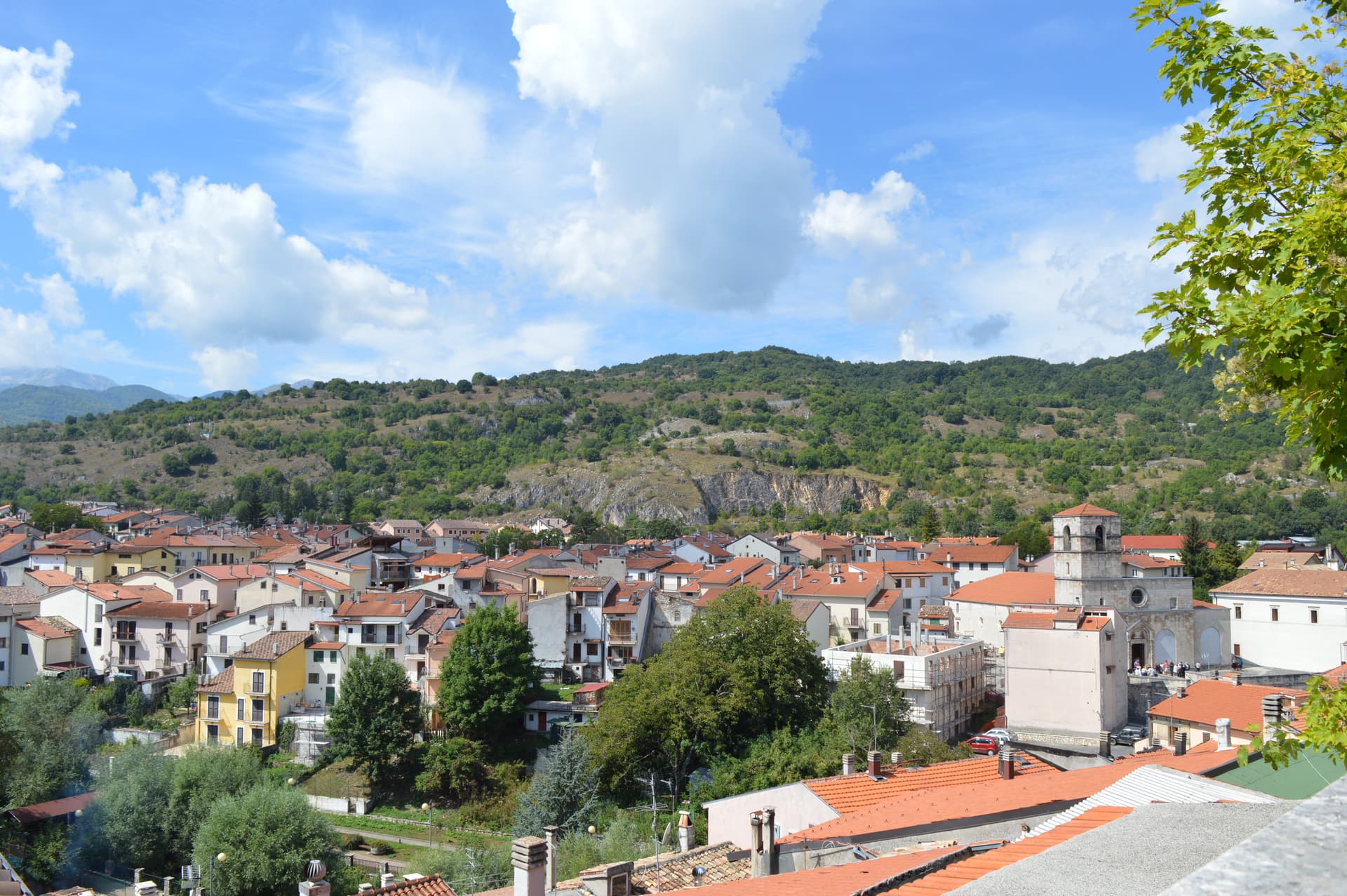
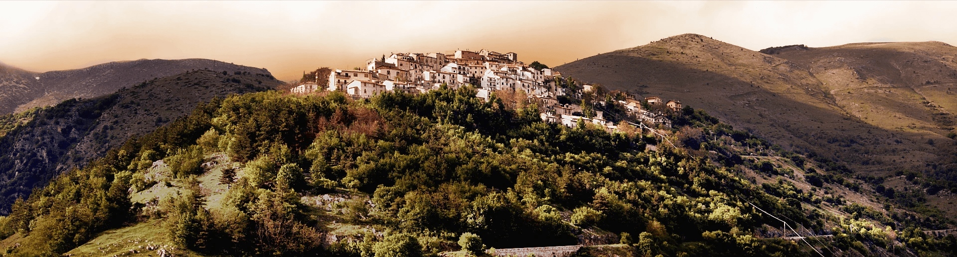
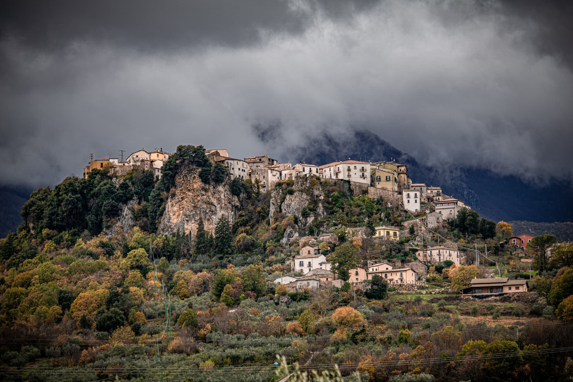
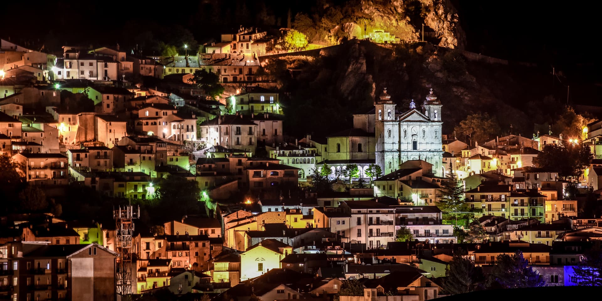
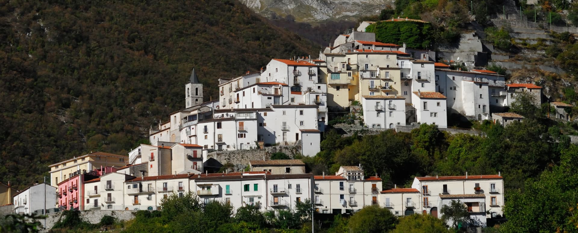
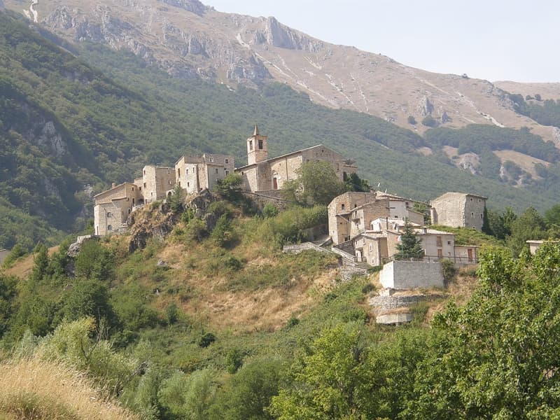
Alfedena sits at 914 meters at the head of the upper Sangro valley, inside the Abruzzo, Lazio and Molise National Park, below the Meta and Monte Greco massifs. The Samnites founded it as Aufidena on two hills above the river, the capital of the Caraceni tribe; the necropolis in the saddle between the two hills holds over 15,000 inhumation tombs from the seventh to third centuries BC, one of the largest Italic burial complexes ever excavated. Rome conquered the place in 298 BC during the Third Samnite War.
The medieval village grew on a third hill and survived earthquakes, the Gustav Line winter, and the slow depopulation that has taken its population down to 944. The Lago della Montagna Spaccata at 1,066 meters above the village, dammed after the war for hydroelectric power, is the modern landmark. Castel di Sangro is twelve kilometers north, Pescara eighty-five.
The Sunday letter
We haven’t written Alfedena’s letter yet.
One town every Sunday, with the photo, the food, the festa. Be there when this one comes up. Free, by Peter & Sophia from Pietrasanta.
By subscribing you agree to Substack’s Terms of Use, our Privacy Policy and our Information collection notice.

What to see
Necropoli sannita di Aufidena
Samnite burial complex with over 15,000 inhumation tombs from the seventh to third centuries BC, between the two original hills of the ancient town.
Resti delle mura megalitiche
Megalithic Samnite walls on the upper hills, visible vestiges of the pre-Roman Aufidena before its conquest in 298 BC.
Lago della Montagna Spaccata
Small artificial lake at 1,066 meters above the village, dammed after the war on the Rio Torto for hydroelectric production.
Parco Nazionale d'Abruzzo, Lazio e Molise
Bear-and-wolf protected area that includes the upper Sangro valley around Alfedena, with marked trails toward Monte Greco.
Monte Greco massif
Range west of the village rising to 2,283 meters, the geographical anchor of the upper Sangro and the nearby Alto Sangro ski area.
The slow-trip planner
Building a trip? Find where Alfedena fits in a slow Italy circuit.
Answer five questions. We will shape a geographically coherent slow trip from the 1,000 Italian towns most travelers skip. Yours to save and share.
Living here
- Population 944
- Very remotei
- Pharmacy in town
- Nearest high school over ~30 minutes away
- Nearest airport Naples / Salerno, 2 h 4 min drive
- Regional capital L'Aquila, 2 h 15 min drive
Tags & datadesignations · numbers · sources
Recognised as
The numbers
- Elevation: 914 m
- Population: 944
- Surface area: 39.96 km²
These figures were compiled from public directories — ISTAT, OpenStreetMap, Wikidata — and from the official listings of the guides named on this page. Town details change; verify with official sources before you travel.
Close by
More towns near Alfedena

Barrea
Province: L'Aquila
A 1,066-meter spur above an artificial lake at the heart of the Abruzzo National Park, with a Samnite necropolis and an 11th-century di Sangro castle.
Scontrone
Province: L'Aquila
A 1,038-meter borgo above the Sangro gorge in the Alto Sangro, with two dozen emigration-themed murals and a paleontological site of European importance.
Castel San Vincenzo
Province: Isernia
A 749-meter village near the Volturno source, sharing ground with one of medieval Europe's most powerful abbeys and a ninth-century frescoed crypt.
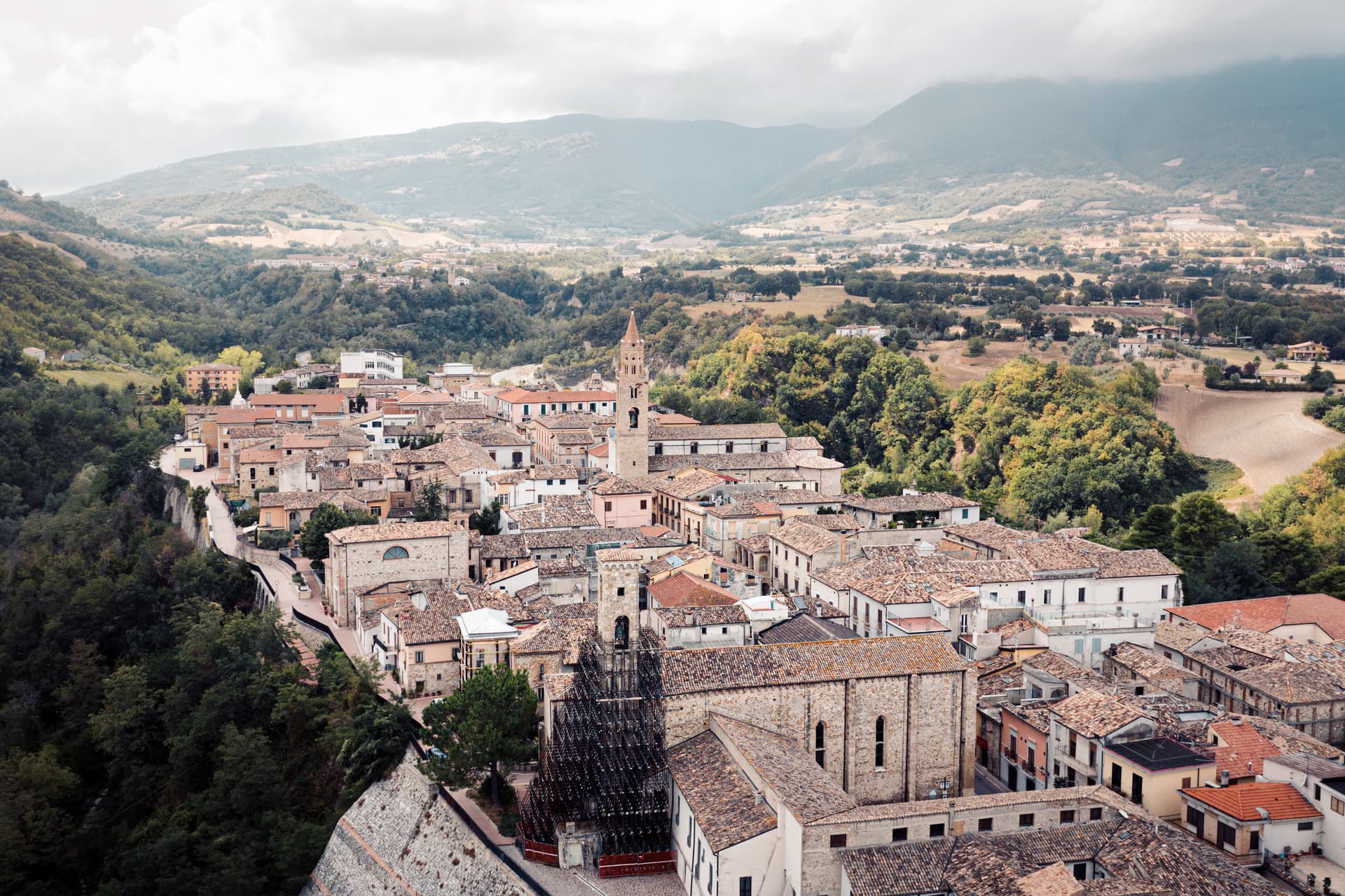
Castel di Sangro
Province: L'Aquila
At 805 meters where the Sangro meets the Zittola, the Roman Aufidena and 1990s football miracle, liberated by the West Nova Scotia Regiment in 1943.
Pizzone
Province: Isernia
A 313-person Mainarde village at 724 meters in the Molise sector of the Abruzzo, Lazio and Molise National Park, above the Volturno springs.
🌲 Parco Nazionale
More Parco Nazionale towns in Abruzzo

Calascio
Province: L'Aquila
At 1,200 meters under the highest castle in the Apennines, a village of 125 people that played the monk's refuge in Ladyhawke.
Campli
Province: Teramo
A 393-meter town under the Monti della Laga, held by the Farnese for two centuries, with a Scala Santa carrying papal indulgence.

Campo di Giove
Province: L'Aquila
At 1,064 meters under the southwestern Maiella, the highest village in the park, named for a Roman temple to Jupiter.

Capestrano
Province: L'Aquila
A hilltop village at 465 meters above the Tirino valley, where in 1934 a farmer turned up the 6th-century BC limestone Warrior of Capestrano.
Caramanico Terme
Province: Pescara
A 650-meter Majella spa village at the confluence of the Orfento and Orta, with sulphurous springs whose properties were documented in 1576.