
Abruzzo · L'Aquila
Calascio
At 1,200 meters under the highest castle in the Apennines, a village of 125 people that played the monk's refuge in Ladyhawke.
Known for
ROCCA CALASCIO
Highest fortress in the Apennines at 1,460 meters, watchtower for the Abruzzo-Puglia transhumance routes, film set for Ladyhawke and The Name of the Rose.
LADYHAWKE
The 1985 Richard Donner film added crowns to the Rocca's towers; the scene where Michelle Pfeiffer falls was staged on one of them.
TRANSUMANZA
Wool capital under the transhumance, with flocks moved 250 km to Puglia every September; the wealth ended in the 1850s and the population followed.
When to visit
Best · Jun–Sep, Dec–Mar
- J
- F
- M
- A
- M
- J
- J
- A
- S
- O
- N
- D
- Best
- Hot or crowded
- Quiet
- Mostly closed
The festa: Nicola di Bari, 9 May
Why come
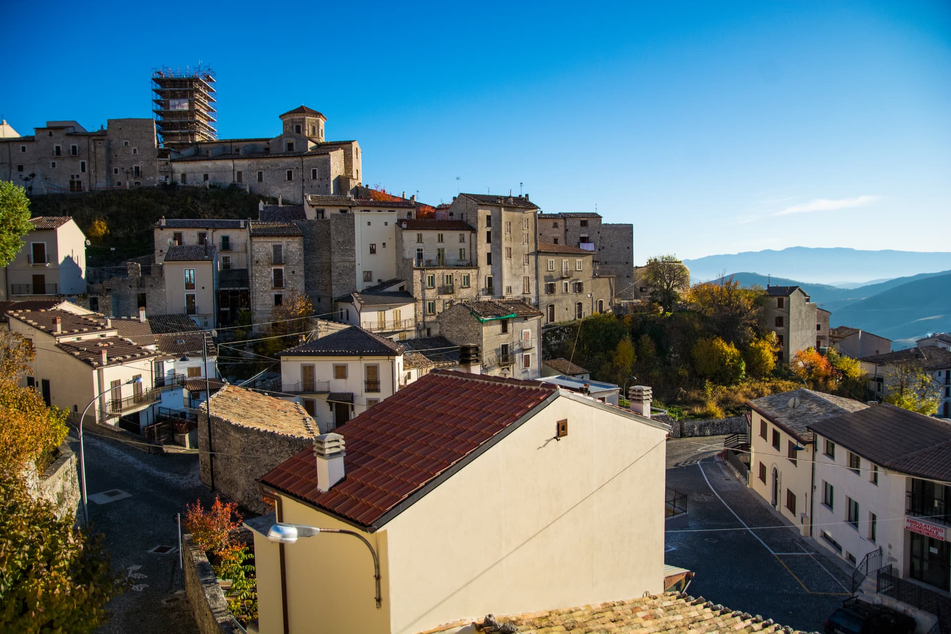
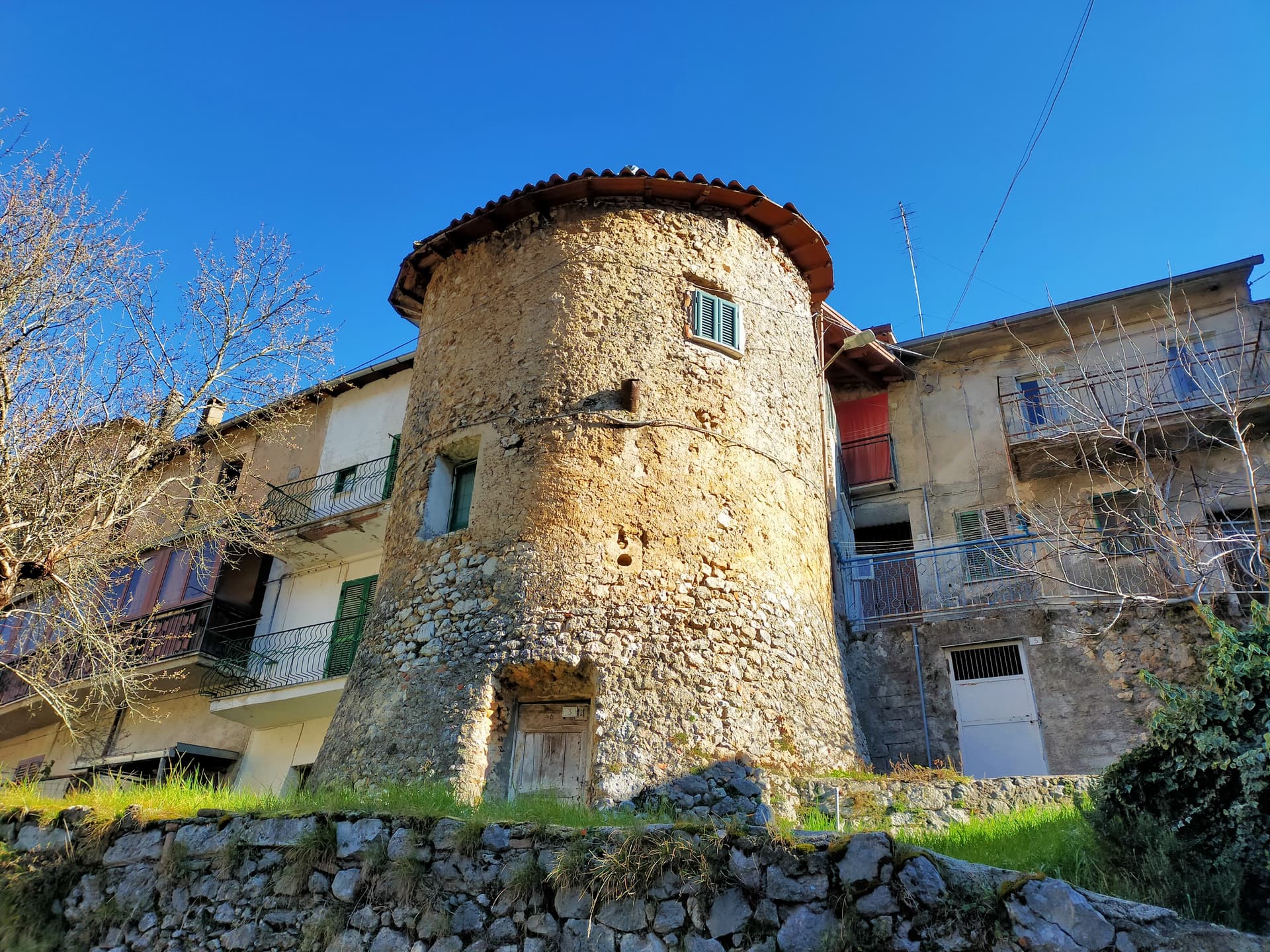
Calascio sits at 1,200 meters in the Gran Sasso e Monti della Laga National Park, with Rocca Calascio above it at 1,460 meters, the highest fortress in the Apennines. The Rocca began around the year 1000 as a watchtower controlling the transhumance routes that ran 250 kilometers down from L'Aquila to the Tavoliere delle Puglie, the wool wealth that built the village. Wool from these flocks was so prized that the Medici came north to buy it.
The transhumance ended in the 1850s and the village emptied. Today 125 people remain. The Rocca became a film set: Ladyhawke in 1985, with crowns added to the towers and Michelle Pfeiffer's fall staged on one of them, then The Name of the Rose, The American, and a series of others.
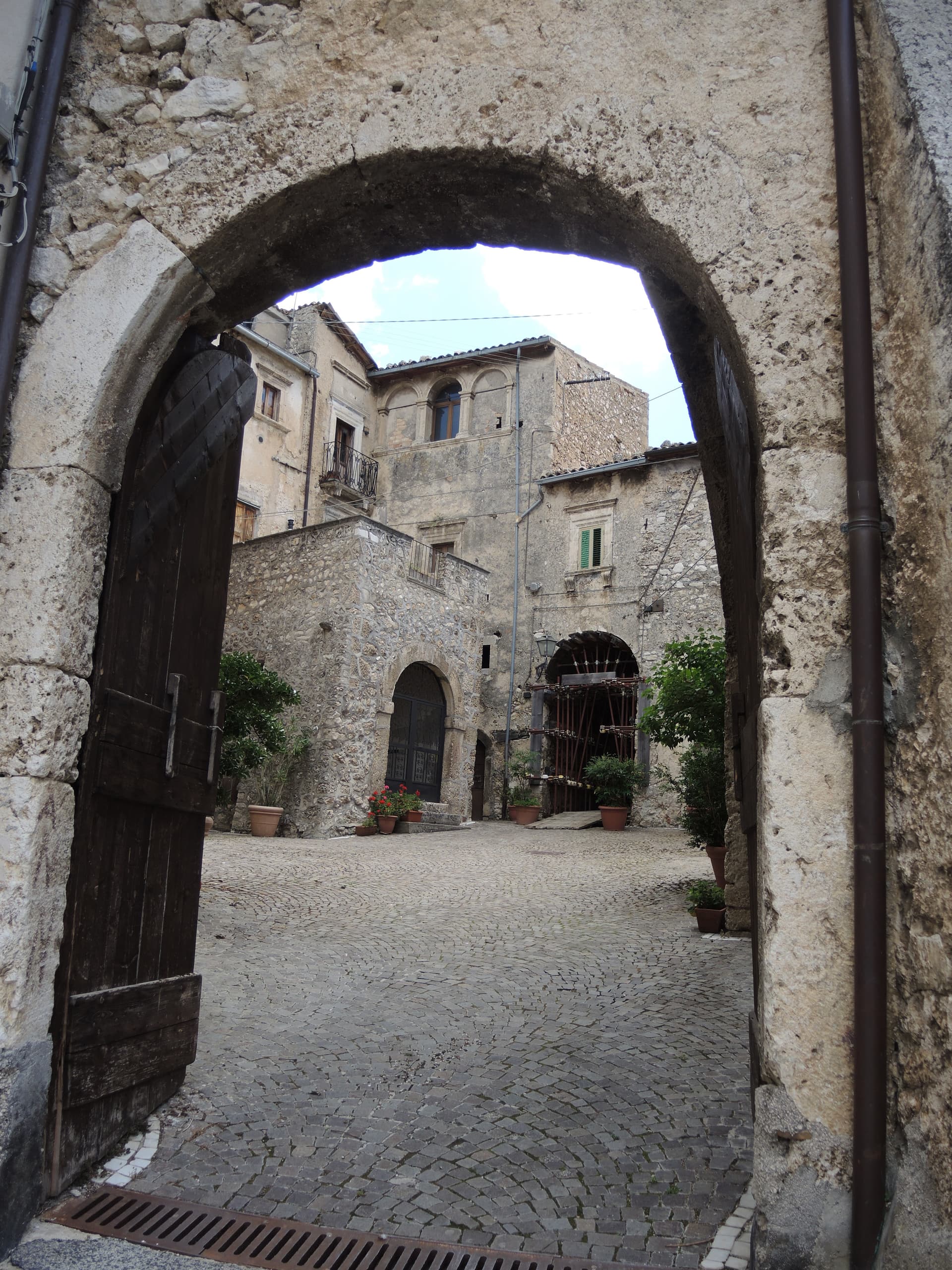
The Borgo Autentici designation reflects the slow restoration of the abandoned upper village (Rocca Calascio borgo) by stonemasons working with original materials. From the castle, the view runs across Campo Imperatore to the Gran Sasso peaks.
The Sunday letter
We haven’t written Calascio’s letter yet.
One town every Sunday, with the photo, the food, the festa. Be there when this one comes up. Free, by Peter & Sophia from Pietrasanta.
By subscribing you agree to Substack’s Terms of Use, our Privacy Policy and our Information collection notice.


What to see
Rocca Calascio
Highest fortress in the Apennines at 1,460 meters, watchtower for transhumance routes from L'Aquila to Puglia, film location for Ladyhawke and The Name of the Rose.
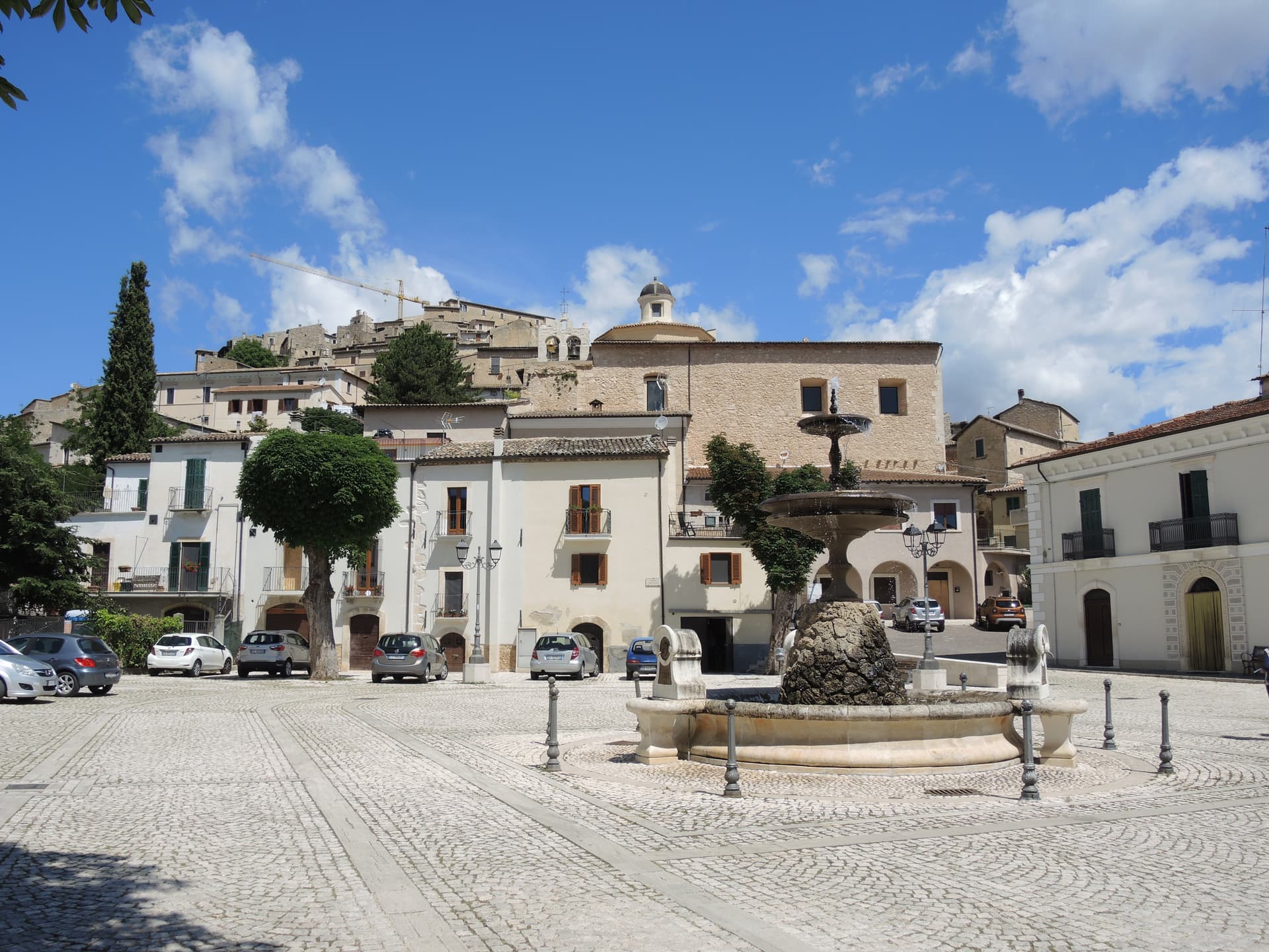
Chiesa di Santa Maria della Pietà
Octagonal Renaissance chapel below the Rocca, built on the site of a 1456 battle won by local farmers against bandits, with painted interior.
Borgo di Rocca Calascio
Partly abandoned upper village beside the castle, slowly restored by stonemasons, with the Rifugio della Rocca offering rooms in stone houses.
Centro storico di Calascio
Lower stone village at 1,200 meters, with the parish church of San Nicola di Bari and the houses of the post-transhumance shepherds who stayed.
Campo Imperatore
The high plateau immediately north of Calascio, 27 km long at 1,800 meters average, the largest pasture of central Italy, called Italy's little Tibet.
The slow-trip planner
Building a trip? Find where Calascio fits in a slow Italy circuit.
Answer five questions. We will shape a geographically coherent slow trip from the 1,000 Italian towns most travelers skip. Yours to save and share.
Living here
- Population 125
- In-betweeni
- Pharmacy in town
- Nearest high school over ~30 minutes away
- Nearest airport Ancona / Pescara, 2 h 54 min drive
- Regional capital L'Aquila, 1 h 3 min drive
Tags & datadesignations · numbers · sources
Recognised as
The numbers
- Elevation: 1200 m
- Population: 125
- Surface area: 39.44 km²
These figures were compiled from public directories — ISTAT, OpenStreetMap, Wikidata — and from the official listings of the guides named on this page. Town details change; verify with official sources before you travel.
Featured on
Calascio appears on this themed pick from our Collections:
Close by
More towns near Calascio
Castelvecchio Calvisio
Province: L'Aquila
118 people at 1,067 meters on a ridge above the Tirino, inside a fortified ellipse of stone walls with alleys orthogonal to its perimeter.
Ofena
Province: L'Aquila
A 531-meter Vestian basin called the Forno d'Abruzzo, sealed by the Gran Sasso wall, where Montepulciano ripens on what may be the oldest of its slopes.
Castel del Monte
Province: L'Aquila
At 1,346 meters under Monte Bolza facing Rocca Calascio, the capital of shepherds, whose wool reached the Medici and whose witches return each August.

Capestrano
Province: L'Aquila
A hilltop village at 465 meters above the Tirino valley, where in 1934 a farmer turned up the 6th-century BC limestone Warrior of Capestrano.
Navelli
Province: L'Aquila
At 760 meters above the Navelli plain, the pyramid of stone houses growing the saffron a 13th-century Dominican brought from Spain.
💎 Borghi Autentici
More Borghi Autentici towns in Abruzzo

Archi
Province: Chieti
A 492-meter rocky spur called the Terrazza sul Sangro, fief of del Balzo, Cantelmo, Colonna and Carafa, now Città del Tartufo and Città dell'Olio.

Balsorano
Province: L'Aquila
At 359 meters in the Valle Roveto, a Piccolomini castle that became the backdrop for half of 1970s Italian horror cinema.

Barrea
Province: L'Aquila
A 1,066-meter spur above an artificial lake at the heart of the Abruzzo National Park, with a Samnite necropolis and an 11th-century di Sangro castle.

Campo di Giove
Province: L'Aquila
At 1,064 meters under the southwestern Maiella, the highest village in the park, named for a Roman temple to Jupiter.
Capistrello
Province: L'Aquila
At 734 meters where the upper Liri valley meets the Marsica, the village where Emperor Claudius's 52 AD tunnel emptied a lake into a river.