Abruzzo · L'Aquila
Capistrello
At 734 meters where the upper Liri valley meets the Marsica, the village where Emperor Claudius's 52 AD tunnel emptied a lake into a river.
Known for
CLAUDIUS TUNNELS
Eastern mouth of the 52 AD imperial drainage tunnel from Lake Fucino, one of the largest hydraulic projects in the Roman world.
LIRI HEADWATERS
Where the Liri river takes on the Fucino outflow before running south into the Roveto valley toward Lazio.
MARSICA EDGE
Border between the Marsica plateau and the Liri valley, with the Simbruini range rising west toward Filettino in Lazio.
When to visit
Best · May–Oct
- J
- F
- M
- A
- M
- J
- J
- A
- S
- O
- N
- D
- Best
- Hot or crowded
- Quiet
- Mostly closed
The festa: Antonio di Padova, 13 June
Why come
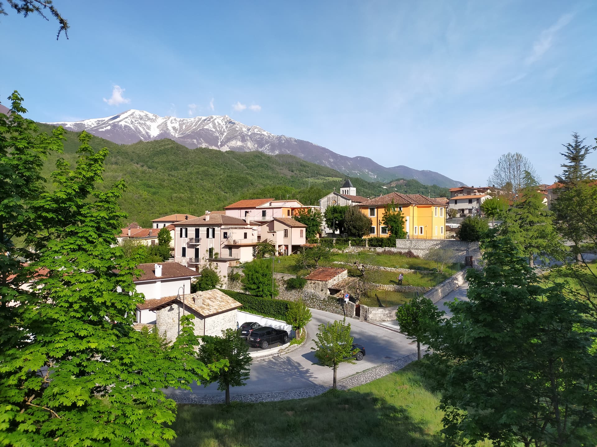
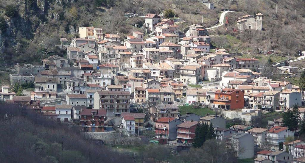
Capistrello sits at 734 meters at the seam between the upper Liri valley and the Marsica plateau, in the foothills of the Simbruini mountains. The Roman emperor Claudius built a six-kilometer tunnel here, completed in 52 AD, to drain part of Lake Fucino and discharge it into the Liri river beneath the present town. The Cunicoli di Claudio are visible as the eastern outflow of one of the largest hydraulic projects of the ancient world, with a drop of about eight meters and an average gradient of 1.
5 meters per kilometer over six kilometers. The first settlements on the site date to the Neolithic, and the modern town developed around the tunnel mouth. Capistrello borders Avezzano, Tagliacozzo, Filettino and four other communes, sitting at the corner where Abruzzo meets Lazio.
The population is around 4,800. The Liri runs cold off the mountains and the chestnut woods cover the slopes behind the town.
The Sunday letter
We haven’t written Capistrello’s letter yet.
One town every Sunday, with the photo, the food, the festa. Be there when this one comes up. Free, by Peter & Sophia from Pietrasanta.
By subscribing you agree to Substack’s Terms of Use, our Privacy Policy and our Information collection notice.

What to see
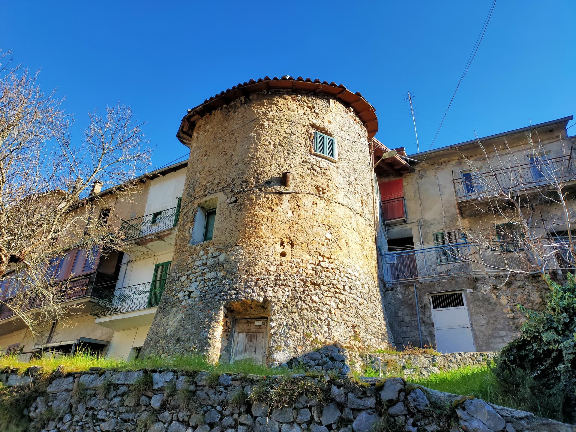
Cunicoli di Claudio
Eastern outflow of the 52 AD Roman tunnel that drained Lake Fucino, a six-kilometer underground emissary still visible beneath the town.
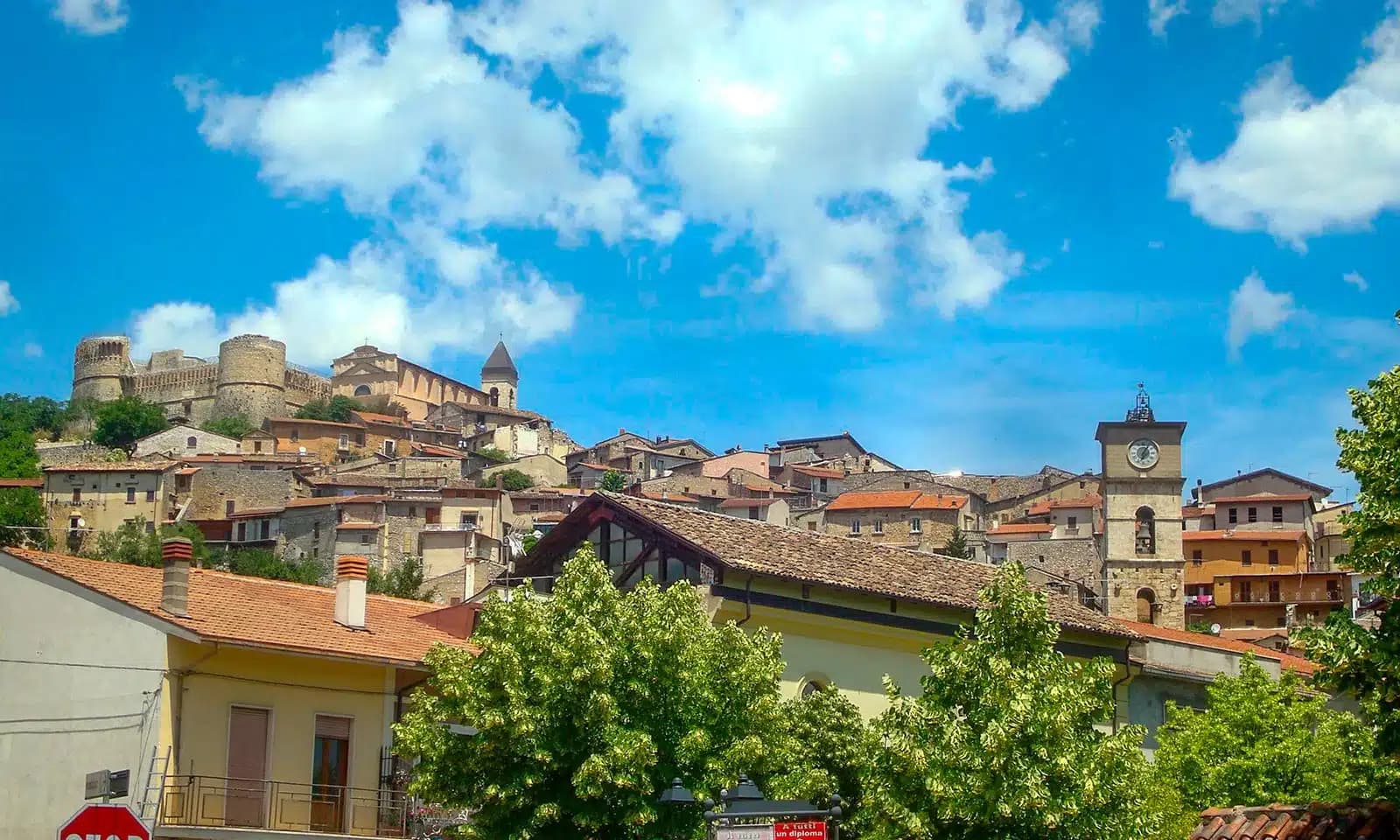
Borgo storico
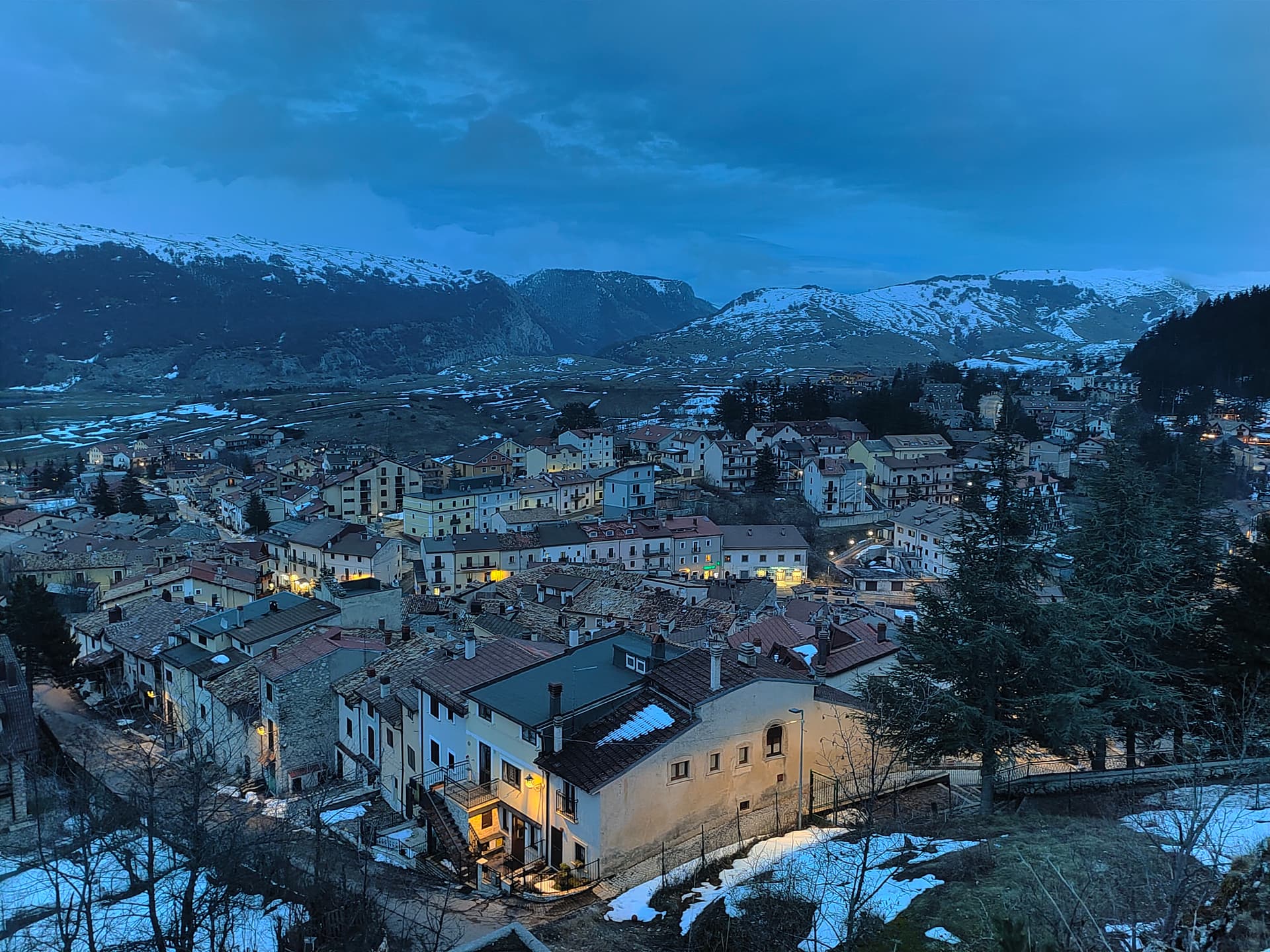
Old village above the Liri river, with stone houses stepped up the slope and a small piazza at the upper edge.
Fiume Liri
Cold river that emerges from the Simbruini springs and runs south through the valley, picking up the Claudius tunnel outflow at Capistrello.
Monti Simbruini
Forested range of the central Apennines forming the western horizon, with chestnut woods and trails toward Filettino in Lazio.
The slow-trip planner
Building a trip? Find where Capistrello fits in a slow Italy circuit.
Answer five questions. We will shape a geographically coherent slow trip from the 1,000 Italian towns most travelers skip. Yours to save and share.
Living here
- Population 4,793
- Commuter belti
- Pharmacy: none mapped
- High school within a 30-minute drive
- Train station in the comune
- Nearest airport Rome, 2 h 1 min drive
- Regional capital L'Aquila, 45 min drive
Tags & datadesignations · numbers · sources
Recognised as
The numbers
- Elevation: 734 m
- Population: 4,793
- Surface area: 60.97 km²
These figures were compiled from public directories — ISTAT, OpenStreetMap, Wikidata — and from the official listings of the guides named on this page. Town details change; verify with official sources before you travel.
Close by
More towns near Capistrello
Scurcola Marsicana
Province: L'Aquila
At 700 meters below Monte San Nicola on the Piani Palentini, the field where Charles of Anjou broke the Hohenstaufen in 1268.
Tagliacozzo
Province: L'Aquila
A Marsica town at 740 meters below Monte Civita, where Charles of Anjou won the 1268 battle and the Orsini built the ducal palace.
Civita d'Antino
Province: L'Aquila
At 904 meters above the Roveto valley, the ancient Marsi town that became a Danish painters' colony from 1883 until the 1915 earthquake.

Balsorano
Province: L'Aquila
At 359 meters in the Valle Roveto, a Piccolomini castle that became the backdrop for half of 1970s Italian horror cinema.
Ovindoli
Province: L'Aquila
At 1,375 meters on the Altopiano delle Rocche, the closest serious ski station to Rome, working since 1959 on the slopes of Monte Magnola.
💎 Borghi Autentici
More Borghi Autentici towns in Abruzzo

Archi
Province: Chieti
A 492-meter rocky spur called the Terrazza sul Sangro, fief of del Balzo, Cantelmo, Colonna and Carafa, now Città del Tartufo and Città dell'Olio.

Barrea
Province: L'Aquila
A 1,066-meter spur above an artificial lake at the heart of the Abruzzo National Park, with a Samnite necropolis and an 11th-century di Sangro castle.

Calascio
Province: L'Aquila
At 1,200 meters under the highest castle in the Apennines, a village of 125 people that played the monk's refuge in Ladyhawke.

Campo di Giove
Province: L'Aquila
At 1,064 meters under the southwestern Maiella, the highest village in the park, named for a Roman temple to Jupiter.
Cappadocia
Province: L'Aquila
Italy's Cappadocia — a 575-resident Marsican borgo at 1,102m in Abruzzo's western mountains, with the spectacular Grotte di Pietrasecca karst cave system (the longest in the central Apennines), Borgo Autentico + Città delle Grotte signals, and a name that does cause genuine reservations for travellers expecting Turkey's hot-air balloon landscape.