
Abruzzo · L'Aquila
Civita d'Antino
At 904 meters above the Roveto valley, the ancient Marsi town that became a Danish painters' colony from 1883 until the 1915 earthquake.
Known for
DANISH COLONY
Summer school of Kristian Zahrtmann from 1883 to 1911, drawing some 80 Scandinavian painters including P.S. Krøyer.
ANTINUM
Ancient Marsi municipal town named by Pliny, with inscriptions still visible in the walls of the modern village.
1915 EARTHQUAKE
Marsica quake of 13 January 1915 broke the painters' colony and the 30-year link with Scandinavia.
When to visit
Best · May–Oct
- J
- F
- M
- A
- M
- J
- J
- A
- S
- O
- N
- D
- Best
- Hot or crowded
- Quiet
- Mostly closed
Why come
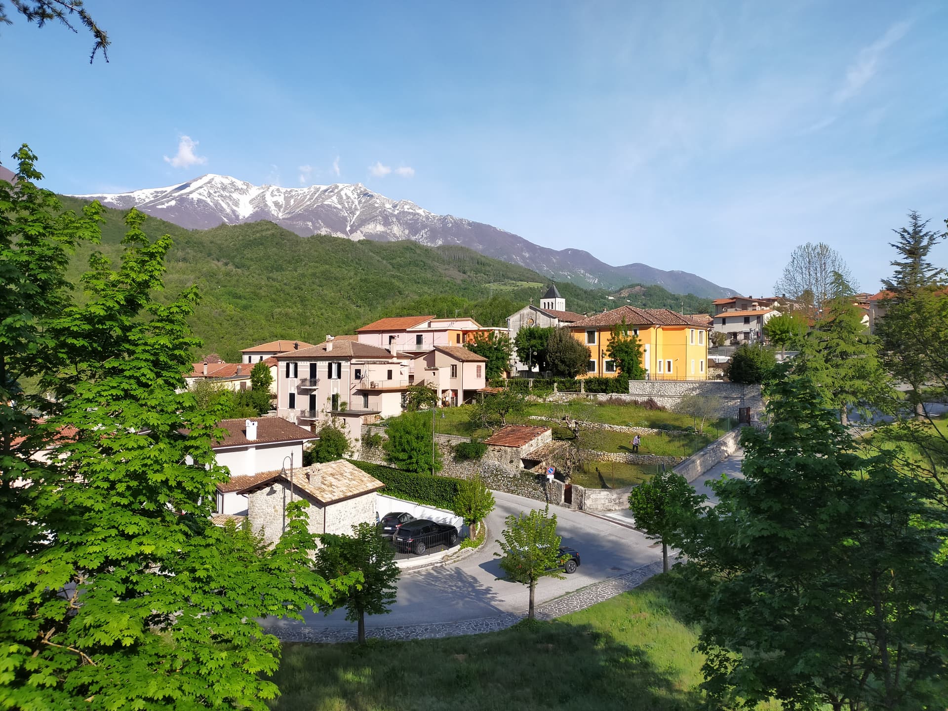
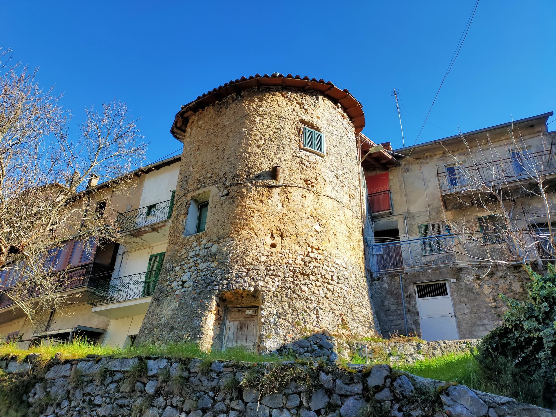
Civita d'Antino sits at 904 meters on a plateau above the Roveto valley, with the Liri running below. The Latin name Antinum identifies it as a town of the Marsi people, mentioned by Pliny and confirmed by inscriptions suggesting it was a significant municipal center. The natural stone barrier around the village survived into the present.
In 1883 the Danish painter Kristian Zahrtmann arrived and began spending every summer here through 1911, lodging with the Cerroni family. Around him grew an artists' colony of roughly 80 Scandinavian painters, including P. S.
Krøyer, drawn by the light over the Roveto valley. Zahrtmann was made an honorary citizen in 1902. In 1908 he held an exhibition in Copenhagen marking 25 years of the Civita connection.
The 1915 Marsica earthquake ended the colony. Gabriele D'Annunzio had discovered Zahrtmann's school in Venice in 1895. Most of Civita today still trades on this story.
The Sunday letter
We haven’t written Civita d'Antino’s letter yet.
One town every Sunday, with the photo, the food, the festa. Be there when this one comes up. Free, by Peter & Sophia from Pietrasanta.
By subscribing you agree to Substack’s Terms of Use, our Privacy Policy and our Information collection notice.

What to see
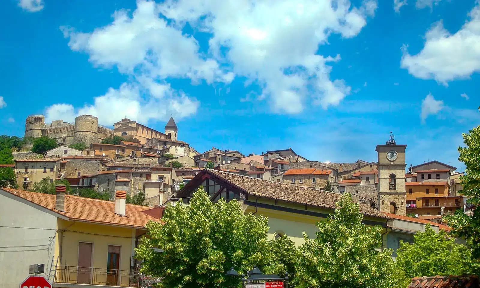
Centro storico
Stone village on a plateau at 904 meters, the painted subject of two generations of Scandinavian artists, surrounded by a natural rock barrier.
Casa-museo Zahrtmann
Cerroni family house where Kristian Zahrtmann lodged every summer from 1883 to 1911, now a memorial museum to the painters' colony.
Resti di Antinum
Roman-era inscriptions and fragments of the ancient Marsi municipal town, scattered through the modern village walls.
Belvedere sulla Valle Roveto
Plateau-edge viewpoint over the Liri valley, the precise vantage that drew the Danish painters and held them for thirty years.
The slow-trip planner
Building a trip? Find where Civita d'Antino fits in a slow Italy circuit.
Answer five questions. We will shape a geographically coherent slow trip from the 1,000 Italian towns most travelers skip. Yours to save and share.
Living here
- Population 913
- In-betweeni
- Pharmacy: none mapped
- Nearest high school over ~30 minutes away
- Train station in the comune
- Nearest airport Naples / Salerno, 2 h 9 min drive
- Regional capital L'Aquila, 1 h 4 min drive
Tags & datadesignations · numbers · sources
Recognised as
The numbers
- Elevation: 904 m
- Population: 913
- Surface area: 28.35 km²
These figures were compiled from public directories — ISTAT, OpenStreetMap, Wikidata — and from the official listings of the guides named on this page. Town details change; verify with official sources before you travel.
Close by
More towns near Civita d'Antino
Capistrello
Province: L'Aquila
At 734 meters where the upper Liri valley meets the Marsica, the village where Emperor Claudius's 52 AD tunnel emptied a lake into a river.

Balsorano
Province: L'Aquila
At 359 meters in the Valle Roveto, a Piccolomini castle that became the backdrop for half of 1970s Italian horror cinema.
Scurcola Marsicana
Province: L'Aquila
At 700 meters below Monte San Nicola on the Piani Palentini, the field where Charles of Anjou broke the Hohenstaufen in 1268.
Tagliacozzo
Province: L'Aquila
A Marsica town at 740 meters below Monte Civita, where Charles of Anjou won the 1268 battle and the Orsini built the ducal palace.
Isola del Liri
Province: Frosinone
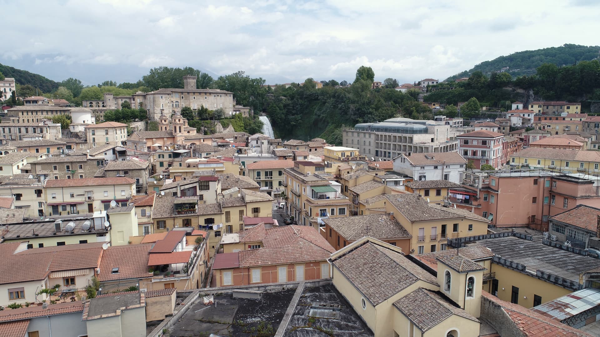
The Ciociaria town with a 27-meter waterfall in its centro storico and a paper-mill past once called the Manchester of Italy.
💎 Borghi Autentici
More Borghi Autentici towns in Abruzzo

Archi
Province: Chieti
A 492-meter rocky spur called the Terrazza sul Sangro, fief of del Balzo, Cantelmo, Colonna and Carafa, now Città del Tartufo and Città dell'Olio.

Barrea
Province: L'Aquila
A 1,066-meter spur above an artificial lake at the heart of the Abruzzo National Park, with a Samnite necropolis and an 11th-century di Sangro castle.

Calascio
Province: L'Aquila
At 1,200 meters under the highest castle in the Apennines, a village of 125 people that played the monk's refuge in Ladyhawke.

Campo di Giove
Province: L'Aquila
At 1,064 meters under the southwestern Maiella, the highest village in the park, named for a Roman temple to Jupiter.