Designation
Borghi Autentici
101 towns across 14 regions
Browse by region
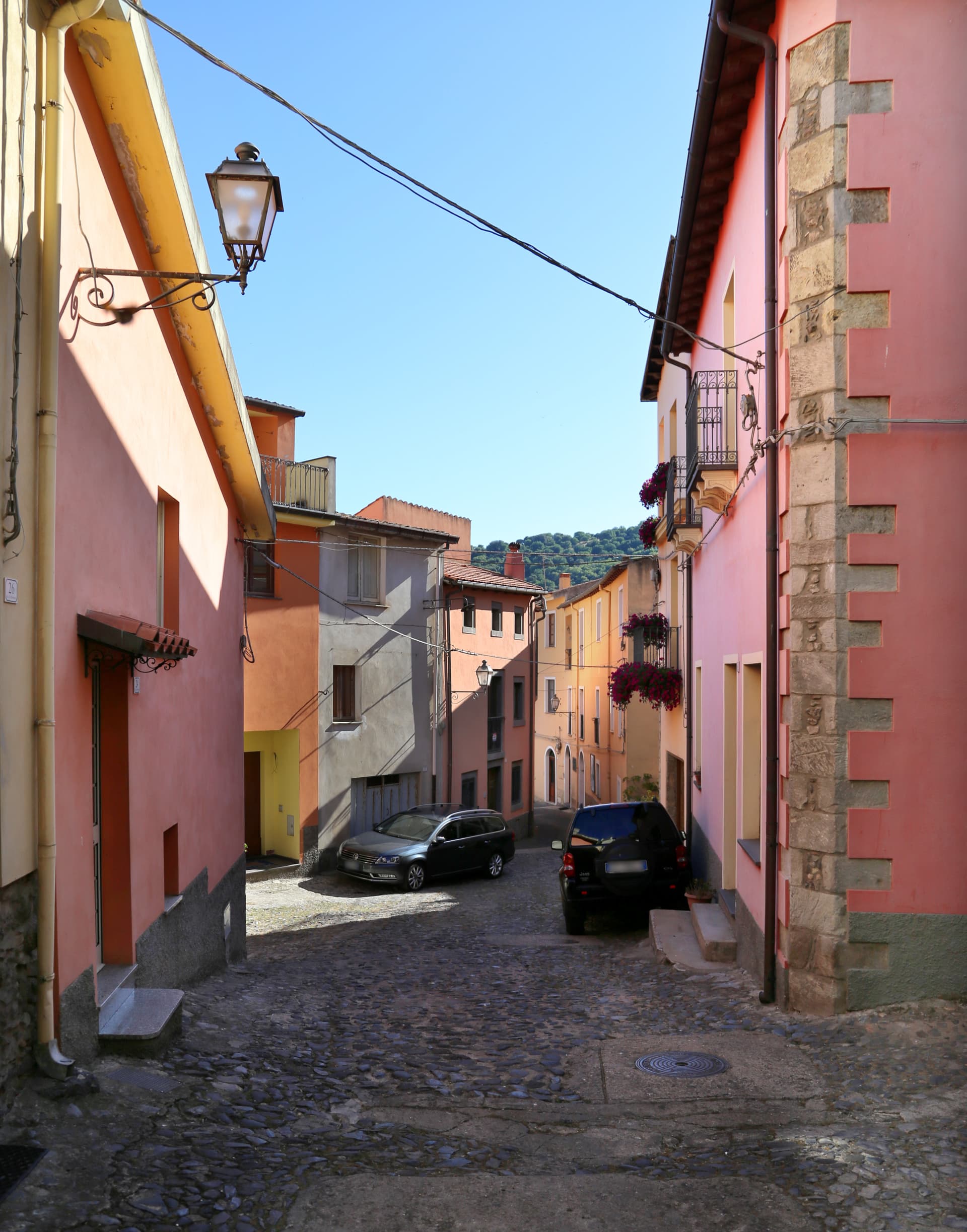
Abruzzo28

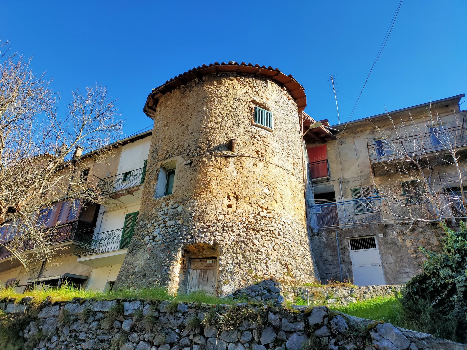
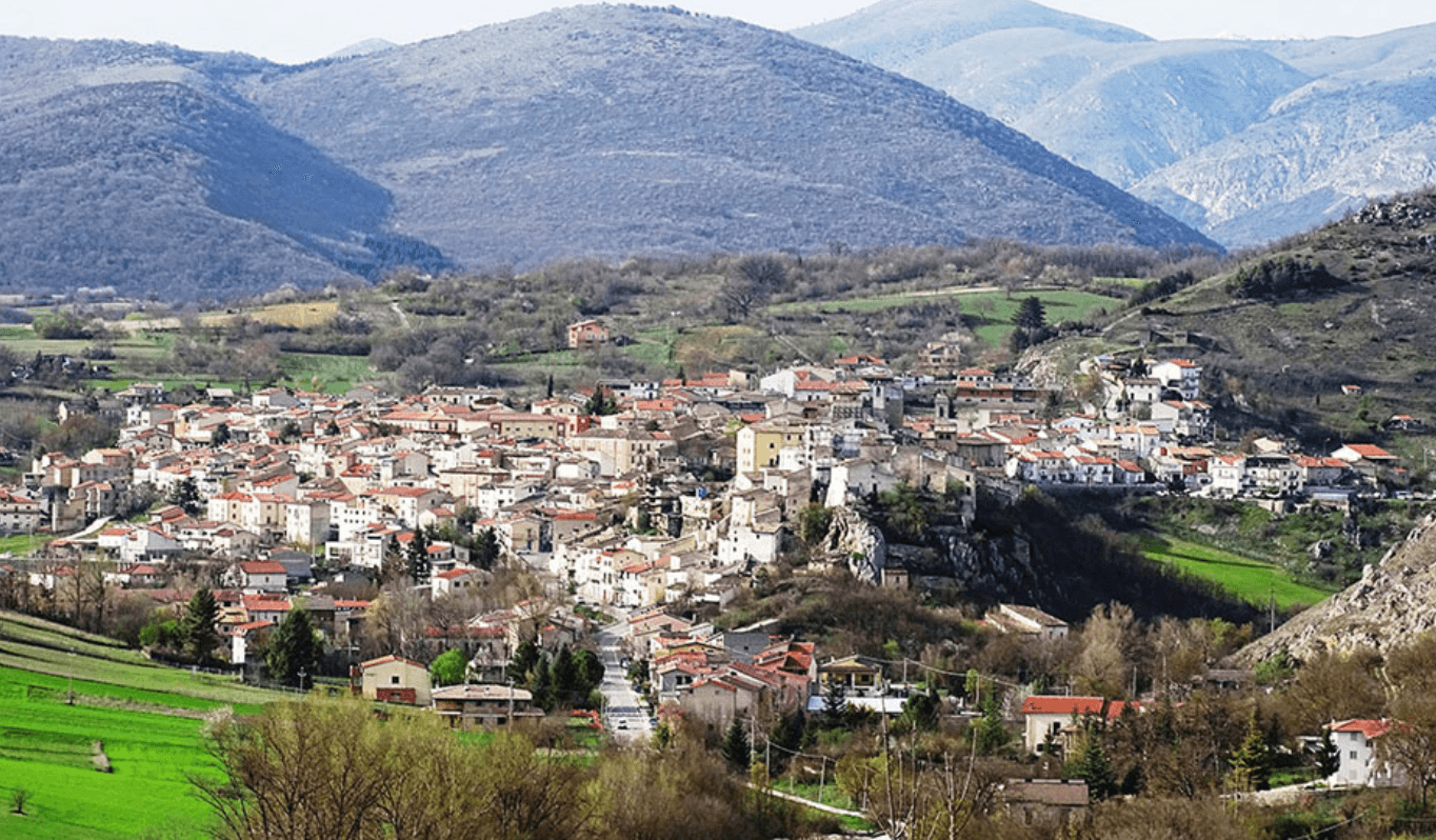
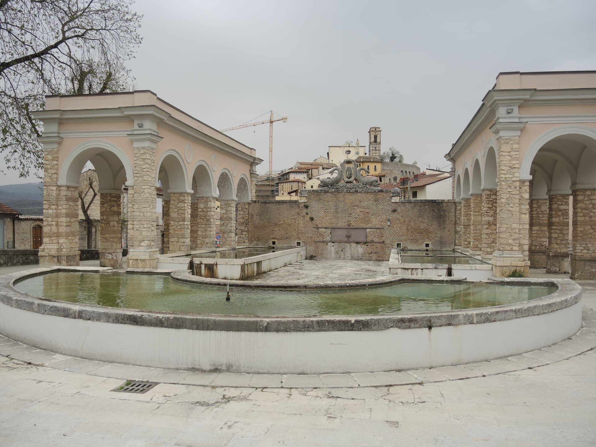
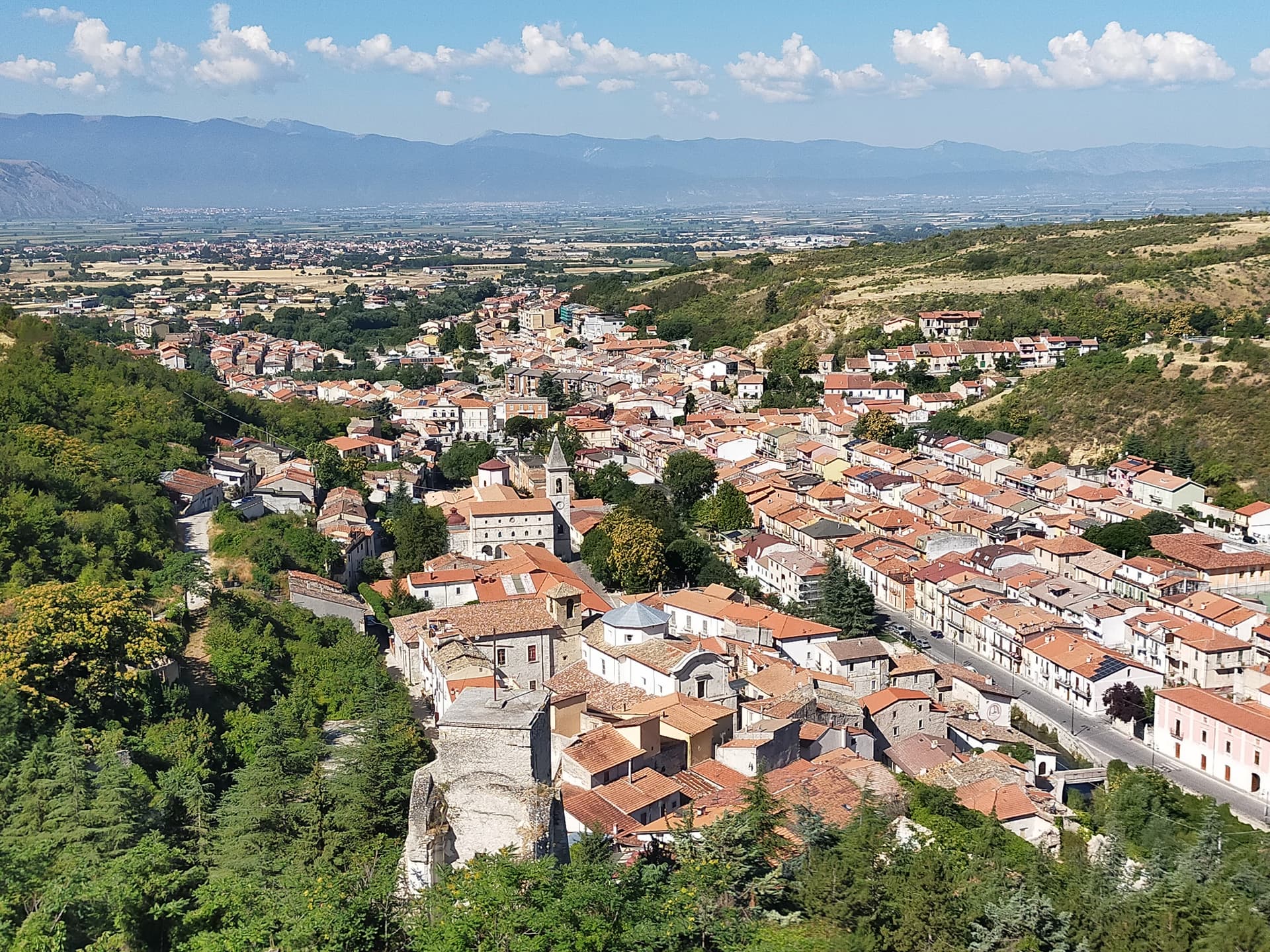
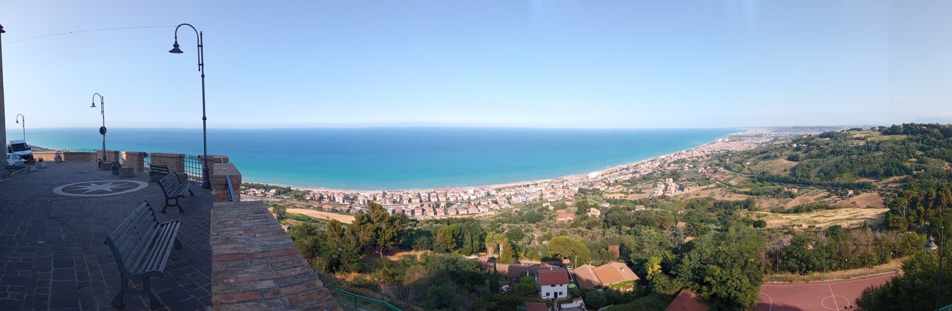
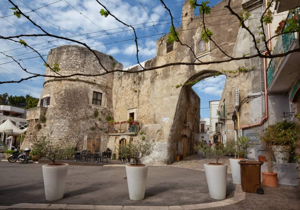
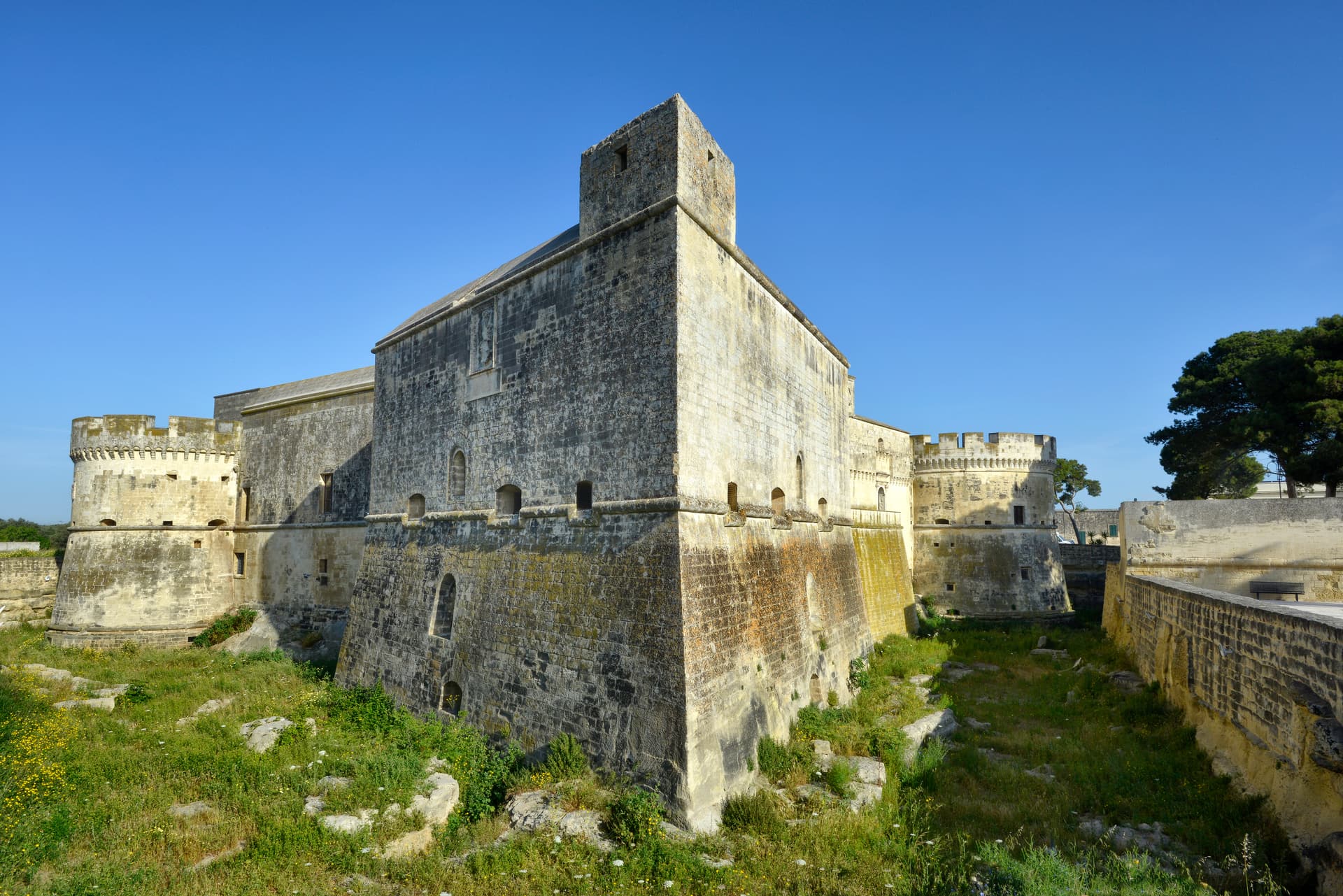
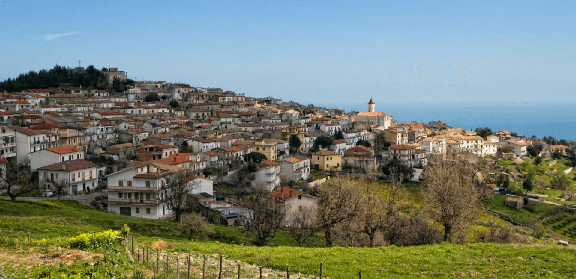
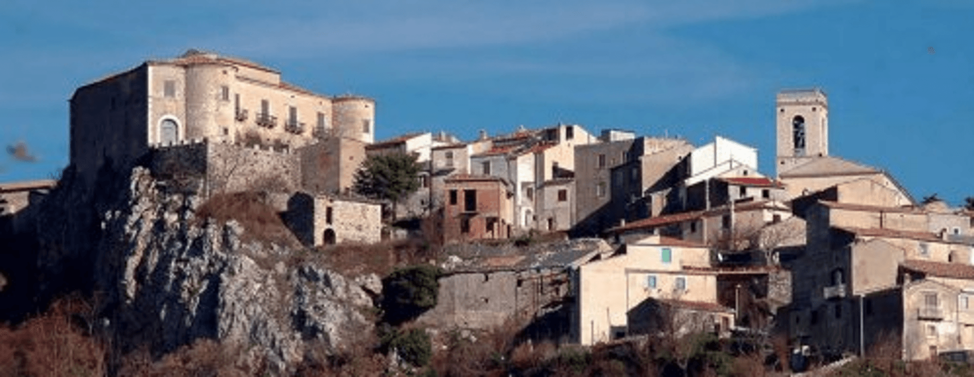
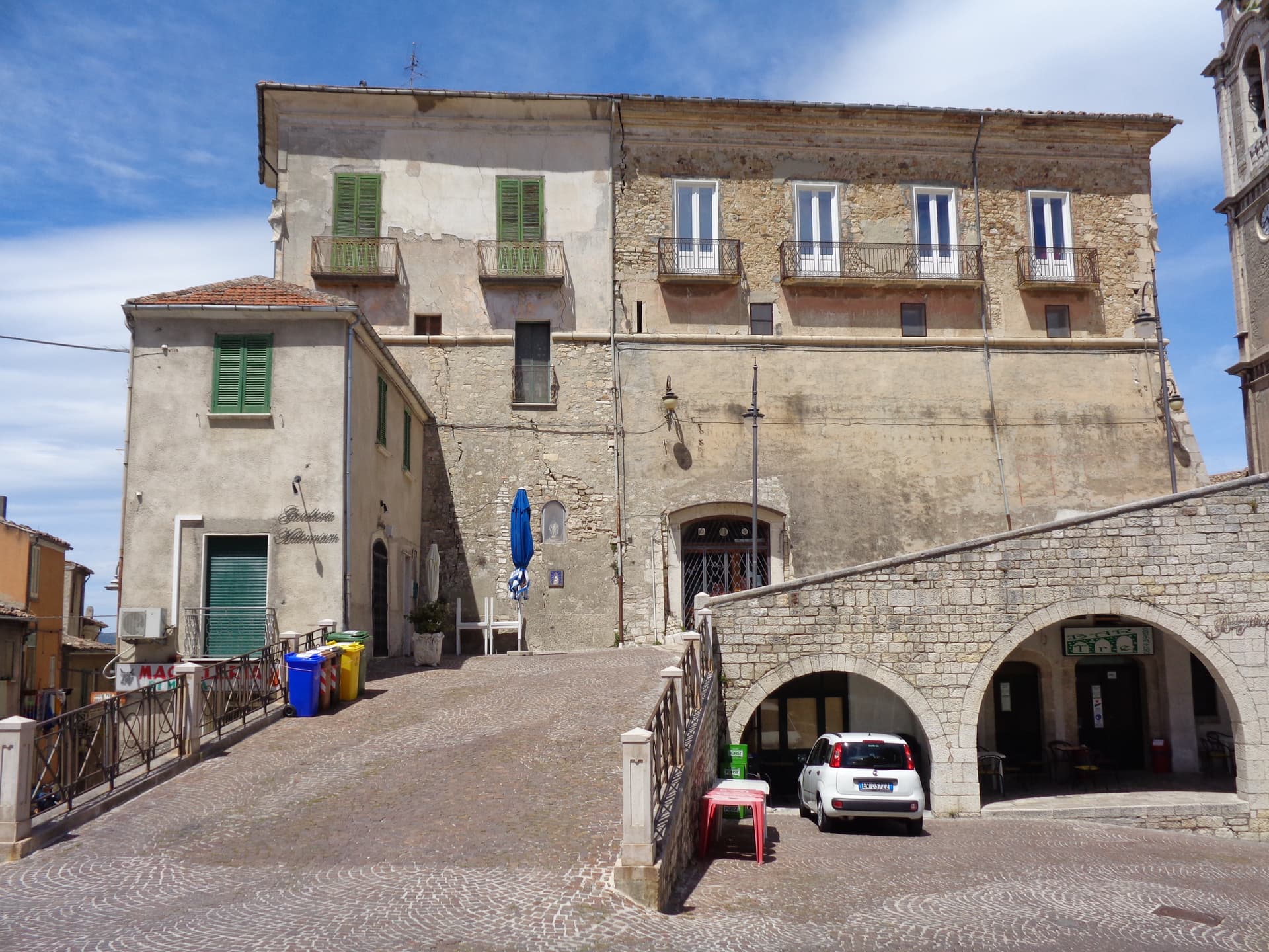
Archi
Province: Chieti · 492 m
A 492-meter rocky spur called the Terrazza sul Sangro, fief of del Balzo, Cantelmo, Colonna and Carafa, now Città del Tartufo and Città dell'Olio.

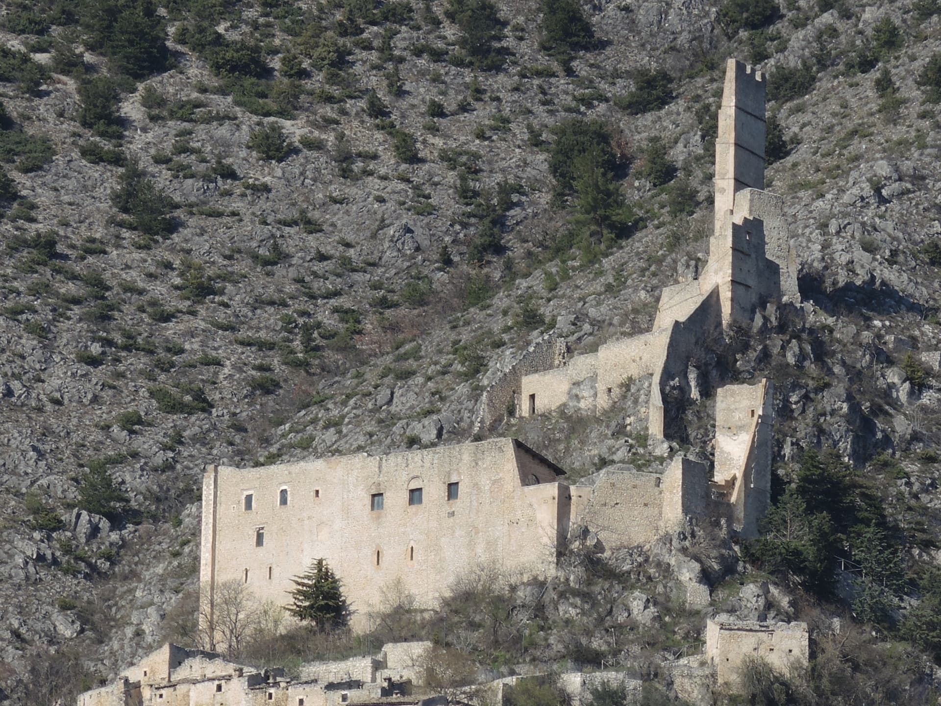
Balsorano
Province: L'Aquila · 359 m
At 359 meters in the Valle Roveto, a Piccolomini castle that became the backdrop for half of 1970s Italian horror cinema.

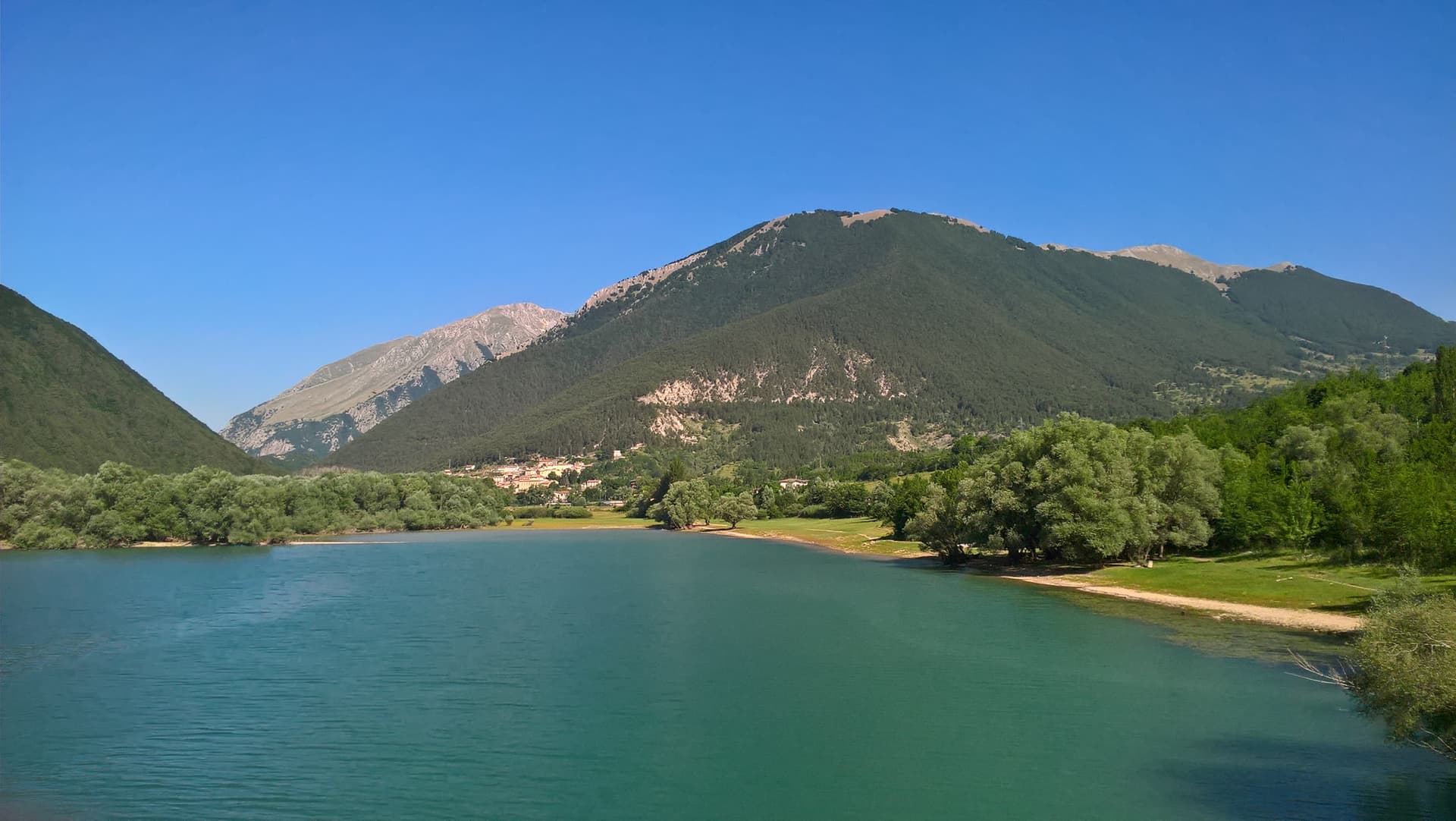
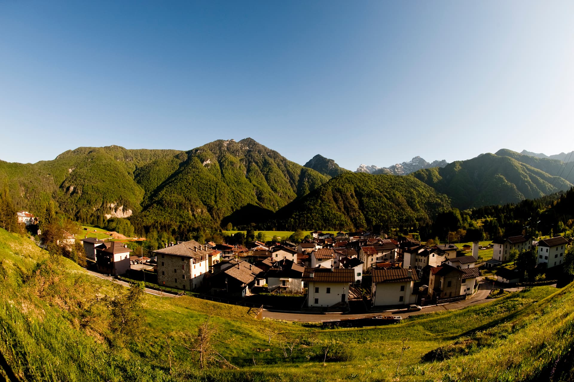
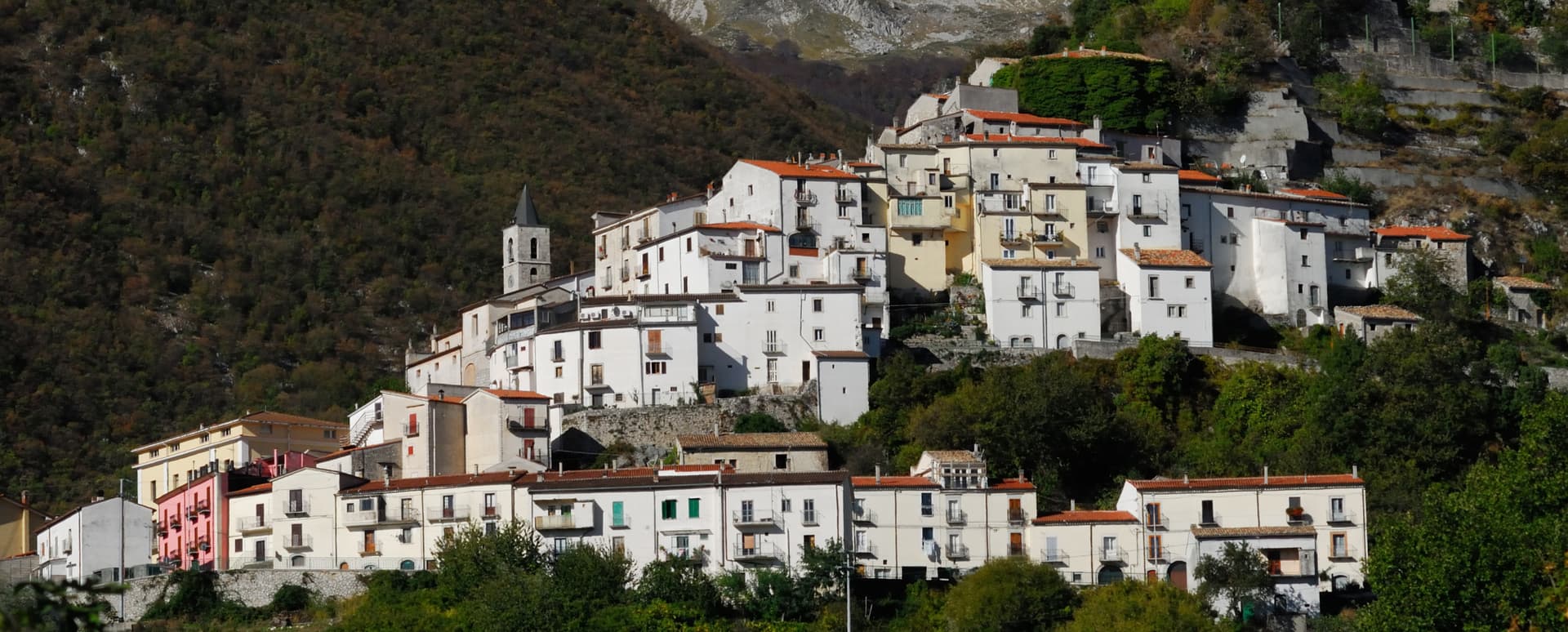
Barrea
Province: L'Aquila · 1,066 m
A 1,066-meter spur above an artificial lake at the heart of the Abruzzo National Park, with a Samnite necropolis and an 11th-century di Sangro castle.

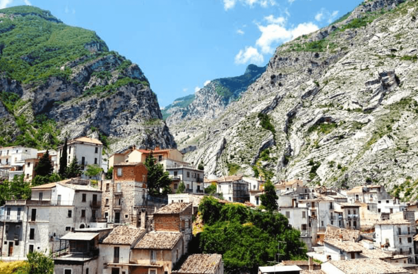
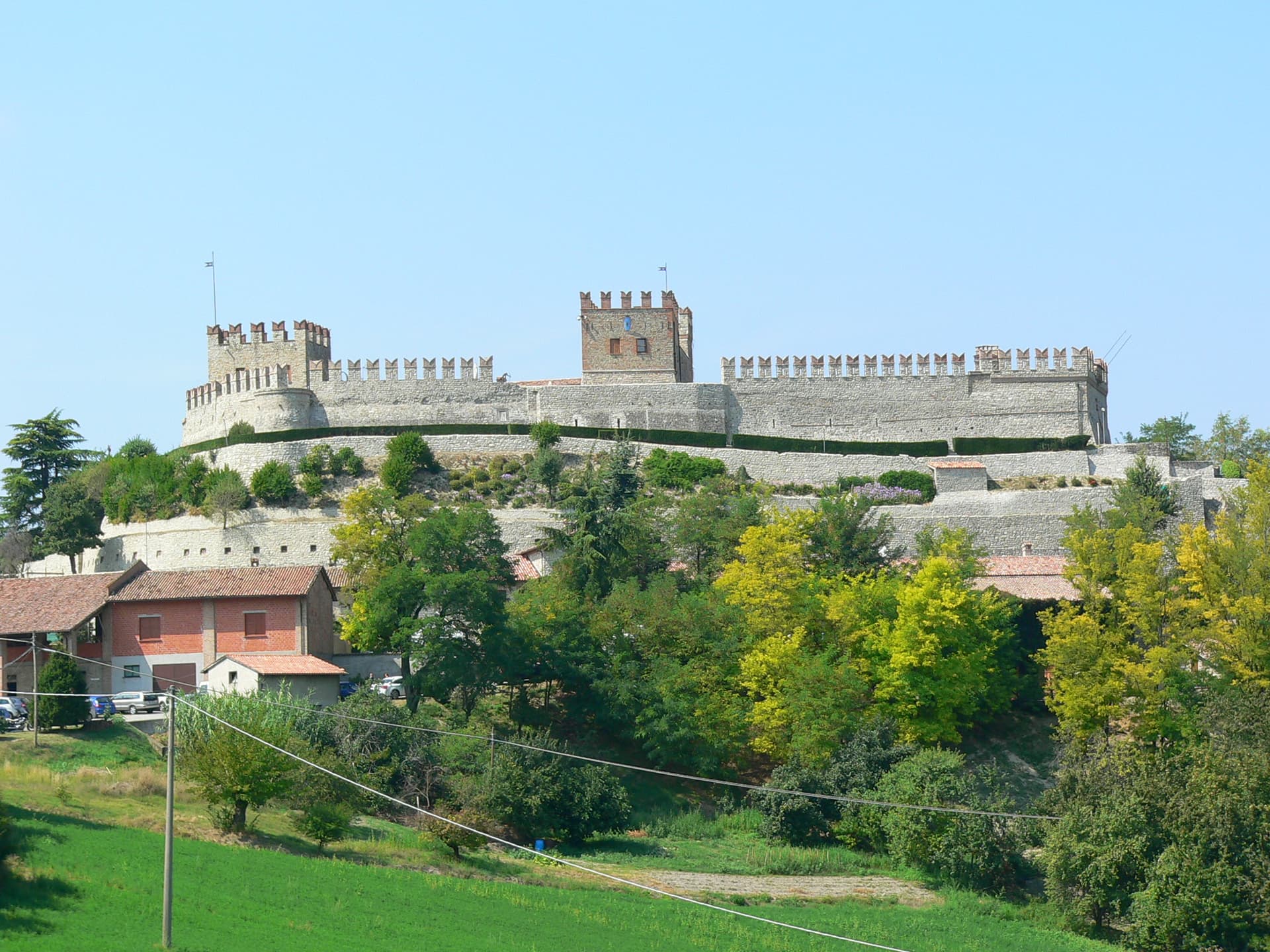
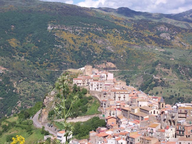
Calascio
Province: L'Aquila · 1,200 m
At 1,200 meters under the highest castle in the Apennines, a village of 125 people that played the monk's refuge in Ladyhawke.

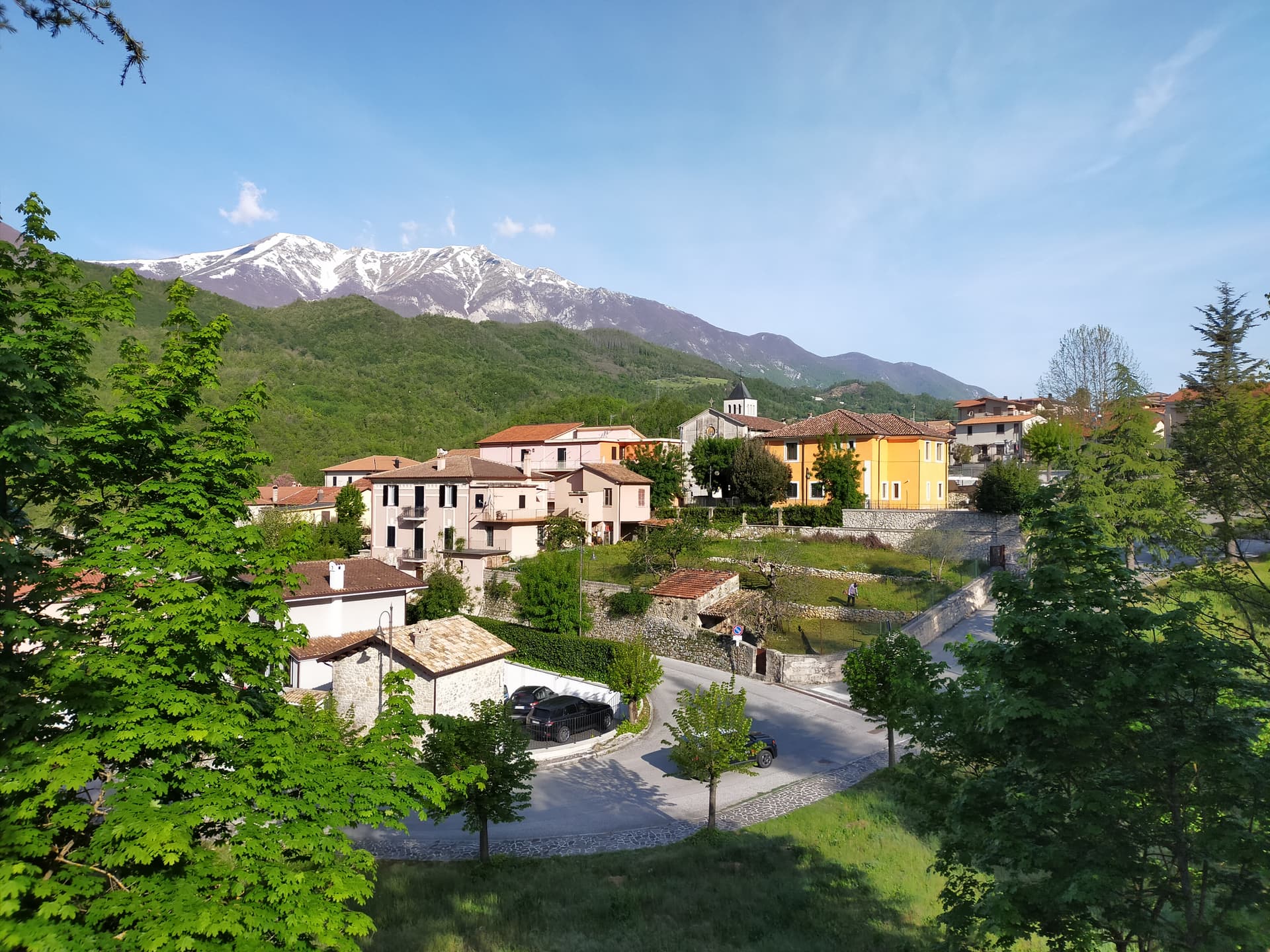
Campo di Giove
Province: L'Aquila · 1,064 m
At 1,064 meters under the southwestern Maiella, the highest village in the park, named for a Roman temple to Jupiter.
Capistrello
Province: L'Aquila · 734 m
At 734 meters where the upper Liri valley meets the Marsica, the village where Emperor Claudius's 52 AD tunnel emptied a lake into a river.
Cappadocia
Province: L'Aquila · 1,102 m
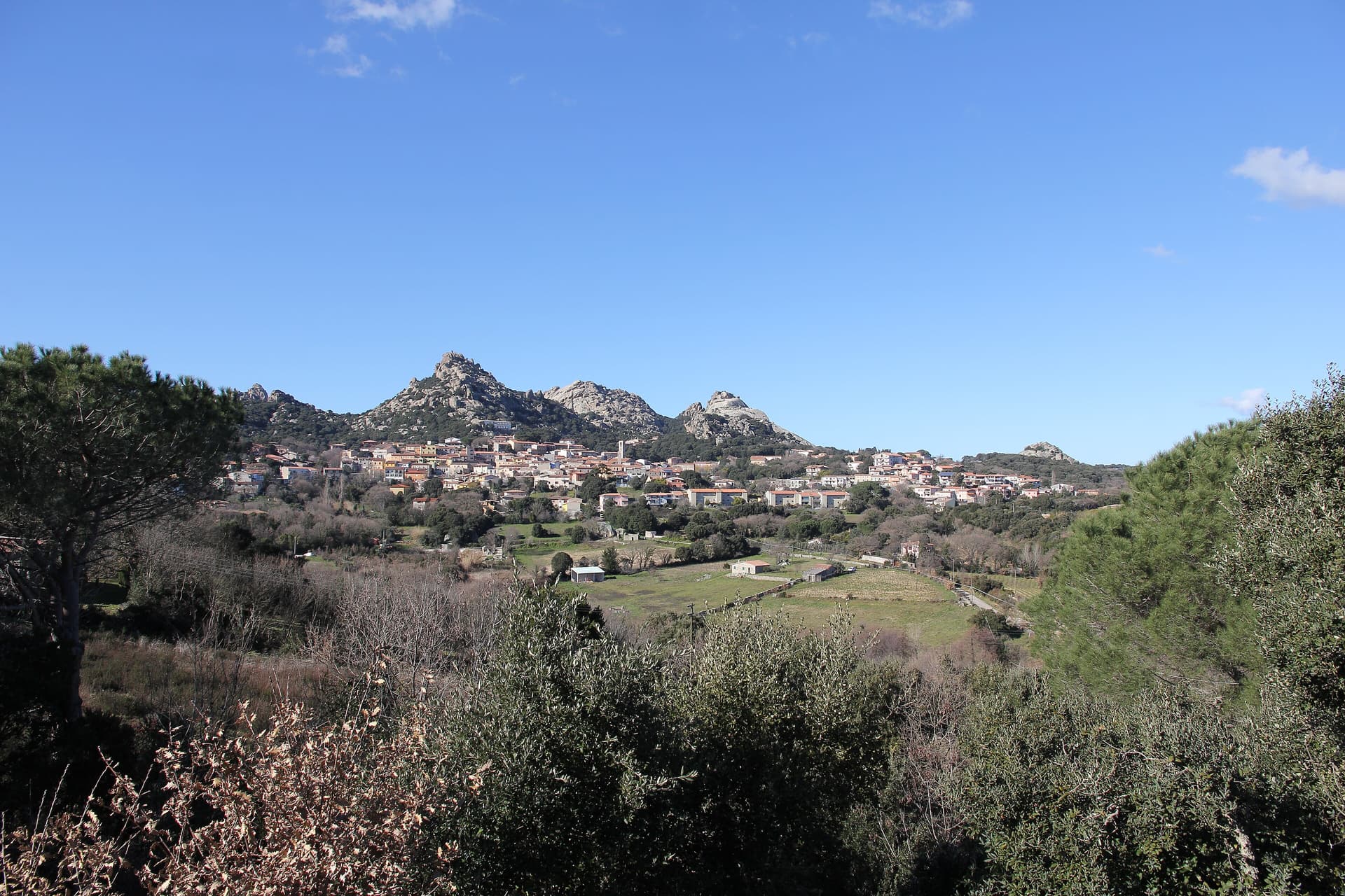
Italy's Cappadocia — a 575-resident Marsican borgo at 1,102m in Abruzzo's western mountains, with the spectacular Grotte di Pietrasecca karst cave system (the longest in the central Apennines), Borgo Autentico + Città delle Grotte signals, and a name that does cause genuine reservations for travellers expecting Turkey's hot-air balloon landscape.
Carsoli
Province: L'Aquila · 616 m
A 616-meter mountain town in the Marsica, built next to the ruins of Roman Carsioli, the 4th-century BC fortress on the road to Alba Fucens.
Castelvecchio Calvisio
Province: L'Aquila · 1,067 m
118 people at 1,067 meters on a ridge above the Tirino, inside a fortified ellipse of stone walls with alleys orthogonal to its perimeter.
Castelvecchio Subequo
Province: L'Aquila · 409 m
At 409 meters under Monte Sirente, the Roman Superaequum and Franciscan station where the saint himself built a convent between 1221 and 1261.
Civita d'Antino
Province: L'Aquila · 904 m
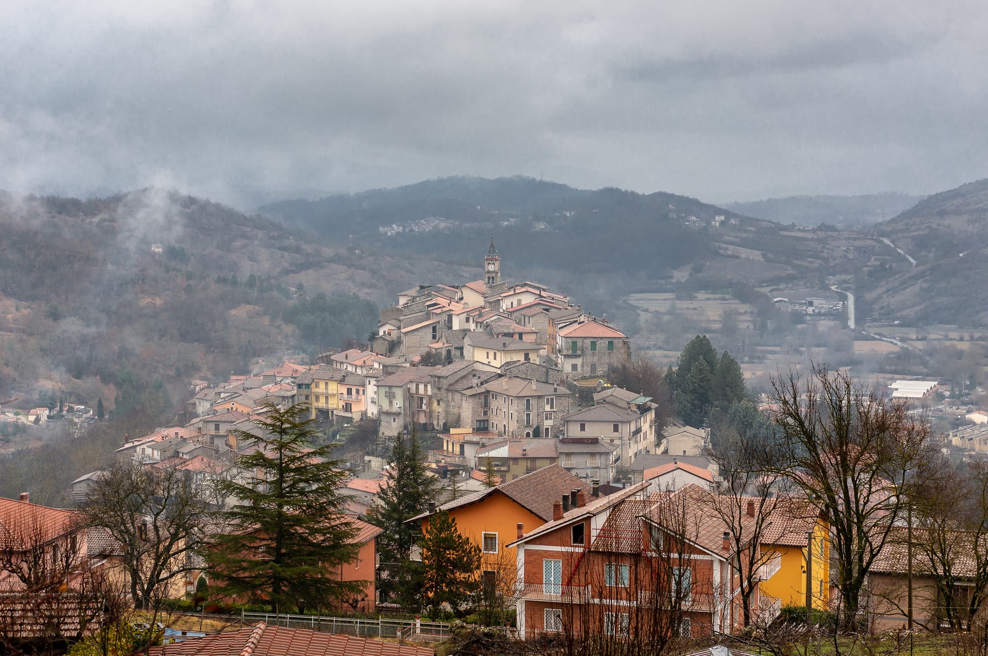
At 904 meters above the Roveto valley, the ancient Marsi town that became a Danish painters' colony from 1883 until the 1915 earthquake.
Corfinio
Province: L'Aquila · 346 m
A village of under a thousand on the Peligna valley floor at 346 meters, sitting on the Italic League's would-be capital Italia.
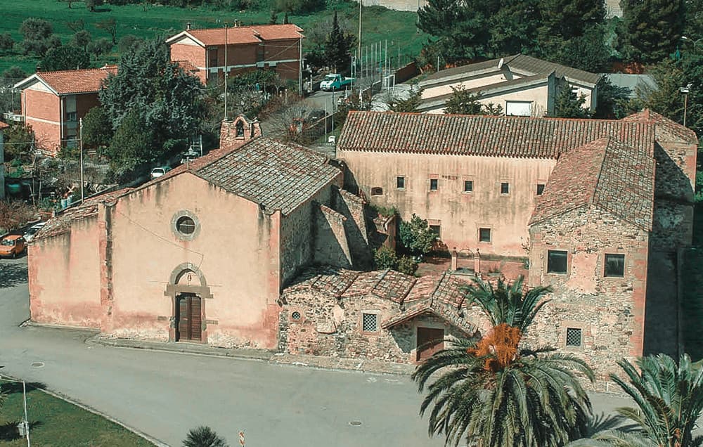
Fara San Martino
Province: Chieti · 440 m
The pasta capital of Italy at 440 meters, where De Cecco was founded in 1886 and the Verde river runs out of a two-meter slot in the Majella wall.
Goriano Sicoli
Province: L'Aquila · 720 m
At 720 meters in the Subequana valley, the medieval village M.C. Escher drew in 1929 and a May ritual the folklorists trace to Demeter.
Monteferrante
Province: Chieti · 800 m
At 800 meters on a terrace above the Sangro valley, a 12th-century Caracciolo feud of 106 people facing Lake Bomba and the Maiella.
Montelapiano
Province: Chieti · 740 m
At 740 meters on a limestone marl ridge, the smallest non-Alpine comune in Italy with 67 residents and a view straight onto Lake Bomba.

Morino
Province: L'Aquila · 440 m
A village at 440 meters in the Val Roveto on the Lazio border, beneath the central Apennines' second-highest waterfall at over 80 meters.
Ovindoli
Province: L'Aquila · 1,375 m
At 1,375 meters on the Altopiano delle Rocche, the closest serious ski station to Rome, working since 1959 on the slopes of Monte Magnola.
Pescina
Province: L'Aquila · 735 m
A Marsica town at 735 meters that lost five thousand of six thousand people in the 1915 earthquake, birthplace of Cardinal Mazarin and Ignazio Silone.
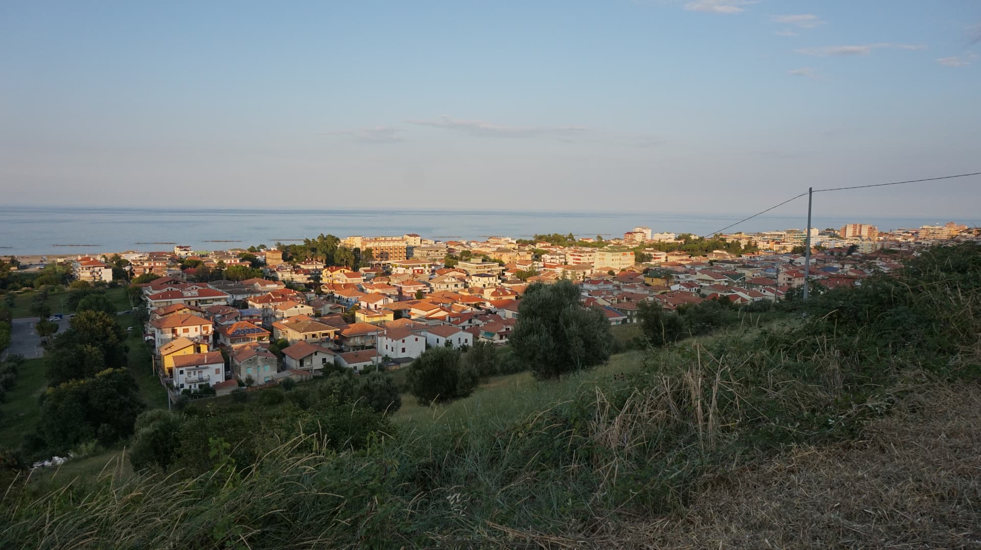
Pineto
Province: Teramo · 4 m
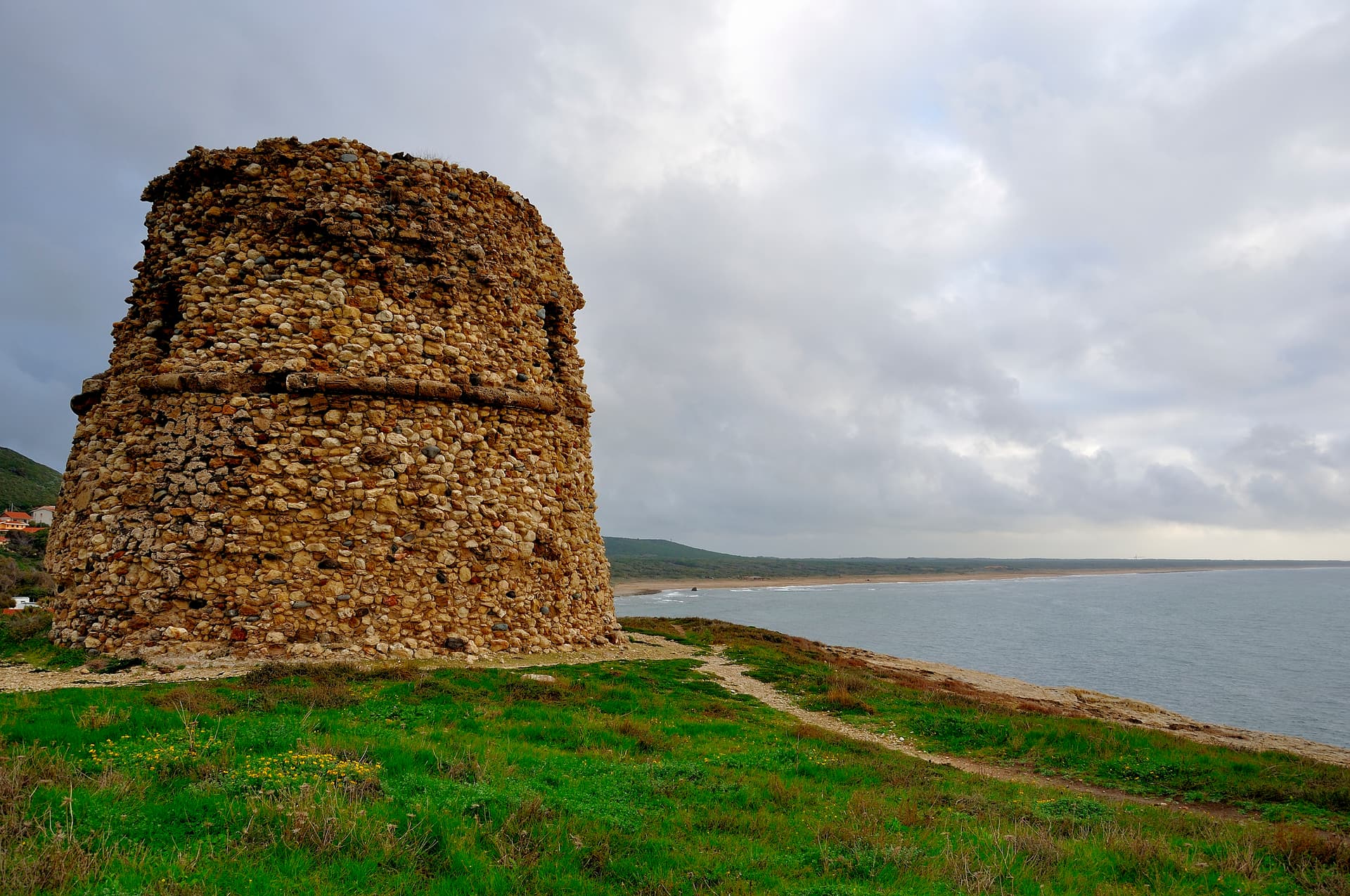
A planned twentieth-century beach town named for D'Annunzio's poem, with the sixteenth-century Cerrano tower anchoring Abruzzo's first marine protected area.
Rocca di Botte
Province: L'Aquila · 750 m
At 750 meters on the Carseolani slopes between Abruzzo and Lazio, the birthplace of an eleventh-century hermit and a fief of the Colonna.
Roccacasale
Province: L'Aquila · 450 m
A village of 597 on the slopes of Monte Morrone, under the ruins of a Cantelmo-De Sanctis castle blown up by Napoleon's army in 1803.
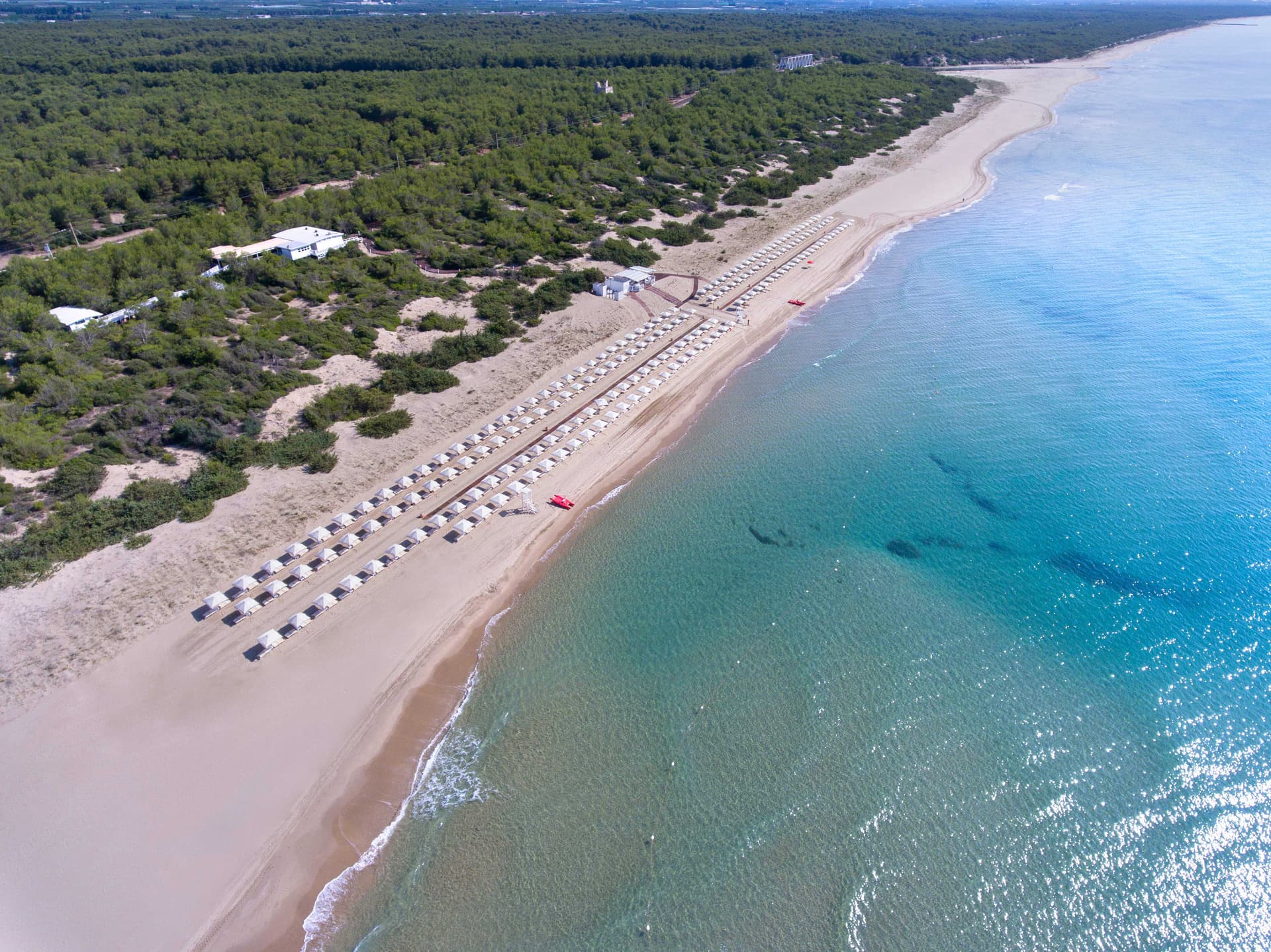
Roseto degli Abruzzi
Province: Teramo · 8 m
An Adriatic beach town of 25,500 with ten kilometers of low-rise sand, a hilltop frazione at 285 meters, and Blue Flags since 1995.
Sante Marie
Province: L'Aquila · 950 m
A 950-meter Marsica village and the trailhead of the Cammino dei Briganti, the seven-day brigand trail through the Cartore band's territory.
Scontrone
Province: L'Aquila · 1,038 m
A 1,038-meter borgo above the Sangro gorge in the Alto Sangro, with two dozen emigration-themed murals and a paleontological site of European importance.
Scurcola Marsicana
Province: L'Aquila · 700 m
At 700 meters below Monte San Nicola on the Piani Palentini, the field where Charles of Anjou broke the Hohenstaufen in 1268.
Silvi
Province: Teramo · 242 m
A split town on the Teramo coast, medieval Silvi Paese at 242 meters above a nine-kilometer beach that built itself on licorice in the 1930s.
Villetta Barrea
Province: L'Aquila · 975 m
At 975 meters on the shore of Lake Barrea, a village inside the Abruzzo National Park where red deer walk the streets alongside residents.
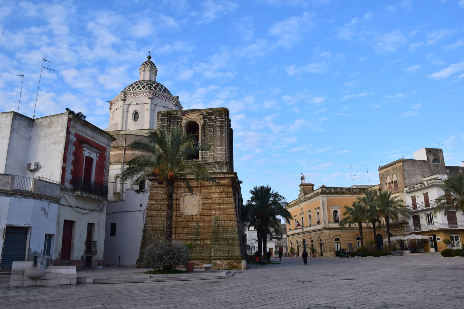
Apulia23
Acquaviva delle Fonti
Province: Bari · 300 m
A Murge town at 300 meters between Bari and the Itria valley, named for its springs and a DOP red onion.
Biccari
Province: Foggia · 450 m
A Subappennino Dauno borgo at 450 meters under Monte Cornacchia, the highest peak in Puglia at 1,151 meters, with a Byzantine tower at its core.
Campi Salentina
Province: Lecce · 47 m
A Salento plain town fifteen kilometers north of Lecce, founded after the Saracen raids of 926, with a Frederician castle that became a Paladini-Enriquez marquisate.
Casamassima
Province: Bari · 230 m
The blue town of the Murge, twenty kilometers south of Bari, its centro storico painted with copper-blue lime after the 1658 plague spared its residents.
Cassano delle Murge
Province: Bari · 341 m
A Murge foothills town at 341 meters at the gate of the Alta Murgia park, with the 1,300-hectare Foresta Mercadante mostly inside its territory.
Castellaneta
Province: Taranto · 235 m
A cliff-edge Murge town at 235 meters above the Gravina Grande canyon, birthplace of Rudolph Valentino in 1895, with a Bandiera Blu Ionian marina.

Celle di San Vito
Province: Foggia · 726 m
The smallest commune in Puglia, 148 residents at 726 meters in the Monti Dauni, one of two Franco-Provençal-speaking villages in the south.
Copertino
Province: Lecce · 34 m
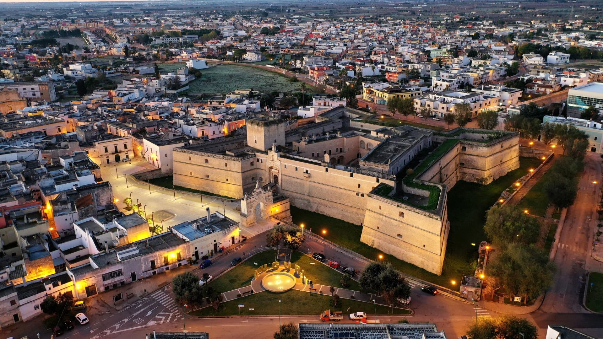
A Salento town fifteen kilometers west of Lecce, with one of Puglia's largest Renaissance fortresses and the birthplace of Saint Joseph of Copertino.

Faeto
Province: Foggia · 820 m
The highest village in Puglia at 820 meters, Franco-Provençal-speaking since 1266, on a Monti Dauni ridge below Monte Cornacchia.
Galatone
Province: Lecce · 57 m
A Salento town at 57 meters thirteen kilometers from Gallipoli, built around a Baroque sanctuary raised over a fourteenth-century Byzantine icon.
Gallipoli
Province: Lecce · 12 m
The Ionian beach city on a limestone island, Greek Kallipolis meaning beautiful city, tied to the mainland by a seventeenth-century bridge.
Giurdignano
Province: Lecce · 78 m
A two-thousand-resident Salento borgo at 78 meters known as the megalithic garden of Italy, with nineteen menhirs and a cluster of dolmens.
Martano
Province: Lecce · 91 m
The biggest town in the Grecìa Salentina, twenty kilometers south of Lecce, where the Griko language still survives among older residents.
Melendugno
Province: Lecce · 36 m
Salento's archaeological-beach capital — a 10,000-resident Lecce-province comune covering 17 km of Adriatic coast with three Bandiera Blu beaches (Torre dell'Orso, San Foca, Sant'Andrea), the Grotta della Poesia karst pool (one of the world's most beautiful natural pools per National Geographic), and the Bronze-Age-to-Messapian-to-medieval Roca Vecchia archaeological site.
Minervino Murge
Province: Barletta-Andria-Trani · 445 m
The Balcone di Puglia at 445 meters on the Alta Murgia, between the Ofanto valley and Monte Vulture, inside the national park.
Nociglia
Province: Lecce · 90 m
A small Salento interior village forty kilometers south of Lecce, a fourteenth-century baronial castle and a Bosco Belvedere that gave the place its name.
Peschici
Province: Foggia · 91 m
A Gargano cliff-top village above the Adriatic with a Norman castle of 1023, white houses spilling toward the sea and trabucchi on the headlands.
Poggiorsini
Province: Bari · 461 m
The smallest commune in metropolitan Bari, an Orsini estate of 1609 that became an independent town only in 1957.

San Giovanni Rotondo
Province: Foggia · 565 m
The Gargano town where Padre Pio lived for fifty-two years, second-largest pilgrimage site in Italy, with a Renzo Piano sanctuary that seats 6,500.
Trinitapoli
Province: Barletta-Andria-Trani · 5 m
A Tavoliere town between the Saline di Margherita and the Ofanto, sitting on a Bronze Age sanctuary that still surprises archaeologists.
Ugento
Province: Lecce · 108 m
A Messapian-Roman town five kilometers from the Ionian, where a Baroque castle sits on the walls of the ancient city of Ozan.
Vernole
Province: Lecce · 38 m
A Salento commune ten kilometers from Lecce whose frazione of Acaya is the only Renaissance fortified town in southern Italy.

Vieste
Province: Foggia · 43 m
The Gargano headland of whitewashed alleys on a white limestone cliff, with the Pizzomunno sea stack standing 26 meters offshore.
Basilicata5
Accettura
Province: Matera · 770 m
A 770-meter village in the Gallipoli Cognato park where, each Pentecost, a Turkey oak is married to a holly tree.
Aliano
Province: Matera · 555 m
The clay-hill village at 555 meters above the Agri valley where Carlo Levi served his 1935 exile and is buried in the cemetery.
Grottole
Province: Matera · 481 m
A hilltop borgo at 481 meters between the Bradano and Basento, where six hundred empty houses outnumber residents in the centro storico.
Rotonda
Province: Potenza · 626 m
The Pollino park's Lucanian gateway — a 3,171-resident borgo at 626m on the Basilicata/Calabria border, headquartered HQ for the Parco Nazionale del Pollino (Italy's largest national park), with the Fagiolo Bianco Poverello + Melanzana Rossa di Rotonda DOP slow-food products, the Borgo Autentico mark, and the Loricato pine forests immediately above town.
San Mauro Forte
Province: Matera · 540 m
A 540-meter Lucanian hill town built around a surviving Norman tower, where the Sagra dei Campanacci on 16 January wakes the village with cowbells.
Calabria11
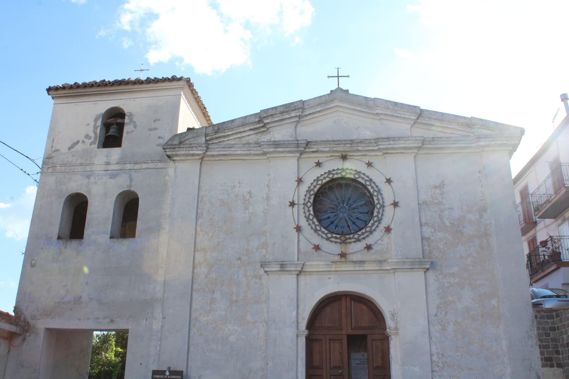
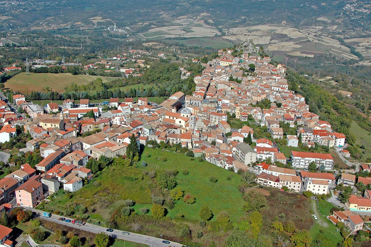
Albidona
Province: Cosenza · 810 m
A hill village at 810 meters between the Pollino and the Ionian, identified by ancient writers as Leutarnia, the city founded by Calchas after Troy.
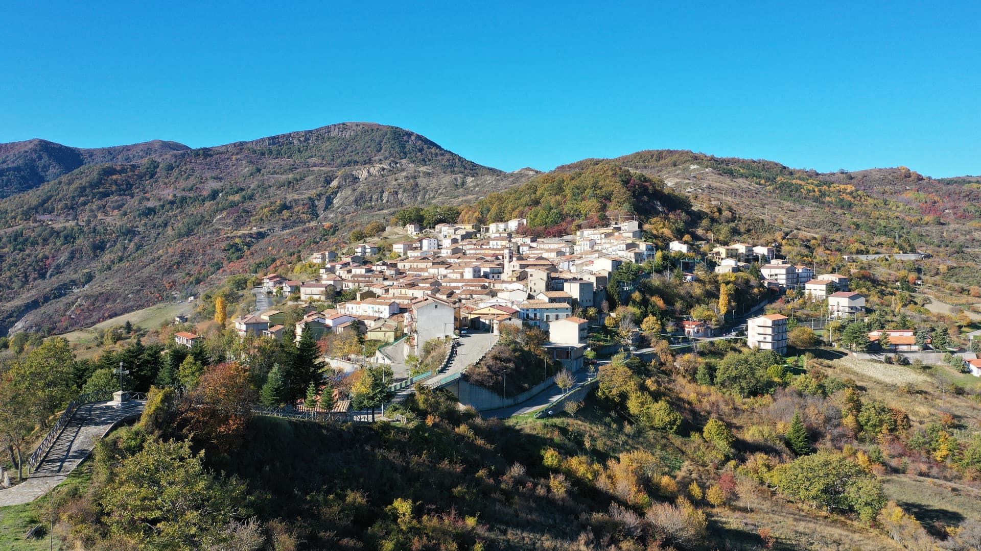
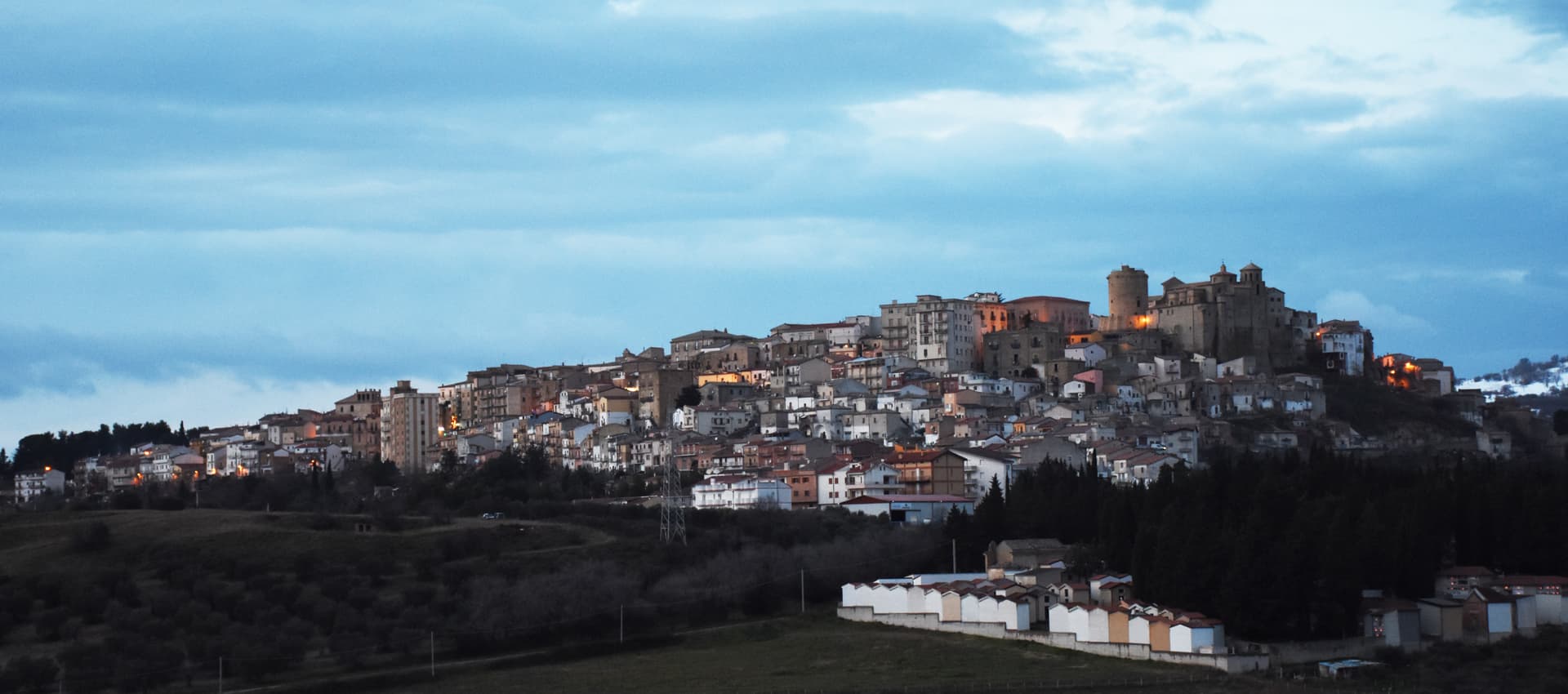
Alessandria del Carretto
Province: Cosenza · 1,043 m
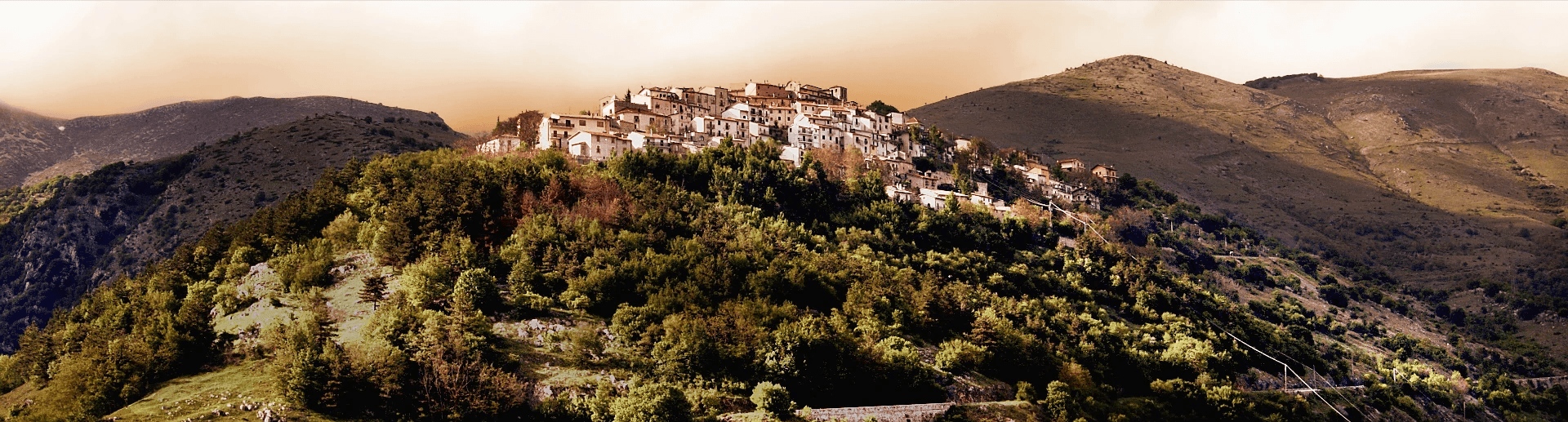
The highest village in the Pollino at 1,043 meters, the only Italian commune carrying its founder's full name, with a fir-tree ritual every 3 May.

Cicala
Province: Catanzaro · 829 m
A village of 887 people at 829 meters on the western foothills of the Sila Piccola, founded in 1616 by farmers asking the Count Cigala for land.
Cirò
Province: Crotone · 351 m
A hill village at 351 meters above the Ionian, the historic heart of Cirò DOC, Calabria's first denominazione and a candidate for the region's first DOCG.
Gizzeria
Province: Catanzaro · 600 m
An Arbëreshë hill village at 600 meters above the Gulf of Sant'Eufemia, with kitesurf beaches and brackish lagoons on the Tyrrhenian below.
Laino Borgo
Province: Cosenza · 582 m
Southern Italy's only Sacro Monte, sixteen pilgrimage chapels begun in 1557, on the Lao river canyon that made it Calabria's rafting capital.
Mendicino
Province: Cosenza · 475 m
A silk-mill village at the foot of Monte Cocuzzo, ten kilometers from Cosenza, where water still drives the old spinning wheels.
Montegiordano
Province: Cosenza · 619 m
A 619-meter Alto Jonio hill town with a Pignone del Carretto hunting castle and more than two hundred murals across its centro storico.
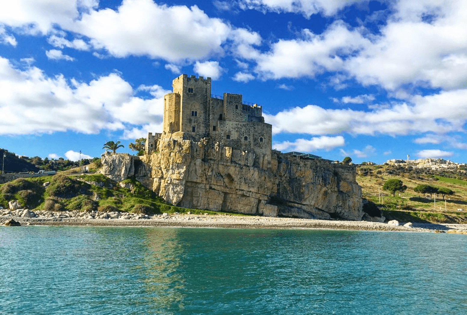
Roseto Capo Spulico
Province: Cosenza · 217 m
A Frederician castle on a rock above the Ionian, a former Sybaris satellite city founded in the seventh century BC, Templar legend included.

Saracena
Province: Cosenza · 606 m
A 606-meter Pollino borgo named for its Saracen souk and protected by Slow Food for a passito Moscato traced to the sixteenth century.
Serrastretta
Province: Catanzaro · 840 m
The chair town of the Reventino massif, founded in 1383 in a narrow gorge between two mountain ranges, still weaving straw seats by hand.
Campania2

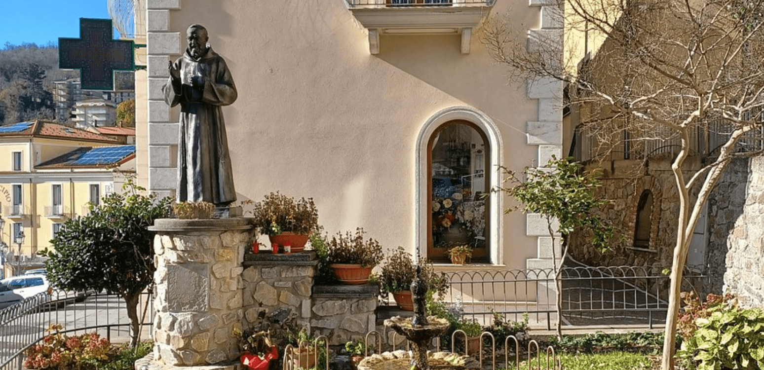
Morcone
Province: Benevento · 600 m
A Sannite hill town at 600 meters above the Tammaro valley, with 5th-century BC walls and the convent where Padre Pio took vows.
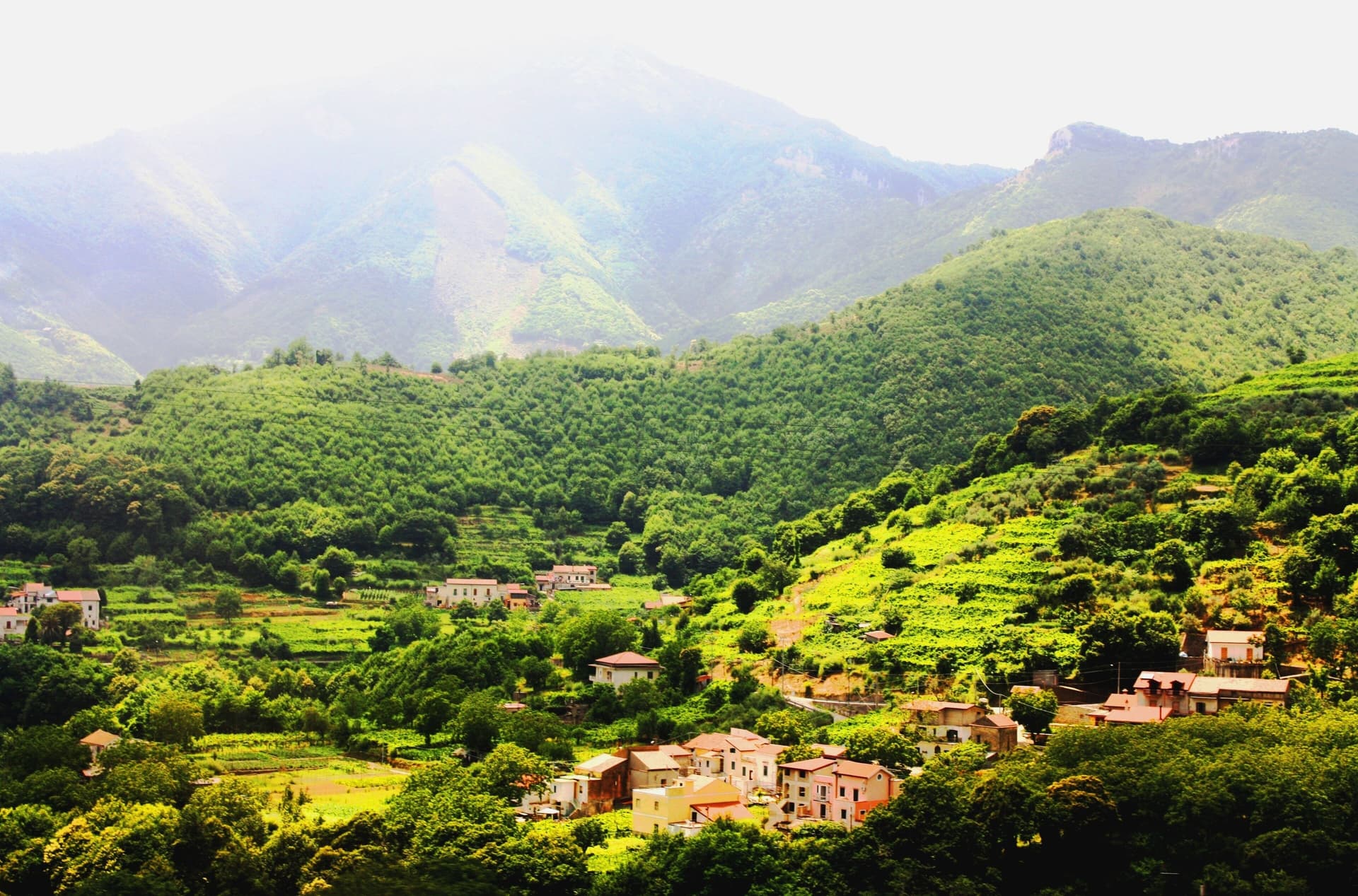
Tramonti
Province: Salerno · 321 m
The inland side of the Amalfi Coast, thirteen hamlets on the Lattari slopes producing the Costa d'Amalfi Tramonti DOC and an exported pizza dough.
Friuli-Venezia Giulia2
Forni di Sotto
Province: Udine · 791 m
Carnia's Dolomite gateway — a 548-resident alpine borgo at 791m at the head of the Val Tagliamento, gateway to the Parco Naturale delle Dolomiti Friulane (UNESCO Dolomites), with Borgo Autentico mark, a centro almost entirely rebuilt after the 1944 German wartime burning, and direct access to the Forni Avoltri-Sappada ski + hiking circuit.
Sauris
Province: Udine · 1,212 m
A 1,212-meter German-speaking island in the Carnic Alps, second-highest commune in Friuli, where Tyrolean settlers founded the village around the thirteenth century.
Lazio2
Bassiano
Province: Latina · 562 m
The highest village in the province of Latina at 562 meters, birthplace of Aldo Manuzio, who shrank the book to pocket size.
Oriolo Romano
Province: Viterbo · 420 m
A planned sixteenth-century village in the Sabatini hills, founded in 1560 by a Santacroce nobleman next to the UNESCO beech forest of Monte Raschio.
Marche2
Magliano di Tenna
Province: Fermo · 281 m
A small Fermo-province borgo at 281 meters above the Tenna river, ringed by fourteenth-century walls with two of its six original towers still standing.

Monte Rinaldo
Province: Fermo · 478 m
A 317-resident village on a 478-meter ridge of the Aso valley in the Marche interior, anchored by the 1st-century BC Roman sanctuary of La Cuma — the largest pre-imperial sanctuary excavated in the central Adriatic.
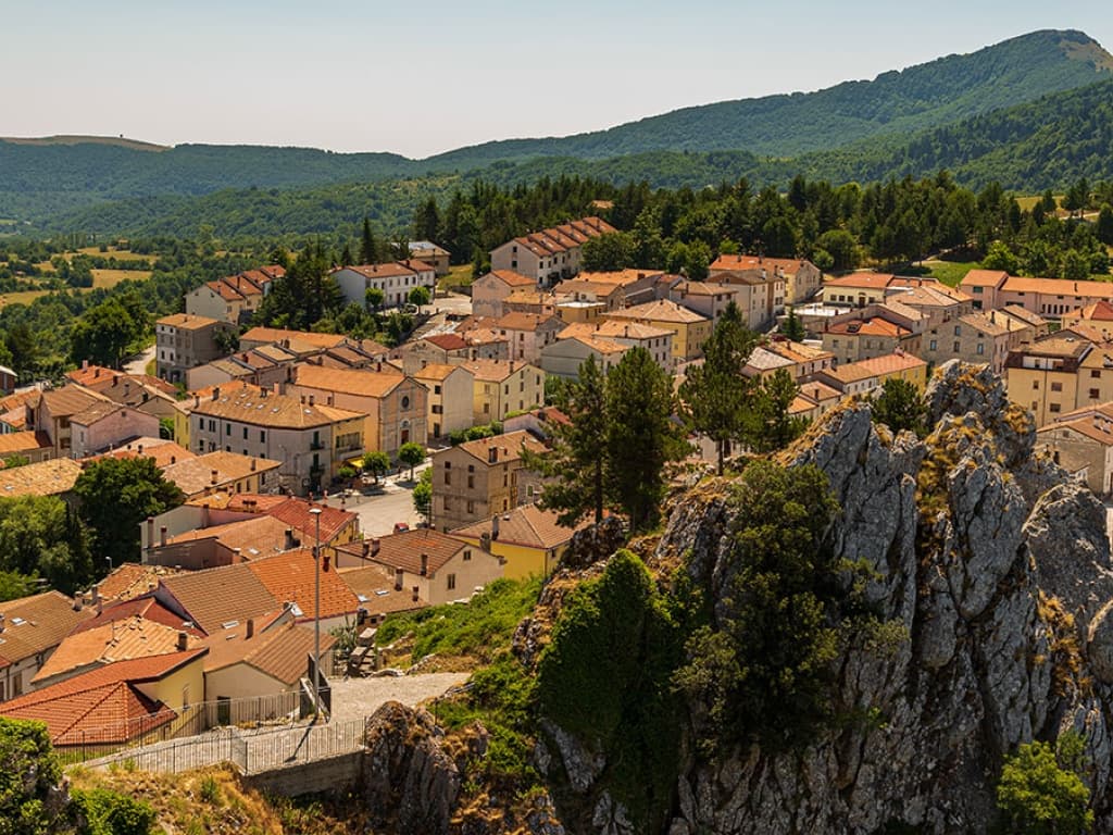
Molise6
Capracotta
Province: Isernia · 1,421 m
At 1,421 meters the second-highest commune in central Italy, holder of the world record for snowfall in 24 hours: 2.56 meters on 5 March 2015.
Castel del Giudice
Province: Isernia · 800 m
Italy's most-cited Apennine reinvention case study — a 308-resident Alto Molise borgo at 800m that rebuilt its abandoned schoolhouse as a 30-room albergo diffuso, recovered 5,000 ancient apple trees into a recognised organic-orchard cooperative, and became the template Comuni Virtuosi cite when explaining how depopulated villages can self-sustain.
Macchiagodena
Province: Isernia · 868 m
Molise's white truffle capital — a 1,648-resident hilltop borgo at 868m in the Apennine middle Molise, with the Castello dei Pignatelli on the summit, intact medieval streets, and 30+ active truffle hunters working the surrounding oak forests with the local Molise white truffle harvest October-December.
Pescopennataro
Province: Isernia · 1,190 m
An Alto Molise stone village at 1,190 meters, the paese della pietra e degli abeti, above a rare high-altitude white-fir forest.
Pizzone
Province: Isernia · 724 m
A 313-person Mainarde village at 724 meters in the Molise sector of the Abruzzo, Lazio and Molise National Park, above the Volturno springs.
Ripalimosani
Province: Campobasso · 640 m
A sandstone-ridge village at 640 meters above the Biferno valley, the historic land of the funai rope makers and a Tintilia wine commune.

Sardinia14
Aggius
Province: Sassari · 514 m
A Gallura granite village at 514 meters under the Monti di Aggius, with the largest ethnographic museum in Sardegna and three centuries of bandit history.
Aritzo
Province: Nuoro · 800 m
A Mandrolisai mountain village at 800 meters in chestnut and hazelnut forest, where snow once travelled out in straw and came back as lemon sorbet.
Bolotana
Province: Nuoro · 472 m
A Marghine hill village at 472 meters between mountain and Tirso valley, with a Welsh railway engineer's villa hidden in a four-hectare exotic garden.
Cuglieri
Province: Oristano · 428 m
A Montiferru town at 428 meters, with the first minor basilica in Sardegna above it and the ruins of Punic Cornus below.

Galtellì
Province: Nuoro · 49 m
Grazia Deledda's 'Canne al vento' set — a 2,354-resident Baronia borgo under the Monte Tuttavista in Sardinia's northeast, with the triple Borghi Autentici + Bandiera Arancione + Città del Vino signal, the 11th-c Cattedrale di San Pietro (Sardinia's first), and the entire centro recognised as the Parco Letterario Grazia Deledda for being the literal setting of her 1913 Nobel-trajectory novel.
Masullas
Province: Oristano · 129 m
A Marmilla village at 129 meters where a 17th-century Capuchin convent houses fossils, minerals, and the volcanic history of Monte Arci.
Montresta
Province: Oristano · 405 m
A Planargia hill village of 438 people founded in 1746 by Maniot Greek families who left Corsica for new land in Sardinia.
Orosei
Province: Nuoro · 19 m
A small Baroque town at 19 meters in the Cedrino valley, two kilometers from the limestone gulf whose southern coves are reached only by boat.

Orroli
Province: Sud Sardegna · 550 m
A Sarcidano village at 550 meters on the Pranemuru basalt plateau, home of the Nuraghe Arrubiu, the only five-tower nuraghe in Sardinia.
Samugheo
Province: Oristano · 380 m
Sardinia's textile-weaving capital — a 2,757-resident Mandrolisai borgo with the MURATS regional textile museum, the annual Tessingiu woven-art biennale, an active community of weavers still on traditional looms, and the Mandrolisai DOC red from the granite-soil vineyards around it.
Santu Lussurgiu
Province: Oristano · 503 m
A Montiferru village at 503 meters where the Carnival horse race runs through a steep stone street and saddlery has been made since 1923.
Sardara
Province: Sud Sardegna · 163 m
A Campidano thermal town where Nuragic well-temples, Roman Aquae Neapolitanae and a hilltop Arborea castle share the same hot springs.

Sedini
Province: Sassari · 295 m
Sardinia's most spectacular Domus de Janas — a 1,245-resident Anglona borgo with a prehistoric rock-cut tomb complex carved into a giant limestone outcrop inside the village itself, later reused as a Romanesque church and now a small museum, anchoring a Borgo Autentico-marked centro in the inland Sassari province.
Seneghe
Province: Oristano · 305 m
An olive-oil village on the eastern slope of Montiferru, 25 km from Oristano, that doubles as Sardegna's poetry capital each September.
Sicily3
Cammarata
Province: Agrigento · 700 m
A Sicani town at 700 meters on the northeast slope of Monte Cammarata, the 1,578-meter peak that gives the comune its name and shape.
Castel di Lucio
Province: Messina · 750 m
A Nebrodi village at 750 meters on the borderline of three provinces, with a Ventimiglia castle from 1090 and a Fiumara d'Arte sculpture by Paolo Schiavocampo.
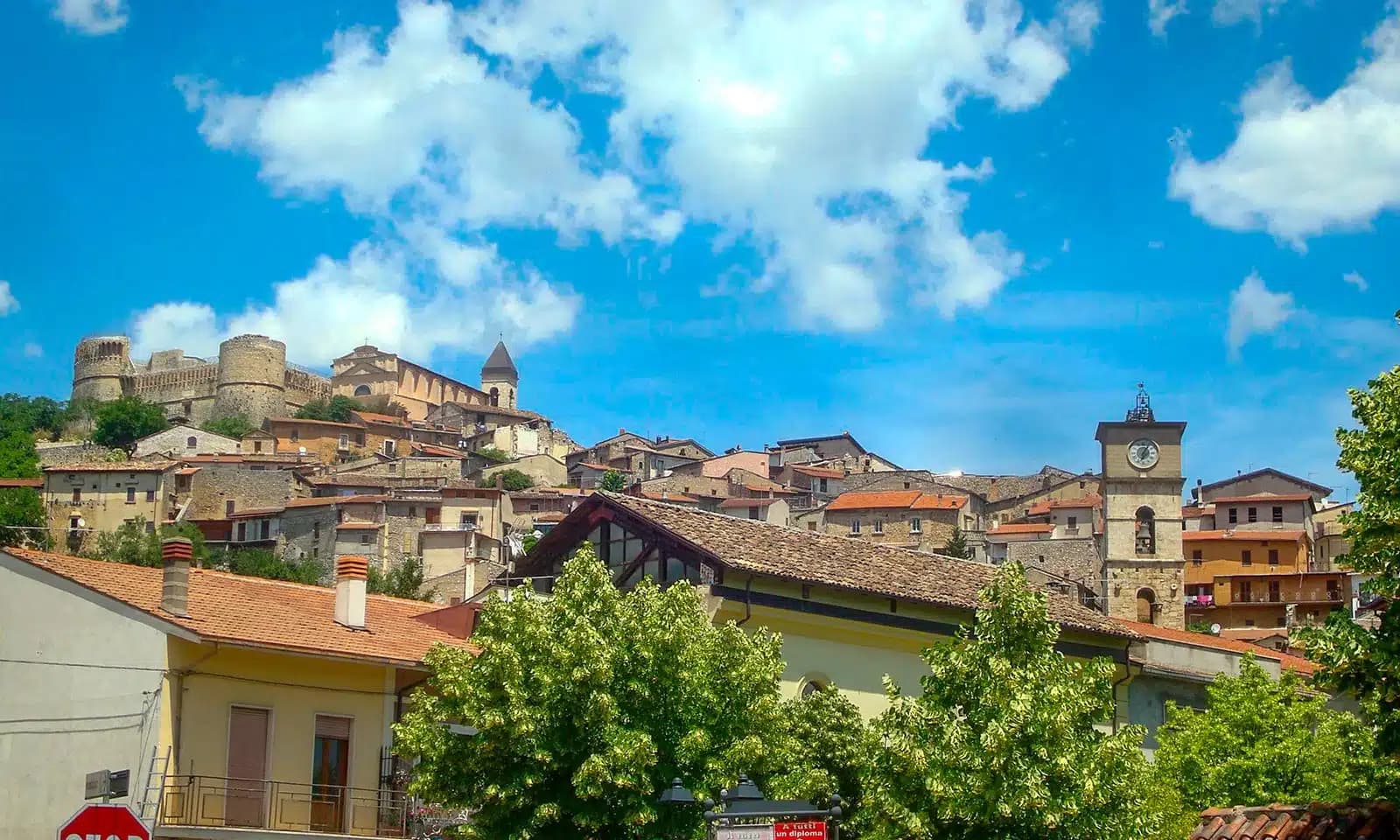
Corleone
Province: Palermo · 542 m
A town of 10,364 in the Palermo hinterland that gave its name to Mario Puzo's Don Vito and now runs Italy's national antimafia documentation centre.
Subscribe — free
Get the best guides on hidden Italian towns.
One letter on Sundays. The week’s town, with the photo, the food, the festa. Free, by Peter & Sophia from Pietrasanta.
Substack sends a confirmation link to your inbox. The signup finishes when it’s clicked.
From elsewhere in Italy
Five more towns to discover
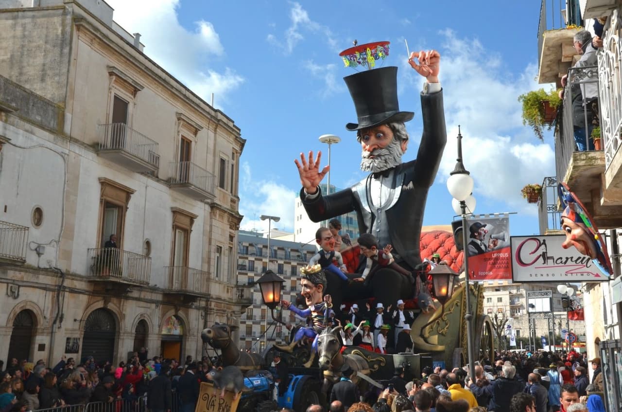
Putignano
Province: Bari
Europe's longest-running carnival — Putignano Carnevale has run continuously since 1394, with 631 years of cartapesta papier-mâché floats, a 26,000-resident Murgia town on the Bari–Lecce plateau, and the Grotta del Trullo karst cave inside the centro.

Pistoia
Province: Pistoia
Italy's nursery capital and the medieval Tuscan rival that gave its name to the pistol — a quietly extraordinary centro storico of zebra-striped Romanesque churches, Andrea della Robbia's polychrome frieze on the Ospedale del Ceppo, and Italy's Capital of Culture 2017, all 30 minutes from Florence by train.
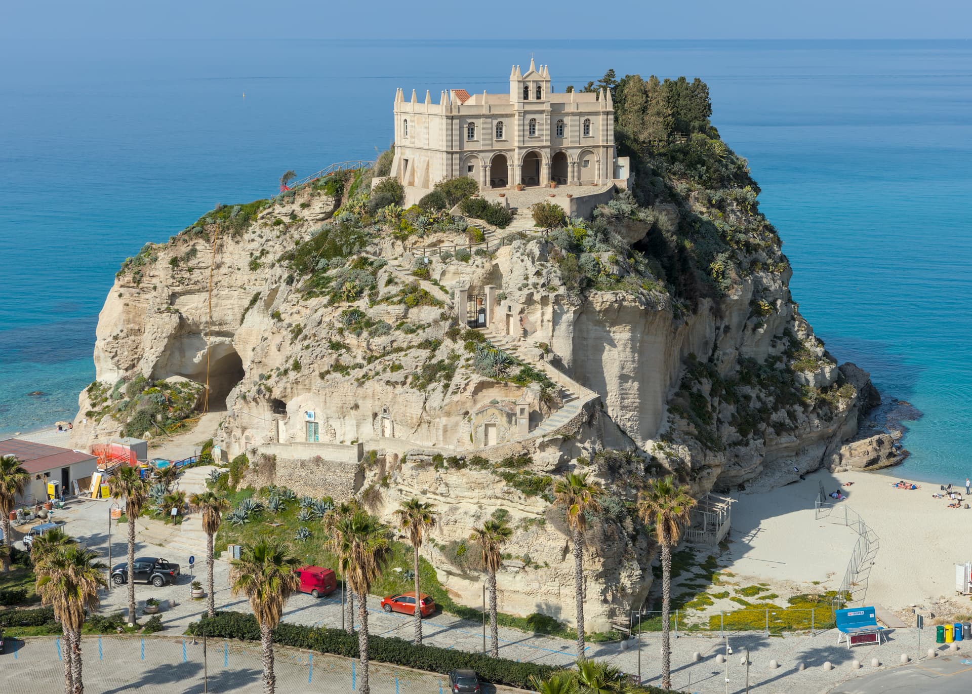
Tropea
Province: Vibo Valentia
Cliff town on a tufa headland over the Tyrrhenian Coast of the Gods, with a Norman monastery on a sea rock.
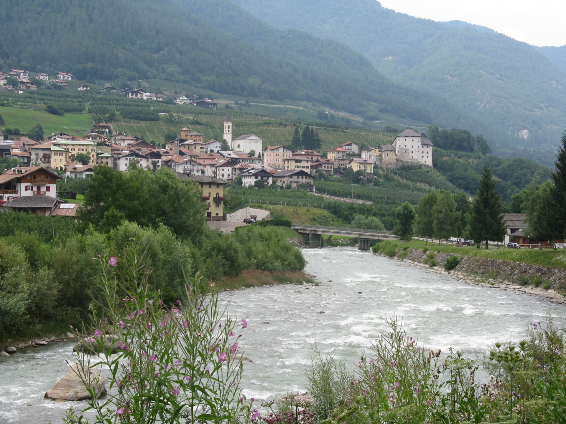
Caldes
Province: Trento
A scattered Val di Sole commune on the Noce, six hamlets gathered around a thirteenth-century tower-house castle that once belonged to the Thun family.
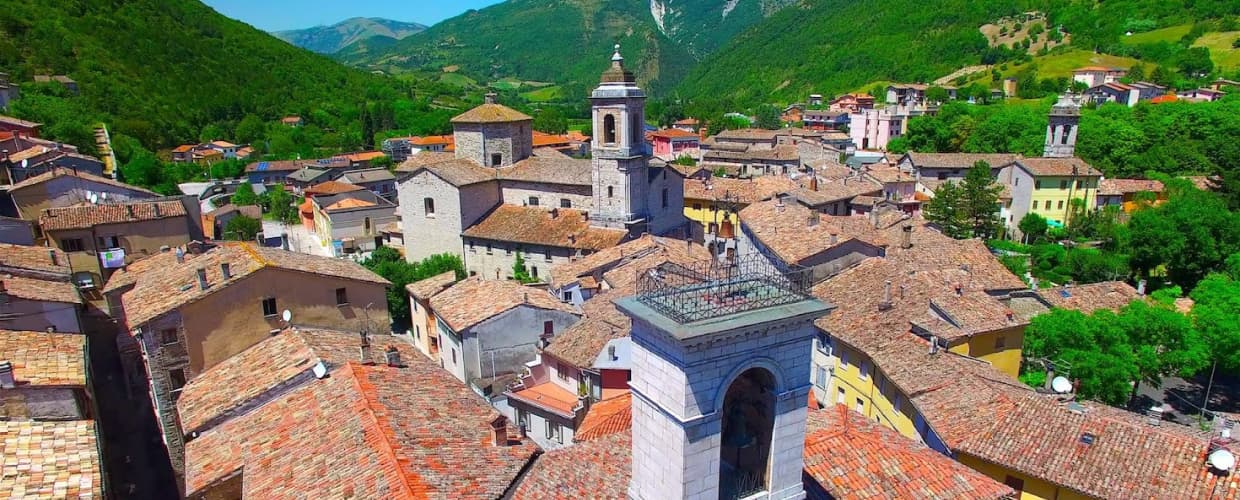
Cantiano
Province: Pesaro e Urbino
A border borgo at 374 meters under Monte Catria on the old Via Flaminia, known for the Good Friday Turba and the sour-cherry visciola harvest.