
Abruzzo · L'Aquila
Carsoli
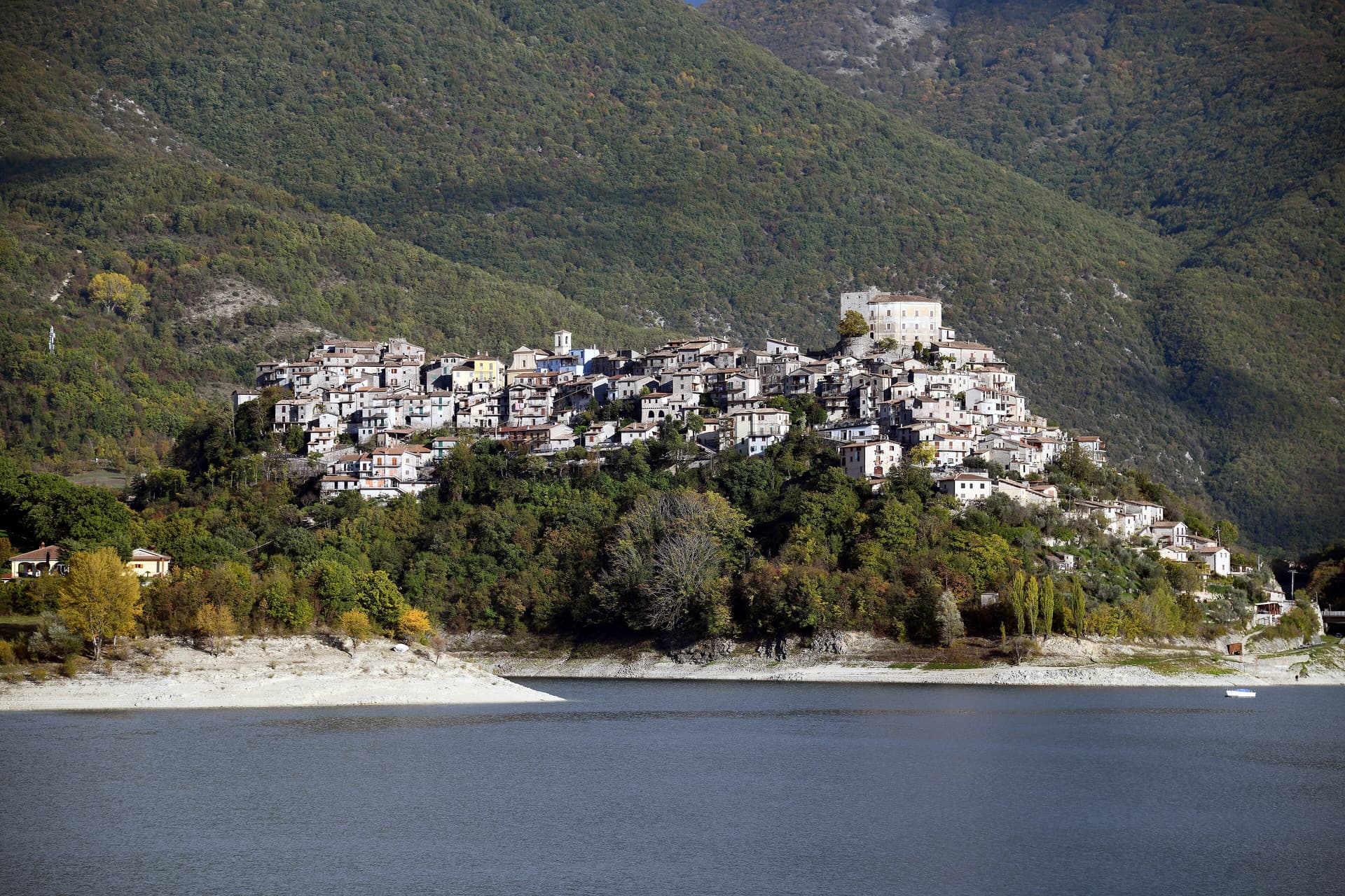
A 616-meter mountain town in the Marsica, built next to the ruins of Roman Carsioli, the 4th-century BC fortress on the road to Alba Fucens.
Known for
CARSIOLI
Roman colony founded 302-298 BC to guard the road to Alba Fucens, with surviving walls and aqueduct four km from the modern town.
CHESTNUT FAIRS
Autumn fairs of chestnut and polenta, deep peasant traditions of the Marsica, run through October each year in the historic centre.
SANTA MARIA IN CELLIS
10th-century church with an image of Charles I of Anjou, one of the oldest religious buildings standing in the western Marsica.
When to visit
Best · May–Oct
- J
- F
- M
- A
- M
- J
- J
- A
- S
- O
- N
- D
- Best
- Hot or crowded
- Quiet
- Mostly closed
The festa: Vittoria, Anatolia e Audace, 23 August
Why come
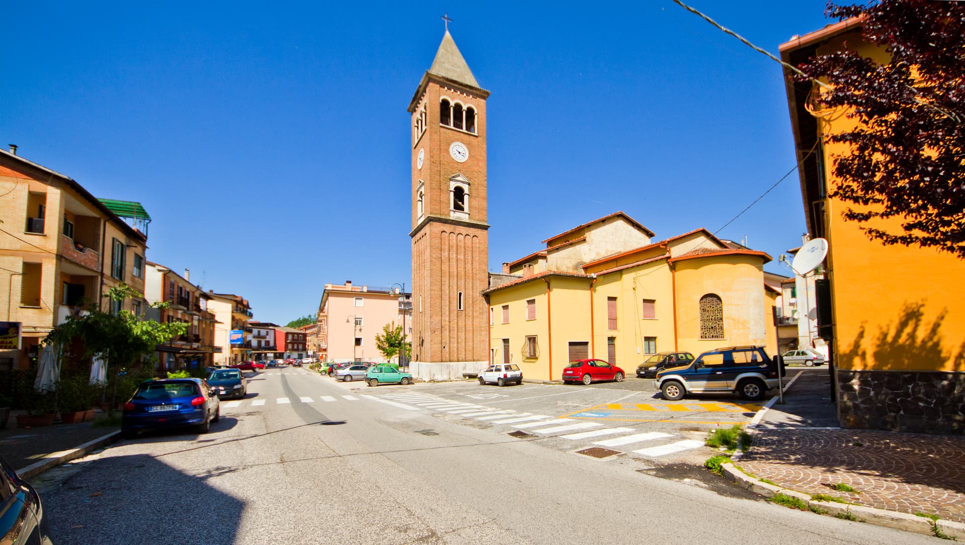
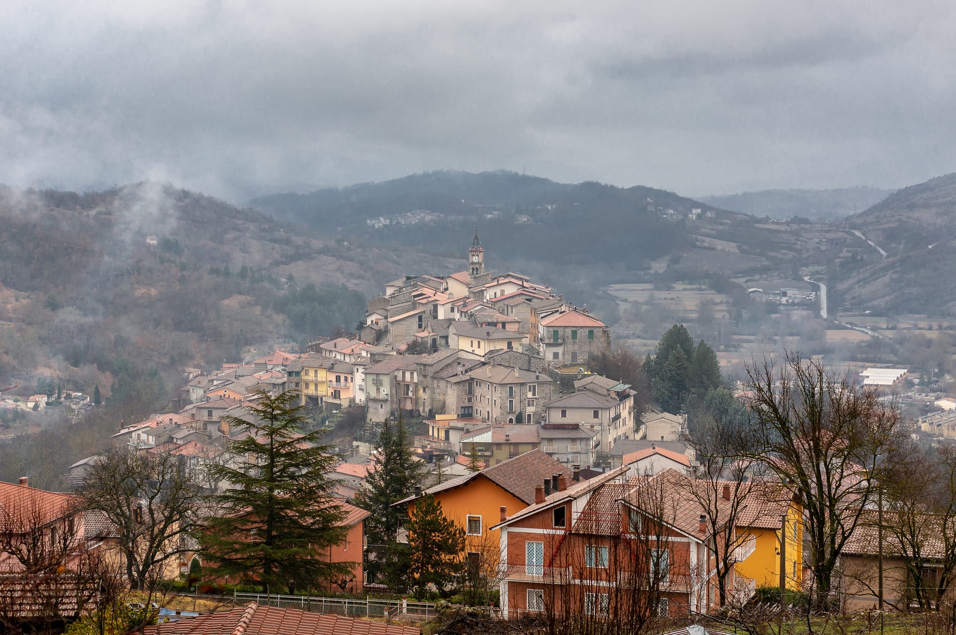
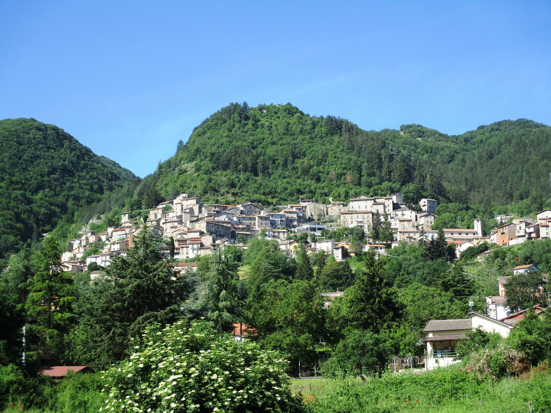
Carsoli sits at 616 meters in the Marsica, between the plain of the former Fucino lake and the valley of the Turano river, with Monte Velino and Monte Calvo both rising above 2,000 meters on its skyline. The modern town stands four kilometres northeast of Carsioli, the Roman colony founded between 302 and 298 BC, set up as a stronghold to guard the road to Alba Fucens. Walls and an aqueduct still stand at the locality of Muro Pertuso, surveyed in 1901 by the archaeologists Pfeiffer and Ashby.
The medieval Church of Santa Maria in Cellis, on the edge of town, dates from the 10th century and preserves an image of Charles I of Anjou. The Castle of Colle Sant'Angelo, built around the year 1000 by the Counts of the Marsi, stood until later wars; ruins of the Church of Sant'Angelo are still visible near the site. Carsoli's autumn season runs on chestnut and polenta fairs, both with deep peasant roots; the patron-saint feast of Santa Vittoria fills the streets with procession and stalls.
The Sunday letter
We haven’t written Carsoli’s letter yet.
One town every Sunday, with the photo, the food, the festa. Be there when this one comes up. Free, by Peter & Sophia from Pietrasanta.
By subscribing you agree to Substack’s Terms of Use, our Privacy Policy and our Information collection notice.

What to see
Sito archeologico di Carsioli
Roman colony founded 302-298 BC, four km from the modern town, with surviving city walls and an aqueduct surveyed in 1901.
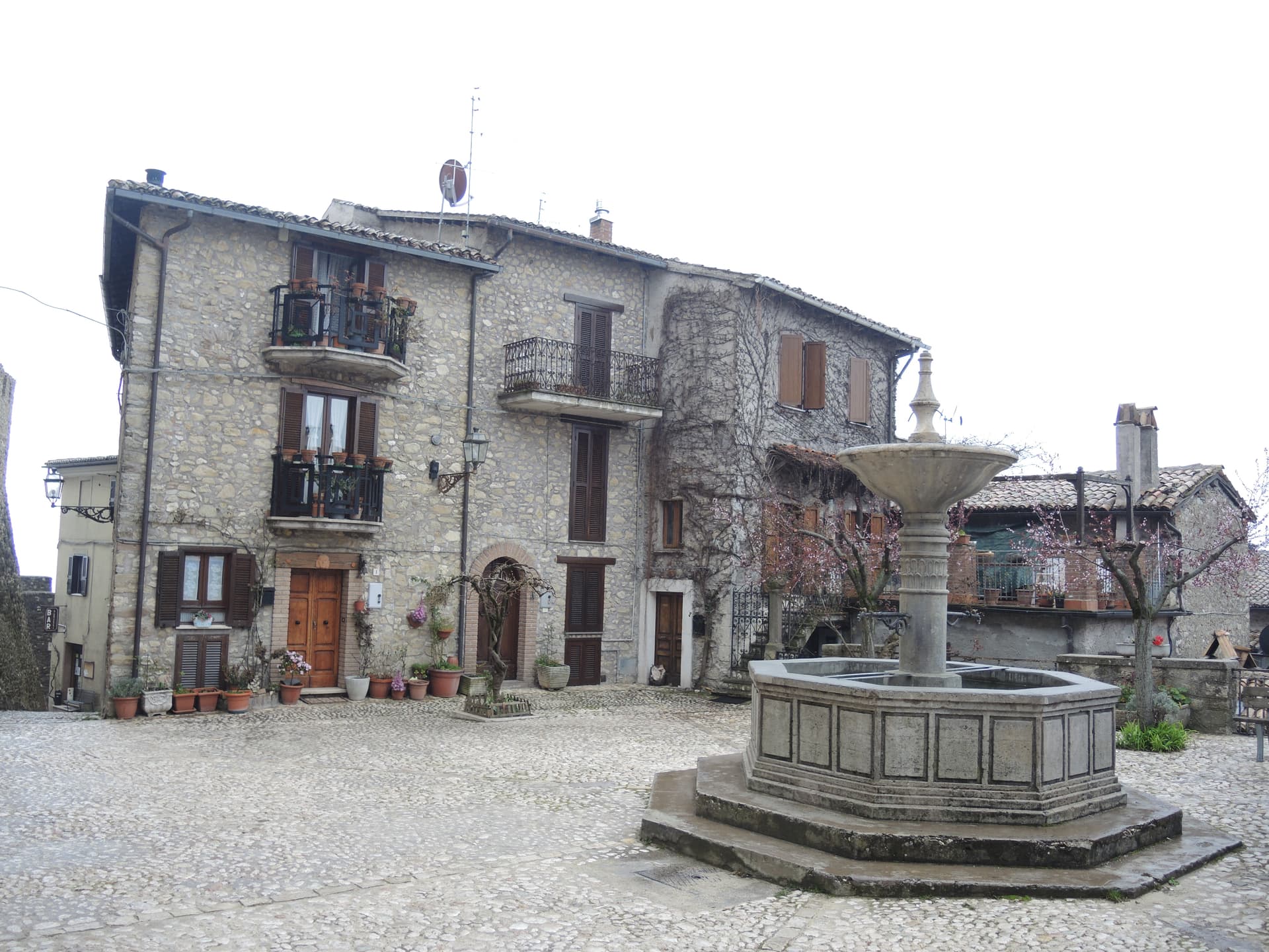
Chiesa di Santa Maria in Cellis
10th-century church on the edge of Carsoli, preserving an image of Charles I of Anjou and a rose window over the main portal.
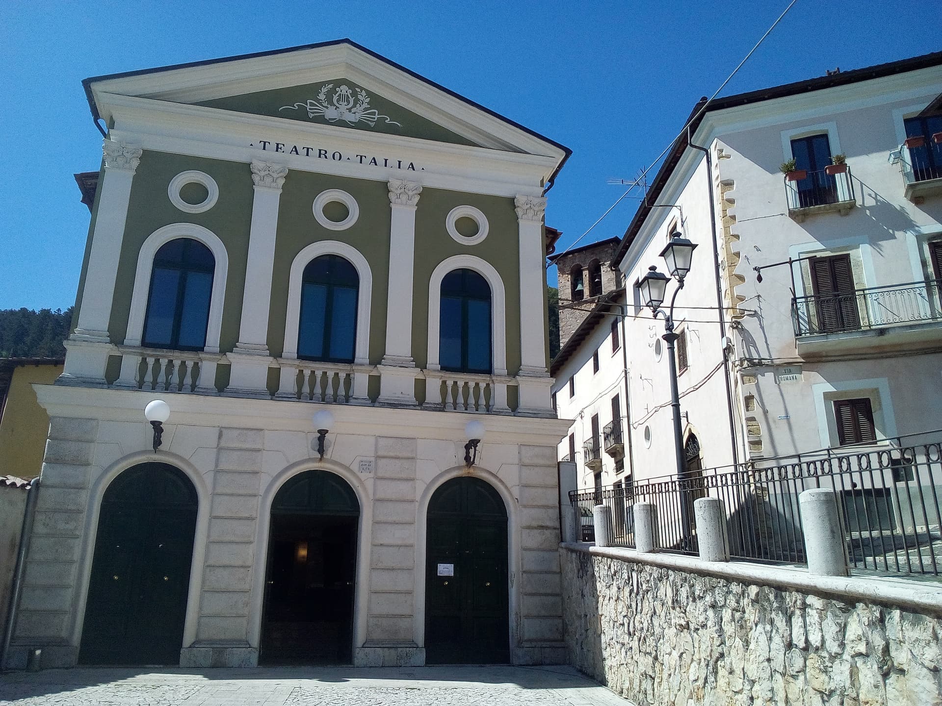
Chiesa di Sant'Antonio
16th-century church inside the centro storico, used as a hospital and later as a nursery, with a frescoed altar inside.
Castello di Colle Sant'Angelo
Ruins of the castle built around the year 1000 by the Counts of the Marsi, with the remains of the adjoining Church of Sant'Angelo.
Parco dei Monti Simbruini
Carsoli sits on the northeastern edge of the Simbruini regional park, with trails into the high Apennine beech forests.
The slow-trip planner
Building a trip? Find where Carsoli fits in a slow Italy circuit.
Answer five questions. We will shape a geographically coherent slow trip from the 1,000 Italian towns most travelers skip. Yours to save and share.
We recommend
Where to eat and stay
Not our picks, but places the guides put their name to — a Michelin star, a Gambero Rosso fork, a Slow Food snail, a Michelin Key for the hotels. Worth a table, a counter, or a night when you pass through.
L'Angolo d'AbruzzoRistorante
Two Gambero Rosso forks (81/100) for L'Angolo d'Abruzzo, and a spot in the Michelin Guide.
V'Incanto Osteria ModernaRistorante
V'Incanto Osteria Moderna carries a Gambero Rosso listing.
Living here
- Population 5,007
- In-betweeni
- Pharmacy in town
- High school within a 30-minute drive
- Train station in the comune
- Nearest airport Rome, 1 h 41 min drive
- Regional capital L'Aquila, 49 min drive
Tags & datadesignations · numbers · sources
Recognised as
The numbers
- Elevation: 616 m
- Population: 5,007
- Surface area: 95.8 km²
These figures were compiled from public directories — ISTAT, OpenStreetMap, Wikidata — and from the official listings of the guides named on this page. Town details change; verify with official sources before you travel.
Featured on
Carsoli appears on this themed pick from our Collections:
Close by
More towns near Carsoli
Sante Marie
Province: L'Aquila
A 950-meter Marsica village and the trailhead of the Cammino dei Briganti, the seven-day brigand trail through the Cartore band's territory.
Rocca di Botte
Province: L'Aquila
At 750 meters on the Carseolani slopes between Abruzzo and Lazio, the birthplace of an eleventh-century hermit and a fief of the Colonna.
Collalto Sabino
Province: Rieti
A 980-meter Sabine borgo dominated by a Barberini baronial castle, with a 360-degree panorama from the keep over the Gran Sasso, Terminillo and Maiella.
Tagliacozzo
Province: L'Aquila
A Marsica town at 740 meters below Monte Civita, where Charles of Anjou won the 1268 battle and the Orsini built the ducal palace.
Castel di Tora
Province: Rieti
A village of 266 on Lago del Turano at 607 meters, with an eleventh-century polygonal tower and a ghost promontory called Antuni.
💎 Borghi Autentici
More Borghi Autentici towns in Abruzzo

Archi
Province: Chieti
A 492-meter rocky spur called the Terrazza sul Sangro, fief of del Balzo, Cantelmo, Colonna and Carafa, now Città del Tartufo and Città dell'Olio.

Balsorano
Province: L'Aquila
At 359 meters in the Valle Roveto, a Piccolomini castle that became the backdrop for half of 1970s Italian horror cinema.

Barrea
Province: L'Aquila
A 1,066-meter spur above an artificial lake at the heart of the Abruzzo National Park, with a Samnite necropolis and an 11th-century di Sangro castle.

Calascio
Province: L'Aquila
At 1,200 meters under the highest castle in the Apennines, a village of 125 people that played the monk's refuge in Ladyhawke.

Campo di Giove
Province: L'Aquila
At 1,064 meters under the southwestern Maiella, the highest village in the park, named for a Roman temple to Jupiter.