
Lazio · Rieti
Collalto Sabino
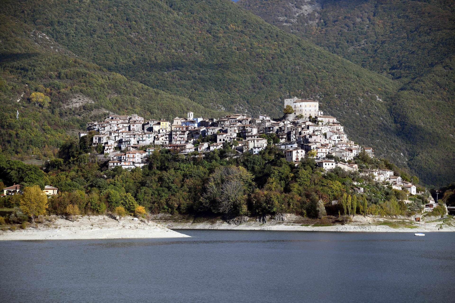
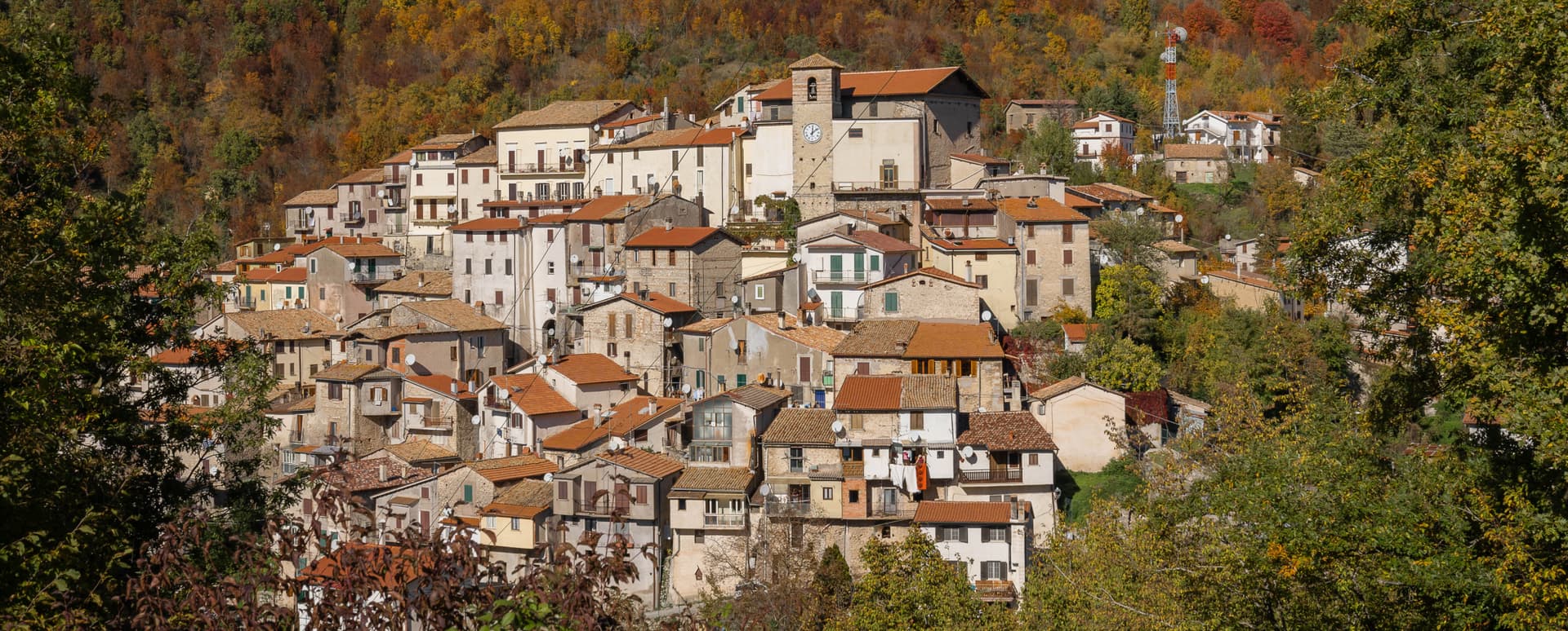
A 980-meter Sabine borgo dominated by a Barberini baronial castle, with a 360-degree panorama from the keep over the Gran Sasso, Terminillo and Maiella.
Known for
BARBERINI CASTLE
Baronial castle held by the Barberini from 1641, with square keep, two round corner towers and 360-degree panorama.
THREE PEAKS VIEW
Panorama from the keep over Gran Sasso, Terminillo and Maiella, the three highest ranges of the central Apennines.
WALLED BORGO
Fifteenth-century walls and stone-house alleys earning the Borghi più belli d'Italia membership.
When to visit
Best · May–Oct
- J
- F
- M
- A
- M
- J
- J
- A
- S
- O
- N
- D
- Best
- Hot or crowded
- Quiet
- Mostly closed
The festa: papa Gregorio I, domenica dopo il 3 settembre
Why come
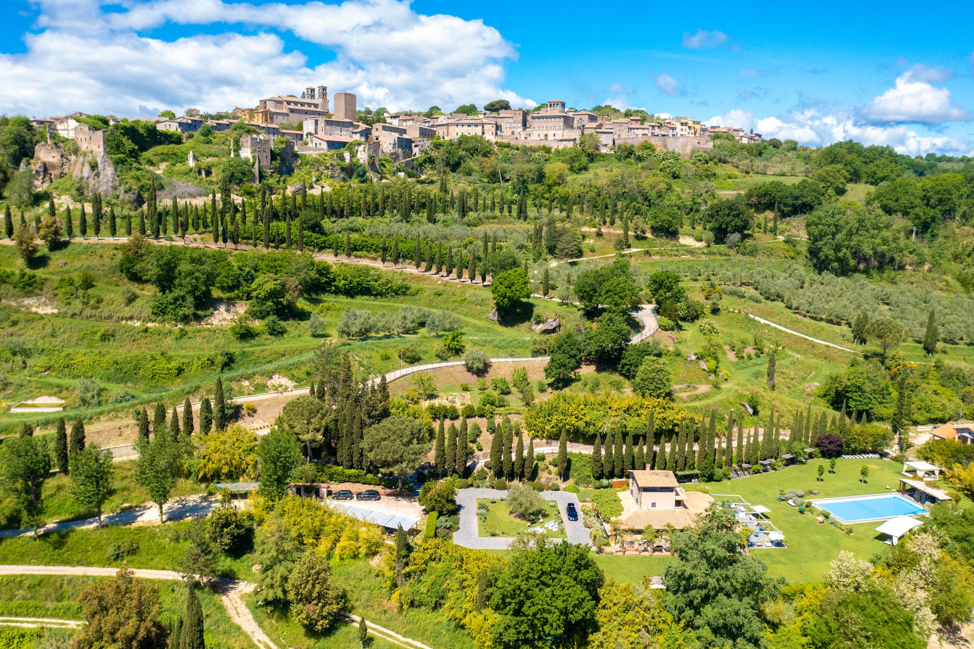
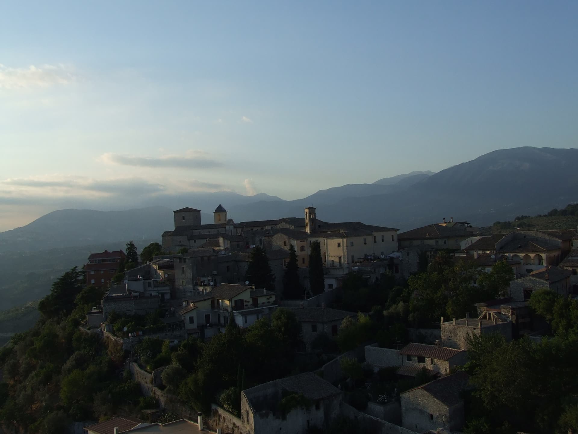
Collalto Sabino sits at 980 meters on a Sabine hill northeast of Rome, the name preserving Collis Altus and the family who first held it. The Lombards established the village in the tenth century; the Savelli, Strozzi and Soderini families owned it in turn before Cardinal Francesco Barberini took the fief in 1641. The baronial castle on the summit is the result of his work and that of his nephew Francesco Barberini junior, who enlarged the keep, fortified the walls and built dungeons inside the rock.
It has a central square tower, two round corner towers and a curtain of watchtowers and sentry posts. The keep terrace gives a 360-degree panorama over the Gran Sasso, the Terminillo and the Maiella, the three highest ranges of the central Apennines. Fifteenth-century walls still ring the village below the castle; stone houses, narrow stairs and panoramic alleys earned the Borghi più belli d'Italia membership.
The Sunday letter
We haven’t written Collalto Sabino’s letter yet.
One town every Sunday, with the photo, the food, the festa. Be there when this one comes up. Free, by Peter & Sophia from Pietrasanta.
By subscribing you agree to Substack’s Terms of Use, our Privacy Policy and our Information collection notice.


What to see
Castello Baronale
Seventeenth and eighteenth-century baronial castle enlarged by Cardinal Francesco Barberini after 1641, with central square tower and two round corner towers.
Centro storico
Medieval village ringed by fifteenth-century walls below the castle, with stone houses, narrow stairs and panoramic alleys.
Panorama from the keep
360-degree view from the castle terrace covering the Gran Sasso, Terminillo and Maiella ranges of the central Apennines.
Chiesa di San Giovanni Battista
Parish church inside the walls, with a Renaissance altar and a baptismal font from the Barberini rebuilding.
Riserva Naturale Monte Navegna e Monte Cervia
Regional reserve covering the wooded slopes around the village, with marked trails toward Lago del Turano.
The slow-trip planner
Building a trip? Find where Collalto Sabino fits in a slow Italy circuit.
Answer five questions. We will shape a geographically coherent slow trip from the 1,000 Italian towns most travelers skip. Yours to save and share.
Living here
- Population 391
- Off the beaten pathi
- Pharmacy in town
- High school within a 30-minute drive
- Nearest airport Rome, 1 h 46 min drive
- Regional capital Roma, 1 h 5 min drive
Tags & datadesignations · numbers · sources
Recognised as
The numbers
- Elevation: 980 m
- Population: 391
- Surface area: 22.37 km²
These figures were compiled from public directories — ISTAT, OpenStreetMap, Wikidata — and from the official listings of the guides named on this page. Town details change; verify with official sources before you travel.
Close by
More towns near Collalto Sabino
Carsoli
Province: L'Aquila
A 616-meter mountain town in the Marsica, built next to the ruins of Roman Carsioli, the 4th-century BC fortress on the road to Alba Fucens.
Castel di Tora
Province: Rieti
A village of 266 on Lago del Turano at 607 meters, with an eleventh-century polygonal tower and a ghost promontory called Antuni.
Rocca di Botte
Province: L'Aquila
At 750 meters on the Carseolani slopes between Abruzzo and Lazio, the birthplace of an eleventh-century hermit and a fief of the Colonna.
Sante Marie
Province: L'Aquila
A 950-meter Marsica village and the trailhead of the Cammino dei Briganti, the seven-day brigand trail through the Cartore band's territory.
Orvinio
Province: Rieti
The highest borgo in the Monti Lucretili park at 840 meters, called Canemorto until 1863 and dominated by the Castello Malvezzi-Campeggi.
🎨 Borghi più belli d'Italia
More Borghi più belli d'Italia towns in Lazio
Acquapendente
Province: Viterbo
The northernmost town in Lazio on the Via Francigena, at 420 meters above the Paglia, named in 964 for its waterfalls.
Amatrice
Province: Rieti
A 955-meter Apennine town leveled by the 24 August 2016 earthquake, slowly rebuilding the streets that gave amatriciana its name.
Atina
Province: Frosinone
A polygonal-walled town in the Val di Comino at the foot of the Mainarde, and the DOC that makes Cabernet in central Italy.
Bassano in Teverina
Province: Viterbo
A tufa-spur borgo of 1,260 above the Tiber valley between Lazio and Umbria, with a clock tower that hides an eleventh-century animated bell tower.
Boville Ernica
Province: Frosinone
A Ciociaria hilltop town with eighteen intact medieval towers and Giotto's only surviving mosaic, the Angelo del Navicella, in San Pietro Ispano.