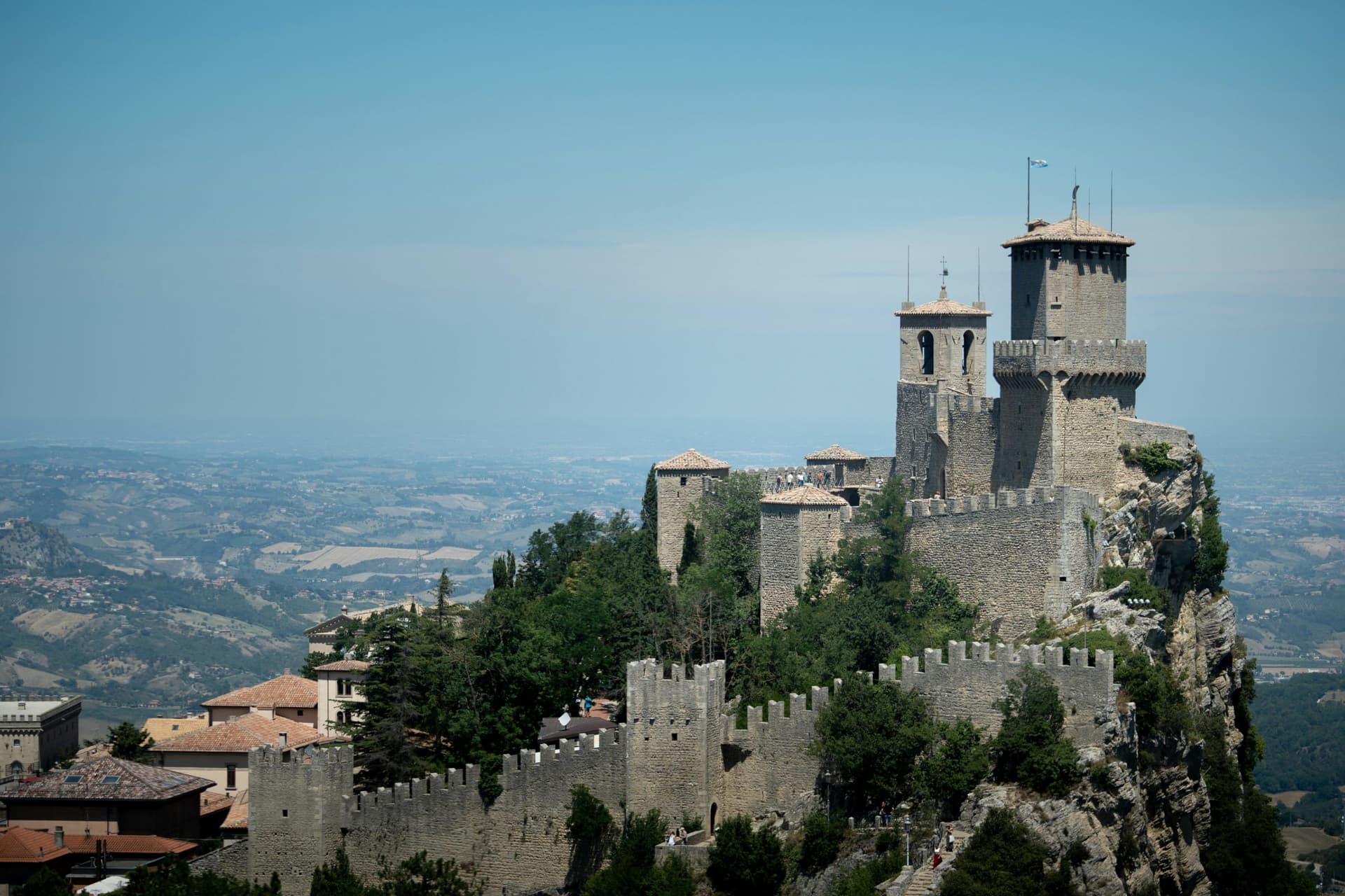
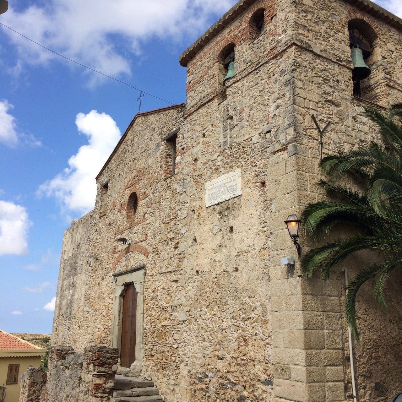
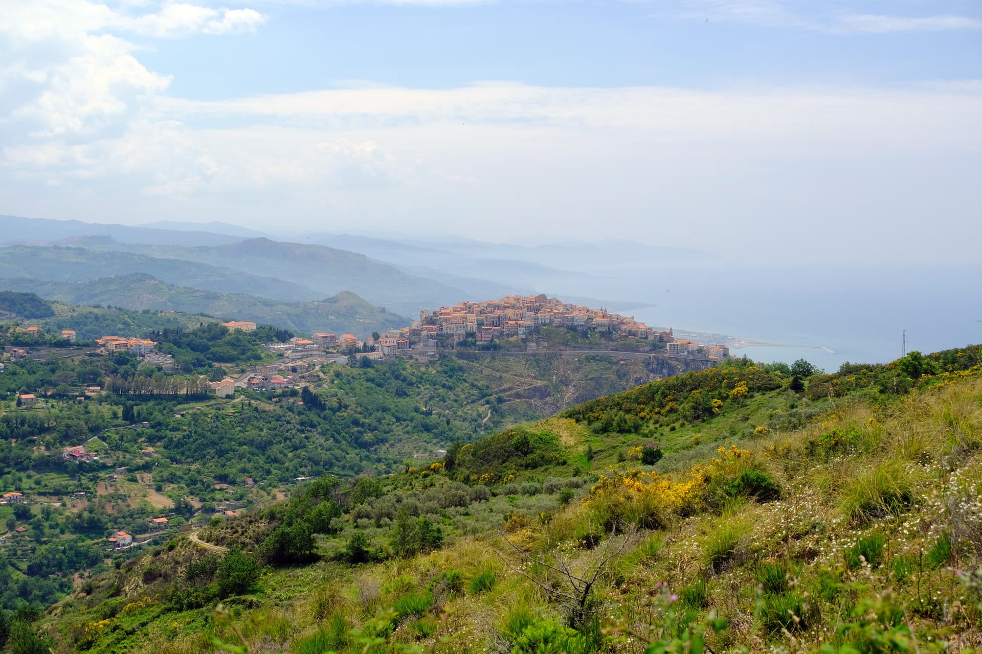
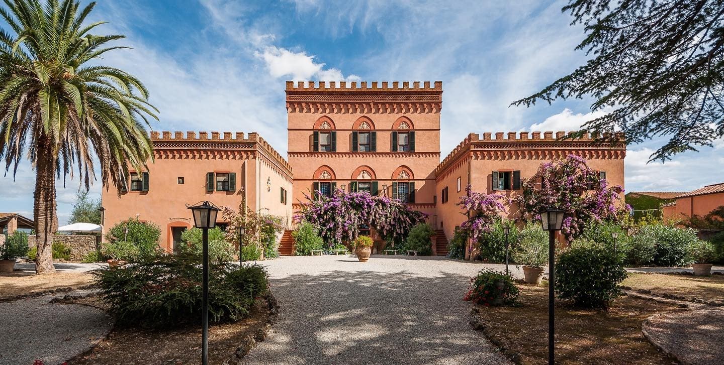
Designation
Borghi più belli d'Italia
344 towns across 20 regions
Browse by region
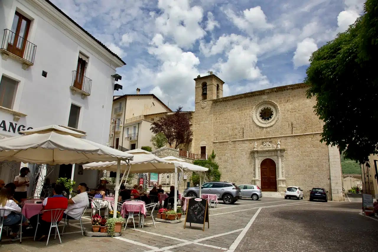
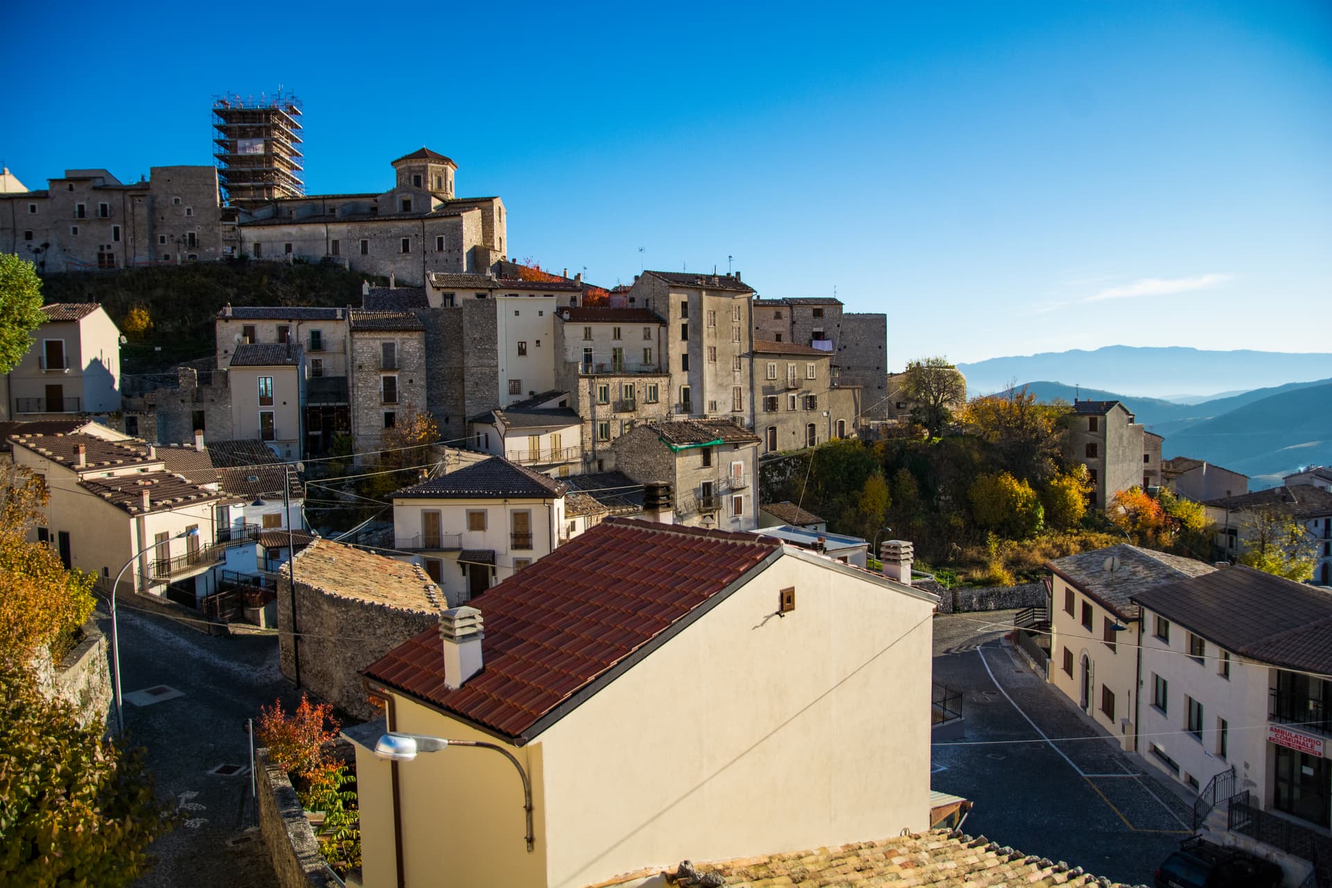
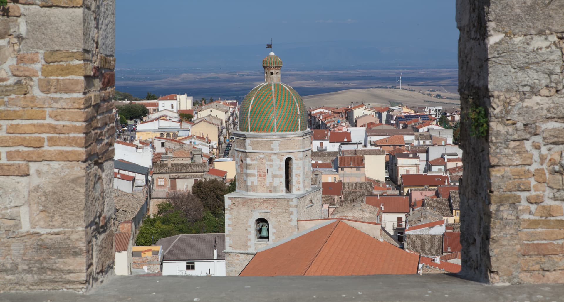
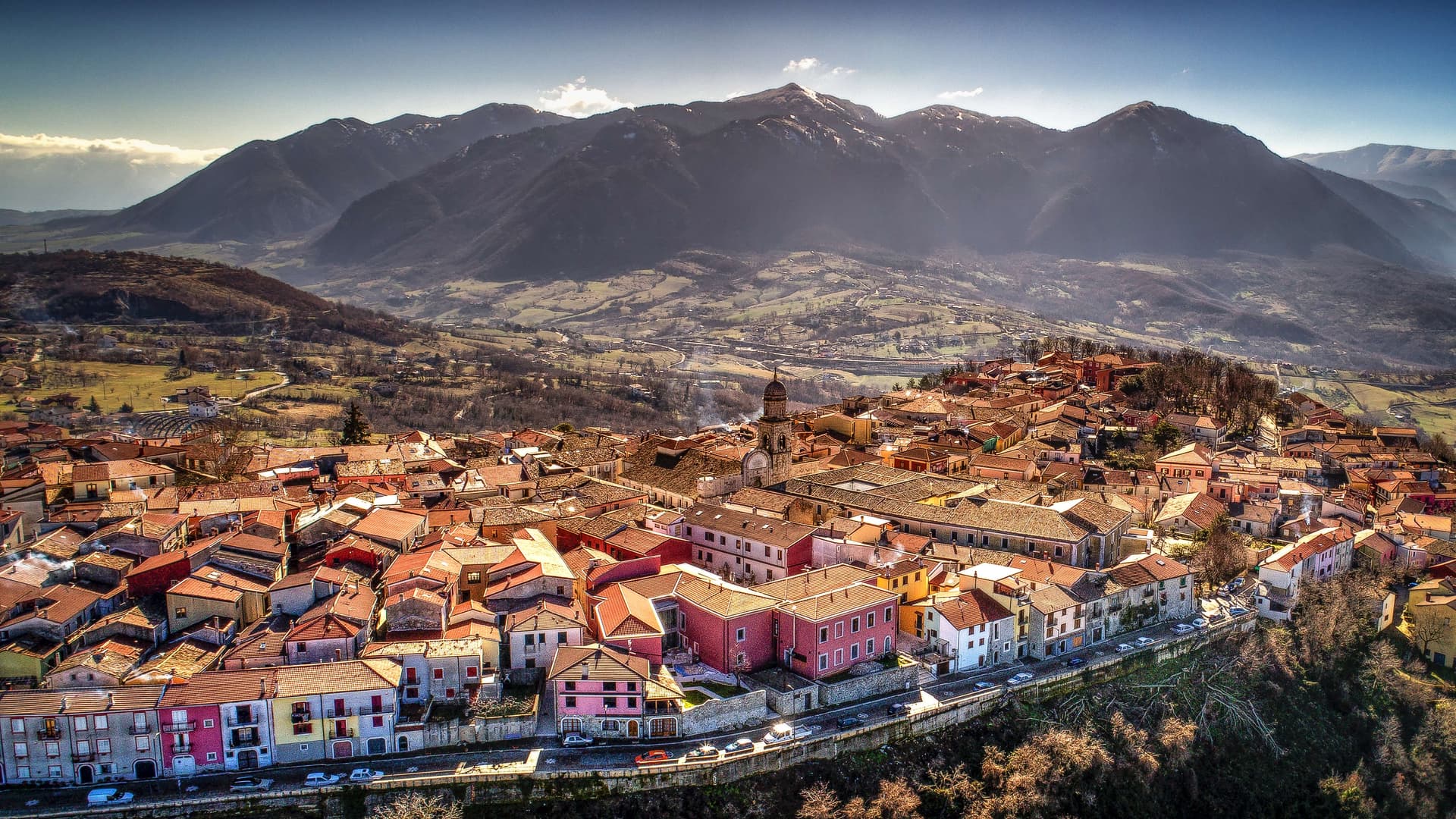
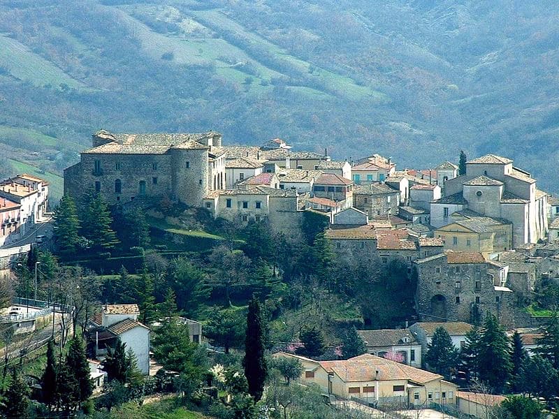
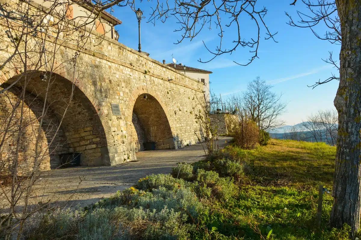
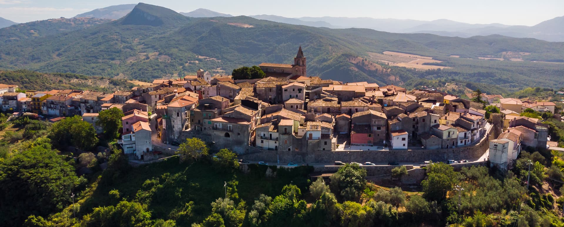
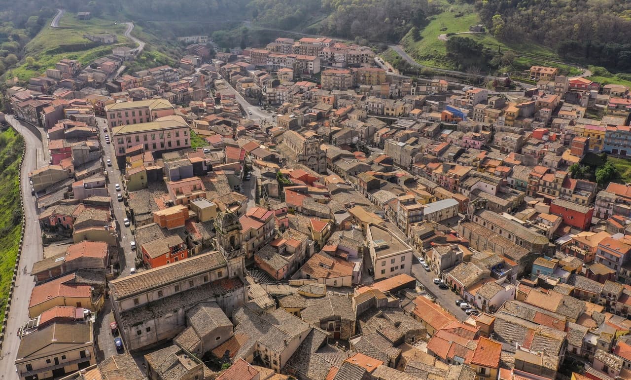
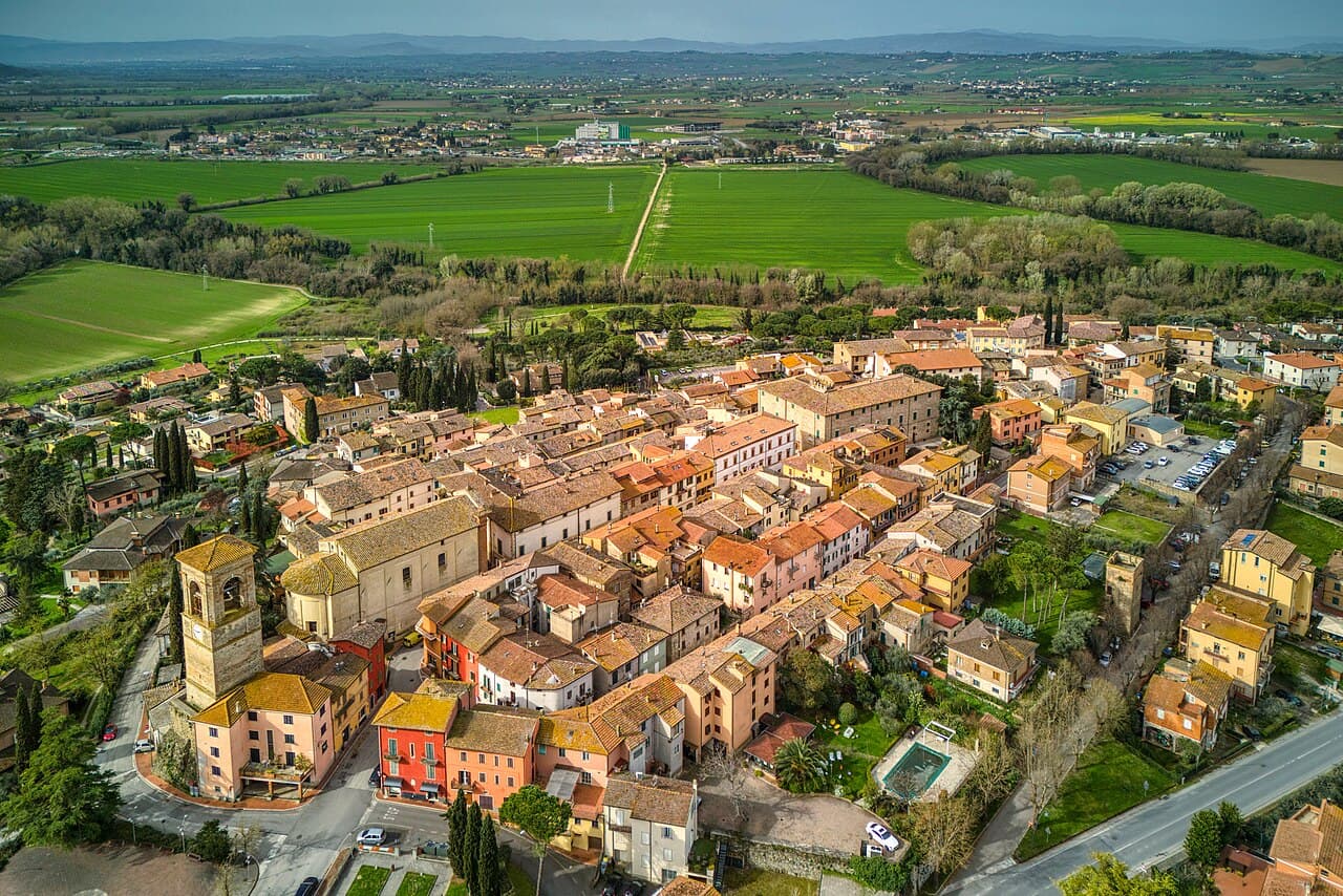
Abruzzo22
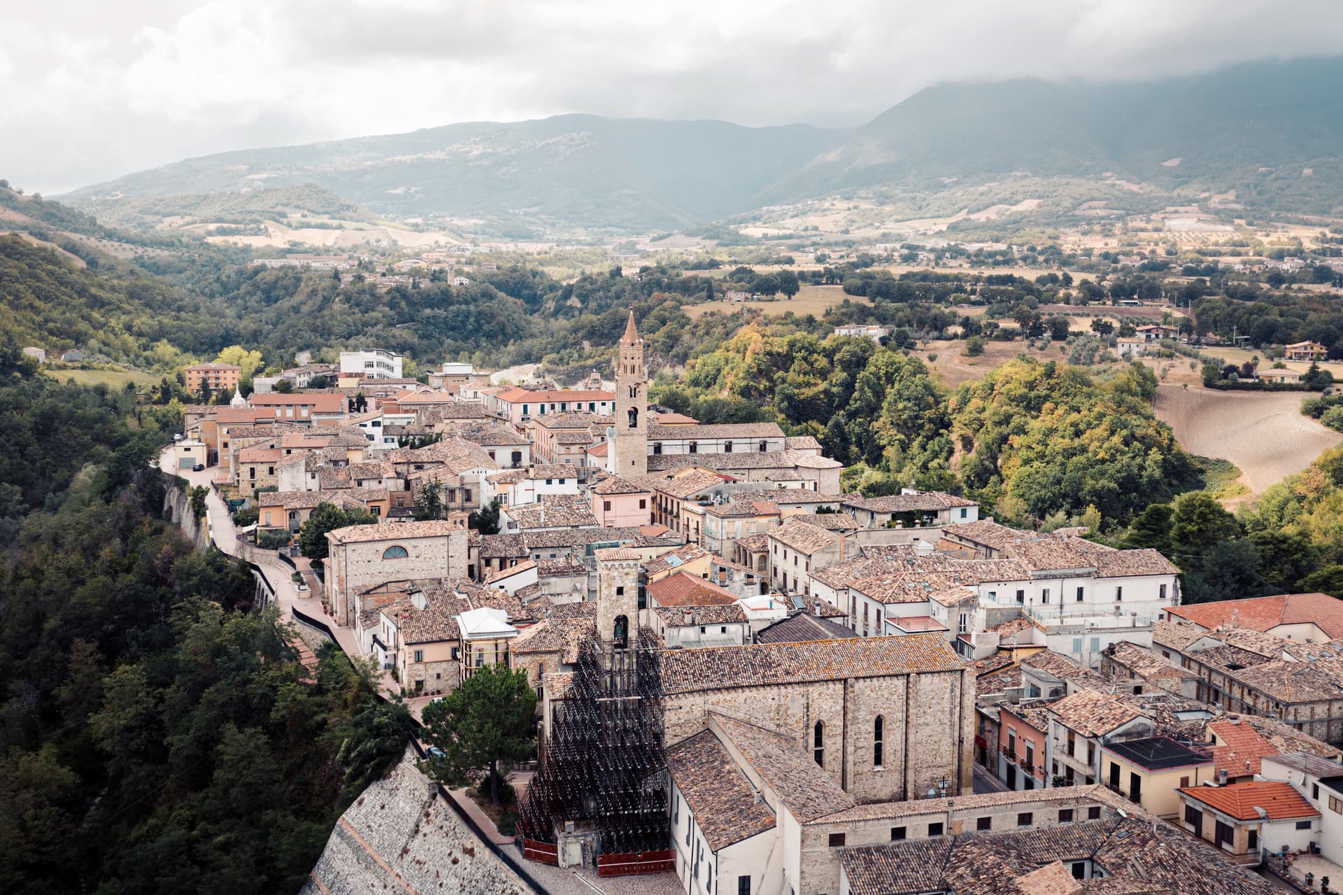
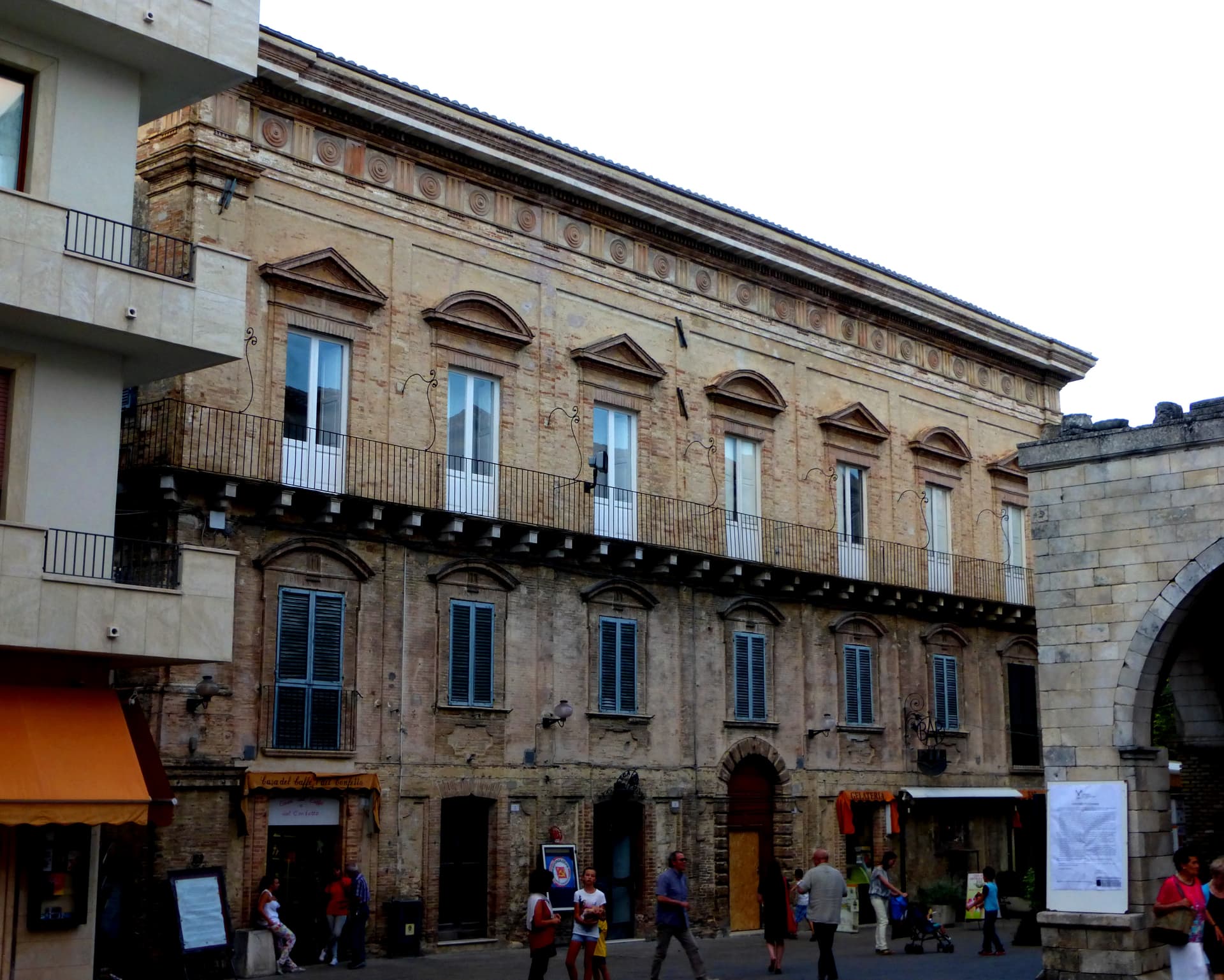
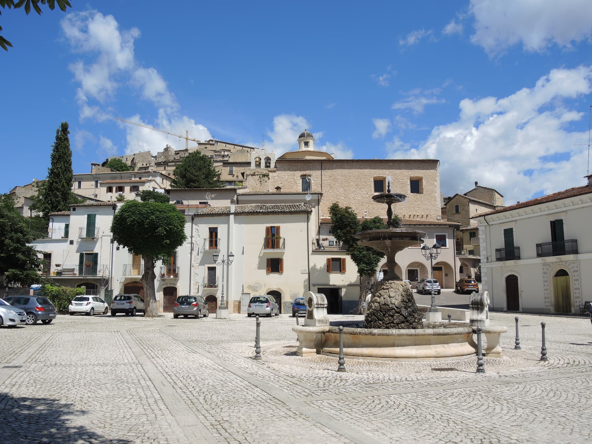
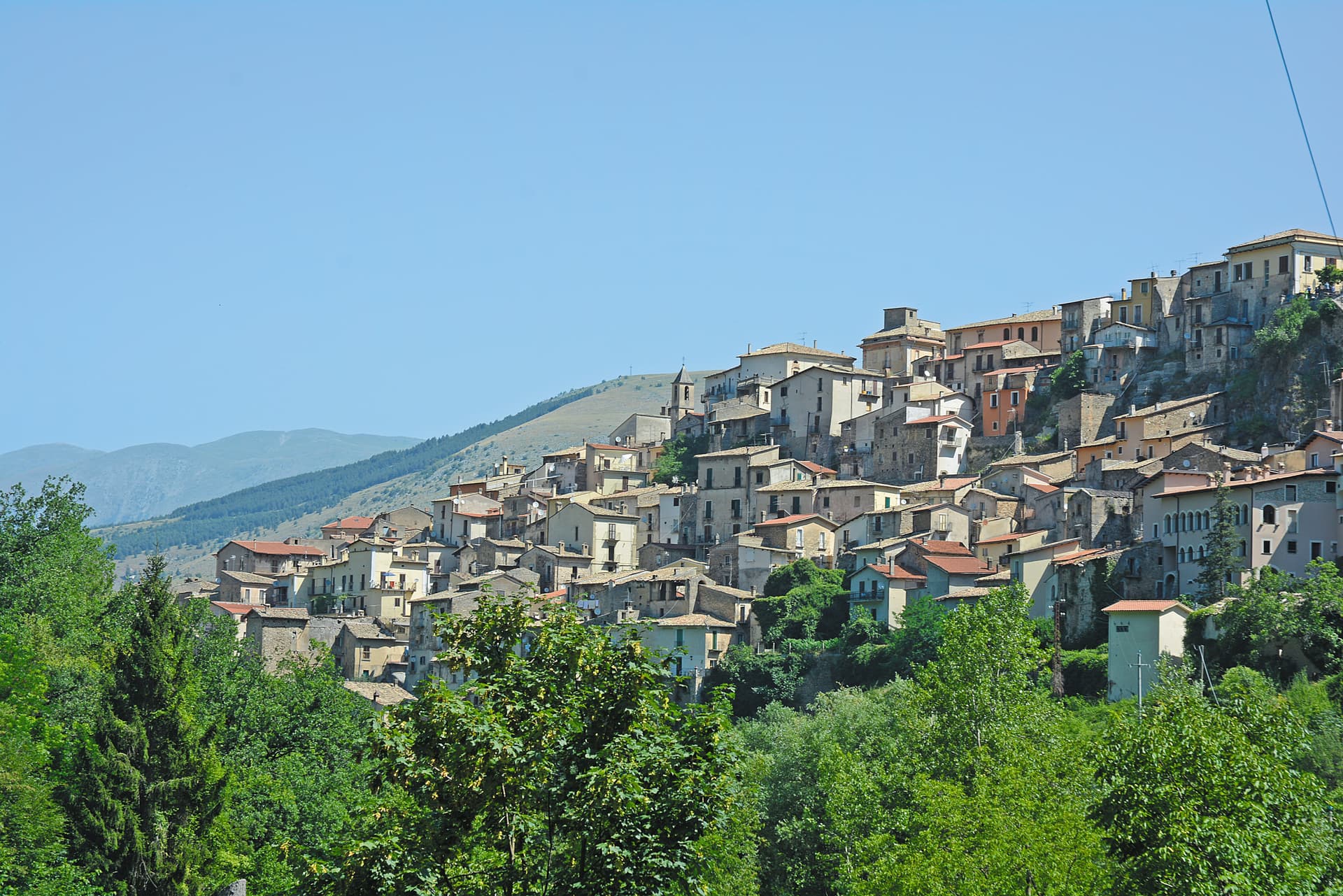
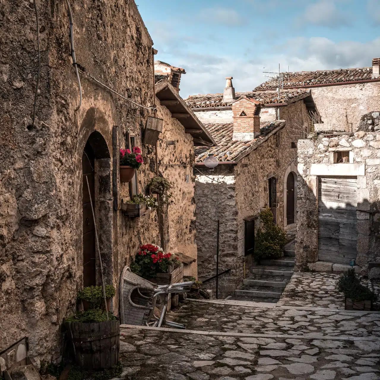
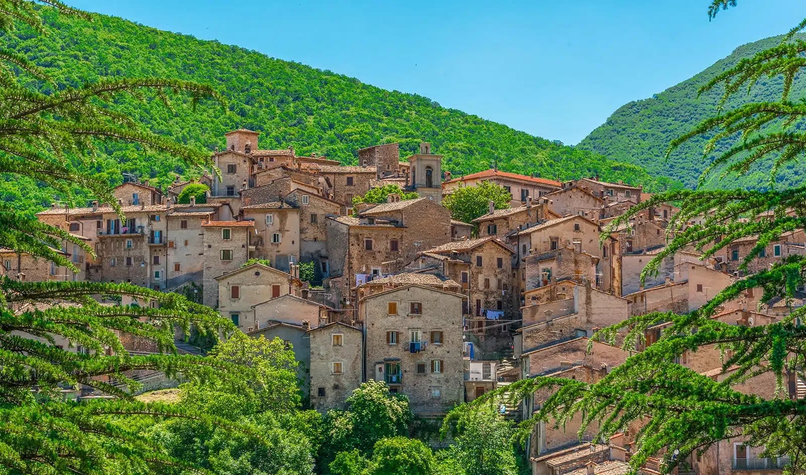
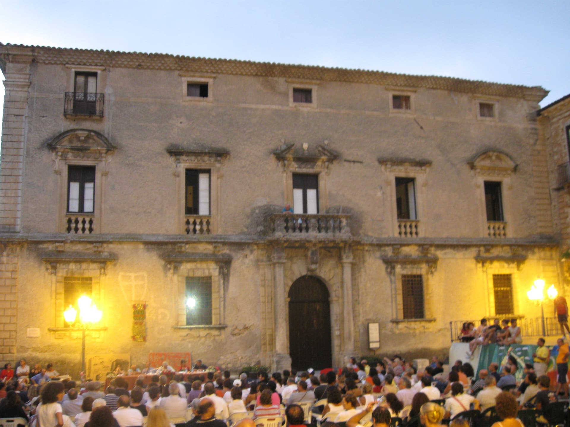
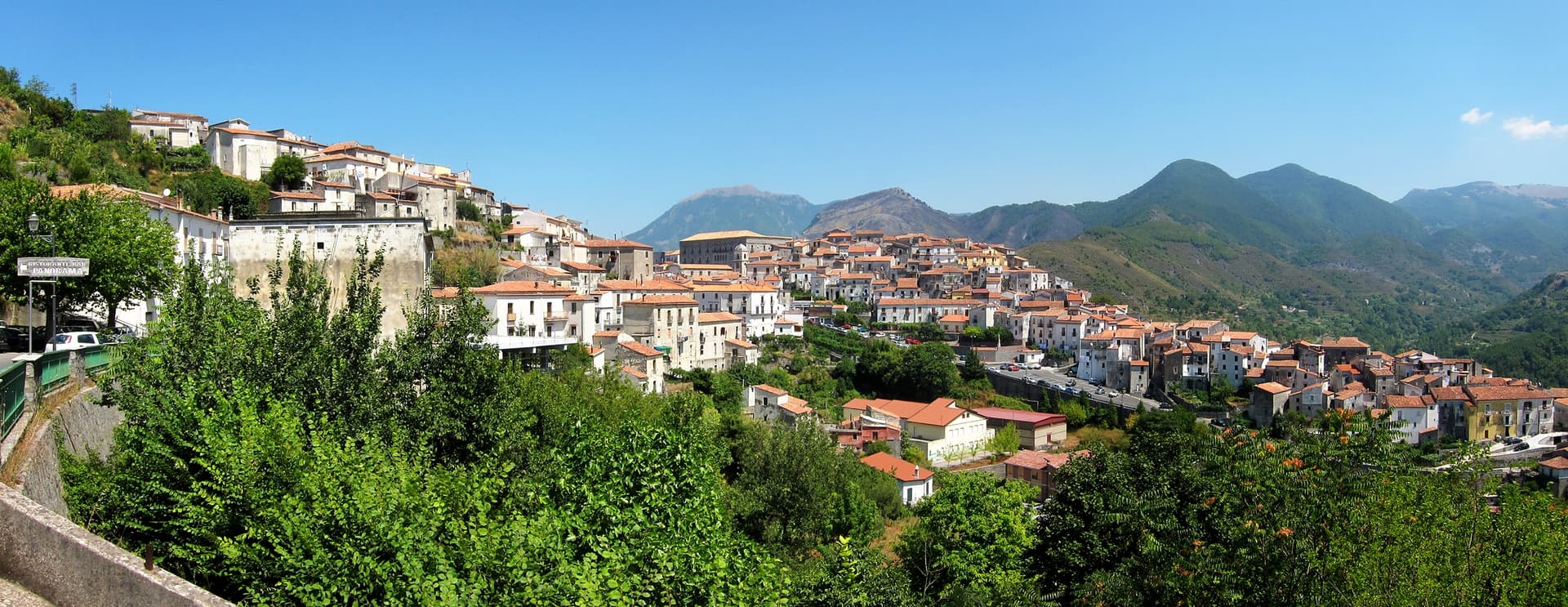
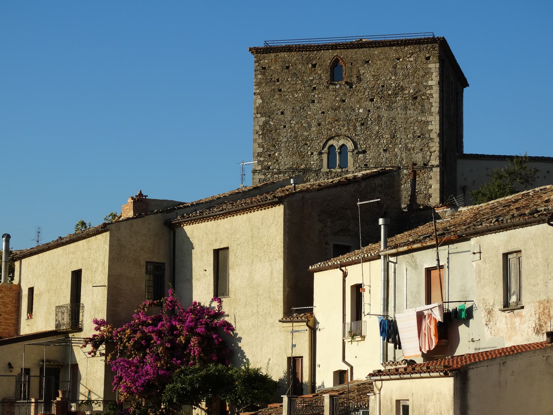
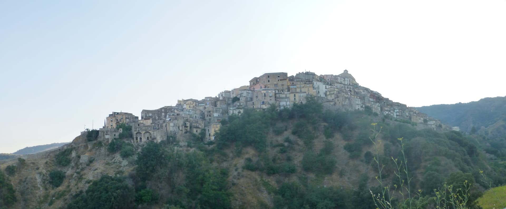
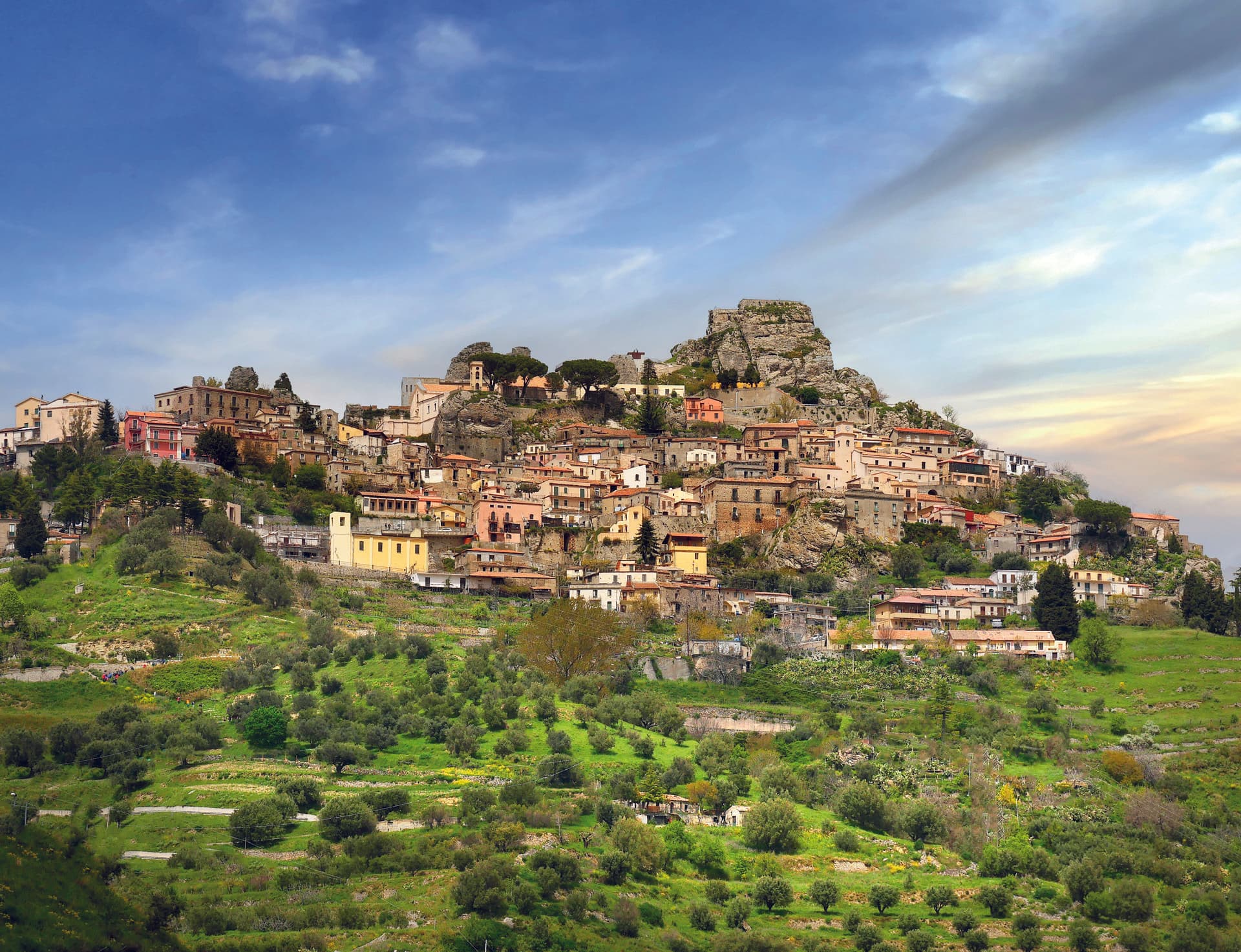
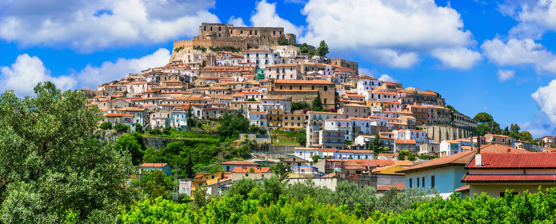
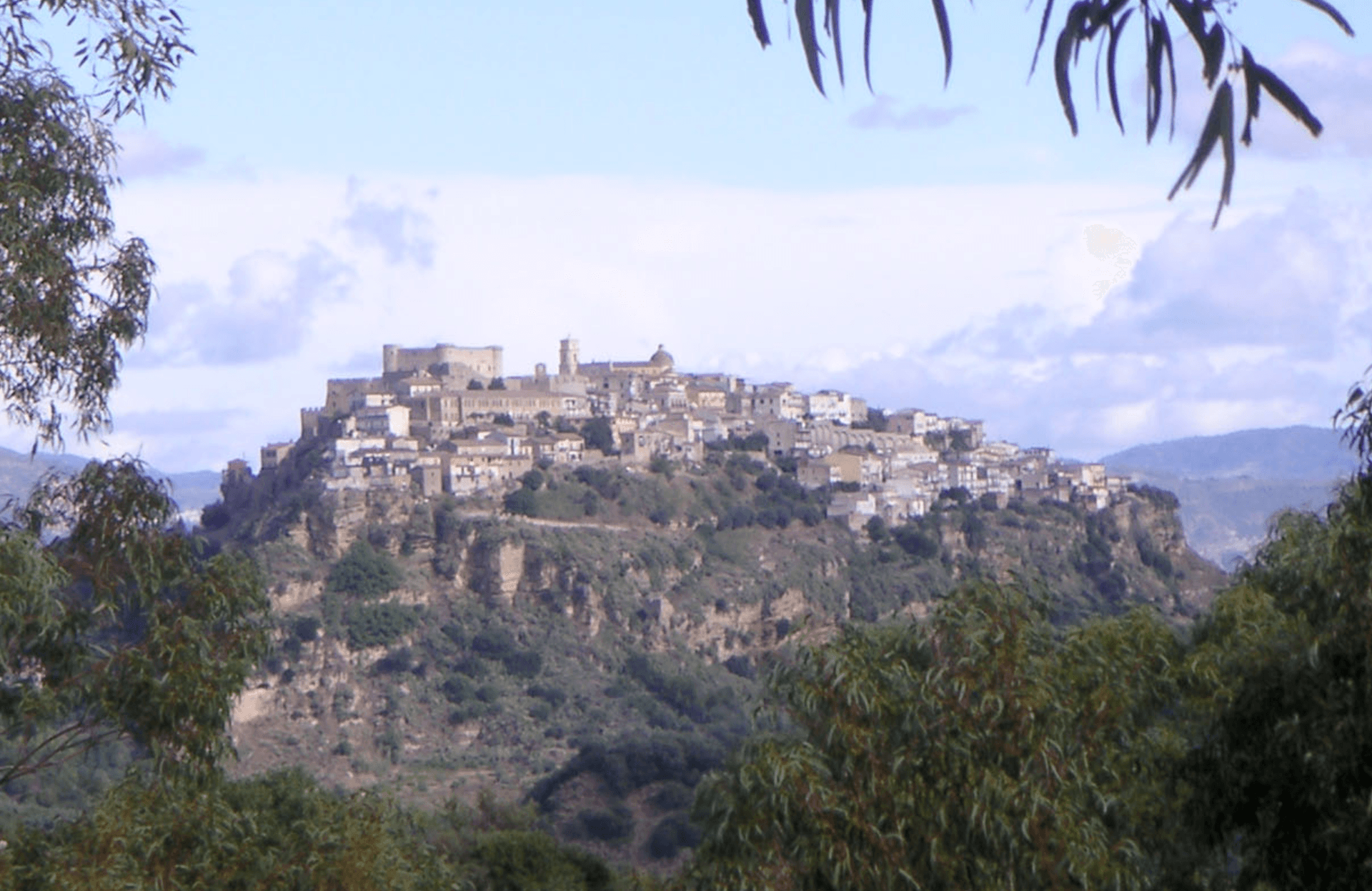
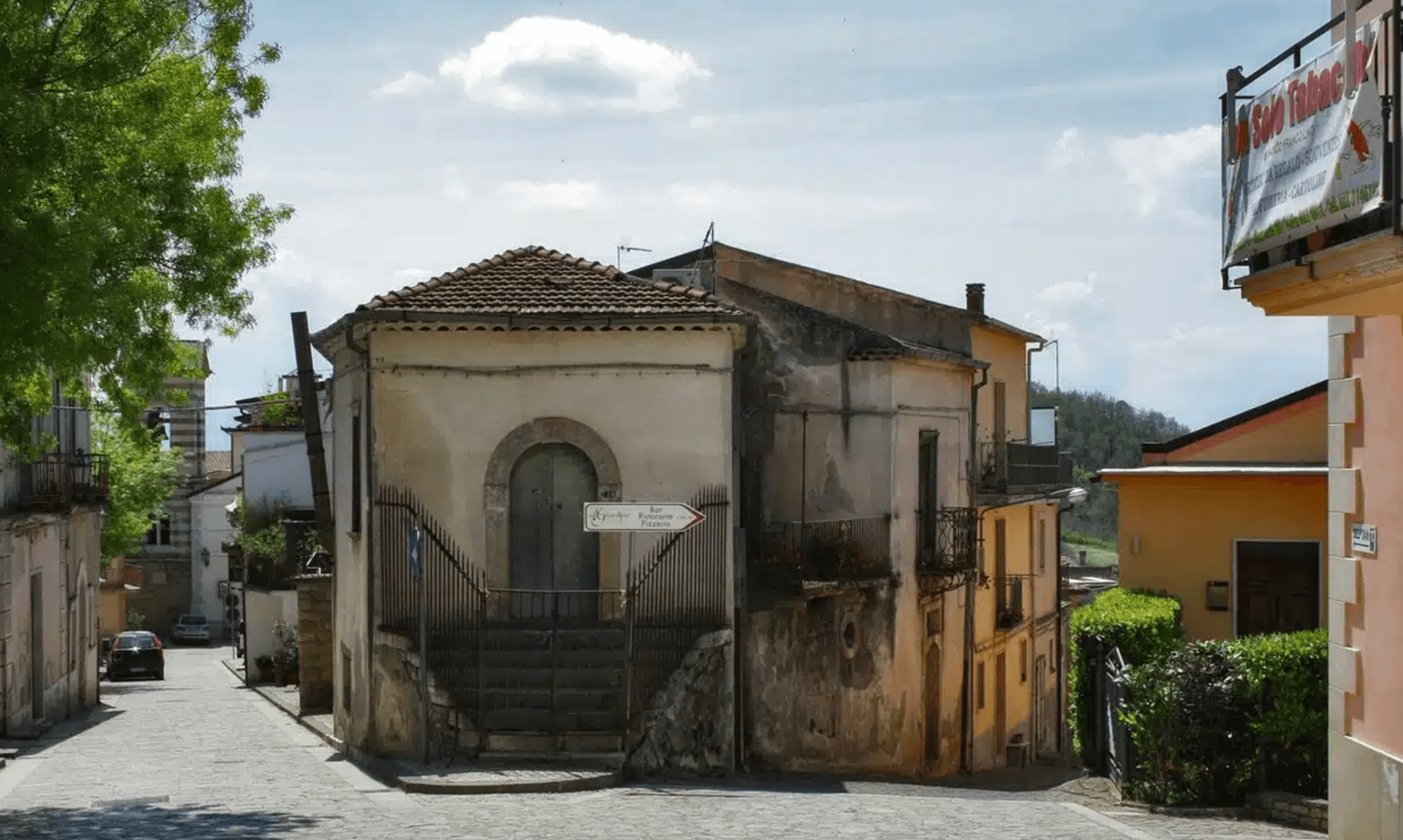
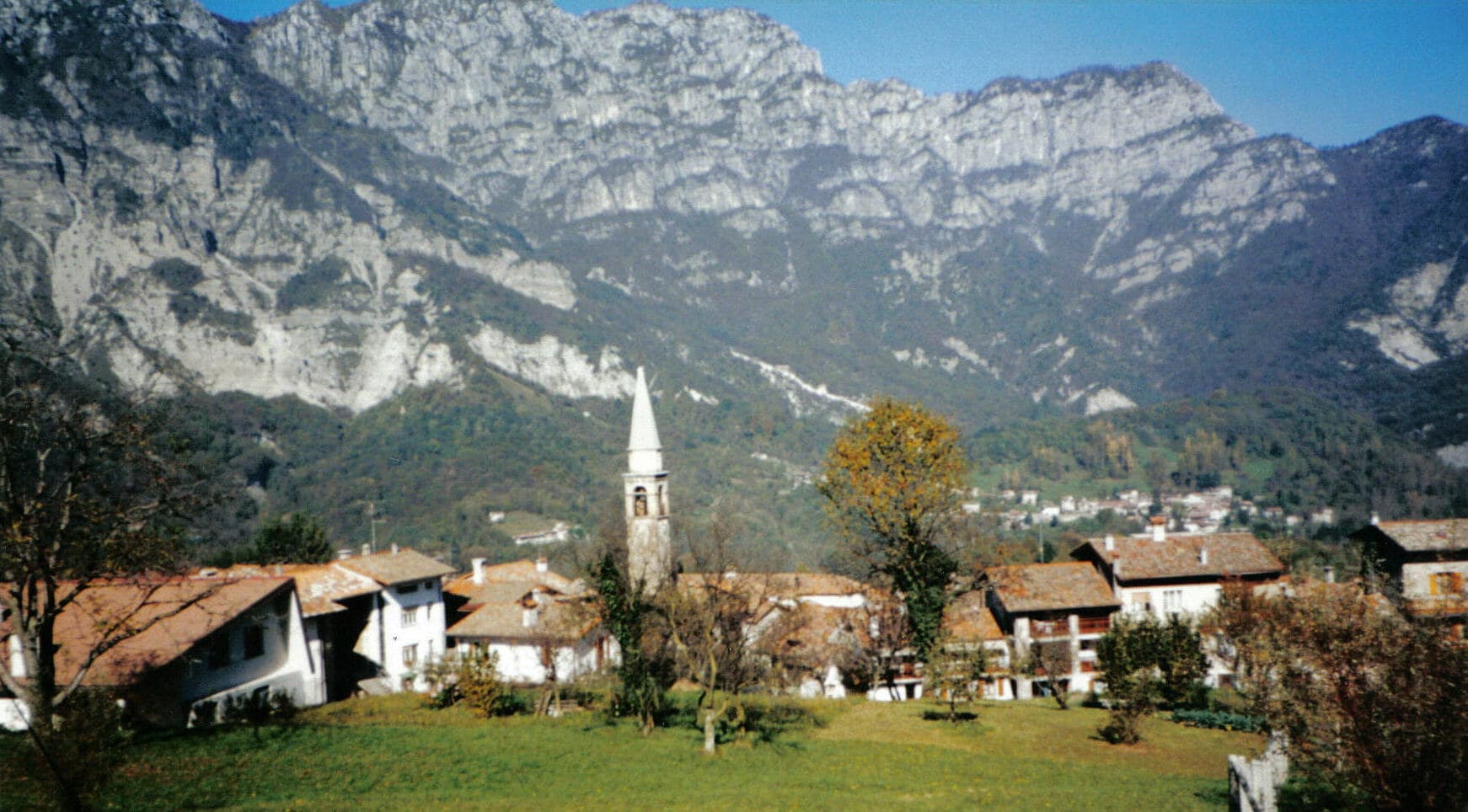
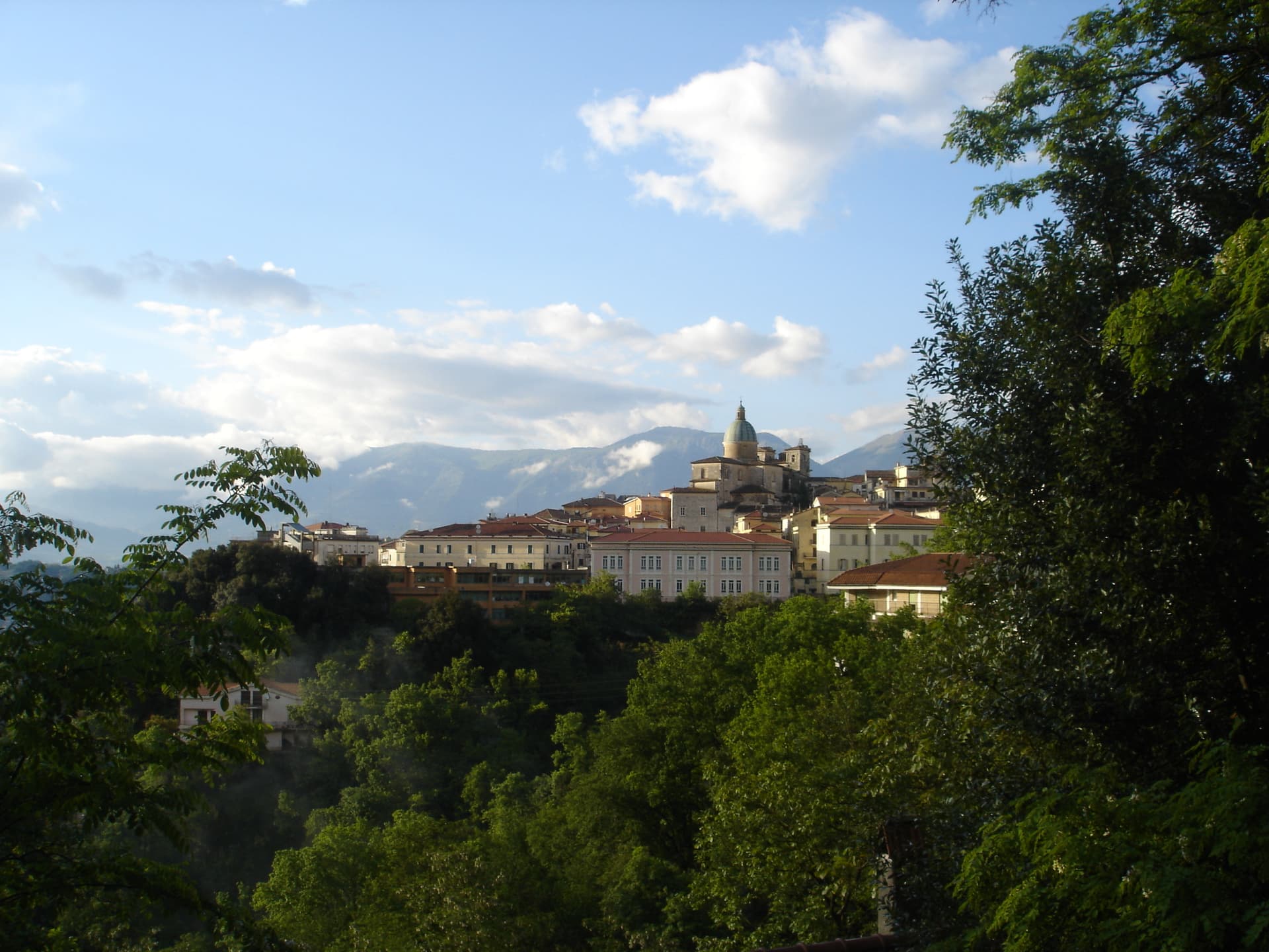
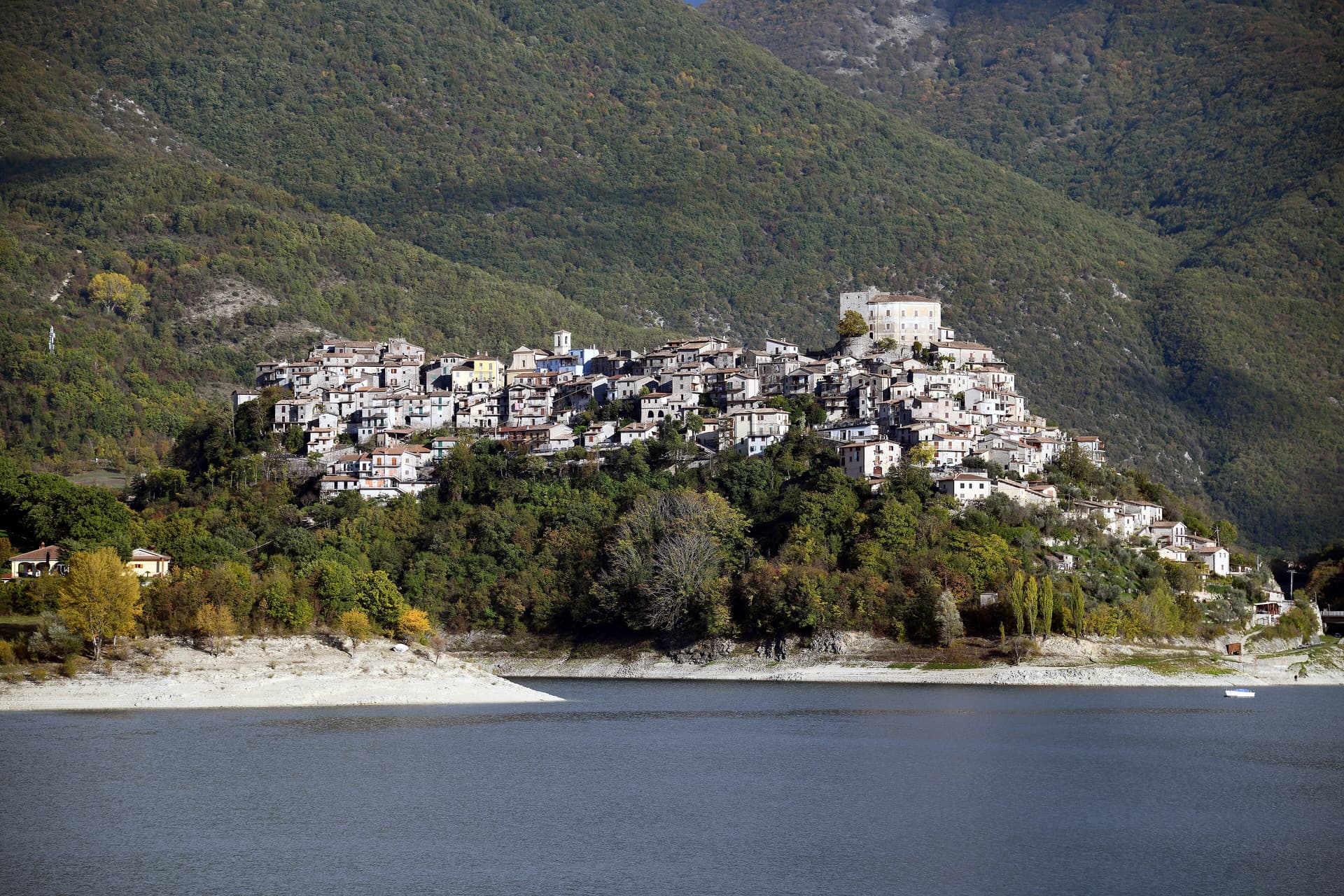
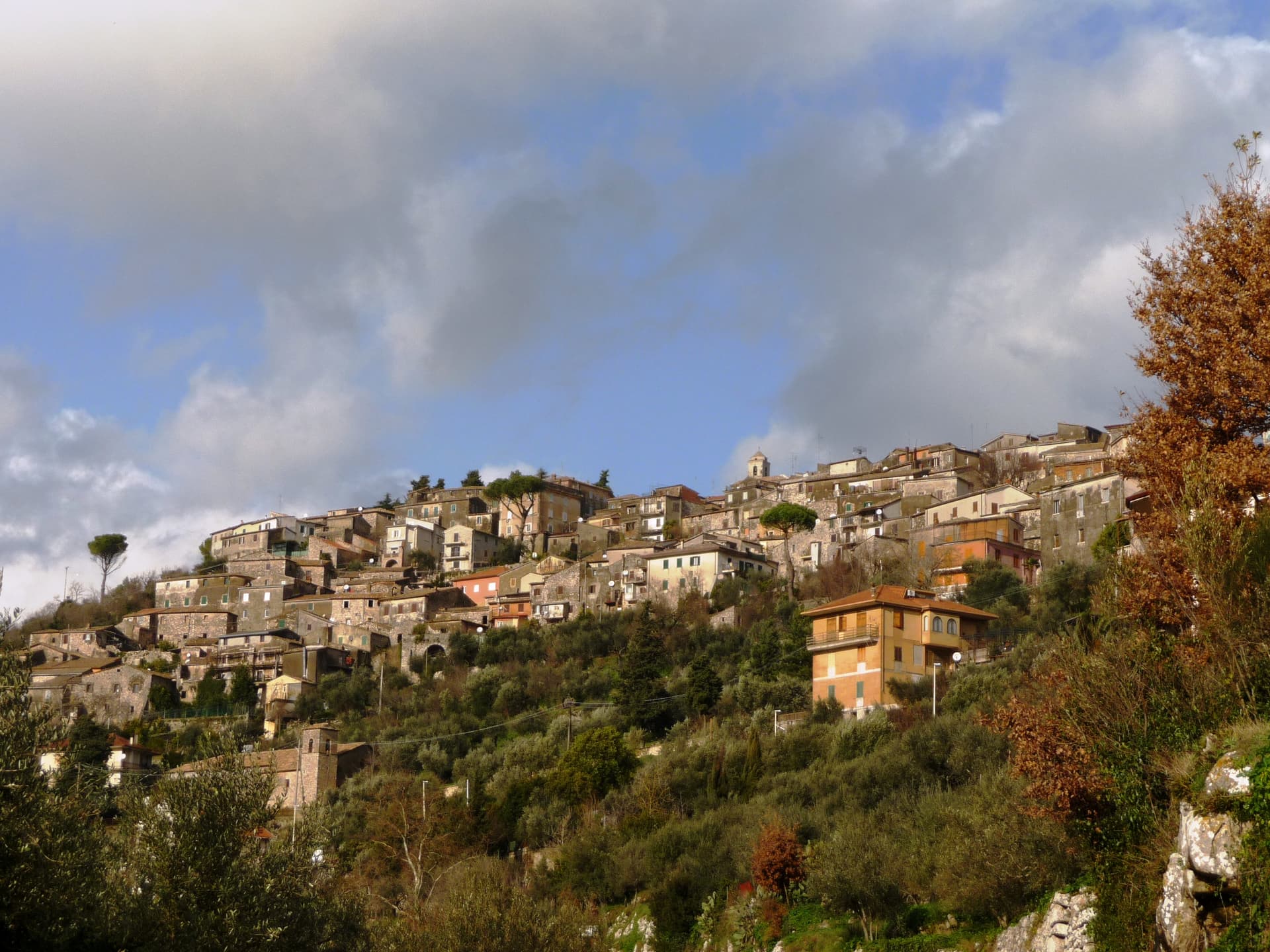
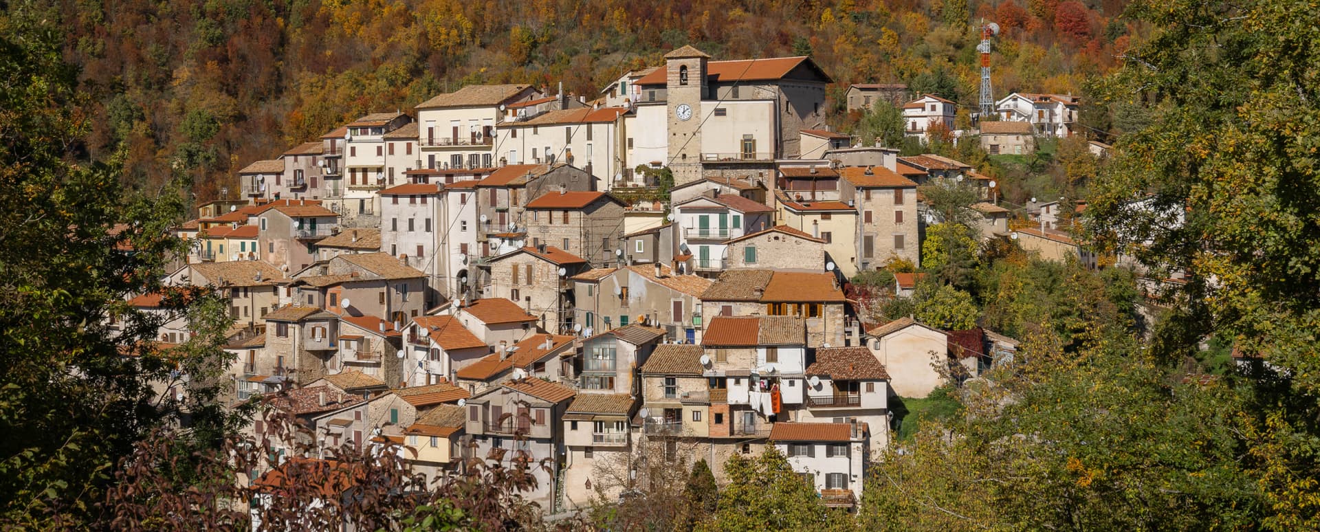
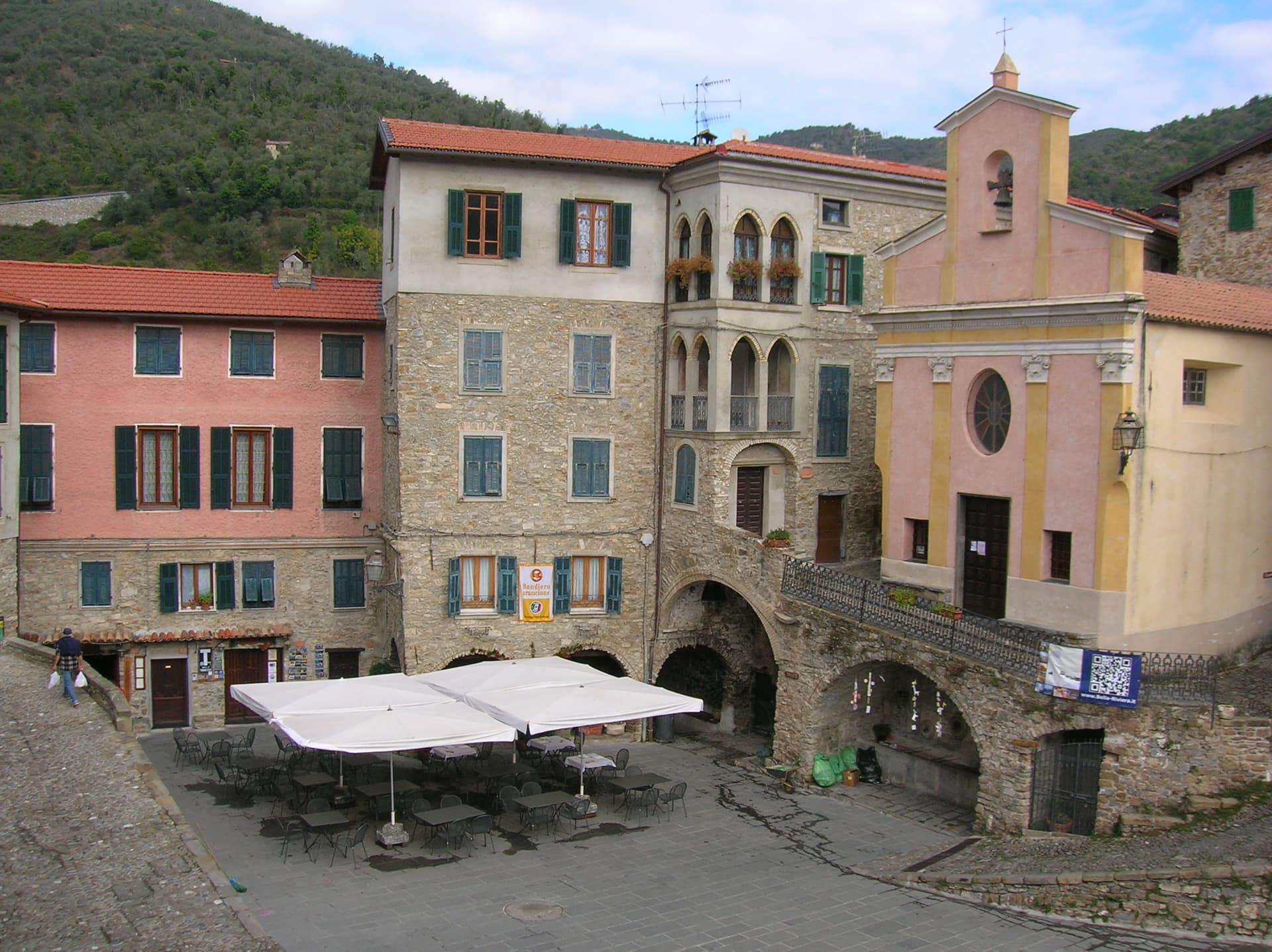
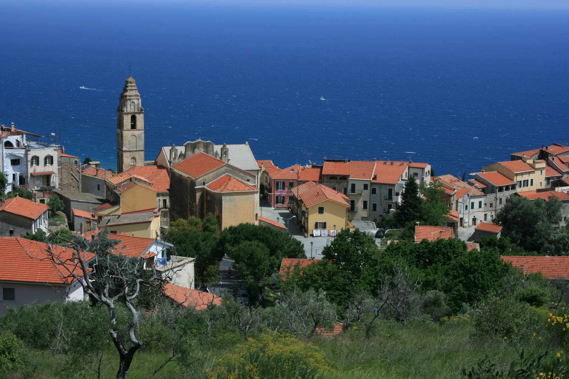
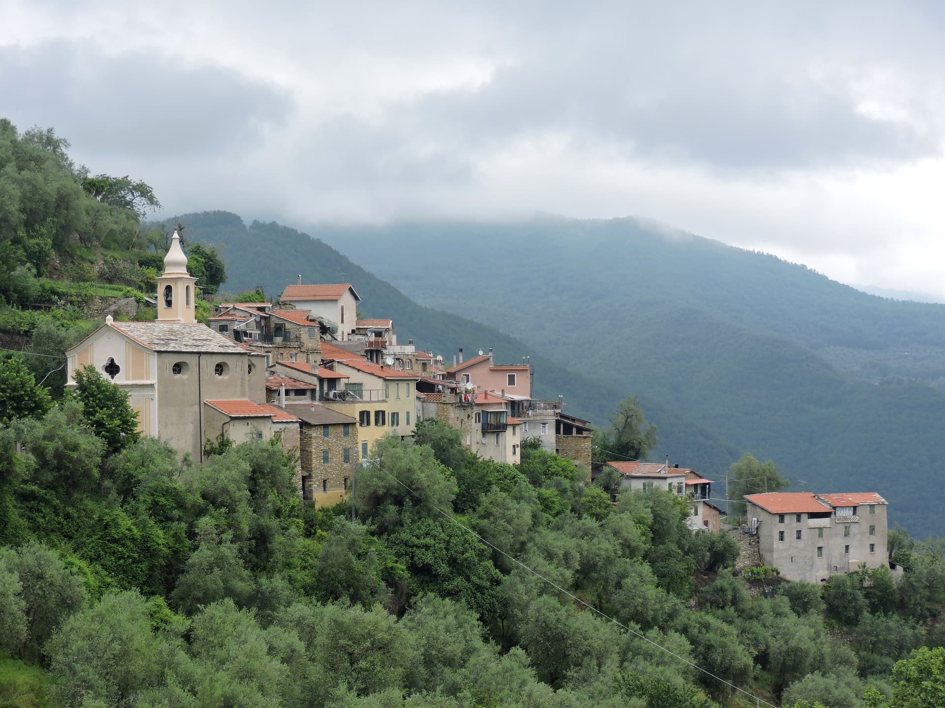
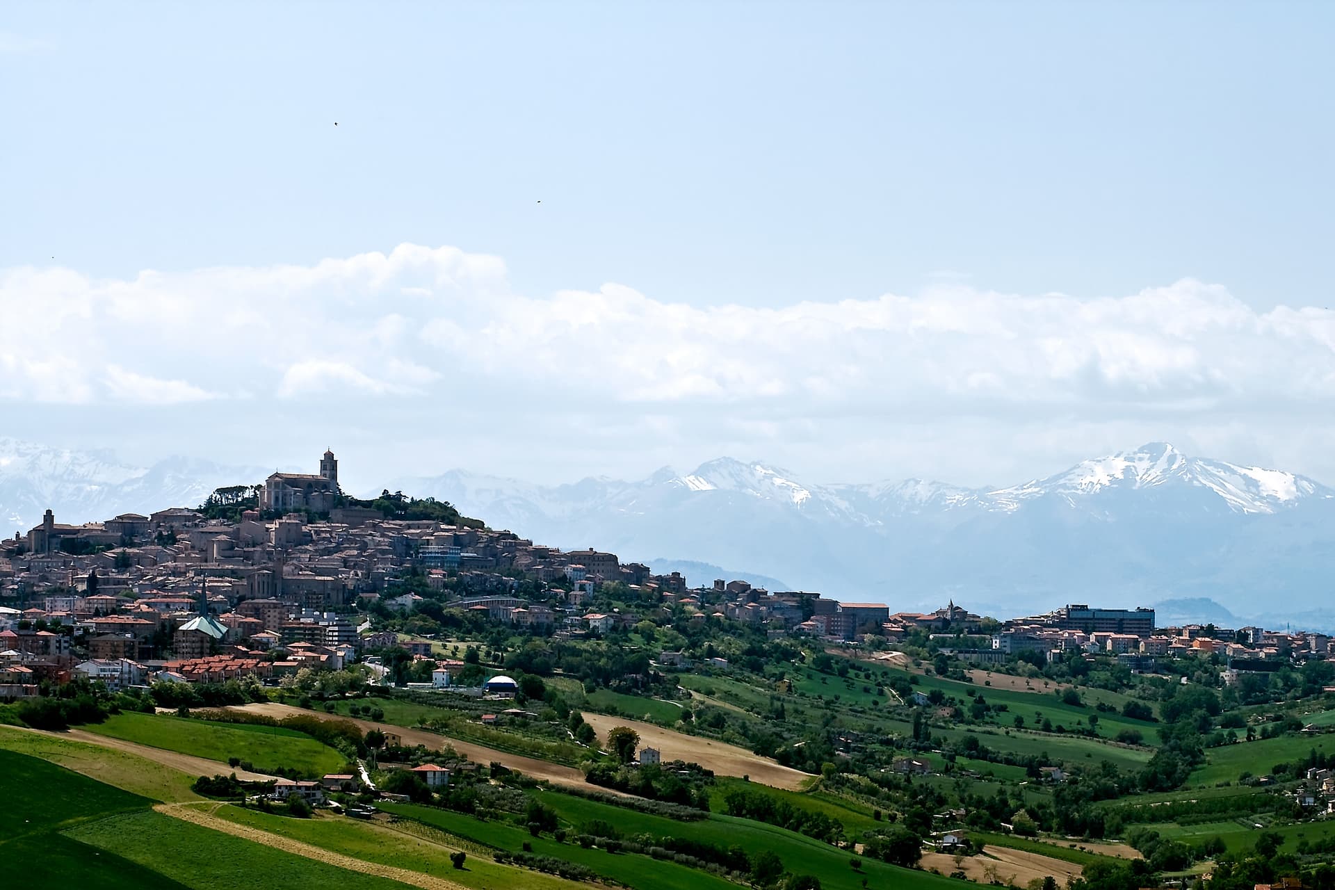
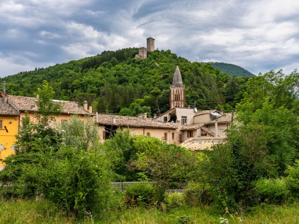
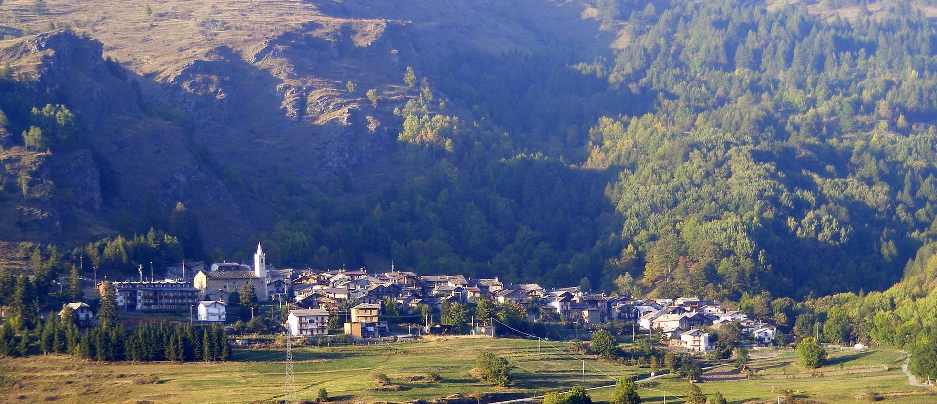
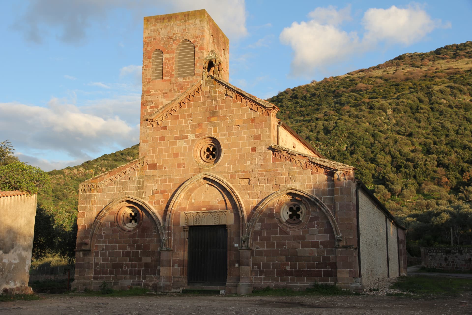
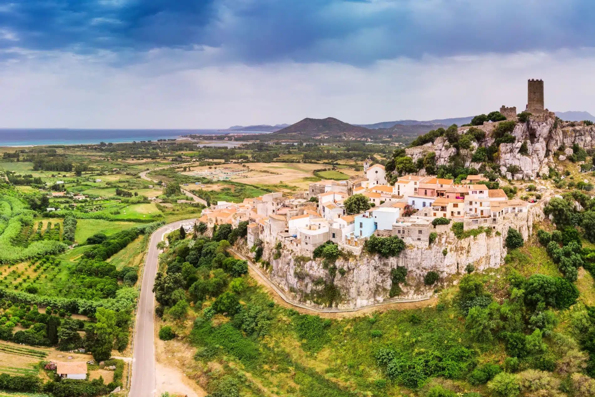
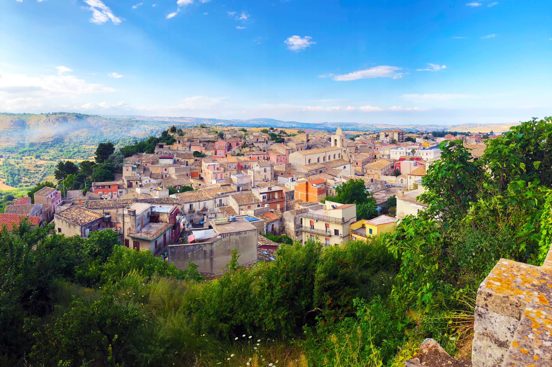
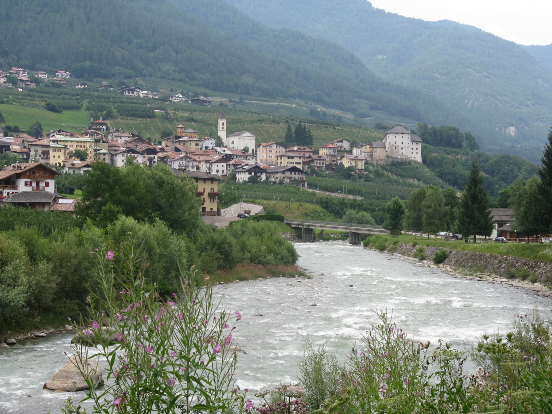
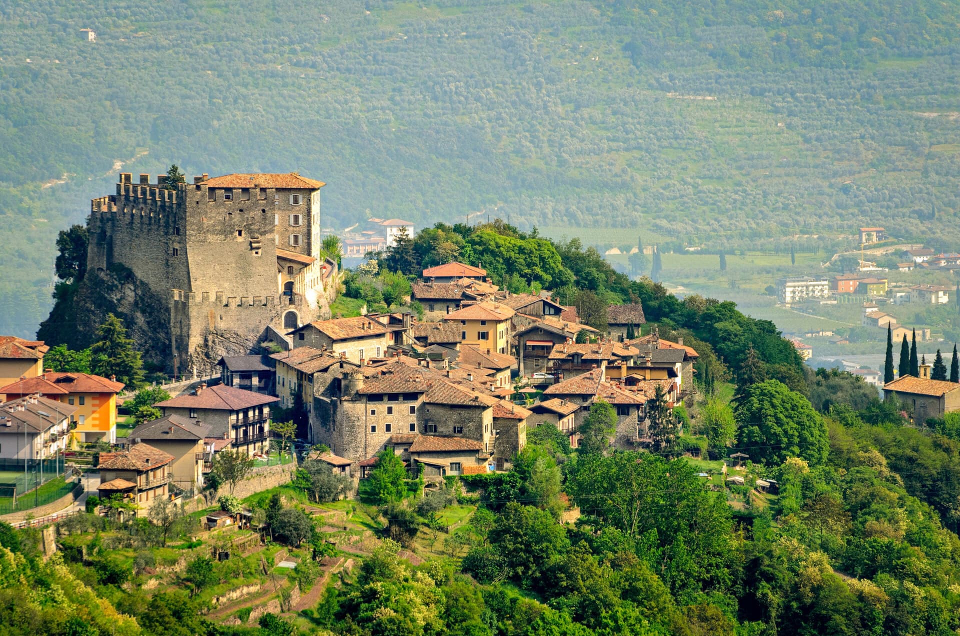
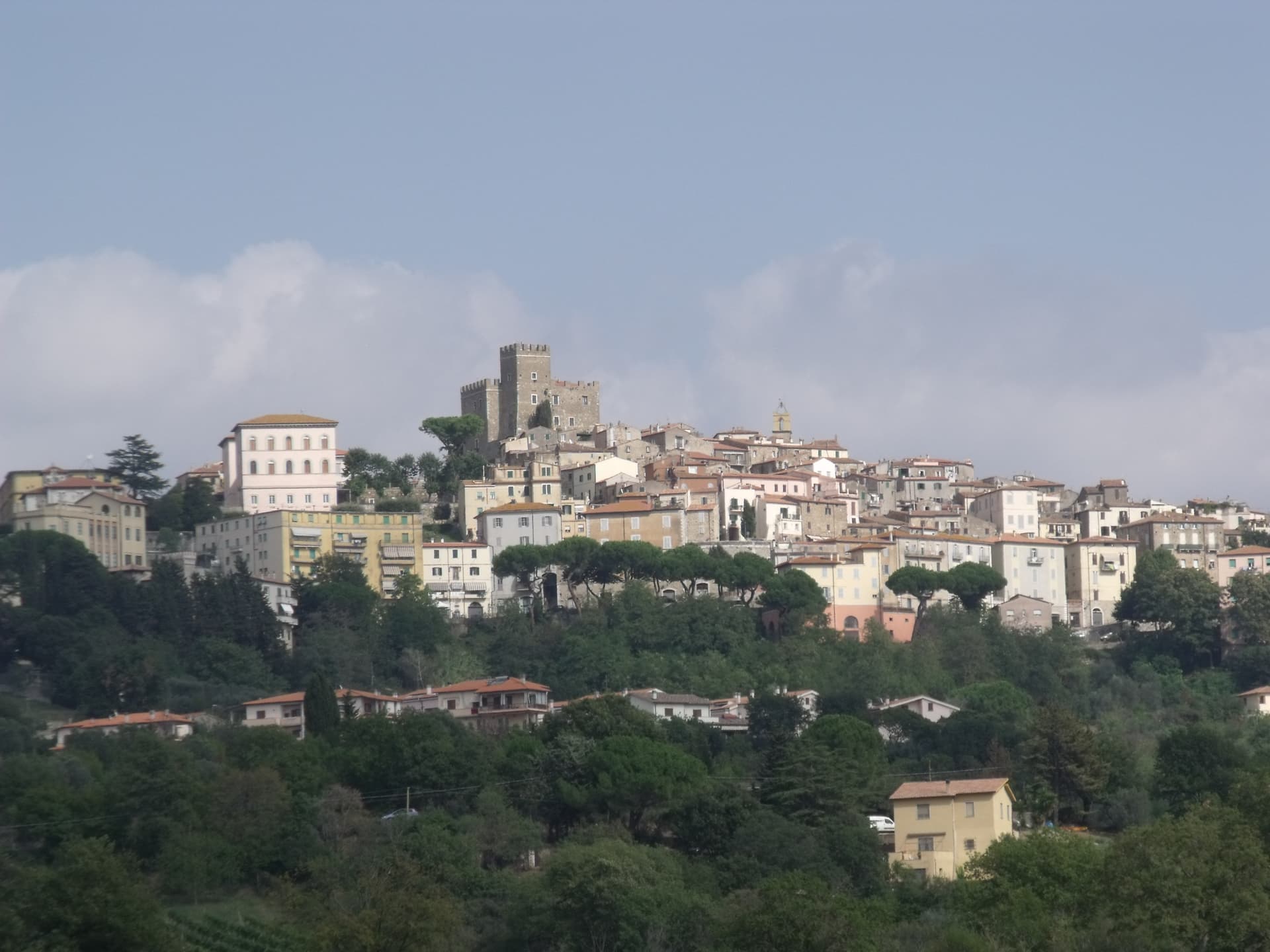
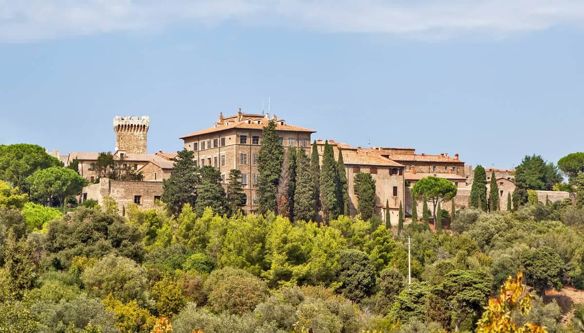
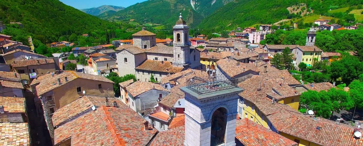
Anversa degli Abruzzi
Province: L'Aquila · 604 m
At 604 meters above the Sagittario Gorges, the cliff village where D'Annunzio set La Fiaccola sotto il moggio in 1905.
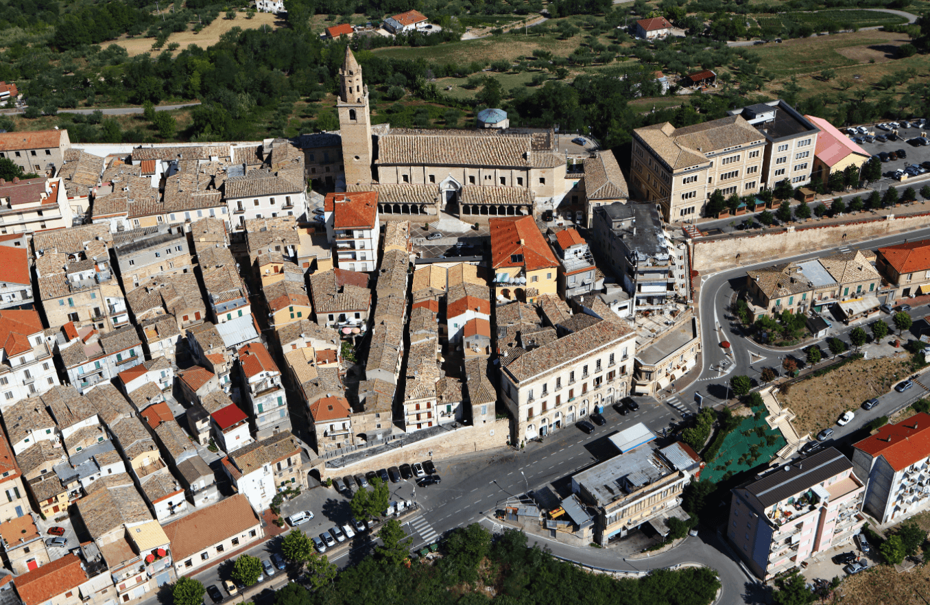
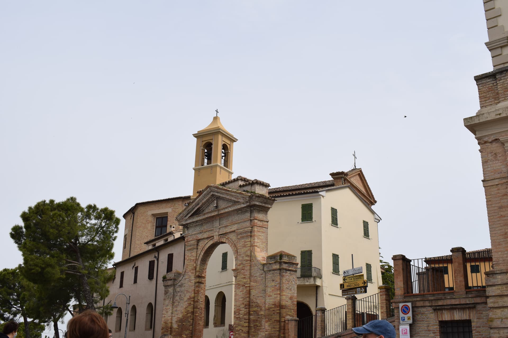
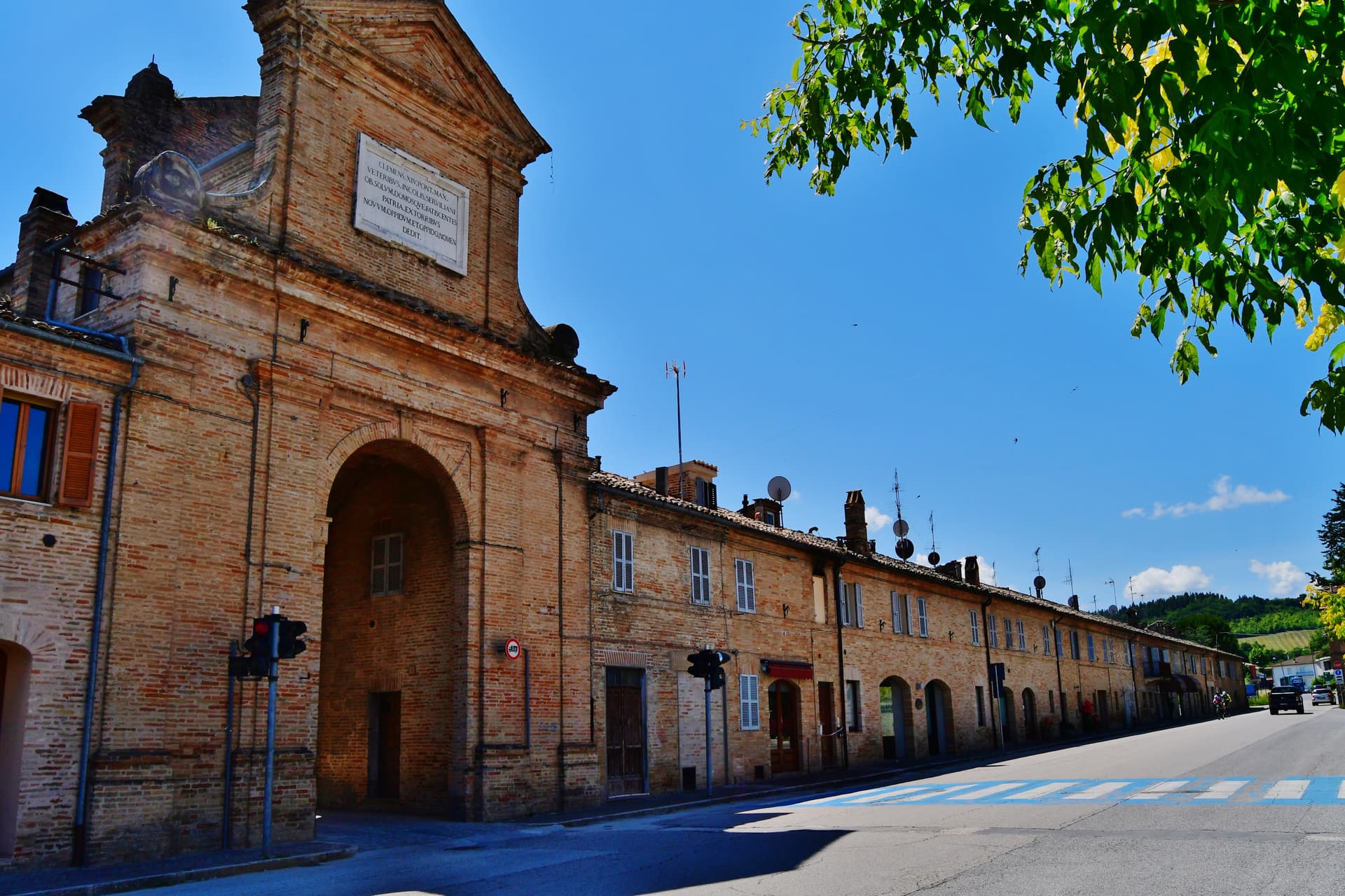
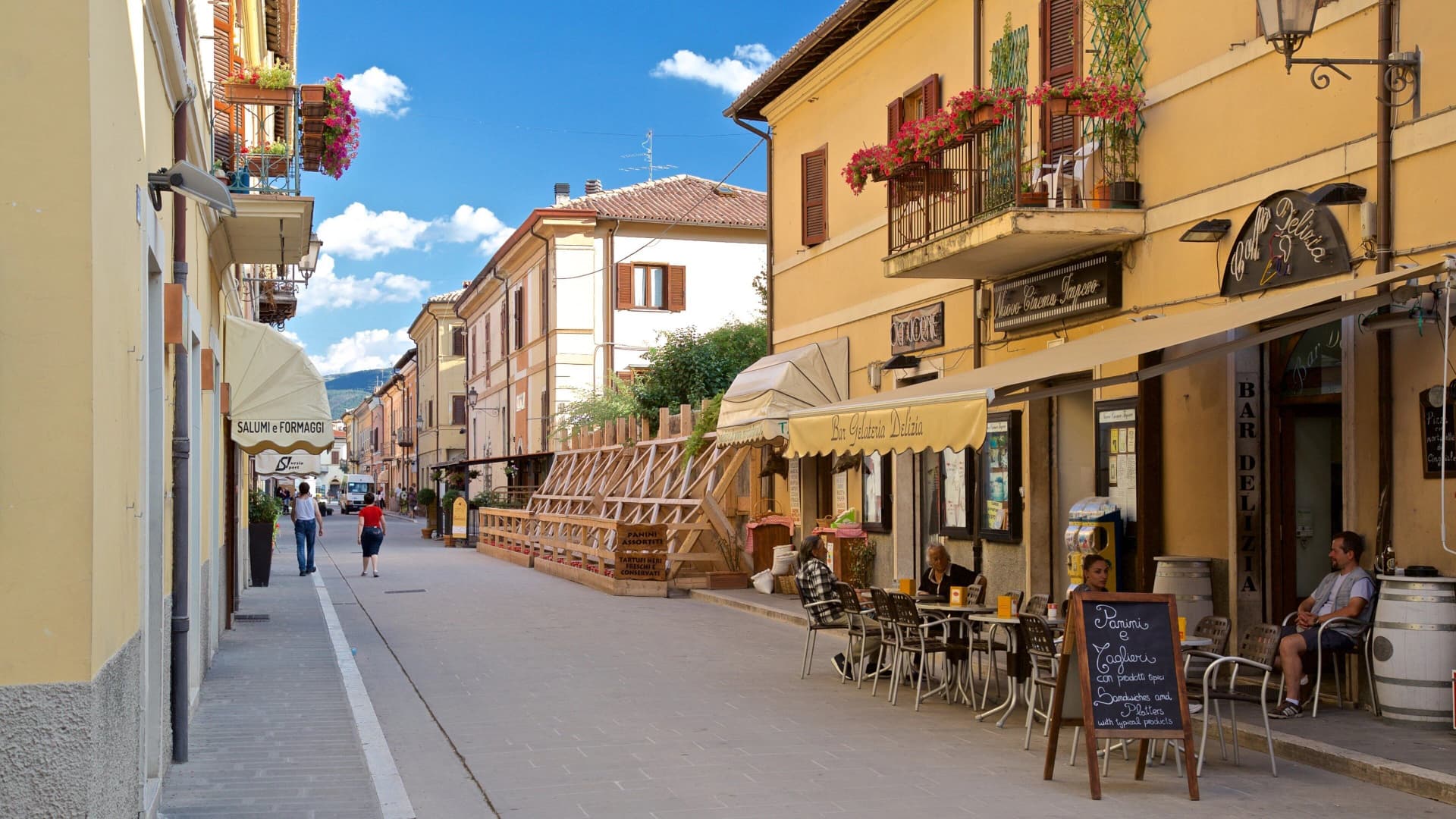
Campli
Province: Teramo · 393 m
A 393-meter town under the Monti della Laga, held by the Farnese for two centuries, with a Scala Santa carrying papal indulgence.
Caramanico Terme
Province: Pescara · 650 m
A 650-meter Majella spa village at the confluence of the Orfento and Orta, with sulphurous springs whose properties were documented in 1576.
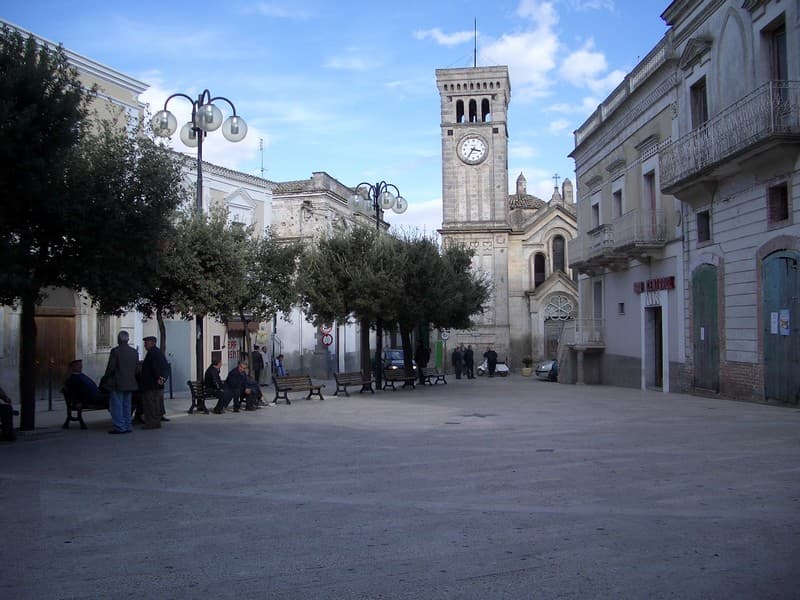
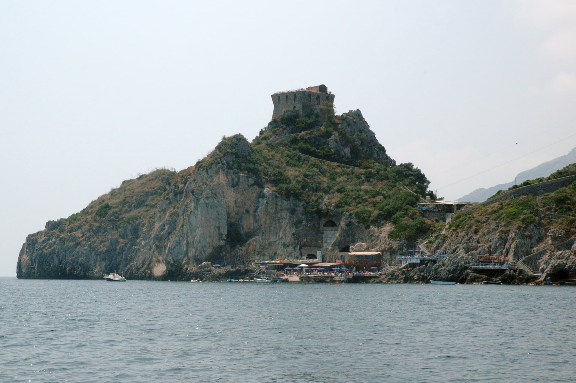
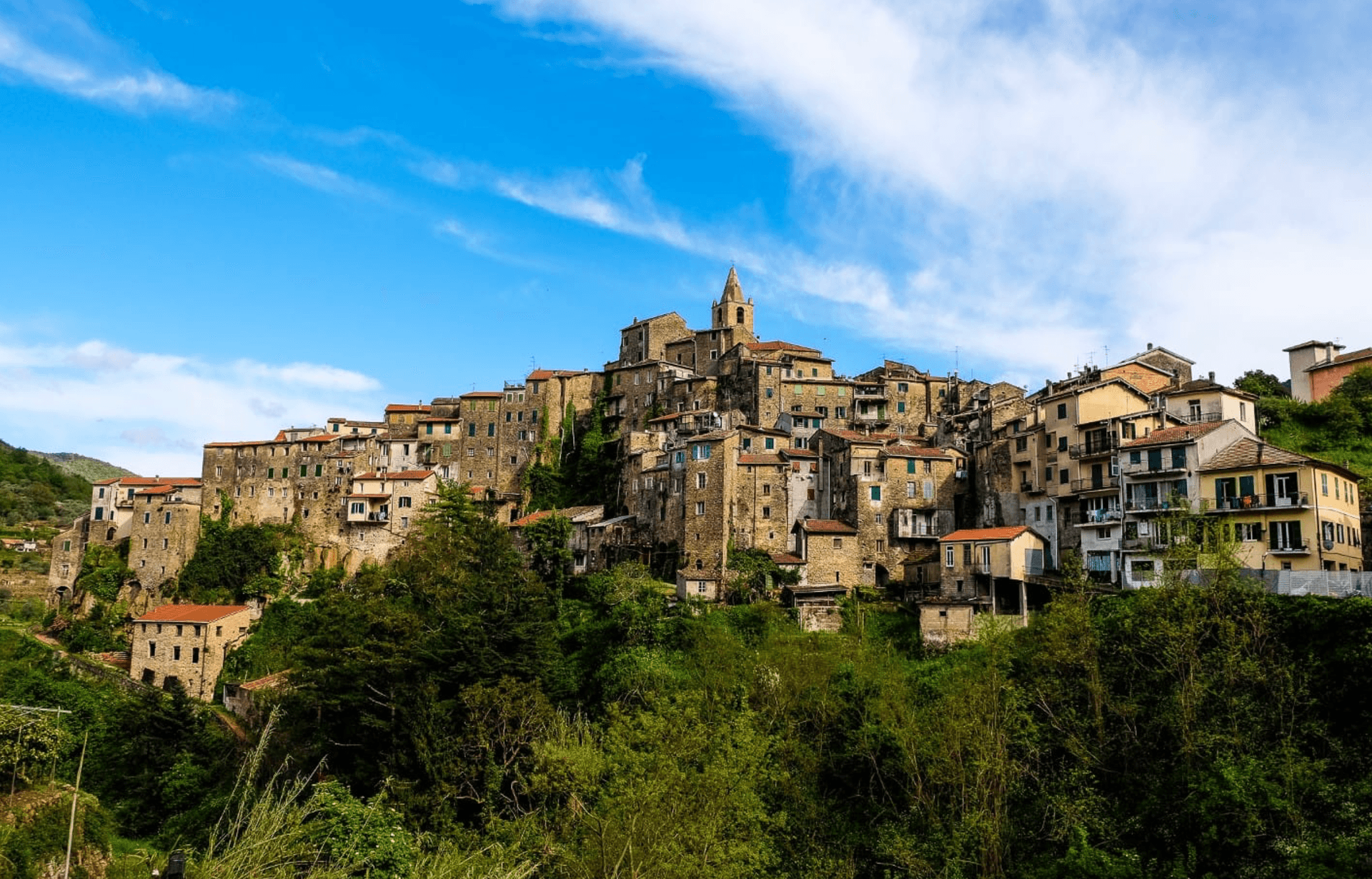
Casoli
Province: Chieti · 378 m
A 378-meter hill town above the Aventino under the Maiella, with a pentagonal Norman tower where Gabriele D'Annunzio held a Renaissance court of artists.
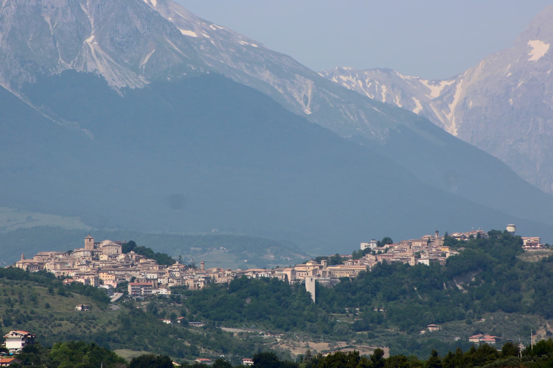
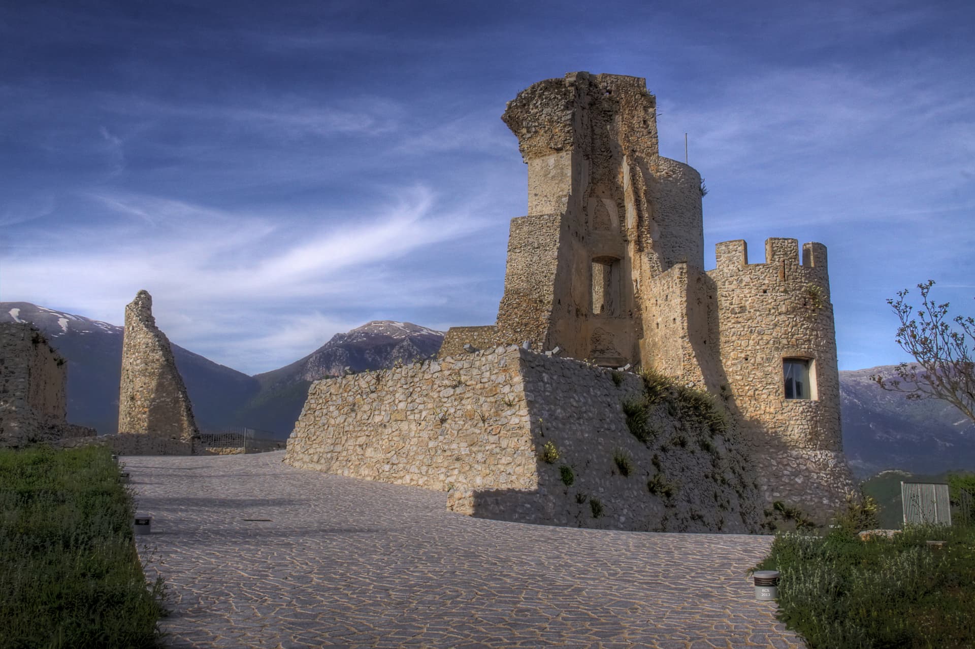
Castel del Monte
Province: L'Aquila · 1,346 m
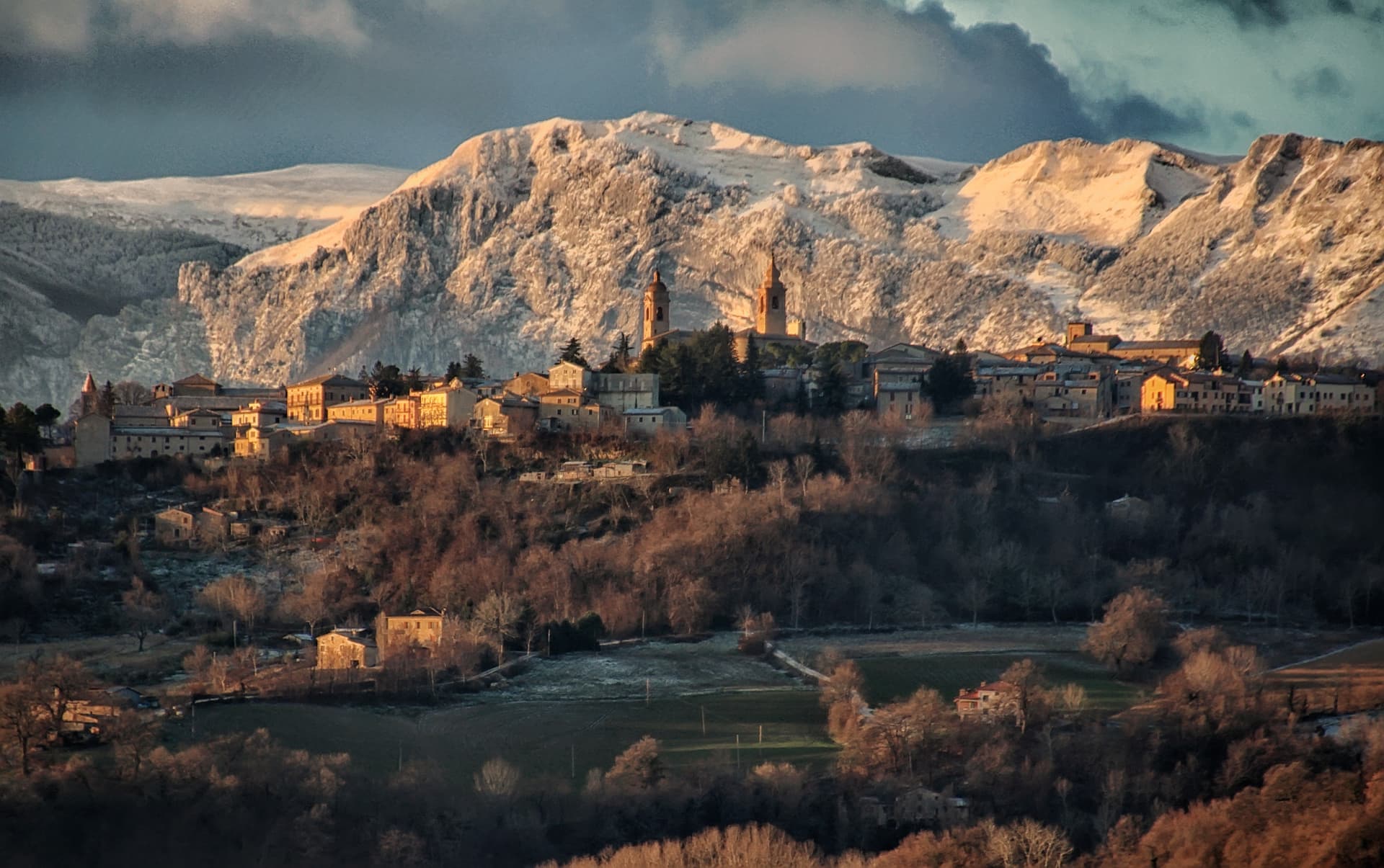
At 1,346 meters under Monte Bolza facing Rocca Calascio, the capital of shepherds, whose wool reached the Medici and whose witches return each August.
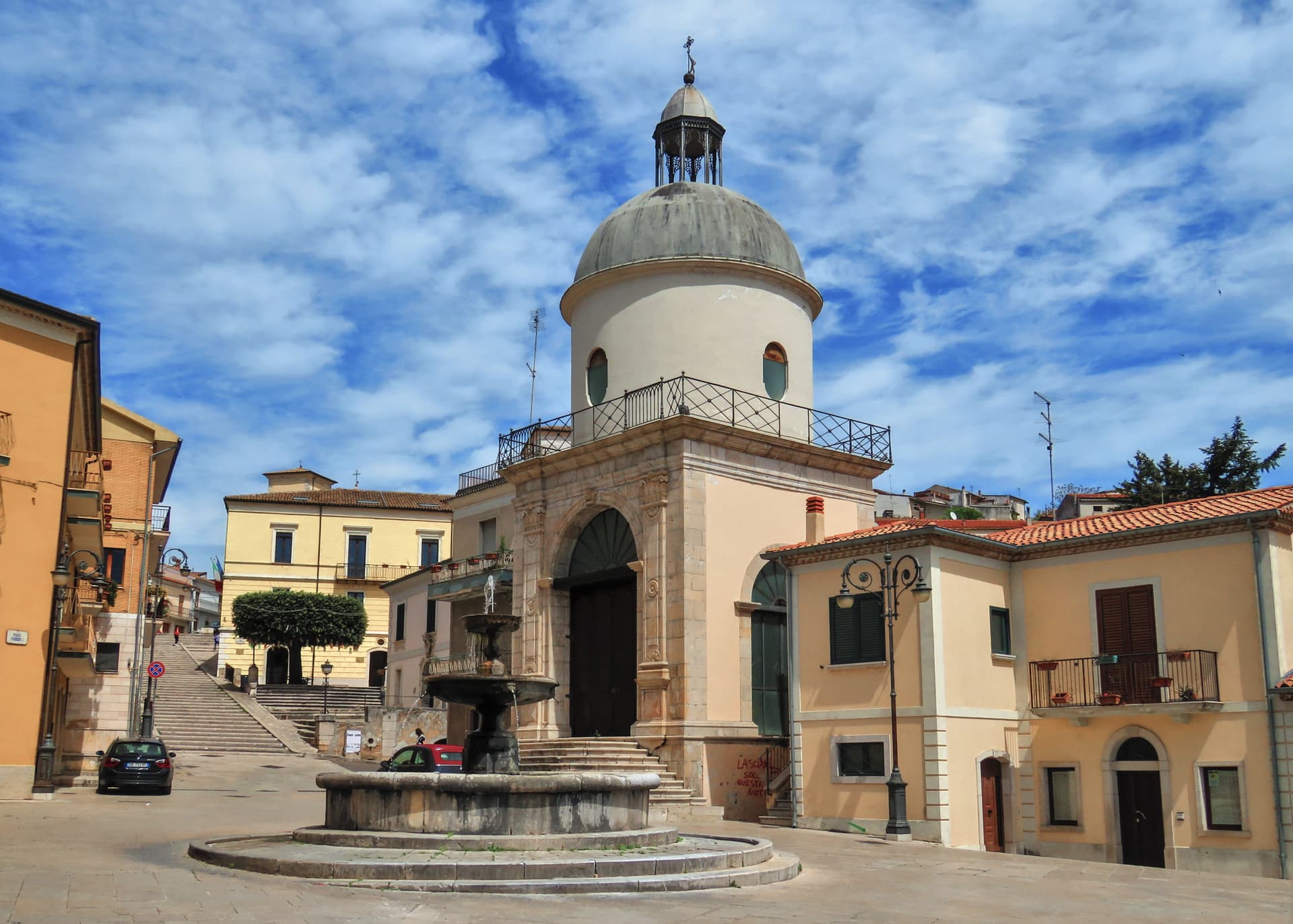
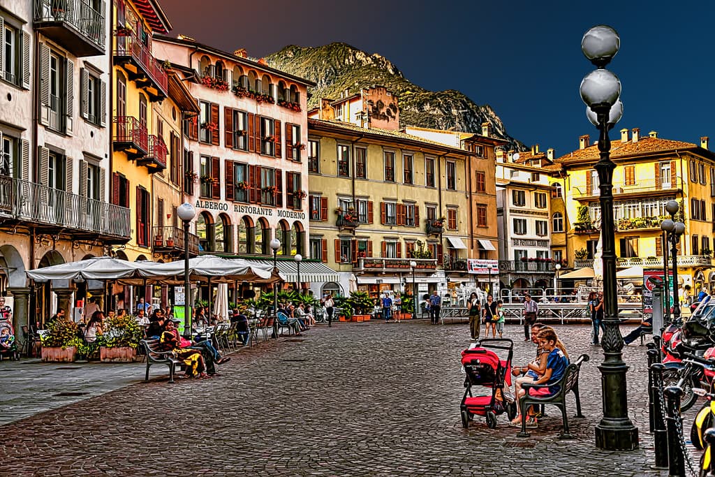
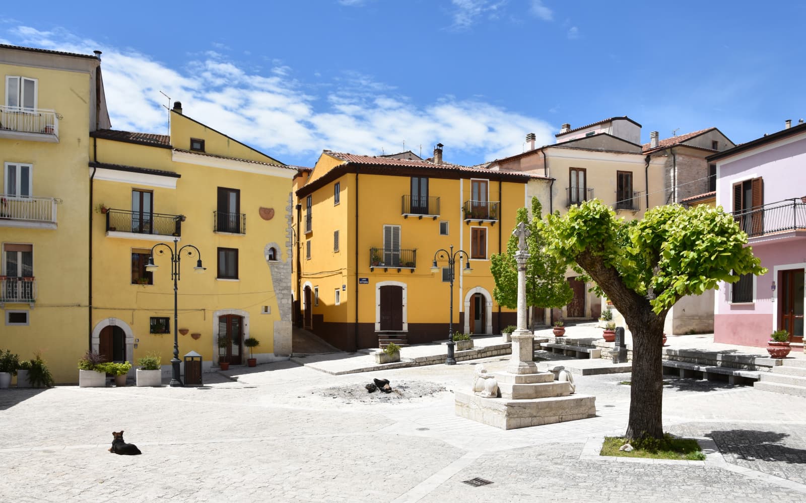
Città Sant'Angelo
Province: Pescara · 320 m
A hilltop borgo at 320 meters between the Vestina hills and the Adriatic, named for the Archangel and known since 1352 as a Collegiata seat.
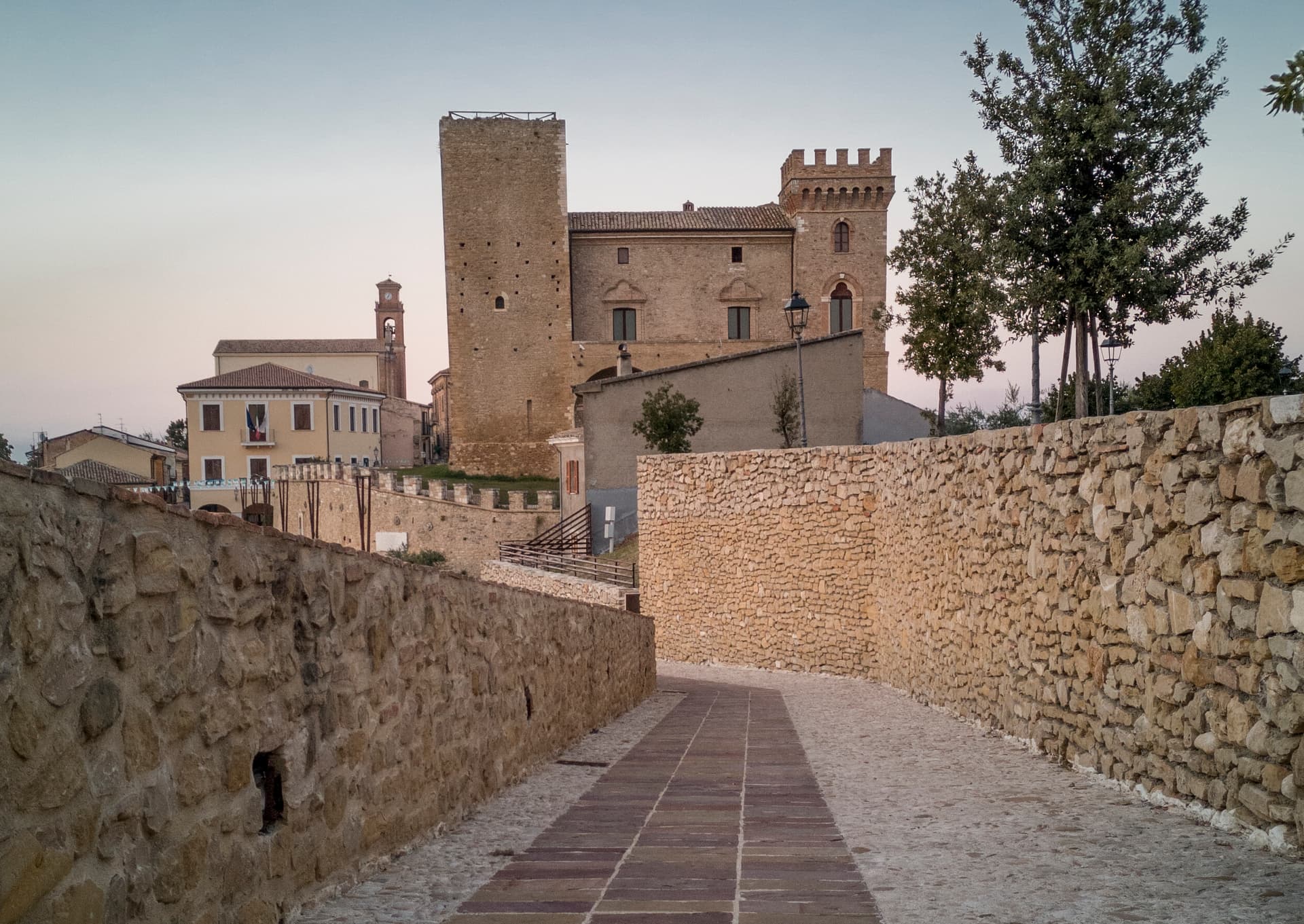
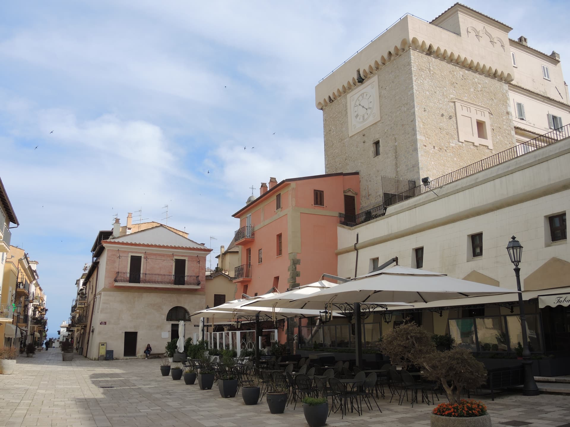
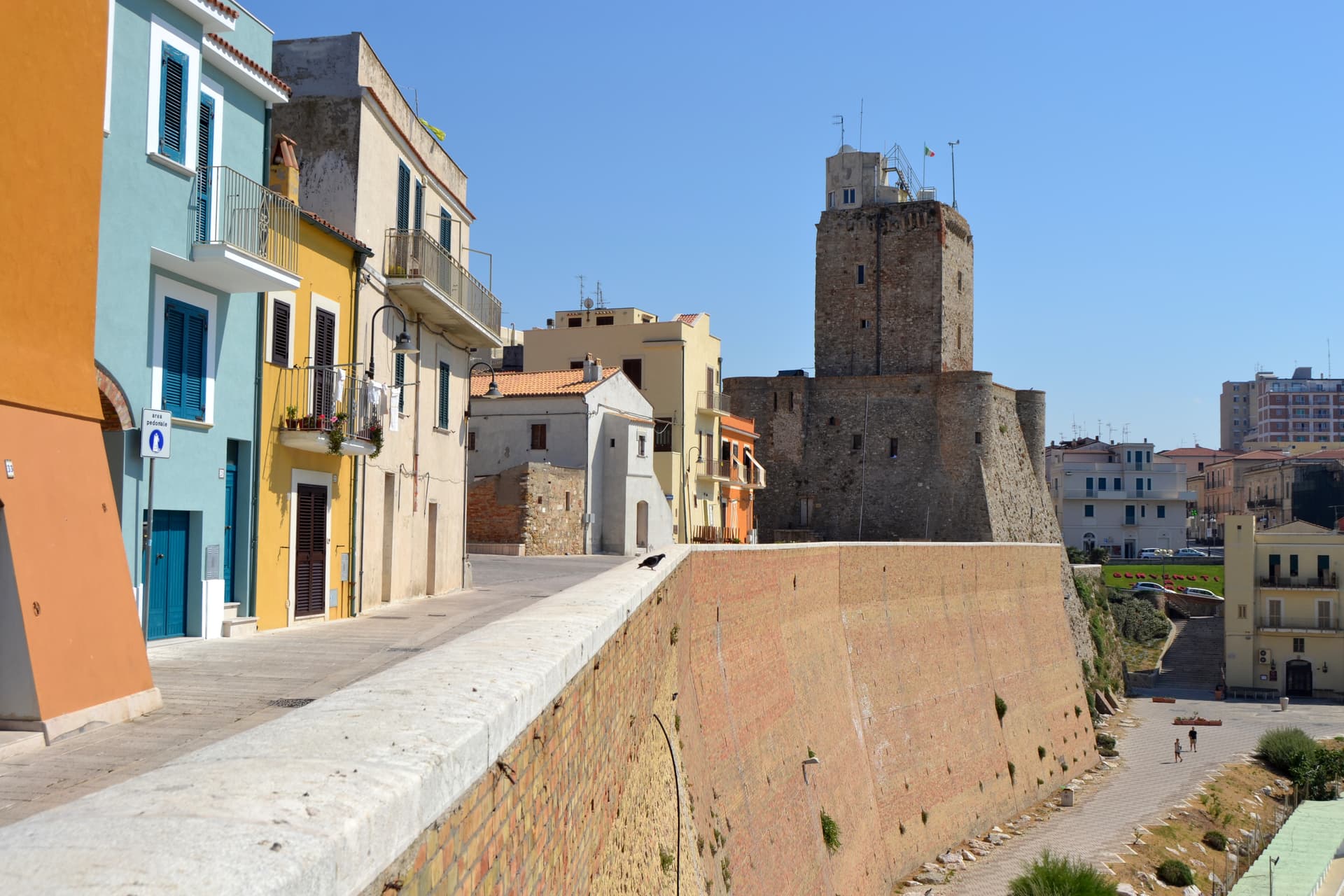
Civitella del Tronto
Province: Teramo · 589 m
A rocky crest at 589 meters above the Tronto valley, crowned by the last Bourbon fortress to surrender to united Italy in March 1861.
Crecchio
Province: Chieti · 209 m
A 209-meter hill town between the Adriatic and the Maiella, capital of Italy for one night in 1943 when the king slept in its castle.
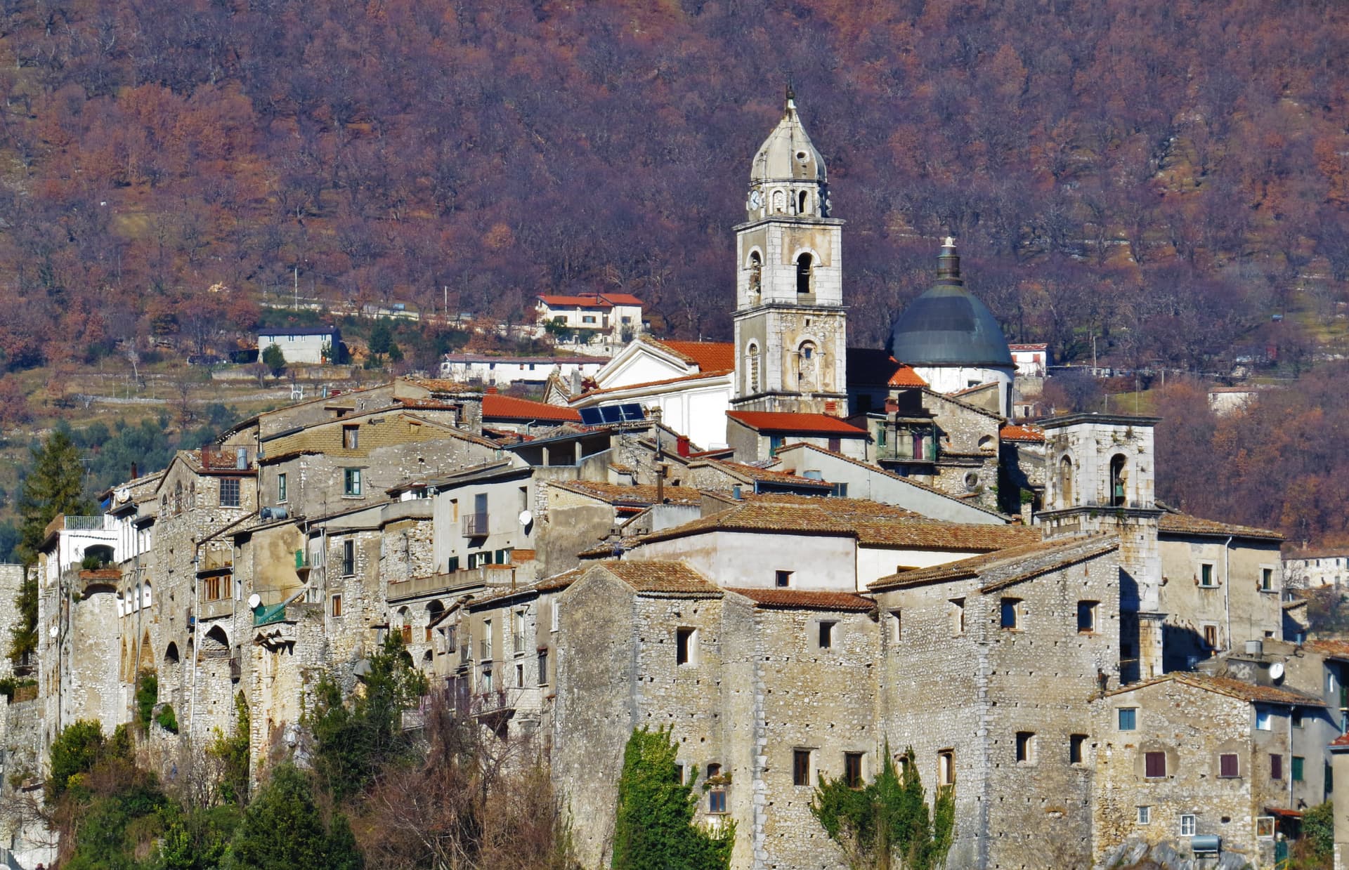
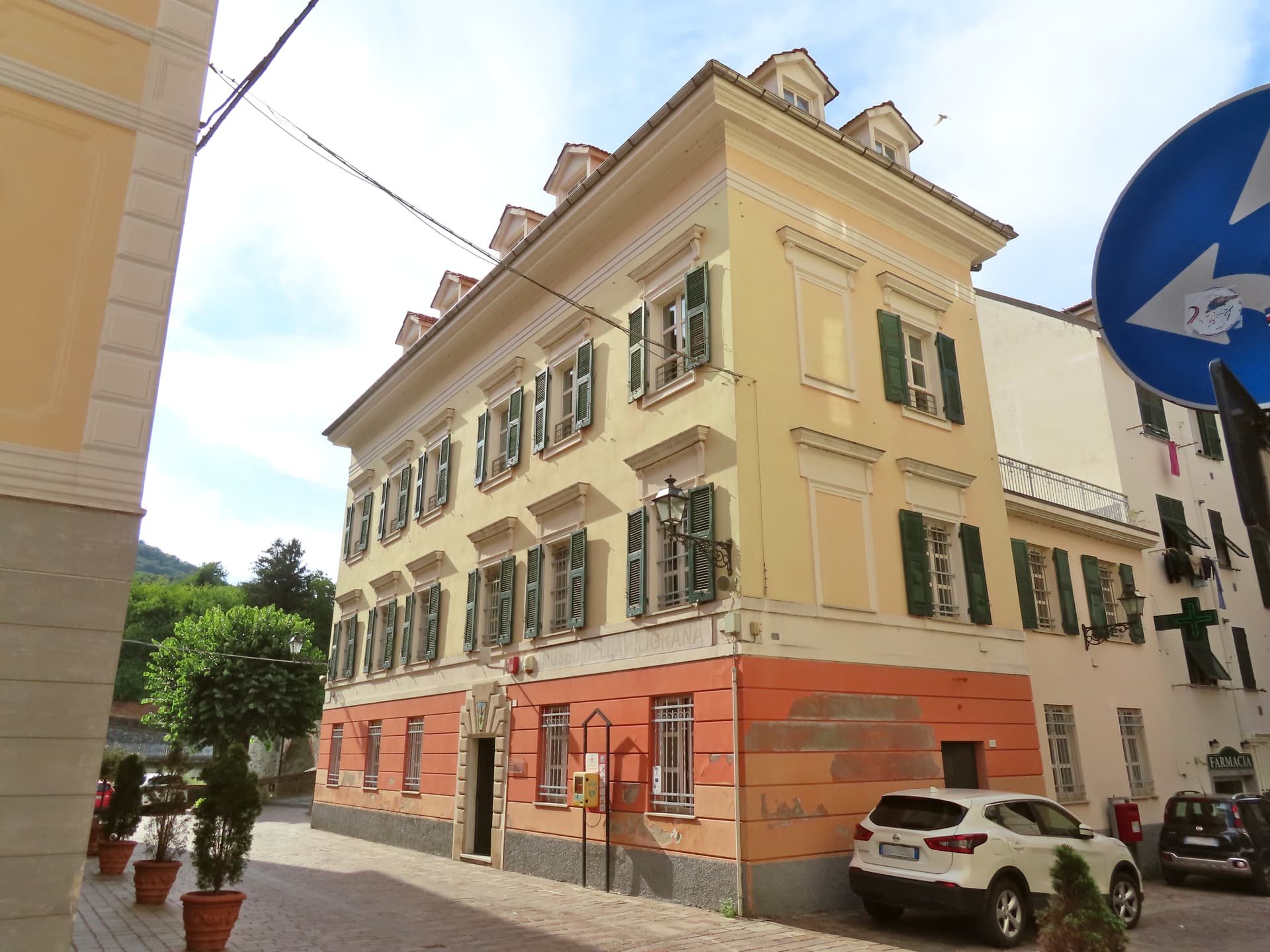
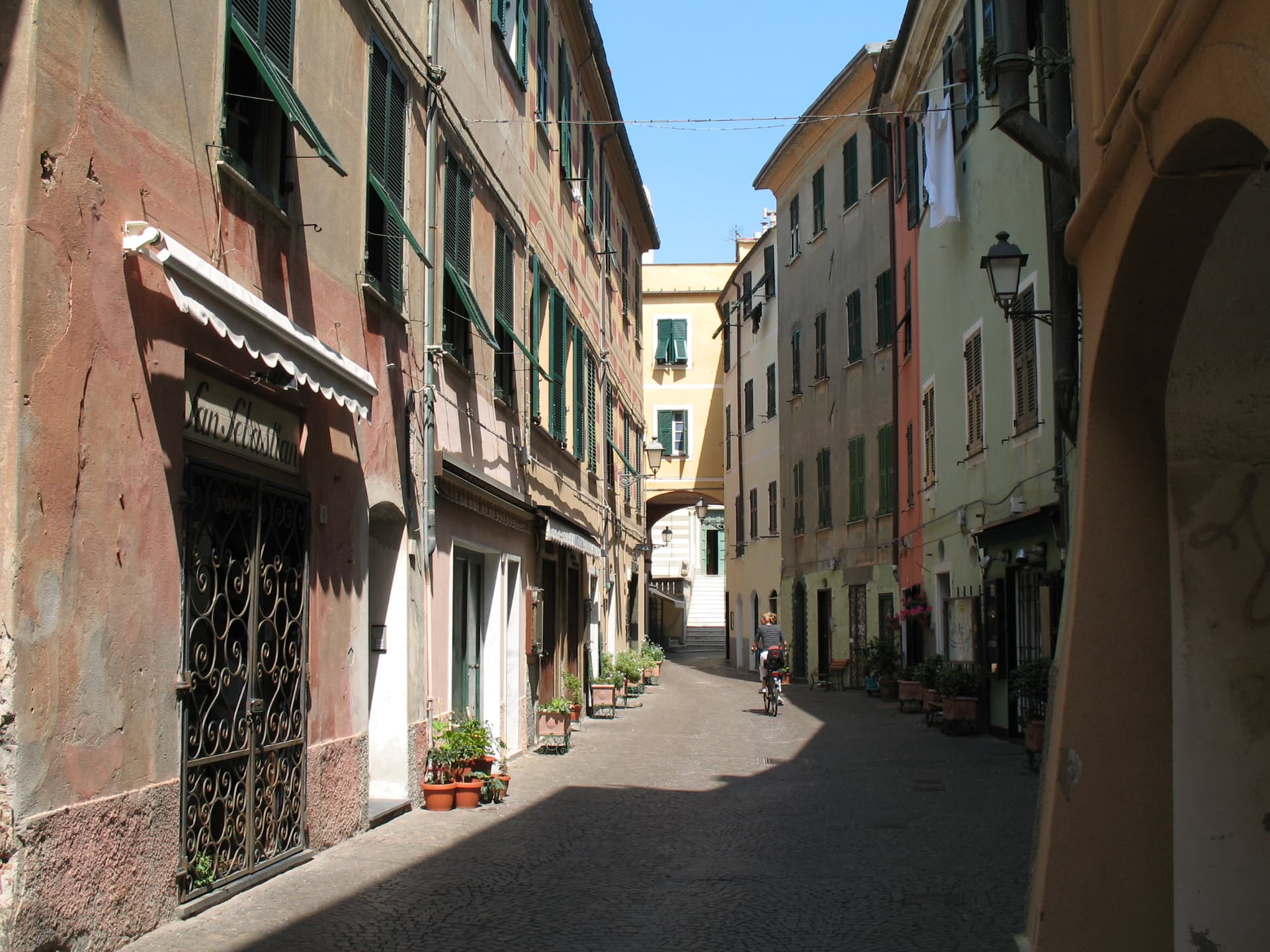
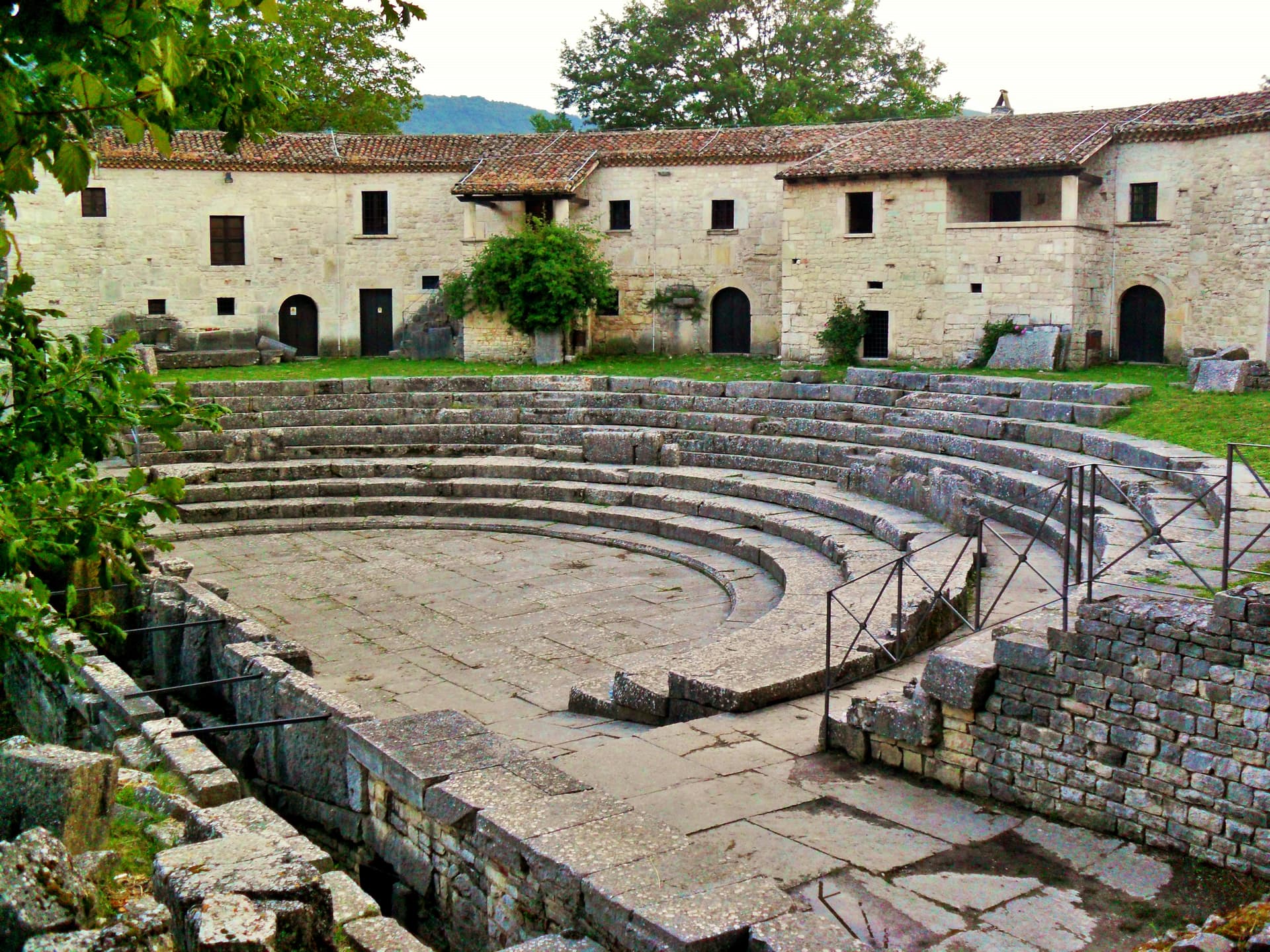
Guardiagrele
Province: Chieti · 576 m
The 576-meter terrazza d'Abruzzo on the Majella's foothills, hometown of fifteenth-century goldsmith Nicola da Guardiagrele and seat of the Majella park.

Introdacqua
Province: L'Aquila · 670 m
At 670 meters in the Valle Peligna, the spring-fed village whose Latin name means inside the waters, now a magnet for foreign residents.
Navelli
Province: L'Aquila · 760 m
At 760 meters above the Navelli plain, the pyramid of stone houses growing the saffron a 13th-century Dominican brought from Spain.

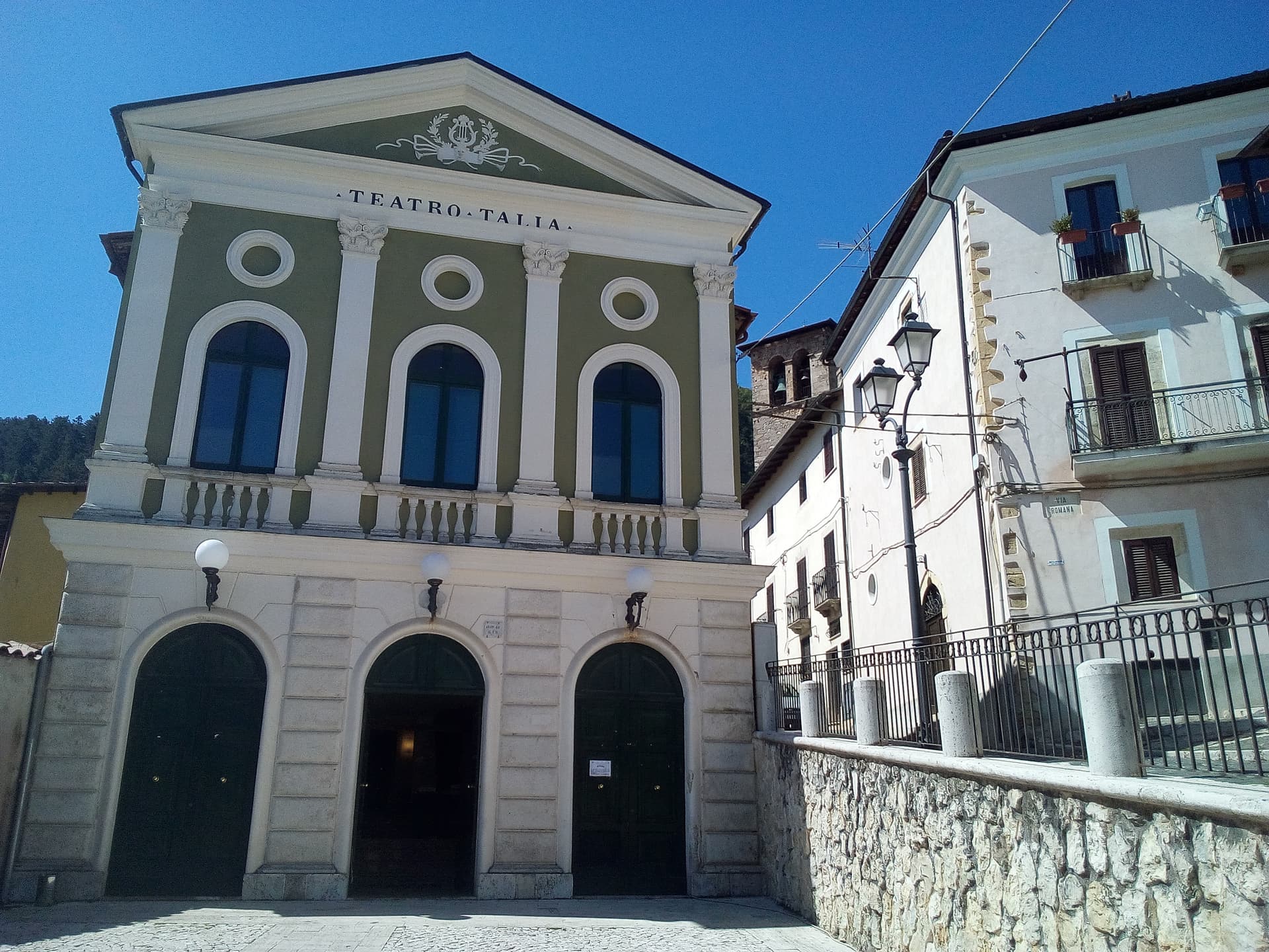
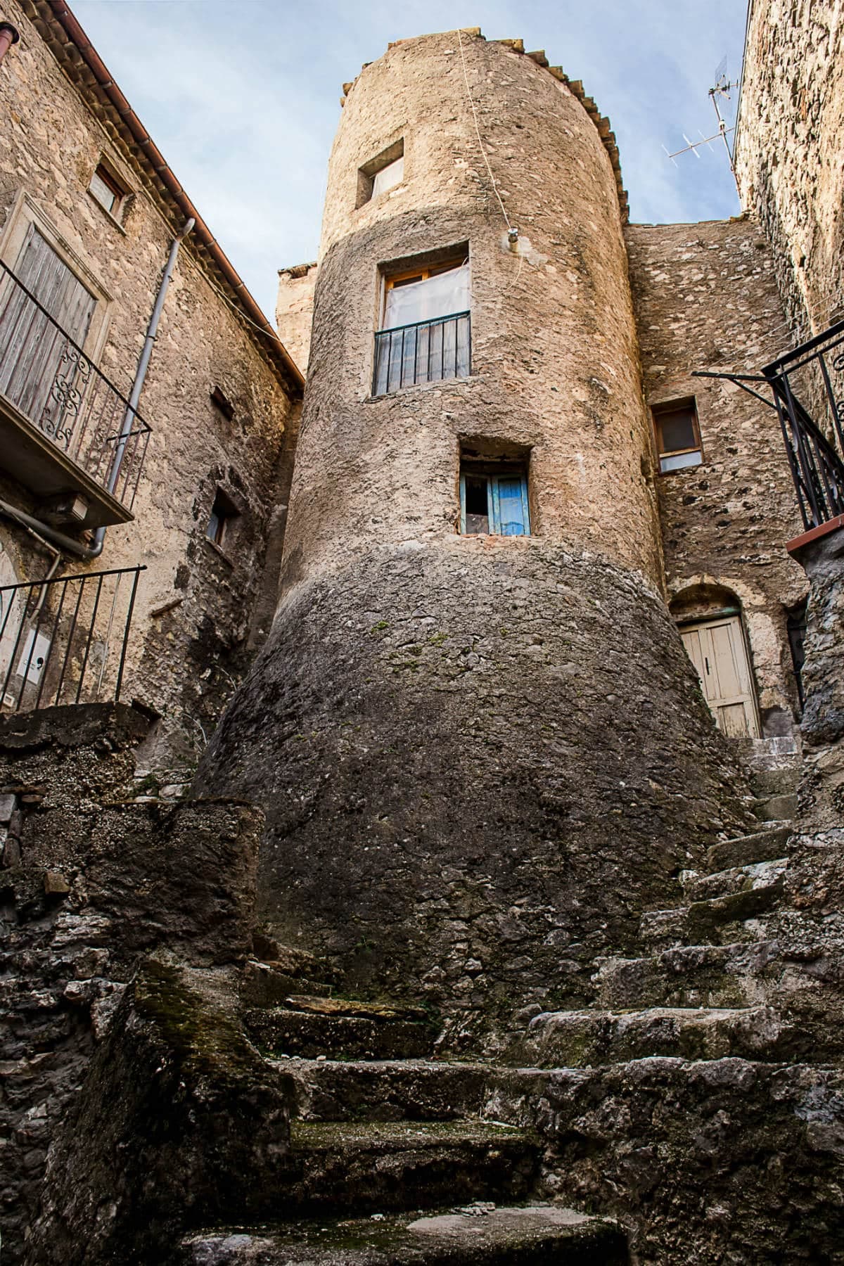
Pacentro
Province: L'Aquila · 650 m
A medieval village at 650 meters under the Caldora castle towers, where every September a barefoot race honors a Madonna and a pop singer's grandparents.
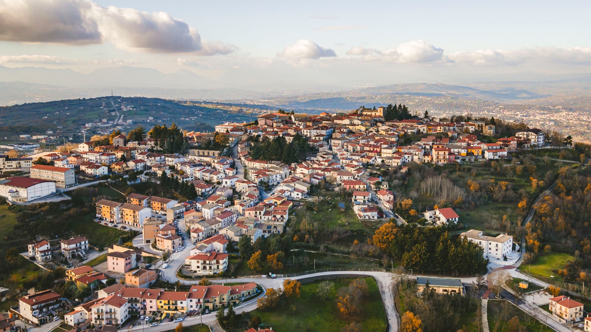
Penne
Province: Pescara · 438 m
The brick city at 438 meters between the Tavo and Fino, ancient capital of the Vestini, rebuilt after Allied bombing and awarded the Silver Medal of Civic Merit.
Pescocostanzo
Province: L'Aquila · 1,395 m
A planned Renaissance town at 1,395 meters on the Quarto Grande plateau, with bobbin lace, wrought iron, and the wood ceilings of a five-nave church.
Pettorano sul Gizio
Province: L'Aquila · 656 m
At 656 meters above the Gizio river, a Cantelmo fortress town that guarded the gateway to the Peligna valley for four hundred years.
Pietracamela
Province: Teramo · 1,005 m
A village of 218 people clinging at 1,005 meters under the north wall of Corno Piccolo, birthplace of Italian Apennine climbing in 1925.
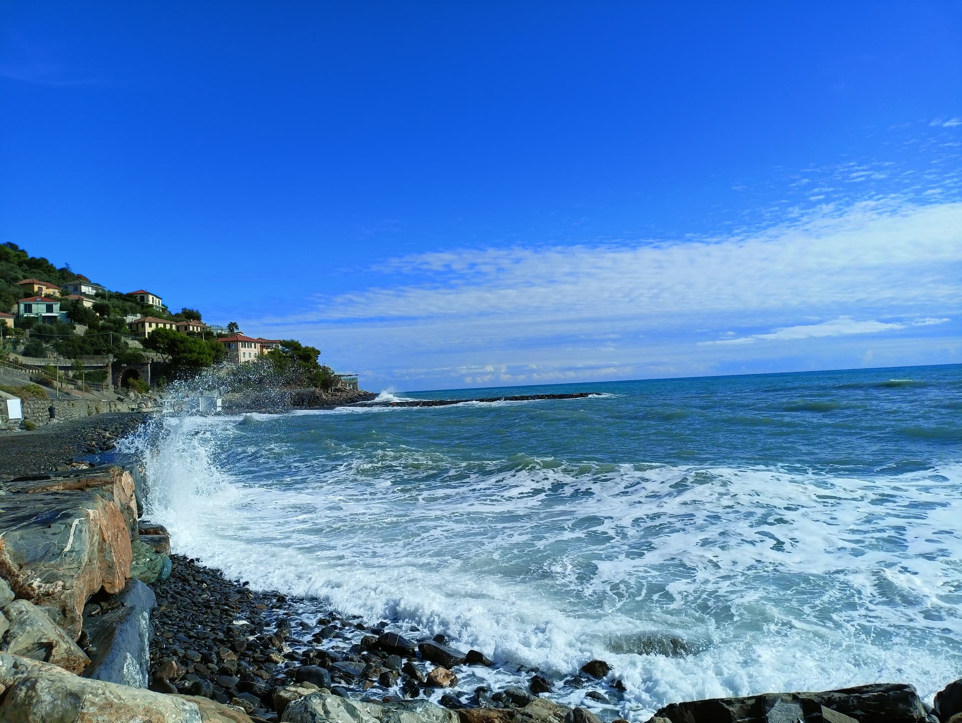
Pretoro
Province: Chieti · 530 m
A village of 856 stacked at 530 meters on the eastern Maiella, with wolves in a fenced enclosure and woodturners still working on Via Roma.
Rocca San Giovanni
Province: Chieti · 155 m
A walled hill town at 155 meters on the Costa dei Trabocchi, founded around 1060 by an abbot guarding the Abbey of San Giovanni in Venere.
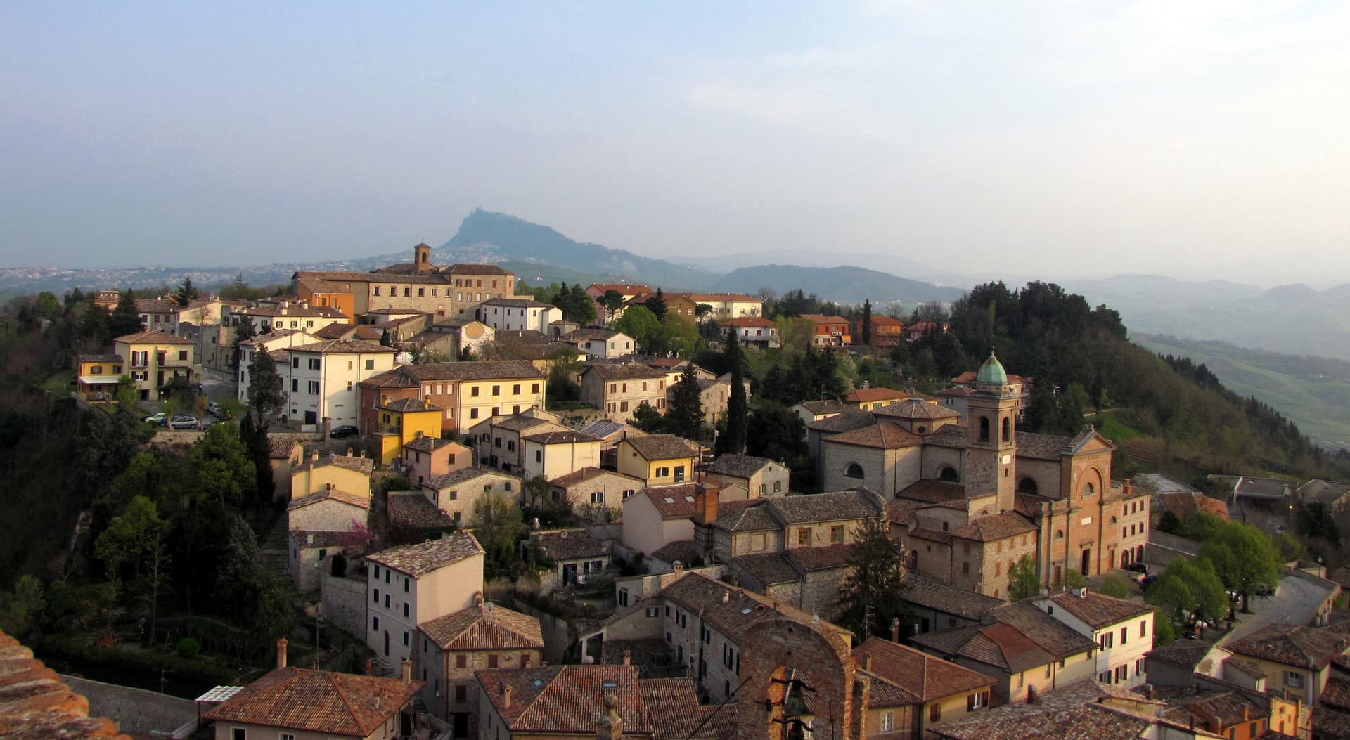
Santo Stefano di Sessanio
Province: L'Aquila · 1,250 m
A Medici outpost at 1,250 meters on the southern edge of Campo Imperatore, restored building by building since 1999 into Italy's first scattered hotel.
Scanno
Province: L'Aquila · 1,057 m
A 1,057-meter Sagittario valley village photographed by Cartier-Bresson and Giacomelli, where women in black still walk the same alleys as the 1957 series.
Tagliacozzo
Province: L'Aquila · 740 m
A Marsica town at 740 meters below Monte Civita, where Charles of Anjou won the 1268 battle and the Orsini built the ducal palace.
Villalago
Province: L'Aquila · 930 m
A 930-meter village above three lakes, named for the nine that once filled the valley, with a hermit's cave on the water's edge.
Aosta Valley3
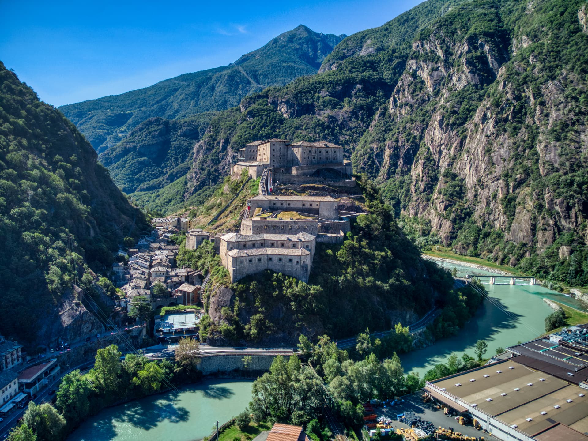
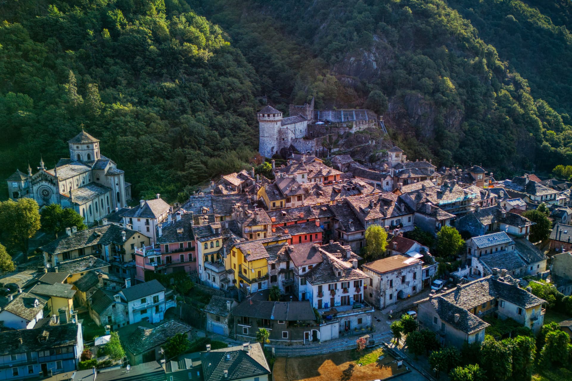
Bard
Province: Aosta Valley · 400 m
A 108-person village under the largest Savoy fortress in the Alps, where 400 soldiers held off Napoleon's 40,000 for two weeks in 1800.

Etroubles
Province: Aosta Valley · 1,280 m
A 478-person village at 1,280 metres on the Via Francigena, with an open-air contemporary art museum and the region's first dairy.
Fontainemore
Province: Aosta Valley · 760 m
A 418-person Walser-influenced village at 760 metres in the Lys Valley, with a single-arch medieval bridge and a five-yearly pilgrimage to Oropa.
Apulia12
Bovino
Province: Foggia · 646 m
A Daunian Mountains hill town at 646 meters above the Cervaro valley, Roman Vibinum, with a Norman-Swabian castle later turned into a Guevara ducal palace.
Cisternino
Province: Brindisi · 394 m
An Itria valley borgo on the southern Murgia at 394 meters, whitewashed, Cittaslow since 2003 and Cittaslow City of the Year in 2014.
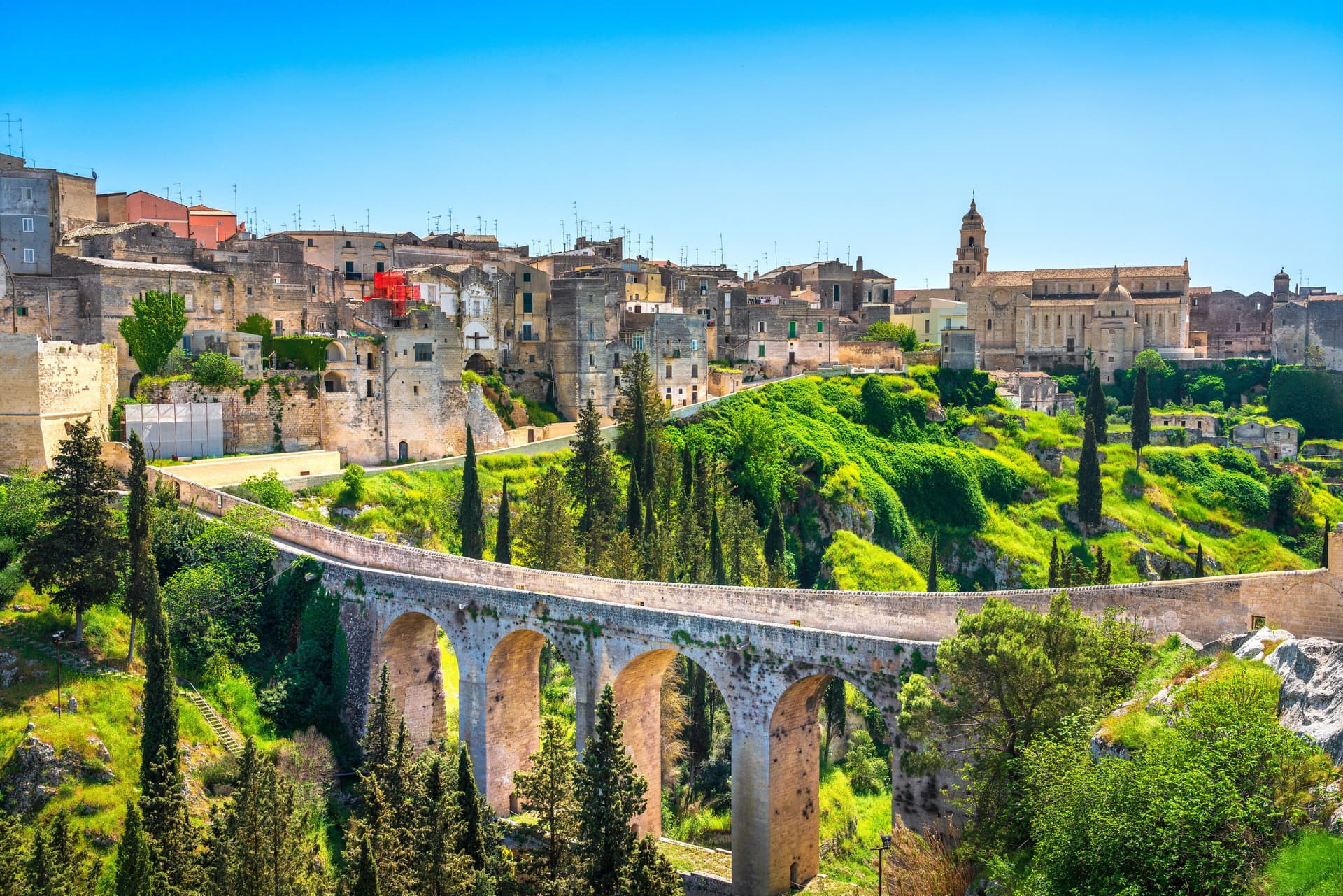
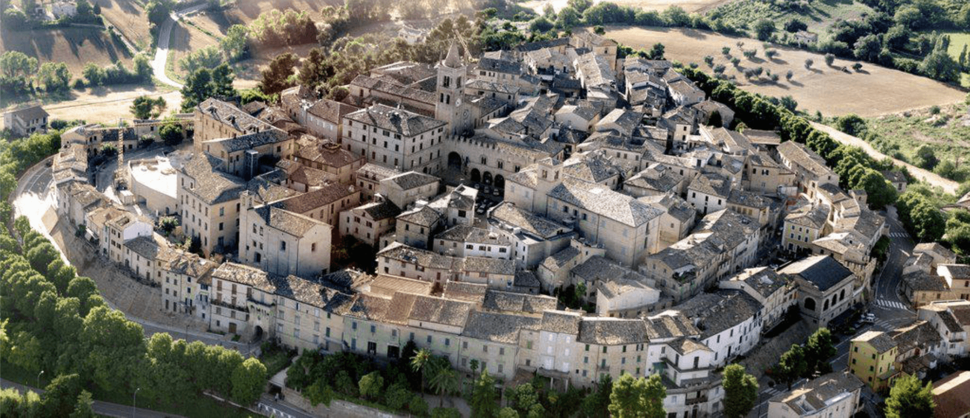
Gravina in Puglia
Province: Bari · 350 m
Puglia's deepest gravina — a 42,700-resident Bari-province town built on the lip of a 100m-deep limestone canyon, with the 18th-c Ponte Acquedotto walkway across the gorge that James Bond crossed in No Time to Die, a network of rupestrian cave churches in the cliff face, and the four-signal BPB + Cittaslow + Via Francigena + Parco Nazionale combination.
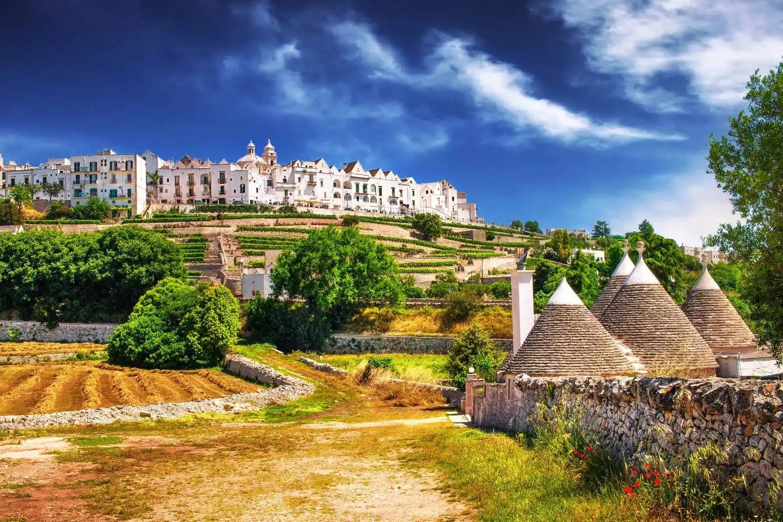
Locorotondo
Province: Bari · 410 m
The round white town on the Itria valley ridge at 410 meters, with cummerse roofs the rest of Puglia does not have.
Maruggio
Province: Taranto · 35 m
Salento's Knights of Malta borgo — a fortified Borgo più Bello on a low Ionian hill with 11 km of Bandiera Blu coast at Campomarino, Negroamaro and Primitivo vines pressing into the centro, and a unique commanderie history that made it the Order's southern Italian headquarters for 600 years.
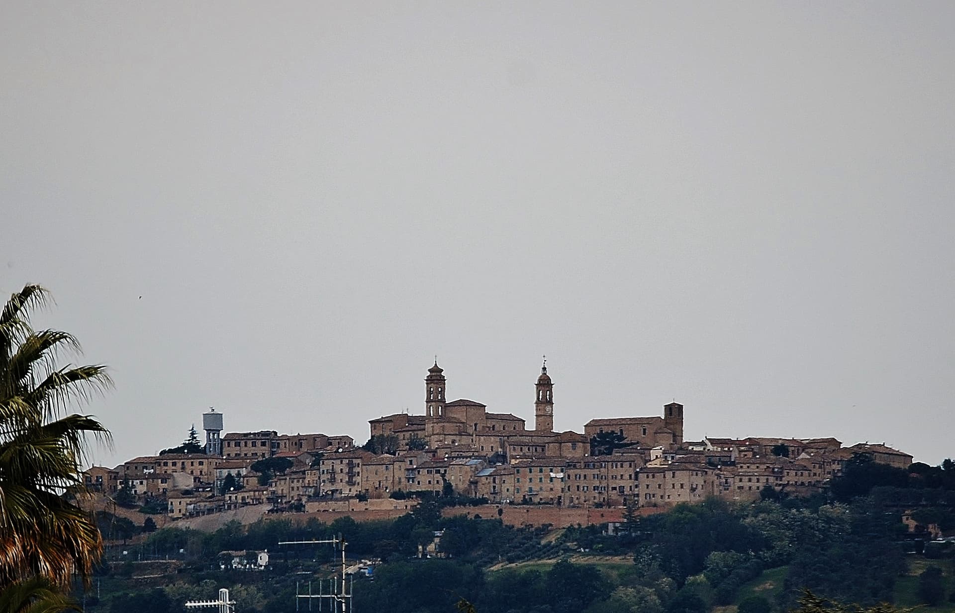
Monte Sant'Angelo
Province: Foggia · 843 m
The Gargano peak at 843 meters where the Archangel Michael appeared in 490, the oldest western shrine to him, UNESCO since 2011.

Otranto
Province: Lecce · 20 m
Italy's easternmost city, eighty kilometers from Albania, with a Norman mosaic floor and the bones of 813 martyrs in the cathedral.
Pietramontecorvino
Province: Foggia · 456 m
A Subappennino Dauno village at 456 meters on a tufa spur with a 30-meter Norman-Angevin tower and houses carved into the rock.

Roseto Valfortore
Province: Foggia · 658 m
A Daunian Mountain stone village at 658 meters near the Fortore springs, named for the wild roses and known for black and white truffles.

Sammichele di Bari
Province: Bari · 280 m
A Murge town at 280 meters founded in 1609, anchored by the Caracciolo castle and famous for the zampina pork sausage.
Specchia
Province: Lecce · 130 m
A medieval Salento borgo on the Serra Magnone at 130 meters, named for the Messapian stone lookouts that once watched the coast.
Vico del Gargano
Province: Foggia · 445 m
A Gargano hill town at 445 meters with a Norman castle, a kiss alley, and DOP citrus groves stepping down to the Adriatic.
Basilicata9
Acerenza
Province: Potenza · 833 m
A walled ridge town at 833 meters in the north Lucanian hills, archbishopric since 1068 under a Romanesque cathedral begun in 1080.
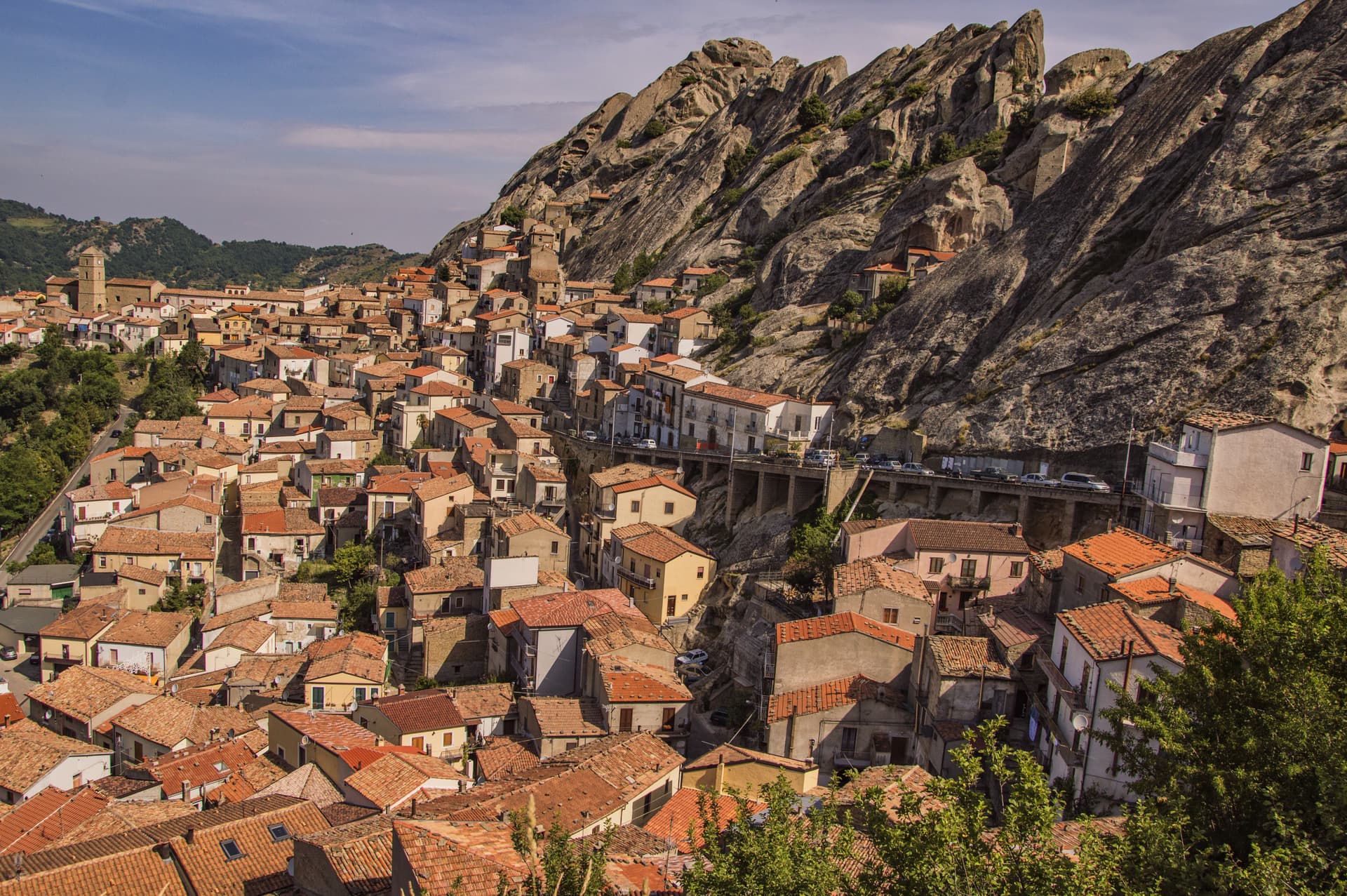
Castelmezzano
Province: Potenza · 750 m
A medieval village at 750 meters wedged into the Dolomiti Lucane sandstone teeth, linked to Pietrapertosa by a 1,452-meter zipline since 2007.
Guardia Perticara
Province: Potenza · 678 m
The stone village at 678 meters above the Sauro valley, rebuilt block by block in Gorgoglione sandstone after the 1980 earthquake.
Irsina
Province: Matera · 548 m
Called Montepeloso until 1895, a 548-meter Bradano-valley hill town whose cathedral holds the only surviving polychrome sculpture attributed to Andrea Mantegna.
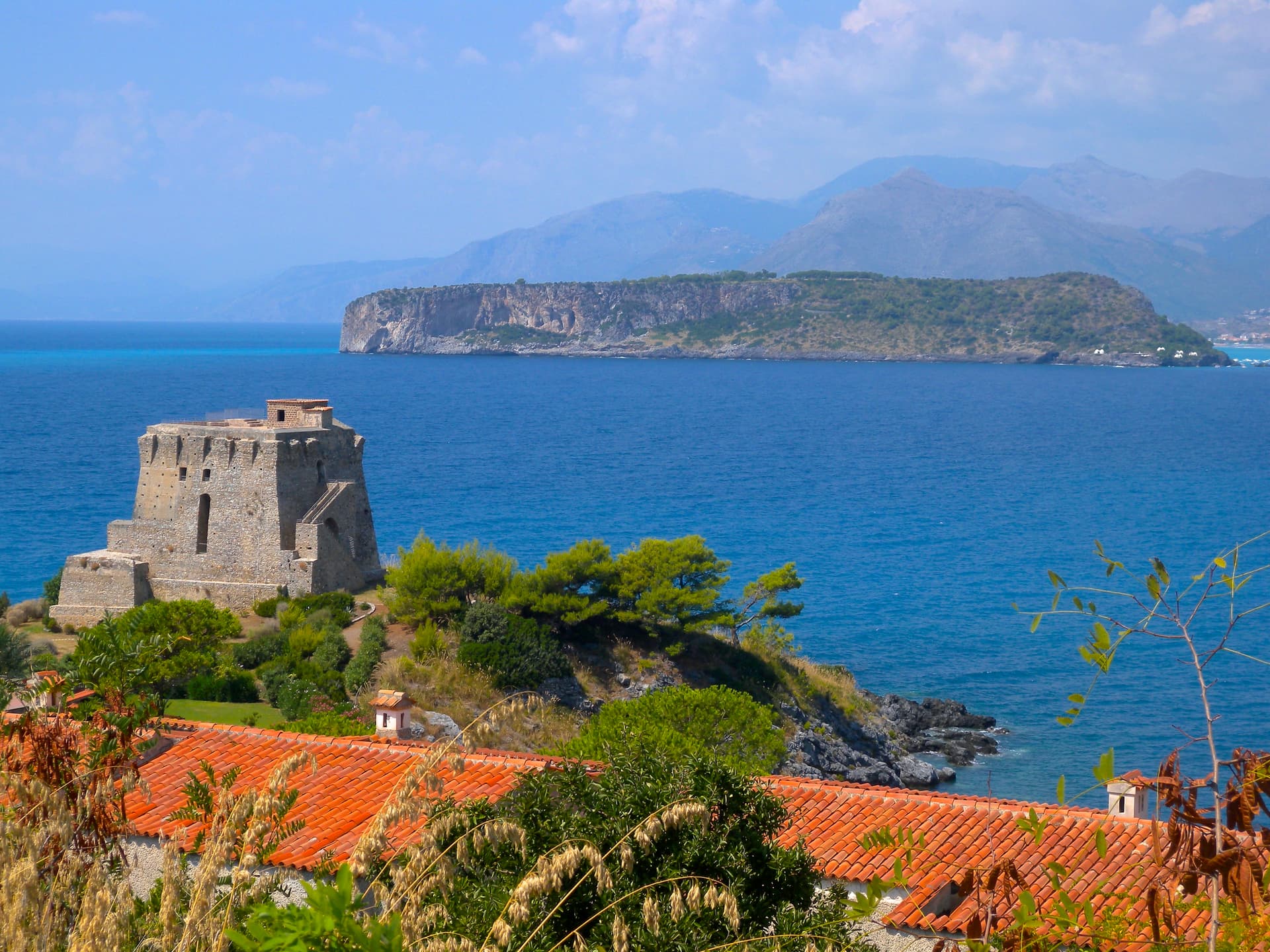
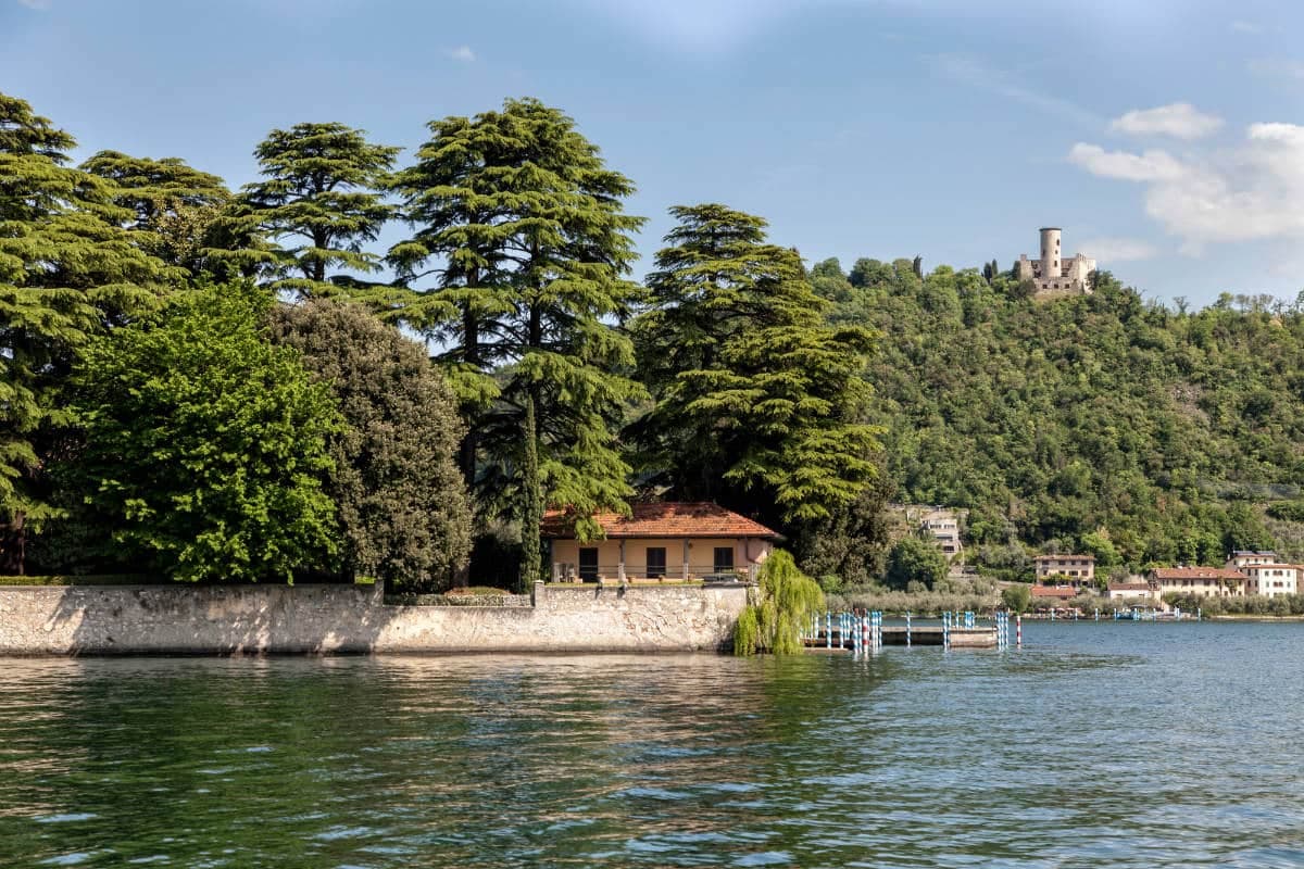
Maratea
Province: Potenza · 300 m
Basilicata's only commune on the Tyrrhenian, thirty-two kilometers of rocky coast under a twenty-one meter marble Christ raised over Monte San Biagio in 1965.
Miglionico
Province: Matera · 461 m
A hilltop borgo at 461 meters above the Bradano, the seven-tower castle that gave the 1485 Conspiracy of the Barons its hall.
Pietrapertosa
Province: Potenza · 1,088 m
Basilicata's highest commune at 1,088 meters, built into the Lucanian Dolomites with a Saracen rock-cut fortress and a 1,400-meter zipline to Castelmezzano.
Rivello
Province: Potenza · 479 m
A 479-meter ridge above the Noce valley where Lombards and Byzantines lived side by side, holding Latin and Greek rites until the seventeenth century.
Venosa
Province: Potenza · 415 m
Founded as Roman Venusia in 291 BC, birthplace of Horace, with an unfinished abbey built from amphitheater stones and a 1470 Aragonese castle.
Calabria16
Aiello Calabro
Province: Cosenza · 502 m
A hilltop borgo at 502 meters in the Tyrrhenian hinterland of Cosenza, ruled for two centuries by the Cybo-Malaspina from Massa Carrara.
Aieta
Province: Cosenza · 524 m
An eagle's-nest village in the western Pollino, with one of the few sixteenth-century Renaissance palazzi standing in Calabria.
Altomonte
Province: Cosenza · 455 m
The highest Gothic-Angevin church in Calabria, a Simone Martini panel commissioned in 1326, and a hill of 455 meters in the Esaro valley.
Badolato
Province: Catanzaro · 240 m
A medieval borgo of thirteen churches at 240 meters above the Ionian, which took in 350 Kurdish refugees in 1997 and started its own slow rebirth.
Bova
Province: Reggio di Calabria · 820 m
The capital of the Bovesìa — a 416-resident Aspromonte hilltop borgo at 820m that is the cultural centre of the Grecanic minority, where the Calabrian-Greek dialect (a direct descendant of Byzantine-era Greek) is still spoken by elders, with the triple Borghi più belli + Bandiera Arancione + Parco Nazionale dell'Aspromonte signal.
Caccuri
Province: Crotone · 646 m
A 646-meter Presila borgo dominated by a sixth-century Byzantine castle with a cylindrical tower built in 1882, birthplace of Renaissance statesman Cicco Simonetta.

Fiumefreddo Bruzio
Province: Cosenza · 220 m
A Tyrrhenian hill town under Monte Cocuzzo, with a thirteenth-century castle frescoed in the 1990s by the Sicilian painter Salvatore Fiume.
Gerace
Province: Reggio di Calabria · 470 m
A 470-meter conglomerate rock above Locri, founded by Locri Epizefiri refugees, with Calabria's largest cathedral on Roman columns from Magna Graecia temples.
Morano Calabro
Province: Cosenza · 694 m
A conical hill of stone houses stacked under a Norman-Swabian castle at the southern gate of the Pollino, called Italy's nativity village.

Oriolo
Province: Cosenza · 450 m
A medieval borgo on a sandstone outcrop at 450 meters, on the eastern slopes of Pollino, twenty kilometers from the Ionian coast.
Rocca Imperiale
Province: Cosenza · 210 m
Frederick II's Hohenstaufen fortress at the Calabria–Basilicata border — a Borgo più Bello d'Italia perched on a hill above the Ionian coast, with the 1225 castello at the summit, a Bandiera Blu beach at Rocca Imperiale Marina below, and the locally-grown limone di Rocca Imperiale IGP scenting the orchards.
San Nicola Arcella
Province: Cosenza · 110 m
A cliff village above the Tyrrhenian Riviera dei Cedri, where the Arco Magno sea arch fronts a cove only reachable on foot or by boat.
Santa Severina
Province: Crotone · 326 m
A tufa-rock stone ship at 326 meters between the Sila and the Ionian, holding the only Byzantine baptistery still standing in Calabria.
Stilo
Province: Reggio di Calabria · 400 m
A Byzantine hilltown below Monte Consolino, home to the tenth-century Cattolica and the legendary inspiration for Campanella's City of the Sun.
Trebisacce
Province: Cosenza · 73 m
A Bronze Age plateau above the Ionian Gulf of Taranto whose name comes from the Greek for small table, with a Byzantine mother church below.
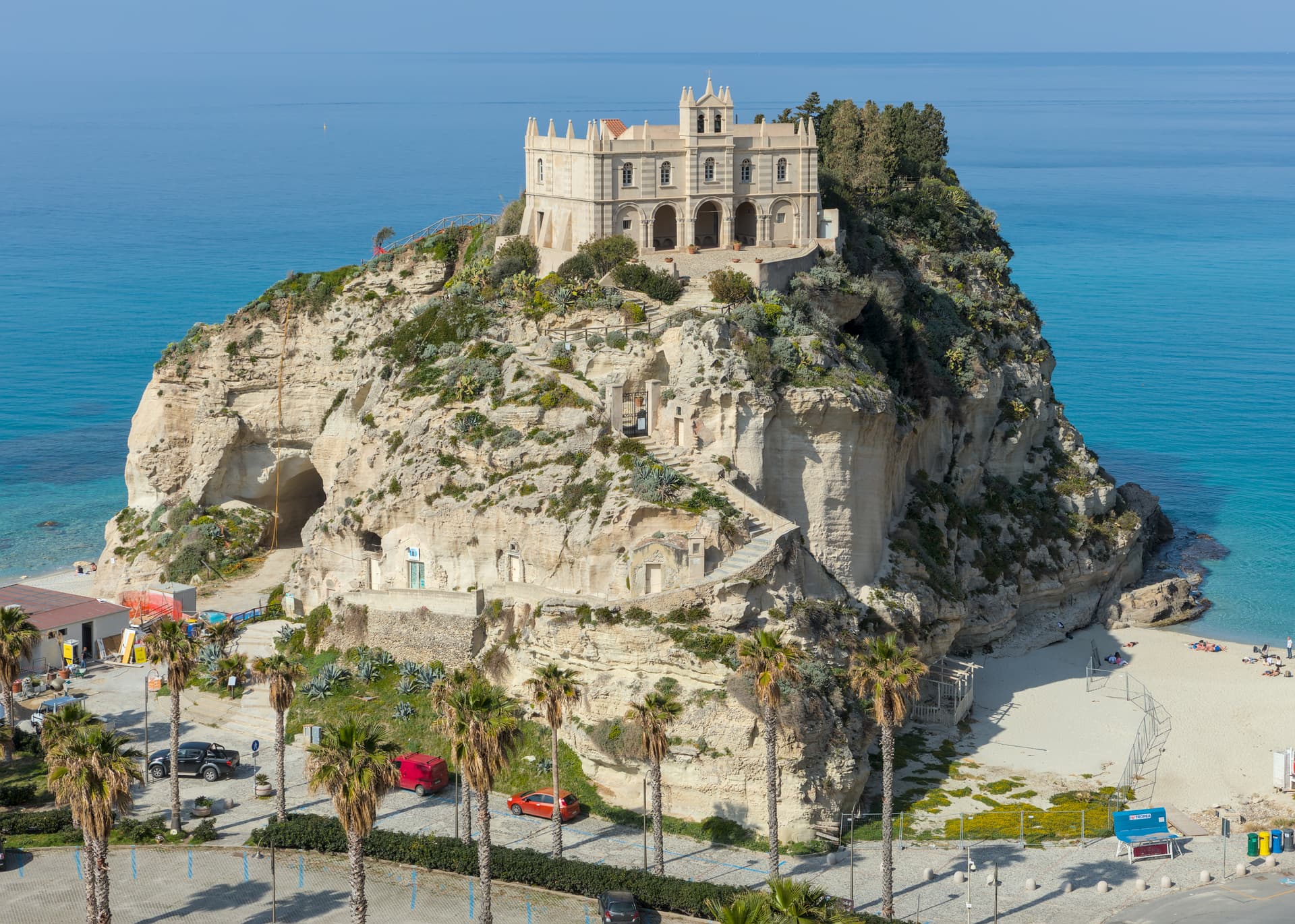
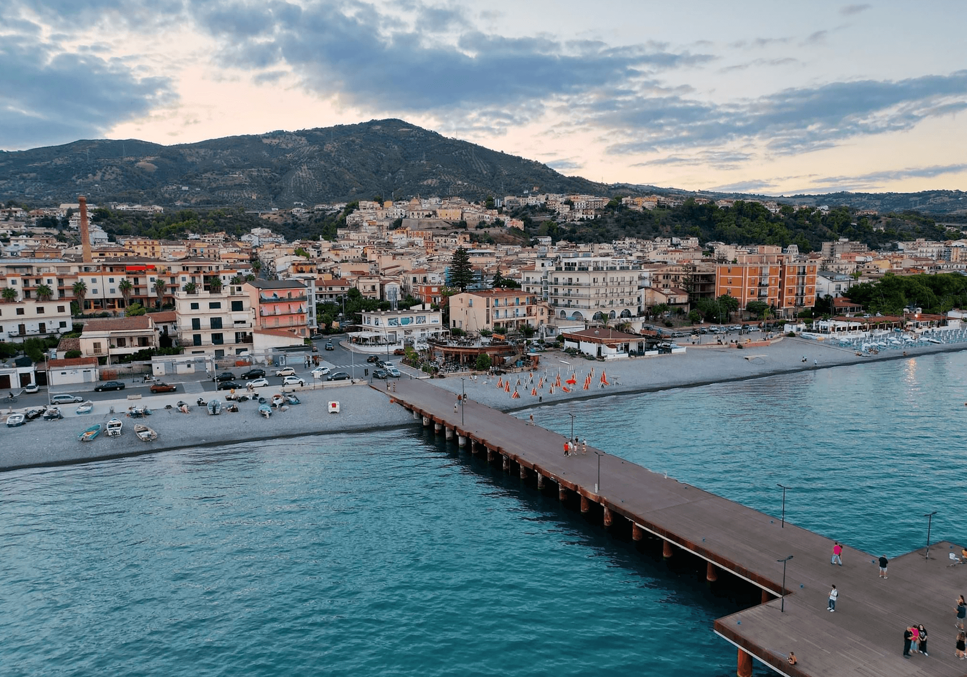
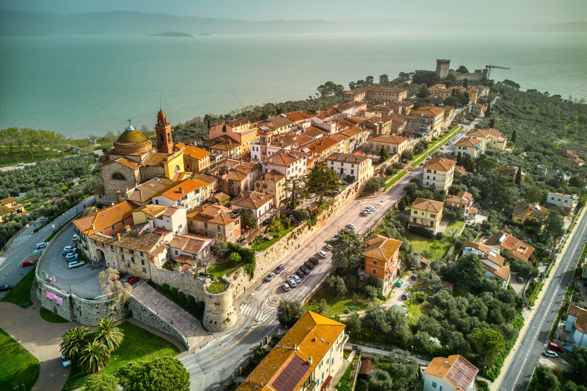
Tropea
Province: Vibo Valentia · 50 m
Cliff town on a tufa headland over the Tyrrhenian Coast of the Gods, with a Norman monastery on a sea rock.
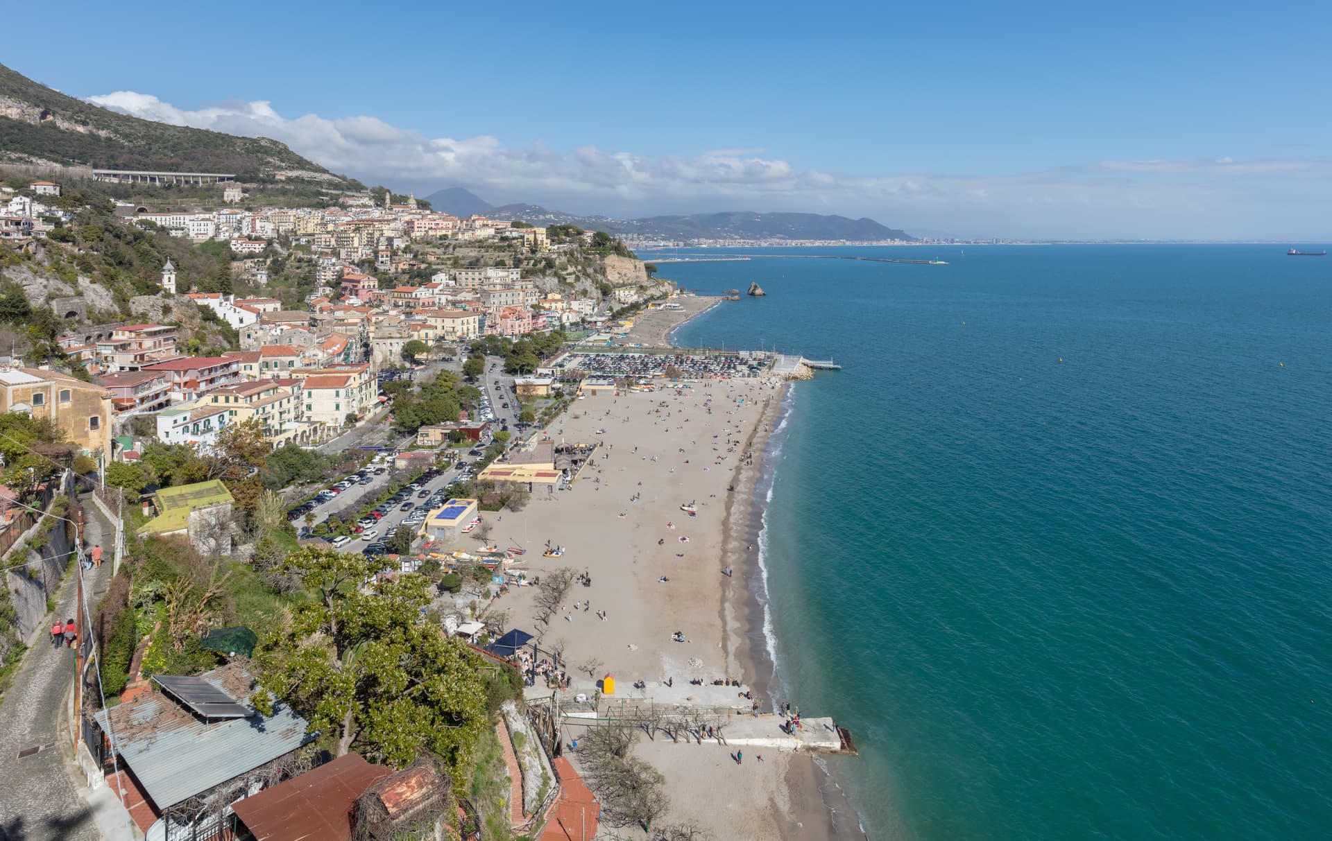
Campania14
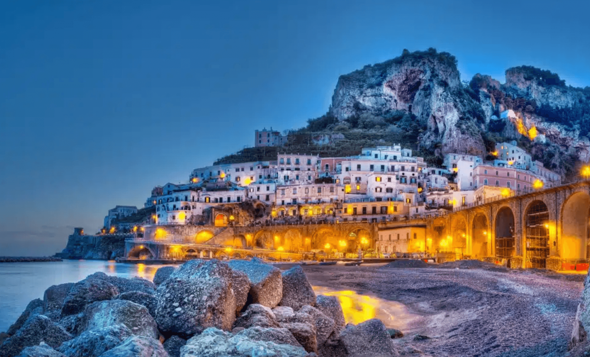
Atrani
Province: Salerno · 21 m
The smallest commune in Italy by area, twelve hectares of stacked houses where the Amalfi Coast pinches shut around a single piazza.
Castellabate
Province: Salerno · 280 m
A 1123 abbot's castle on a 280-meter Cilento ridge, with a Bandiera Blu beach below and the Benvenuti al Sud film.
Conca dei Marini
Province: Salerno · 138 m
A coastal hamlet of 664 people on the Amalfi Coast, the birthplace of the sfogliatella Santa Rosa and home to the Emerald Grotto.
Cusano Mutri
Province: Benevento · 475 m
A Sannio hill borgo at 475 meters on the south face of the Matese, the only town in the area spared by the 1688 earthquake.
Frigento
Province: Avellino · 911 m
An Irpinia hill village at 911 meters with a Republican-era Roman cistern complex on its summit and four valleys at its feet.

Furore
Province: Salerno · 300 m
The Amalfi Coast village with no piazza and no center, scattered on rock walls 300 meters above the only fjord in southern Italy.
Gesualdo
Province: Avellino · 676 m
An Irpinia village at 676 meters built around the castle where Carlo Gesualdo, prince of Venosa and madrigalist murderer, wrote his six books of madrigals.

Montesarchio
Province: Benevento · 300 m
Ancient Caudium at 300 meters in the Valle Caudina, the Roman defeat at the Forche Caudine still attached to the name two thousand years later.
Monteverde
Province: Avellino · 740 m
A 740-meter borgo on the Apulian border of Irpinia where the Grimaldi of Monaco held the castle from 1532 to 1641.
Nusco
Province: Avellino · 914 m
The Balcony of Irpinia at 914 meters, a ridge town between the Ofanto and Calore valleys, hometown of Prime Minister Ciriaco De Mita.

Savignano Irpino
Province: Avellino · 718 m
A 718-meter stone borgo above the Cervaro valley on the Campania-Apulia border, called Savignano di Puglia until 1963.

Summonte
Province: Avellino · 738 m
An Irpinia hill village at 738 meters on the slope of Monte Vallatrone, built around a 16-meter Angevin cylinder tower over the Partenio.
Vietri sul Mare
Province: Salerno · 80 m
The eastern end of the Amalfi Coast at 80 meters, the ceramics town since the fifteenth century, the gateway between Salerno and the cliff road.
Zungoli
Province: Avellino · 657 m
An Irpinia ridge at 657 meters between the Ufita valley and the Daunian hills, with Norman walls above and Byzantine tuff caves below the houses.
Emilia-Romagna18
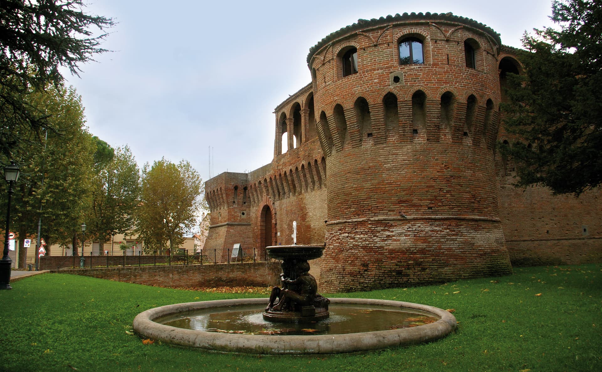
Bagnara di Romagna
Province: Ravenna · 22 m
A 22-meter plain commune in the Bassa Romagna, the only fully preserved medieval castrum surviving in the Romagna lowlands.
Bagno di Romagna
Province: Forlì-Cesena · 491 m
A 491-meter thermal town at the head of the Savio valley, drawing on springs that have run at 47 degrees since Roman times.
Bertinoro
Province: Forlì-Cesena · 254 m
A 254-meter Romagna-hill borgo above the Via Emilia, with a twelve-ring hospitality column from 1300 and the slopes that grow Albana DOCG.
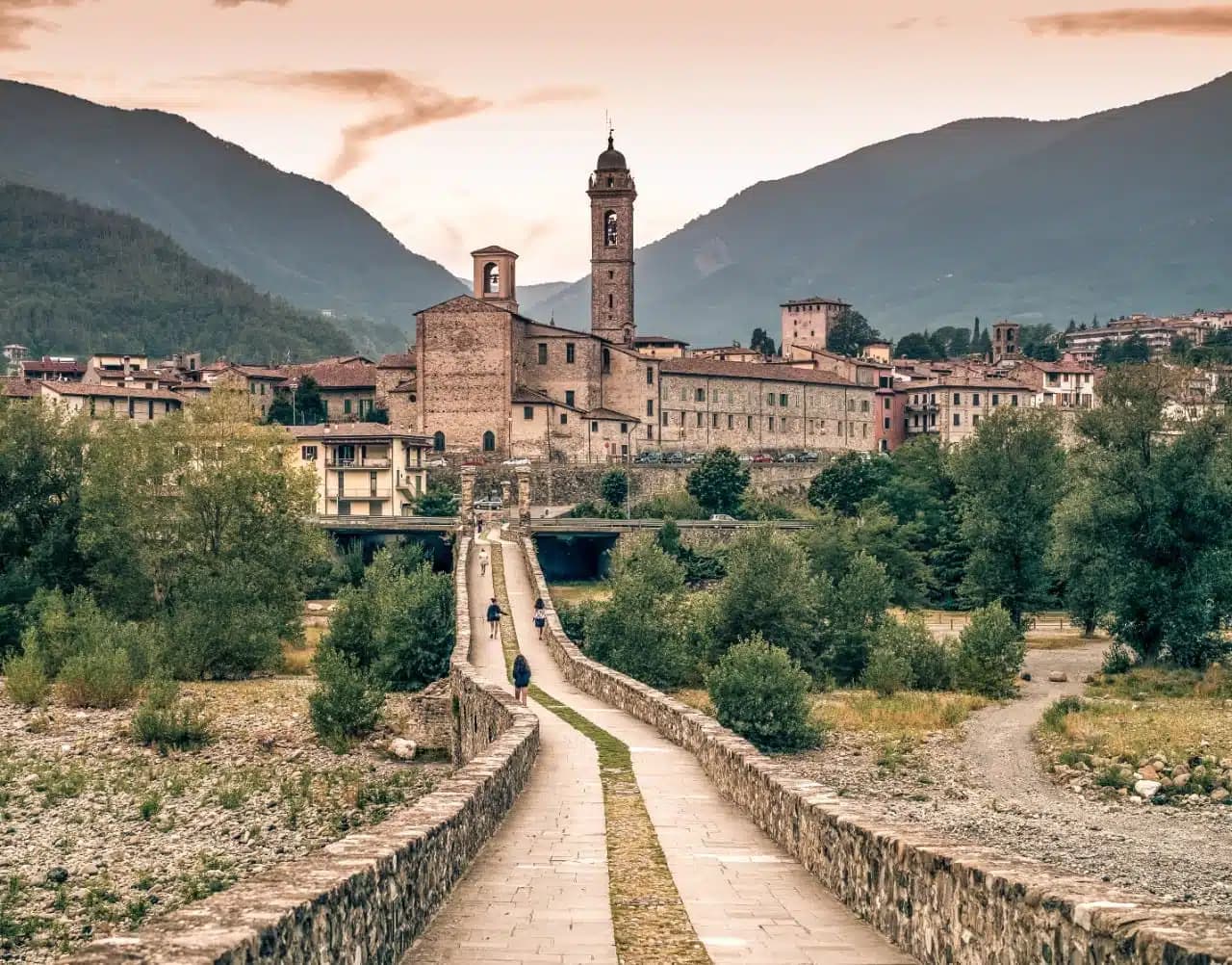
Bobbio
Province: Piacenza · 272 m
A 272-meter Trebbia-valley town built around the abbey Saint Columbanus founded in 614, named Borgo dei Borghi by RAI in 2019.
Brisighella
Province: Ravenna · 115 m
A Lamone-valley borgo at 115 meters under three selenite hills crowned by a fortress, a clock tower, and a sanctuary.
Castell'Arquato
Province: Piacenza · 224 m
A 224-meter hilltop borgo in the Val d'Arda, kept intact since the tenth century and crowned by Luchino Visconti's 1342 fortress.
Castelvetro di Modena
Province: Modena · 152 m
A 152-meter hill borgo south of Modena whose checkerboard piazza sits above the slopes that grow Lambrusco Grasparossa.

Compiano
Province: Parma · 519 m
A 519-meter walled borgo over the Taro, ruled by the Landi for 425 years and used by Maria Luigia as a state prison.
Dozza
Province: Bologna · 190 m
A 190-meter painted borgo above the Sellustra valley, where contemporary artists have repainted the house walls every two years since 1960.
Fiumalbo
Province: Modena · 935 m
A 935-meter stone village in the Modenese Apennines on the Tuscan border, at the confluence of two rivers under Monte Cimone.
Gualtieri
Province: Reggio nell'Emilia · 22 m
A right-bank Po commune in the Reggiana lowlands, built around a hundred-meter-square arcaded piazza and the Bentivoglio palace that holds the Ligabue collection.
Montechiarugolo
Province: Parma · 130 m
A Parmigiano-country borgo on the Enza river, built around a fourteenth-century castle that has stayed in the Marchi family since 1864.
Montefiore Conca
Province: Rimini · 385 m
A 385-meter Malatesta hilltop above the Conca valley, dominated by a fourteenth-century fortress that was once a summer residence of the lords of Rimini.
Montegridolfo
Province: Rimini · 290 m
A walled borgo of fewer than a thousand residents on the Romagna-Marche border, held alternately by the Malatesta and the Montefeltro through the fifteenth century.
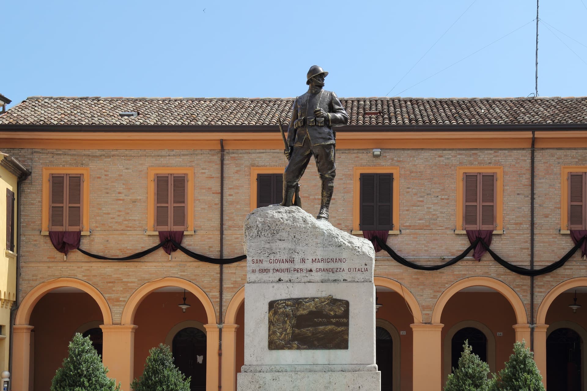
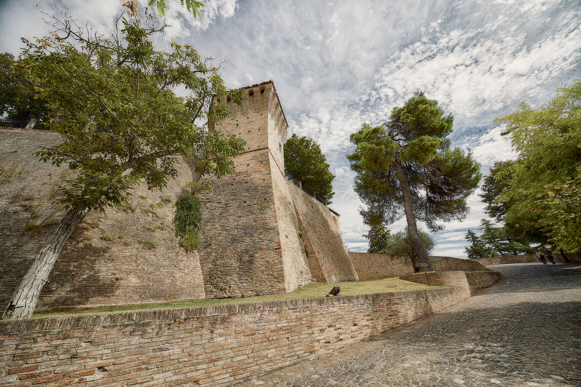
San Giovanni in Marignano
Province: Rimini · 29 m
A walled Conca-valley borgo, granary of the Malatesta state, where the Notte delle Streghe has marked the summer solstice since 1988.
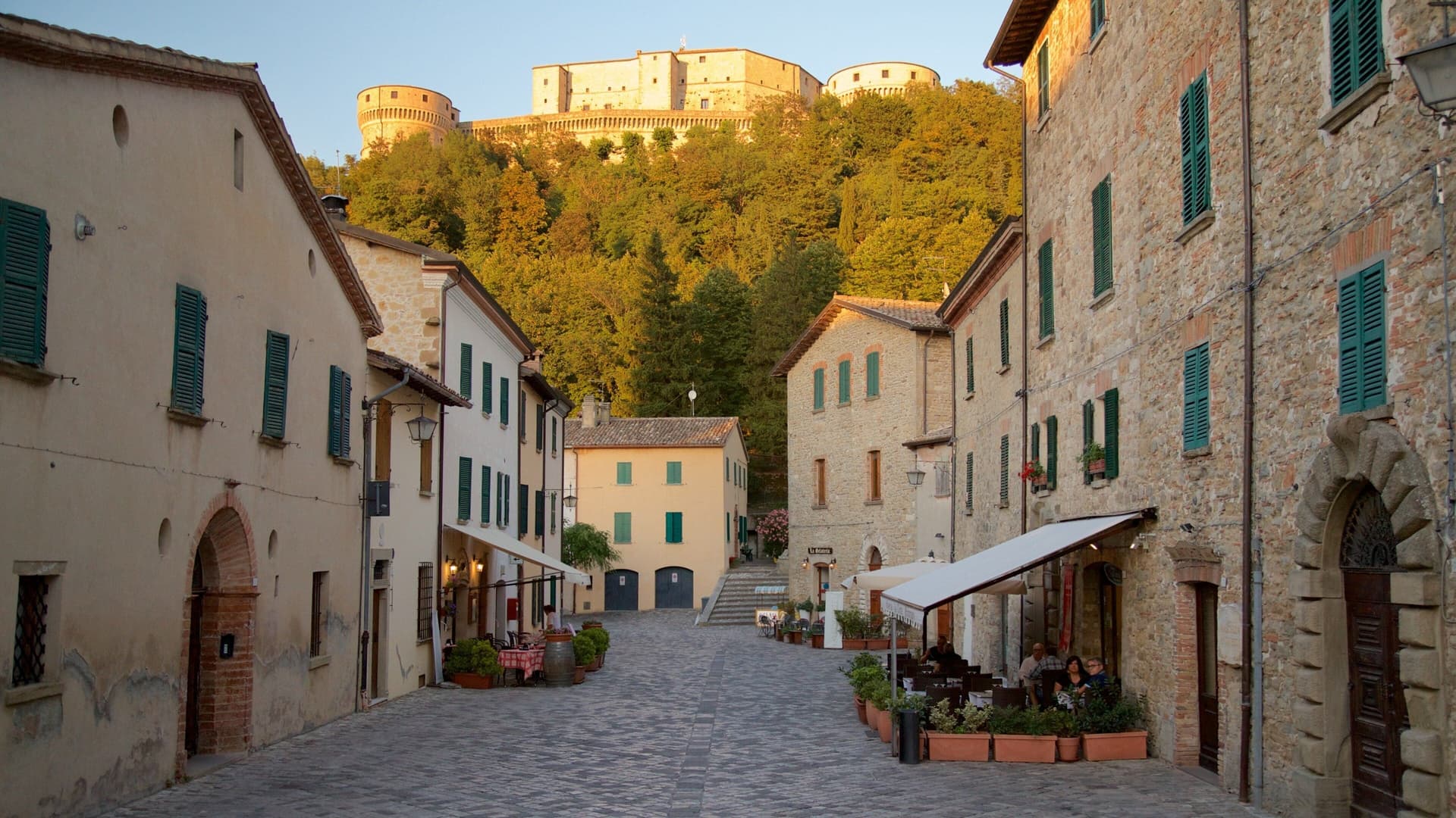
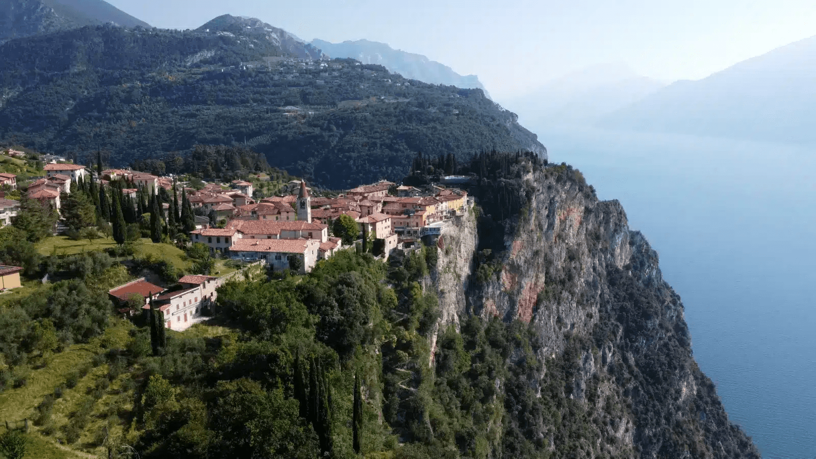
San Leo
Province: Rimini · 583 m
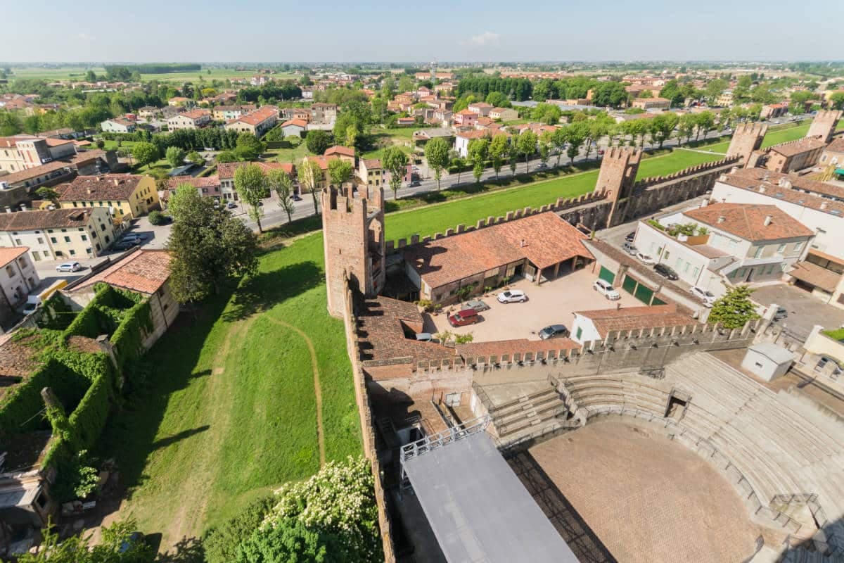
Italy's most dramatic hilltop fortress town — a 2,820-resident borgo on a vertical 583m limestone outcrop in the Montefeltro, 35 km from Rimini, with the Renaissance Forte di San Leo (where Cagliostro was imprisoned and died in 1795), the 9th-c Pieve, the 12th-c Duomo, and the Romagna/Marche frontier panorama from every wall.
Vernasca
Province: Piacenza · 457 m
A Val d'Arda commune in the Piacenza Apennines, holding the walled village of Vigoleno and one of the most compact castled borghi in Emilia.
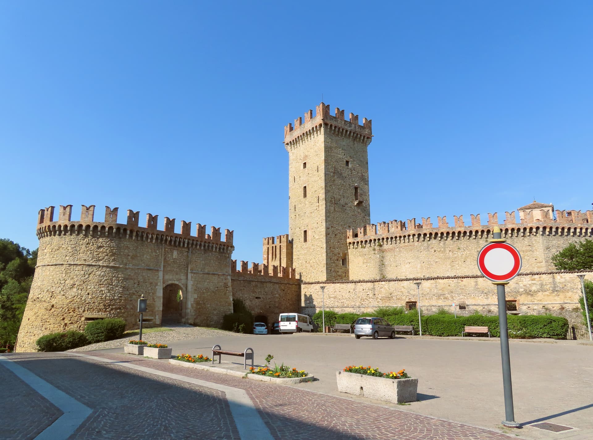
Verucchio
Province: Rimini · 330 m
A spur over the lower Marecchia valley, cradle of the Villanovan civilization and birthplace of the Malatesta lordship of Romagna.
Friuli-Venezia Giulia13
Cervignano del Friuli
Province: Udine · 5 m
The capital of Bassa Friulana on the Ausa river, an inland river port for Aquileia in 181 BC and a railway junction since 1860.
Cividale del Friuli
Province: Udine · 138 m
The Lombard capital on the Natisone, founded as Forum Iulii by Julius Caesar, where an eighth-century chapel still holds six stucco saints.

Cordovado
Province: Pordenone · 15 m
A 15-meter Friulian village in the Pordenone plain, fortified by the bishops of Concordia as their summer seat and described in Ippolito Nievo's Confessions.
Fagagna
Province: Udine · 177 m
A 177-meter Friulian hill town northwest of Udine, fortified by Otto II in 983 and racing donkeys in the piazza since 1891.
Frisanco
Province: Pordenone · 415 m
A 572-resident commune in the Val Colvera whose frazione Poffabro, at 525 meters, became a model of Prealpine stone-and-wood vernacular architecture.
Gradisca d'Isonzo
Province: Gorizia · 32 m
A 1479 Venetian bastion on the right bank of the Isonzo, with seven towers, twenty-meter walls, and a Habsburg court inside.
Palmanova
Province: Udine · 26 m
A nine-pointed Venetian star fortress founded 7 October 1593, designed as a perfect Renaissance city and finished, in three phases, under Napoleon in 1813.
Polcenigo
Province: Pordenone · 40 m
A 40-meter village at the foot of the Carnic Prealps where the Livenza rises, neighbour to the UNESCO Palù pile-dwelling site occupied since 4900 BC.

Sappada
Province: Udine · 1,250 m
A German-speaking alpine village at 1,250 meters near the source of the Piave, settled from East Tyrol in the eleventh century and Italian since 1852.

Sesto al Reghena
Province: Pordenone · 13 m
A 730s Benedictine abbey on the Reghena, ravaged by Magyars in 899, refortified in the tenth century, and still the town hall today.
Spilimbergo
Province: Pordenone · 132 m
A 132-meter Friulian town on the Tagliamento, home since 1922 to the Scuola Mosaicisti, whose alumni made the Library of Congress mosaics.
Valvasone Arzene
Province: Pordenone · 57 m
A medieval borgo at 57 meters on the Tagliamento's right bank, organized around a castle and a Duomo with a 1532 Italian-built organ.

Venzone
Province: Udine · 230 m
A 230-meter walled medieval town in the Tagliamento valley, leveled by the 1976 earthquake and rebuilt stone by stone, winner of Borgo dei Borghi 2017.
Lazio24
Acquapendente
Province: Viterbo · 420 m
The northernmost town in Lazio on the Via Francigena, at 420 meters above the Paglia, named in 964 for its waterfalls.
Amatrice
Province: Rieti · 955 m
A 955-meter Apennine town leveled by the 24 August 2016 earthquake, slowly rebuilding the streets that gave amatriciana its name.
Atina
Province: Frosinone · 500 m
A polygonal-walled town in the Val di Comino at the foot of the Mainarde, and the DOC that makes Cabernet in central Italy.
Bassano in Teverina
Province: Viterbo · 304 m
A tufa-spur borgo of 1,260 above the Tiber valley between Lazio and Umbria, with a clock tower that hides an eleventh-century animated bell tower.
Boville Ernica
Province: Frosinone · 450 m
A Ciociaria hilltop town with eighteen intact medieval towers and Giotto's only surviving mosaic, the Angelo del Navicella, in San Pietro Ispano.
Capranica Prenestina
Province: Roma · 915 m
A 915-meter ridge village on the Monti Prenestini east of Rome, with the Mentorella sanctuary at 1,018 meters above the Giovenzano valley.
Castel di Tora
Province: Rieti · 607 m
A village of 266 on Lago del Turano at 607 meters, with an eleventh-century polygonal tower and a ghost promontory called Antuni.
Castel Gandolfo
Province: Roma · 426 m
A papal town on the rim of Lake Albano's volcanic crater, summer residence of the popes since 1626 in the Castelli Romani.
Castel San Pietro Romano
Province: Roma · 763 m
A 763-meter hill village on Monte Ginestro above Palestrina, sitting on the acropolis of ancient Praeneste and inside the Colonna fortress walls.
Castelnuovo di Porto
Province: Roma · 250 m
A tufa-ridge borgo twenty-five kilometers north of Rome inside the Parco di Veio, dominated by the Rocca Colonna above the Tiber valley.
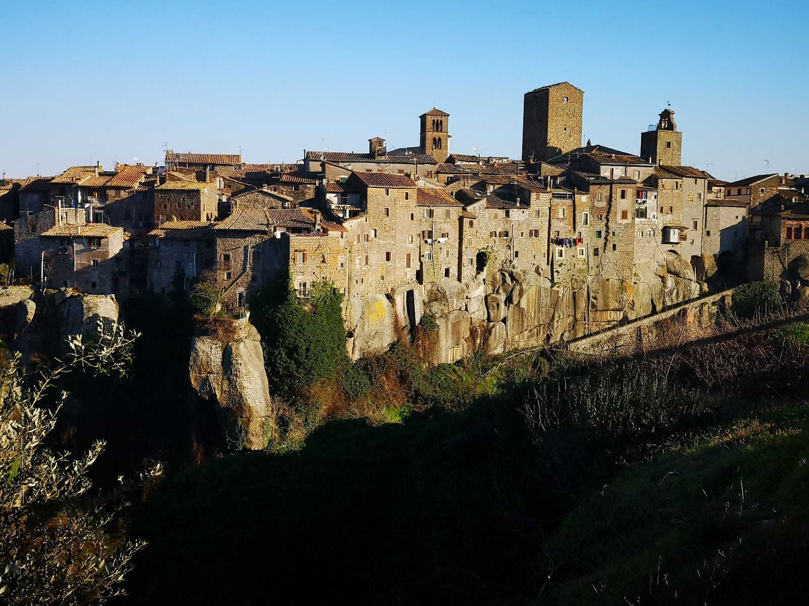
Castro dei Volsci
Province: Frosinone · 385 m
A Ciociaria hilltop borgo at 385 meters in the Sacco valley, named for the pre-Roman Volsci and birthplace of actor Nino Manfredi.
Collalto Sabino
Province: Rieti · 980 m
A 980-meter Sabine borgo dominated by a Barberini baronial castle, with a 360-degree panorama from the keep over the Gran Sasso, Terminillo and Maiella.
Greccio
Province: Rieti · 705 m
A 705-meter borgo above the Rieti valley where Francis of Assisi staged the first living nativity scene in a cliff cave on Christmas Eve 1223.
Magliano Sabina
Province: Rieti · 222 m
A 222-meter Sabine town on a Tiber terrace facing Monte Soratte, cathedral seat of the Sabina diocese on the Lazio-Umbria border.

Nemi
Province: Roma · 521 m
The smallest comune in the Castelli Romani, perched at 521 meters above a volcanic crater lake the Romans called the mirror of Diana.
Orvinio
Province: Rieti · 840 m
The highest borgo in the Monti Lucretili park at 840 meters, called Canemorto until 1863 and dominated by the Castello Malvezzi-Campeggi.
Percile
Province: Roma · 575 m
A 219-person medieval borgo at 575 meters in the Monti Lucretili park, with two karst lakes called Lagustelli hidden in the beech woods above.
Pico
Province: Frosinone · 220 m
Tommaso Landolfi's home town — a 2,634-resident Ciociaria borgo at 220m on the Monti Ausoni between Rome and Naples, with the Castello Baronale dei Boncompagni (now the Casa Museo Tommaso Landolfi for the eccentric 20th-c Italian fantastic-realism writer), a BPB-inscribed medieval centro, and the surrounding Monti Ausoni hiking + wild boar country.
Ronciglione
Province: Viterbo · 441 m
A tufa-brick borgo above Lake Vico at 441 meters, fortified by the Prefects of Vico and crowned Borgo dei Borghi in 2023.
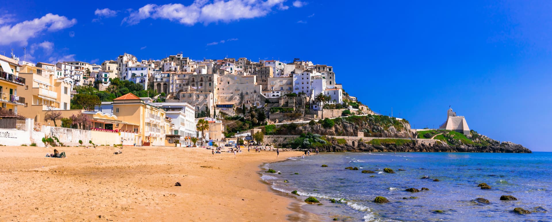
San Felice Circeo
Province: Latina · 100 m
A medieval borgo on the flank of Monte Circeo, the 540-meter promontory Homer made the home of Circe in the Odyssey.
Sperlonga
Province: Latina · 55 m
A whitewashed cliff town on Monte San Magno halfway between Rome and Naples, built above the sea grotto where Tiberius staged the Odyssey in marble.
Subiaco
Province: Roma · 408 m
The Aniene valley town where Benedict spent three years in a cliff cave, and where Italy's first printed book appeared in 1465.

Sutri
Province: Viterbo · 291 m
An Etruscan and Roman town on a tuff spur, with a rock-cut amphitheater carved straight from the volcanic stone of the Cimini.
Vitorchiano
Province: Viterbo · 285 m
A peperino borgo built on a single volcanic boulder near Viterbo, and the only place outside Easter Island with a true Moai.
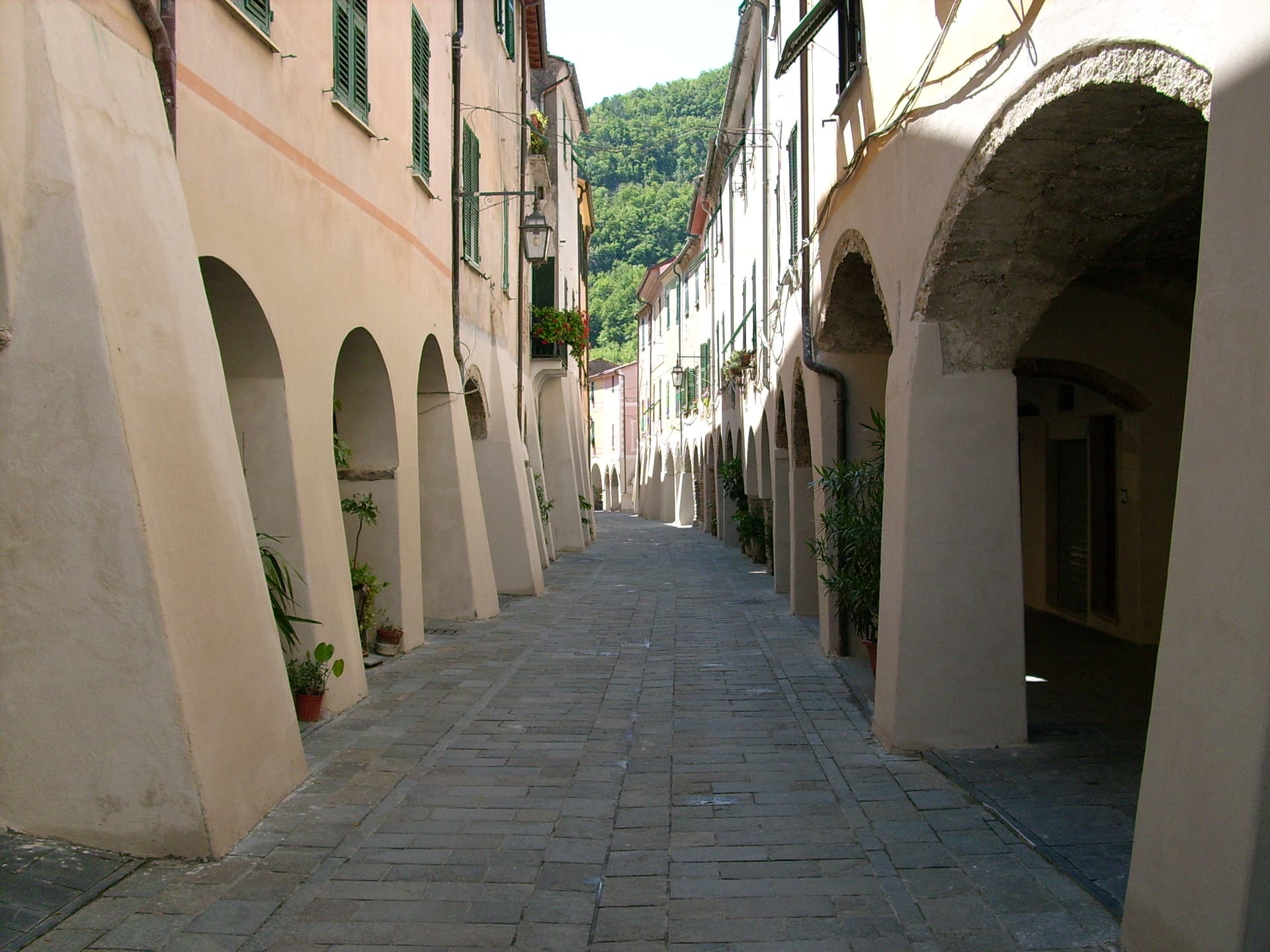
Liguria28
- ✷ We've been

Ameglia
Province: La Spezia · 89 m
A hilltop borgo at 89 meters above the mouth of the Magra, the Lunigiana edge of Liguria where the river meets the Gulf of Poets.
Apricale
Province: Imperia · 273 m
A medieval hill village in the Nervia Valley, named for the Latin apricus, sunny, with a tenth-century castle shaped like a lizard on the rock.
Badalucco
Province: Imperia · 179 m
A medieval village wrapped in a bend of the Argentina torrent, with murals on its caruggi and a Slow Food bean on its terraces.
Borgio Verezzi
Province: Savona · 30 m
Two villages joined under one comune in 1933: Borgio on the Bandiera Blu beach and Verezzi at 200 meters on the pink-stone hill above.
- ✷ We've been
Brugnato
Province: La Spezia · 115 m
The medieval ecclesiastical capital of the Val di Vara, seat of a diocese from 1133 to 1820, with a co-cathedral built over a Columban monastery.
Campo Ligure
Province: Genova · 342 m
A Spinola borgo at 342 meters in the Stura valley north of Genova, the last working centre for gold and silver filigree in Italy.

Castelvecchio di Rocca Barbena
Province: Savona · 420 m
A stone village of 130 residents at 420 meters in the Val Neva, built into the southern foot of Rocca Barbena at 1,142 meters.
Celle Ligure
Province: Savona · 5 m
A Riviera di Ponente beach town with kilns firing since the 1600s and a Lucio Fontana ceramic on the parish church façade.
Ceriana
Province: Imperia · 369 m
A medieval village at 369 meters above the Valle Armea, inland from Sanremo, built on the Roman castrum that gave it its name.
Cervo
Province: Imperia · 66 m
A hilltop village on the Riviera di Ponente built by coral fishermen, named for the Roman mansio on the Via Julia Augusta.
Cipressa
Province: Imperia · 232 m
A ridgeline village at 232 meters above the Riviera dei Fiori, the climb that decides Milan-San Remo and a sixteenth-century Saracen-defence tower as its summit.

Deiva Marina
Province: La Spezia · 12 m
A Riviera di Levante seaside commune between Sestri Levante and the Cinque Terre, reachable by sea only after the 1874 railway.

Diano
Province: Imperia · 70 m
A twin destination on the Riviera dei Fiori — the medieval hilltop borgo of Diano Castello above and the palm-fronted beach resort of Diano Marina below — sharing one Bay of Diano, one Taggiasca olive valley, and the longest Bandiera Blu beach in western Liguria.
Finale Ligure
Province: Savona · 12 m
Three boroughs on the Gulf of Genoa, with walled Finalborgo as the Del Carretto seat and a Bandiera Blu beachfront below.

Framura
Province: La Spezia · 76 m
Five hamlets between sea level and 300 meters on the Riviera di Levante, with Byzantine watchtowers built against Saracen incursions.
Laigueglia
Province: Savona · 6 m
A former coral-fishing village on the Riviera di Ponente, with a curved Baroque parish church and a fishermen's grid of caruggi behind the beach.
- ✷ We've been

Lerici
Province: La Spezia · 10 m
The northern anchor of the Bay of Poets, a fishing harbour under a Pisan-Genoese castle where Byron and Shelley wrote and where the frazione of Tellaro hangs over the rocks at the bay's southern edge.

Millesimo
Province: Savona · 429 m
A fortified Del Carretto borgo at 429 meters in the upper Val Bormida, where Napoleon broke the Austro-Sardinian army in April 1796.

Moneglia
Province: Genova · 4 m
A bay on the Riviera di Levante between Punta Moneglia and Punta Rospo, birthplace of the Genoese painter Luca Cambiaso in 1527.

Noli
Province: Savona · 4 m
The fifth Italian maritime republic from 1192 to 1797, a walled coastal town with the Romanesque basilica of San Paragorio outside its gates.
Perinaldo
Province: Imperia · 572 m
A ridge village at 572 meters above the Val Nervia, birthplace of Giovanni Domenico Cassini and home to a working astronomical observatory in his name.
Pieve di Teco
Province: Imperia · 240 m
A planned market town founded in 1233 in the middle Arroscia valley, with porticoed Corso Ponzoni and the second-smallest theater in Italy.
Seborga
Province: Imperia · 517 m
A hilltop village at 517 meters above Bordighera that calls itself a principality, 276 residents, its own coins and stamps since 1963.
Taggia
Province: Imperia · 40 m
The Argentina valley's medieval seat above the Riviera dei Fiori, the town that gave its name to the Taggiasca olive grown across western Liguria.

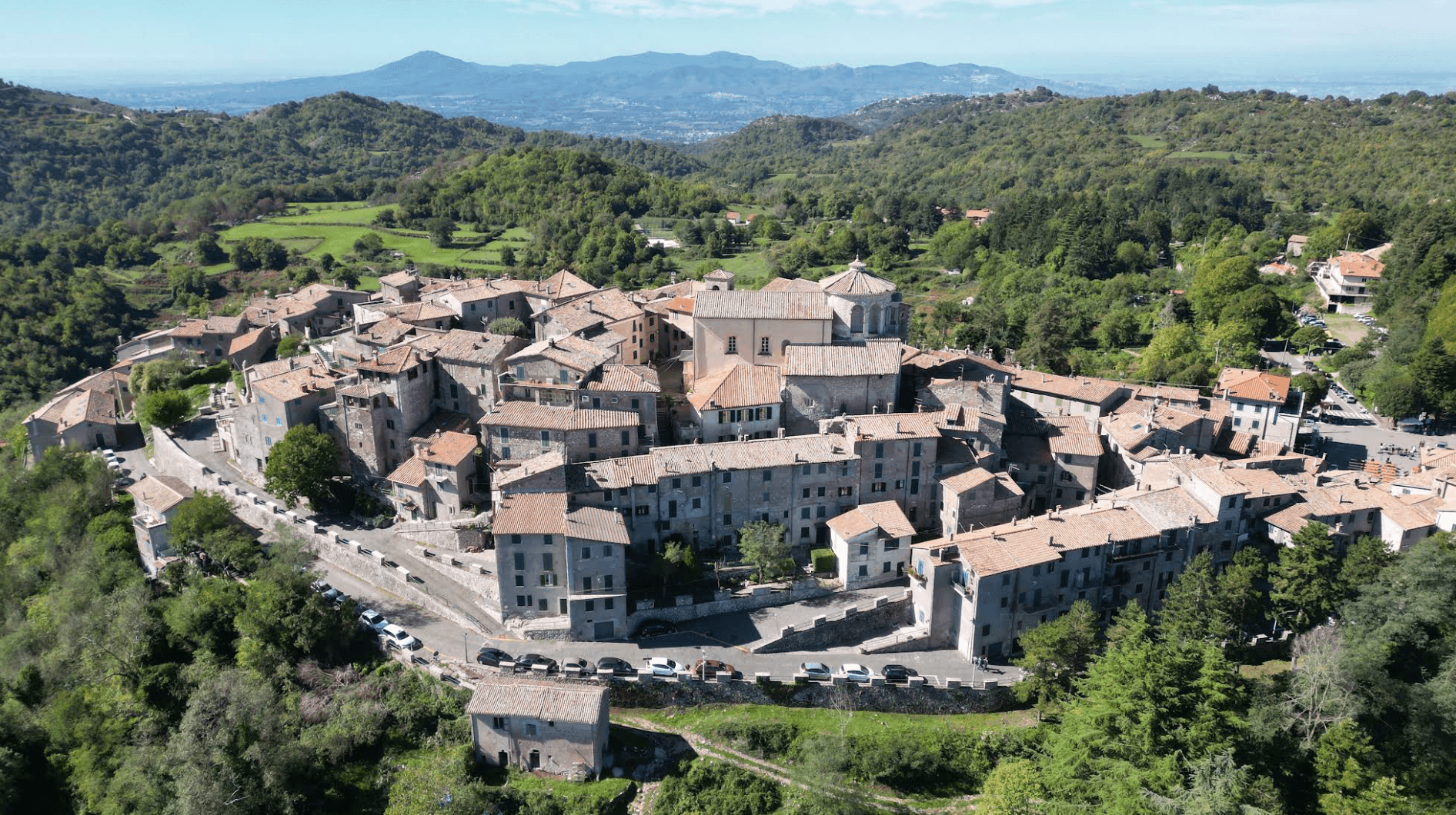
Triora
Province: Imperia · 776 m
The witches' village at 776 meters in the upper Valle Argentina, where the Inquisition put around 200 women on trial between 1587 and 1589.
Varese Ligure
Province: La Spezia · 358 m
The Val di Vara's medieval seat at 358 meters, the first European municipality with ISO 14001 certification, anchor of Italy's largest organic district.
- ✷ We've been

Vernazza
Province: La Spezia · 3 m
The middle village of the Cinque Terre, the only one with a natural harbor, buried under four meters of mud in October 2011.
Zuccarello
Province: Savona · 130 m
A 280-person medieval borgo in the Neva valley above Albenga, founded by the Marquises of Clavesana in 1248, birthplace of Ilaria del Carretto.
Lombardy25
Bagolino
Province: Brescia · 778 m
A mountain village at 778 meters in the Valle del Caffaro, with a three-day February carnival of masked dancers and violins.
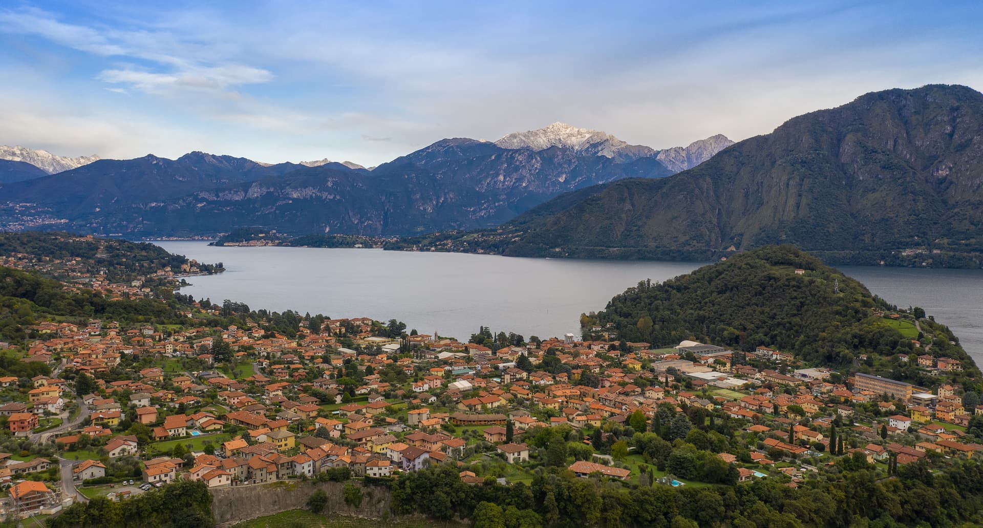
Bellano
Province: Lecco · 202 m
An eastern Lake Como town where the Pioverna cut a gorge through fifteen million years of rock before reaching the lake.
Bienno
Province: Brescia · 445 m
A medieval ironworking village in the Val Camonica, where water hammers driven by the Grigna stream have shaped wrought iron since the 1200s.
Cassinetta di Lugagnano
Province: Milano · 120 m
A Naviglio Grande commune west of Milan with fifteen ville di delizia and Italy's first zero-growth urban plan, adopted in 2007.
Castellaro Lagusello
Province: Mantova · 138 m
A walled medieval borgo south of Lake Garda, ringed by 13th-century stone walls and overlooking a small heart-shaped natural lake that gives the village its second name and most-photographed silhouette.

Clusone
Province: Bergamo · 648 m
At 648 meters in upper Val Seriana, capital of the macabre fresco and the 1583 planetary clock above its civic tower.
Cornello dei Tasso
Province: Bergamo · 691 m
A car-free medieval frazione of Camerata Cornello in the Val Brembana, accessible only on foot, anchored by the Museo dei Tasso e della Storia Postale — birthplace of the family that ran the European postal network from the 16th century onward.

Curtatone
Province: Mantova · 25 m
A commune of eight frazioni west of Mantova, anchored by the Grazie sanctuary and the 1848 battle that delayed Radetzky's advance.
Dervio
Province: Lecco · 220 m
A peninsula on upper Lake Como's eastern shore at the Varrone delta, with a Romanesque bell tower and one of the lake's best sailing winds.
Fortunago
Province: Pavia · 482 m
A 365-resident village on a 482-meter Oltrepò Pavese ridge, with stone façades, porphyry streets and the production zone of Salame di Varzi at its doorstep.
Gardone Riviera
Province: Brescia · 71 m
A western Garda lakeshore town whose hillside holds the Vittoriale, the estate Gabriele D'Annunzio turned into a monument to himself.
Gromo
Province: Bergamo · 676 m
A medieval iron-forging town at 676 meters on a rock spur above the Serio, once called the little Toledo for its sword smiths.
Limone sul Garda
Province: Brescia · 65 m
The northernmost lemon-growing town in the world, at 46 degrees north on the western shore of Lake Garda, reached by road only in 1932.
Lovere
Province: Bergamo · 200 m
An amphitheater town at the north end of Lake Iseo, in Borghi più belli since 2003, with Canova plasters inside the Accademia Tadini.
Monte Isola
Province: Brescia · 600 m
The largest lake island in southern and central Europe, 4.5 square kilometers in Lake Iseo, with no cars and eleven fishing villages on its shore.
Monzambano
Province: Mantova · 88 m
A Mincio commune at 88 meters in the moraine hills west of Mantova, whose frazione Castellaro Lagusello sits on a heart-shaped lake inside fortified walls.
Morimondo
Province: Milano · 109 m
A Cistercian abbey village on the edge of the Ticino park, twenty-five kilometers southwest of Milano, founded by French monks in 1134.
Pomponesco
Province: Mantova · 21 m
A Mantova river village at 21 meters on the Po's left bank, with a late-Cinquecento Gonzaga grid and arcaded central piazza.
Sabbioneta
Province: Mantova · 25 m
A Renaissance ideal city on the Po, built in thirty years by Vespasiano I Gonzaga and laid out as a six-pointed star.
San Benedetto Po
Province: Mantova · 19 m
The town that grew up around Polirone, the abbey founded in 1007 by the Canossa family, where Matilda of Canossa was buried for five centuries.
Soncino
Province: Cremona · 88 m
A walled borgo on the Oglio with the Sforza fortress of 1473 and the press that printed the first complete Hebrew Bible in 1488.
Tremezzina
Province: Como · 209 m
The 2014 merger of four Lake Como villages that holds Villa Carlotta, Isola Comacina and the UNESCO Sacro Monte di Ossuccio.
Tremosine sul Garda
Province: Brescia · 414 m
A cliff-top commune of 18 frazioni 350 meters above Lake Garda, reached by the Strada della Forra carved through the Brasa gorge.
Varzi
Province: Pavia · 416 m
A medieval Malaspina town at 416 meters in the Staffora valley of the Oltrepò Pavese, the seat of one of Italy's first DOP cured meats.
Zavattarello
Province: Pavia · 525 m
A Val Tidone borgo at 525 meters clinging to a ridge below the Castello Dal Verme, the tenth-century Apennine fortress with walls four meters thick.
Marche31
Arcevia
Province: Ancona · 535 m
A hilltop borgo at 535 meters above the Misa and Nevola valleys, defended in the Middle Ages by a ring of nine satellite castles.
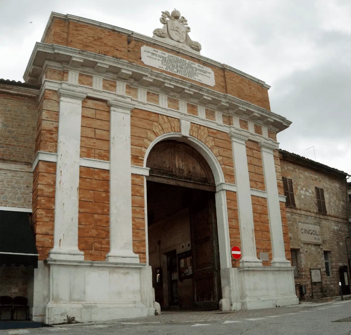
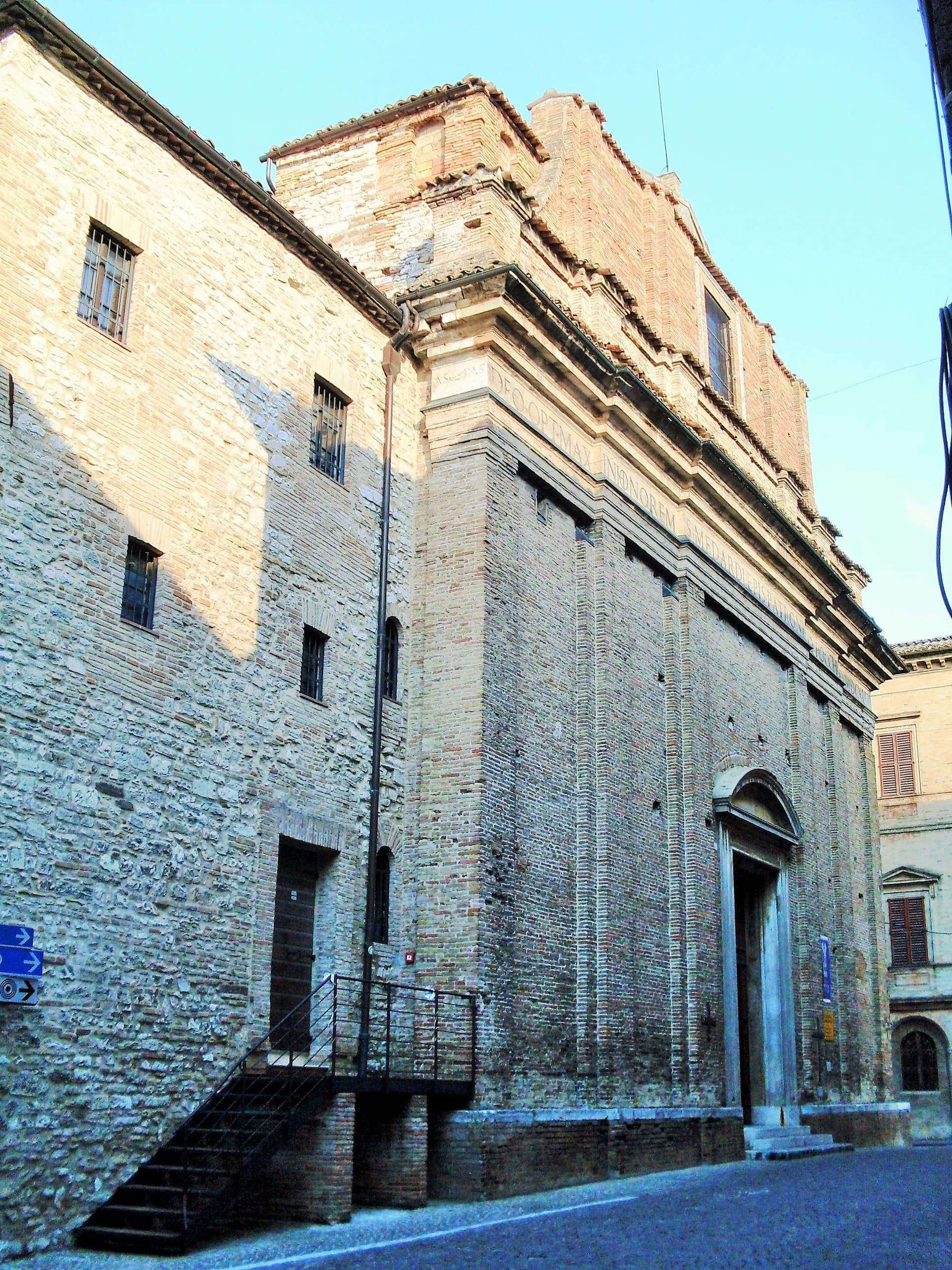
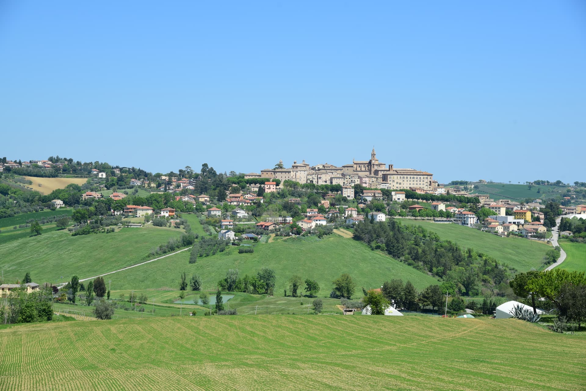
Cingoli
Province: Macerata · 631 m
The Balcone delle Marche at 631 meters, a hilltop borgo where on clear days the view runs from the Sibillini to the Croatian coast.
Corinaldo
Province: Ancona · 203 m
A walled hill borgo at 203 meters with 912 meters of intact medieval walls, the birthplace of Saint Maria Goretti and the Pozzo della Polenta.
Esanatoglia
Province: Macerata · 358 m
A medieval village of seven bell towers at 358 meters on the Marche-Umbria border, sitting at the source of the Esino river.
Fermo
Province: Fermo · 319 m
The provincial capital on the Sabulo hill at 319 meters, with 2,200 square meters of Augustan Roman cisterns running under the centro storico.

Gradara
Province: Pesaro e Urbino · 142 m
The walled hill borgo at 142 meters above the Adriatic where Dante set the deaths of Paolo and Francesca, with one of Italy's best-preserved castles.
Grottammare
Province: Ascoli Piceno · 4 m
A double town on the Riviera delle Palme, with a palm-lined seafront and the medieval Paese Alto where Pope Sixtus V was born.

Macerata Feltria
Province: Pesaro e Urbino · 321 m
Roman Pitinum + Renaissance Montefeltro — a 1,889-resident BPB borgo at 321m in the Marche side of the Montefeltro, built over the Roman municipium of Pitinum Pisaurense (1st c BC), with the Pieve di San Cassiano, a small thermal spa using sulphurous spring water, and Federico da Montefeltro fortifications.
Mercatello sul Metauro
Province: Pesaro e Urbino · 429 m
A walled borgo at 429 meters in the upper Metauro, autonomous since 1235, with a pieve exempt from any bishop.

Mondavio
Province: Pesaro e Urbino · 280 m
A hill borgo at 280 meters whose Rocca Roveresca, designed by Francesco di Giorgio Martini in the 1480s, never took a cannon shot.
Mondolfo
Province: Pesaro e Urbino · 144 m
A walled hill borgo at 144 meters above the Adriatic, with the frazione of Marotta and its Bandiera Blu beach below.
Monte Grimano Terme
Province: Pesaro e Urbino · 536 m
A small Montefeltro borgo at 536 meters on the Marche-Romagna border, with alkaline sulphur springs Andrea Bacci documented in his 1571 De Thermis.
Montecassiano
Province: Macerata · 188 m
A walled hill borgo at 188 meters north of Macerata, holding the seven-meter terracotta altarpiece Mattia della Robbia fired in a kiln built in town.
Montecosaro
Province: Macerata · 267 m
A walled hilltop borgo at 267 meters above the Chienti valley, with a Romanesque basilica rebuilt in 1125 on the river plain below.

Montefiore dell'Aso
Province: Ascoli Piceno · 412 m
A hilltop borgo at 412 meters between the Aso and Menocchia valleys, holding six surviving panels of Carlo Crivelli's 1472 polyptych.
Montelupone
Province: Macerata · 272 m
A walled hill borgo at 272 meters above the lower Potenza valley, with a fourteenth-century civic loggia and a 1889 horseshoe theatre.

Monteprandone
Province: Ascoli Piceno · 266 m
A hilltop borgo at 266 meters above the lower Tronto valley, birthplace of San Giacomo della Marca and home to his fifteenth-century convent library.

Moresco
Province: Fermo · 405 m
A 516-person hill borgo at 405 meters above the Aso valley, with a 25-meter seven-sided tower unique in Europe.
Morro d'Alba
Province: Ancona · 199 m
A walled Castello di Jesi at 199 meters above the Esino valley, ringed by La Scarpa, the 300-meter covered walkway unique in Italy.

Offagna
Province: Ancona · 309 m
A hilltop borgo at 309 meters between Ancona and Osimo, dominated by a Rocca built in just two years by the Anconitans in 1454-56.

Offida
Province: Ascoli Piceno · 293 m
A hill borgo at 293 meters in the Piceno wine country, with a Romanesque-Gothic cliff church and women still working bobbin lace.

Pergola
Province: Pesaro e Urbino · 265 m
A hill town at 265 meters in the upper Cesano valley, holding the only surviving group of Roman gilded bronze statues from antiquity.

Petritoli
Province: Fermo · 358 m
A hilltop borgo at 358 meters above the Aso valley, formed around the year 1000 from the merger of three castles.

Ripatransone
Province: Ascoli Piceno · 494 m
The Belvedere del Piceno at 494 meters, ridgetop borgo with views to the Adriatic and the narrowest alley in Italy at 43 centimeters.
San Ginesio
Province: Macerata · 680 m
The Balcony of the Sibillini at 680 meters, with a 1295 pilgrim hospital and the only flowery gothic collegiate church in the Marche.

Sarnano
Province: Macerata · 539 m
A 539-meter medieval borgo of baked brick at the foot of the Sibillini, with thermal springs that ran for 84 years until the 2016 earthquake.

Sassoferrato
Province: Ancona · 386 m
A two-level Apennine town above Roman Sentinum, where the consuls Decius Mus and Fabius Maximus defeated four allied tribes in 295 BC.
Servigliano
Province: Fermo · 215 m
An eighteenth-century ideal city at 215 meters in the Tenna valley, rebuilt by papal commission on a 137-by-144-meter quadrangle after the old hill village collapsed.

Treia
Province: Macerata · 342 m
A Macerata hill town at 342 meters, the Roman municipium Trea, renamed by Pope Pius VI in 1790 after centuries as Montecchio.
Vallefoglia
Province: Pesaro e Urbino · 295 m
A 2014 merger commune at 295 meters in the Foglia valley, born from Colbordolo, birthplace of Raffaello's father, and Sant'Angelo in Lizzola.
Visso
Province: Macerata · 607 m
The northern Sibillini gate at 607 meters where the Nera meets the Ussita, holding one of two surviving manuscripts of Leopardi's L'Infinito.
Molise5
Fornelli
Province: Isernia · 530 m
A walled medieval borgo at 530 meters with seven towers and the birthplace of Nancy Pelosi's mother, eight kilometers west of Isernia.
Frosolone
Province: Isernia · 894 m
A 900-meter blade-making town in the Matese foothills, called Italy's Toledo for the knives and scissors forged here since the 1800s.

Oratino
Province: Campobasso · 780 m
A stonemason borgo at 780 meters above the Biferno, with a square tower on a limestone spur that an earthquake in 1456 left standing alone.
Sepino
Province: Campobasso · 698 m
A hilltop borgo at 698 meters at the foot of the Matese, two kilometers above the Roman Saepinum, the open-air city the sheep tracks built.
Termoli
Province: Campobasso · 15 m
Molise's only port, a walled promontory of fishermen's houses on the Adriatic with a Frederick II castle and the ferry pier for the Tremiti islands.
Piedmont17
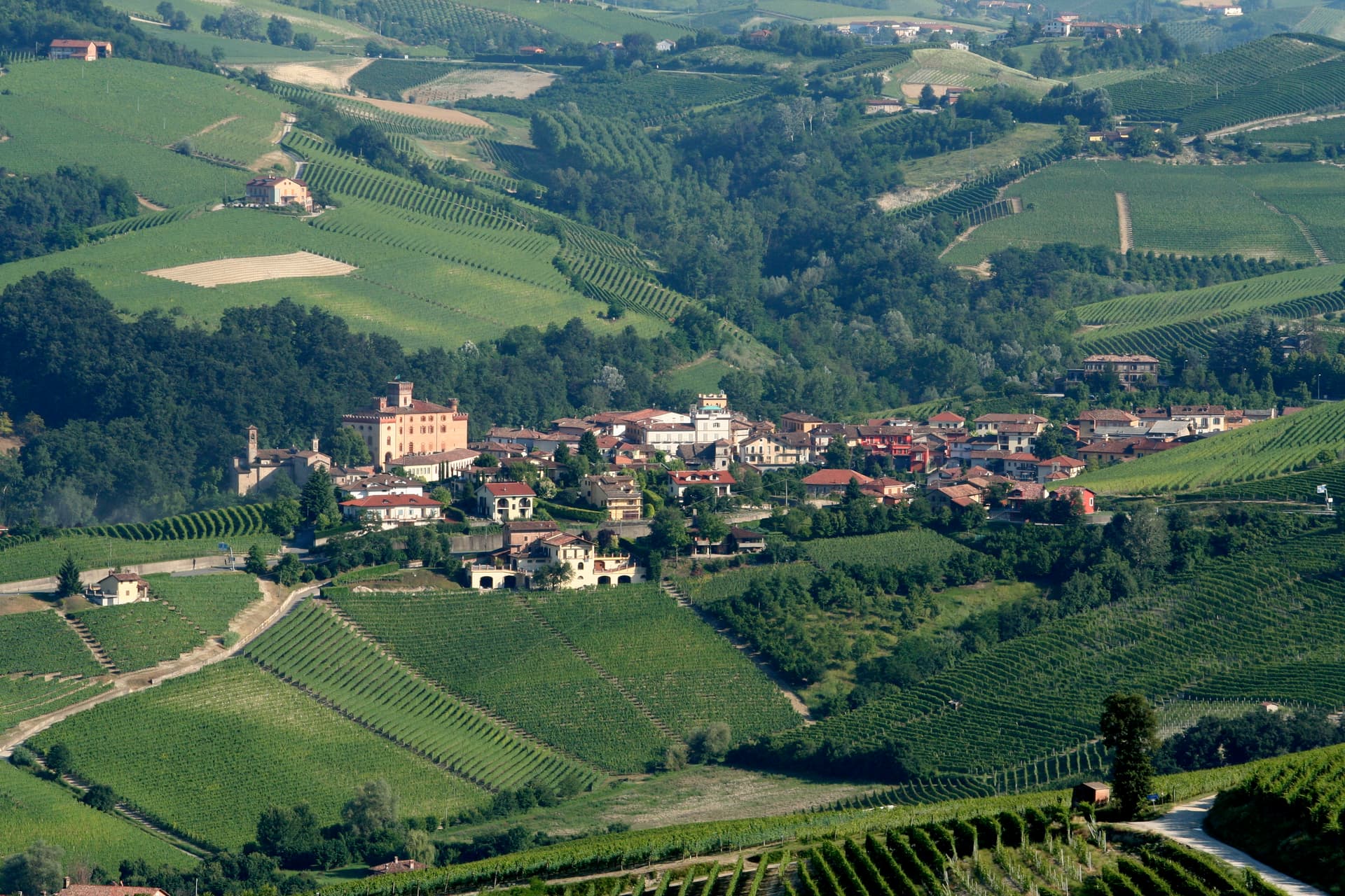
Barolo
Province: Cuneo · 301 m
A Langhe borgo at 301 meters whose Castello Falletti gave its name to the wine the Marchesi turned dry in the 1830s with Cavour's help.
Biella
Province: Biella · 417 m
A wool city at 417 meters in the Alpine foothills, where the medieval Piazzo sits above the modern Piano, connected by a funicular since 1885.
Candelo
Province: Biella · 350 m
A Biellese commune at 350 meters whose Ricetto, a 13th-century fortified shelter of two hundred stone cellule, is the best-preserved in Piedmont.
Castagnole delle Lanze
Province: Asti · 298 m
An Asti hill town at 298 meters between Langhe and Monferrato, with two Baroque churches and a nineteenth-century astronomical tower.
Cella Monte
Province: Alessandria · 268 m
A 465-person Monferrato Casalese borgo at 268 meters built in pietra da cantoni, with infernot cellars listed under the UNESCO Vineyard Landscape.
Cocconato
Province: Asti · 491 m
A Monferrato ridge town at 491 meters with a microclimate mild enough to grow palms and olives this far north.
Garbagna
Province: Alessandria · 270 m
A Val Curone borgo at 270 meters with tall Ligurian-style houses, home of the Ciliegia Bella di Garbagna cherry.

Garessio
Province: Cuneo · 621 m
A four-borgo medieval town at 621 meters on the Liguria-Piemonte border, built on the salt road and the source of the Acqua San Bernardo.
Guarene
Province: Cuneo · 360 m
A Roero hilltop village at 360 meters above the Tanaro, whose Roero family baroque castle is now a luxury hotel and contemporary art destination.
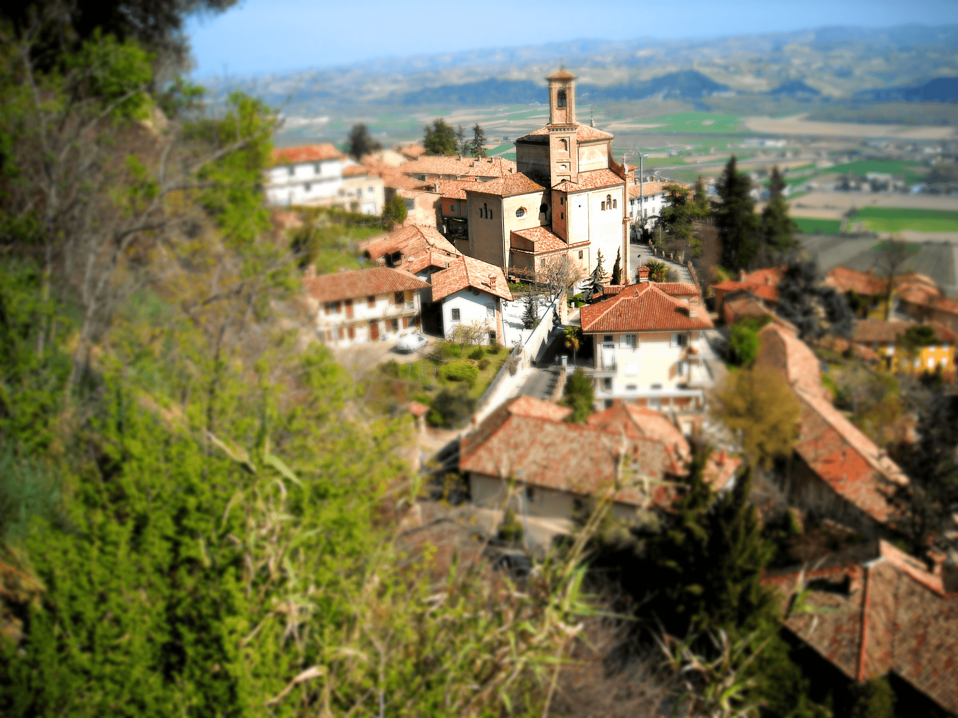
Mombaldone
Province: Asti · 260 m
A walled village of 197 residents in the Langa Astigiana, the only borgo in the area that still holds its full medieval perimeter.
Monforte d'Alba
Province: Cuneo · 480 m
A Barolo cru village at 480 meters where the Cathars were burned in 1028 and where the summer jazz festival fills the old piazza.

Neive
Province: Cuneo · 308 m
A hilltop borgo at 308 meters in the Barbaresco zone, named for the Roman gens Naevia, with four wines in commercial volume.
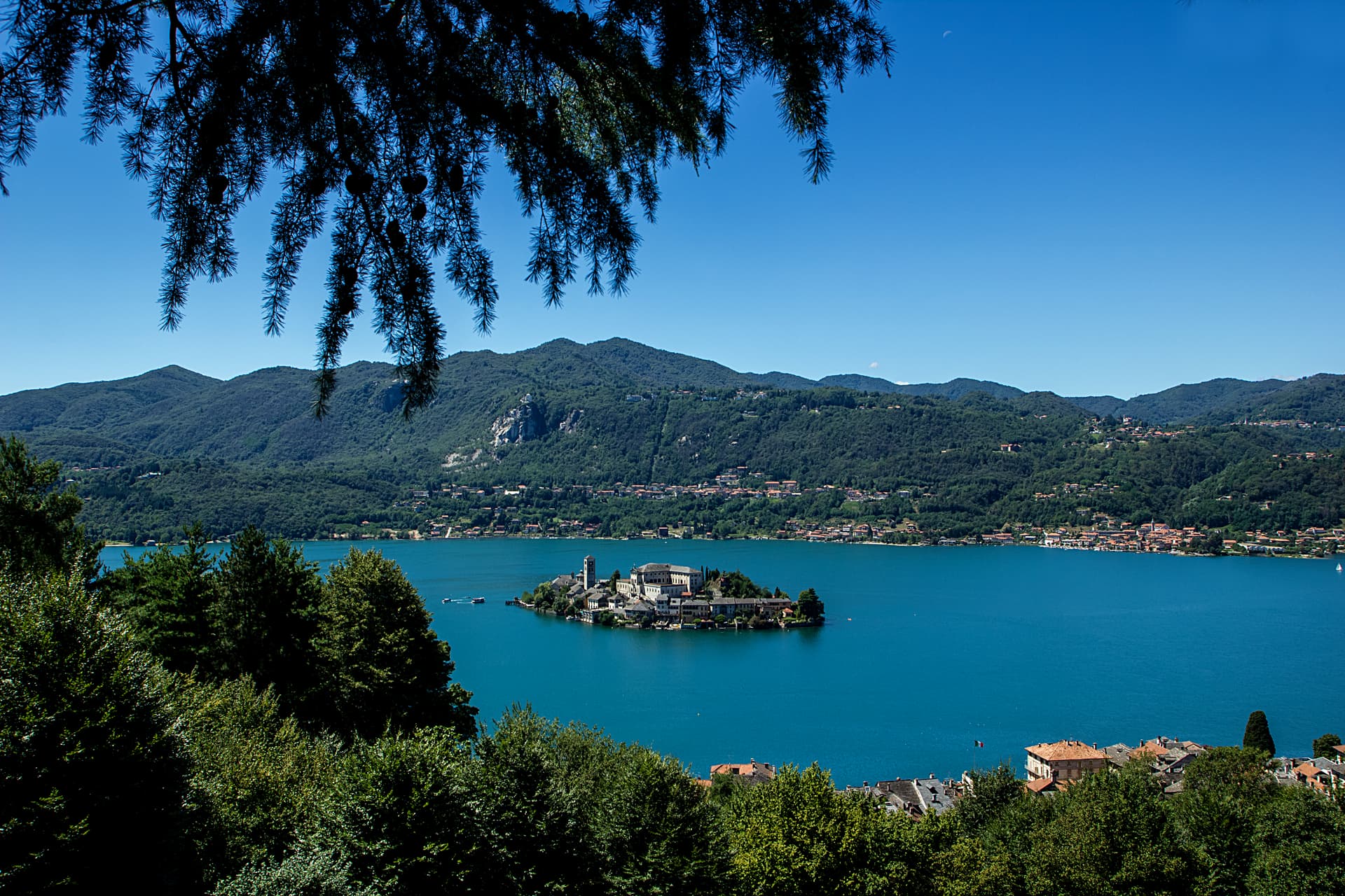
Orta San Giulio
Province: Novara · 294 m
A Lake Orta promontory facing an islet with a Romanesque basilica, plus a UNESCO Sacro Monte of twenty Francis-of-Assisi chapels on the hill above.

Ostana
Province: Cuneo · 1,280 m
Italy's most spectacular Monviso belvedere — an 85-resident Occitan-speaking alpine borgo at 1,280m in the upper Po valley, with a direct frontal view of Monviso (3,841m), an architecturally celebrated mountain renaissance (60+ ruined stone houses rebuilt 2000-2024 by a regional master plan), and Borghi più belli d'Italia inscription despite the small population.
Usseaux
Province: Torino · 1,416 m
A Val Chisone village at 1,416 meters with four scattered borgate and more than forty murals painted across the stone facades.
Vogogna
Province: Verbano-Cusio-Ossola · 226 m
An Ossola medieval capital at 226 meters on the Toce, with a Visconti castle of 1348 and five centuries as seat of the Ossola Inferiore.
Volpedo
Province: Alessandria · 182 m
A Colli Tortonesi village at 182 meters where Giuseppe Pellizza painted Il Quarto Stato and died at thirty-eight in 1907.
Sardinia8
Atzara
Province: Nuoro · 553 m
A Mandrolisai wine village on the western Gennargentu, painted in the early twentieth century by Spanish costumbristas and the Sardinian Scuola di Atzara.
Bosa
Province: Oristano · 10 m
A colour-washed riverside town on Sardinia's only navigable river, with a Malaspina castle on the hill and the tanneries of Sas Conzas along the Temo.
Carloforte
Province: Sud Sardegna · 10 m
A Ligurian-speaking fishing town on the Isola di San Pietro, founded in 1738 by coral fishers returning from Tunisian Tabarka.
Castelsardo
Province: Sassari · 114 m
A Doria sea fortress at 114 meters above the Gulf of Asinara, Genoese from 1100, Aragonese from 1448, Savoyard from the 1700s.
La Maddalena
Province: Sassari · 19 m
The only inhabited town of a sixty-island granite archipelago between Sardinia and Corsica, and the place Giuseppe Garibaldi chose to die.
Posada
Province: Nuoro · 37 m
The capital of the Baronia, a 3,000-person village on a 71-meter rock above the Rio Posada, with a 13th-century tower over the valley.
Sadali
Province: Sud Sardegna · 750 m
A Barbagia di Seulo borgo at 750 meters with the only waterfall in Sardegna that drops through the inhabited centre.
Tempio Pausania
Province: Sassari · 566 m
The granite capital of Gallura at the foot of Monte Limbara, known for cork, Vermentino DOCG and the largest Carnival in northern Sardinia.
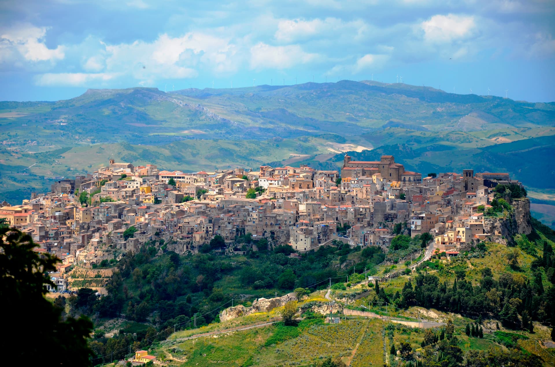
Sicily23
Agira
Province: Enna · 650 m
On the slopes of Monte Teja at 650 meters, birthplace of the Greek historian Diodorus Siculus and burial site of 490 Canadian soldiers of the 1943 campaign.
Buccheri
Province: Siracusa · 820 m
The highest village in the province of Syracuse at 820 meters on Monte Lauro, world capital of Tonda Iblea olive oil at the 2015 Sol d'Oro.
Calascibetta
Province: Enna · 691 m
A promontory town at 691 meters facing Enna across a ravine, founded in the ninth century as a Muslim camp to besiege Byzantine Henna.
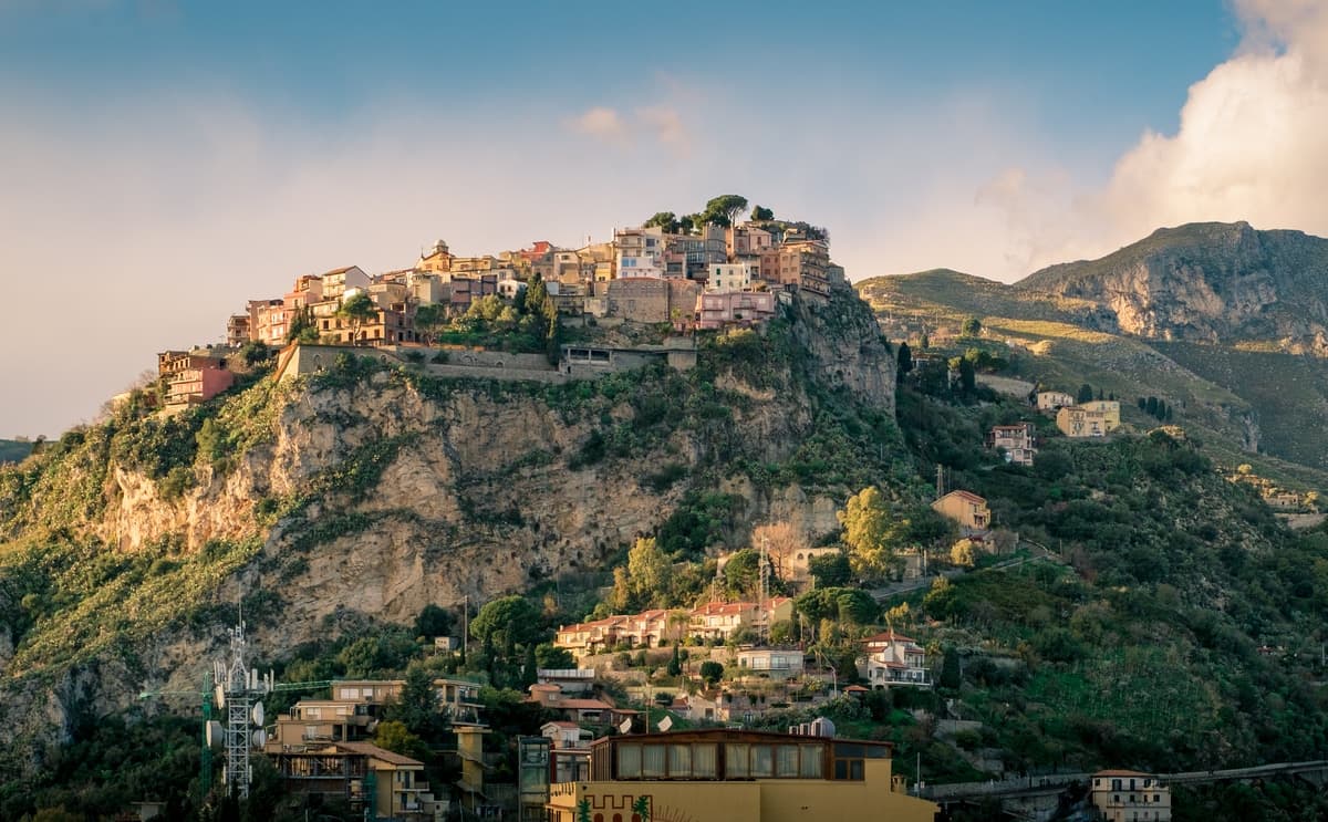
Castelmola
Province: Messina · 529 m
A rock village at 529 meters directly above Taormina, the upper acropolis of ancient Tauromenium with a Norman castle and a 1947 almond-wine bar.
Castiglione di Sicilia
Province: Catania · 621 m
A hill town on the north flank of Etna at 621 meters, base camp for the Alcantara valley and the volcano's most serious red wines.
Castroreale
Province: Messina · 394 m
A ridge town at 394 meters above the Milazzo plain, rebuilt by Frederick II of Aragon in 1324 as a royal demesne and second in the 2018 Borgo dei Borghi.
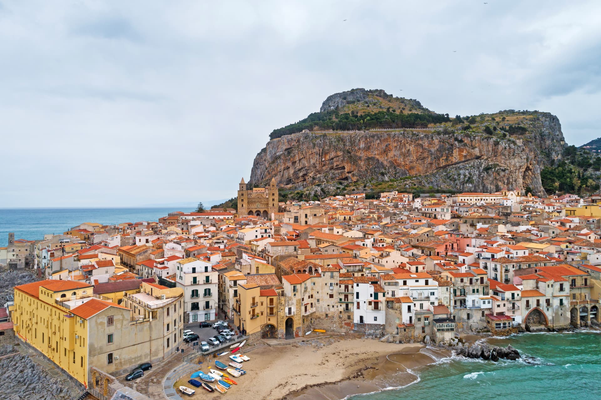
Cefalù
Province: Palermo · 16 m
A Norman cathedral at the foot of a 270-meter rock on the Tyrrhenian coast, founded by Roger II in 1131 and on the UNESCO Arab-Norman list since 2015.
Erice
Province: Trapani · 751 m
An Elymian mountaintop city at 751 meters above Trapani, with a Norman castle on the site of the temple of Venus Erycina and a Cold War physics centre.

Ferla
Province: Siracusa · 500 m
A baroque village at 500 meters on the Monte Lauro slopes, the western gateway to the UNESCO necropolis of Pantalica eleven kilometers downhill.
Forza d'Agrò
Province: Messina · 420 m
A ridge village of 835 people at 420 meters above the Ionian, the Norman fortress town Coppola used in 1972 to stand in for Mafia-era Corleone.
Gangi
Province: Palermo · 1,011 m
A Madonie hill town stacked down Monte Marone at 1,011 meters, RAI's Borgo dei Borghi 2014 and the launching pad for the one-euro-house programme.
Geraci Siculo
Province: Palermo · 1,077 m
A Madonie ridge village at 1,077 meters, capital of the Ventimiglia marquisate from 1258 and the first marquisate granted in Sicily.
Montalbano Elicona
Province: Messina · 907 m
A Nebrodi castle town at 907 meters, Frederick III of Aragon's summer residence and gateway to the Argimusco megalithic plateau.
Novara di Sicilia
Province: Messina · 650 m
A stone village at 650 meters where the Peloritani meet the Nebrodi, with a UNESCO-listed cheese race tumbling down the main street at Carnival.
Palazzolo Acreide
Province: Siracusa · 670 m
The Iblei plateau's UNESCO Baroque + Greek twin — 8,000-resident hilltop town at 670m, founded over the Greek Akrai colony (664 BC), rebuilt entirely in late Baroque after the 1693 earthquake (inscribed on the Val di Noto UNESCO listing 2002), with the original Greek theatre + the unique Santoni rock carvings of Cybele just outside the modern centro.
Petralia Soprana
Province: Palermo · 1,147 m
The highest village in the Madonie at 1,147 meters, RAI Borgo dei Borghi 2018 winner, sitting above 80 kilometers of salt tunnels.
Salemi
Province: Trapani · 446 m
The Belice Valley town where Garibaldi raised the tricolor on 14 May 1860 and proclaimed Salemi the capital of Italy for a day.
Sambuca di Sicilia
Province: Agrigento · 350 m
An Arab-founded hill town in the Belice valley, named Borgo dei Borghi in 2016, still called Zabut in living memory before 1923.
San Marco d'Alunzio
Province: Messina · 540 m
A hilltop borgo at 540 meters built in pink Aluntina marble, Robert Guiscard's first Sicilian base for the eleventh-century Norman conquest.
Savoca
Province: Messina · 300 m
A hilltop borgo at 300 meters above the Ionian where Francis Ford Coppola filmed the Sicilian scenes of The Godfather in 1971.
Sperlinga
Province: Enna · 750 m
A sandstone borgo at 750 meters in the Nebrodi foothills where a Norman castle and dwellings are carved into the rock as one continuous mass.
Sutera
Province: Caltanissetta · 600 m
A medieval village clinging to the base of a 800-meter monolith in the Nisseno interior, with an Arab quarter and a sanctuary on the summit.
Troina
Province: Enna · 1,121 m
At 1,121 meters on the Nebrodi ridge, the first capital and first bishopric the Normans set up in Sicily after taking it from the Arabs.
Trentino-Alto Adige/Südtirol11
Bleggio Superiore
Province: Trento · 628 m
A scattered Giudicarie commune whose hilltop hamlet of Rango holds the Christmas markets, with a Slow Food walnut grown on the terraces below.
Bondone
Province: Trento · 720 m
A two-village commune above Lake Idro at the Lombard border, with a Lodron castle on the cliff and a Bandiera Blu shoreline below.
Borgo Valsugana
Province: Trento · 380 m
The valley town built on both banks of the Brenta in lower Valsugana, with Castel Telvana above and Arte Sella in the side valley.
Caldes
Province: Trento · 698 m
A scattered Val di Sole commune on the Noce, six hamlets gathered around a thirteenth-century tower-house castle that once belonged to the Thun family.
Glurns
Province: Bolzano · 907 m
The smallest city in South Tyrol at 937 inhabitants, ringed by intact sixteenth-century walls in the Val Venosta near the Swiss border.
Kastelruth
Province: Bolzano · 1,060 m
South Tyrolean gateway to the Alpe di Siusi at 1,060 metres, eighty-two-metre bell tower over the square, home of the Kastelruther Spatzen.

Luserna
Province: Trento · 1,333 m
A Cimbrian island at 1,333 metres on the Alpe Cimbra plateau, the last village in Italy where the medieval Bavarian dialect is still spoken at home.
Ossana
Province: Trento · 1,003 m
A small Val di Sole borgo at the foot of a 25-metre stone keep, with Christmas nativity scenes filling its streets every December.

Pieve Tesino
Province: Trento · 843 m
The birthplace of Alcide De Gasperi, founding father of the European Union, on a Trentino plateau of itinerant print-sellers and arboretum gardens.

Sterzing
Province: Bolzano · 948 m
A bilingual mining town at 948 metres on the Brenner road, where a 46-metre tower built in 1472 still divides the old town from the new.
Tenno
Province: Trento · 428 m
A hillside commune at 428 metres above Lake Garda, with a medieval stone hamlet, a turquoise lake, and the northernmost olive groves in Europe.
Tuscany23
Anghiari
Province: Arezzo · 430 m
A walled medieval town at 430 meters over the upper Tiber valley, where Florence beat Milan in 1440 and Leonardo started the fresco he never finished.
- ✷ We've been
Barga
Province: Lucca · 410 m
A medieval hilltop town at 410 meters in the Serchio valley between the Apuan Alps and the Apennines, where Giovanni Pascoli wrote his last poems and the August festival serves fish and chips.
Buonconvento
Province: Siena · 147 m
The walled brick borgo in the Crete Senesi where Emperor Henry VII died in 1313, on the Via Cassia at the confluence of the Arbia and Ombrone.
- ✷ We've been
Campiglia Marittima
Province: Livorno · 231 m
A walled hilltop borgo above the Val di Cornia, where the Rocca tower watches a mining landscape worked from the Etruscans to 1976.
- ✷ We've been
Capalbio
Province: Grosseto · 217 m
A walled hilltop borgo at 217 meters in the southern Maremma, donated to the Abbey of Tre Fontane by Charlemagne and home of Niki de Saint Phalle's Tarot Garden.
Casale Marittimo
Province: Pisa · 214 m
A concentric stone borgo at 214 meters above the Val di Cecina, built where a seventh-century BC Etruscan outpost of Volterra once stood.
- ✷ We've been
Castiglione di Garfagnana
Province: Lucca · 540 m
A walled medieval town at 540 meters in the Garfagnana, the Lucca outpost that refused to submit to the Este and held the pass to San Pellegrino.
Cetona
Province: Siena · 384 m
A medieval borgo at 384 meters below Monte Cetona, sold by Cosimo I to the Vitelli in 1556 and the centro storico still shaped by their fortress reconstruction.
- ✷ We've been
Greve in Chianti
Province: Firenze · 236 m
The market town of the Chianti Classico zone on the Greve river, with a triangular piazza arcaded since the sixteenth century.
Isola del Giglio
Province: Grosseto · 405 m
A granite island in the Tyrrhenian Archipelago, walled village on the ridge, port below, where the Costa Concordia ran aground in January 2012.

Loro Ciuffenna
Province: Arezzo · 330 m
A Valdarno village at 330 meters straddling the Ciuffenna torrent, with the oldest working water mill in Tuscany and a Lombard pulpit two kilometers up the road.
Lucignano
Province: Arezzo · 400 m
A walled elliptical hill town at 400 meters between Siena and Arezzo, planned in medieval concentric rings around the goldsmith's reliquary called the Tree of Life.
- ✷ We've been
Manciano
Province: Grosseto · 444 m
A market town at 444 meters in the southern Maremma, with a Sienese fortress of 1424 and the thermal frazione of Saturnia in its territory.
Montaione
Province: Firenze · 341 m
A medieval glassmaking and truffle borgo at 341 meters above the Valdelsa, with a Franciscan replica of Jerusalem in the woods at San Vivaldo.
- ✷ We've been
Monte Argentario
Province: Grosseto · 5 m
A 635-meter peninsula tied to the mainland by three sand spits, ringed by Spanish forts and the place where Caravaggio died in 1610.
Montescudaio
Province: Pisa · 242 m
A fortified hill borgo at 242 meters above the Val di Cecina, named for a mountain of shields, with DOC wine since 1977 and bread, oil and grape all stamped in its identity.

Mulazzo
Province: Massa-Carrara · 351 m
A Malaspina fief in the Lunigiana hills where Dante stayed in 1306, with a frazione of booksellers who walked their wares across Italy.
- ✷ We've been
Piombino
Province: Livorno · 21 m
A promontory port facing Elba across the channel, founded by refugees from Etruscan Populonia and now the Tuscan archipelago's ferry capital.
Pitigliano
Province: Grosseto · 313 m
The Little Jerusalem of southern Tuscany, carved into a tuff spur in the Maremma, where the houses, the synagogue and the streets are all cut from the same volcanic rock.
Poppi
Province: Arezzo · 437 m
The Casentino borgo at 437 meters whose castle sat above the field where Dante fought the Battle of Campaldino in June 1289.

San Casciano dei Bagni
Province: Siena · 582 m
A hilltop borgo at 582 meters above 42 hot springs that produced the largest Etruscan bronze hoard of the last fifty years.

Santa Fiora
Province: Grosseto · 687 m
An Aldobrandeschi and Sforza mountain borgo on Monte Amiata at 687 meters, holding one of the world's largest collections of Della Robbia terracotta.
- ✷ We've been
Suvereto
Province: Livorno · 127 m
A stone borgo at 127 meters above the Val di Cornia, named for the cork oaks of its forests and ruled from the Rocca Aldobrandesca since 973.
Umbria31
Acquasparta
Province: Terni · 350 m
A hill town at 350 meters above the Naia valley, where Federico Cesi convened the first Accademia dei Lincei in his Palazzo Cesi in 1603.
Allerona
Province: Terni · 472 m
A stone borgo at 472 meters between the Paglia valley and the Valdichiana, an Orvieto outpost whose Monaldeschi castle fell to Charles V.
Arrone
Province: Terni · 243 m
Medieval castle village on the left bank of the Nera at 243 meters, upstream from the largest man-made waterfall in the world.
Bettona
Province: Perugia · 353 m
A hill town at 353 meters between the Topino and Chiascio rivers, the only Etruscan settlement ever built east of the Tiber.
Bevagna
Province: Perugia · 225 m
Roman Mevania on the Umbrian plain at 225 meters, four medieval quarters that compete every June in a reconstructed market of the 13th century.
Castiglione del Lago
Province: Perugia · 304 m
Trasimeno's western promontory, once the lake's fourth island, fortified by Federico II in 1247 and frescoed by Pomarancio for the Corgna marquises.
Citerna
Province: Perugia · 480 m
A medieval borgo at 480 meters above the upper Tiber valley, holding the only sculpture by Donatello in Umbria.
Corciano
Province: Perugia · 408 m
A walled medieval castello at 408 meters eight kilometers west of Perugia, where Saint Francis stopped on his way back from Isola Maggiore in 1223.
Deruta
Province: Perugia · 218 m
A hill town at 218 meters on the left bank of the Tiber, the maiolica capital of central Italy since the late thirteenth century.
Giano dell'Umbria
Province: Perugia · 547 m
A hill commune at 547 meters between Foligno, Spoleto and Todi, anchored by a Romanesque abbey founded over the tomb of a fourth-century martyr.
Lugnano in Teverina
Province: Terni · 441 m
A ridge town at 441 meters above the lower Tiber valley, with a 1230 Romanesque collegiata and a late-Roman infant cemetery on the hill below.
Massa Martana
Province: Perugia · 351 m
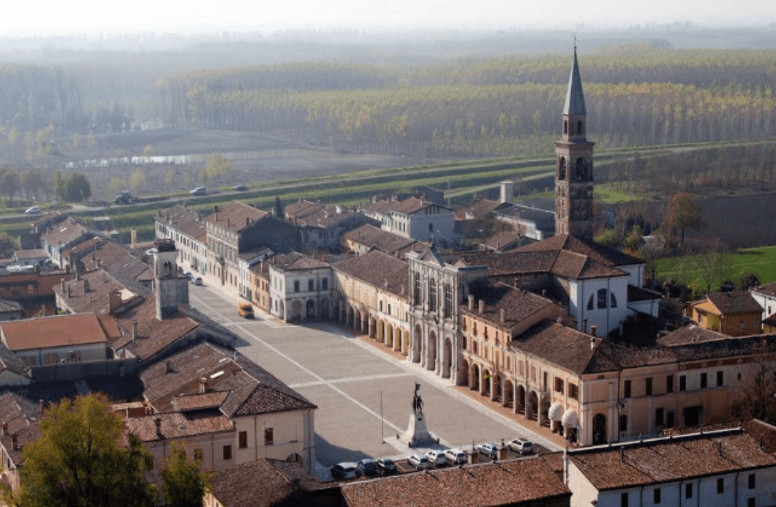
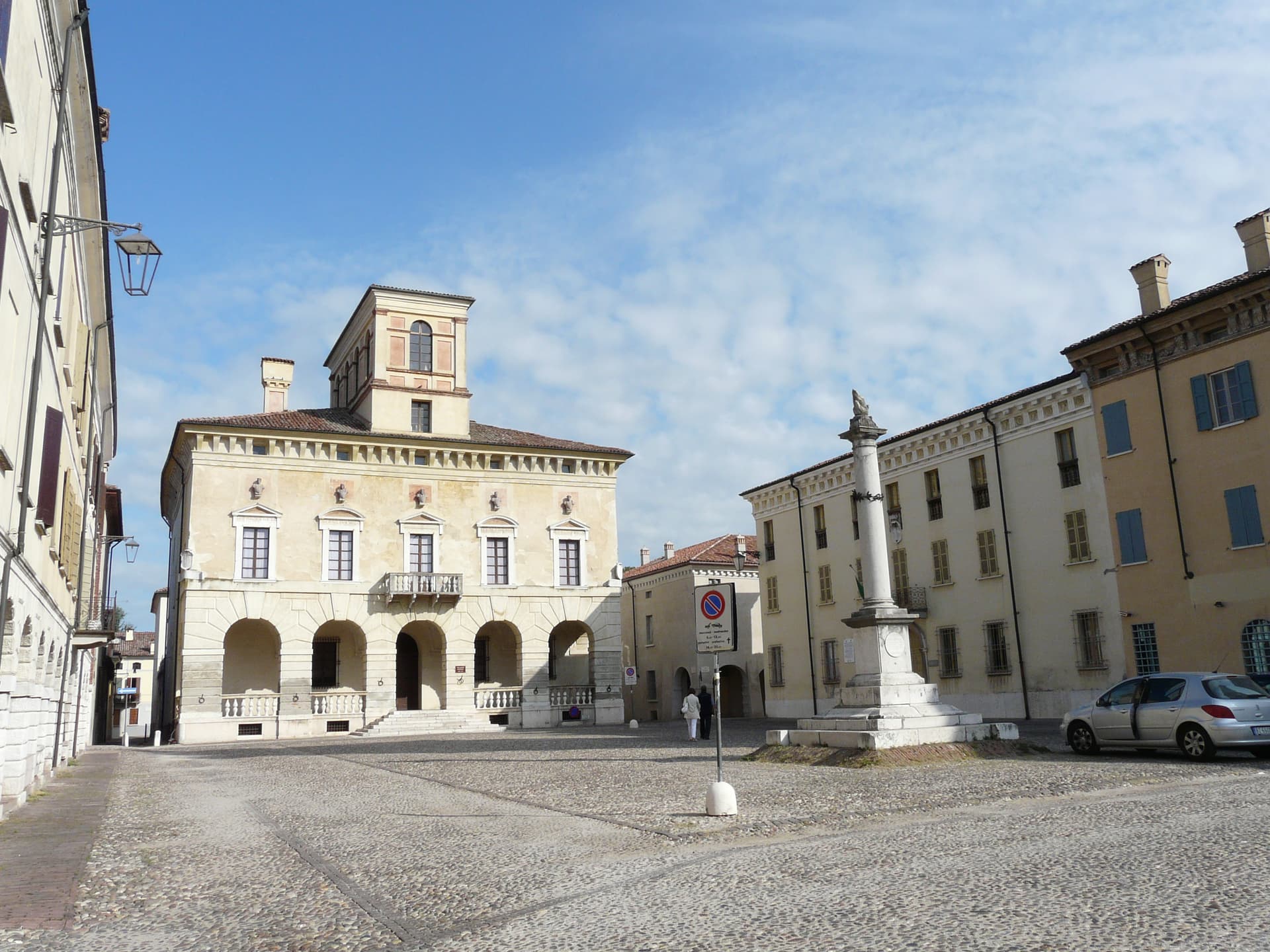
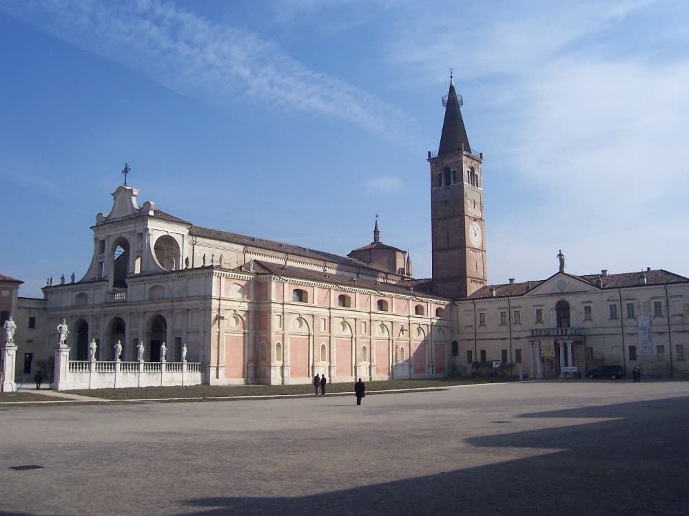
Umbria's Via Flaminia BPB — a 3,613-resident borgo on the original Roman consular road between Rome and Rimini, with the intact 9th-c Abbazia dei Santi Fidenzio e Terenzio above town, a network of Roman-era catacombe Cristiane (Catacombe di Villa San Faustino, the only ones in Umbria), and the Borghi più belli inscription restored after the 1997 Marche-Umbria earthquake.
Monte Castello di Vibio
Province: Perugia · 422 m
A fifteenth-century walled village at 422 meters above the Tiber, home to the world's smallest all'italiana theatre with 99 seats.

Montecchio
Province: Terni · 377 m
A small hill commune at 377 meters above the Tiber, sitting on top of one of Umbria's largest Etruscan-tied necropolises.
Montefalco
Province: Perugia · 472 m
The hilltop wine capital of Umbria at 472 meters, where Sagrantino is grown almost nowhere else and Benozzo Gozzoli painted Francis in 1452.

Monteleone di Spoleto
Province: Perugia · 978 m
Where the 6th-century-BC Etruscan parade chariot now in the Met was found — a 555-resident Borghi più belli d'Italia borgo at 978m in the upper Nera valley, with a replica of the Monteleone Chariot (the original is in New York), the medieval Rocca dei Brancaleoni, and a stop on the Cammino di San Benedetto pilgrim route.
Montone
Province: Perugia · 482 m
A walled medieval hill town at 482 meters above the upper Tiber, birthplace of the condottiero Braccio Fortebracci.
Nocera Umbra
Province: Perugia · 520 m
A hill town at 520 meters on the Apennine slope, leveled by the 1997 earthquake and rebuilt, with mineral springs flowing since the sixteenth century.
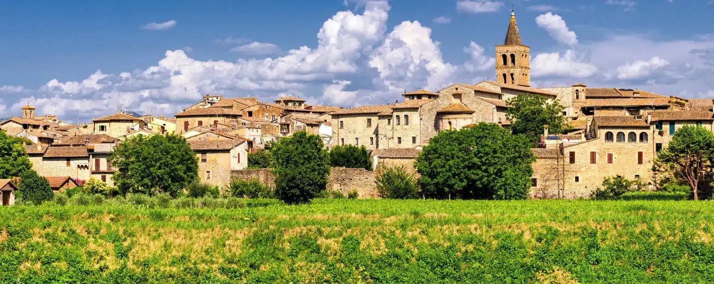
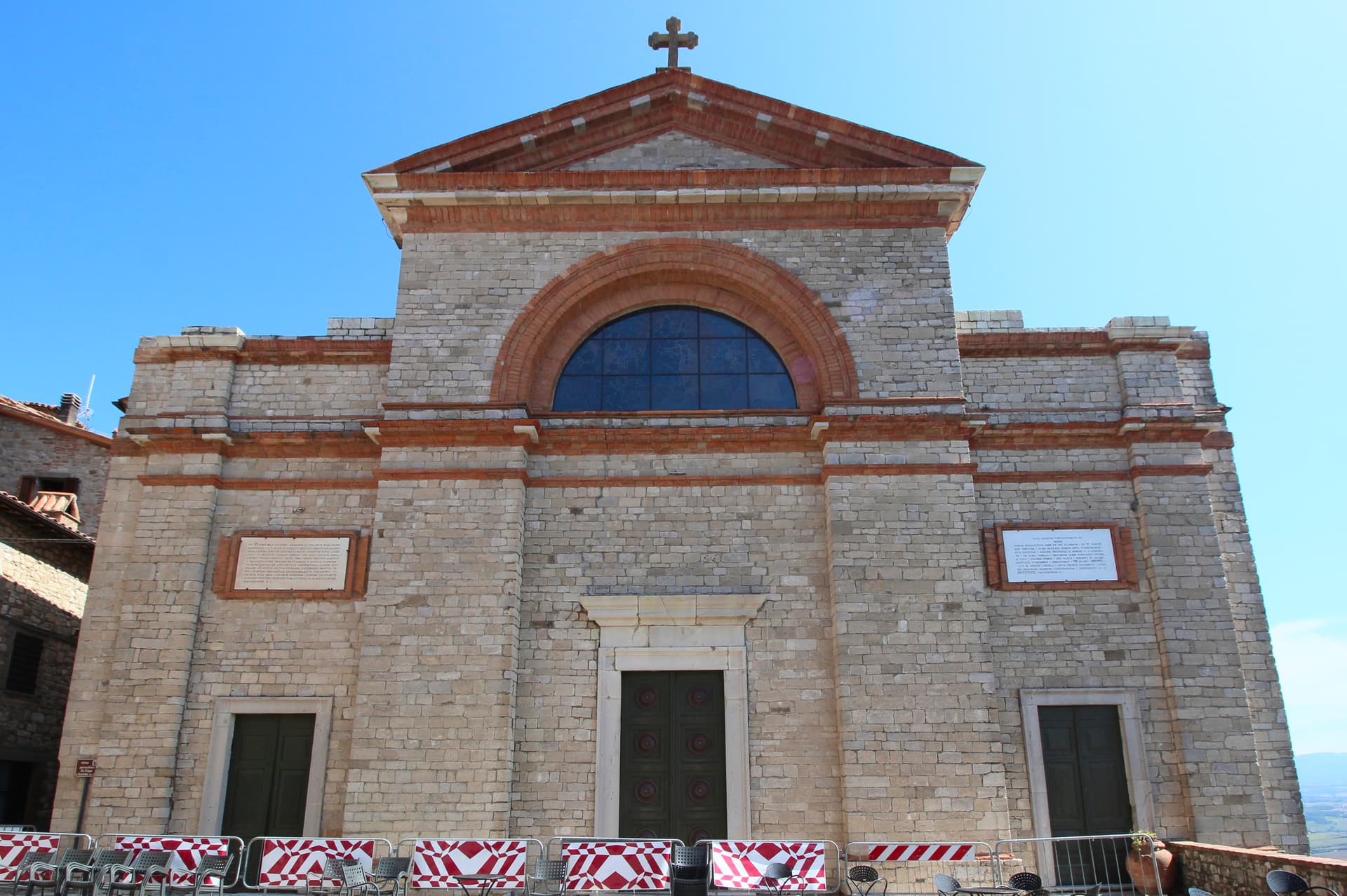
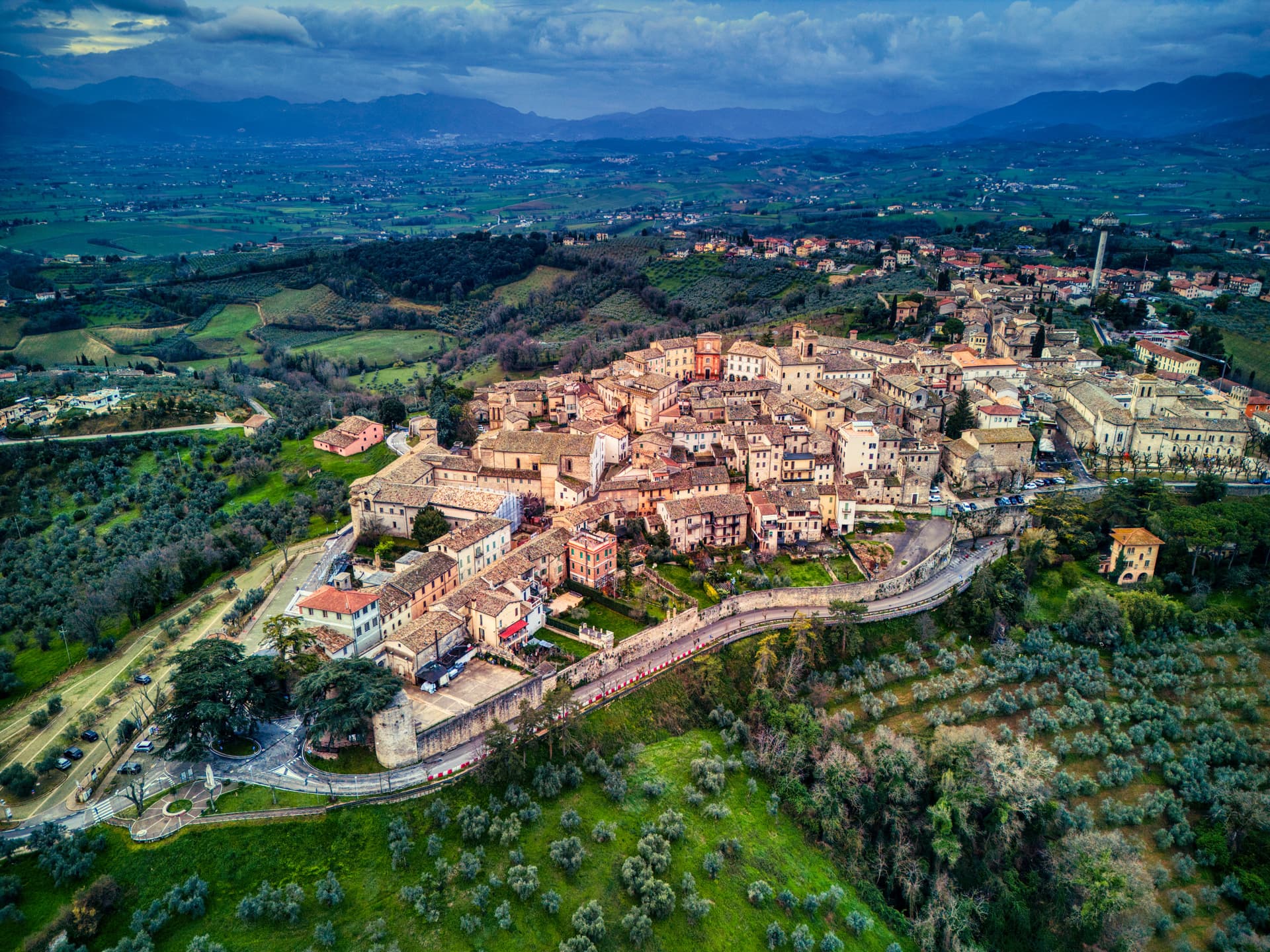
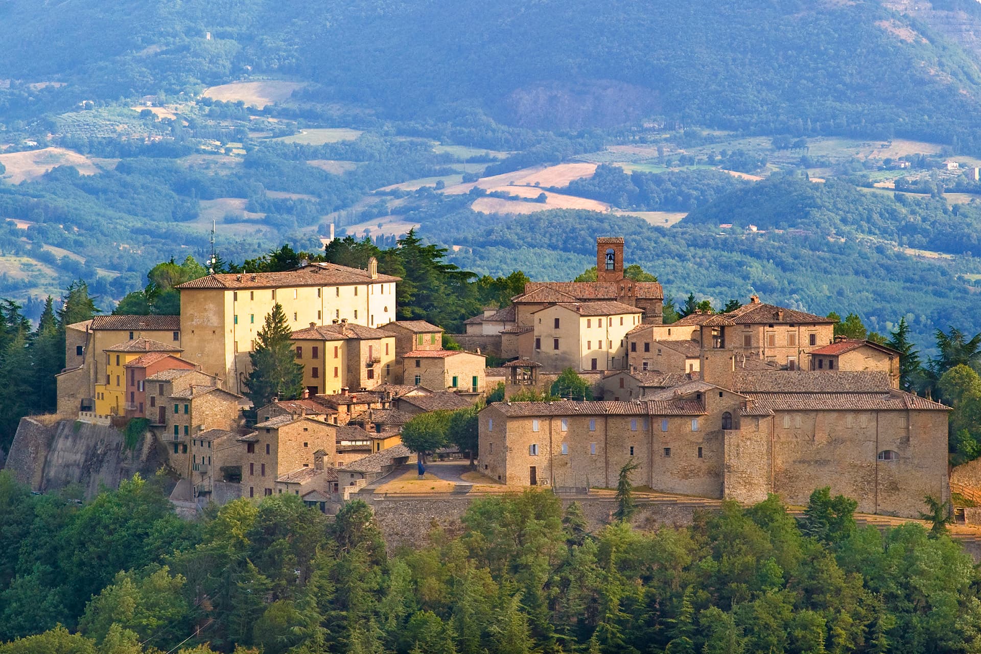
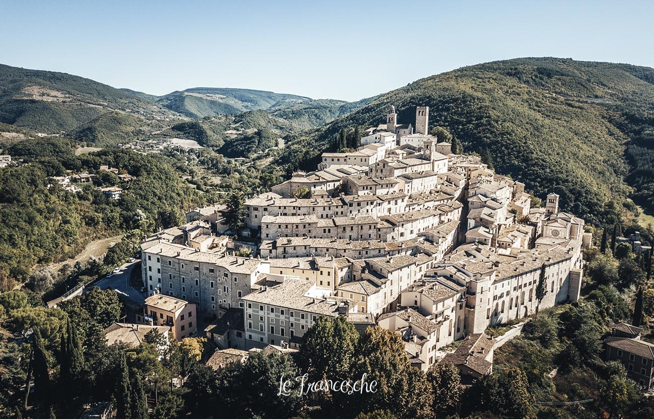
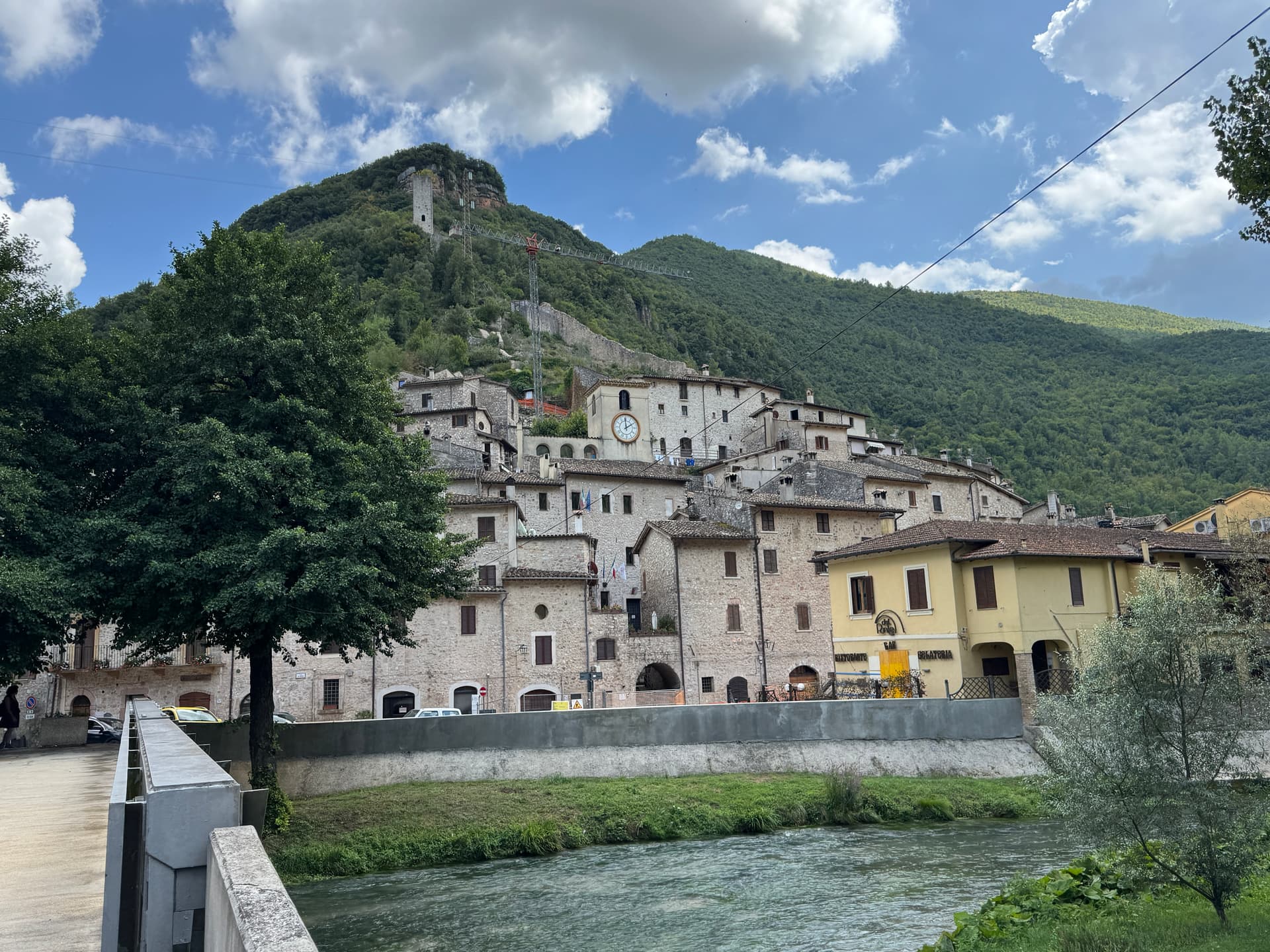
Norcia
Province: Perugia · 604 m
Birthplace of San Benedetto at 604 meters on a Sibillini plateau, leveled by the 2016 earthquake and rebuilt stone by stone.
Paciano
Province: Perugia · 391 m
Walled hill town of 957 people at 391 meters above Lake Trasimeno, three parallel streets, eight towers and three medieval gates intact.

Panicale
Province: Perugia · 431 m
A walled hill town at 431 meters on Monte Petrarvella, where a 1505 Perugino fresco covers the back wall of San Sebastiano.
Passignano sul Trasimeno
Province: Perugia · 289 m
A near-peninsula on the northern shore of Lake Trasimeno, on the road Hannibal closed when he ambushed the Romans in 217 BC.

Preci
Province: Perugia · 596 m
A walled Valnerina village at 596 meters that ran Europe's leading school of surgery for three centuries until the 2016 quake brought the borgo down.
San Gemini
Province: Terni · 337 m
A medieval borgo at 337 meters above the Via Flaminia, four kilometers below the ruins of Roman Carsulae.
Scheggino
Province: Perugia · 280 m
Triangular castle village on the banks of the Nera at 280 meters, where the first commercial Italian truffle company was founded in 1928.
Sellano
Province: Perugia · 641 m
A medieval village in the upper Valnerina at 641 meters, twice flattened by earthquakes, now linked to Montesanto by Europe's highest pedestrian suspension bridge.
Spello
Province: Perugia · 280 m
Augustan Hispellum at 280 meters on Monte Subasio, where streets carry flower petals each Corpus Domini and Pinturicchio frescoed the Baglioni Chapel in 1501.
Stroncone
Province: Terni · 451 m
A walled medieval borgo at 451 meters eight kilometers south of Terni, with a Franciscan convent traditionally founded by Francis himself in 1213.
Torgiano
Province: Perugia · 219 m
A walled river town at 219 meters at the confluence of the Tiber and the Chiascio, the first DOC and DOCG zone in Umbria.
Trevi
Province: Perugia · 412 m
A walled town at 412 meters above the Spoleto valley, ringed by 200,000 olive trees that make it the Umbrian capital of olive oil.
Vallo di Nera
Province: Perugia · 467 m
Castle village of 345 people at 467 meters in the upper Valnerina, granted by Spoleto in 1217 and barely changed since.
Veneto11
Arquà Petrarca
Province: Padova · 56 m
The Euganean Hills village where Francesco Petrarca spent his last four years and died in 1374, renamed in his honor in 1868.

Asolo
Province: Treviso · 205 m
A walled hill town at 205 meters that Caterina Cornaro ran as her court after trading Cyprus to Venice in 1489.
Borgo Valbelluna
Province: Belluno · 367 m
Veneto's youngest comune anchored by an old Borgo — a 13,410-resident comune formed in 2019 by the fusion of Mel + Trichiana + Lentiai in the Belluno-province pre-Dolomite Piave valley, with the BPB-inscribed Mel centro storico (a perfectly preserved 16th-c Venetian terraferma piazza) and the 11th-c Castello di Zumelle on a forested ridge above.
Cison di Valmarino
Province: Treviso · 261 m
A Prosecco hills borgo at 261 meters under the dolomite rock of CastelBrando, the largest inhabited castle complex in Europe.
Follina
Province: Treviso · 191 m
A Prosecco-hills borgo at 191 meters around the Cistercian Abbey of Santa Maria, with a cloister finished in 1268.
Malcesine
Province: Verona · 89 m
The northernmost Veneto town on Lake Garda, where Goethe was nearly arrested for sketching the Castello Scaligero in September 1786.
Montagnana
Province: Padova · 16 m
A walled town on the lower Padova plain with two kilometers of medieval ramparts and 24 hexagonal towers, headquarters of Prosciutto Veneto DOP.

Portobuffolè
Province: Treviso · 10 m
The smallest commune in the Treviso province, a Livenza river port centered on the fourteenth-century home of the poet Gaia da Camino.
Rocca Pietore
Province: Belluno · 1,143 m
An Agordino borgo at 1,143 meters under the Marmolada, where the Pettorina cuts a two-kilometer gorge through 100-meter rock walls.

Sant'Ambrogio di Valpolicella
Province: Verona · 174 m
The Valpolicella DOC gateway northwest of Verona, where the Gargagnago frazione anchors Amarone production and the San Giorgio frazione holds a Lombard-era pieve.
Valeggio sul Mincio
Province: Verona · 88 m
A moraine-hills town at 88 meters between Garda and Mantua, with a 1393 Visconti bridge-dam over the Mincio and a tortellino called the love knot.
Subscribe — free
Get the best guides on hidden Italian towns.
One letter on Sundays. The week’s town, with the photo, the food, the festa. Free, by Peter & Sophia from Pietrasanta.
Substack sends a confirmation link to your inbox. The signup finishes when it’s clicked.
From elsewhere in Italy
Five more towns to discover
Putignano
Province: Bari
Europe's longest-running carnival — Putignano Carnevale has run continuously since 1394, with 631 years of cartapesta papier-mâché floats, a 26,000-resident Murgia town on the Bari–Lecce plateau, and the Grotta del Trullo karst cave inside the centro.

Pistoia
Province: Pistoia
Italy's nursery capital and the medieval Tuscan rival that gave its name to the pistol — a quietly extraordinary centro storico of zebra-striped Romanesque churches, Andrea della Robbia's polychrome frieze on the Ospedale del Ceppo, and Italy's Capital of Culture 2017, all 30 minutes from Florence by train.
Tropea
Province: Vibo Valentia
Cliff town on a tufa headland over the Tyrrhenian Coast of the Gods, with a Norman monastery on a sea rock.
Caldes
Province: Trento
A scattered Val di Sole commune on the Noce, six hamlets gathered around a thirteenth-century tower-house castle that once belonged to the Thun family.
Cantiano
Province: Pesaro e Urbino
A border borgo at 374 meters under Monte Catria on the old Via Flaminia, known for the Good Friday Turba and the sour-cherry visciola harvest.