
Apulia · Foggia
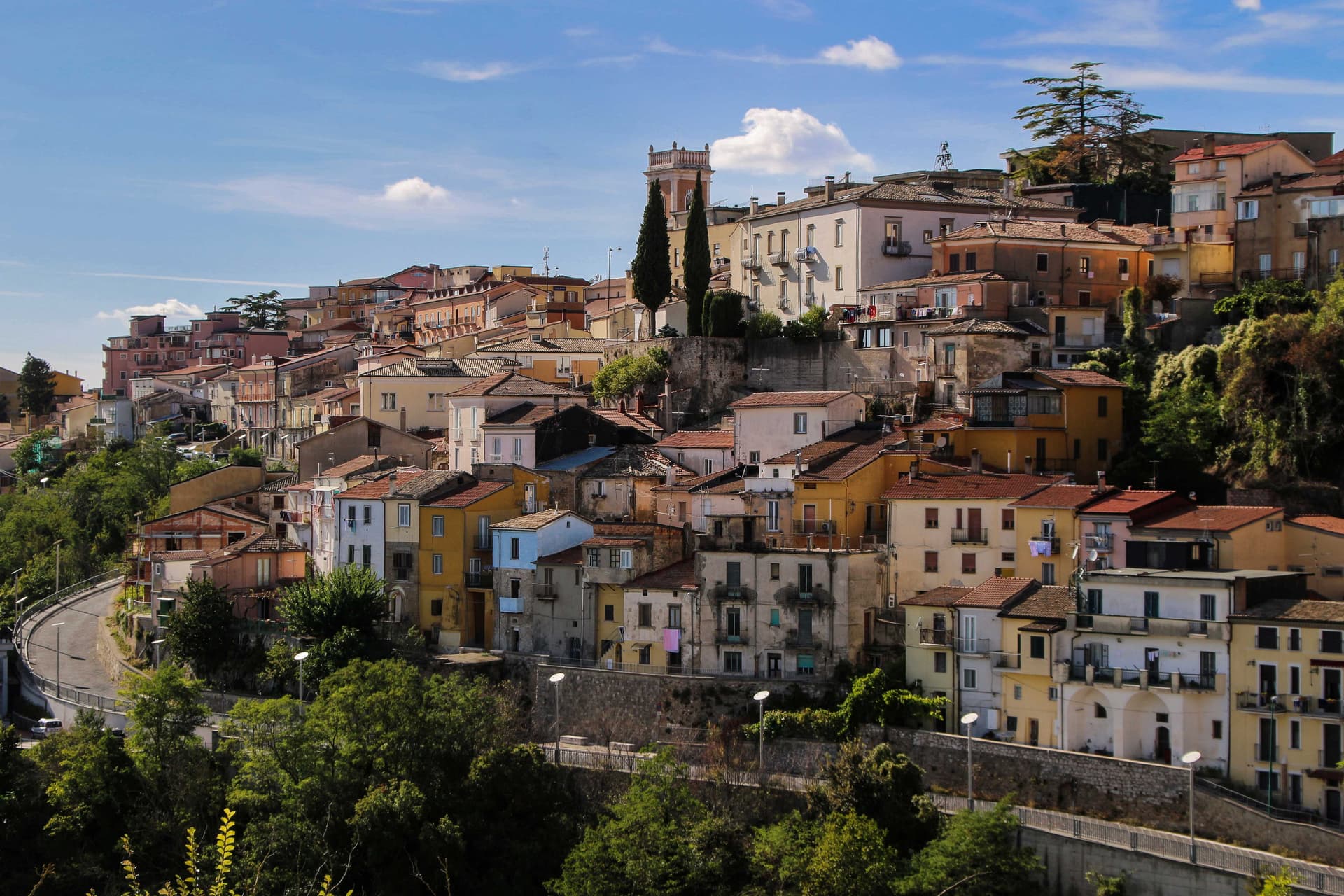
Bovino
A Daunian Mountains hill town at 646 meters above the Cervaro valley, Roman Vibinum, with a Norman-Swabian castle later turned into a Guevara ducal palace.
Known for
DUCAL PALACE
Norman-Swabian castle turned Guevara residence, host to Torquato Tasso, Maria Theresa of Austria, and Pope Benedict XIII before 1961.
STONE PORTALS
Eight hundred sculpted house portals across the centro storico, carved by local masters, the signature detail of the medieval town.
VIBINUM
Roman town mentioned by Pliny and Polybius, fought the Samnite Wars in 323 BC, two thousand years of continuous occupation.
When to visit
Best · May–Oct
- J
- F
- M
- A
- M
- J
- J
- A
- S
- O
- N
- D
- Best
- Hot or crowded
- Quiet
- Mostly closed
Why come
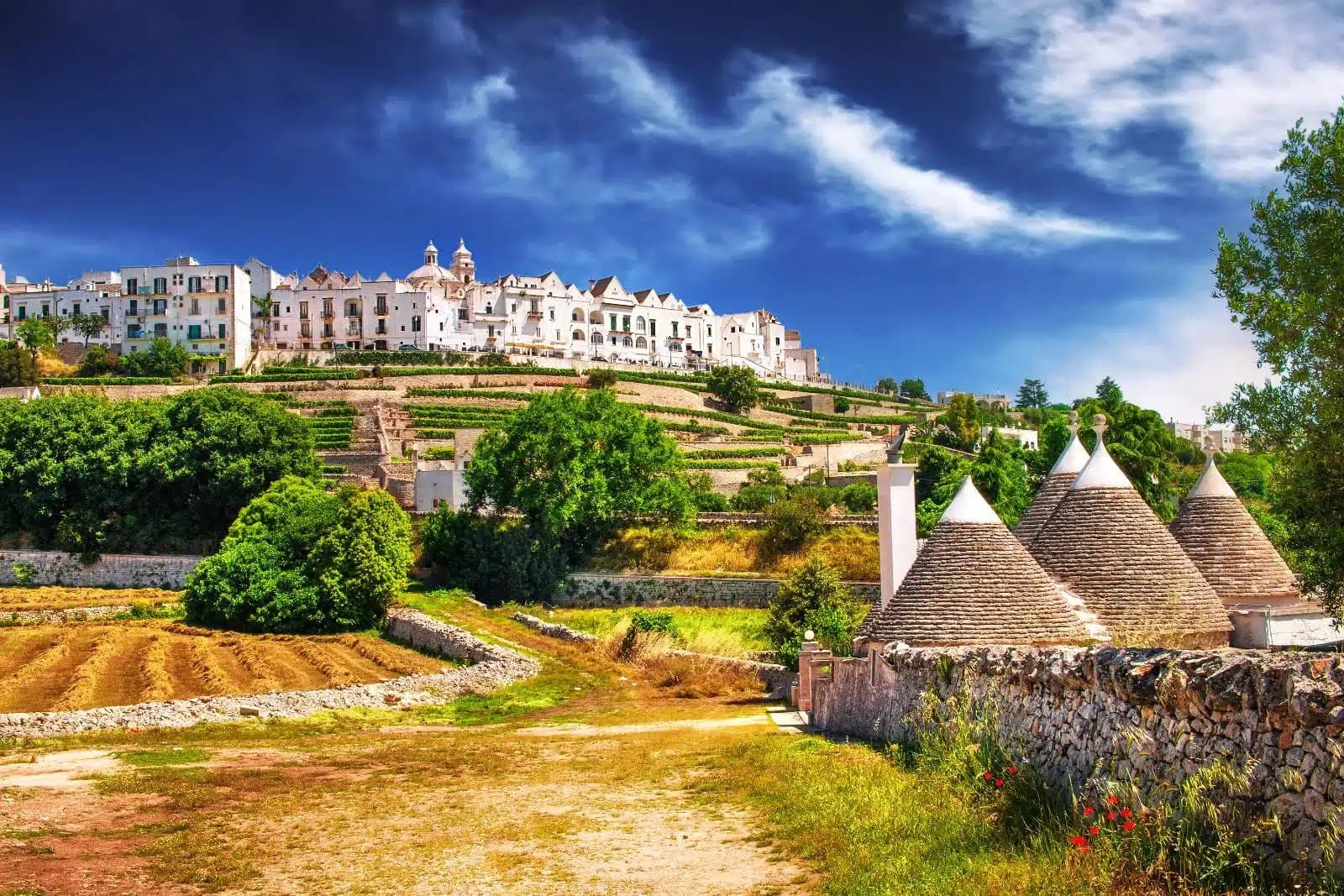
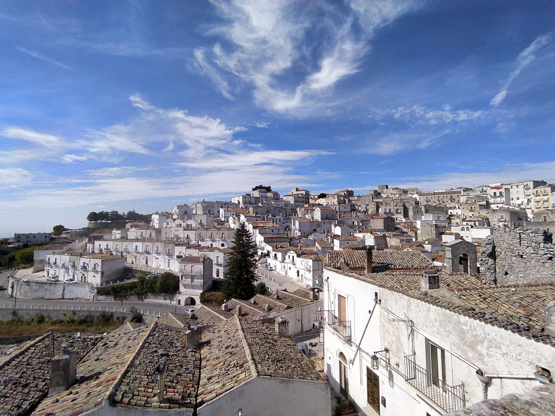
Bovino sits at 646 meters on a terrace of the Monti Dauni above the Cervaro valley, thirty-five kilometers southwest of Foggia. The Roman name Vibinum is recorded by Pliny and Polybius; in 323 BC the town fought the Samnite Wars on the Roman side. The Norman count Drogo built the castle in the eleventh century, Frederick II expanded it in the thirteenth, and the Guevara dukes turned it into a residential palace in the seventeenth century, inhabited by the family until 1961.
The coffered ceilings and the hanging garden hosted Torquato Tasso, Giovan Battista Marino, Maria Theresa of Austria, and Pope Benedict XIII. The concattedrale of Santa Maria Assunta, originally built in 1231 in Apulian Romanesque style, was destroyed by the 1930 Irpinia earthquake and reconsecrated in 1936. Eight hundred sculpted stone portals across the centro storico are the work of local masters; the town carries both Borghi più belli and Bandiera Arancione signals.
The Sunday letter
We haven’t written Bovino’s letter yet.
One town every Sunday, with the photo, the food, the festa. Be there when this one comes up. Free, by Peter & Sophia from Pietrasanta.
By subscribing you agree to Substack’s Terms of Use, our Privacy Policy and our Information collection notice.


What to see
Castello Ducale (Palazzo dei Guevara)
Norman castle built by Count Drogo, expanded by Frederick II, turned into a Guevara ducal palace in the seventeenth century and inhabited until 1961.
Concattedrale di Santa Maria Assunta
Romanesque cathedral of 1231, destroyed by the 1930 Irpinia earthquake and reconsecrated in 1936, co-cathedral of the Archdiocese of Foggia-Bovino.
Centro storico
Medieval hilltop village with eight hundred sculpted stone portals carved by local masters, ringed by the surviving walls of the castrum.
Belvedere sul Cervaro
Panoramic terrace above the Cervaro valley, the Tavoliere visible to the east and the Daunian peaks rising west.
The slow-trip planner
Building a trip? Find where Bovino fits in a slow Italy circuit.
Answer five questions. We will shape a geographically coherent slow trip from the 1,000 Italian towns most travelers skip. Yours to save and share.
Living here
- Population 2,973
- In-betweeni
- Pharmacy in town
- High school within a 30-minute drive
- Train station in the comune
- Nearest airport Bari / Brindisi, 1 h 40 min drive
- Regional capital Bari, 1 h 43 min drive
Tags & datadesignations · numbers · sources
Recognised as
The numbers
- Elevation: 646 m
- Population: 2,973
- Surface area: 84.93 km²
These figures were compiled from public directories — ISTAT, OpenStreetMap, Wikidata — and from the official listings of the guides named on this page. Town details change; verify with official sources before you travel.
Close by
More towns near Bovino

Savignano Irpino
Province: Avellino
A 718-meter stone borgo above the Cervaro valley on the Campania-Apulia border, called Savignano di Puglia until 1963.
Ariano Irpino
Province: Avellino
The City of the Three Hills at 788 meters, where Roger II promulgated the Assizes of 1140 and majolica kilns still fire.

Celle di San Vito
Province: Foggia
The smallest commune in Puglia, 148 residents at 726 meters in the Monti Dauni, one of two Franco-Provençal-speaking villages in the south.

Faeto
Province: Foggia
The highest village in Puglia at 820 meters, Franco-Provençal-speaking since 1266, on a Monti Dauni ridge below Monte Cornacchia.
Biccari
Province: Foggia
A Subappennino Dauno borgo at 450 meters under Monte Cornacchia, the highest peak in Puglia at 1,151 meters, with a Byzantine tower at its core.
🎨 Borghi più belli d'Italia
More Borghi più belli d'Italia towns in Apulia
Cisternino
Province: Brindisi
An Itria valley borgo on the southern Murgia at 394 meters, whitewashed, Cittaslow since 2003 and Cittaslow City of the Year in 2014.
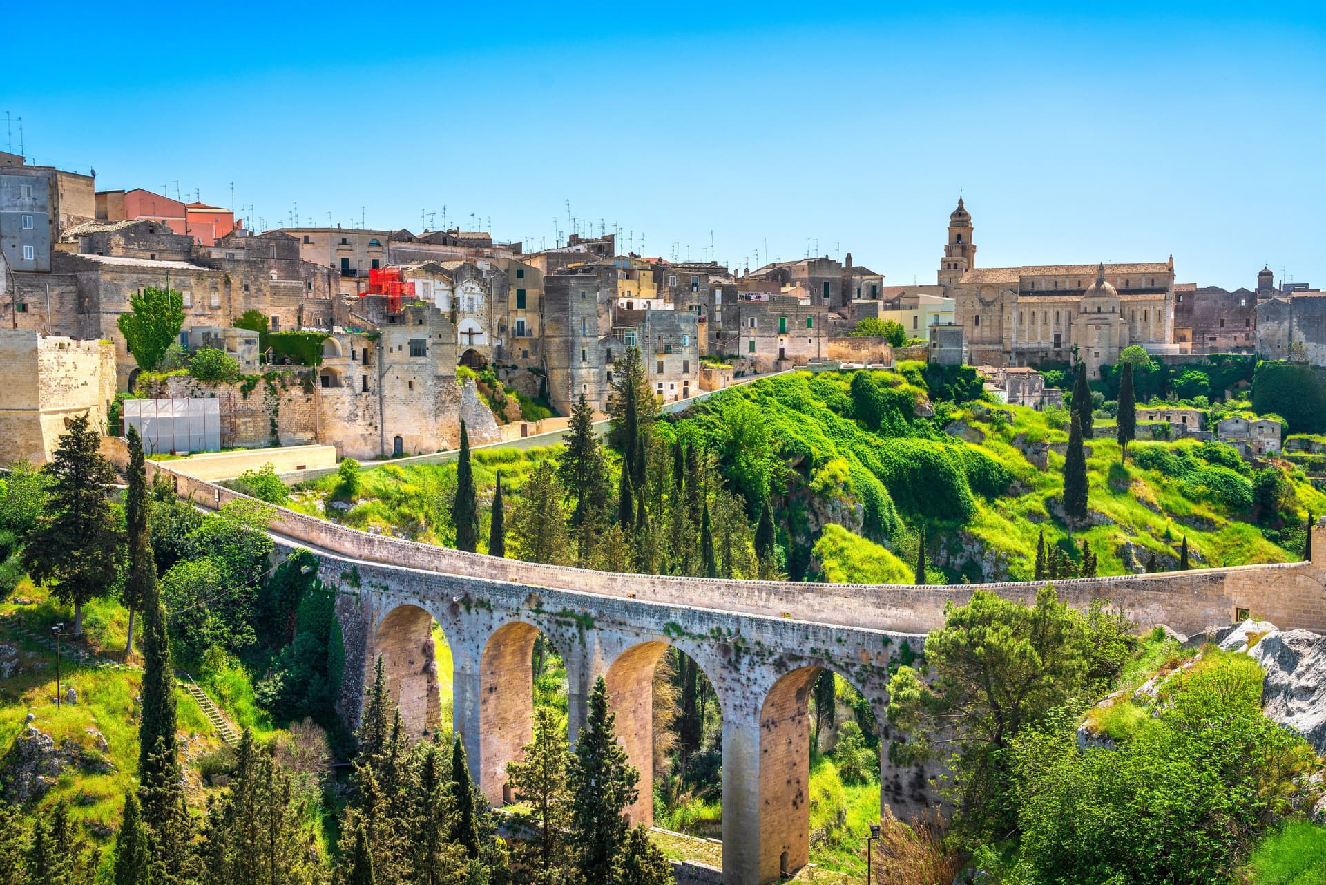
Gravina in Puglia
Province: Bari
Puglia's deepest gravina — a 42,700-resident Bari-province town built on the lip of a 100m-deep limestone canyon, with the 18th-c Ponte Acquedotto walkway across the gorge that James Bond crossed in No Time to Die, a network of rupestrian cave churches in the cliff face, and the four-signal BPB + Cittaslow + Via Francigena + Parco Nazionale combination.
Locorotondo
Province: Bari
The round white town on the Itria valley ridge at 410 meters, with cummerse roofs the rest of Puglia does not have.
Maruggio
Province: Taranto
Salento's Knights of Malta borgo — a fortified Borgo più Bello on a low Ionian hill with 11 km of Bandiera Blu coast at Campomarino, Negroamaro and Primitivo vines pressing into the centro, and a unique commanderie history that made it the Order's southern Italian headquarters for 600 years.
Monte Sant'Angelo
Province: Foggia
The Gargano peak at 843 meters where the Archangel Michael appeared in 490, the oldest western shrine to him, UNESCO since 2011.