
Apulia · Bari
Locorotondo
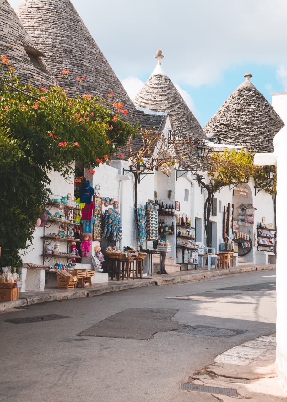
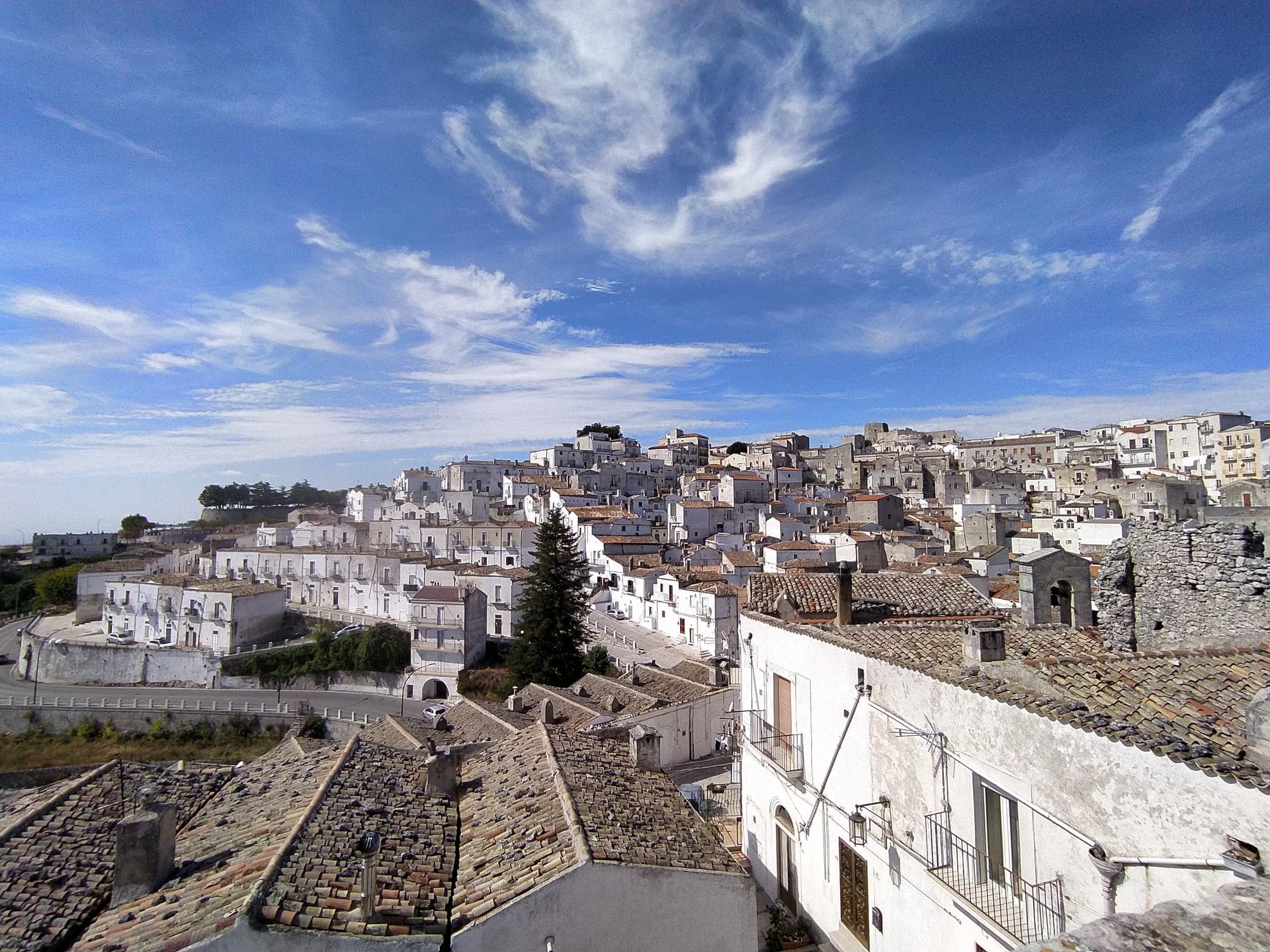
The round white town on the Itria valley ridge, with cummerse roofs the rest of Puglia does not have.
Known for
CUMMERSE
Whitewashed houses with double-pitch limestone-slab roofs, an architectural type unique to Locorotondo's centro storico.
VALLE D'ITRIA BALCONY
Terrace town at 410 meters looking south over the trulli countryside toward Alberobello, Cisternino and Martina Franca.
LOCOROTONDO DOC
White DOC wine from Verdeca and Bianco d'Alessano, made still or sparkling, from 1,650 hectares around the town.
When to visit
Best · Apr–Oct
- J
- F
- M
- A
- M
- J
- J
- A
- S
- O
- N
- D
- Best
- Hot or crowded
- Quiet
- Mostly closed
The festa: San Rocco, 15 August
Why come
Locorotondo sits on a natural terrace, the high edge of the Valle d'Itria looking south over the trulli countryside between Alberobello, Cisternino and Martina Franca. The name means round place: the centro storico is a perfect circle of whitewashed houses, and the architecture is unique to this town. The cummerse are stone houses with steep pitched roofs covered in two thin layers of limestone slabs, a profile that exists nowhere else in Puglia.
The streets between them run in concentric arcs and are narrow enough to lose the sun by mid-afternoon. Both the Borghi più belli d'Italia and the Touring Club's Bandiera Arancione recognize the place. The town also makes a white DOC wine from Verdeca and Bianco d'Alessano grapes, grown on 1,650 hectares of vineyards across the surrounding plateau, plus a Città dell'Olio membership for the oil that comes off the same hills.
The Sunday letter
We haven’t written Locorotondo’s letter yet.
One town every Sunday, with the photo, the food, the festa. Be there when this one comes up. Free, by Peter & Sophia from Pietrasanta.
By subscribing you agree to Substack’s Terms of Use, our Privacy Policy and our Information collection notice.


What to see
Centro storico
Circular old town of whitewashed cummerse, an architectural type with double-pitch limestone-slab roofs found only here.
Villa Garibaldi
Public garden on the ridge with the widest panoramic view over the Itria valley and its trulli countryside.
Chiesa Madre di San Giorgio
Eighteenth-century parish church on the highest point of the historic center, with a neoclassical façade and a tall central nave.
Locorotondo DOC vineyards
1,650 hectares of Verdeca and Bianco d'Alessano on the plateau around the town, the source of the local white DOC wine.
The slow-trip planner
Building a trip? Find where Locorotondo fits in a slow Italy circuit.
Answer five questions. We will shape a geographically coherent slow trip from the 1,000 Italian towns most travelers skip. Yours to save and share.
We recommend
Where to eat and stay
Not our picks, but places the guides put their name to — a Michelin star, a Gambero Rosso fork, a Slow Food snail, a Michelin Key for the hotels. Worth a table, a counter, or a night when you pass through.
Leonardo Trulli ResortHotel
A place in the Michelin hotel guide, at Leonardo Trulli Resort.
Ottolire ResortHotel
Ottolire Resort carries one Michelin Key.
Living here
- Population 13,930
- In-betweeni
- Pharmacy in town
- High school within a 30-minute drive
- Train station in the comune
- Nearest airport Bari / Brindisi, 1 h 8 min drive
- Regional capital Bari, 56 min drive
Tags & datadesignations · numbers · sources
The numbers
- Elevation: 410 m
- Population: 13,930
- Surface area: 48.19 km²
These figures were compiled from public directories — ISTAT, OpenStreetMap, Wikidata — and from the official listings of the guides named on this page. Town details change; verify with official sources before you travel.
Featured on
Locorotondo appears on this themed pick from our Collections:
Close by
More towns near Locorotondo
Cisternino
Province: Brindisi
An Itria valley borgo on the southern Murgia at 394 meters, whitewashed, Cittaslow since 2003 and Cittaslow City of the Year in 2014.
Alberobello
Province: Bari
The Itria valley town built entirely of trulli, 1,500 corbelled limestone cones in two quarters, UNESCO since 1996.
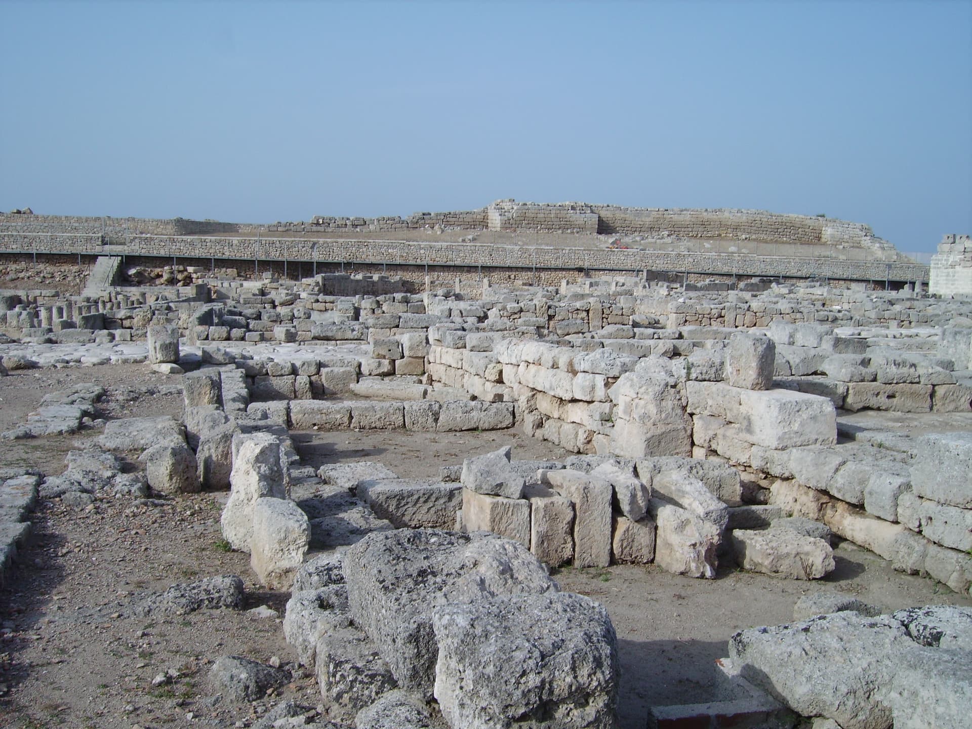
Fasano
Province: Brindisi
A Brindisi-province town from the Adriatic up to the Itria escarpment, holding the Roman ruins of Egnazia, the Selva, and Europe's second-largest safari park.
Martina Franca
Province: Taranto
Puglia's second Baroque city after Lecce, on the Itria ridge at 431 meters, with an opera festival in its ducal courtyard since 1975.
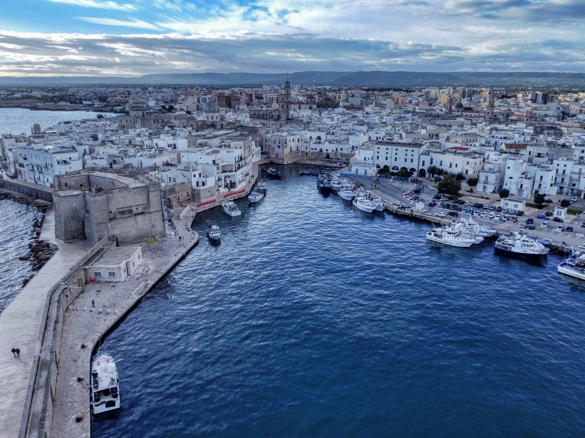
Monopoli
Province: Bari
An Adriatic walled town forty kilometers south of Bari, the Charles V castle on the headland, 156 square kilometers of coastline behind it.
🎨 Borghi più belli d'Italia
More Borghi più belli d'Italia towns in Apulia
Bovino
Province: Foggia
A Daunian Mountains hill town at 646 meters above the Cervaro valley, Roman Vibinum, with a Norman-Swabian castle later turned into a Guevara ducal palace.
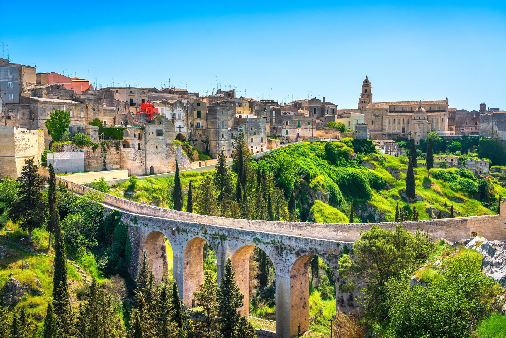
Gravina in Puglia
Province: Bari
Puglia's deepest gravina — a 42,700-resident Bari-province town built on the lip of a 100m-deep limestone canyon, with the 18th-c Ponte Acquedotto walkway across the gorge that James Bond crossed in No Time to Die, a network of rupestrian cave churches in the cliff face, and the four-signal BPB + Cittaslow + Via Francigena + Parco Nazionale combination.
Maruggio
Province: Taranto
Salento's Knights of Malta borgo — a fortified Borgo più Bello on a low Ionian hill with 11 km of Bandiera Blu coast at Campomarino, Negroamaro and Primitivo vines pressing into the centro, and a unique commanderie history that made it the Order's southern Italian headquarters for 600 years.
Monte Sant'Angelo
Province: Foggia
The Gargano peak at 843 meters where the Archangel Michael appeared in 490, the oldest western shrine to him, UNESCO since 2011.

Otranto
Province: Lecce
Italy's easternmost city, eighty kilometers from Albania, with a Norman mosaic floor and the bones of 813 martyrs in the cathedral.