
Apulia · Foggia
Monte Sant'Angelo
The Gargano peak at 843 meters where the Archangel Michael appeared in 490, the oldest western shrine to him, UNESCO since 2011.
Known for
ARCHANGEL CAVE
Sanctuary built over the cave of Michael's 490 apparition, the oldest western shrine to the Archangel, UNESCO 2011 as a Lombard place of power.
VIA SACRA
Final stop of the Lombard pilgrim route to Jerusalem, a fixed station on the medieval southern arm of the Via Francigena.
PANE DI MONTE
Mountain bread of the Gargano, certified Città del Pane, baked from grano duro with a thick crust to keep through a pilgrim's day on the road.
When to visit
Best · May–Oct
- J
- F
- M
- A
- M
- J
- J
- A
- S
- O
- N
- D
- Best
- Hot or crowded
- Quiet
- Mostly closed
The festa: Michele, 29 September
Why come
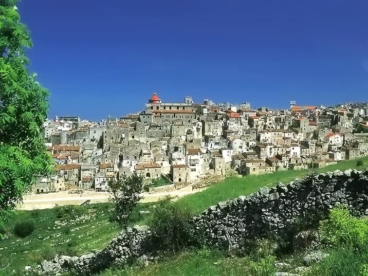
Monte Sant'Angelo sits at 843 meters on the southern slope of the Gargano promontory, the highest inhabited settlement in the massif. The town is built around a cave where, according to tradition, the Archangel Michael appeared to the bishop of Siponto in 490. A first sanctuary was raised over the cave in 493; by the seventh century the Lombards of the Duchy of Benevento had made it the principal Michaeline shrine in the West and a fixed stop on the pilgrimage route to Jerusalem now called the Via Sacra Langobardorum.
The Santuario di San Michele Arcangelo is what they built and what later centuries extended. UNESCO inscribed it in 2011 as one of seven sites in the serial property 'Longobards in Italy: Places of Power (568-774 A. D.)' The Gargano National Park surrounds the commune, beech and oak forests at this altitude, the Adriatic visible to the east on clear days.
The Sunday letter
We haven’t written Monte Sant'Angelo’s letter yet.
One town every Sunday, with the photo, the food, the festa. Be there when this one comes up. Free, by Peter & Sophia from Pietrasanta.
By subscribing you agree to Substack’s Terms of Use, our Privacy Policy and our Information collection notice.


What to see
Santuario di San Michele Arcangelo
Cave sanctuary of the Archangel Michael at the heart of town, founded in 493 over the apparition site, UNESCO World Heritage since 2011.
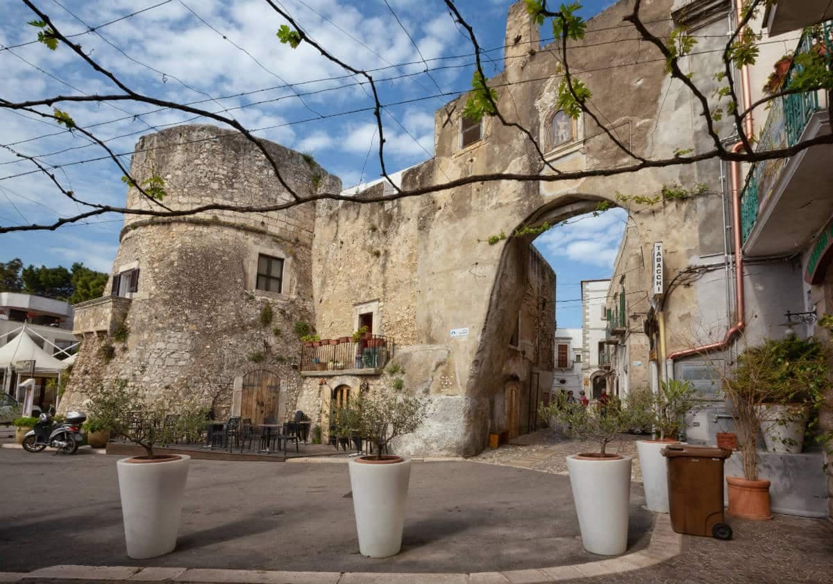
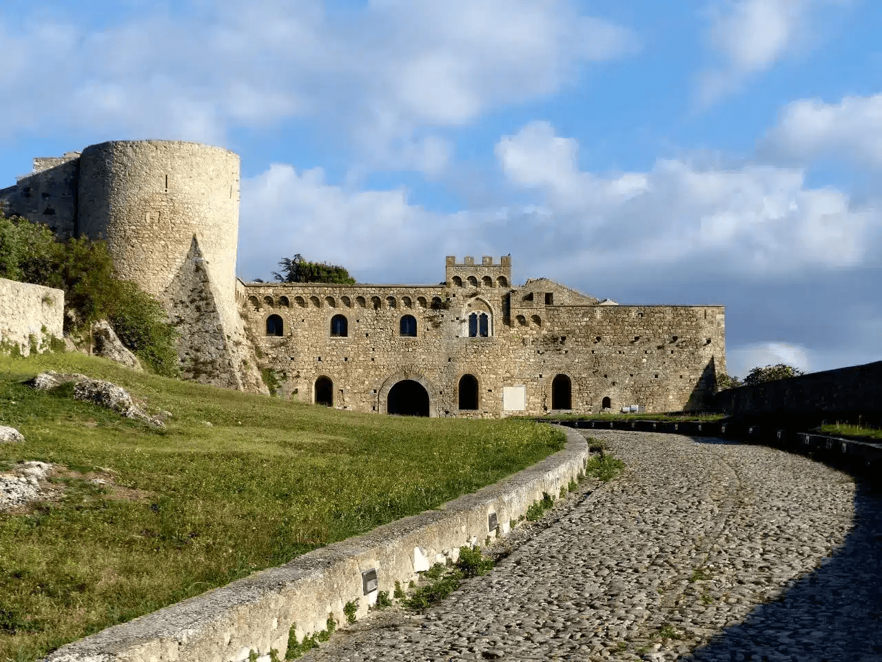
Castello di Monte Sant'Angelo
Norman-Swabian-Aragonese castle above the sanctuary, expanded over five centuries on the highest point of the town, with views across the Gargano.
Tomba di Rotari
Twelfth-century baptistery near the sanctuary, long misidentified as the tomb of the Lombard king Rotari, a fragment of the older religious complex.
Rione Junno
Oldest residential quarter, narrow stepped alleys of small whitewashed houses with single-pitch roofs, the working medieval pilgrim quarter below the sanctuary.
Parco Nazionale del Gargano
National park surrounding the commune, beech and oak forest on the Gargano massif, the Foresta Umbra reserve a short drive northeast.
The slow-trip planner
Building a trip? Find where Monte Sant'Angelo fits in a slow Italy circuit.
Answer five questions. We will shape a geographically coherent slow trip from the 1,000 Italian towns most travelers skip. Yours to save and share.
We recommend
Where to eat and stay
Not our picks, but places the guides put their name to — a Michelin star, a Gambero Rosso fork, a Slow Food snail, a Michelin Key for the hotels. Worth a table, a counter, or a night when you pass through.
Casa li JalantuùmeneRistorante
Casa li Jalantuùmene has two Gambero Rosso forks (81/100) to its name.
Il Rifugio dell'Elda HotelRistorante
Il Rifugio dell'Elda Hotel has one Gambero Rosso fork (78/100) to its name.
Li JalantuùmeneRistorante
Li Jalantuùmene has a spot in the Michelin Guide to its name.
Living here
- Population 11,353
- Off the beaten pathi
- Pharmacy in town
- High school within a 30-minute drive
- Nearest airport Bari / Brindisi, 2 h 19 min drive
- Regional capital Bari, 2 h 22 min drive
Tags & datadesignations · numbers · sources
The numbers
- Elevation: 843 m
- Population: 11,353
- Surface area: 245.13 km²
These figures were compiled from public directories — ISTAT, OpenStreetMap, Wikidata — and from the official listings of the guides named on this page. Town details change; verify with official sources before you travel.
Close by
More towns near Monte Sant'Angelo
Vico del Gargano
Province: Foggia
A Gargano hill town at 445 meters with a Norman castle, a kiss alley, and DOP citrus groves stepping down to the Adriatic.

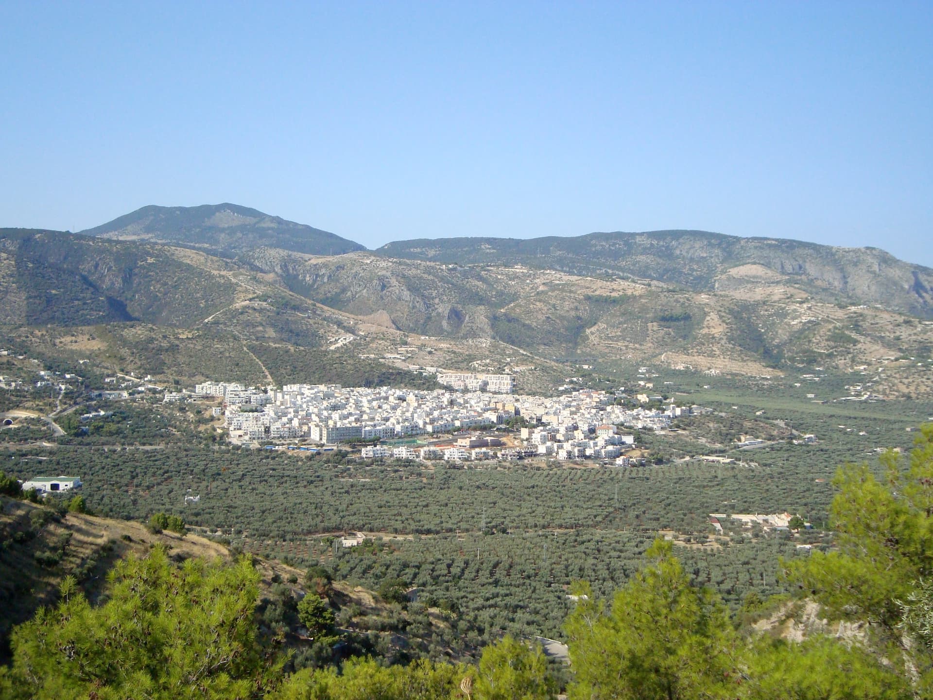
San Giovanni Rotondo
Province: Foggia
The Gargano town where Padre Pio lived for fifty-two years, second-largest pilgrimage site in Italy, with a Renzo Piano sanctuary that seats 6,500.
Rodi Garganico
Province: Foggia
A Gargano promontory town above the Adriatic, citrus capital of the peninsula, with DOP oranges and lemons grown since the Middle Ages.
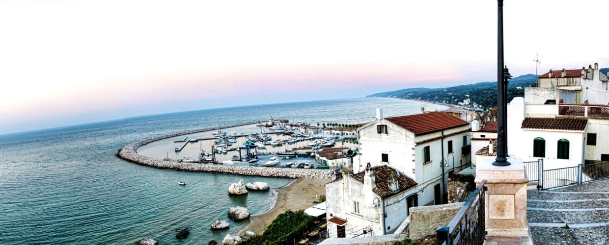
Mattinata
Province: Foggia
The only Apulian town that faces south on the Adriatic, the white amphitheater of the eastern Gargano with the Zagare sea stacks below.
Peschici
Province: Foggia
A Gargano cliff-top village above the Adriatic with a Norman castle of 1023, white houses spilling toward the sea and trabucchi on the headlands.
🎨 Borghi più belli d'Italia
More Borghi più belli d'Italia towns in Apulia
Bovino
Province: Foggia
A Daunian Mountains hill town at 646 meters above the Cervaro valley, Roman Vibinum, with a Norman-Swabian castle later turned into a Guevara ducal palace.
Cisternino
Province: Brindisi
An Itria valley borgo on the southern Murgia at 394 meters, whitewashed, Cittaslow since 2003 and Cittaslow City of the Year in 2014.
Gravina in Puglia
Province: Bari
Puglia's deepest gravina — a 42,700-resident Bari-province town built on the lip of a 100m-deep limestone canyon, with the 18th-c Ponte Acquedotto walkway across the gorge that James Bond crossed in No Time to Die, a network of rupestrian cave churches in the cliff face, and the four-signal BPB + Cittaslow + Via Francigena + Parco Nazionale combination.
Locorotondo
Province: Bari
The round white town on the Itria valley ridge at 410 meters, with cummerse roofs the rest of Puglia does not have.
Maruggio
Province: Taranto
Salento's Knights of Malta borgo — a fortified Borgo più Bello on a low Ionian hill with 11 km of Bandiera Blu coast at Campomarino, Negroamaro and Primitivo vines pressing into the centro, and a unique commanderie history that made it the Order's southern Italian headquarters for 600 years.