
Apulia · Foggia
Peschici
A Gargano cliff-top village above the Adriatic with a Norman castle of 1023, white houses spilling toward the sea and trabucchi on the headlands.
Known for
NORMAN CASTLE
Castle of 1023 on the cliff above the port, the cornerstone of Norman Gargano defense and the village's defining silhouette.
GARGANO COVES
Limestone coast of sandy bays and cliff sections, including San Nicola, Cala Lunga and Cala Santa Croce, Bandiera Blu Adriatic.
TRABUCCHI
Adriatic timber fishing platforms on the headlands, in use since at least the eighteenth century, several still operating in summer.
When to visit
Best · May–Sep
- J
- F
- M
- A
- M
- J
- J
- A
- S
- O
- N
- D
- Best
- Hot or crowded
- Quiet
- Mostly closed
The festa: Elia, 20 July
Why come
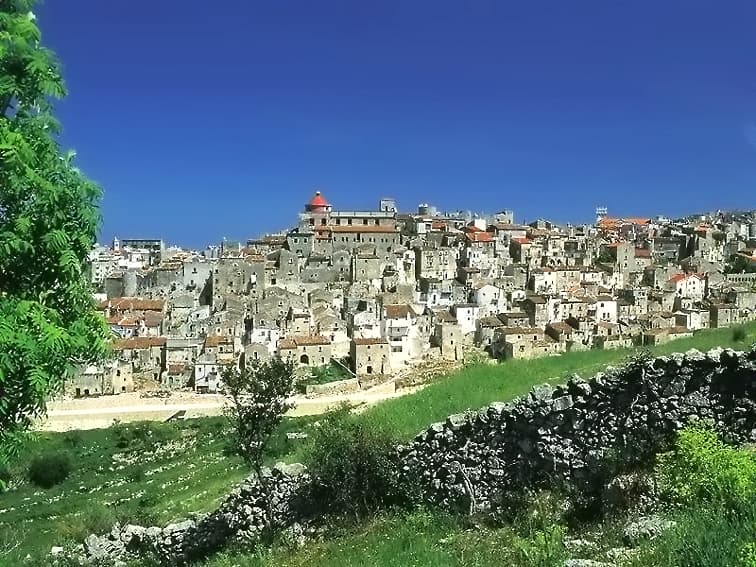
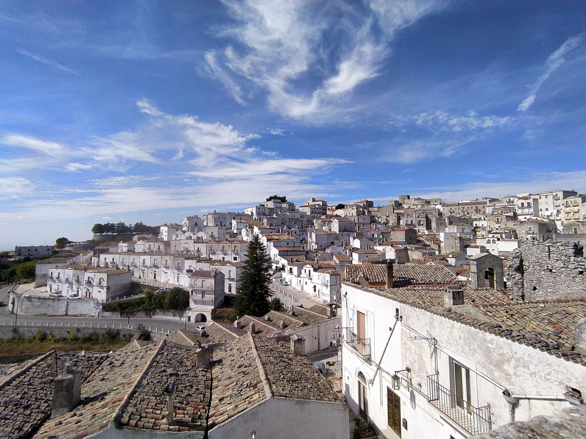
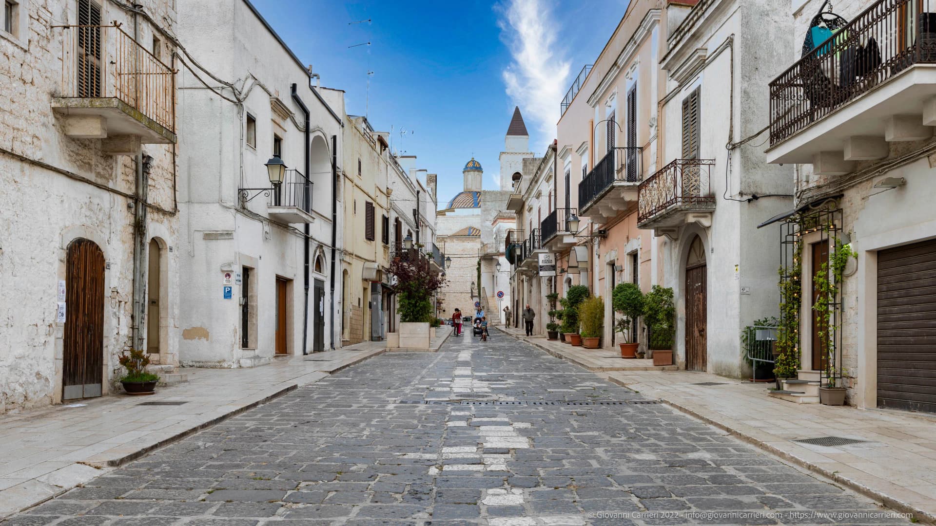
Peschici sits on a karst spur on the northeastern Gargano, 91 meters above the Adriatic, nine kilometers east of San Menaio and nineteen kilometers west of Vieste. The town was founded by the Daunians and later taken by the Romans; the present village grew around the Norman castle built in 1023 on the cliff overlooking the small port below. The whitewashed houses with their flat or shallow-domed roofs are unusual on the Gargano and read at distance as a single bright crown above the cliff.
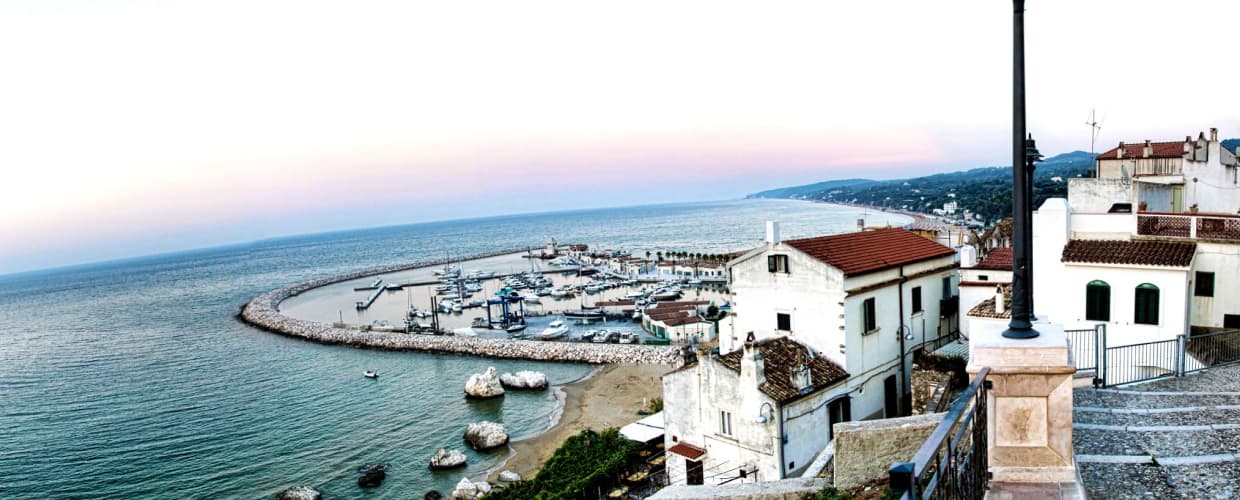
The municipal coastline runs through Gargano National Park territory: sandy bays between limestone headlands, the karst pine forest immediately inland, and the trabucchi, the Adriatic fishing platforms of timber and rope used here since at least the eighteenth century, several still working. Beaches at San Nicola, Cala Lunga and Cala Santa Croce alternate with cliff sections accessible only from the sea.
The Sunday letter
We haven’t written Peschici’s letter yet.
One town every Sunday, with the photo, the food, the festa. Be there when this one comes up. Free, by Peter & Sophia from Pietrasanta.
By subscribing you agree to Substack’s Terms of Use, our Privacy Policy and our Information collection notice.


What to see
Castello Normanno-Svevo
Norman castle of 1023 on the cliff overlooking the port, expanded by the Swabians, the village's defining landmark visible from sea and inland.
Centro storico
White cliff-top village of small whitewashed houses with flat or shallow-domed roofs, unusual on the Gargano, terraced down the karst spur toward the sea.
Baia di San Nicola
Sandy bay west of the village beneath limestone cliffs, with the small medieval monastery of San Nicola on the headland above the beach.
Trabucchi della Costa
Adriatic wooden fishing platforms on the headlands east and west of town, in continuous use since the eighteenth century, several still working.
Parco Nazionale del Gargano
National park covering the inland half of the commune, karst pine forest and limestone gorges, the Foresta Umbra core reserve a short drive south.
The slow-trip planner
Building a trip? Find where Peschici fits in a slow Italy circuit.
Answer five questions. We will shape a geographically coherent slow trip from the 1,000 Italian towns most travelers skip. Yours to save and share.
We recommend
Where to eat and stay
Not our picks, but places the guides put their name to — a Michelin star, a Gambero Rosso fork, a Slow Food snail, a Michelin Key for the hotels. Worth a table, a counter, or a night when you pass through.
Porta di BassoRistorante
Porta di Basso carries two Gambero Rosso forks (83/100), plus a spot in the Michelin Guide.
Al Trabucco da MimìTrattoria
Al Trabucco da Mimì holds one Gambero Rosso prawn.
EdenRistorante
Eden holds a Gambero Rosso listing.
Living here
- Population 4,283
- Very remotei
- Pharmacy in town
- High school within a 30-minute drive
- Nearest airport Bari / Brindisi, 3 h 1 min drive
- Regional capital Bari, 3 h 5 min drive
Tags & datadesignations · numbers · sources
The numbers
- Elevation: 91 m
- Population: 4,283
- Surface area: 49.39 km²
These figures were compiled from public directories — ISTAT, OpenStreetMap, Wikidata — and from the official listings of the guides named on this page. Town details change; verify with official sources before you travel.
Close by
More towns near Peschici

Vieste
Province: Foggia
The Gargano headland of whitewashed alleys on a white limestone cliff, with the Pizzomunno sea stack standing 26 meters offshore.
Vico del Gargano
Province: Foggia
A Gargano hill town at 445 meters with a Norman castle, a kiss alley, and DOP citrus groves stepping down to the Adriatic.
Monte Sant'Angelo
Province: Foggia
The Gargano peak at 843 meters where the Archangel Michael appeared in 490, the oldest western shrine to him, UNESCO since 2011.
Rodi Garganico
Province: Foggia
A Gargano promontory town above the Adriatic, citrus capital of the peninsula, with DOP oranges and lemons grown since the Middle Ages.
Mattinata
Province: Foggia
The only Apulian town that faces south on the Adriatic, the white amphitheater of the eastern Gargano with the Zagare sea stacks below.
💎 Borghi Autentici
More Borghi Autentici towns in Apulia
Acquaviva delle Fonti
Province: Bari
A Murge town at 300 meters between Bari and the Itria valley, named for its springs and a DOP red onion.
Biccari
Province: Foggia
A Subappennino Dauno borgo at 450 meters under Monte Cornacchia, the highest peak in Puglia at 1,151 meters, with a Byzantine tower at its core.
Campi Salentina
Province: Lecce
A Salento plain town fifteen kilometers north of Lecce, founded after the Saracen raids of 926, with a Frederician castle that became a Paladini-Enriquez marquisate.
Casamassima
Province: Bari
The blue town of the Murge, twenty kilometers south of Bari, its centro storico painted with copper-blue lime after the 1658 plague spared its residents.
Cassano delle Murge
Province: Bari
A Murge foothills town at 341 meters at the gate of the Alta Murgia park, with the 1,300-hectare Foresta Mercadante mostly inside its territory.