
Sardinia · Nuoro
Posada
The capital of the Baronia, a 3,000-person village on a 71-meter rock above the Rio Posada, with a 13th-century tower over the valley.
Known for
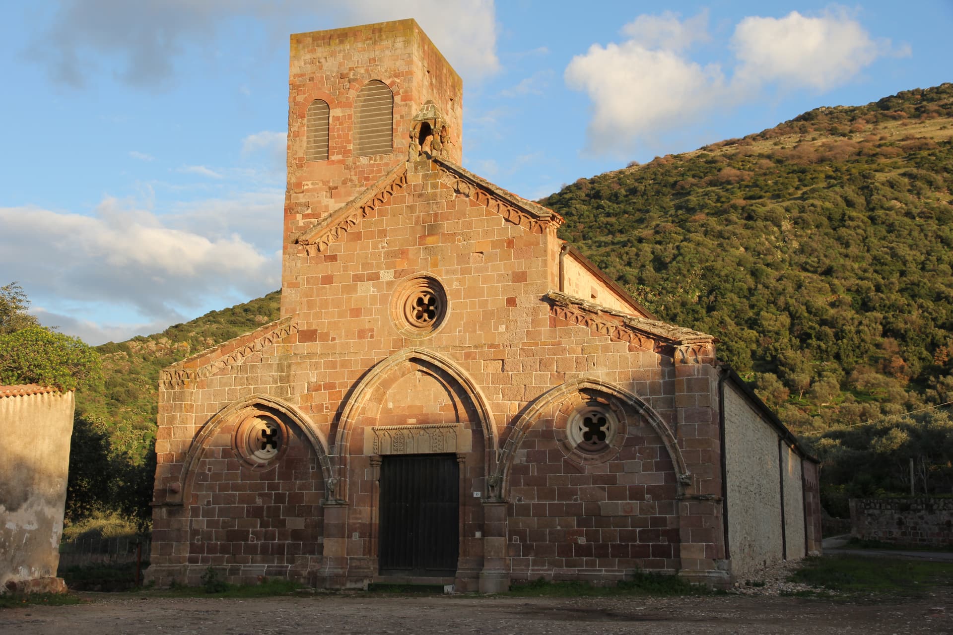
CASTELLO DELLA FAVA
Thirteenth-century tower on a rock above the Rio Posada, residence of Eleanor of Arborea and seat of the Carroz barons.
RIO POSADA
The river that runs from the Tepilora hills to the Tyrrhenian, with dunes and beaches at the village mouth.
BARONIA CAPITAL
Historic capital of the Baronia, the eastern coastal region of the Nuorese, and a member of the Borghi più belli d'Italia.
When to visit
Best · May–Oct
- J
- F
- M
- A
- M
- J
- J
- A
- S
- O
- N
- D
- Best
- Hot or crowded
- Quiet
- Mostly closed
The festa: Antonio abate, 17 January
Why come
Posada sits on a rock above the mouth of the Rio Posada, the village center but the Castello della Fava rising to 71 meters above the plain. The castle has a square panoramic tower from the thirteenth century, served as a holiday residence for Eleanor of Arborea, and was fought over between the Giudicato of Arborea and Aragon. Title-wise it became the seat of the Baron of Posada, a Carroz fief created in 1431 and formally ended in 1856.
From the tower the view runs down the river valley to the dunes and beaches around San Giovanni di Posada and out to the Tyrrhenian. The village inside the walls is small, stacked along a single climbing street, recognized among the Borghi più belli d'Italia and treated by Sardinia as the historic capital of the Baronia. The Parco Naturale Regionale di Tepilora, declared in 2014, runs inland from here.
The Sunday letter
We haven’t written Posada’s letter yet.
One town every Sunday, with the photo, the food, the festa. Be there when this one comes up. Free, by Peter & Sophia from Pietrasanta.
By subscribing you agree to Substack’s Terms of Use, our Privacy Policy and our Information collection notice.


What to see
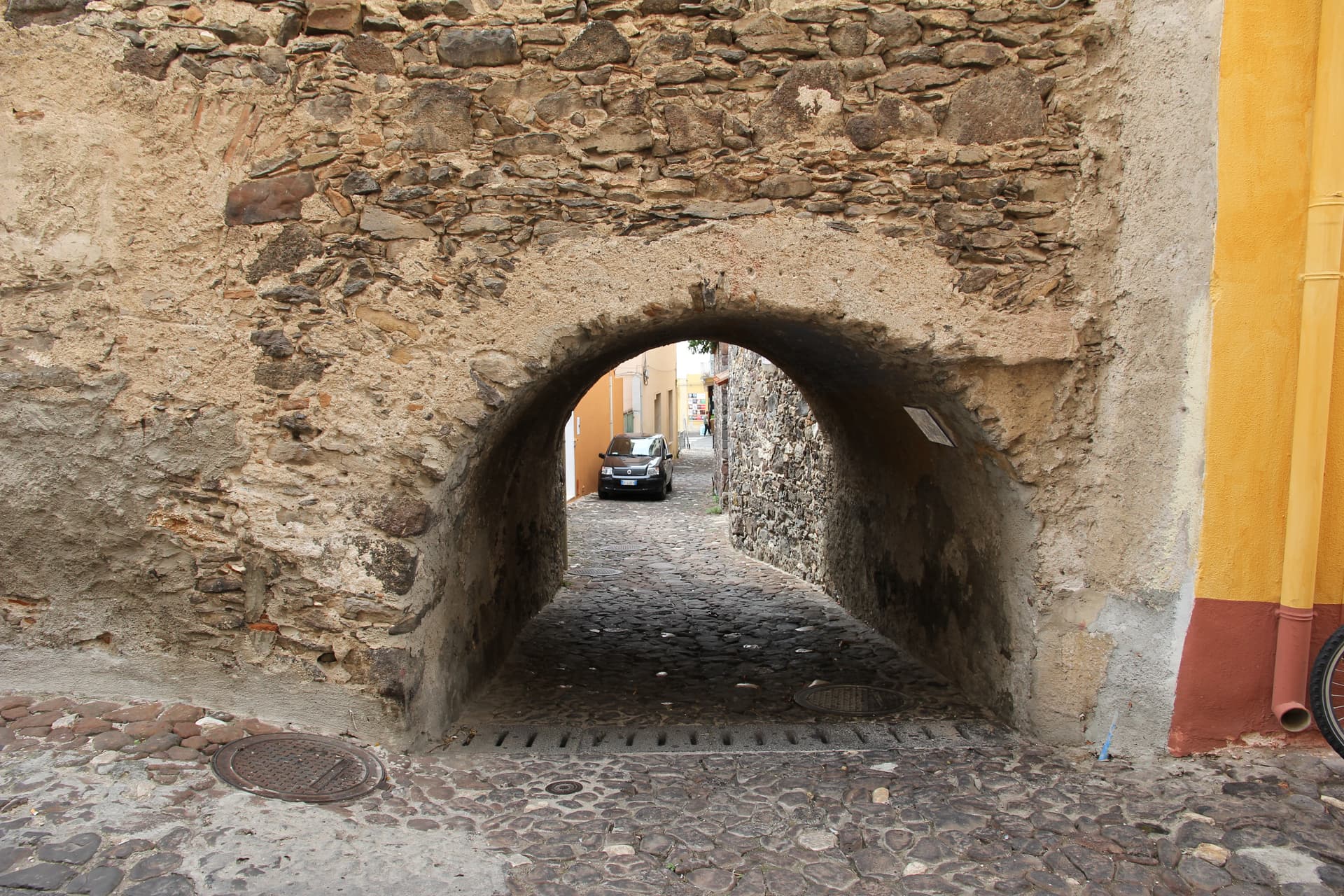
Castello della Fava
Thirteenth-century square tower on a 71-meter rock above the Rio Posada valley, named for a legend involving Saracen besiegers and a sack of beans.
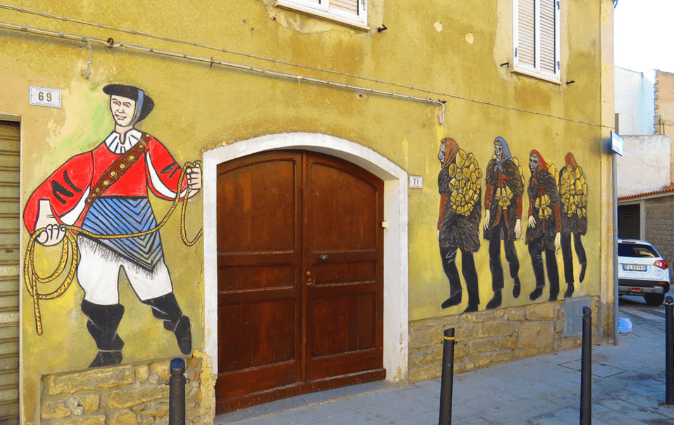
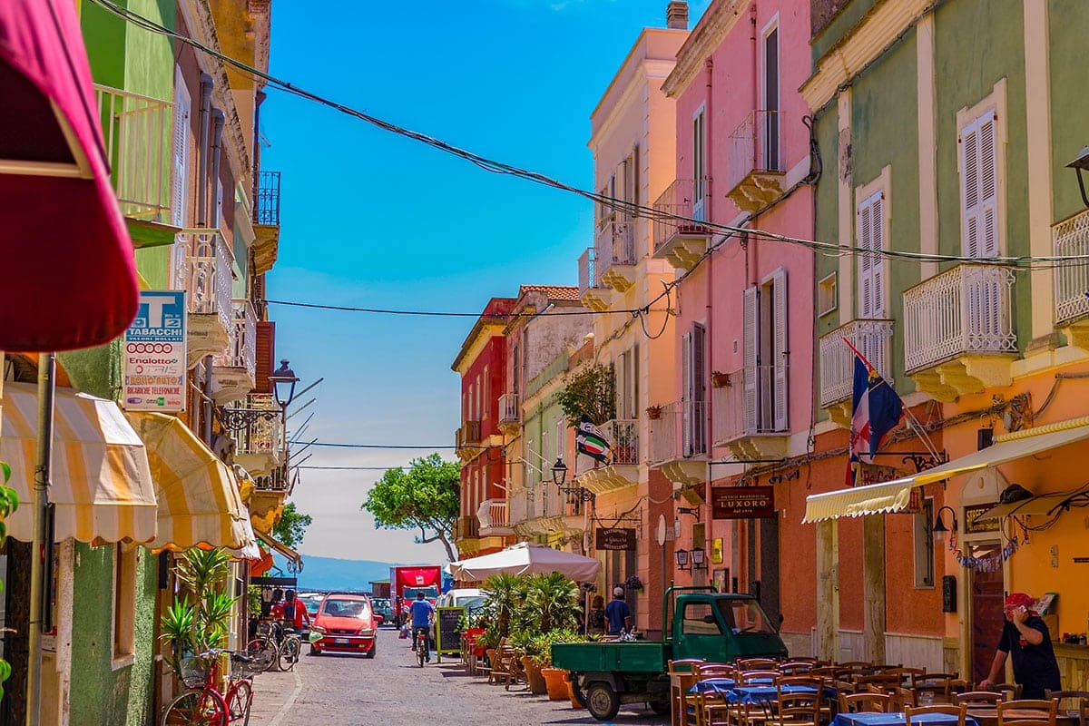
Centro storico
Stone village stacked along a single climbing street below the castle, member of the Borghi più belli d'Italia.
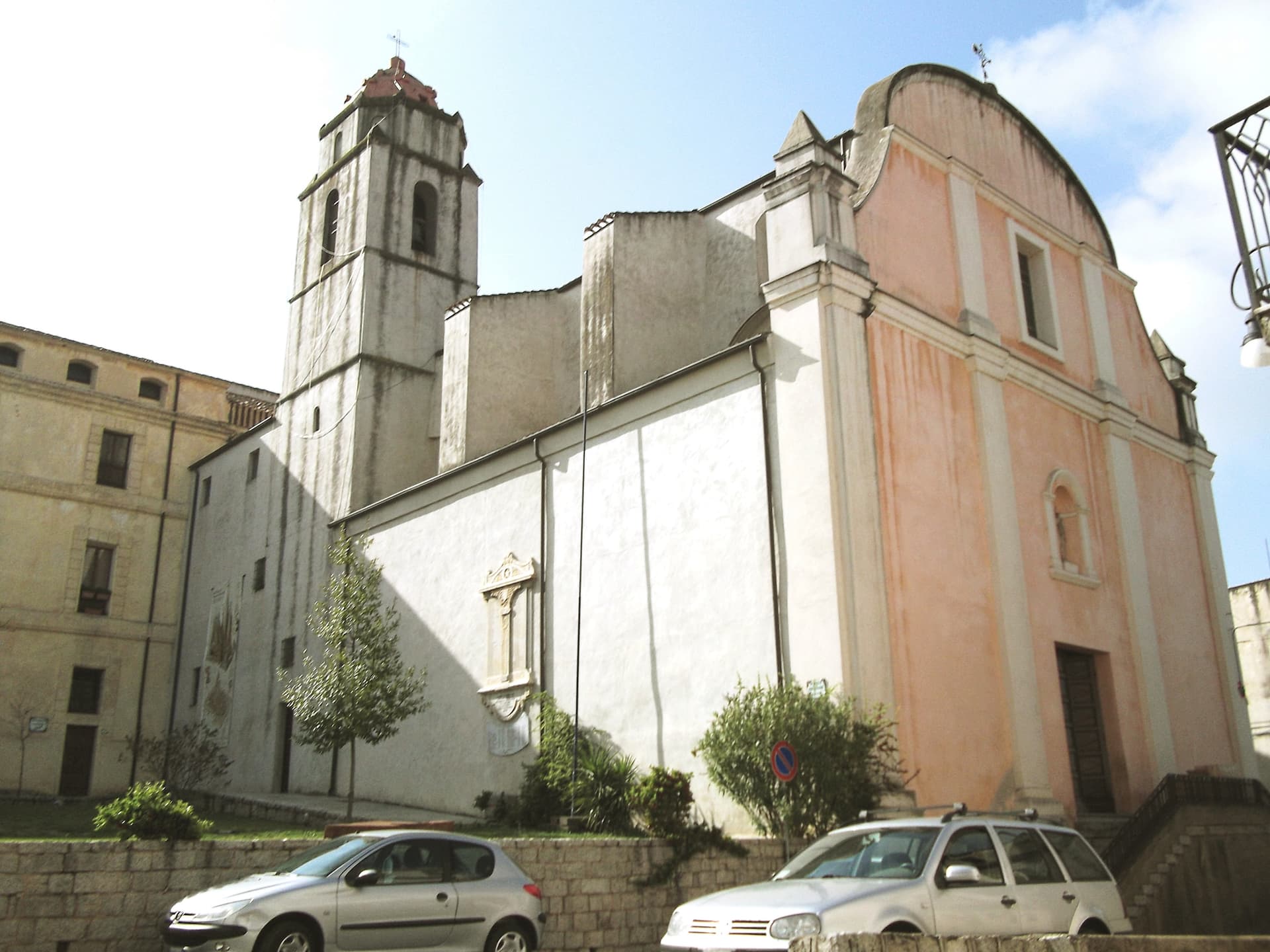
Chiesa di Sant'Antonio Abate
Parish church of Posada, the religious center of the medieval village below the castle keep.
Foce del Rio Posada
River mouth and dune system at San Giovanni di Posada, a few kilometers below the castle, with the Tyrrhenian coast beyond.
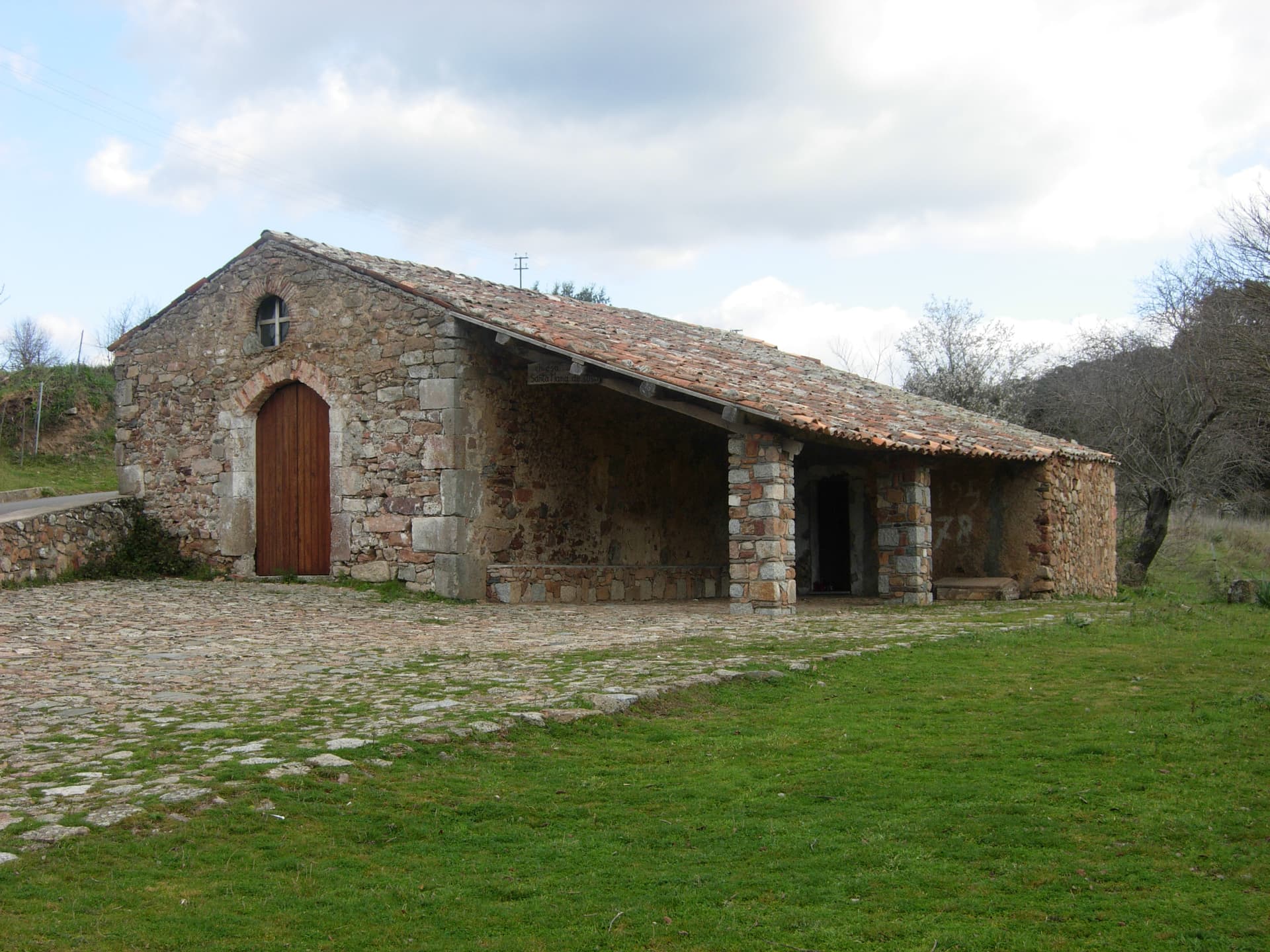
Parco Naturale di Tepilora
Regional park declared in 2014, inland from Posada, covering oak forest and the upper Rio Posada watershed.
The slow-trip planner
Building a trip? Find where Posada fits in a slow Italy circuit.
Answer five questions. We will shape a geographically coherent slow trip from the 1,000 Italian towns most travelers skip. Yours to save and share.
Living here
- Population 3,019
- In-betweeni
- Pharmacy in town
- High school within a 30-minute drive
- Nearest airport Sardinia, 3 h 44 min drive
- Regional capital Cagliari, 3 h 32 min drive
Tags & datadesignations · numbers · sources
Recognised as
The numbers
- Elevation: 37 m
- Population: 3,019
- Surface area: 32.77 km²
These figures were compiled from public directories — ISTAT, OpenStreetMap, Wikidata — and from the official listings of the guides named on this page. Town details change; verify with official sources before you travel.
Close by
More towns near Posada
Orosei
Province: Nuoro
A small Baroque town at 19 meters in the Cedrino valley, two kilometers from the limestone gulf whose southern coves are reached only by boat.

Galtellì
Province: Nuoro
Grazia Deledda's 'Canne al vento' set — a 2,354-resident Baronia borgo under the Monte Tuttavista in Sardinia's northeast, with the triple Borghi Autentici + Bandiera Arancione + Città del Vino signal, the 11th-c Cattedrale di San Pietro (Sardinia's first), and the entire centro recognised as the Parco Letterario Grazia Deledda for being the literal setting of her 1913 Nobel-trajectory novel.
Oliena
Province: Nuoro
A Supramonte village at the foot of Monte Corrasi, source of Cannonau Nepente, base camp for Tiscali and the Lanaitto valley.
Mamoiada
Province: Nuoro
The Barbagia village where the Mamuthones come out on January 17, twelve men in black sheepskins carrying thirty kilos of cowbells.

Dorgali
Province: Nuoro
A Supramonte town at 387 meters with the coastal frazione Cala Gonone, the Tiscali Nuragic village, and the 400-meter walls of Su Gorropu.
🎨 Borghi più belli d'Italia
More Borghi più belli d'Italia towns in Sardinia
Atzara
Province: Nuoro
A Mandrolisai wine village on the western Gennargentu, painted in the early twentieth century by Spanish costumbristas and the Sardinian Scuola di Atzara.
Bosa
Province: Oristano
A colour-washed riverside town on Sardinia's only navigable river, with a Malaspina castle on the hill and the tanneries of Sas Conzas along the Temo.
Carloforte
Province: Sud Sardegna
A Ligurian-speaking fishing town on the Isola di San Pietro, founded in 1738 by coral fishers returning from Tunisian Tabarka.
Castelsardo
Province: Sassari
A Doria sea fortress at 114 meters above the Gulf of Asinara, Genoese from 1100, Aragonese from 1448, Savoyard from the 1700s.
La Maddalena
Province: Sassari
The only inhabited town of a sixty-island granite archipelago between Sardinia and Corsica, and the place Giuseppe Garibaldi chose to die.