
Sardinia · Oristano
Bosa
A colour-washed riverside town on Sardinia's only navigable river, with a Malaspina castle on the hill and the tanneries of Sas Conzas along the Temo.
Known for
MALASPINA CASTLE
Thirteenth-century Tuscan fortress of the Malaspina di Spino Secco, called by the Aragonese the key to all Sardinia in the Sardinian-Catalan war.
MALVASIA DI BOSA
DOC sweet wine from the Planargia hills behind the town, in dry, semi-dry, natural sweet and sweet versions, one of Sardinia's classic dessert wines.
SAS CONZAS
Nineteenth-century tanneries lining the south bank of the Temo in identical industrial blocks, an intact piece of Sardinian industrial heritage.
When to visit
Best · May–Oct
- J
- F
- M
- A
- M
- J
- J
- A
- S
- O
- N
- D
- Best
- Hot or crowded
- Quiet
- Mostly closed
Why come
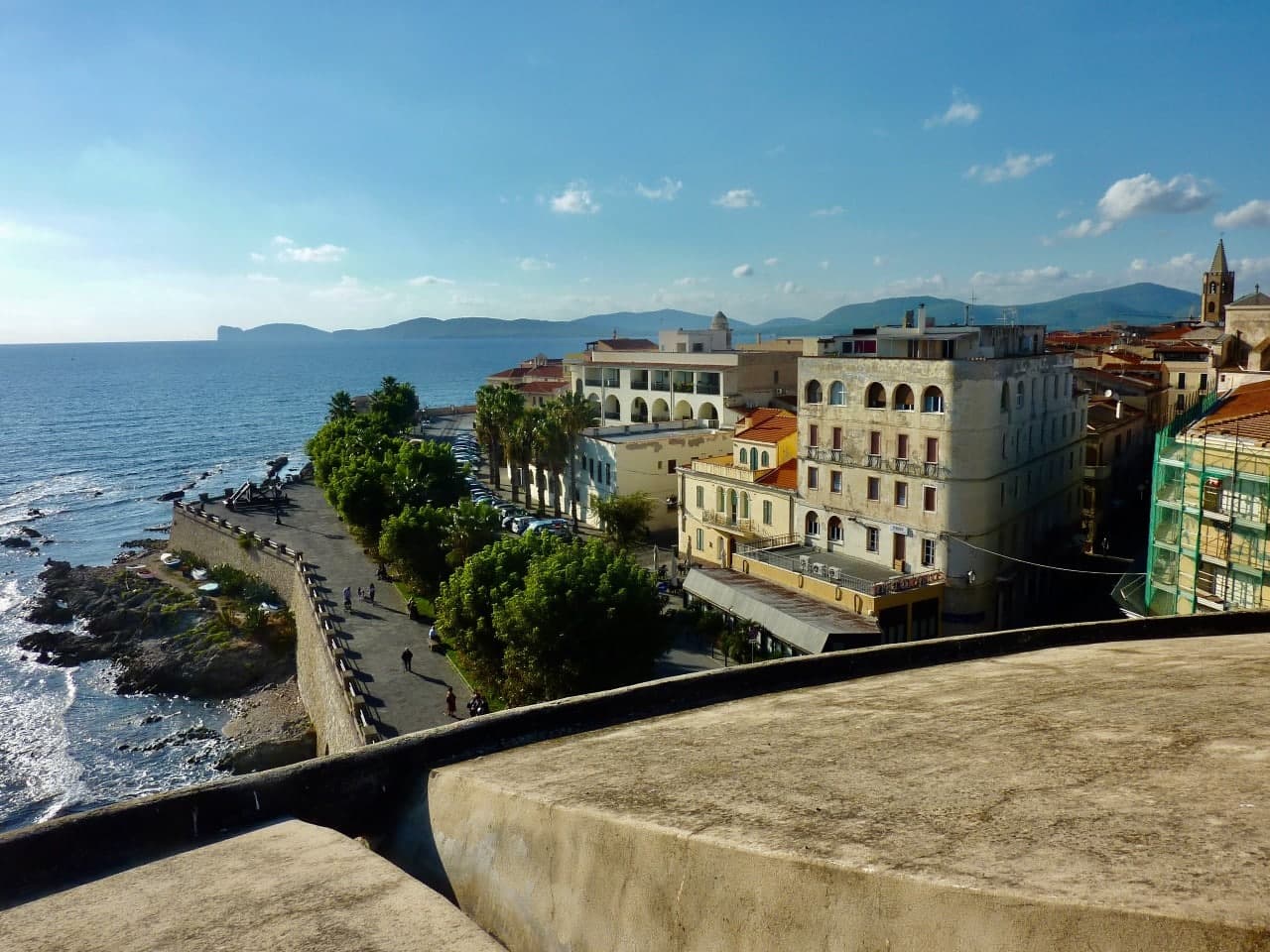
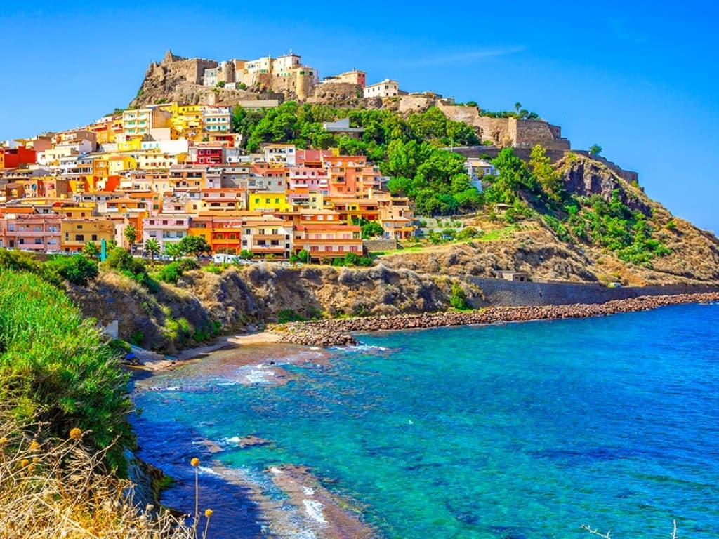
Bosa sits three kilometres inland from the western coast of Sardinia, on the north bank of the Temo, the only navigable river on the island. The Castello di Serravalle, built around the second half of the thirteenth century by the Tuscan Malaspina family of Spino Secco, dominates the town from the hill above the centro storico. During the Sardinian-Catalan war the Aragonese described it as one of the noblest castles in the world and the key to the entire island.
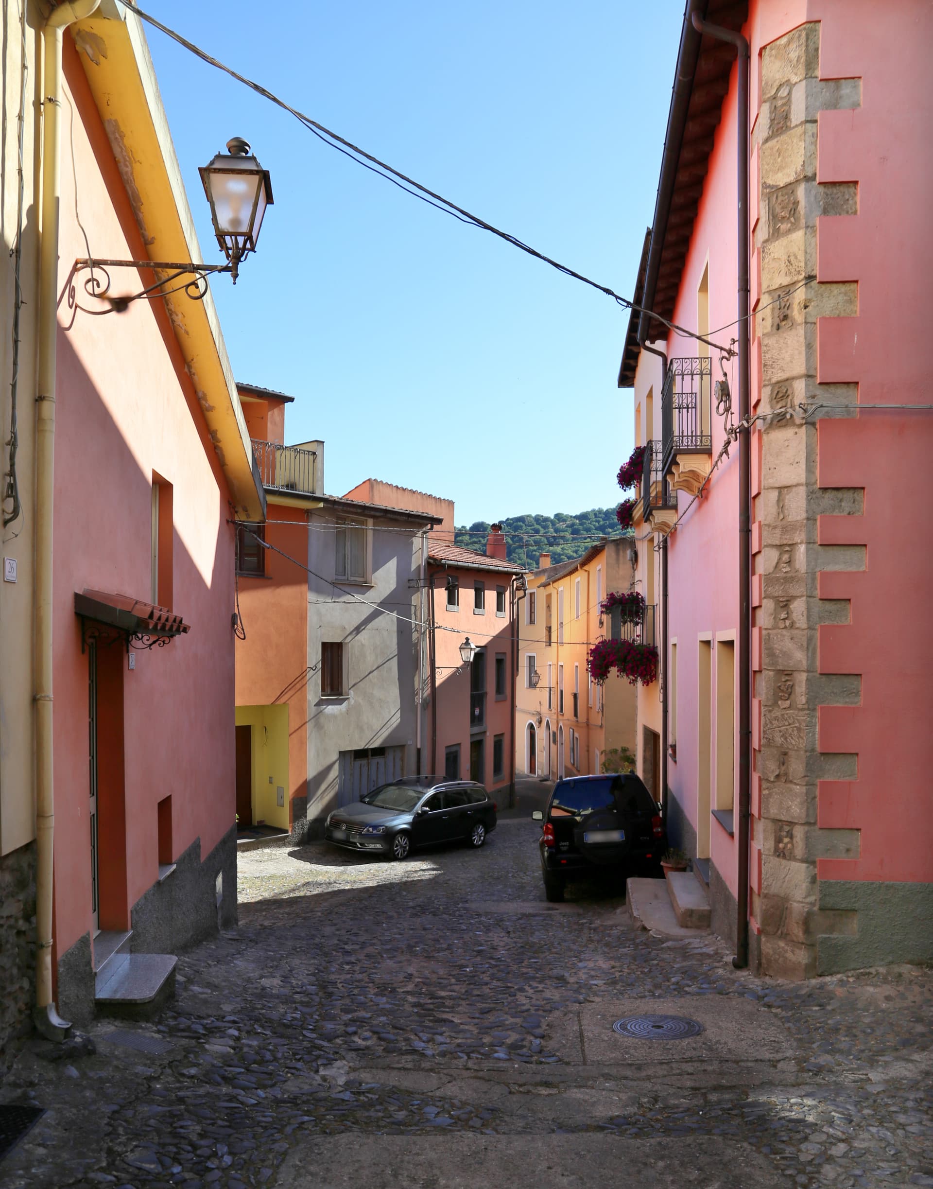
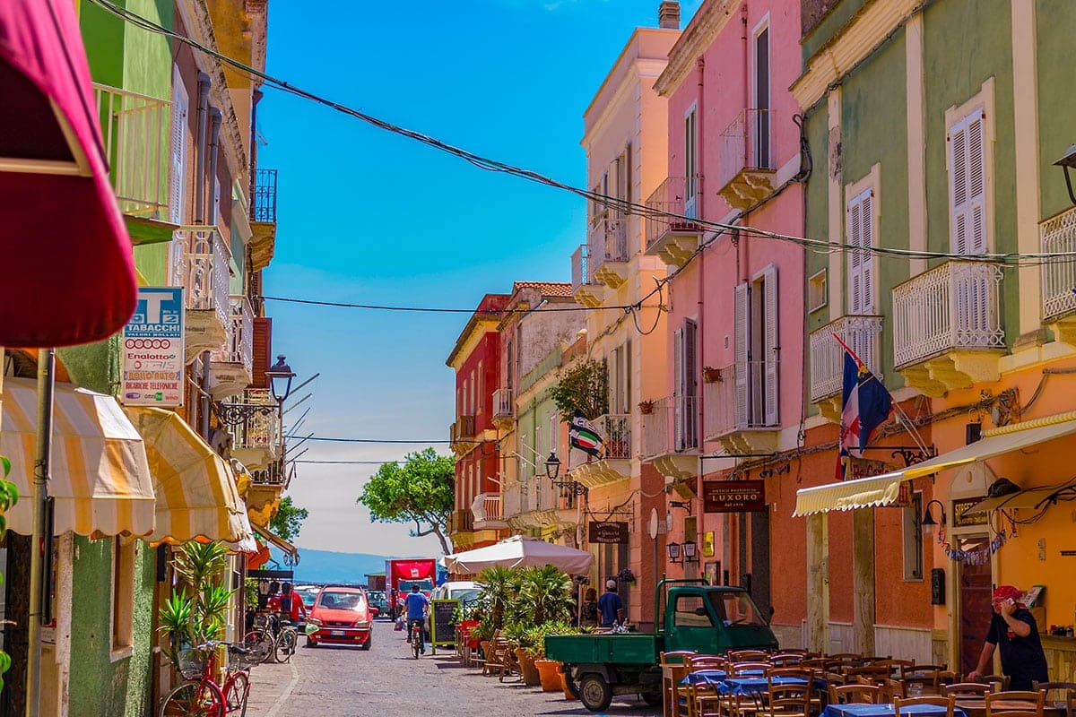
Below the castle, the houses of the Sa Costa quarter step down the slope in lines of pink, yellow, blue and green to the river. On the opposite bank stretches Sas Conzas, the nineteenth-century tannery district, identical industrial buildings with stone soaking tanks where Bosa hides were processed for export. The Planargia hills behind the town produce Malvasia di Bosa DOC, one of Sardinia's classic sweet wines, alongside olive oil.
The Sunday letter
We haven’t written Bosa’s letter yet.
One town every Sunday, with the photo, the food, the festa. Be there when this one comes up. Free, by Peter & Sophia from Pietrasanta.
By subscribing you agree to Substack’s Terms of Use, our Privacy Policy and our Information collection notice.

What to see
Castello di Serravalle (o dei Malaspina)
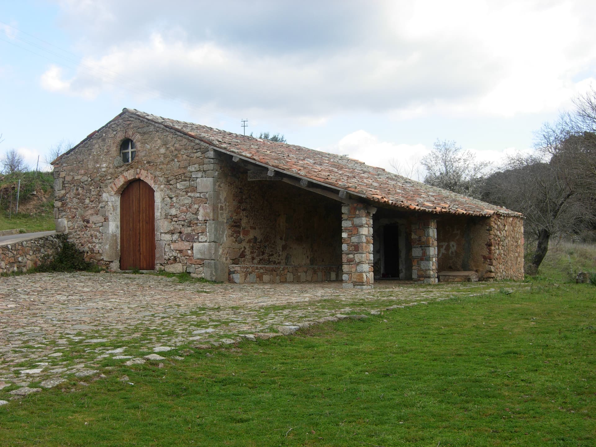
Thirteenth-century castle built by the Tuscan Malaspina family on the hill above the Temo, with the small chapel of Nostra Signora de sos Regnos Altos in its enclosure.
Sa Costa
Old quarter of pink, yellow and blue houses climbing the slope from the river to the Malaspina castle, the postcard image of Bosa.
Sas Conzas
Nineteenth-century riverside district of identical tannery buildings on the south bank of the Temo, an industrial heritage site with original stone soaking tanks.
Fiume Temo
Sardinia's only navigable river, six kilometres open to small boats from the sea to the town, lined with the colour-washed houses of the centro storico.
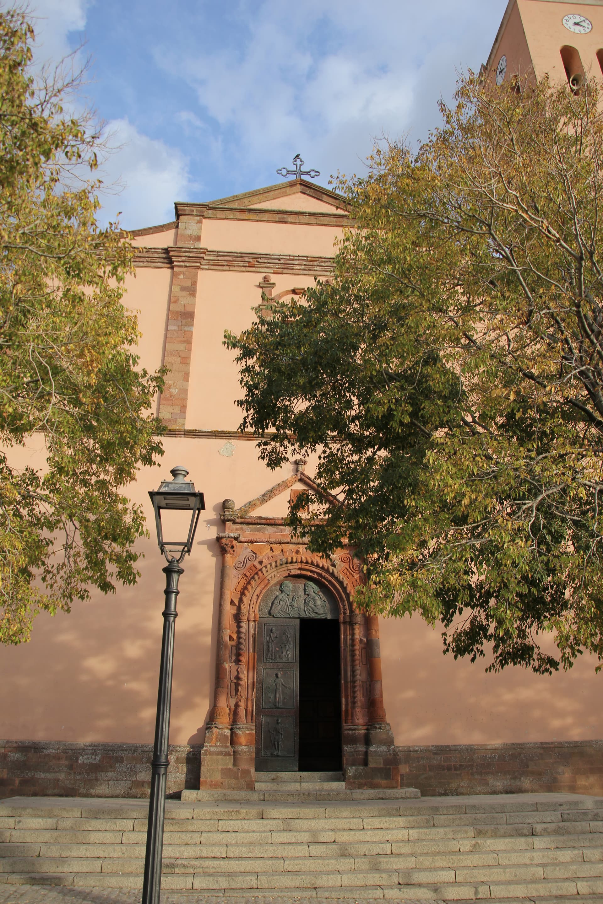
Cattedrale dell'Immacolata Concezione
Eighteenth-century cathedral on the Temo embankment, seat of the diocese of Alghero-Bosa, rebuilt over an earlier Romanesque structure.
The slow-trip planner
Building a trip? Find where Bosa fits in a slow Italy circuit.
Answer five questions. We will shape a geographically coherent slow trip from the 1,000 Italian towns most travelers skip. Yours to save and share.
Living here
- Population 7,487
- Very remotei
- Pharmacy in town
- High school within a 30-minute drive
- Nearest airport Sardinia, 2 h 57 min drive
- Regional capital Cagliari, 2 h 45 min drive
Tags & datadesignations · numbers · sources
The numbers
- Elevation: 10 m
- Population: 7,487
- Surface area: 128.02 km²
These figures were compiled from public directories — ISTAT, OpenStreetMap, Wikidata — and from the official listings of the guides named on this page. Town details change; verify with official sources before you travel.
Close by
More towns near Bosa
Montresta
Province: Oristano
A Planargia hill village of 438 people founded in 1746 by Maniot Greek families who left Corsica for new land in Sardinia.
Cuglieri
Province: Oristano
A Montiferru town at 428 meters, with the first minor basilica in Sardegna above it and the ruins of Punic Cornus below.
Santu Lussurgiu
Province: Oristano
A Montiferru village at 503 meters where the Carnival horse race runs through a steep stone street and saddlery has been made since 1923.
Alghero
Province: Sassari
The Catalan city of northwest Sardinia, repopulated by Peter IV of Aragon in 1354 and still speaking Algherese Catalan today.
Bolotana
Province: Nuoro
A Marghine hill village at 472 meters between mountain and Tirso valley, with a Welsh railway engineer's villa hidden in a four-hectare exotic garden.
🎨 Borghi più belli d'Italia
More Borghi più belli d'Italia towns in Sardinia
Atzara
Province: Nuoro
A Mandrolisai wine village on the western Gennargentu, painted in the early twentieth century by Spanish costumbristas and the Sardinian Scuola di Atzara.
Carloforte
Province: Sud Sardegna
A Ligurian-speaking fishing town on the Isola di San Pietro, founded in 1738 by coral fishers returning from Tunisian Tabarka.
Castelsardo
Province: Sassari
A Doria sea fortress at 114 meters above the Gulf of Asinara, Genoese from 1100, Aragonese from 1448, Savoyard from the 1700s.
La Maddalena
Province: Sassari
The only inhabited town of a sixty-island granite archipelago between Sardinia and Corsica, and the place Giuseppe Garibaldi chose to die.
Posada
Province: Nuoro
The capital of the Baronia, a 3,000-person village on a 71-meter rock above the Rio Posada, with a 13th-century tower over the valley.