Designation
Città del Vino
159 towns across 20 regions
Browse by region
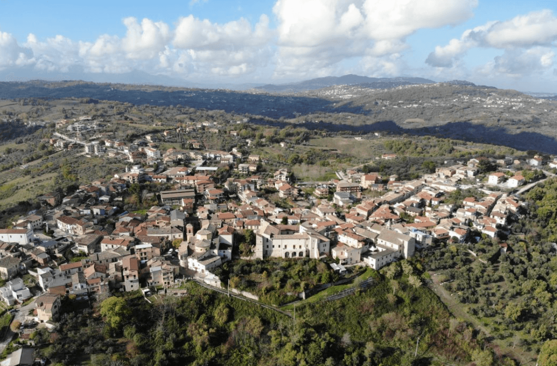
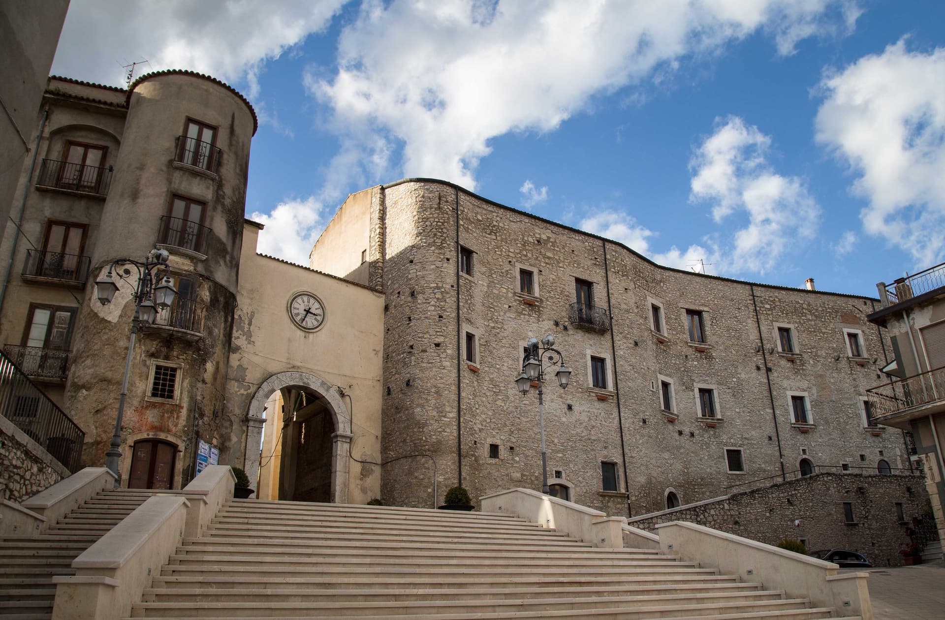
Abruzzo8
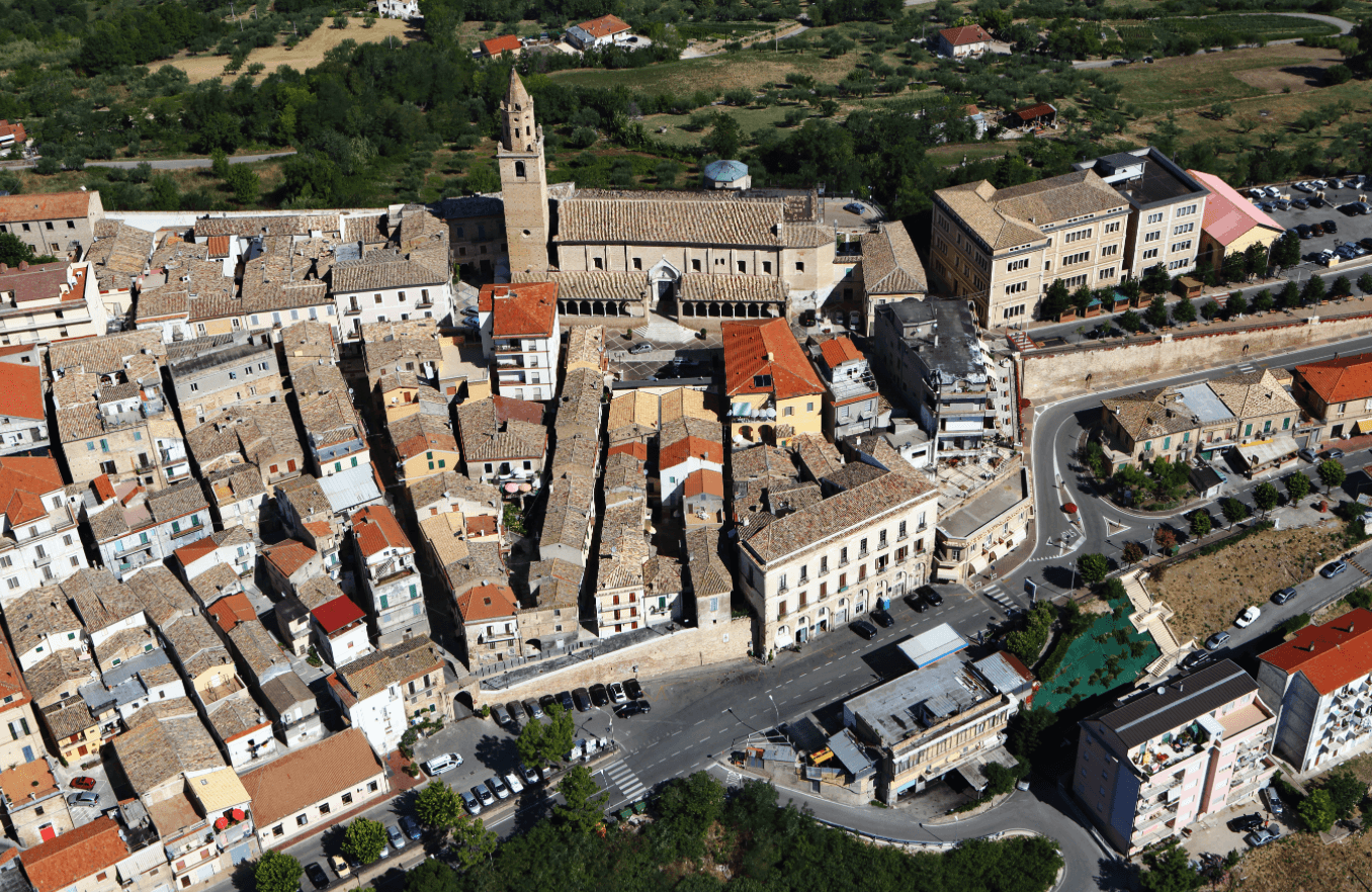
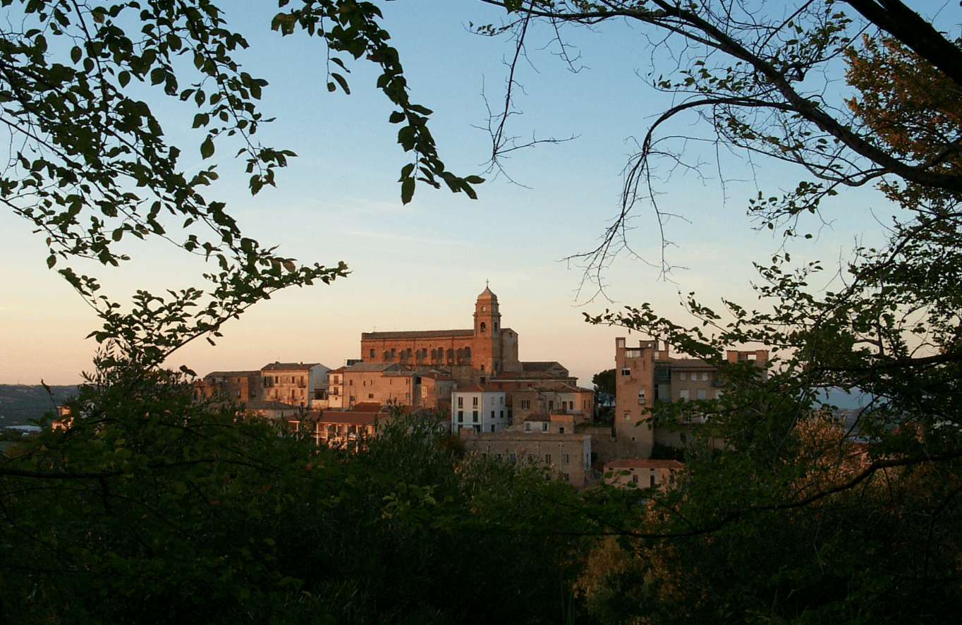
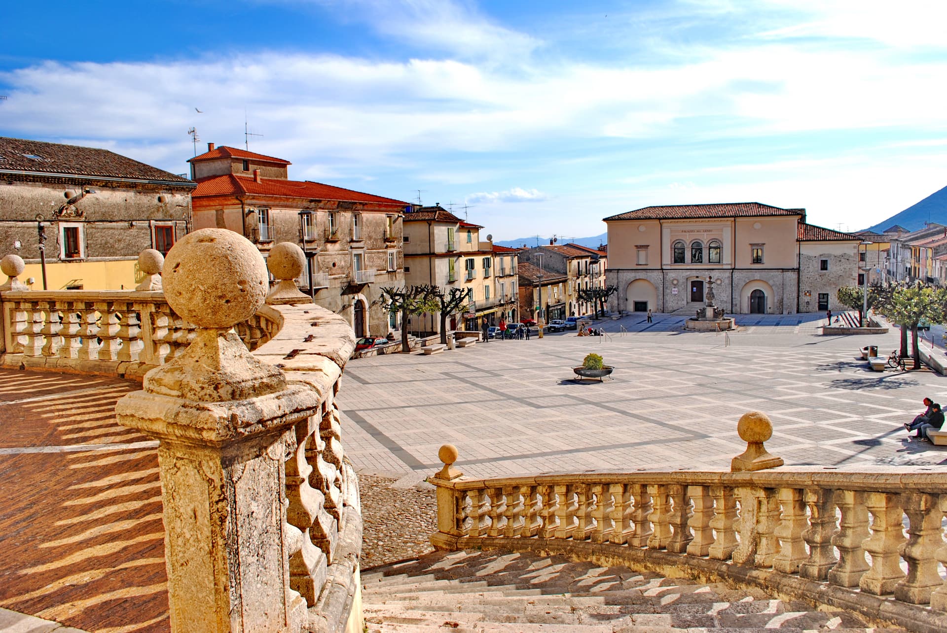
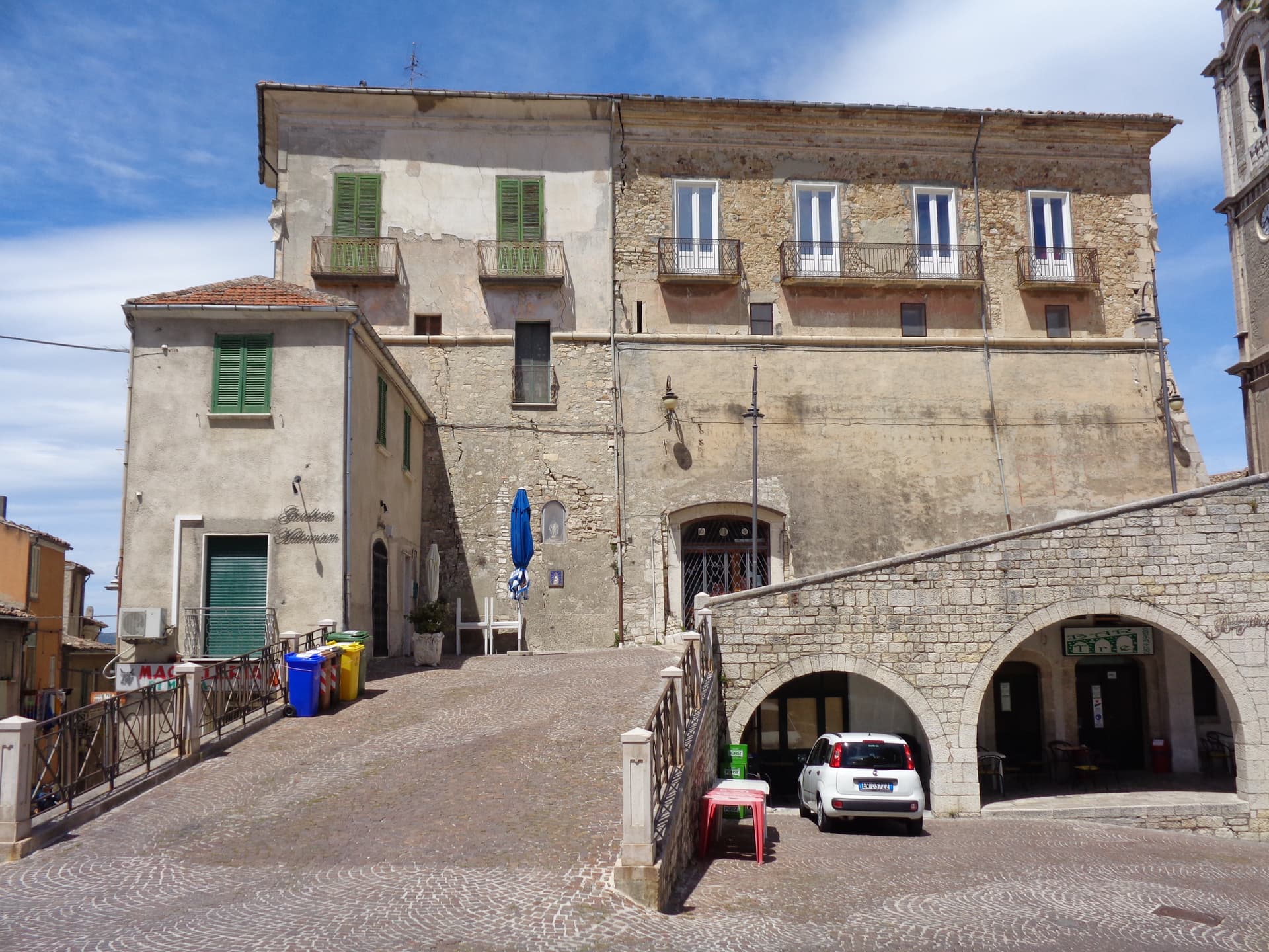
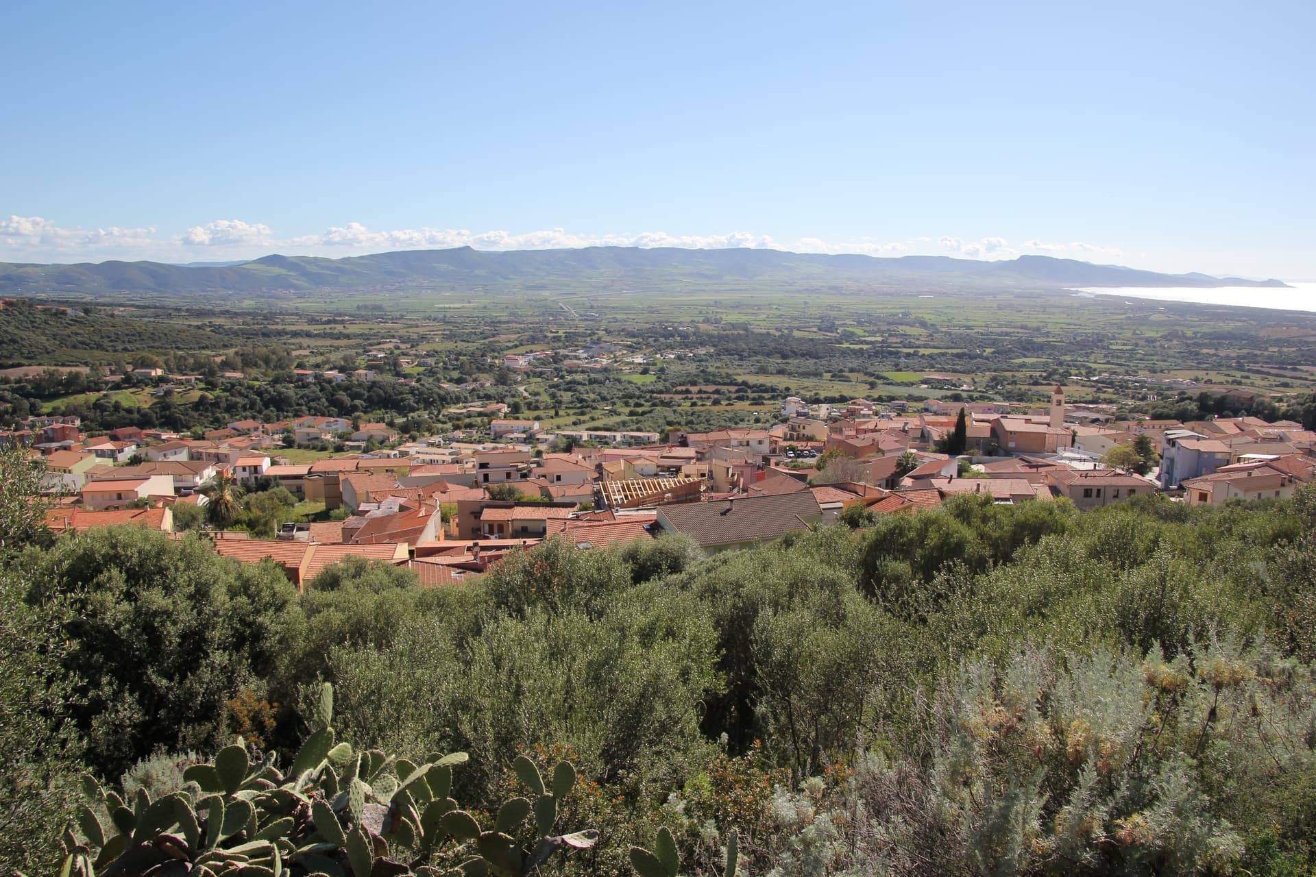
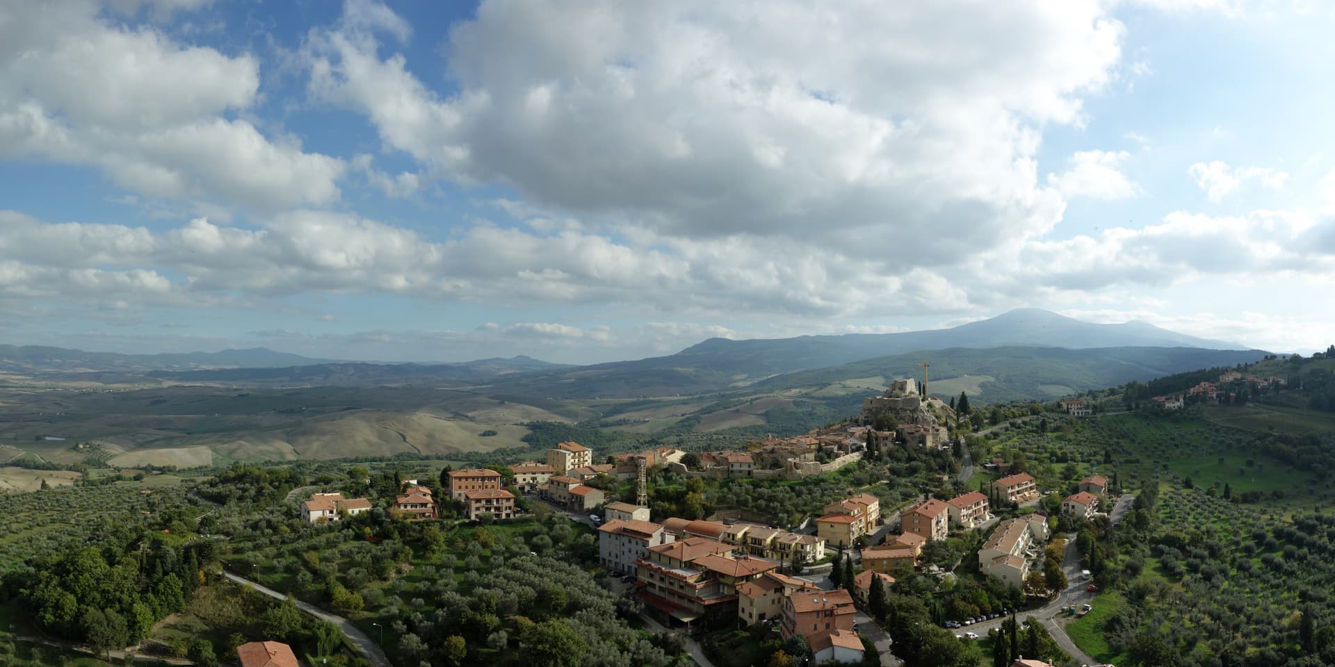
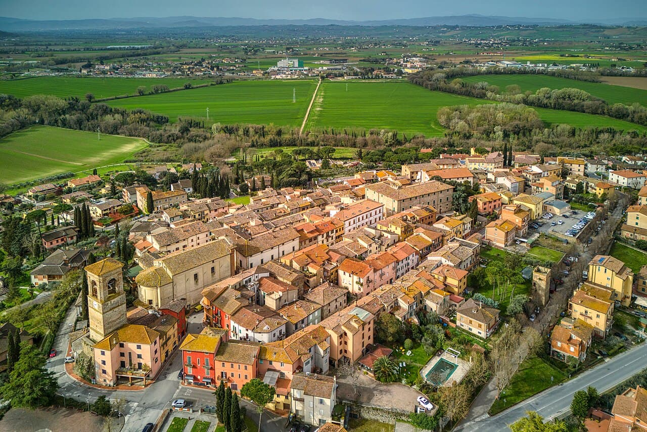
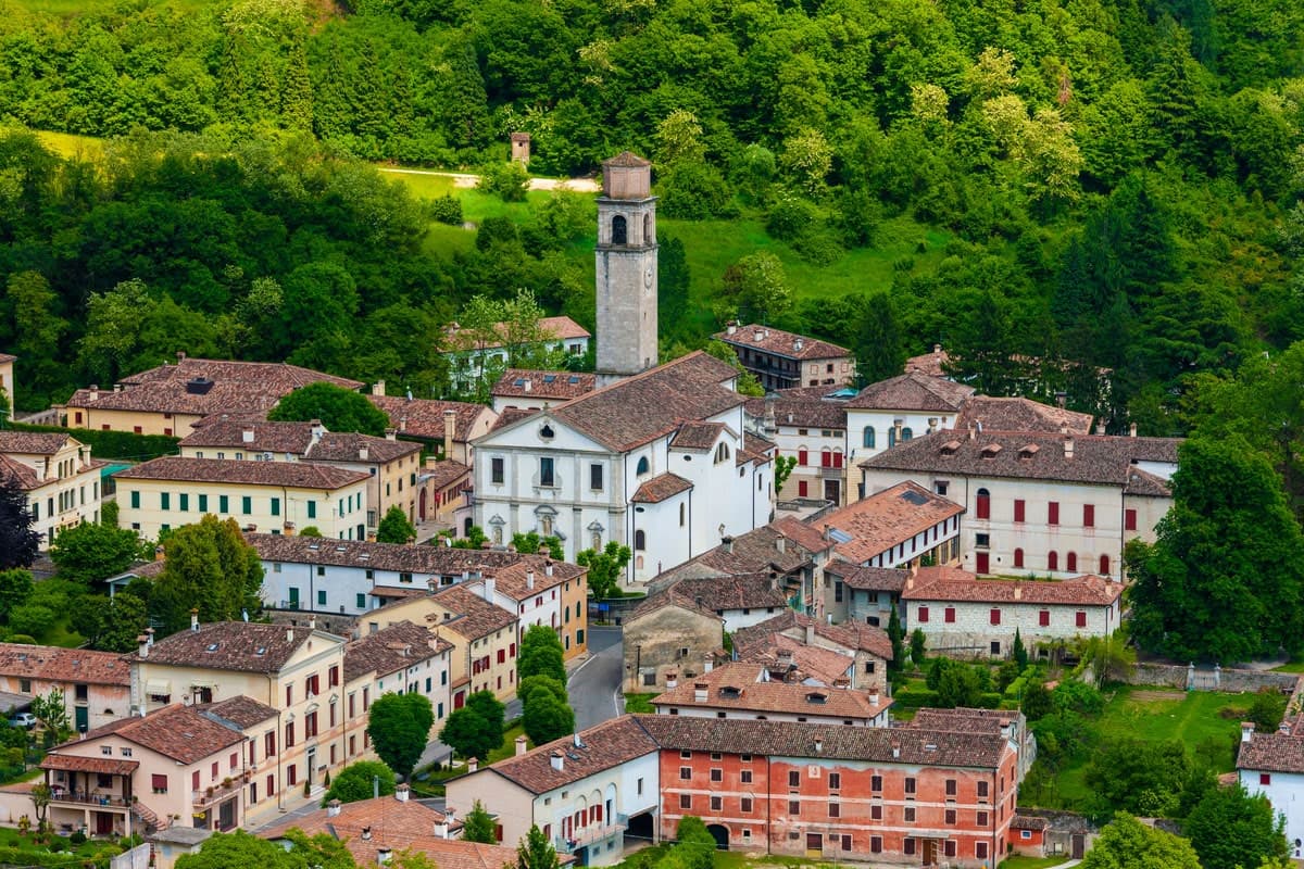
Città Sant'Angelo
Province: Pescara · 320 m
A hilltop borgo at 320 meters between the Vestina hills and the Adriatic, named for the Archangel and known since 1352 as a Collegiata seat.
Controguerra
Province: Teramo · 267 m
A 267-meter Val Vibrata wine village, seat of the Controguerra DOC since 1996, and a founding Cittaslow of the Teramo hills.
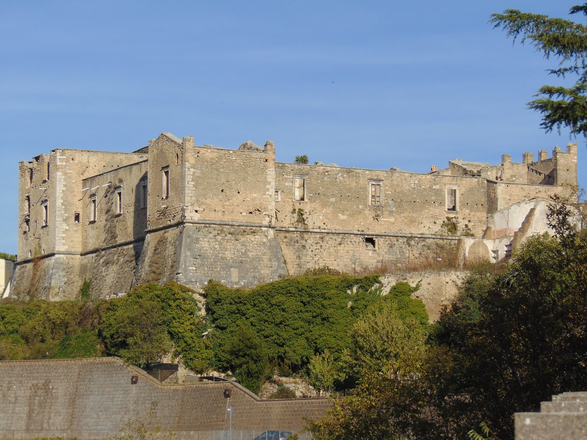
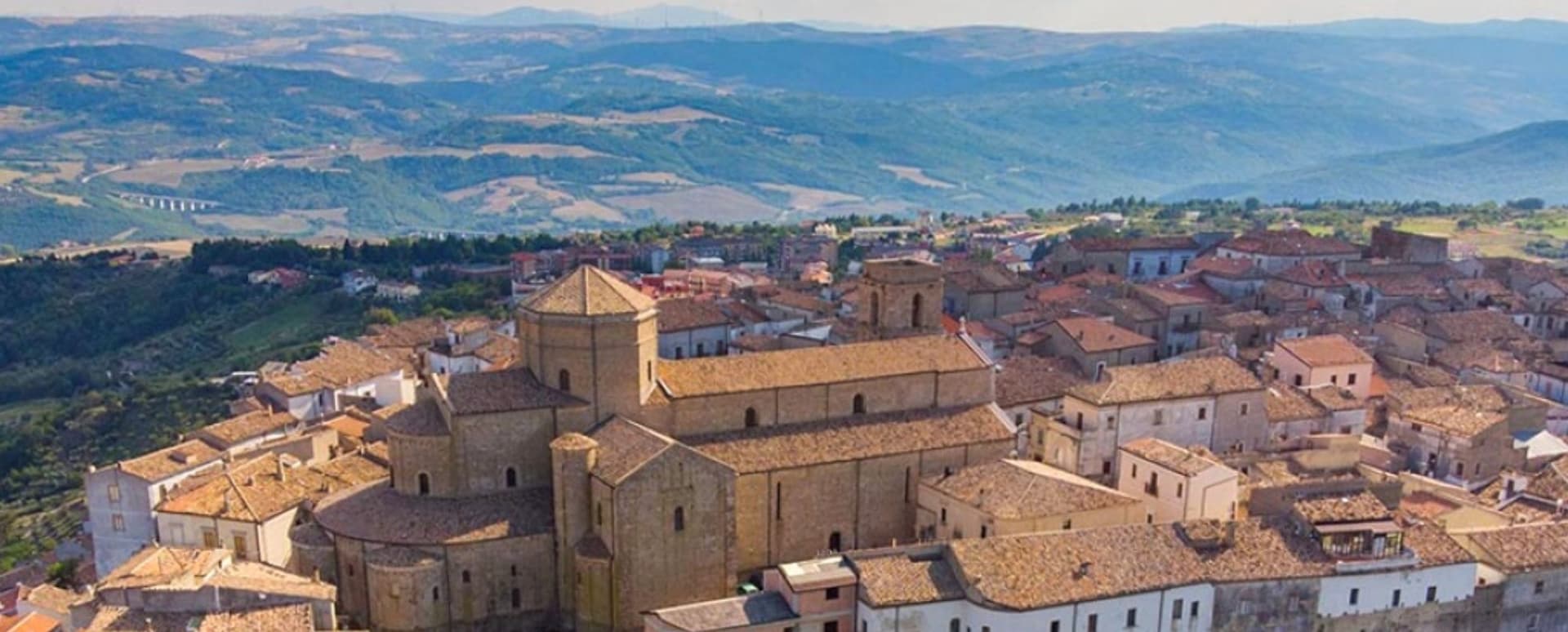
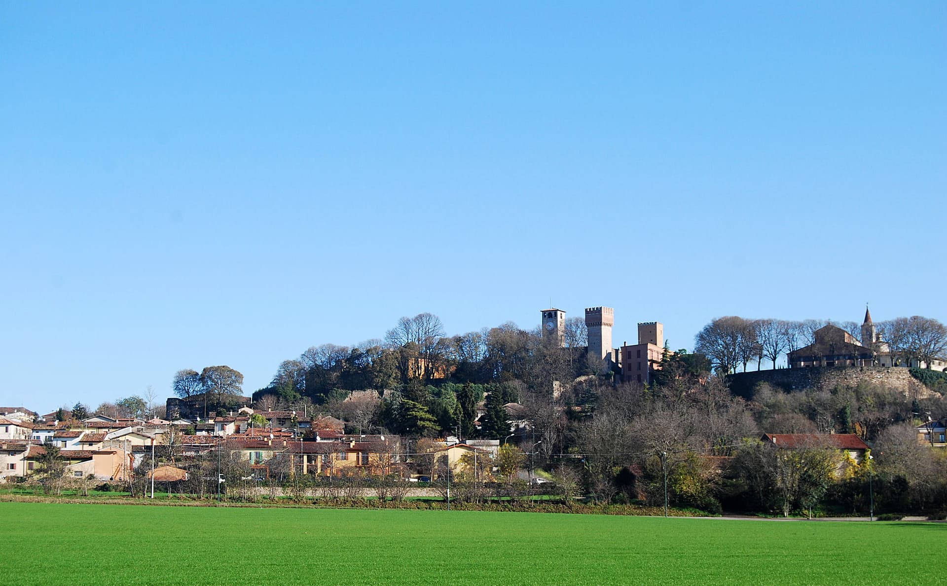
Crecchio
Province: Chieti · 209 m
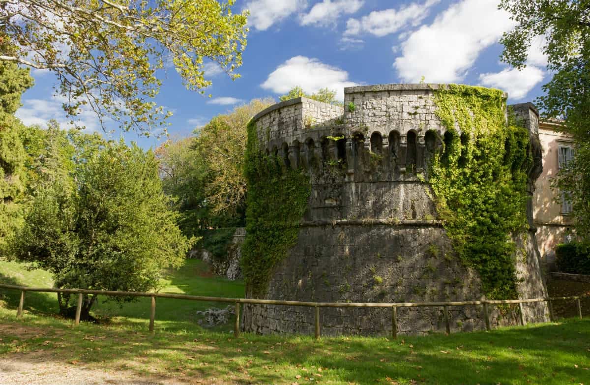
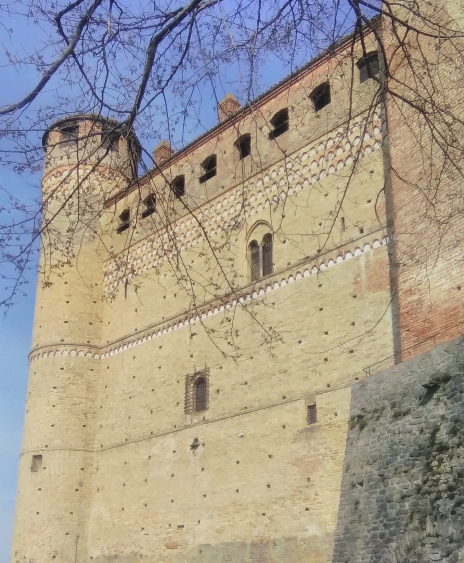
A 209-meter hill town between the Adriatic and the Maiella, capital of Italy for one night in 1943 when the king slept in its castle.
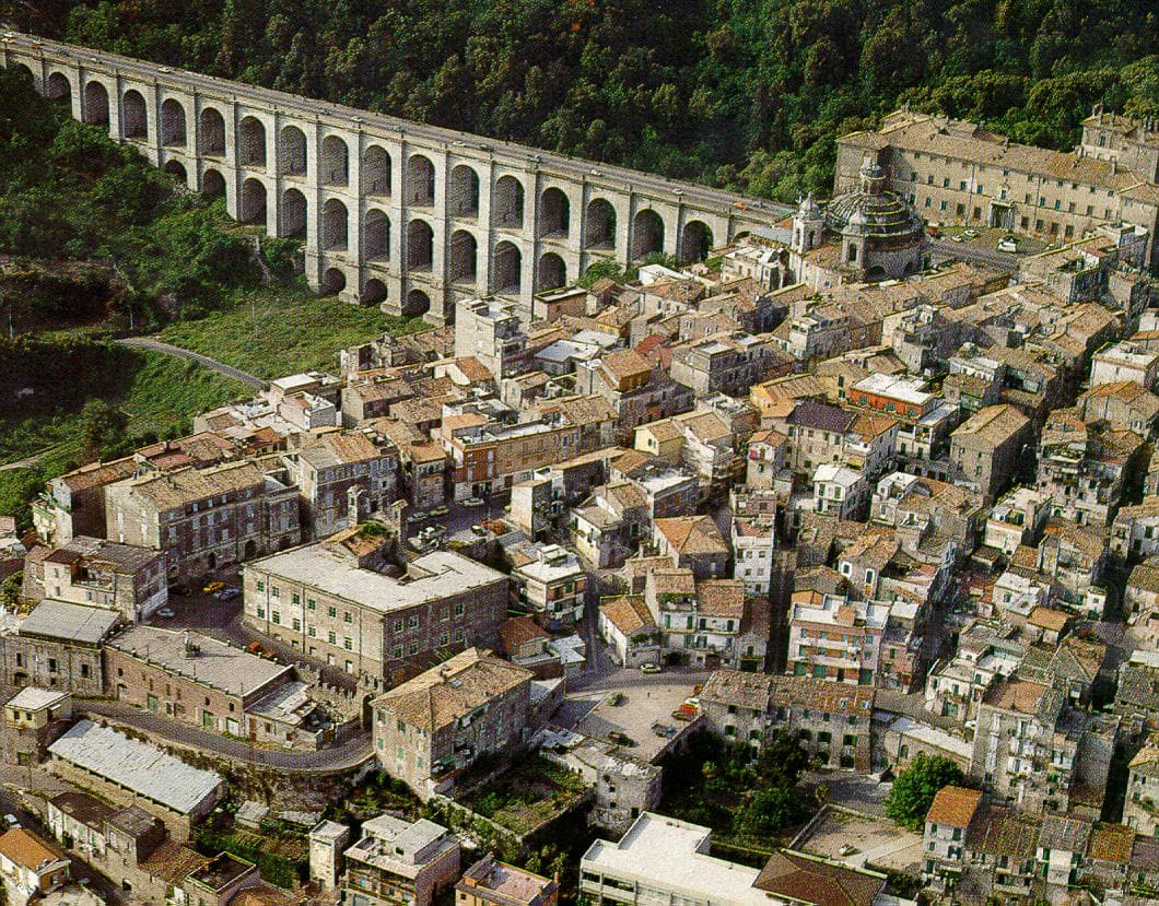
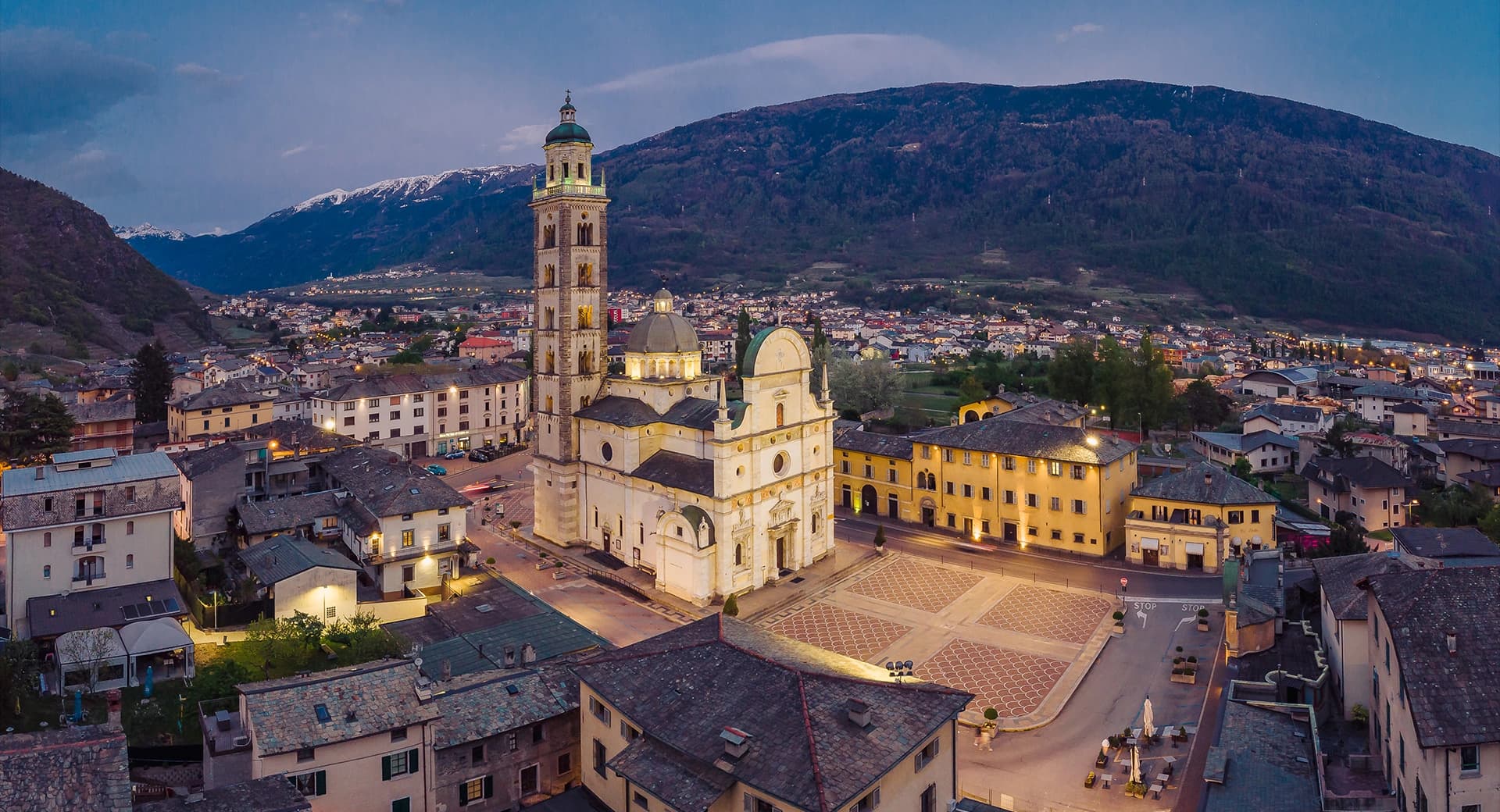
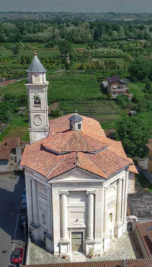
Loreto Aprutino
Province: Pescara · 290 m
A hilltop town at 290 meters in the Aprutino olive country, with a fourteenth-century Judgment fresco and a Castelli majolica collection.
Miglianico
Province: Chieti · 125 m
A wine hill town at 125 meters between Pescara and the Adriatic, with the sanctuary of San Pantaleone above an unbroken horizon of vineyards.
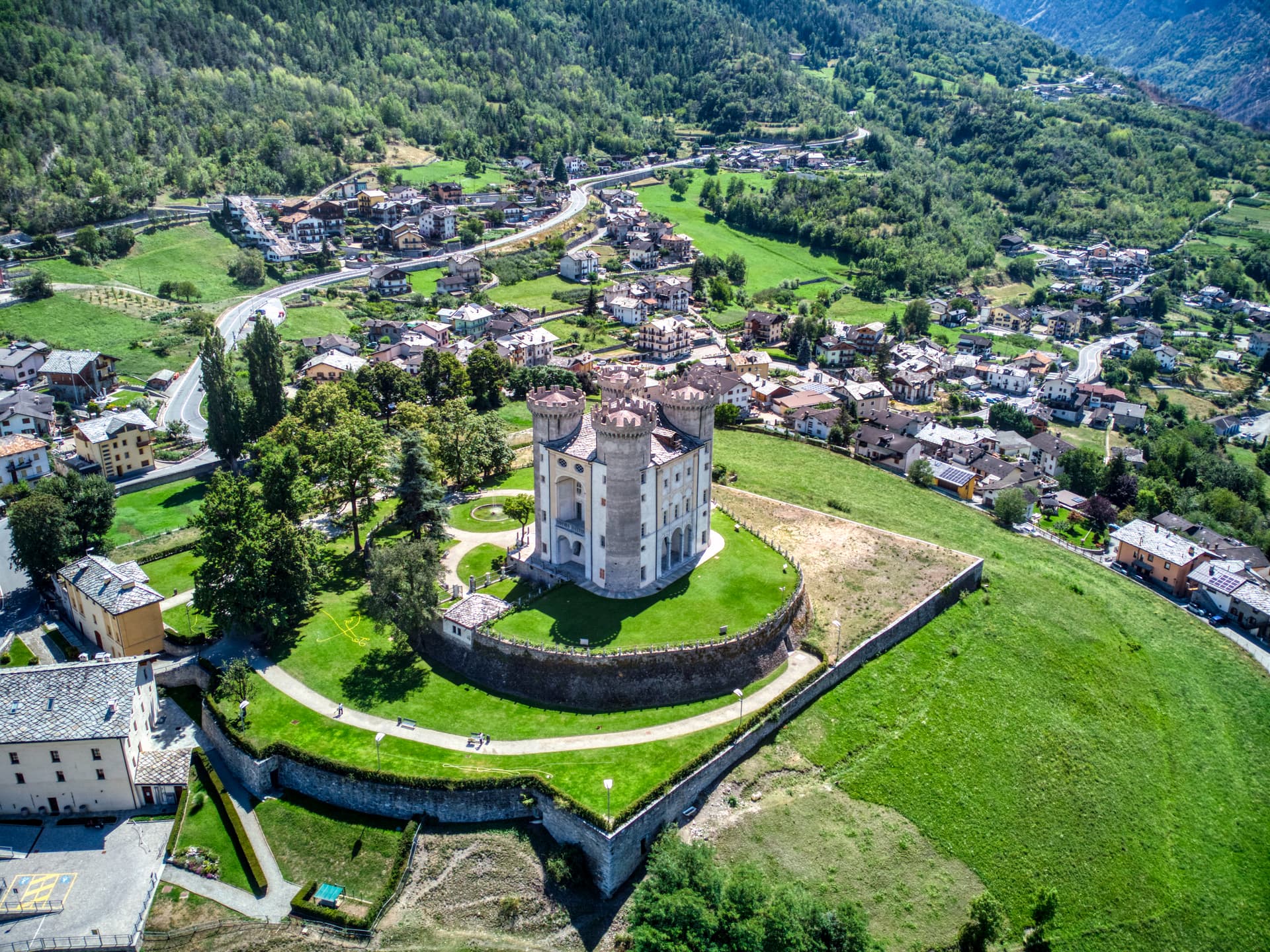
Ofena
Province: L'Aquila · 531 m
A 531-meter Vestian basin called the Forno d'Abruzzo, sealed by the Gran Sasso wall, where Montepulciano ripens on what may be the oldest of its slopes.
Rocca San Giovanni
Province: Chieti · 155 m
A walled hill town at 155 meters on the Costa dei Trabocchi, founded around 1060 by an abbot guarding the Abbey of San Giovanni in Venere.
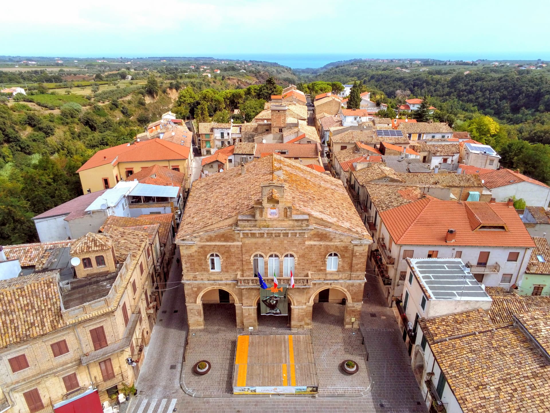
Tocco da Casauria
Province: Pescara · 356 m
A 356-meter hill town between the Pescara river and the Maiella, built around a Carolingian abbey and an herb liqueur called Centerba.
Aosta Valley2
Aymavilles
Province: Aosta Valley · 646 m
Gateway to the Gran Paradiso at 646 metres, with a four-towered Challant castle and a 3 BC Roman aqueduct above the Grand'Eyvia.

Donnas
Province: Aosta Valley · 322 m
The first DOC of Valle d'Aosta, a Nebbiolo-on-terraces wine town at 322 metres where the Roman Via delle Gallie was carved into living rock.
Apulia4
Galatina
Province: Lecce · 78 m
The Salento town at 78 meters where the cult of San Paolo bred tarantism and gave the pizzica its origin myth.
Manduria
Province: Taranto · 79 m
The Messapian capital thirty-five kilometers east of Taranto, ringed by three concentric stone walls and the home of Primitivo.
Maruggio
Province: Taranto · 35 m
Salento's Knights of Malta borgo — a fortified Borgo più Bello on a low Ionian hill with 11 km of Bandiera Blu coast at Campomarino, Negroamaro and Primitivo vines pressing into the centro, and a unique commanderie history that made it the Order's southern Italian headquarters for 600 years.

San Severo
Province: Foggia · 86 m
The Daunia wine capital on the Tavoliere, home to Puglia's first DOC of 1968 and a Carnevale of fanoia explosions known across the south.
Basilicata3
Acerenza
Province: Potenza · 833 m
A walled ridge town at 833 meters in the north Lucanian hills, archbishopric since 1068 under a Romanesque cathedral begun in 1080.
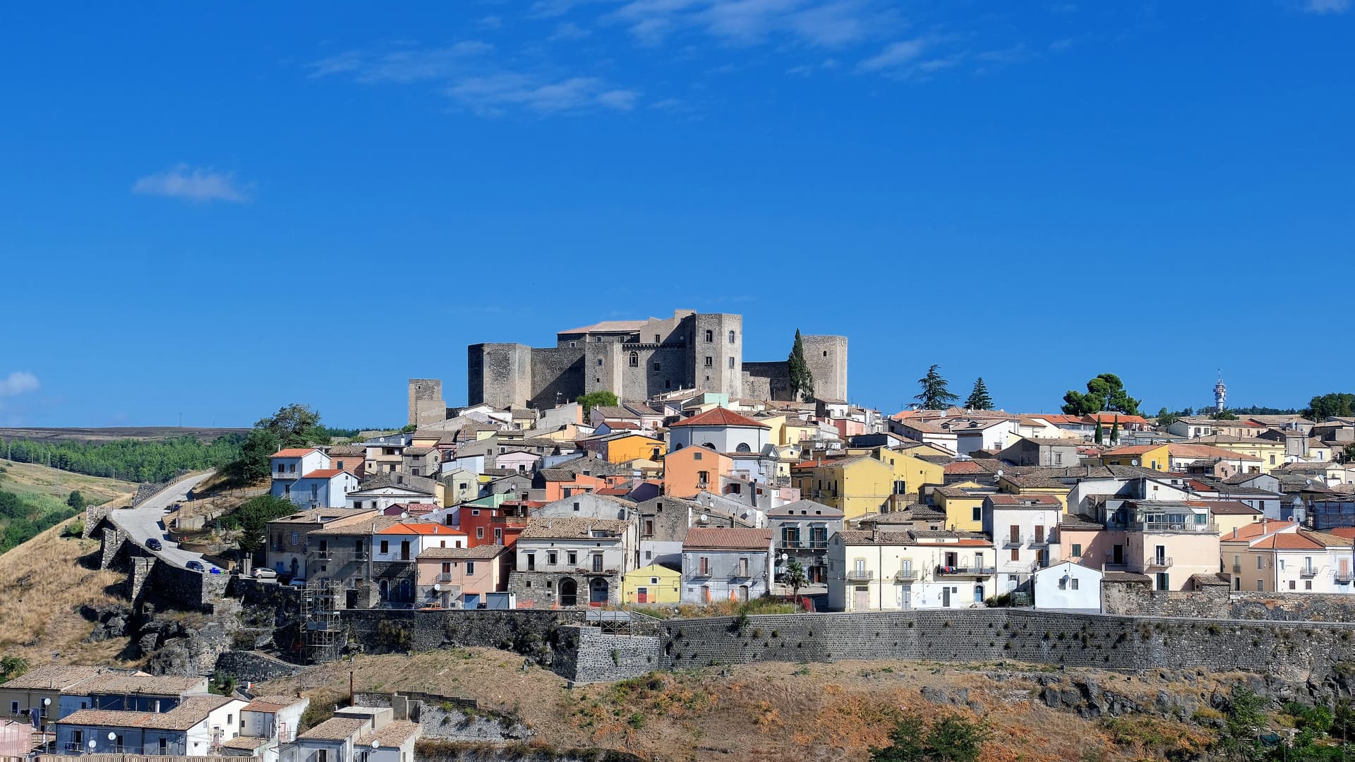
Melfi
Province: Potenza · 530 m
At 530 meters on the slopes of Monte Vulture, first Norman capital of the south and the seat of Frederick II's 1231 Constitutions of Melfi.
Venosa
Province: Potenza · 415 m
Founded as Roman Venusia in 291 BC, birthplace of Horace, with an unfinished abbey built from amphitheater stones and a 1470 Aragonese castle.
Calabria6
Montegiordano
Province: Cosenza · 619 m
A 619-meter Alto Jonio hill town with a Pignone del Carretto hunting castle and more than two hundred murals across its centro storico.
Mormanno
Province: Cosenza · 840 m
A Pollino mountain borgo at 840 meters between the Costa and Vernita ridges, known for lentils, white poverelli beans and the bocconotto pastry.
Roseto Capo Spulico
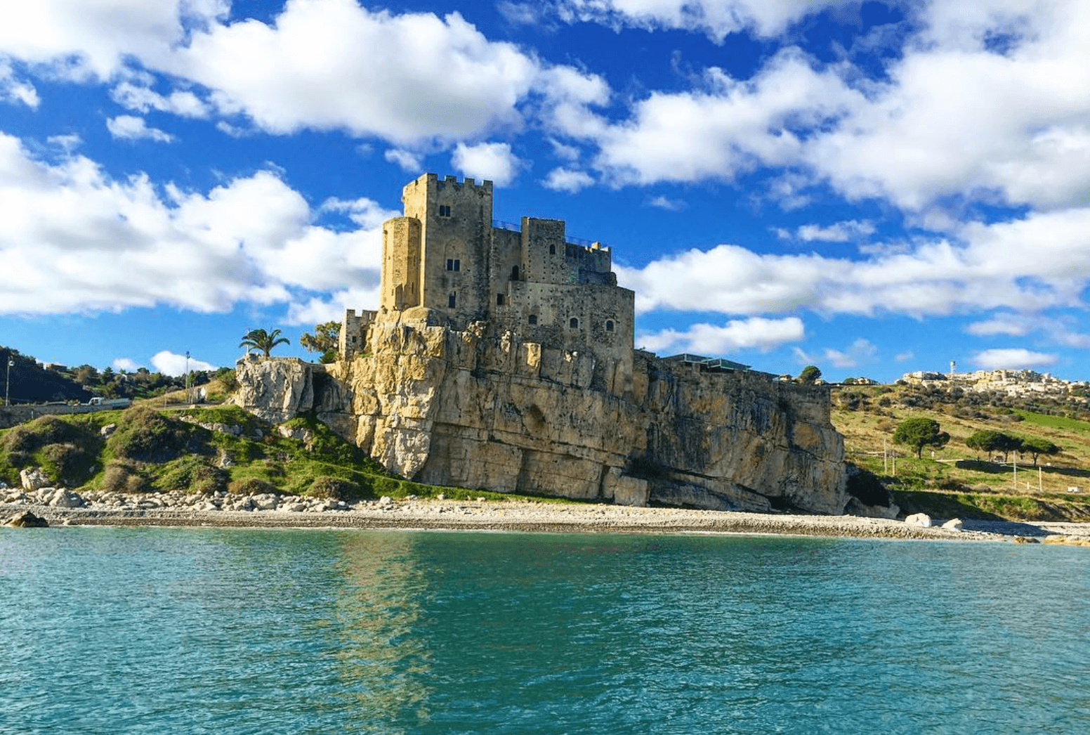
Province: Cosenza · 217 m
A Frederician castle on a rock above the Ionian, a former Sybaris satellite city founded in the seventh century BC, Templar legend included.
San Giovanni in Fiore
Province: Cosenza · 1,049 m
The capital of the Sila Grande at 1,049 meters, grown from the abbey Gioacchino da Fiore founded in 1188, Italy's most populated commune above a thousand.
Santa Severina
Province: Crotone · 326 m
A tufa-rock stone ship at 326 meters between the Sila and the Ionian, holding the only Byzantine baptistery still standing in Calabria.

Saracena
Province: Cosenza · 606 m
A 606-meter Pollino borgo named for its Saracen souk and protected by Slow Food for a passito Moscato traced to the sixteenth century.
Campania15
Alife
Province: Caserta · 110 m
A Roman walled town at the foot of the Matese, founded as a 326 BC oppidum, with Italy's fourth-largest amphitheatre still half-buried.
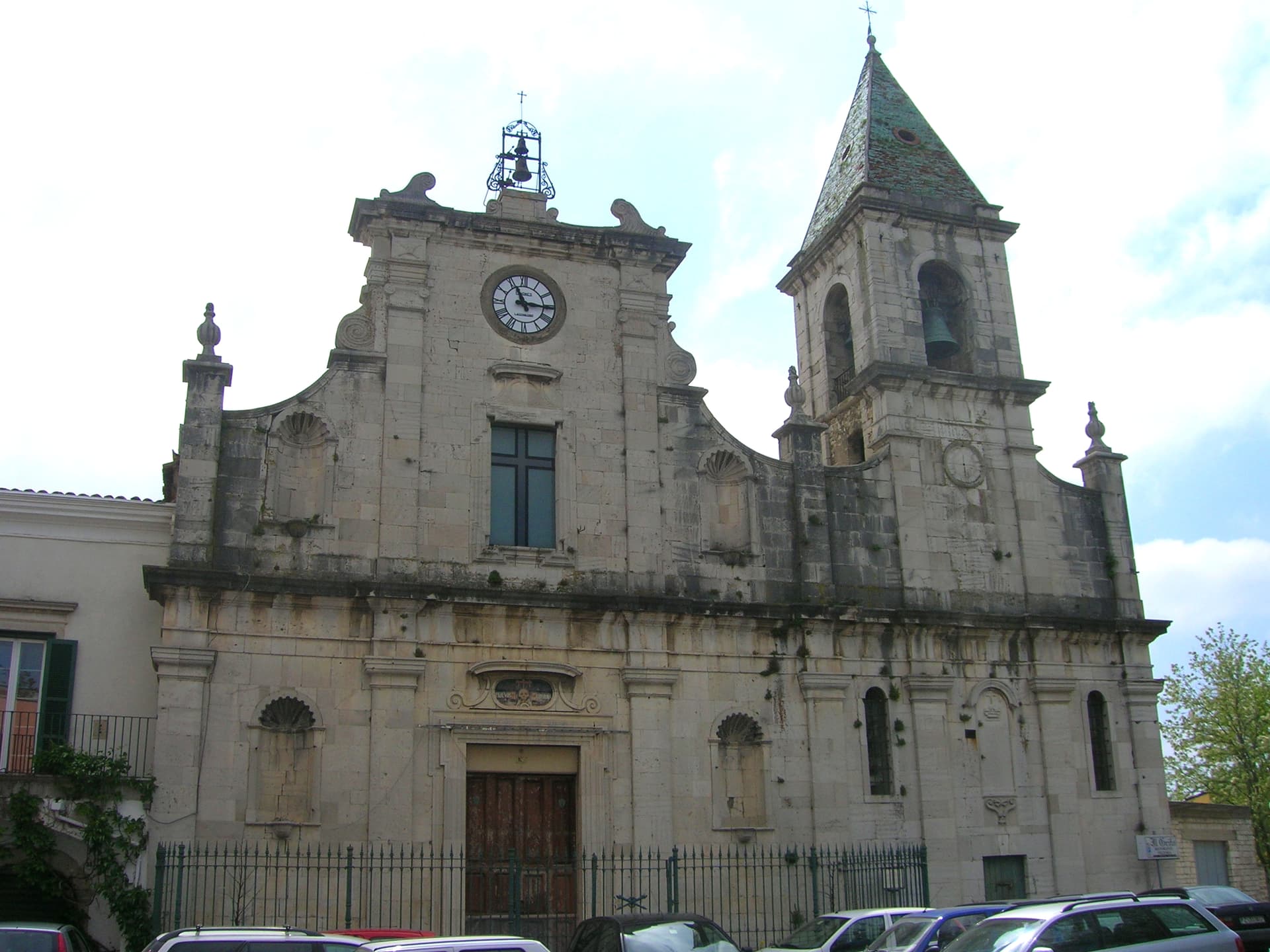
Benevento
Province: Benevento · 130 m
Sannio capital at the Calore-Sabato confluence, with a 114 AD Trajan arch and a Lombard rotunda on the UNESCO list.
Caiazzo
Province: Caserta · 200 m
A Cittaslow hill above the Volturno, turned by Franco Pepe's pizza into a destination for 800 covers a day in eighteenth-century rooms.
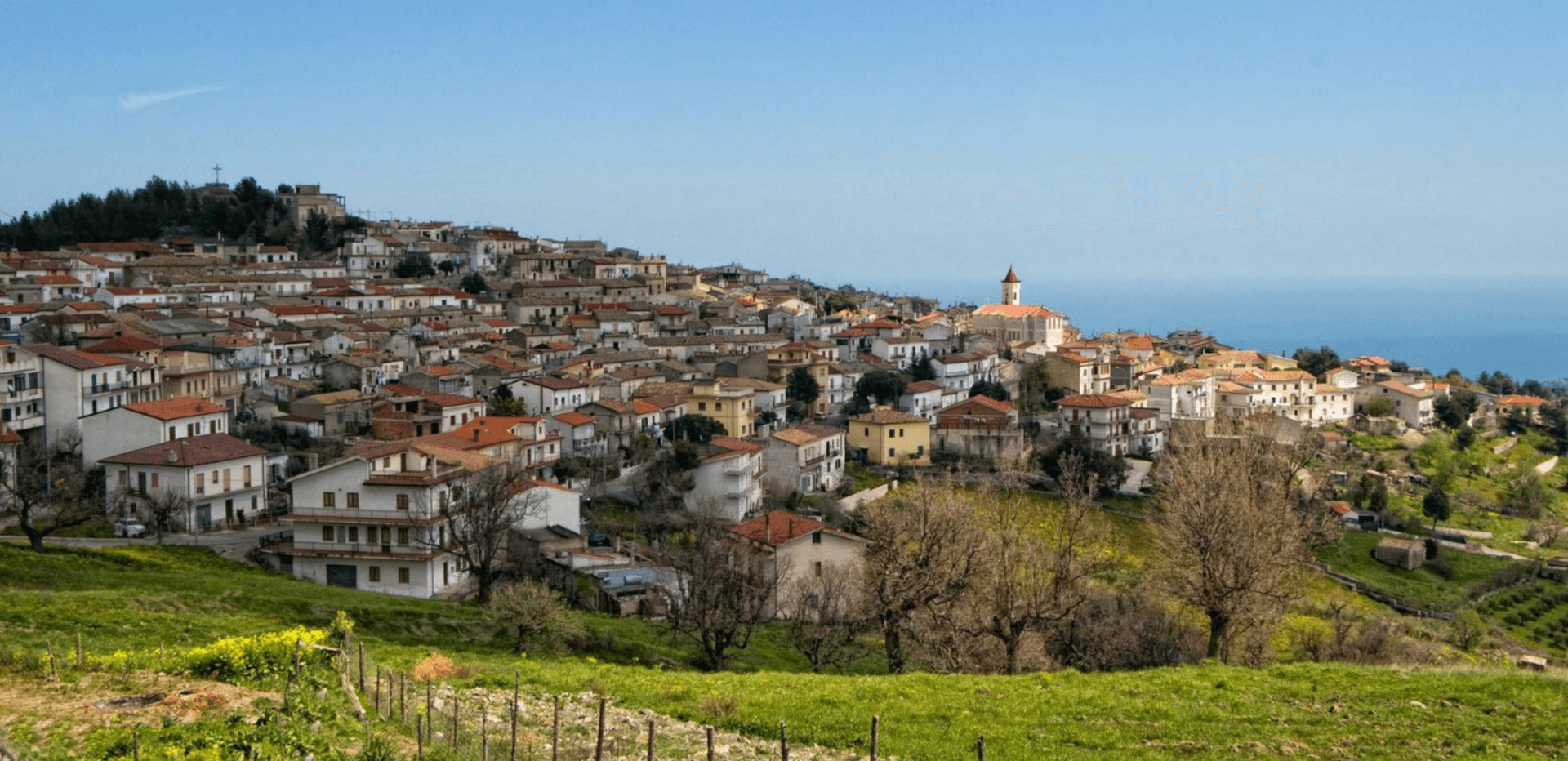
Centola
Province: Salerno · 336 m
A Cilento hill village at 336 meters whose seaside frazione, Palinuro, carries the helmsman of Aeneas and a Bandiera Blu coastline.
Cerreto Sannita
Province: Benevento · 290 m
A Sannio ceramics town at 290 meters, rebuilt from scratch by royal engineer Giovanni Battista Manni after the 1688 earthquake leveled the old hill.

Furore
Province: Salerno · 300 m
The Amalfi Coast village with no piazza and no center, scattered on rock walls 300 meters above the only fjord in southern Italy.
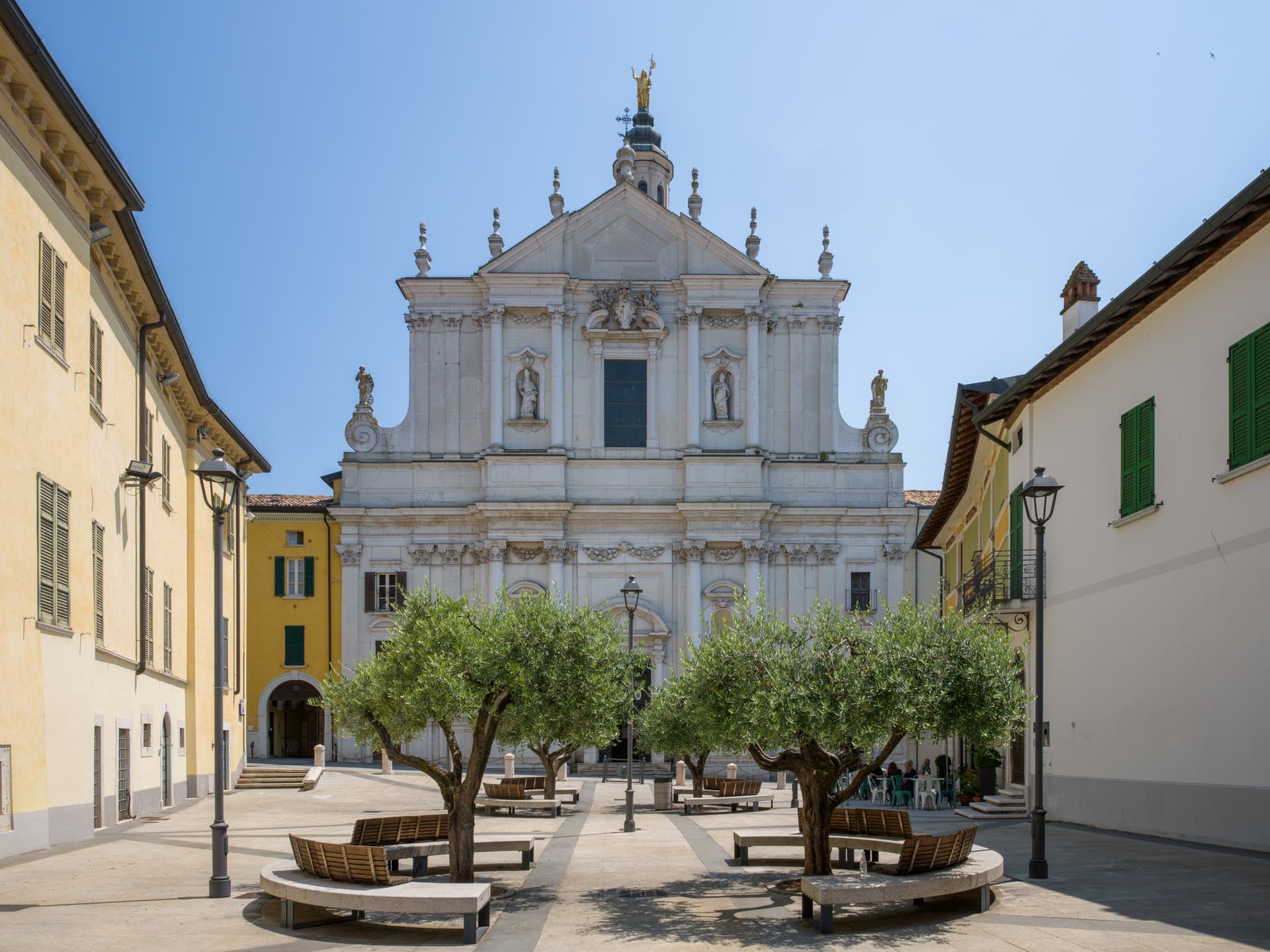
Lapio
Province: Avellino · 590 m
The heart of Fiano di Avellino DOCG country — a 1,428-resident Irpinia borgo at 590m in the hills east of Avellino, with the medieval Castello Filangieri anchoring an intact centro and a rare four-signal combination (Città del Vino + Olio + Miele + Nocciola) recognising the whole local agricultural ecosystem.

Maiori
Province: Salerno · 5 m
The Amalfi Coast town with the longest beach and a grid street plan, rebuilt after the 1954 flood took the medieval lanes.

Montesarchio
Province: Benevento · 300 m
Ancient Caudium at 300 meters in the Valle Caudina, the Roman defeat at the Forche Caudine still attached to the name two thousand years later.
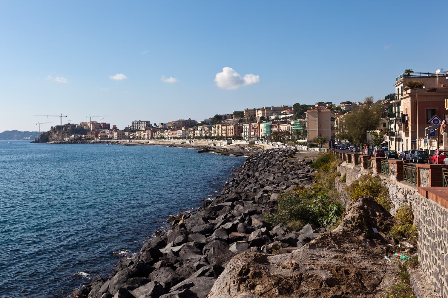
Pozzuoli
Province: Napoli · 28 m
A Roman port on the Campi Flegrei caldera, the Greek Dicearchia and Roman Puteoli, where the Macellum columns first proved bradyseism.
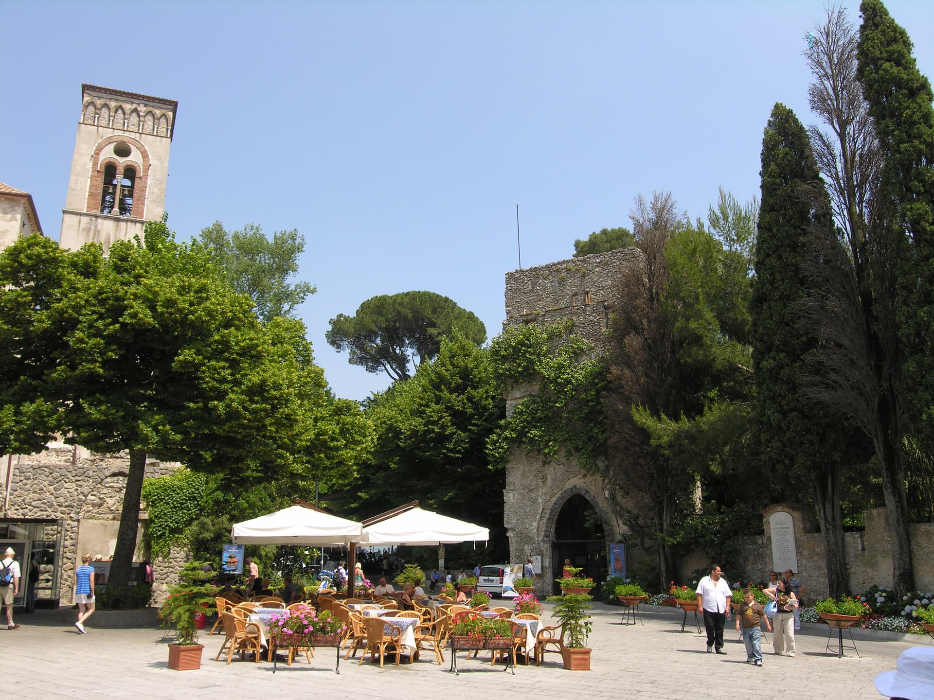
Ravello
Province: Salerno · 365 m
A ridge town 365 meters above the sea, where Wagner found Klingsor's garden in 1880 and the Ravello Festival has played his music since 1953.
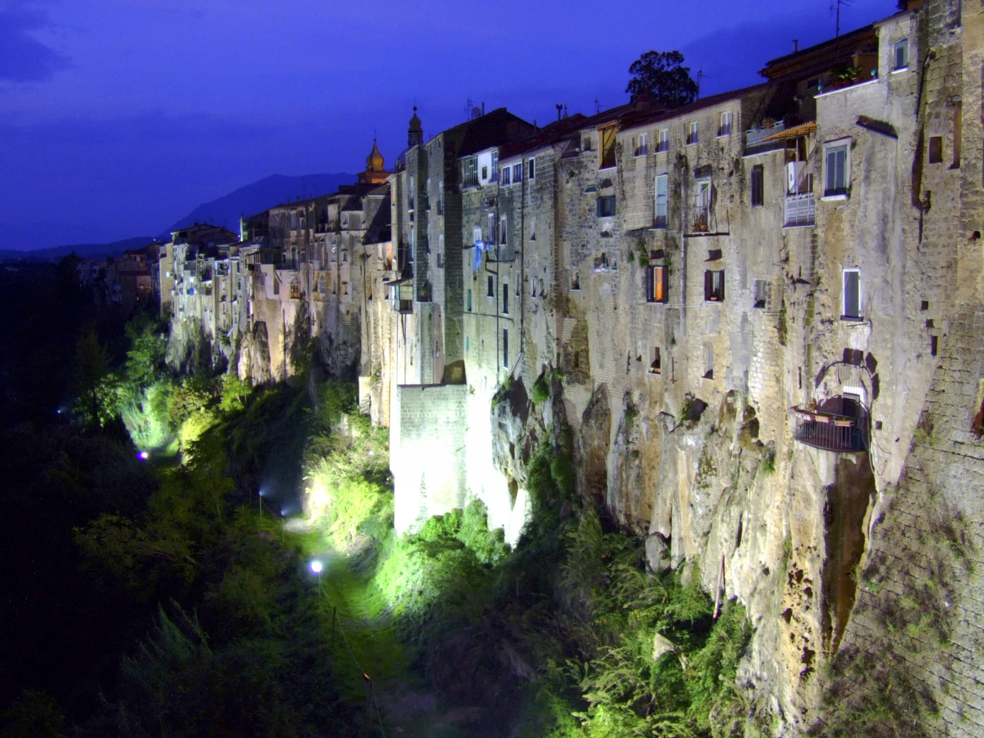
Sant'Agata de' Goti
Province: Benevento · 156 m
A medieval town built on a tuff cliff between two gorges, the houses standing flush with the edge over the Isclero river below.
Taurasi
Province: Avellino · 400 m
An Irpinia wine village at 400 meters above the Calore valley, the namesake of Taurasi DOCG, the southern Aglianico called Barolo of the South.
Tramonti
Province: Salerno · 321 m
The inland side of the Amalfi Coast, thirteen hamlets on the Lattari slopes producing the Costa d'Amalfi Tramonti DOC and an exported pizza dough.
Tufo
Province: Avellino · 250 m
A 250-meter Irpinia hill town that gives its name to Greco di Tufo DOCG, the white wine grown on sulfur-rich limestone slopes around it.
Emilia-Romagna4
Bertinoro
Province: Forlì-Cesena · 254 m
A 254-meter Romagna-hill borgo above the Via Emilia, with a twelve-ring hospitality column from 1300 and the slopes that grow Albana DOCG.
Castell'Arquato
Province: Piacenza · 224 m
A 224-meter hilltop borgo in the Val d'Arda, kept intact since the tenth century and crowned by Luchino Visconti's 1342 fortress.
Castelvetro di Modena
Province: Modena · 152 m
A 152-meter hill borgo south of Modena whose checkerboard piazza sits above the slopes that grow Lambrusco Grasparossa.

Sasso Marconi
Province: Bologna · 128 m
A 128-meter pre-Apennine town renamed in 1938 for Marconi, with Villa Griffone holding his tomb and the attic where he first sent radio in 1895.
Friuli-Venezia Giulia10
Aquileia
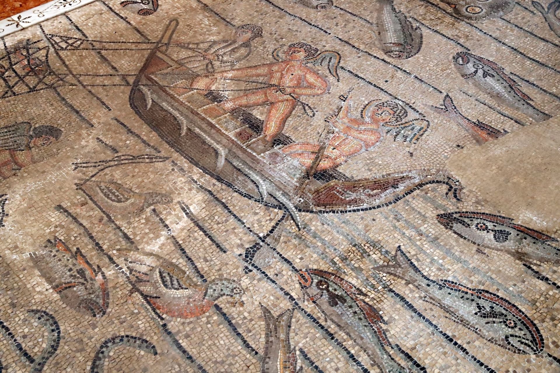
Province: Udine · 5 m
A village of 3,128 on a Roman capital of 100,000, where the largest paleochristian mosaic floor in the West runs under a Romanesque basilica.
Cervignano del Friuli
Province: Udine · 5 m
The capital of Bassa Friulana on the Ausa river, an inland river port for Aquileia in 181 BC and a railway junction since 1860.
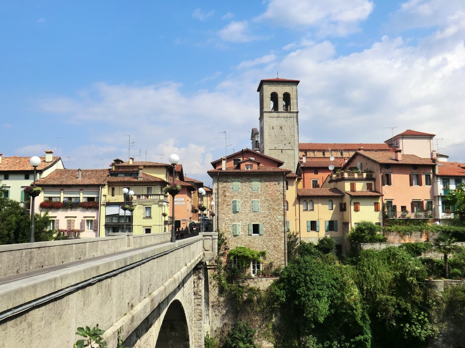
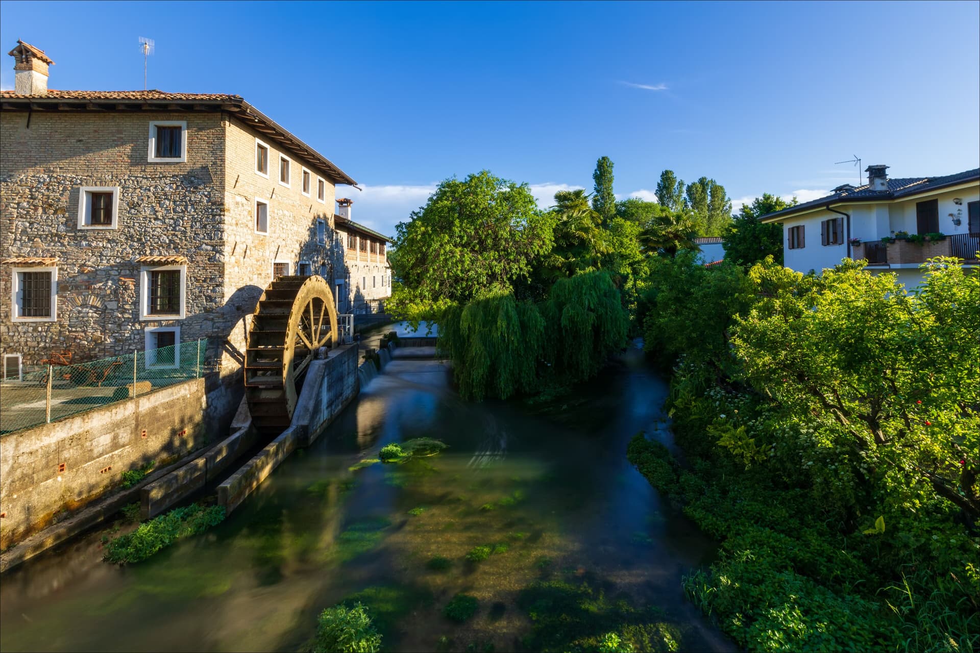
Cividale del Friuli
Province: Udine · 138 m
The Lombard capital on the Natisone, founded as Forum Iulii by Julius Caesar, where an eighth-century chapel still holds six stucco saints.
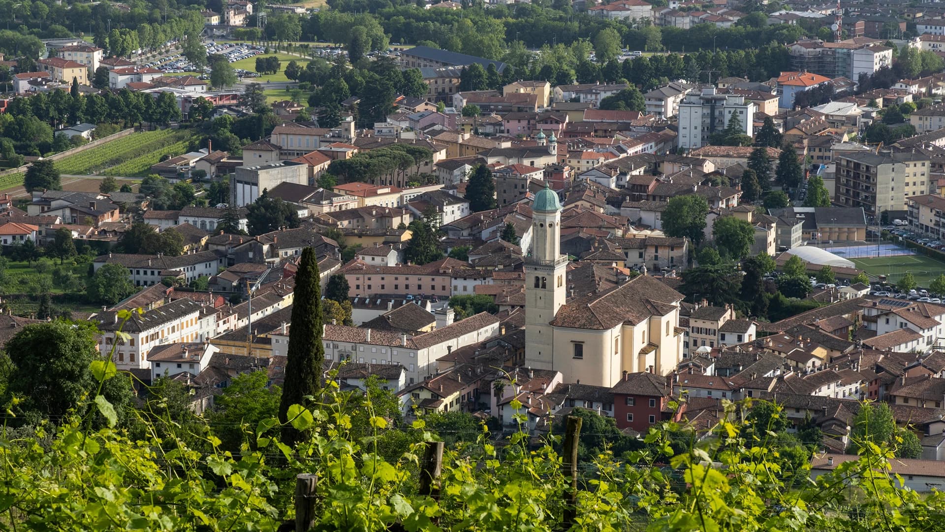
Cormons
Province: Gorizia · 51 m
The capital of the Collio wine zone at the foot of the Friulian-Slovenian hills, with a statue of Emperor Maximilian I on its main square.
Gorizia
Province: Gorizia · 84 m
Border city below the Julian Alps, divided from Nova Gorica by a 1947 wall and rejoined as European Capital of Culture 2025.
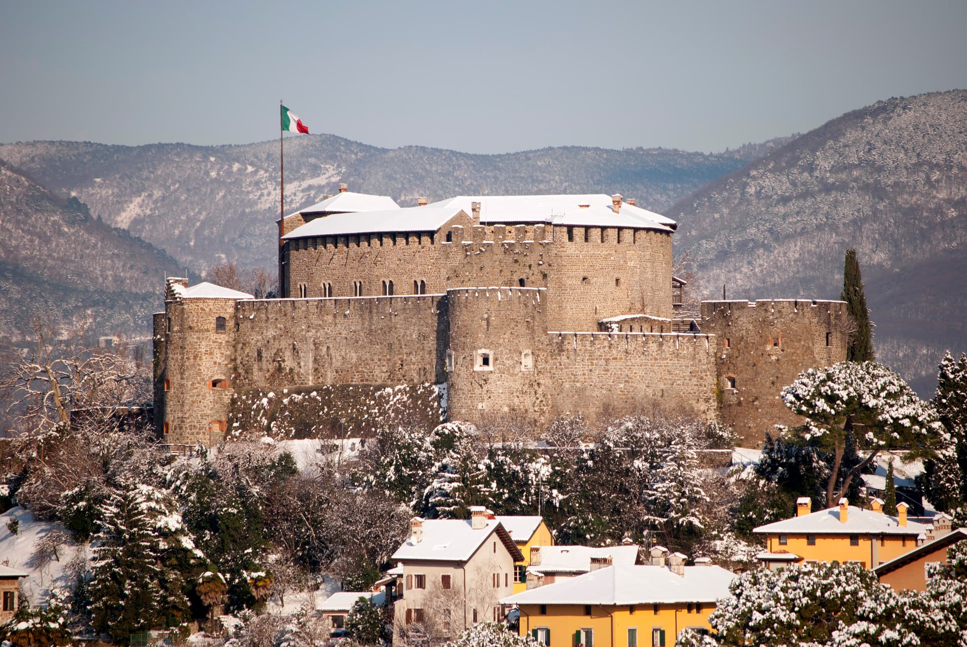
Gradisca d'Isonzo
Province: Gorizia · 32 m
A 1479 Venetian bastion on the right bank of the Isonzo, with seven towers, twenty-meter walls, and a Habsburg court inside.
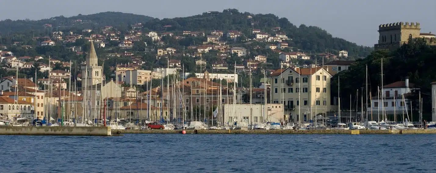
Muggia
Province: Trieste · 13 m
The only town on the Istrian peninsula still inside Italy, a small Venetian port on the Gulf of Trieste five kilometers from the Slovenian border.
San Dorligo della Valle-Dolina
Province: Trieste · 84 m
A Slovene-speaking Karst commune ten kilometers from Trieste, with its own valley, its own wine, and a canyon Roman aqueducts once crossed.

San Vito al Tagliamento
Province: Pordenone · 30 m
A medieval Tagliamento-plain town inside three rings of moats and three towers, where the Renaissance painter Pomponio Amalteo worked from 1536 until 1588.

Sesto al Reghena
Province: Pordenone · 13 m
A 730s Benedictine abbey on the Reghena, ravaged by Magyars in 899, refortified in the tenth century, and still the town hall today.
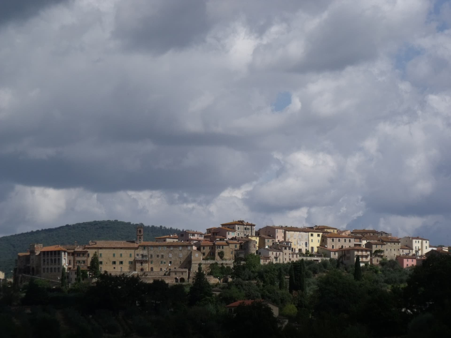
Lazio6
Anagni
Province: Frosinone · 424 m
The hill town in Ciociaria where Sciarra Colonna struck Pope Boniface VIII in September 1303, ending the medieval claim to papal supremacy.
Ariccia
Province: Roma · 412 m
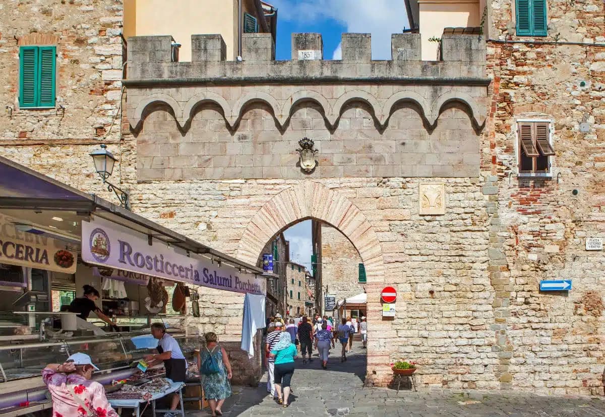
The Castelli Romani town where you go for porchetta — a Bernini-designed Baroque ensemble (palazzo + Santa Maria dell'Assunzione + Piazza di Corte) on a volcanic crater rim 25 km south of Rome, with the most concentrated cluster of fraschette porchetta restaurants in Italy and Lago di Albano below.
Atina
Province: Frosinone · 500 m
A polygonal-walled town in the Val di Comino at the foot of the Mainarde, and the DOC that makes Cabernet in central Italy.

Nemi
Province: Roma · 521 m
The smallest comune in the Castelli Romani, perched at 521 meters above a volcanic crater lake the Romans called the mirror of Diana.
Sabaudia
Province: Latina · 17 m
A rationalist city built in 253 days on drained Pontine marshland, founded 15 April 1934 between Lago di Paola and the Tyrrhenian dunes.
Velletri
Province: Roma · 332 m
The Castelli Romani town where Augustus grew up, now the largest wine commune in the Alban Hills.

Lombardy6
Lonato del Garda
Province: Brescia · 188 m
A hilltop commune on the southwestern Garda morainic ridge, with a Visconti Rocca and the 52,000-volume Casa del Podestà library.
Monzambano
Province: Mantova · 88 m
A Mincio commune at 88 meters in the moraine hills west of Mantova, whose frazione Castellaro Lagusello sits on a heart-shaped lake inside fortified walls.
Sirmione
Province: Brescia · 91 m
A 4-kilometer peninsula reaching into the southern Garda, with the Scaliger fortified port and the Roman villa called the Grotte di Catullo at its tip.
Sondrio
Province: Sondrio · 307 m
The capital of Valtellina at 307 meters, where Castel Masegra watches over terraced vineyards that produce Sassella and Grumello Nebbiolo.
Tirano
Province: Sondrio · 441 m
A Valtellina town at 441 meters where the Bernina railway from St Moritz reaches Italy, beneath terraced Nebbiolo vineyards.
Volta Mantovana
Province: Mantova · 91 m
A morainic hill town between Mantua and Lake Garda where Ludovico Gonzaga built a country palace inside the old medieval castle.
Marche6

Matelica
Province: Macerata · 354 m
A Verdicchio town at 354 meters in the upper Esino valley, with a Roman marble globe in its archaeological museum.
Morro d'Alba
Province: Ancona · 199 m
A walled Castello di Jesi at 199 meters above the Esino valley, ringed by La Scarpa, the 300-meter covered walkway unique in Italy.

Morrovalle
Province: Macerata · 247 m
A hilltop borgo at 247 meters above the Chienti valley, holding a 1560 Eucharistic Miracle from the burning of its Franciscan convent.

Offida
Province: Ascoli Piceno · 293 m
A hill borgo at 293 meters in the Piceno wine country, with a Romanesque-Gothic cliff church and women still working bobbin lace.

Ripatransone
Province: Ascoli Piceno · 494 m
The Belvedere del Piceno at 494 meters, ridgetop borgo with views to the Adriatic and the narrowest alley in Italy at 43 centimeters.

Staffolo
Province: Ancona · 442 m
The Verdicchio balcony at 442 meters above three valleys, with a near-circular medieval wall ring and a wine museum carved into the ramparts.
Molise2
Montenero di Bisaccia
Province: Campobasso · 273 m
A tufa hill town at 273 meters above the northernmost stretch of Molise coast, home base of former magistrate Antonio Di Pietro and his vineyards.
Ripalimosani
Province: Campobasso · 640 m
A sandstone-ridge village at 640 meters above the Biferno valley, the historic land of the funai rope makers and a Tintilia wine commune.
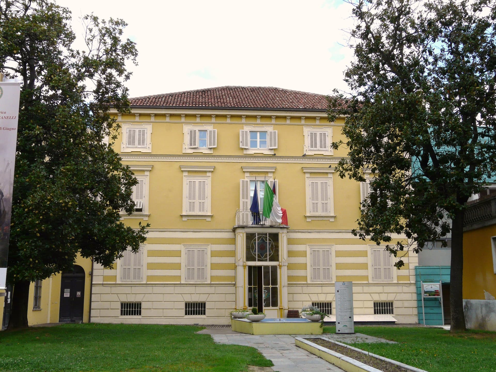
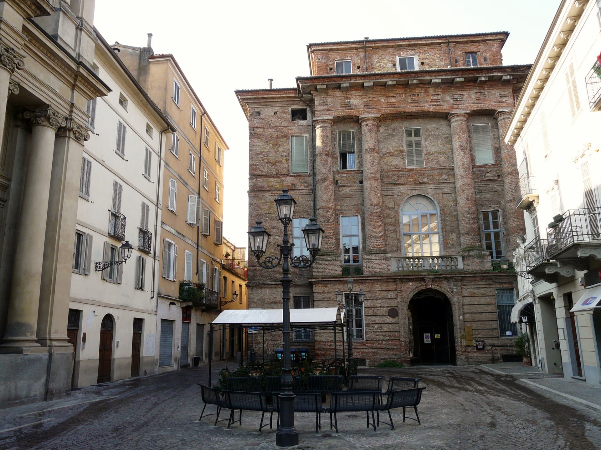
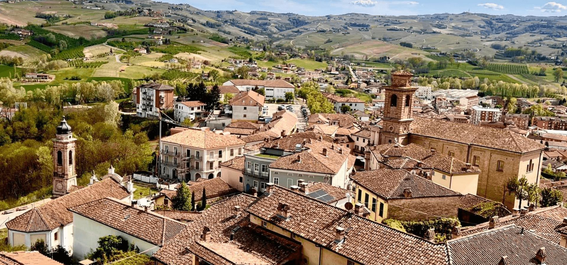
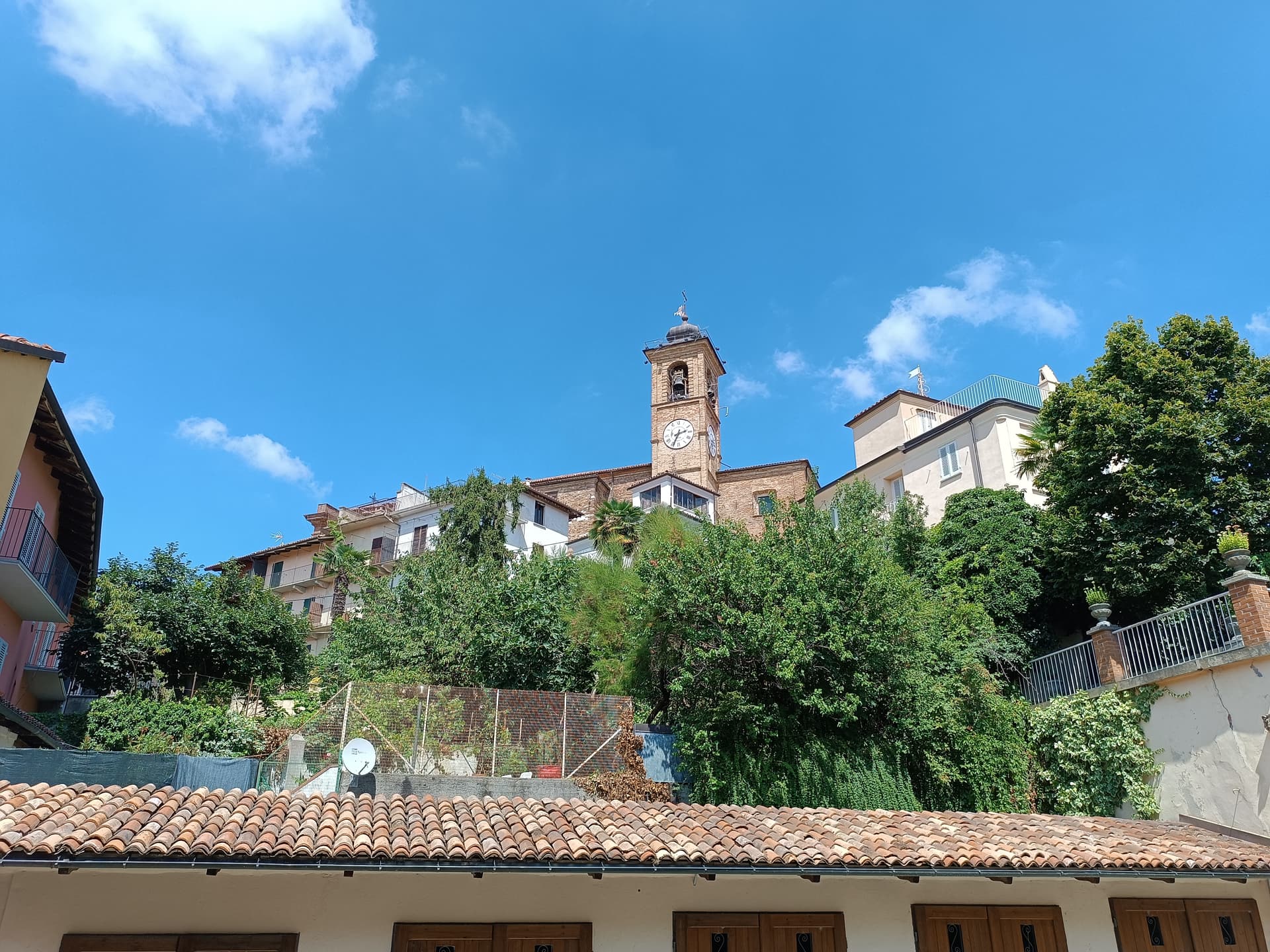
Piedmont18
Acqui Terme
Province: Alessandria · 156 m
A Roman spa town at 156 meters on the Bormida, where a sulphurous spring still surfaces at 74.5 degrees under an 1870 pavilion.
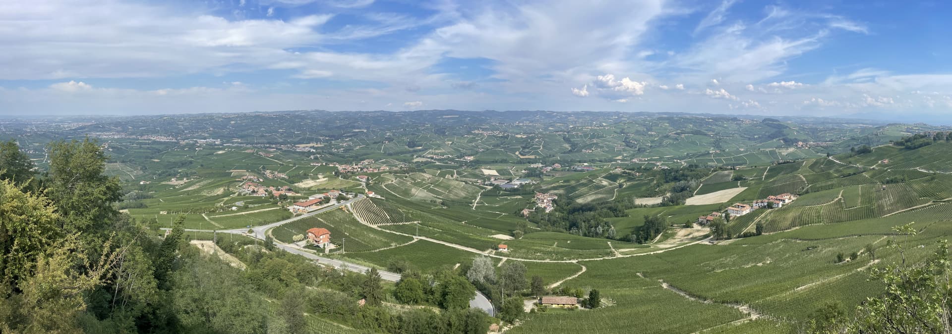
Alba
Province: Cuneo · 172 m
The Langhe capital at 172 meters on the Tanaro, world reference for white truffle and Nebbiolo, headquarters of Ferrero.
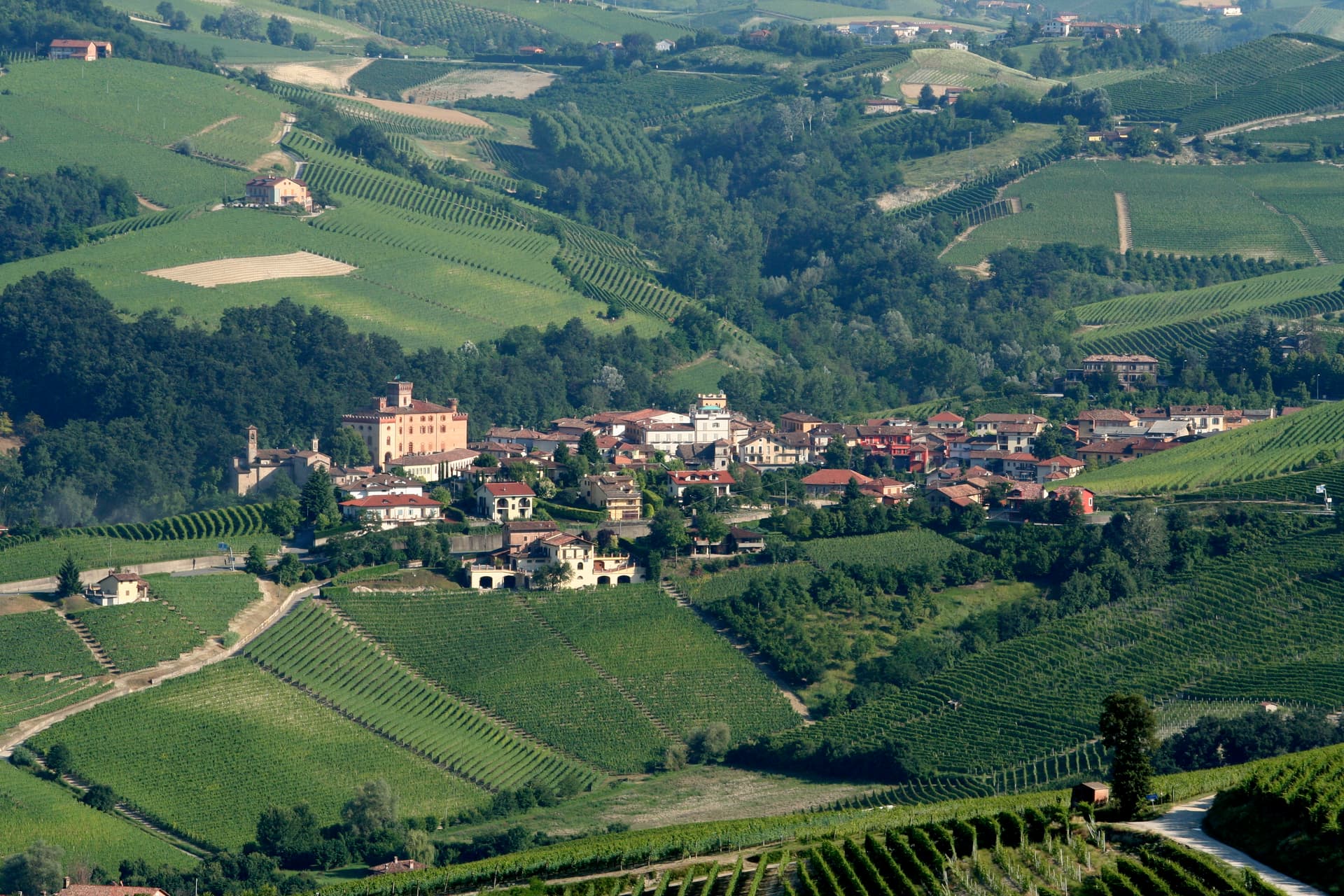
Barolo
Province: Cuneo · 301 m
A Langhe borgo at 301 meters whose Castello Falletti gave its name to the wine the Marchesi turned dry in the 1830s with Cavour's help.
Canelli
Province: Asti · 157 m
The Asti Spumante town at 157 meters in the Belbo valley, where 20 kilometers of underground tuff cellars hold millions of bottles at constant temperature.
Casale Monferrato
Province: Alessandria · 116 m
The historic capital of the Marchesato del Monferrato at 116 meters on the Po, where the Paleologi castle and the Baroque synagogue still stand.
Castagnole delle Lanze
Province: Asti · 298 m
An Asti hill town at 298 meters between Langhe and Monferrato, with two Baroque churches and a nineteenth-century astronomical tower.
Cocconato
Province: Asti · 491 m
A Monferrato ridge town at 491 meters with a microclimate mild enough to grow palms and olives this far north.

Dogliani
Province: Cuneo · 295 m
A two-tier Langhe town at 295 meters, the Borgo by the Rea stream and the Castello on the hill, capital of Dolcetto di Dogliani DOCG.
Gattinara
Province: Vercelli · 265 m
The Alto Piemonte Nebbiolo town on volcanic soil between the Sesia and Monte Rosa, DOCG since 1990, with a tenth-century watchtower above the vines.
Gavi
Province: Alessandria · 233 m
The Cortese di Gavi town below a Genoese star fortress, where Piemonte white wine was first recorded as Ligurian court tribute in 972.
Guarene
Province: Cuneo · 360 m
A Roero hilltop village at 360 meters above the Tanaro, whose Roero family baroque castle is now a luxury hotel and contemporary art destination.
La Morra
Province: Cuneo · 513 m
The hilltop above the Barolo zone at 513 meters, more Nebbiolo acreage than any other commune and 62 wineries inside its perimeter.
Moncalvo
Province: Asti · 305 m
Italy's smallest city by title, 2,730 residents on a Monferrato ridge, with a five-hundred-year truffle tradition and Guglielmo Caccia's home churches.
Nizza Monferrato
Province: Asti · 267 m
The capital of Barbera at 267 meters in the upper Monferrato, founded 1225 and now standalone home of the Nizza DOCG.
Ovada
Province: Alessandria · 186 m
The Monferrato town at 186 meters where the Orba meets the Stura, the first Dolcetto DOC zone in Piemonte and now DOCG.
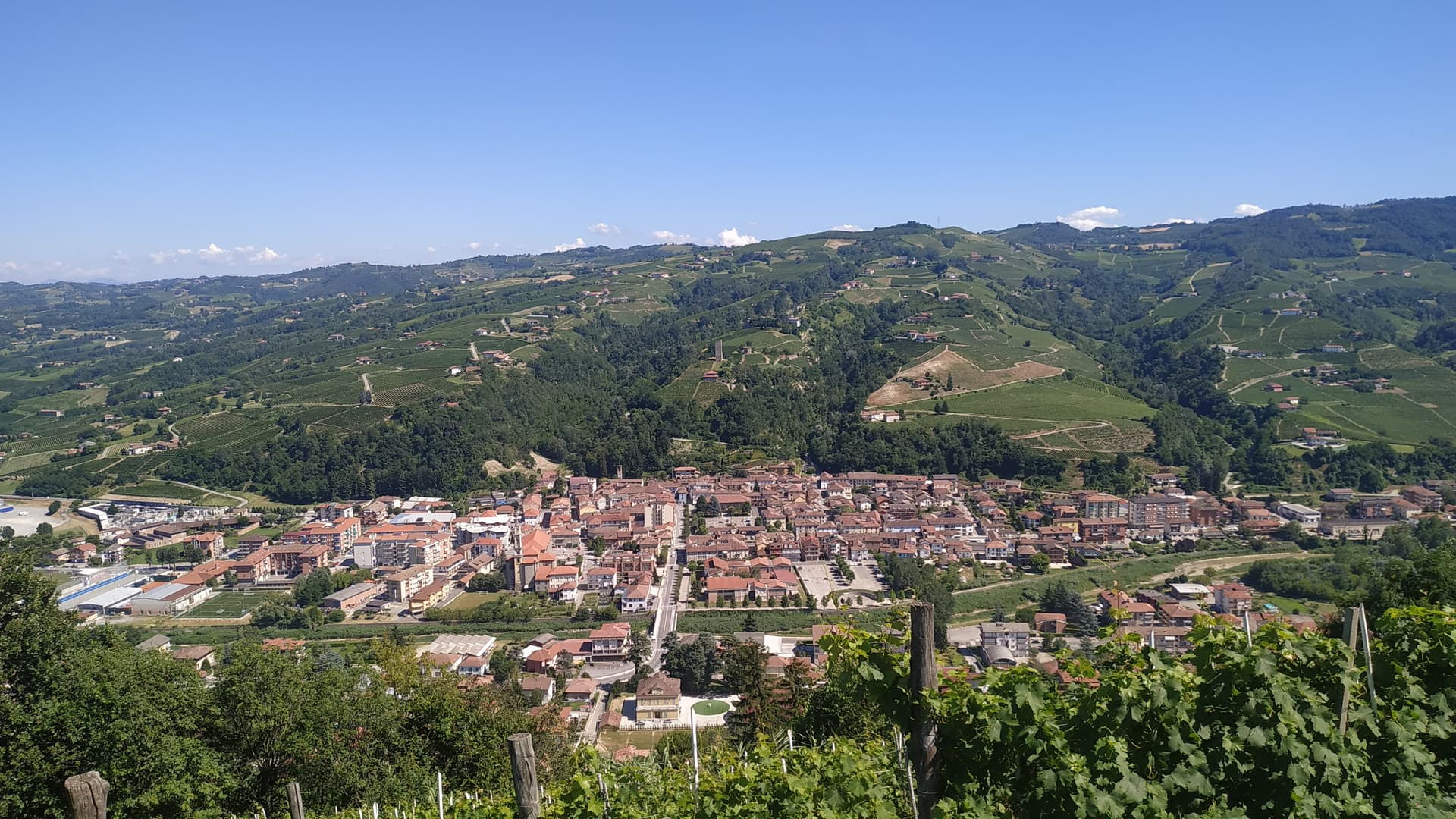
Santo Stefano Belbo
Province: Cuneo · 175 m
A Belbo valley village at 175 meters between the Langhe and Asti hills, birthplace of Cesare Pavese and the largest producer of Moscato d'Asti.
Serralunga d'Alba
Province: Cuneo · 414 m
A 527-inhabitant Barolo cru village at 414 meters on a Langhe ridge, crowned by a 14th-century French-style donjon castle of the Falletti.
Verduno
Province: Cuneo · 381 m
A Langhe hilltop at 381 meters on the northwestern edge of the Barolo DOCG, the home village of the Pelaverga grape.
Sardinia11
Alghero
Province: Sassari · 7 m
The Catalan city of northwest Sardinia, repopulated by Peter IV of Aragon in 1354 and still speaking Algherese Catalan today.
Atzara
Province: Nuoro · 553 m
A Mandrolisai wine village on the western Gennargentu, painted in the early twentieth century by Spanish costumbristas and the Sardinian Scuola di Atzara.
Badesi
Province: Sassari · 102 m
A Gallura commune founded by shepherding families in the 1700s, with eight kilometers of dunes between Isola Rossa and the Coghinas river.
Bosa
Province: Oristano · 10 m
A colour-washed riverside town on Sardinia's only navigable river, with a Malaspina castle on the hill and the tanneries of Sas Conzas along the Temo.

Dorgali
Province: Nuoro · 387 m
A Supramonte town at 387 meters with the coastal frazione Cala Gonone, the Tiscali Nuragic village, and the 400-meter walls of Su Gorropu.

Galtellì
Province: Nuoro · 49 m
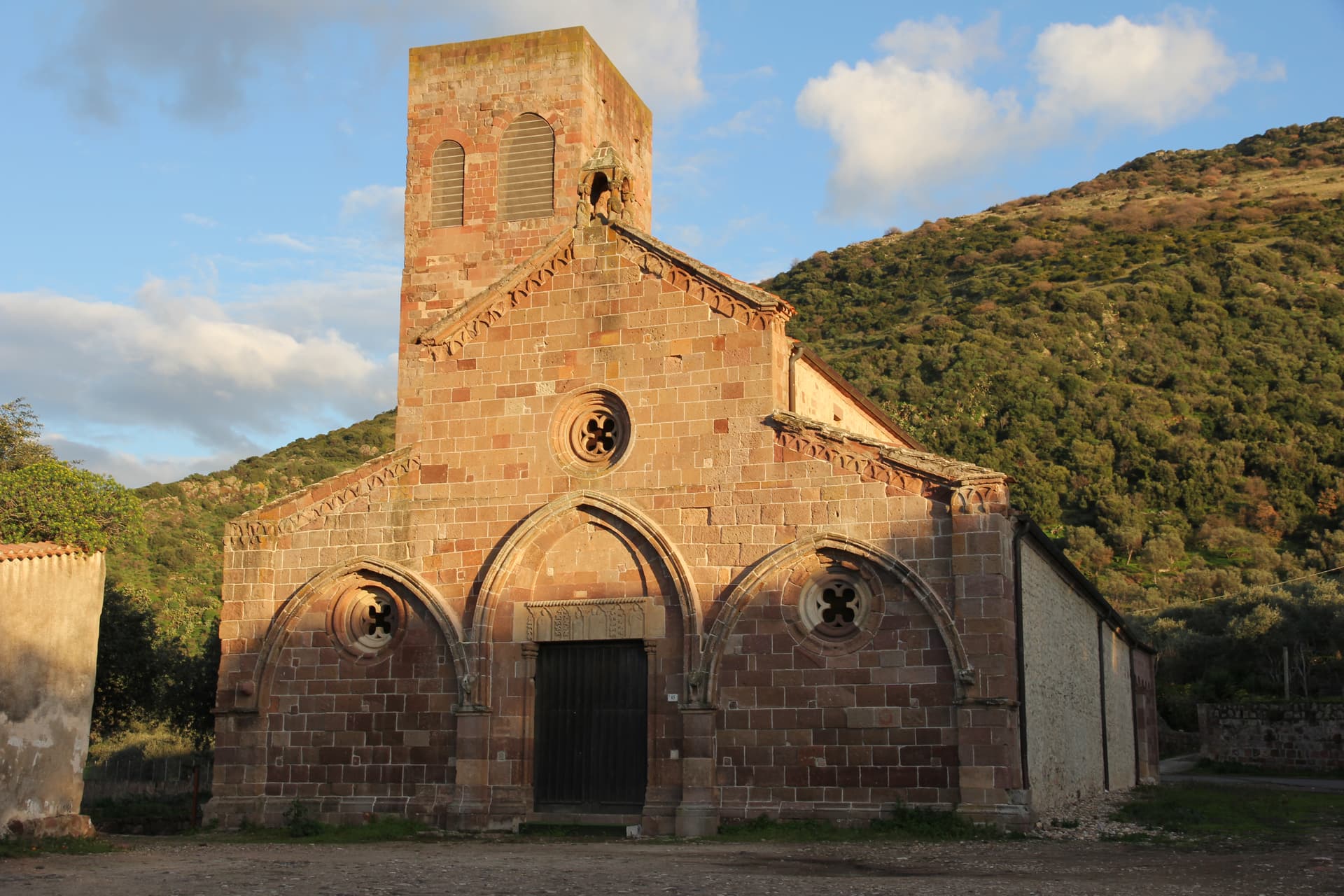
Grazia Deledda's 'Canne al vento' set — a 2,354-resident Baronia borgo under the Monte Tuttavista in Sardinia's northeast, with the triple Borghi Autentici + Bandiera Arancione + Città del Vino signal, the 11th-c Cattedrale di San Pietro (Sardinia's first), and the entire centro recognised as the Parco Letterario Grazia Deledda for being the literal setting of her 1913 Nobel-trajectory novel.

Jerzu
Province: Nuoro · 450 m
The Cannonau capital of Ogliastra, perched at 450 meters under Monte Corongiu, where vineyards have been documented since 1130.
Mamoiada
Province: Nuoro · 644 m
The Barbagia village where the Mamuthones come out on January 17, twelve men in black sheepskins carrying thirty kilos of cowbells.
Oliena
Province: Nuoro · 380 m
A Supramonte village at the foot of Monte Corrasi, source of Cannonau Nepente, base camp for Tiscali and the Lanaitto valley.
Samugheo
Province: Oristano · 380 m
Sardinia's textile-weaving capital — a 2,757-resident Mandrolisai borgo with the MURATS regional textile museum, the annual Tessingiu woven-art biennale, an active community of weavers still on traditional looms, and the Mandrolisai DOC red from the granite-soil vineyards around it.
Tempio Pausania
Province: Sassari · 566 m
The granite capital of Gallura at the foot of Monte Limbara, known for cork, Vermentino DOCG and the largest Carnival in northern Sardinia.
Sicily6
Castiglione di Sicilia
Province: Catania · 621 m
A hill town on the north flank of Etna at 621 meters, base camp for the Alcantara valley and the volcano's most serious red wines.
Marsala
Province: Trapani · 3 m
Sicily's westernmost city, born from the Phoenician refugees of Mozia, where Garibaldi landed in 1860 and English merchants invented Marsala wine.
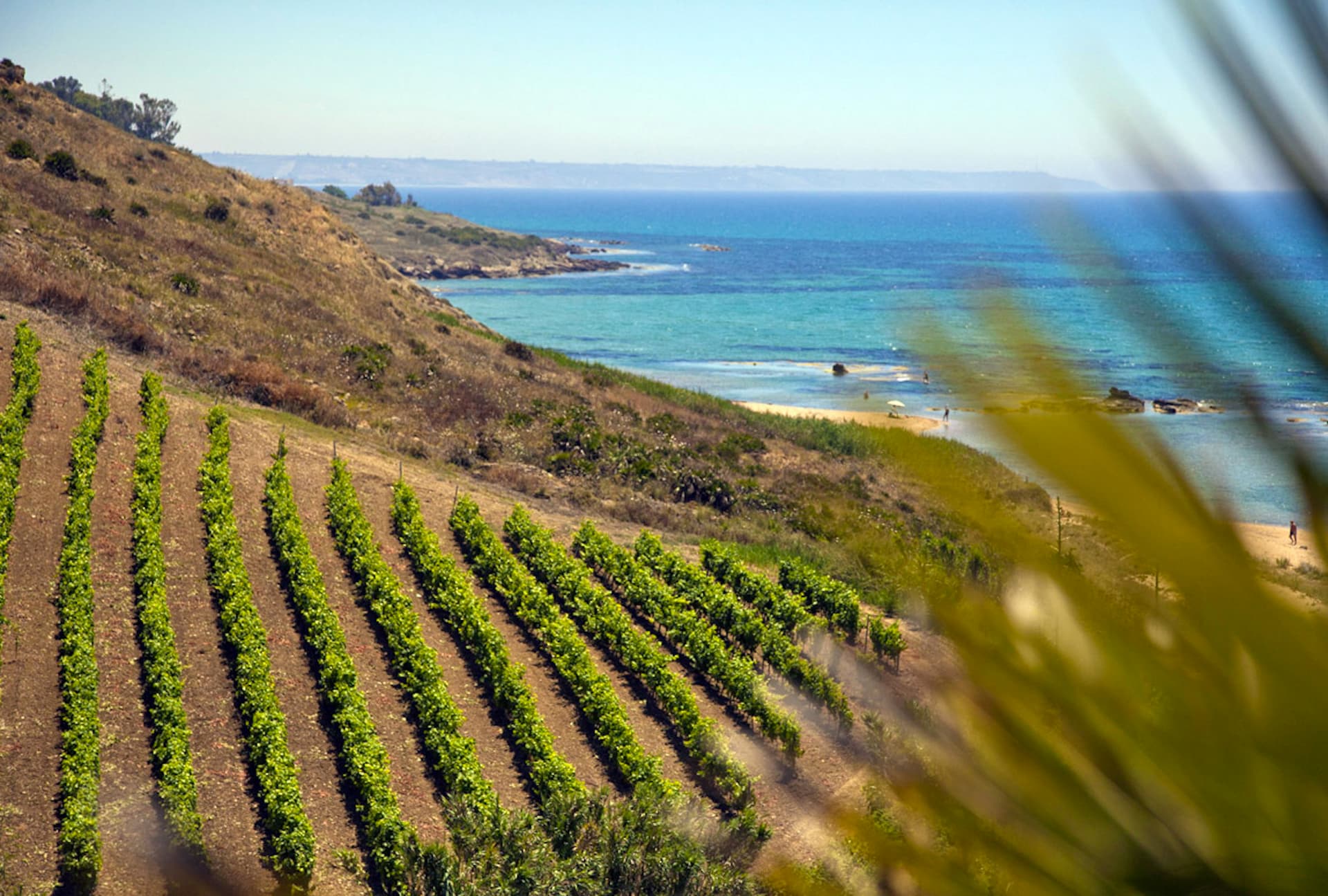
Menfi
Province: Agrigento · 119 m
Sicily's triple-signal western coast town — 11,800 residents on a low ridge above 9 km of Bandiera Blu sand at Porto Palo, with the Federico II tower, the Cantine Settesoli cooperative (Italy's largest by volume, 2,000 grower-members), and the rare Bandiera Blu + Città del Vino + Città dell'Olio combination.

Pantelleria
Province: Trapani · 8 m
A volcanic island closer to Tunisia than Sicily, where dry-stone dammusi sit among bush-trained Zibibbo vines listed by UNESCO.
Sambuca di Sicilia
Province: Agrigento · 350 m
An Arab-founded hill town in the Belice valley, named Borgo dei Borghi in 2016, still called Zabut in living memory before 1923.
Sant'Alfio
Province: Catania · 537 m
An Etna village at 537 meters where the world's largest and oldest chestnut tree has been measured at over 57 meters in girth.
Trentino-Alto Adige/Südtirol4

Brentonico
Province: Trento · 692 m
The Monte Baldo plateau town between Lake Garda and the Vallagarina, with chestnut groves, war trenches and a botanical garden of the Garden of Italy.
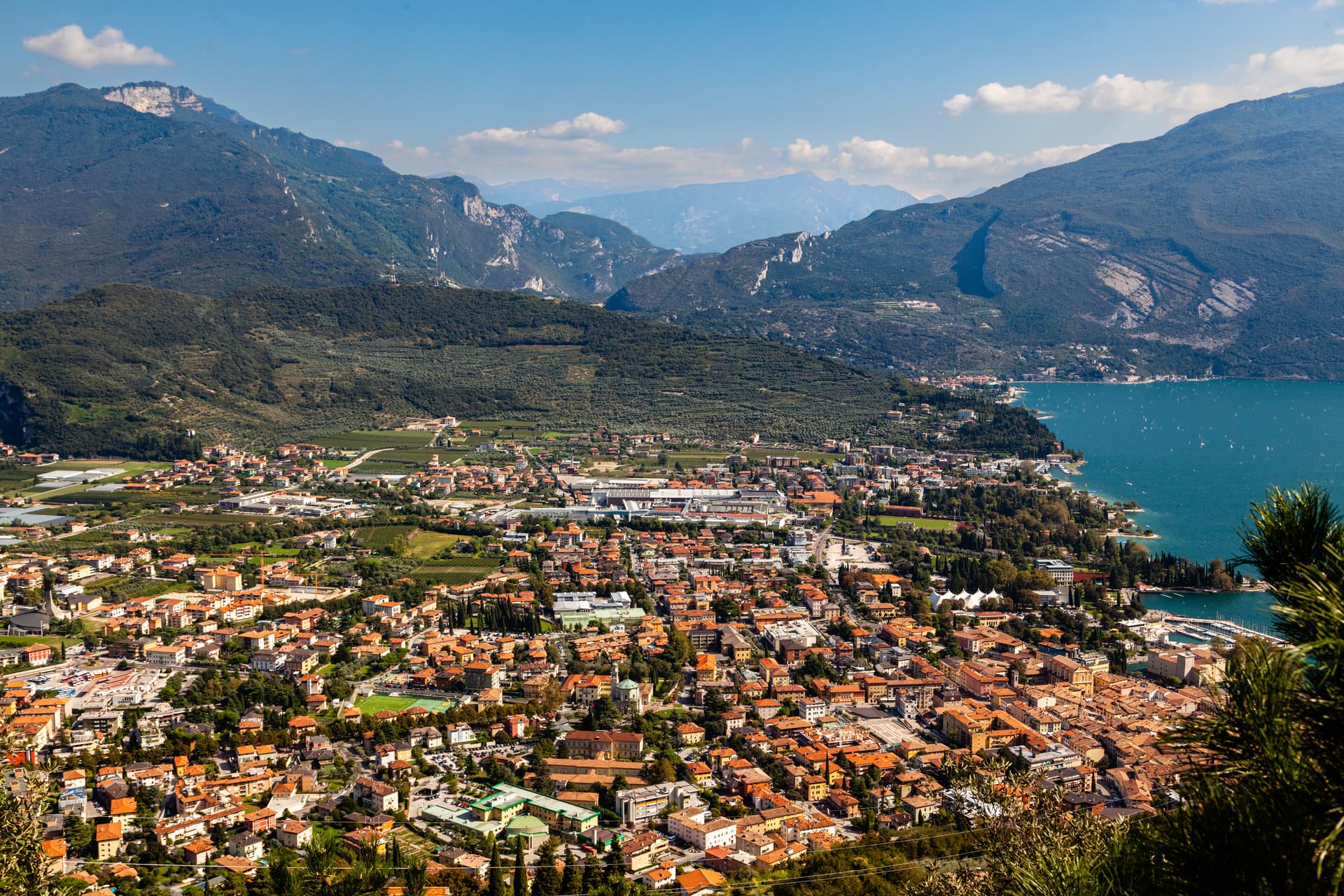
Riva del Garda
Province: Trento · 73 m
The north tip of Lake Garda at 73 metres, where the Trentino mountains close in on the water and a Habsburg port town stayed bilingual into the twentieth century.
Rovereto
Province: Trento · 204 m
The Vallagarina city at 204 metres where a Venetian-Austrian castle holds the Italian war museum and a Mario Botta dome holds Italy's largest contemporary art collection.
Trento
Province: Trento · 194 m
The Alpine capital on the Adige at 194 metres, where the Council that reshaped the Catholic Church met in a castle still standing above the city.
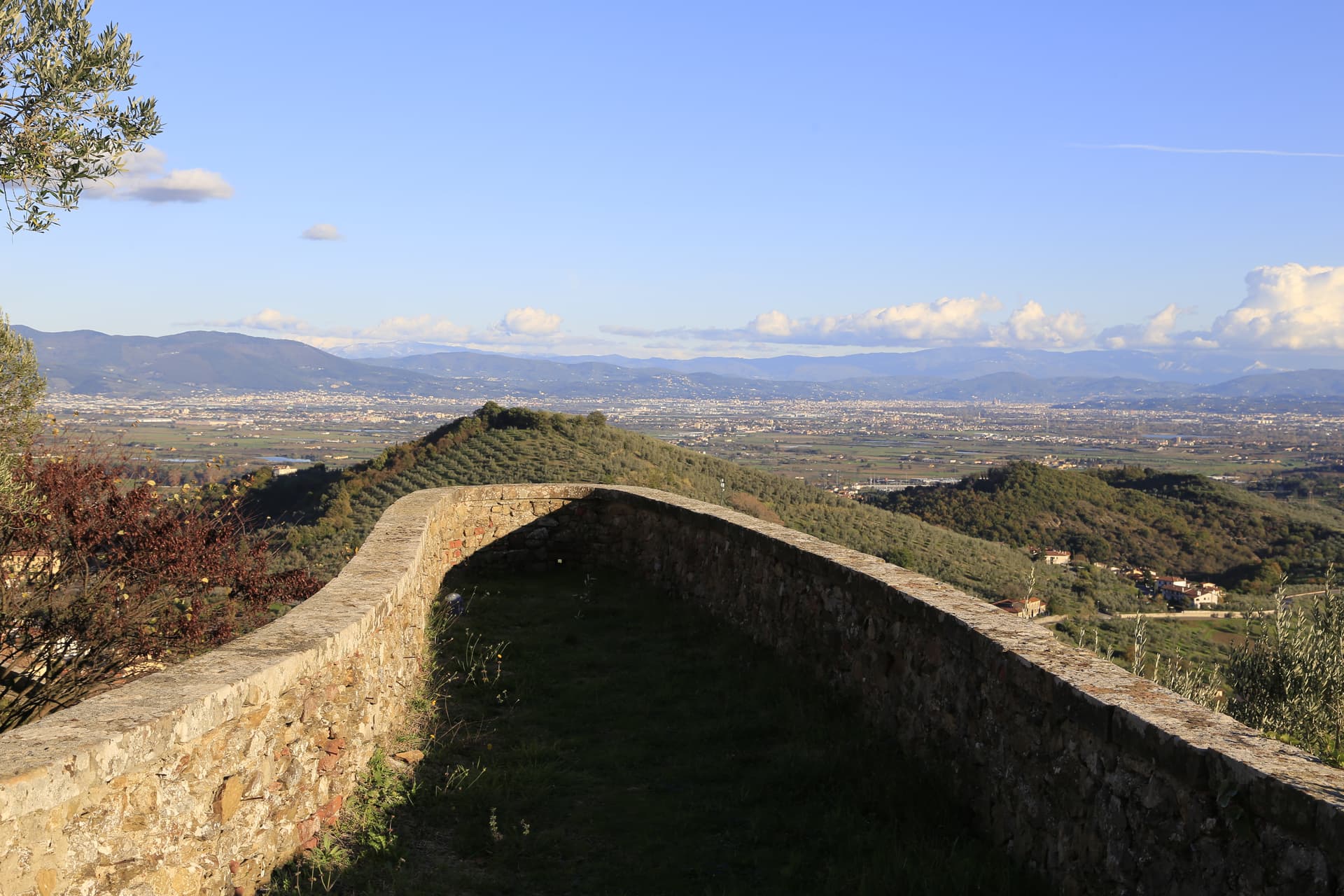
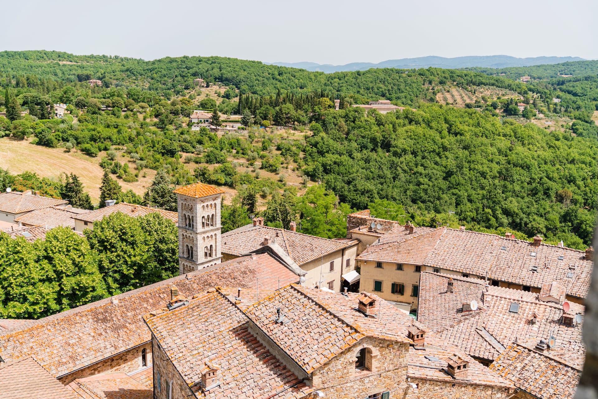
Tuscany26
- ✷ We've been
Campiglia Marittima
Province: Livorno · 231 m
A walled hilltop borgo above the Val di Cornia, where the Rocca tower watches a mining landscape worked from the Etruscans to 1976.
- ✷ We've been
Capalbio
Province: Grosseto · 217 m
A walled hilltop borgo at 217 meters in the southern Maremma, donated to the Abbey of Tre Fontane by Charlemagne and home of Niki de Saint Phalle's Tarot Garden.
Carmignano
Province: Prato · 189 m
A Medici village at 189 meters on the Montalbano slopes, where Pontormo's Visitation hangs in the parish church and Etruscan tumuli sit below the Renaissance villas.
- ✷ We've been

Castagneto Carducci
Province: Livorno · 194 m
A hilltop borgo at 194 meters above the Costa degli Etruschi, renamed for the poet Carducci in 1907 and the home of Bolgheri and Sassicaia.
- ✷ We've been
Castellina in Chianti
Province: Siena · 578 m
A Chianti hill town at 578 meters on the watershed between the Arno and the Ombrone, with an Etruscan tumulus, a Brunelleschi-reinforced wall and a covered medieval walkway around its edge.
- ✷ We've been
Castelnuovo Berardenga
Province: Siena · 351 m
A Chianti Classico commune at 351 meters between the Ombrone and the Crete Senesi, the last castle Siena built against Florence, in 1366.
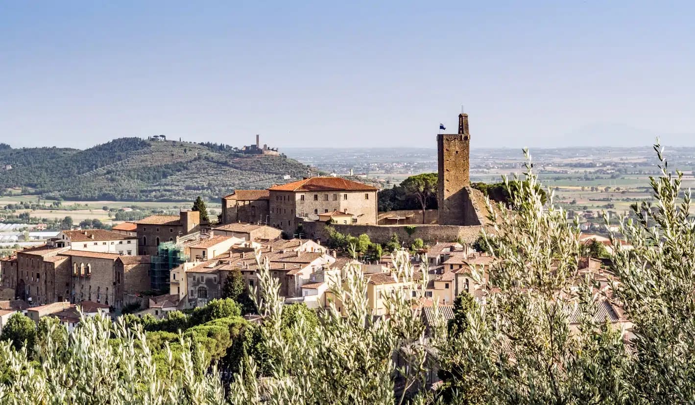
Castiglion Fiorentino
Province: Arezzo · 342 m
A walled hill town at 342 meters between Arezzo and Cortona, where Etruscan walls support the medieval Cassero and Vasari's loggia frames the Val di Chiana below.
- ✷ We've been
Castiglione d'Orcia
Province: Siena · 540 m
A stone borgo at 540 meters in the UNESCO Val d'Orcia, first recorded in 714, with two fortresses guarding the road from Amiata to the Via Francigena.
Cetona
Province: Siena · 384 m
A medieval borgo at 384 meters below Monte Cetona, sold by Cosimo I to the Vitelli in 1556 and the centro storico still shaped by their fortress reconstruction.
Chiusi
Province: Siena · 398 m
The Etruscan city of King Porsenna at 398 meters above the Val di Chiana, with one of Italy's major Etruscan museums and tunnels carved beneath the streets.
- ✷ We've been
Manciano
Province: Grosseto · 444 m
A market town at 444 meters in the southern Maremma, with a Sienese fortress of 1424 and the thermal frazione of Saturnia in its territory.

Massa Marittima
Province: Grosseto · 380 m
A medieval mining town at 380 meters in the Colline Metallifere, free commune from 1255 to 1337, whose cathedral holds the relics of San Cerbone.
- ✷ We've been
Montalcino
Province: Siena · 564 m
A walled hill town at 564 meters above the Val d'Orcia, the last fortress to hold out for the Sienese Republic and the birthplace of Brunello.
Montecarlo
Province: Lucca · 163 m
A walled hill village at 163 meters above the Lucca plain, founded by Emperor Charles IV in 1333 and named for him, surrounded by twenty wineries.
Montepulciano
Province: Siena · 605 m
A Renaissance hill town at 605 meters on a limestone ridge, where Vino Nobile is aged in vaulted cellars beneath the palazzi of Piazza Grande.
Montescudaio
Province: Pisa · 242 m
A fortified hill borgo at 242 meters above the Val di Cecina, named for a mountain of shields, with DOC wine since 1977 and bread, oil and grape all stamped in its identity.

Murlo
Province: Siena · 314 m
A medieval bishops' fief twenty kilometers south of Siena, with an Etruscan princely palace on Poggio Civitate and the Cappellone statue as its symbol.

Peccioli
Province: Pisa · 144 m
Borgo dei Borghi 2024 in the Valdera hills, a medieval village that funded a public contemporary-art program with revenue from its landfill plant.
- ✷ We've been
Piombino
Province: Livorno · 21 m
A promontory port facing Elba across the channel, founded by refugees from Etruscan Populonia and now the Tuscan archipelago's ferry capital.
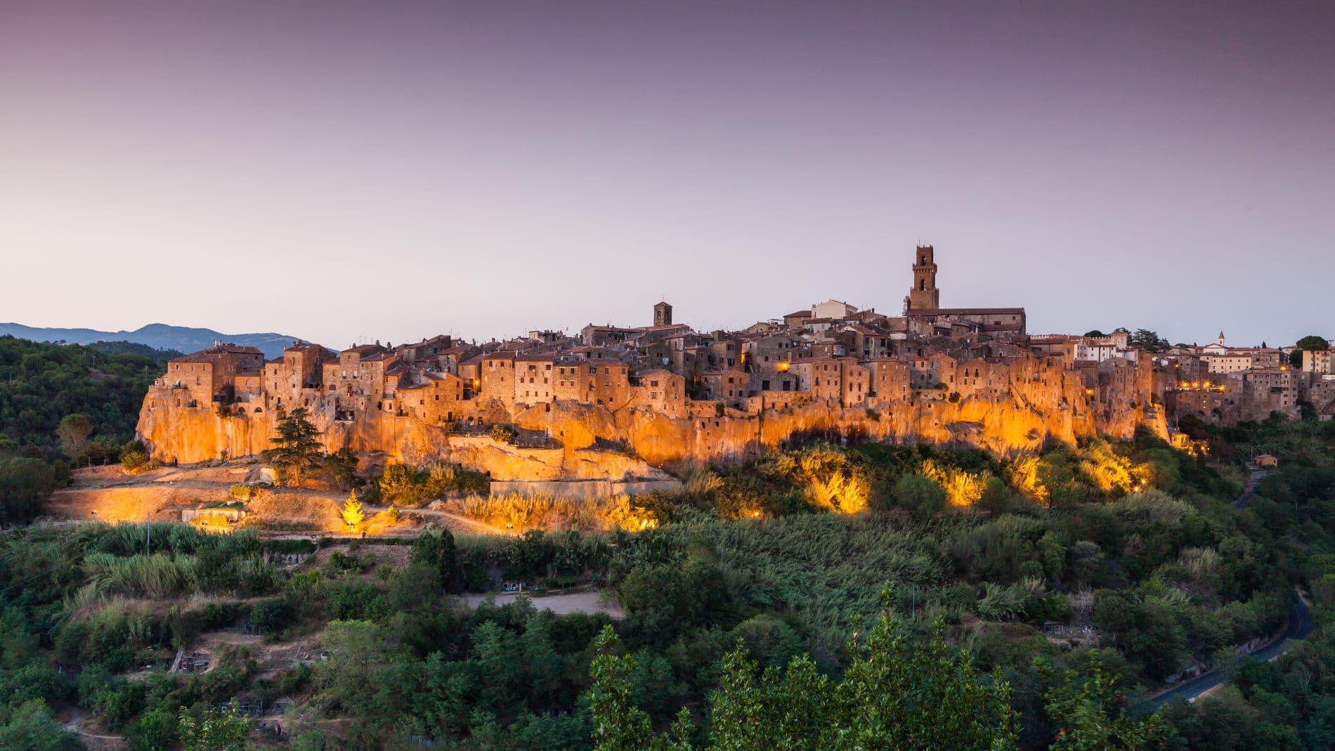
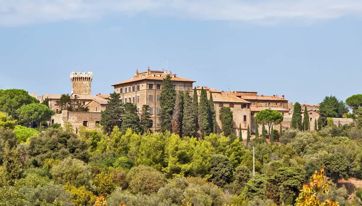
Pitigliano
Province: Grosseto · 313 m
The Little Jerusalem of southern Tuscany, carved into a tuff spur in the Maremma, where the houses, the synagogue and the streets are all cut from the same volcanic rock.
Rapolano Terme
Province: Siena · 334 m
A Sienese thermal town in the Crete Senesi, 38-degree calcium-sulphur waters and travertine quarries that supplied the Pienza Duomo and Montepulciano's San Biagio.

San Casciano dei Bagni
Province: Siena · 582 m
A hilltop borgo at 582 meters above 42 hot springs that produced the largest Etruscan bronze hoard of the last fifty years.
- ✷ We've been
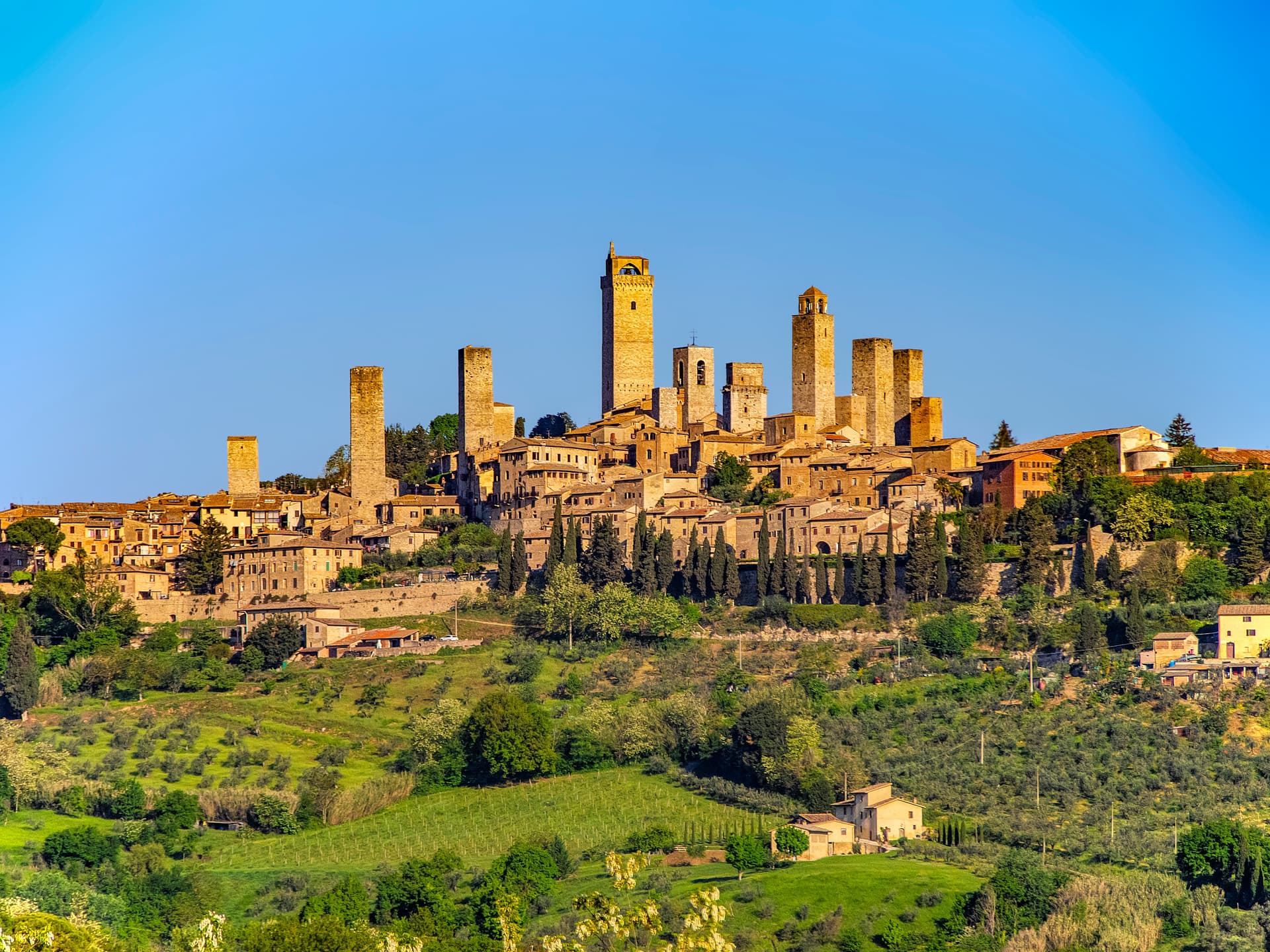
San Gimignano
Province: Siena · 334 m
A walled hill town at 334 meters with 14 surviving medieval towers, UNESCO listed since 1990 and the home of Vernaccia.
- ✷ We've been

Siena
Province: Siena · 322 m
The medieval rival of Florence at 322 meters on three hills, with a shell-shaped piazza where seventeen contrade race bareback horses twice a year.
- ✷ We've been
Suvereto
Province: Livorno · 127 m
A stone borgo at 127 meters above the Val di Cornia, named for the cork oaks of its forests and ruled from the Rocca Aldobrandesca since 973.
Vinci
Province: Firenze · 97 m
The hill town on Montalbano where Leonardo was born in 1452, with a ship-shaped castle that now holds his machines.
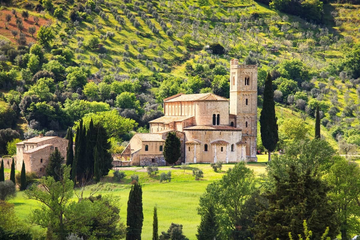
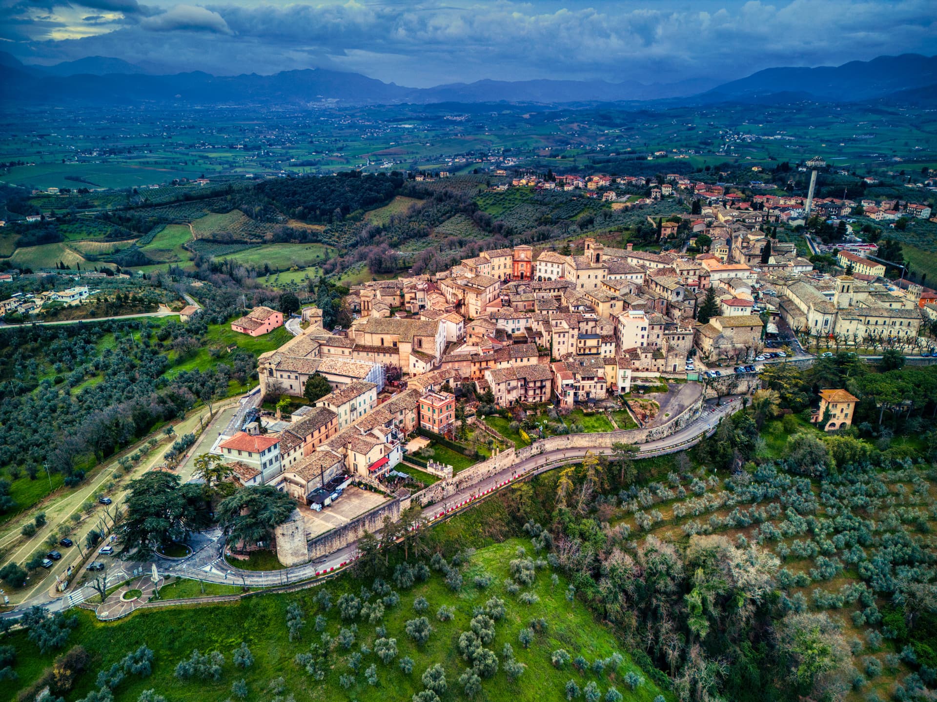
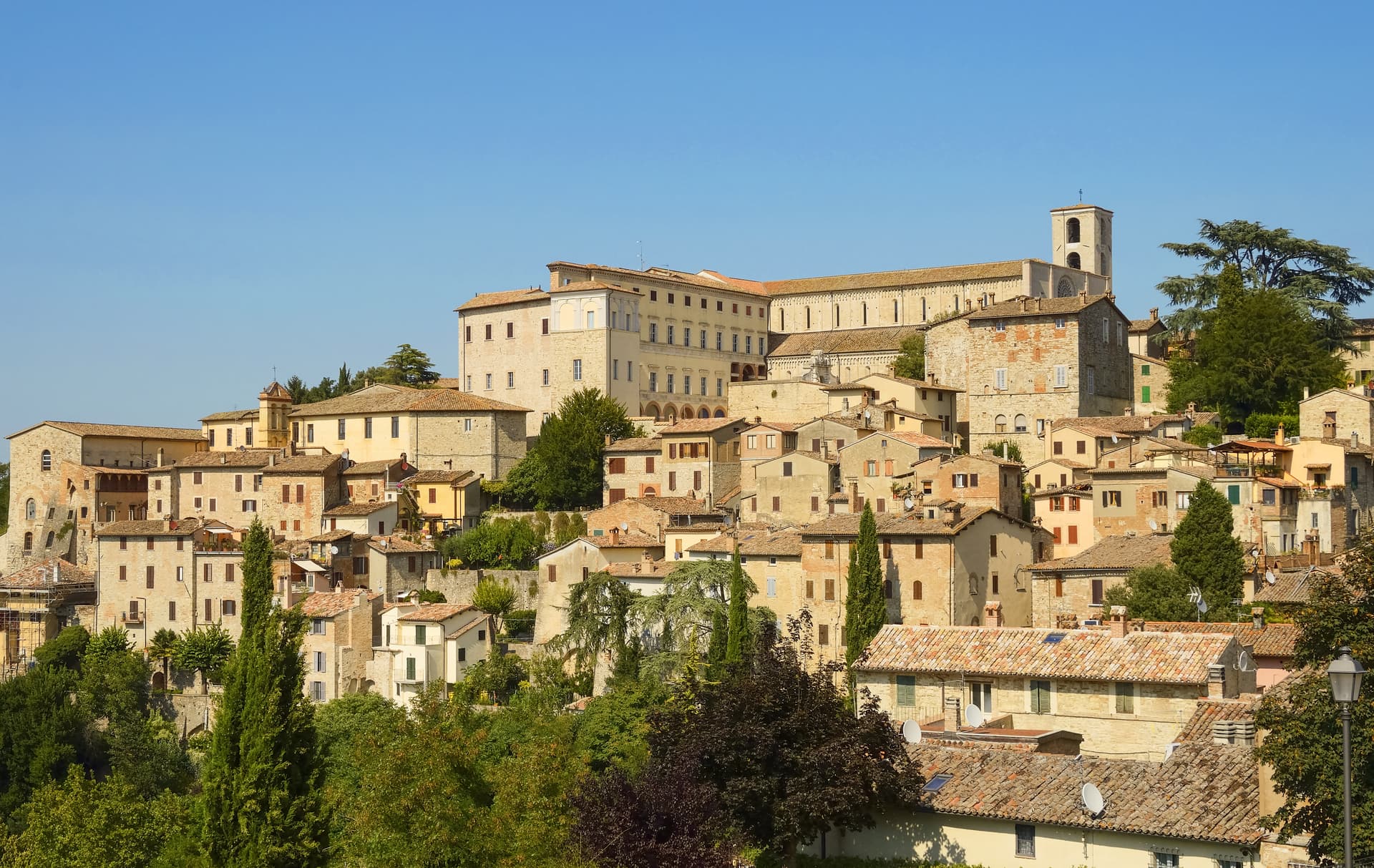
Umbria8
Bevagna
Province: Perugia · 225 m
Roman Mevania on the Umbrian plain at 225 meters, four medieval quarters that compete every June in a reconstructed market of the 13th century.
Giano dell'Umbria
Province: Perugia · 547 m
A hill commune at 547 meters between Foligno, Spoleto and Todi, anchored by a Romanesque abbey founded over the tomb of a fourth-century martyr.
Montefalco
Province: Perugia · 472 m
The hilltop wine capital of Umbria at 472 meters, where Sagrantino is grown almost nowhere else and Benozzo Gozzoli painted Francis in 1452.
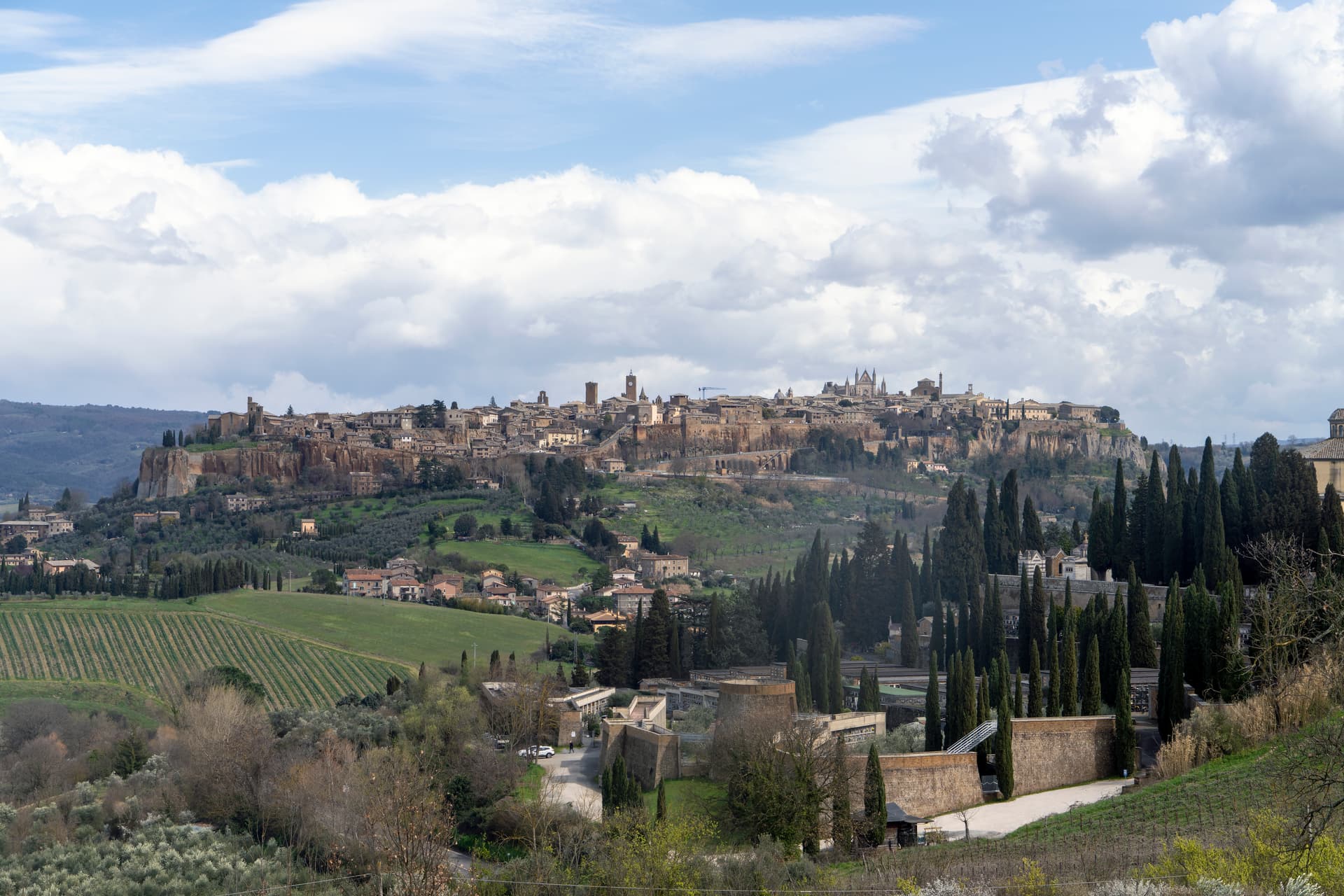
Orvieto
Province: Terni · 325 m
Etruscan Velzna on a 325-meter tufa butte, the medieval refuge of popes and the home of Italy's most decorated Gothic cathedral.
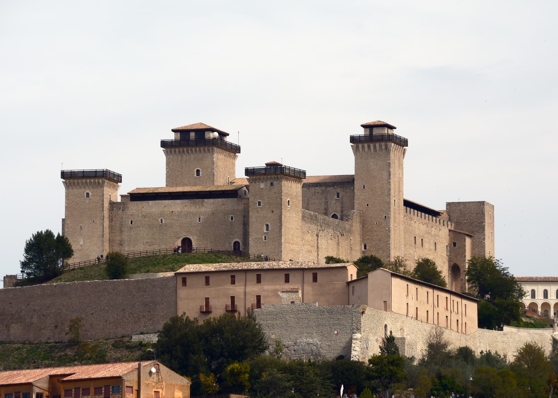
Spoleto
Province: Perugia · 396 m
Lombard ducal capital at 396 meters under the Rocca Albornoziana, where a 230-meter aqueduct bridge crosses to Monteluco and Menotti founded the Festival in 1958.
Todi
Province: Perugia · 398 m
A walled hill town at 398 meters on the Tiber, with Etruscan, Roman, and medieval rings stacked up Colle Nidoli.
Torgiano
Province: Perugia · 219 m
A walled river town at 219 meters at the confluence of the Tiber and the Chiascio, the first DOC and DOCG zone in Umbria.
Trevi
Province: Perugia · 412 m
A walled town at 412 meters above the Spoleto valley, ringed by 200,000 olive trees that make it the Umbrian capital of olive oil.
Veneto13
Arquà Petrarca
Province: Padova · 56 m
The Euganean Hills village where Francesco Petrarca spent his last four years and died in 1374, renamed in his honor in 1868.

Asolo
Province: Treviso · 205 m
A walled hill town at 205 meters that Caterina Cornaro ran as her court after trading Cyprus to Venice in 1489.
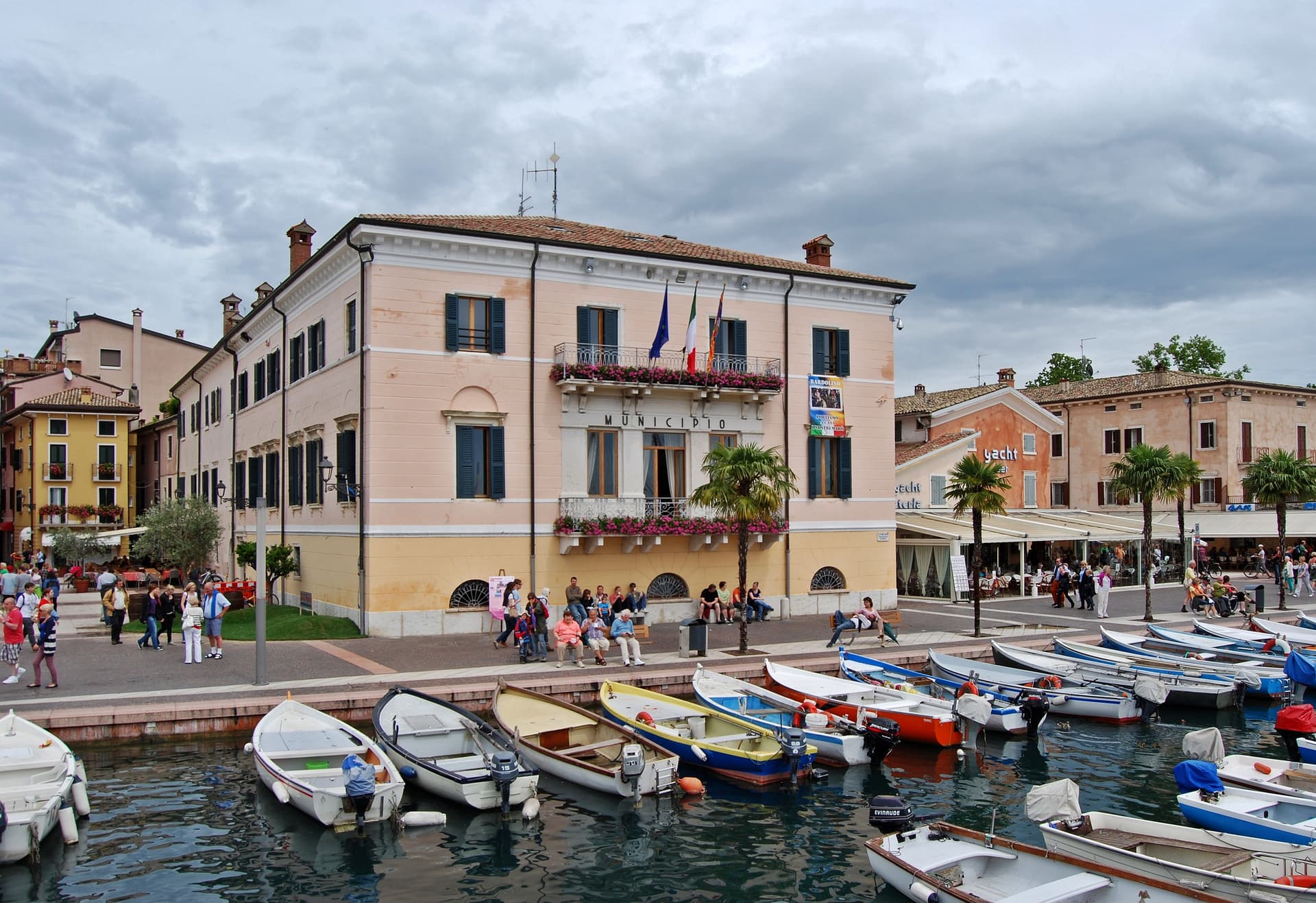
Bardolino
Province: Verona · 65 m
Lake Garda's east-shore wine town at 65 meters, where Corvina and Rondinella grapes have made Bardolino and Chiaretto since the Roman period.
Cison di Valmarino
Province: Treviso · 261 m
A Prosecco hills borgo at 261 meters under the dolomite rock of CastelBrando, the largest inhabited castle complex in Europe.
Conegliano
Province: Treviso · 65 m
The Prosecco capital at 65 meters, birthplace of the painter Cima and home of Italy's first oenology school, opened in 1876.
Farra di Soligo
Province: Treviso · 161 m
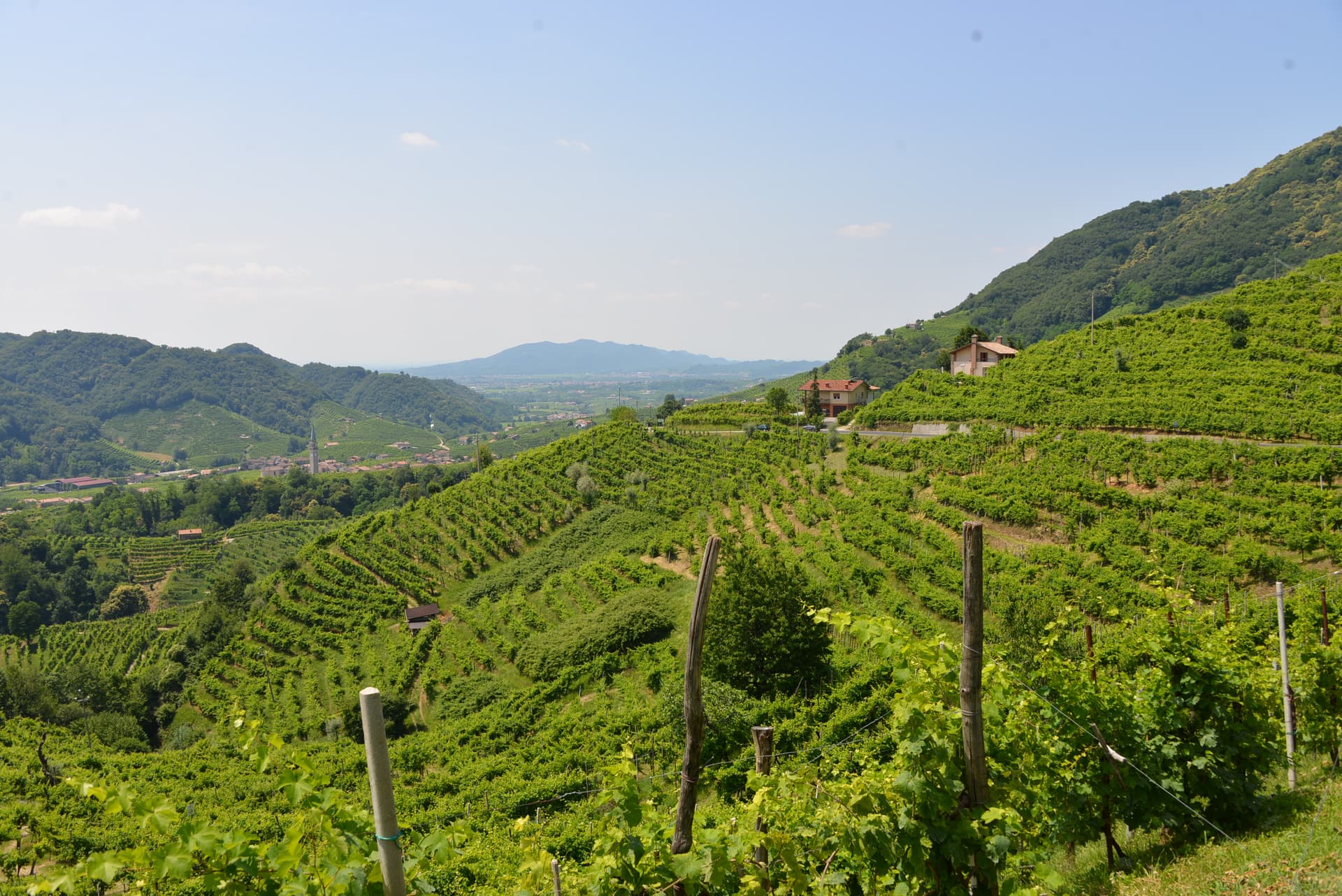
The heart of the Prosecco Hills UNESCO landscape — an 8,477-resident comune in the Conegliano-Valdobbiadene DOCG zone (UNESCO World Heritage since 2019), with the three medieval Torri di Credazzo crowning a hilltop above its vineyards, Cittaslow + Città del Vino signals, and direct walking access to the most photographed stretch of the hogback ridge.
Follina
Province: Treviso · 191 m
A Prosecco-hills borgo at 191 meters around the Cistercian Abbey of Santa Maria, with a cloister finished in 1268.

Lazise
Province: Verona · 76 m
The walled port on the southeastern shore of Lake Garda granted the right to fortify in 983, considered the first comune in Italy.
Pieve di Soligo
Province: Treviso · 132 m
The market town between the Soligo and Lierza rivers in the Prosecco UNESCO zone, birthplace of the twentieth-century poet Andrea Zanzotto.

Soave
Province: Verona · 40 m
A walled wine town twenty kilometers east of Verona, 2022 Borgo dei Borghi winner, where Garganega vineyards climb to the Scaligeri castle on Colle Tenda.

Susegana
Province: Treviso · 76 m
The Collalto castle town at 76 meters on the left bank of the Piave, with one of the largest medieval fortresses in northern Italy.
Valdobbiadene
Province: Treviso · 253 m
The Prosecco Superiore capital at 253 meters in the Treviso Prealps, where Glera grown on Cartizze's 108 hectares produces the most expensive Italian sparkling wine.
Vittorio Veneto
Province: Treviso · 138 m
Two old towns fused at 138 meters under the Cansiglio, where the October 1918 battle ended the First World War on the Italian front.
Subscribe — free
Get the best guides on hidden Italian towns.
One letter on Sundays. The week’s town, with the photo, the food, the festa. Free, by Peter & Sophia from Pietrasanta.
Substack sends a confirmation link to your inbox. The signup finishes when it’s clicked.
From elsewhere in Italy
Five more towns to discover
Putignano
Province: Bari
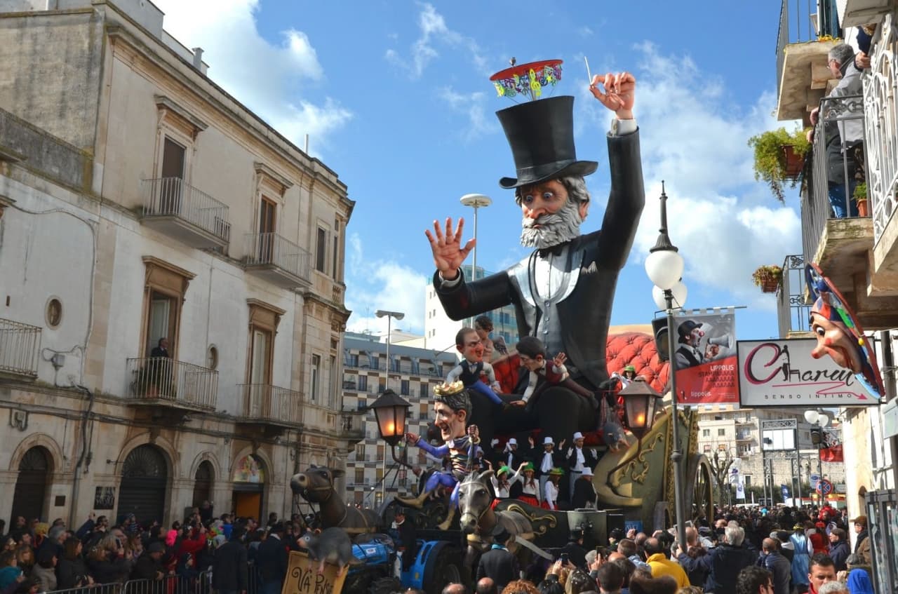
Europe's longest-running carnival — Putignano Carnevale has run continuously since 1394, with 631 years of cartapesta papier-mâché floats, a 26,000-resident Murgia town on the Bari–Lecce plateau, and the Grotta del Trullo karst cave inside the centro.

Pistoia
Province: Pistoia
Italy's nursery capital and the medieval Tuscan rival that gave its name to the pistol — a quietly extraordinary centro storico of zebra-striped Romanesque churches, Andrea della Robbia's polychrome frieze on the Ospedale del Ceppo, and Italy's Capital of Culture 2017, all 30 minutes from Florence by train.
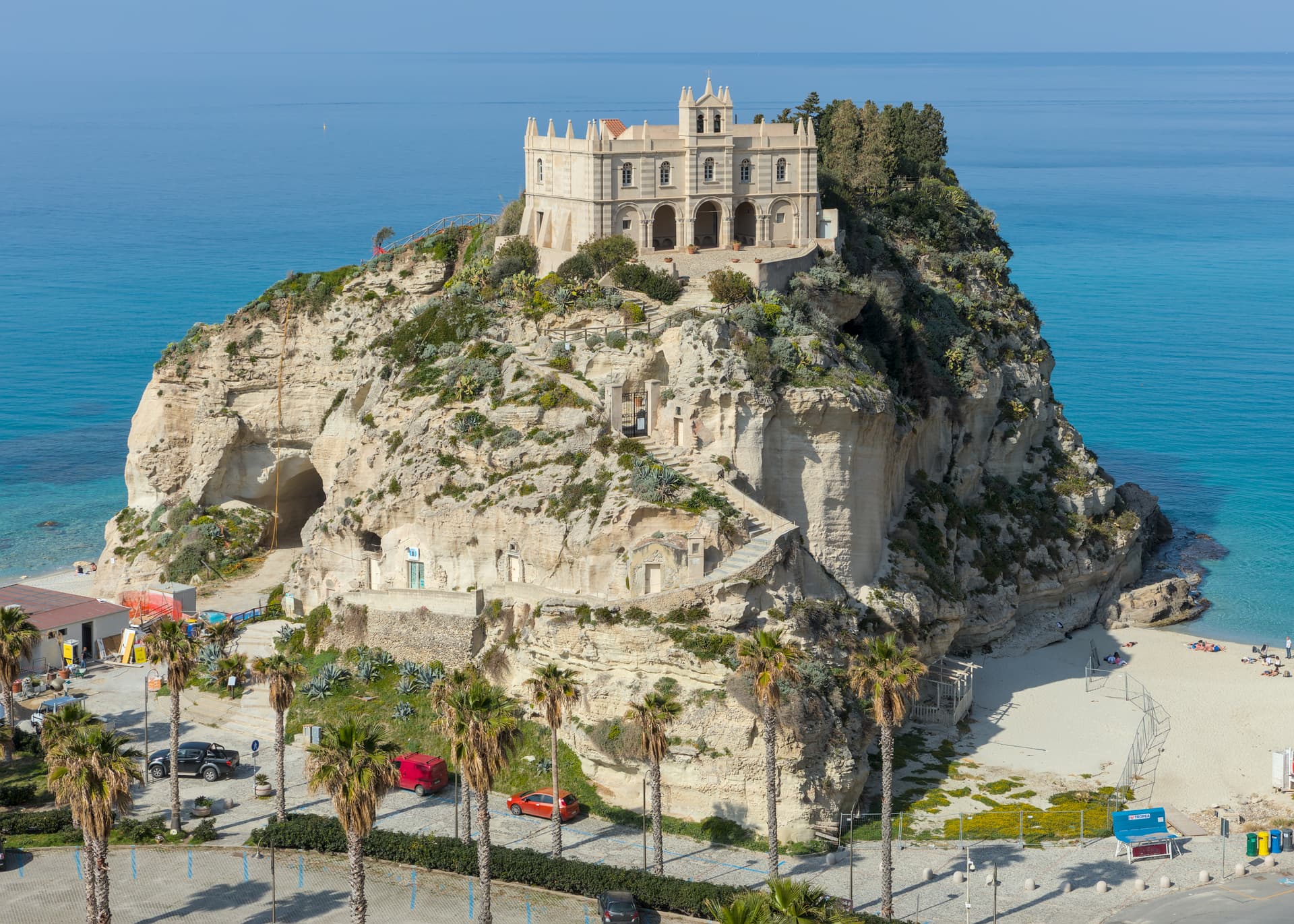
Tropea
Province: Vibo Valentia
Cliff town on a tufa headland over the Tyrrhenian Coast of the Gods, with a Norman monastery on a sea rock.
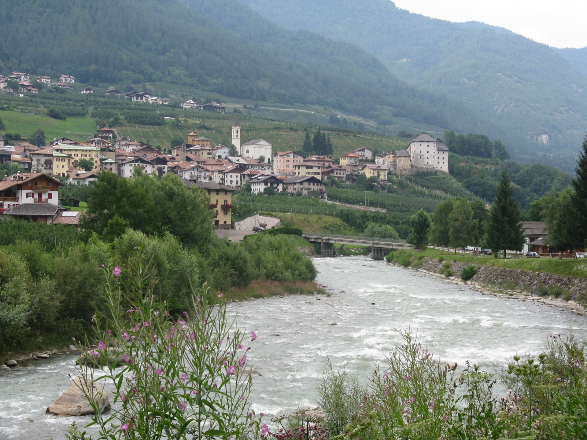
Caldes
Province: Trento
A scattered Val di Sole commune on the Noce, six hamlets gathered around a thirteenth-century tower-house castle that once belonged to the Thun family.
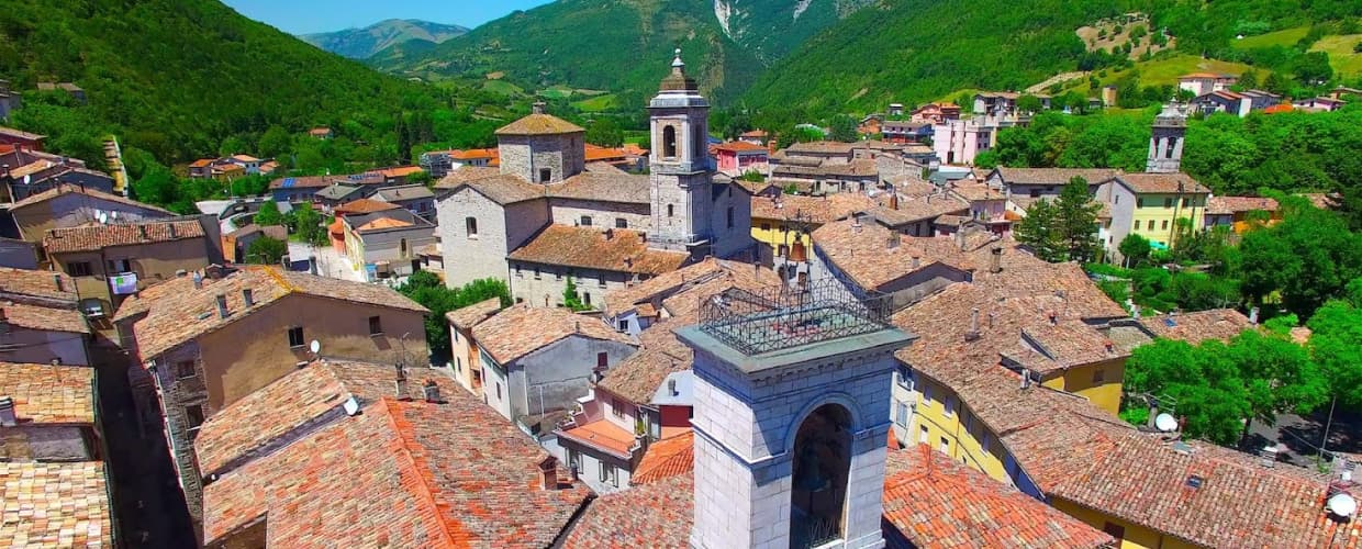
Cantiano
Province: Pesaro e Urbino
A border borgo at 374 meters under Monte Catria on the old Via Flaminia, known for the Good Friday Turba and the sour-cherry visciola harvest.