
Marche · Ancona
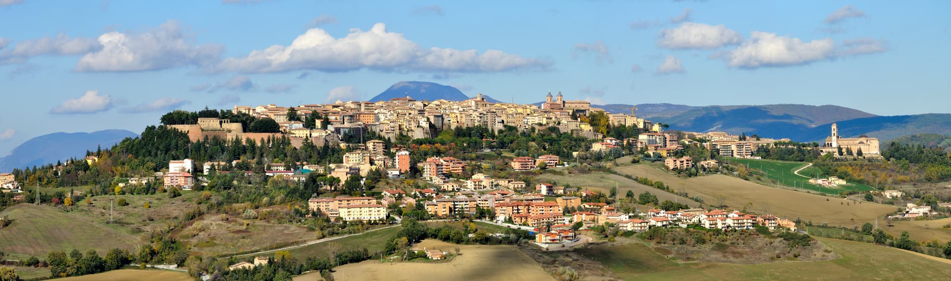
Staffolo
The Verdicchio balcony above three valleys, with a near-circular medieval wall ring and a wine museum carved into the ramparts.
Known for
VERDICCHIO
Colle del Verdicchio, in the heart of the Castelli di Jesi DOCG zone, with cultivation documented locally from 1569.
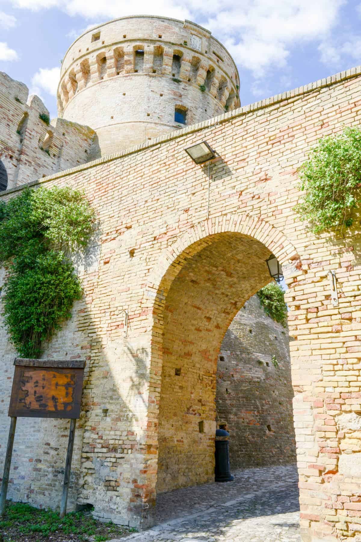
TORRE ALBORNOZ
Fourteenth-century watchtower rising from the walls, the highest point of the near-circular medieval circuit.
BALCONE DELLA VALLESINA
Panoramic ridge looking across three valleys (Esino, Misa, Musone) toward the Adriatic, the source of the town's nickname.
When to visit
Best · Apr–Oct
- J
- F
- M
- A
- M
- J
- J
- A
- S
- O
- N
- D
- Best
- Hot or crowded
- Quiet
- Mostly closed
The festa: Egidio, 1 September
Why come
Staffolo rises to 442 meters on a hill between the Esino, Misa and Musone valleys, thirty-five kilometers from Ancona. The town calls itself the Balcone della Vallesina for the panoramic ridge it stands on, and Colle del Verdicchio for the vines that cover the south-facing slopes around it. Verdicchio cultivation here is documented from 1569; the surrounding Castelli di Jesi DOCG zone draws from south-facing parcels between 220 and 500 meters of altitude.
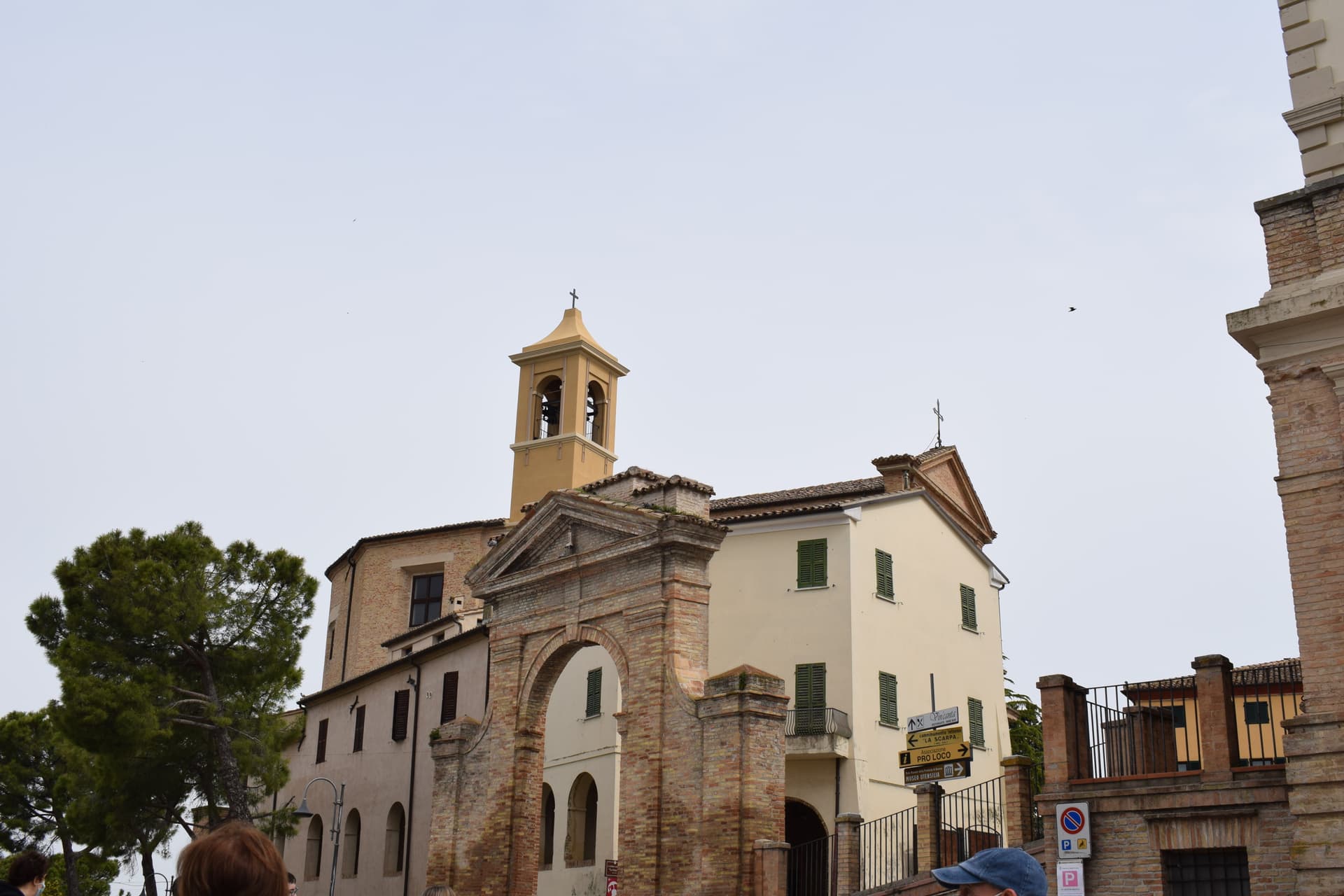
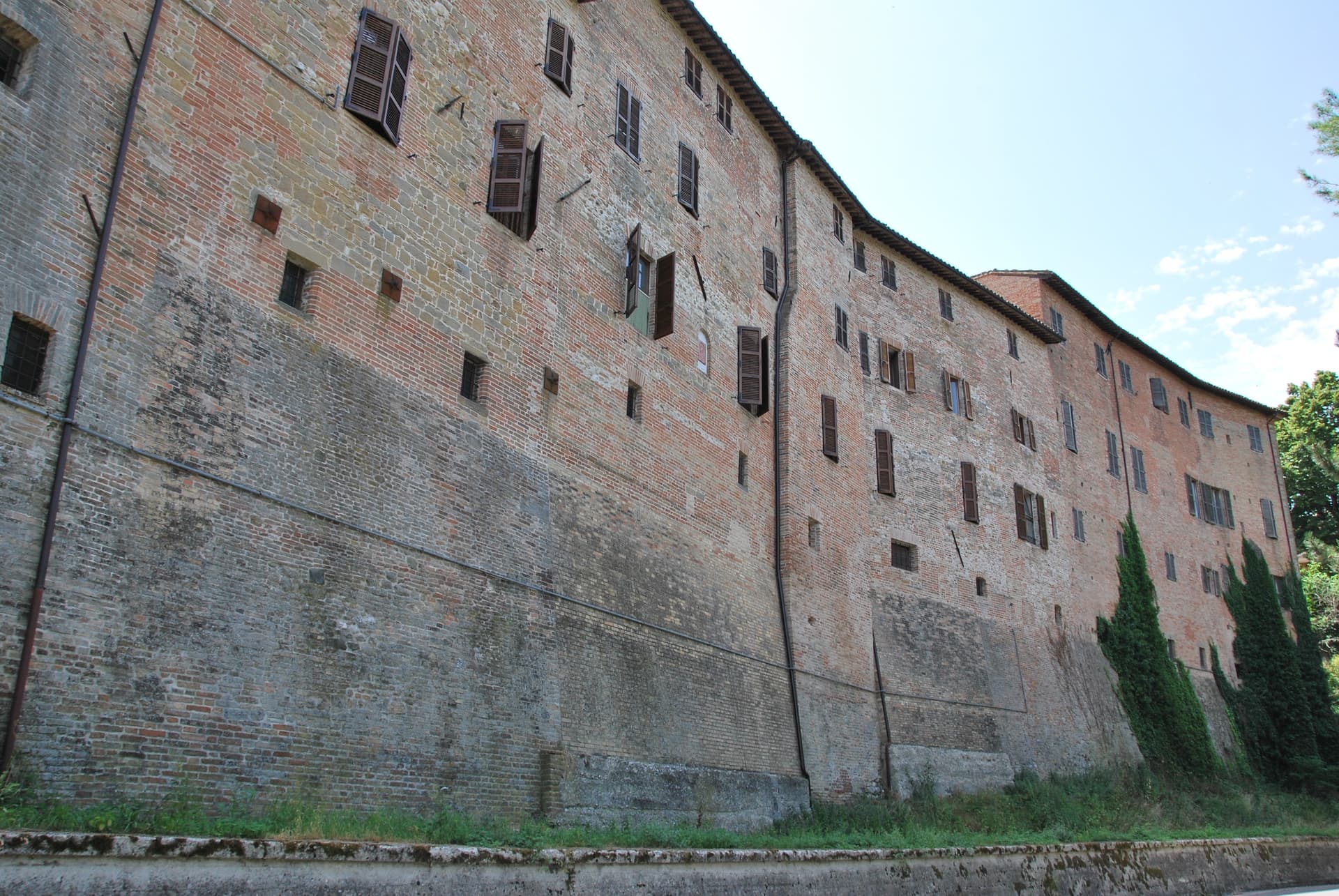
The centro storico is almost circular, walled with partly original ramparts and entered through two opposing gates; the fourteenth-century Albornoz tower rises above the walls. The Museo dell'Arte del Vino, carved into rooms inside the walls themselves, holds an oak press from 1695 and the working tools of the local cellars, with an enoteca attached. Three churches anchor the village: Sant'Egidio with a fifteenth-century Master of Staffolo polyptych, San Francesco with a 1769 Callido organ, and the baroque Santa Maria di Castellaretta built by survivors of the Battle of Lepanto.
The Sunday letter
We haven’t written Staffolo’s letter yet.
One town every Sunday, with the photo, the food, the festa. Be there when this one comes up. Free, by Peter & Sophia from Pietrasanta.
By subscribing you agree to Substack’s Terms of Use, our Privacy Policy and our Information collection notice.


What to see
Centro storico
Almost circular walled medieval nucleus with partly original ramparts, two opposing gates and the fourteenth-century Torre Albornoz rising above the circuit.
Museo dell'Arte del Vino
Wine museum carved into rooms inside the walls themselves, holding an oak grape press from 1695 and the working tools of the Staffolo cellars, with attached enoteca.
Chiesa di Sant'Egidio
Parish church on the ridge, holding a fifteenth-century polyptych by the anonymous Master of Staffolo of the Fabrianese school.
Chiesa di San Francesco
Conventual church with a Callido organ from 1769 still in working order, on the eastern flank of the centro storico.
Santa Maria di Castellaretta
Baroque votive temple just outside the walls, built by residents who returned from the 1571 Battle of Lepanto.
The slow-trip planner
Building a trip? Find where Staffolo fits in a slow Italy circuit.
Answer five questions. We will shape a geographically coherent slow trip from the 1,000 Italian towns most travelers skip. Yours to save and share.
Living here
- Population 2,087
- Commuter belti
- Pharmacy in town
- High school within a 30-minute drive
- Nearest airport Ancona / Pescara, 31 min drive
- Regional capital Ancona, 42 min drive
Tags & datadesignations · numbers · sources
Recognised as
The numbers
- Elevation: 442 m
- Population: 2,087
- Surface area: 27.5 km²
These figures were compiled from public directories — ISTAT, OpenStreetMap, Wikidata — and from the official listings of the guides named on this page. Town details change; verify with official sources before you travel.
Close by
More towns near Staffolo
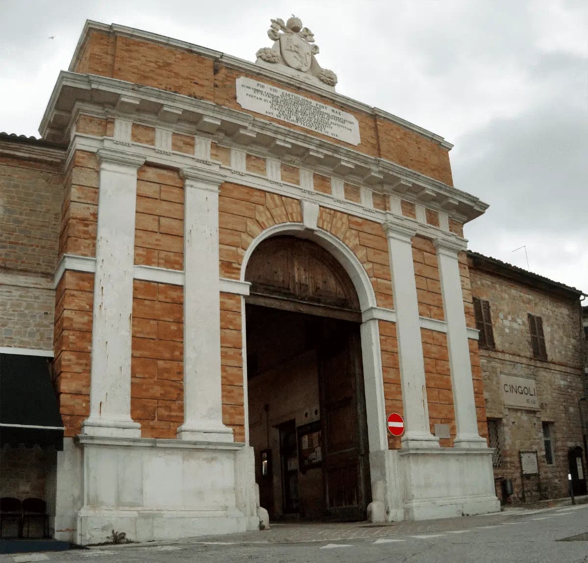
Cingoli
Province: Macerata
The Balcone delle Marche at 631 meters, a hilltop borgo where on clear days the view runs from the Sibillini to the Croatian coast.
Serra San Quirico
Province: Ancona
A stone borgo on Monte Murano at the entrance to the Gola della Rossa, ringed by 1300 walls with covered passageways called copertelle.
Morro d'Alba
Province: Ancona
A walled Castello di Jesi at 199 meters above the Esino valley, ringed by La Scarpa, the 300-meter covered walkway unique in Italy.

San Severino Marche
Province: Macerata
A two-level town where a 224-meter elliptical piazza in the lower city looks up at the Smeducci tower and Salimbeni-painted churches on Monte Nero.

Offagna
Province: Ancona
A hilltop borgo at 309 meters between Ancona and Osimo, dominated by a Rocca built in just two years by the Anconitans in 1454-56.
🟠 Bandiera Arancione
More Bandiera Arancione towns in Marche
Acquaviva Picena
Province: Ascoli Piceno
A walled hill borgo at 359 meters six kilometers from the Adriatic, anchored by a Baccio Pontelli fortress and the surviving pajarola craft.
Amandola
Province: Fermo
A Sibillini gateway at 550 meters on three hills above the Tenna valley, founded 1248 and damaged but not levelled in 2016.
Camerino
Province: Macerata
A university city at 661 meters on the ridge between the Chienti and Potenza, Da Varano capital from 1259 to 1539, rebuilding after 2016.
Cantiano
Province: Pesaro e Urbino
A border borgo at 374 meters under Monte Catria on the old Via Flaminia, known for the Good Friday Turba and the sour-cherry visciola harvest.
Corinaldo
Province: Ancona
A walled hill borgo at 203 meters with 912 meters of intact medieval walls, the birthplace of Saint Maria Goretti and the Pozzo della Polenta.