
Marche · Pesaro e Urbino
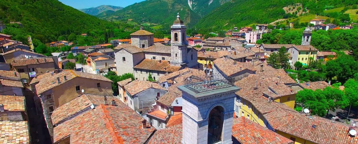
Cantiano
A border borgo under Monte Catria on the old Via Flaminia, known for the Good Friday Turba and the sour-cherry visciola harvest.
Known for
LA TURBA
Good Friday Passion procession with 250 costumed actors, performed since the 1260s and one of the oldest continuous sacred dramas in Italy.
VISCIOLA
Wild sour cherry from the surrounding hills, harvested in June and turned into visciolata, the local infused cherry wine.
PANE DI CANTIANO
Bread made to a Città del Pane standard, with sourdough from the local mills, central to the town's craft economy.
When to visit
Best · Apr–Oct
- J
- F
- M
- A
- M
- J
- J
- A
- S
- O
- N
- D
- Best
- Hot or crowded
- Quiet
- Mostly closed
The festa: Giovanni Battista, 24 June
Why come
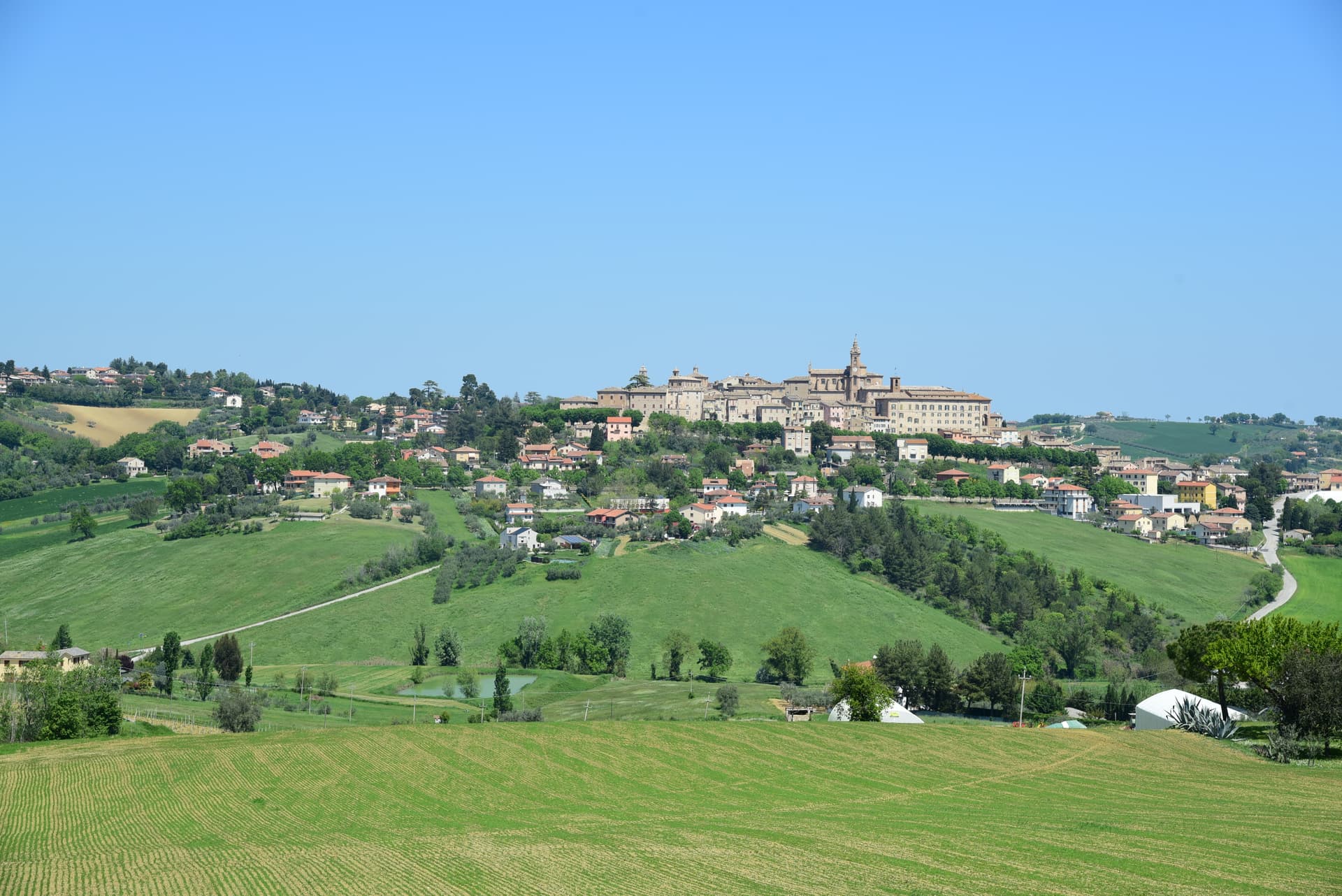
Cantiano sits on the southern slope of Monte Catria (1,702 meters), on the old Via Flaminia where the Marche meets Umbria. The town has been Bandiera Arancione for two decades and carries the Città del Pane and Comuni Virtuosi marks for its bakeries and its waste-reduction policies. The Turba, a Good Friday procession with 250 costumed actors in mid-thirteenth-century dress, traces the Passion through the streets of the centro storico and is among the oldest continuously performed sacred dramas in Italy, with documented origins in the 1260s among the Disciplinati flagellant brotherhoods.
The visciola, a wild sour cherry from the hills around town, is harvested in June and turned into the local visciolata wine, infused on the cherry skins and pits. Monte Catria above the town has been an eremitic site since 980, with the monastery of Fonte Avellana, where Dante stayed, on the western flank.
The Sunday letter
We haven’t written Cantiano’s letter yet.
One town every Sunday, with the photo, the food, the festa. Be there when this one comes up. Free, by Peter & Sophia from Pietrasanta.
By subscribing you agree to Substack’s Terms of Use, our Privacy Policy and our Information collection notice.

What to see
La Turba di Cantiano
Good Friday procession with 250 costumed actors in mid-thirteenth-century dress, traces the Passion through the centro storico, performed since the 1260s.
Monte Catria
At 1,702 meters, the highest peak of the northern Apennines on this stretch, with eremitic sites used since the tenth century on its western flank.
Collegiata di San Giovanni Battista
Main parish church of the centro storico, built in the seventeenth century over an earlier medieval foundation, with eighteenth-century paintings inside.
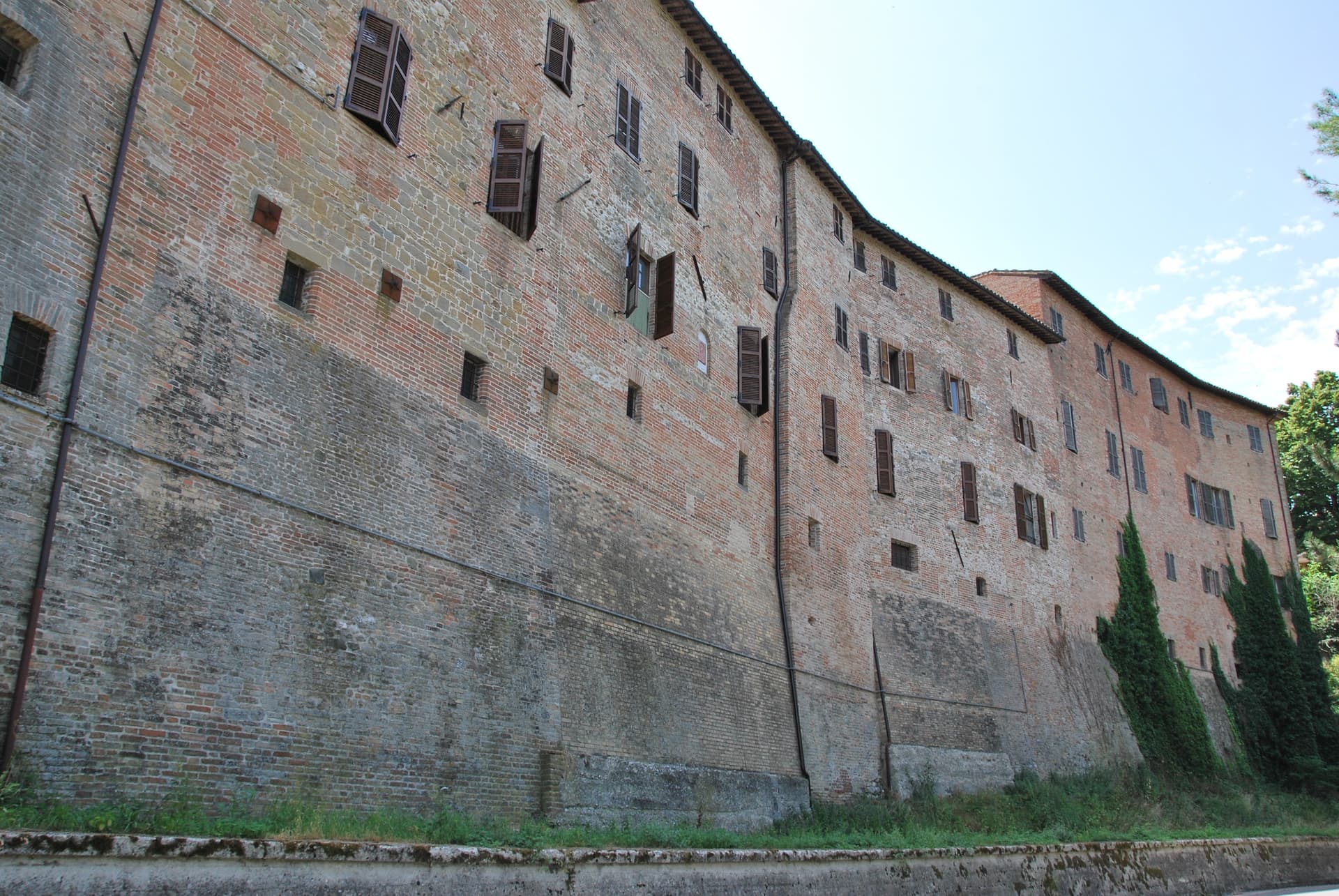
Centro storico di Cantiano
Walled border-town centro storico on the Via Flaminia route, recognized with the Bandiera Arancione, with bakeries that hold the Città del Pane status.
The slow-trip planner
Building a trip? Find where Cantiano fits in a slow Italy circuit.
Answer five questions. We will shape a geographically coherent slow trip from the 1,000 Italian towns most travelers skip. Yours to save and share.
Living here
- Population 1,999
- Off the beaten pathi
- Pharmacy in town
- High school within a 30-minute drive
- Nearest airport Ancona / Pescara, 1 h 25 min drive
- Regional capital Ancona, 1 h 37 min drive
Tags & datadesignations · numbers · sources
Recognised as
The numbers
- Elevation: 374 m
- Population: 1,999
- Surface area: 83.25 km²
These figures were compiled from public directories — ISTAT, OpenStreetMap, Wikidata — and from the official listings of the guides named on this page. Town details change; verify with official sources before you travel.
Close by
More towns near Cantiano
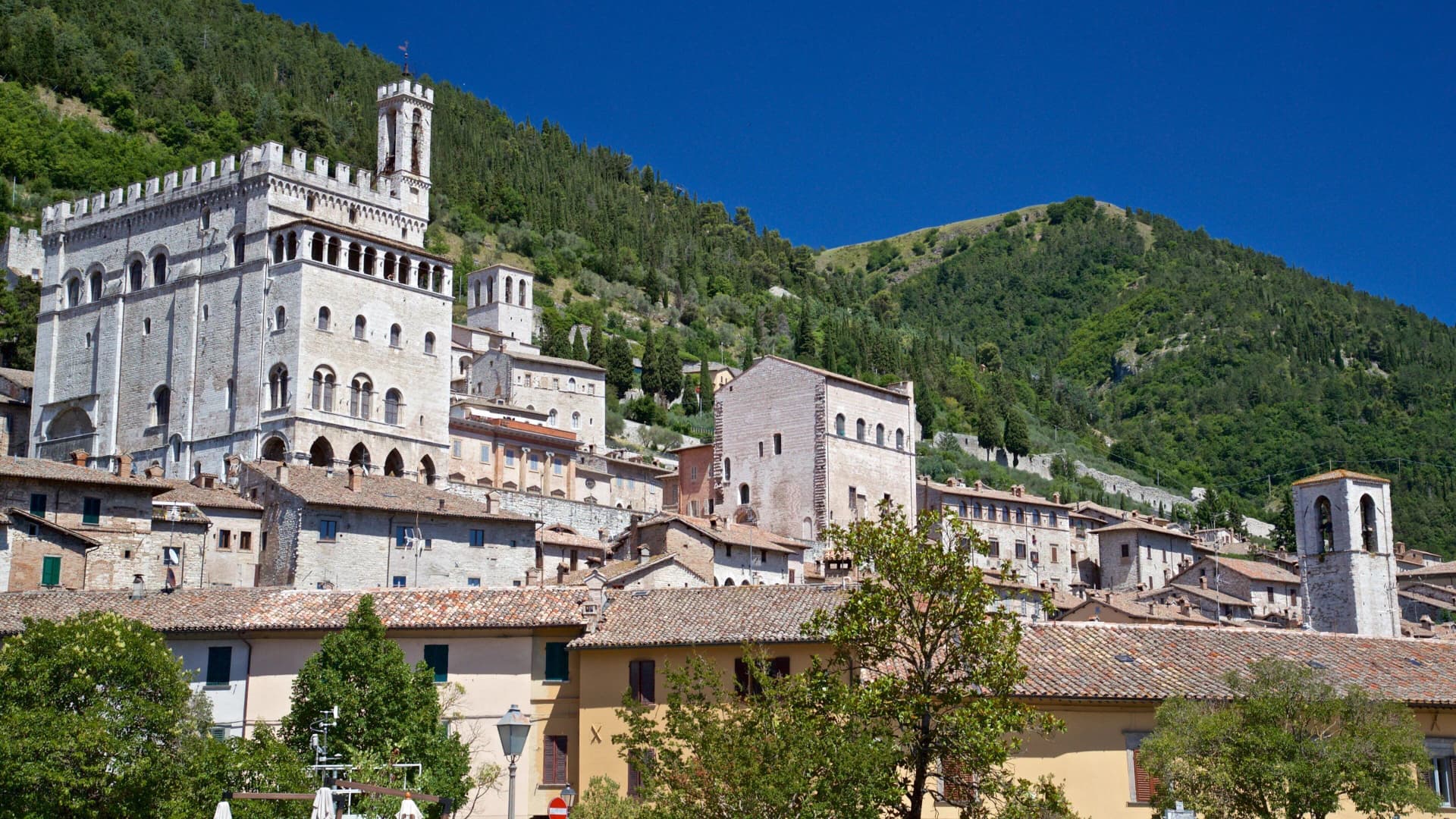
Gubbio
Province: Perugia
Pre-Roman Ikuvium of the Umbri at the foot of Monte Ingino, where seven bronze tablets carry the longest text of the Umbrian language.
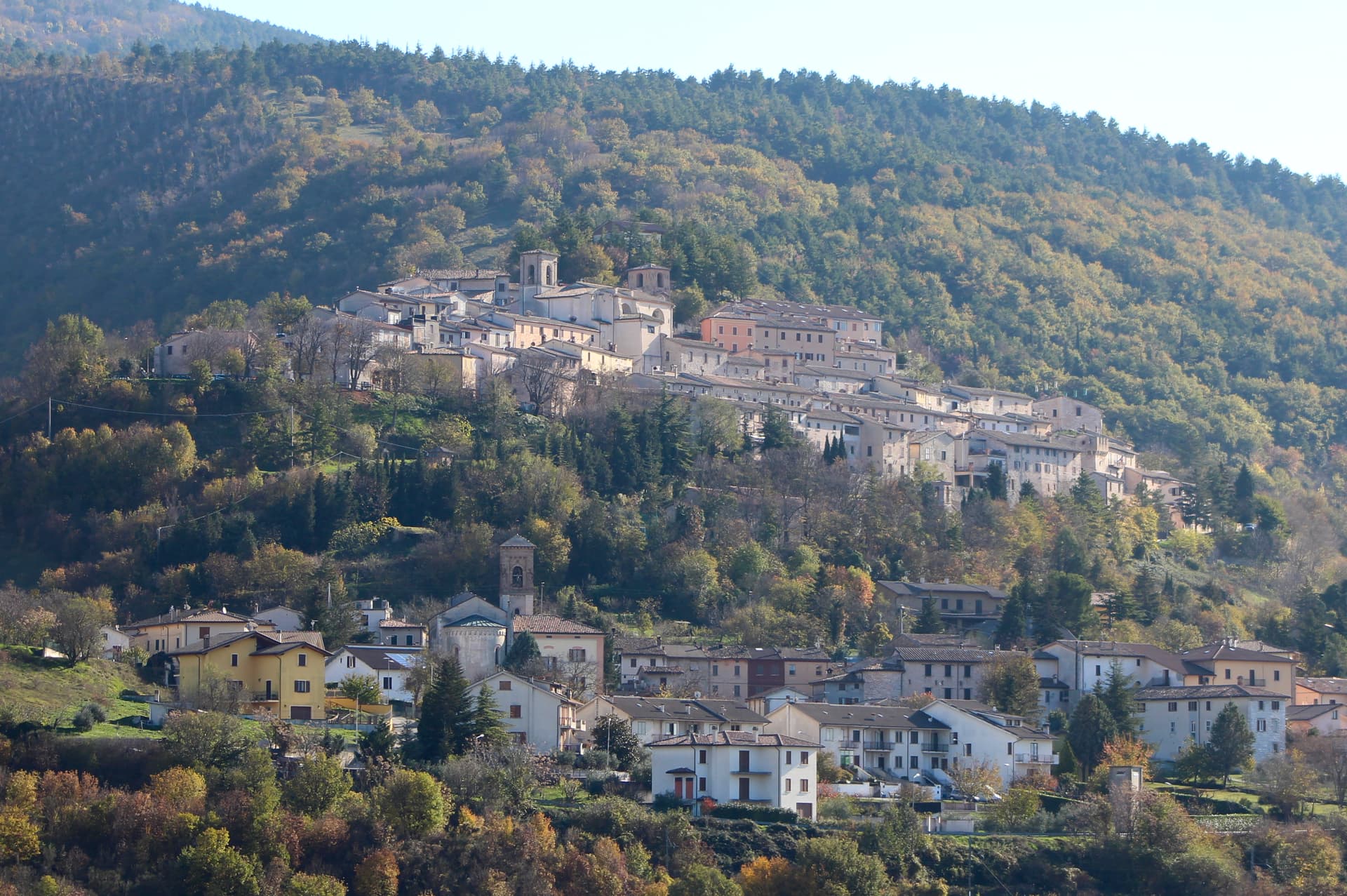
Fossato di Vico
Province: Perugia
A medieval village on Mount Mutali at 581 meters, where the Via Flaminia's Roman waystation Hellvillum became a tenth-century castle still threaded by covered alleyways.

Acqualagna
Province: Pesaro e Urbino
The Italian truffle capital at 204 meters in the Metauro valley, supplying two-thirds of the country's white truffle harvest from the surrounding limestone woods.

Pergola
Province: Pesaro e Urbino
A hill town at 265 meters in the upper Cesano valley, holding the only surviving group of Roman gilded bronze statues from antiquity.

Sassoferrato
Province: Ancona
A two-level Apennine town above Roman Sentinum, where the consuls Decius Mus and Fabius Maximus defeated four allied tribes in 295 BC.
🟠 Bandiera Arancione
More Bandiera Arancione towns in Marche
Acquaviva Picena
Province: Ascoli Piceno
A walled hill borgo at 359 meters six kilometers from the Adriatic, anchored by a Baccio Pontelli fortress and the surviving pajarola craft.
Amandola
Province: Fermo
A Sibillini gateway at 550 meters on three hills above the Tenna valley, founded 1248 and damaged but not levelled in 2016.
Camerino
Province: Macerata
A university city at 661 meters on the ridge between the Chienti and Potenza, Da Varano capital from 1259 to 1539, rebuilding after 2016.
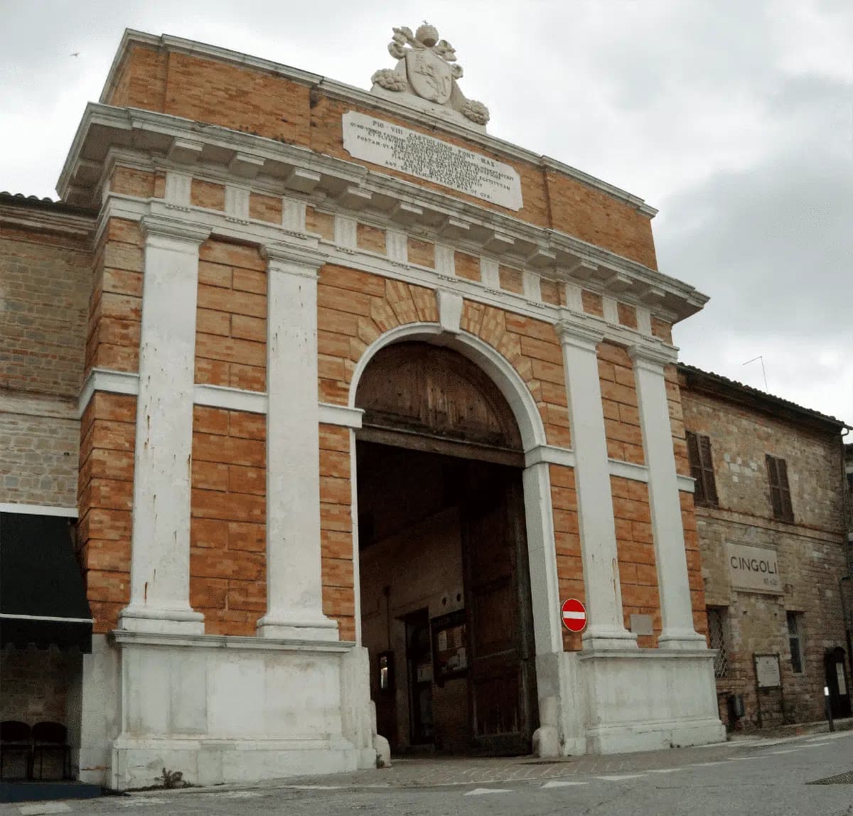
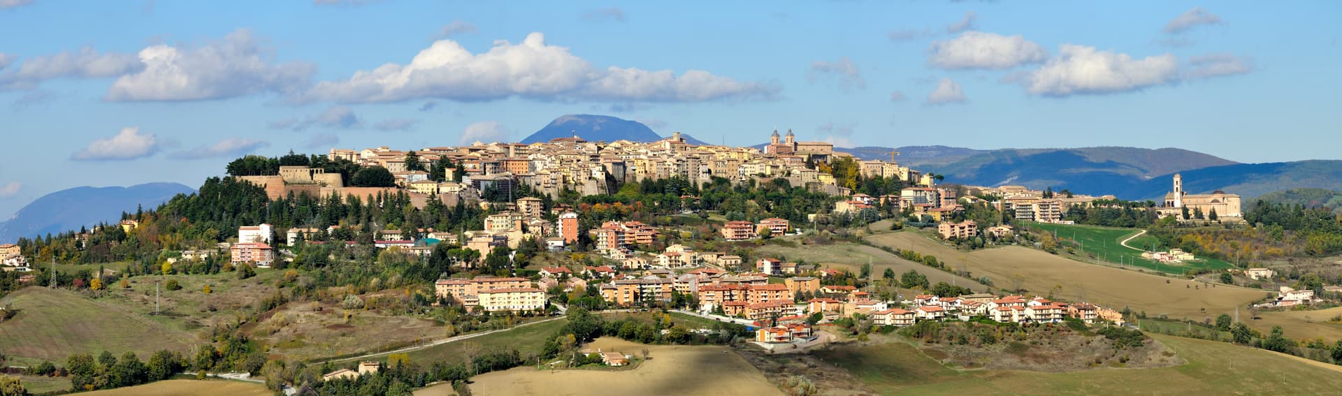
Cingoli
Province: Macerata
The Balcone delle Marche at 631 meters, a hilltop borgo where on clear days the view runs from the Sibillini to the Croatian coast.
Corinaldo
Province: Ancona
A walled hill borgo at 203 meters with 912 meters of intact medieval walls, the birthplace of Saint Maria Goretti and the Pozzo della Polenta.