
Umbria · Perugia
Fossato di Vico
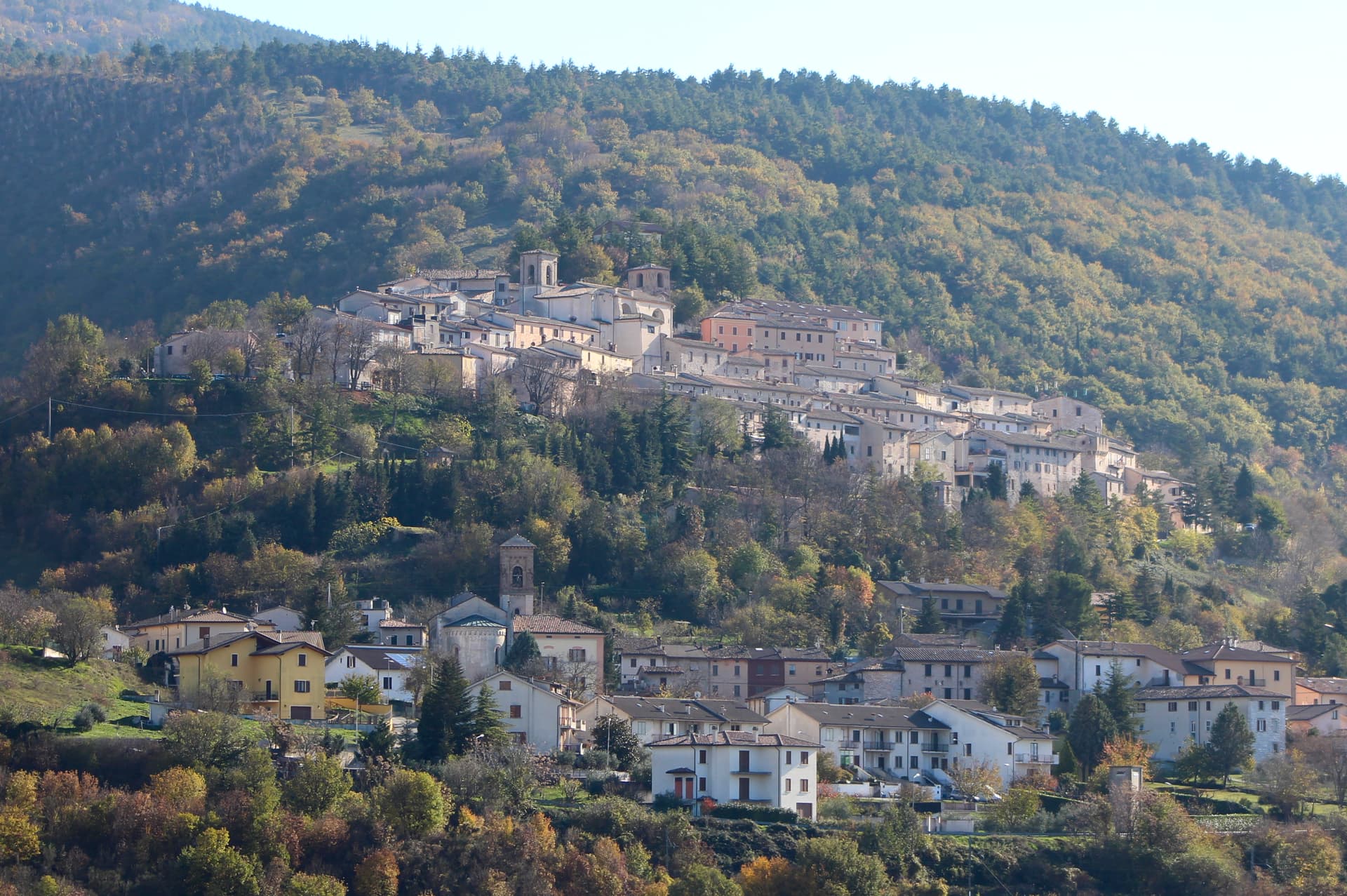
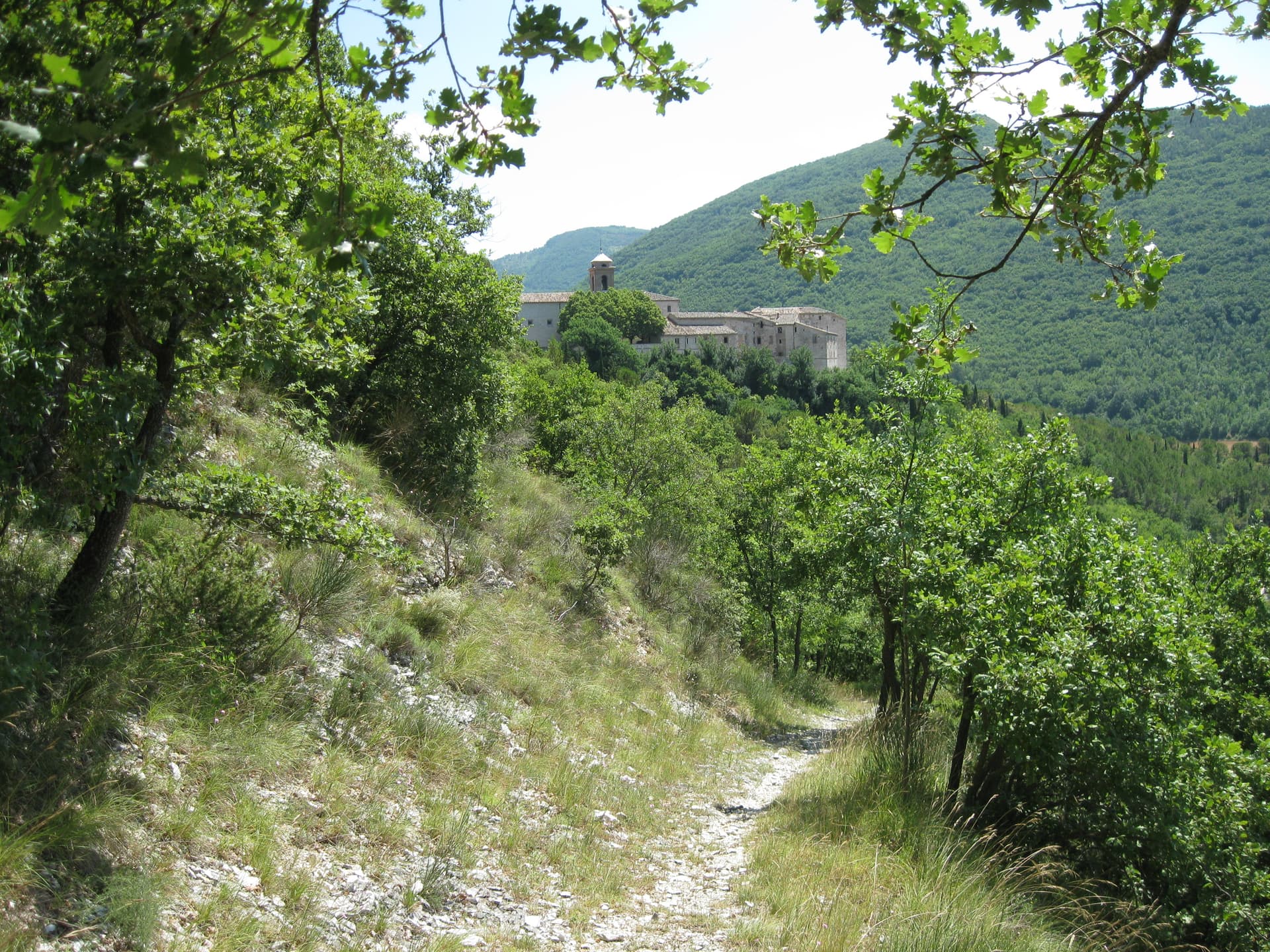
A medieval village on Mount Mutali at 581 meters, where the Via Flaminia's Roman waystation Hellvillum became a tenth-century castle still threaded by covered alleyways.
Known for
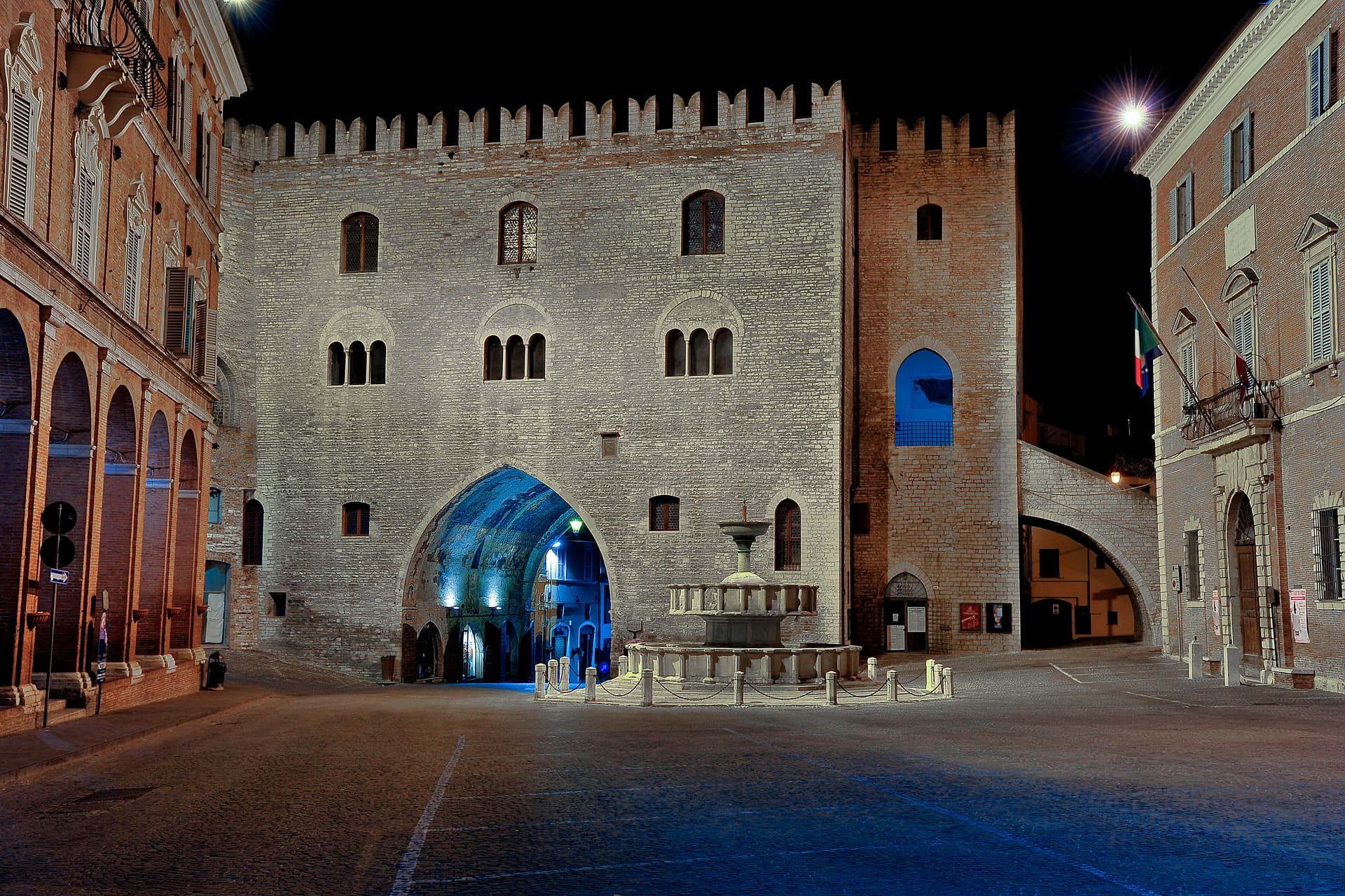
LE RUGHE
Stone-vaulted covered alleys, thirteenth-century defensive street architecture preserved as the borgo's main internal axis.
VIA FLAMINIA
The Roman road of 220 BC ran through the commune, with the changing station Hellvillum as the original settlement nucleus.
SAN BENEDETTO
Benedictine abbey outside the walls, Eugubine-school frescoes including an early known portrait of Pope Urban V.
When to visit
Best · Apr–Oct
- J
- F
- M
- A
- M
- J
- J
- A
- S
- O
- N
- D
- Best
- Hot or crowded
- Quiet
- Mostly closed
The festa: San Sebastiano, 20 January
Why come
Fossato di Vico stands at 581 meters on the slopes of Mount Mutali, on the line of the Via Flaminia between Foligno and Gubbio. The Romans built a changing station here called Hellvillum after laying the road in 220 BC. The borgo proper was founded in 980 by Lupo, called Vico, son of Monaldo, count of Nocera.
In the twelfth century it passed to the Marsciano counts, who eventually sold it to Gubbio; in the thirteenth Perugia took it militarily and the commune declared independence. What survives from that period is the network of covered passages called Le Rughe, stone vaults that turned the street into a defensible interior, a rare example of thirteenth-century castle architecture used as everyday infrastructure. The church of San Pietro, the oldest in town, predates the castle and was founded as a Camaldolese monastery. The Chiesa di San Benedetto outside the walls keeps Eugubine-school frescoes including what is taken to be one of the earliest known portraits of a pope.
The Sunday letter
We haven’t written Fossato di Vico’s letter yet.
One town every Sunday, with the photo, the food, the festa. Be there when this one comes up. Free, by Peter & Sophia from Pietrasanta.
By subscribing you agree to Substack’s Terms of Use, our Privacy Policy and our Information collection notice.

What to see
Le Rughe
Thirteenth-century covered alleyways under round stone vaults, rare surviving example of defensive castle-street architecture.
Chiesa di San Pietro
Oldest church in town, founded as a Camaldolese monastery, Romanesque structure predating the medieval castle.
Chiesa di San Benedetto
Thirteenth-century Benedictine abbey outside the walls, fragments of fourteenth and fifteenth-century Eugubine-school frescoes including an early papal portrait.
Chiesa di San Cristoforo
Small chapel within the medieval walls, on the line of the historic main street.
Tracciato della Via Flaminia
Surviving line of the Roman road of 220 BC, with the site of the Hellvillum waystation in the commune's territory.
The slow-trip planner
Building a trip? Find where Fossato di Vico fits in a slow Italy circuit.
Answer five questions. We will shape a geographically coherent slow trip from the 1,000 Italian towns most travelers skip. Yours to save and share.
Living here
- Population 2,639
- In-betweeni
- Pharmacy in town
- High school within a 30-minute drive
- Train station in the comune
- Nearest airport Ancona / Pescara, 1 h 2 min drive
- Regional capital Perugia, 45 min drive
Tags & datadesignations · numbers · sources
Recognised as
The numbers
- Elevation: 581 m
- Population: 2,639
- Surface area: 35.39 km²
These figures were compiled from public directories — ISTAT, OpenStreetMap, Wikidata — and from the official listings of the guides named on this page. Town details change; verify with official sources before you travel.
Close by
More towns near Fossato di Vico
Fabriano
Province: Ancona
The Italian paper town at 325 meters, making fine watermarked sheets since 1264 and a UNESCO Creative City of Crafts and Folk Art.
Cantiano
Province: Pesaro e Urbino
A border borgo at 374 meters under Monte Catria on the old Via Flaminia, known for the Good Friday Turba and the sour-cherry visciola harvest.
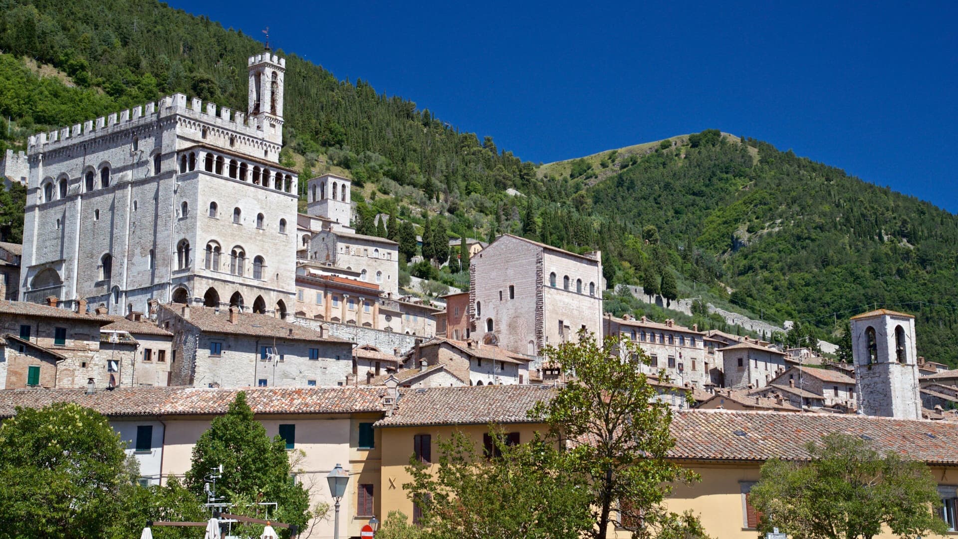
Gubbio
Province: Perugia
Pre-Roman Ikuvium of the Umbri at the foot of Monte Ingino, where seven bronze tablets carry the longest text of the Umbrian language.
Genga
Province: Ancona
A small Sentino-valley commune at 322 meters whose territory holds the Frasassi caves, the largest karst show cave in Italy.

Sassoferrato
Province: Ancona
A two-level Apennine town above Roman Sentinum, where the consuls Decius Mus and Fabius Maximus defeated four allied tribes in 295 BC.
💎 Borghi Autentici
More Borghi Autentici towns

Archi
Province: Chieti
A 492-meter rocky spur called the Terrazza sul Sangro, fief of del Balzo, Cantelmo, Colonna and Carafa, now Città del Tartufo and Città dell'Olio.

Balsorano
Province: L'Aquila
At 359 meters in the Valle Roveto, a Piccolomini castle that became the backdrop for half of 1970s Italian horror cinema.

Barrea
Province: L'Aquila
A 1,066-meter spur above an artificial lake at the heart of the Abruzzo National Park, with a Samnite necropolis and an 11th-century di Sangro castle.

Calascio
Province: L'Aquila
At 1,200 meters under the highest castle in the Apennines, a village of 125 people that played the monk's refuge in Ladyhawke.

Campo di Giove
Province: L'Aquila
At 1,064 meters under the southwestern Maiella, the highest village in the park, named for a Roman temple to Jupiter.