
Marche · Ancona
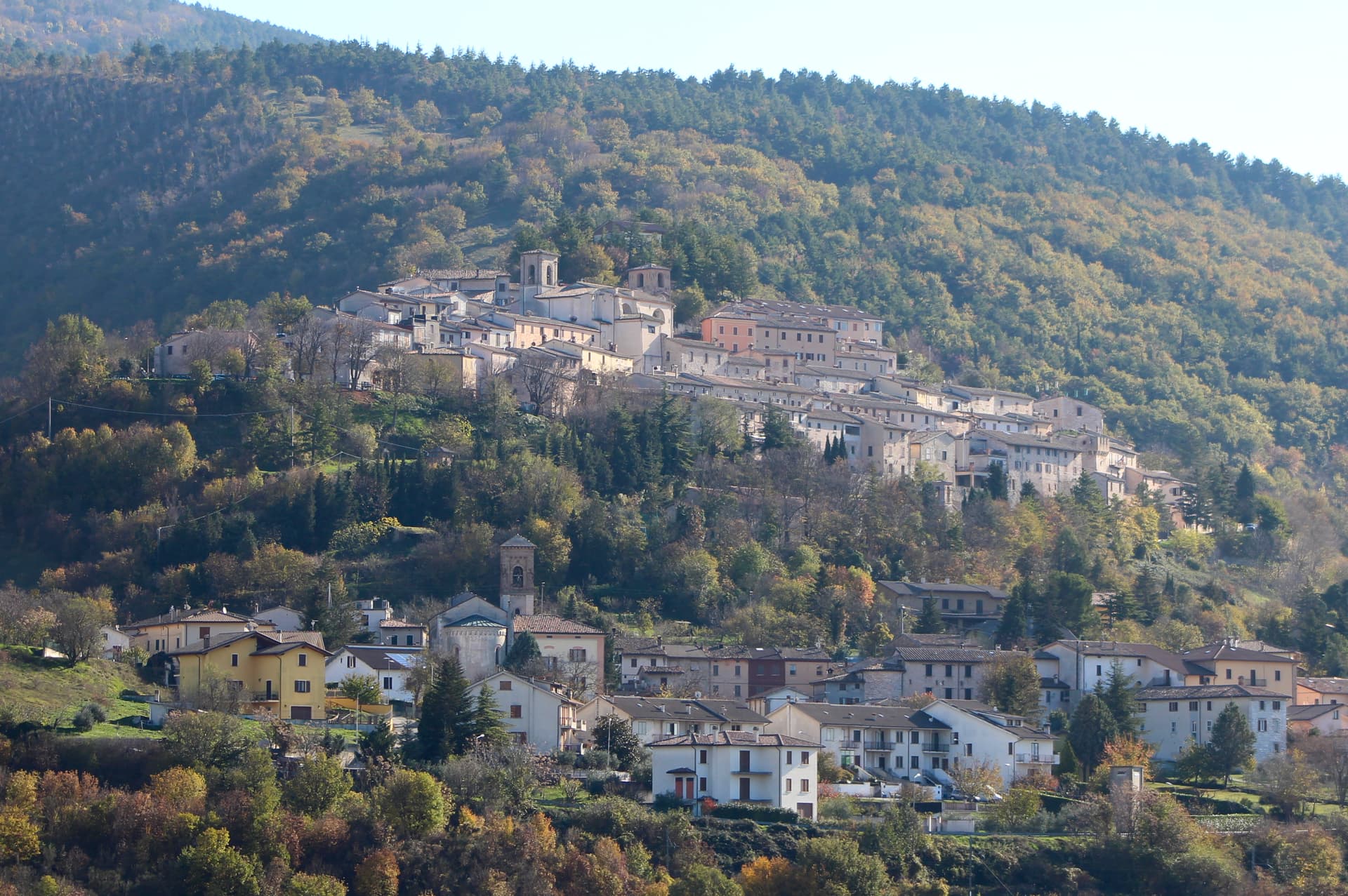
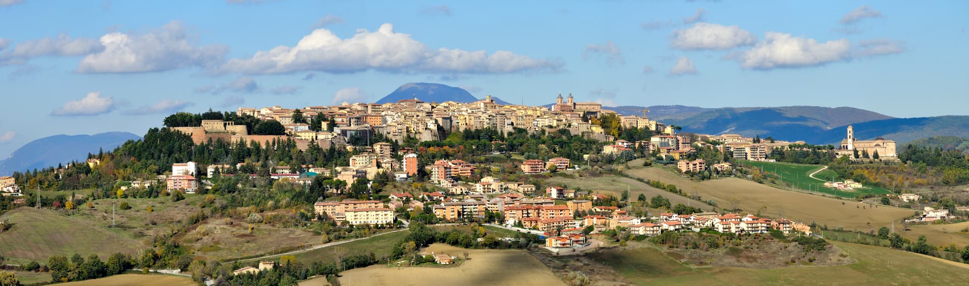
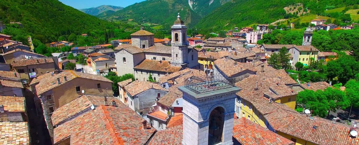
Genga
A small Sentino-valley commune whose territory holds the Frasassi caves, the largest karst show cave in Italy.
Known for
FRASASSI CAVES
The largest karst show-cave system in Italy, with the Abisso Ancona chamber large enough to hold the Milan cathedral inside it.
VALADIER TEMPLE
Octagonal neoclassical chapel cut into the cliff face above the gorge, commissioned by Pope Leo XII from Valadier in 1828.
POPE LEO XII
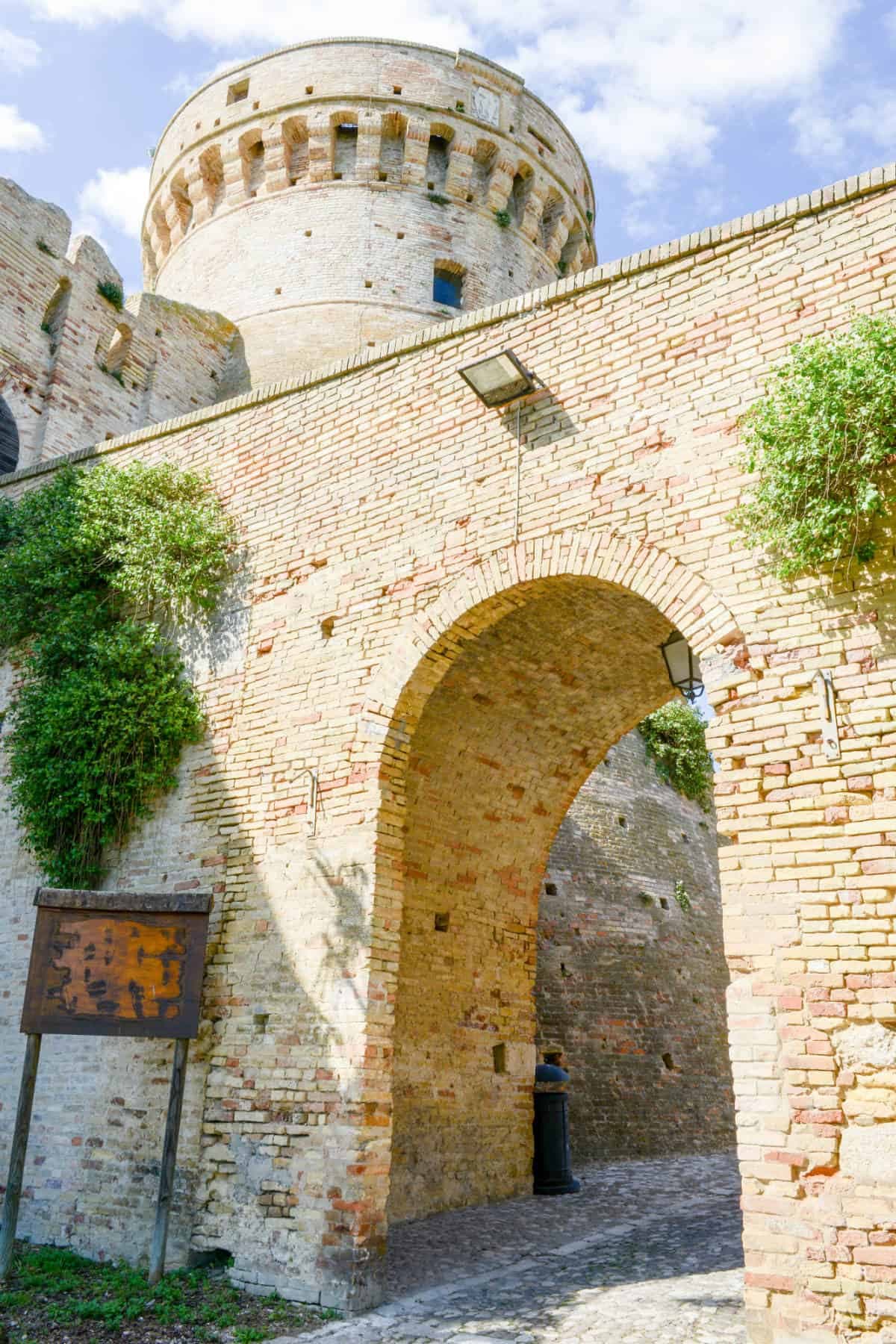
Annibale della Genga, born at the family castello in 1760 and elected pope in 1823, took his title from this Marche commune.
When to visit
Best · Apr–Oct
- J
- F
- M
- A
- M
- J
- J
- A
- S
- O
- N
- D
- Best
- Hot or crowded
- Quiet
- Mostly closed
The festa: papa Clemente I, 23 November
Why come
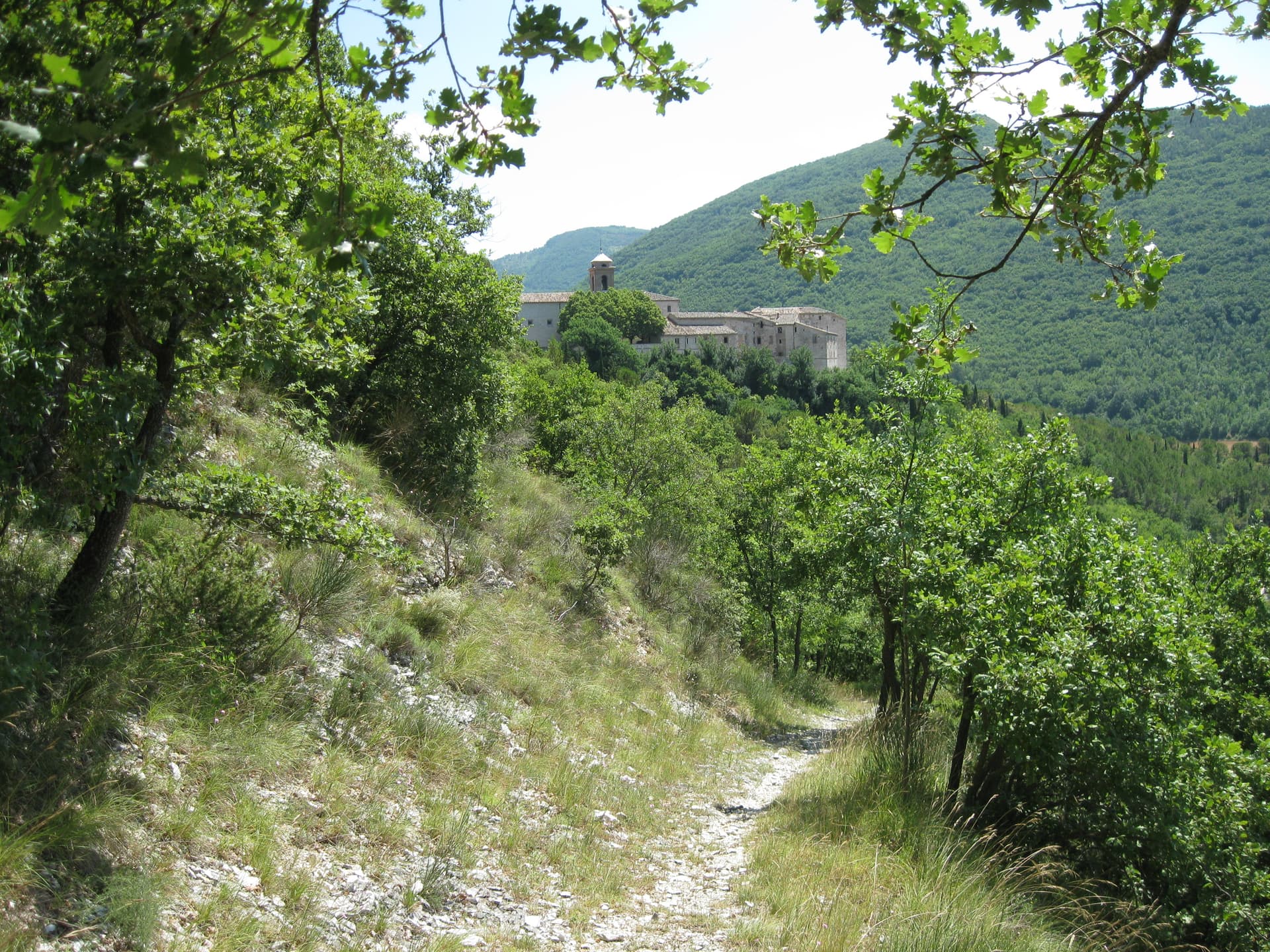
Genga sits on the Sentino river in the Apennine foothills of the Marche, seven kilometers downstream from Sassoferrato and twelve north of Fabriano. The commune is the ancestral seat of the della Genga, the noble family that gave the Catholic Church Pope Leo XII, born at the Castello della Genga in 1760. The territory is best known for the Grotte di Frasassi, a thirteen-kilometer karst system whose entrance was found in 1971 and opened to visitors in 1974.
The Abisso Ancona, a single chamber roughly 180 by 120 meters and nearly 200 tall, is large enough to hold the Milan cathedral. Above the cave entrance, the Tempio del Valadier, an octagonal neoclassical chapel set into a cliff wall, was commissioned by Leo XII from Giuseppe Valadier in 1828. The Abbazia di San Vittore alle Chiuse, a Romanesque Benedictine church on a Greek-cross plan, stands at the gorge mouth and dates to before 1080.
The Sunday letter
We haven’t written Genga’s letter yet.
One town every Sunday, with the photo, the food, the festa. Be there when this one comes up. Free, by Peter & Sophia from Pietrasanta.
By subscribing you agree to Substack’s Terms of Use, our Privacy Policy and our Information collection notice.

What to see
Grotte di Frasassi
Thirteen kilometers of karst passageways found in 1971 and opened in 1974, with the Abisso Ancona chamber 180 by 120 meters wide and 200 meters tall.
Tempio del Valadier
Octagonal neoclassical chapel commissioned by Pope Leo XII from Giuseppe Valadier in 1828, built of travertine and set into the cliff above the gorge.
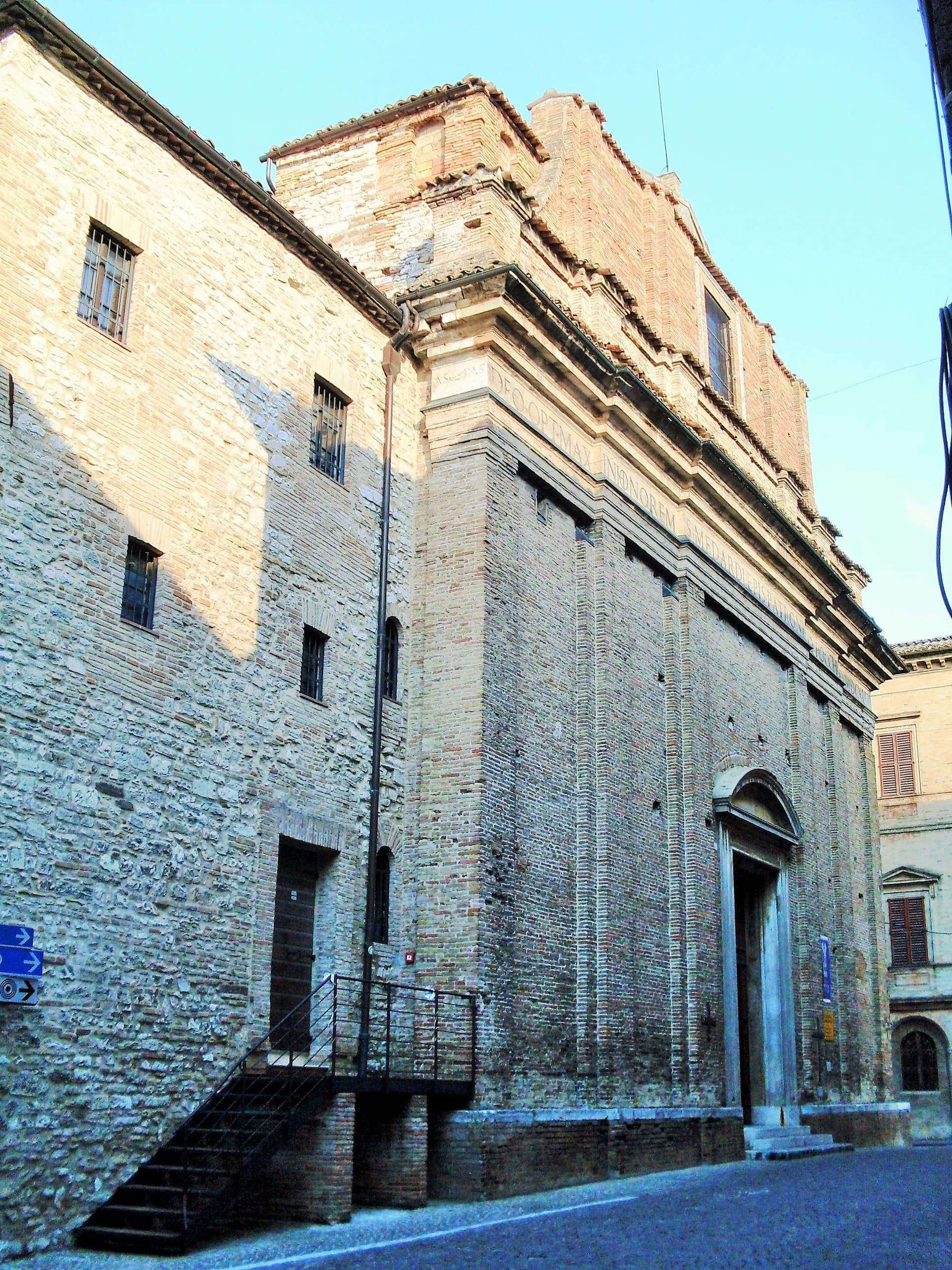
Abbazia di San Vittore alle Chiuse
Romanesque Benedictine church on a Greek-cross plan with four columns, built of local limestone, attested before 1080 at the mouth of the Frasassi gorge.
Parco Naturale Regionale della Gola della Rossa e di Frasassi
Regional natural park of 9,167 hectares covering the limestone ridges and gorges that hold the cave system and the abbey.
Castello della Genga
Hilltop family seat of the della Genga, where Annibale della Genga, the future Pope Leo XII, was born in 1760.
The slow-trip planner
Building a trip? Find where Genga fits in a slow Italy circuit.
Answer five questions. We will shape a geographically coherent slow trip from the 1,000 Italian towns most travelers skip. Yours to save and share.
Living here
- Population 1,682
- In-betweeni
- Pharmacy in town
- High school within a 30-minute drive
- Train station in the comune
- Nearest airport Ancona / Pescara, 50 min drive
- Regional capital Ancona, 1 h 2 min drive
Thermal baths in town: Hotel Terme San Vittore.
Tags & datadesignations · numbers · sources
Recognised as
The numbers
- Elevation: 322 m
- Population: 1,682
- Surface area: 73.16 km²
These figures were compiled from public directories — ISTAT, OpenStreetMap, Wikidata — and from the official listings of the guides named on this page. Town details change; verify with official sources before you travel.
Close by
More towns near Genga

Sassoferrato
Province: Ancona
A two-level Apennine town above Roman Sentinum, where the consuls Decius Mus and Fabius Maximus defeated four allied tribes in 295 BC.
Fabriano
Province: Ancona
The Italian paper town at 325 meters, making fine watermarked sheets since 1264 and a UNESCO Creative City of Crafts and Folk Art.
Serra San Quirico
Province: Ancona
A stone borgo on Monte Murano at the entrance to the Gola della Rossa, ringed by 1300 walls with covered passageways called copertelle.
Arcevia
Province: Ancona
A hilltop borgo at 535 meters above the Misa and Nevola valleys, defended in the Middle Ages by a ring of nine satellite castles.
Fossato di Vico
Province: Perugia
A medieval village on Mount Mutali at 581 meters, where the Via Flaminia's Roman waystation Hellvillum became a tenth-century castle still threaded by covered alleyways.
🟠 Bandiera Arancione
More Bandiera Arancione towns in Marche
Acquaviva Picena
Province: Ascoli Piceno
A walled hill borgo at 359 meters six kilometers from the Adriatic, anchored by a Baccio Pontelli fortress and the surviving pajarola craft.
Amandola
Province: Fermo
A Sibillini gateway at 550 meters on three hills above the Tenna valley, founded 1248 and damaged but not levelled in 2016.
Camerino
Province: Macerata
A university city at 661 meters on the ridge between the Chienti and Potenza, Da Varano capital from 1259 to 1539, rebuilding after 2016.
Cantiano
Province: Pesaro e Urbino
A border borgo at 374 meters under Monte Catria on the old Via Flaminia, known for the Good Friday Turba and the sour-cherry visciola harvest.
Cingoli
Province: Macerata
The Balcone delle Marche at 631 meters, a hilltop borgo where on clear days the view runs from the Sibillini to the Croatian coast.