
Marche · Ancona
Serra San Quirico
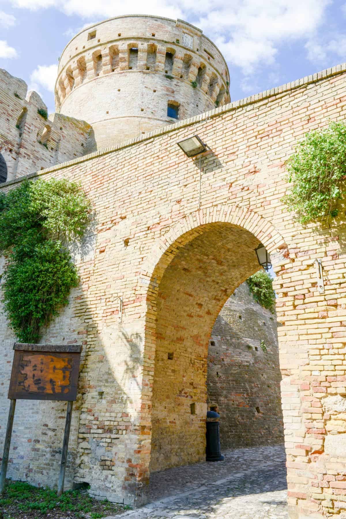
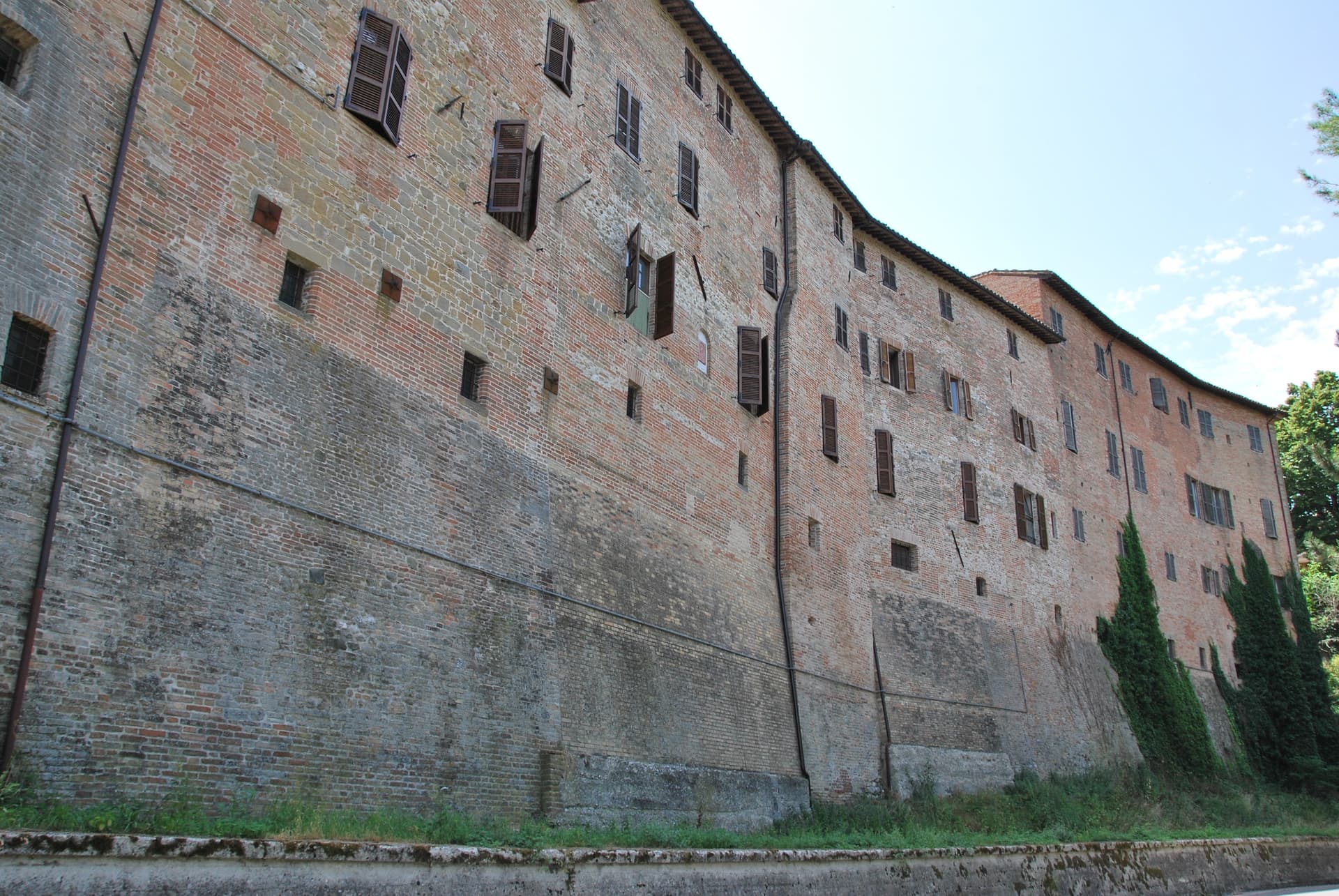
A stone borgo on Monte Murano at the entrance to the Gola della Rossa, ringed by 1300 walls with covered passageways called copertelle.
Known for
COPERTELLE
Covered passageways running above the medieval outer walls from around 1300, the true visual signature of the stone borgo.
PARK HEADQUARTERS
The Santa Lucia complex houses the headquarters of the Parco Naturale Gola della Rossa e di Frasassi, covering 9,167 hectares to the south.
SANTA LUCIA
Baroque church next to the park headquarters, with marble decoration, gold-leaf stucco and a Pasqualino Rossi altarpiece.
When to visit
Best · Apr–Oct
- J
- F
- M
- A
- M
- J
- J
- A
- S
- O
- N
- D
- Best
- Hot or crowded
- Quiet
- Mostly closed
The festa: Quirico e Giulitta, 15 July
Why come
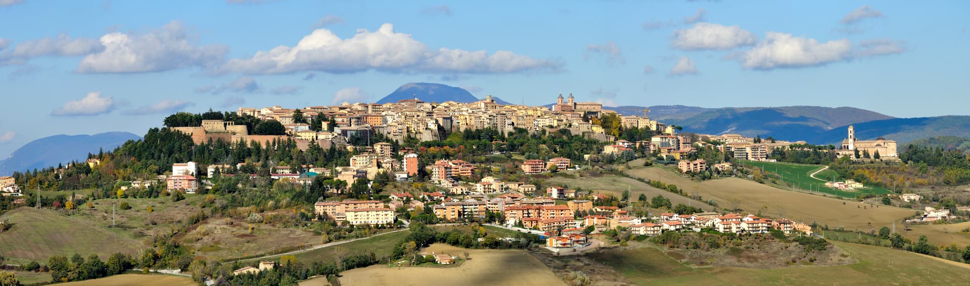
Serra San Quirico sits on the left bank of the Esino river, at the foot of Monte Murano and the entrance to the Gola della Rossa, forty-five kilometers from Ancona. Etruscan, Picene and Roman remains have been found in the area; the Romans established a military garrison that grew into the original village. The medieval town is built almost entirely in stone and rock, ringed by walls dating to around 1300.
Above those walls run the Copertelle, covered passageways that line the outer circuit, the true visual signature of the borgo. The Santa Lucia complex, the former monastery in the centro storico, houses the headquarters of the Parco Naturale Regionale della Gola della Rossa e di Frasassi, the 9,167-hectare regional park that runs from Serra south to the Frasassi caves. The Chiesa di Santa Lucia, baroque inside with marble decoration and gold-leaf stucco, sits next door. The Festa del Centro Storico in late July fills the stone lanes with theatrical reenactments.
The Sunday letter
We haven’t written Serra San Quirico’s letter yet.
One town every Sunday, with the photo, the food, the festa. Be there when this one comes up. Free, by Peter & Sophia from Pietrasanta.
By subscribing you agree to Substack’s Terms of Use, our Privacy Policy and our Information collection notice.

What to see
Le Copertelle
Covered passageways running above the medieval outer walls from around 1300, the true visual signature of the stone borgo.
Chiesa di Santa Lucia
Baroque church in the centro storico, with marble decoration, gold-leaf stucco and a Pasqualino Rossi seventeenth-century altarpiece.
Parco Naturale Gola della Rossa e di Frasassi
9,167-hectare regional park with headquarters at the Santa Lucia complex in the centro storico, running south to the Frasassi caves.
Centro storico di Serra San Quirico
Stone borgo ringed by walls from around 1300, with the Copertelle covered passageways, recognized with the Bandiera Arancione from the Italian Touring Club.
Gola della Rossa
Limestone gorge cut by the Esino river south of town, opening the access route into the regional park and toward the Frasassi caves.
The slow-trip planner
Building a trip? Find where Serra San Quirico fits in a slow Italy circuit.
Answer five questions. We will shape a geographically coherent slow trip from the 1,000 Italian towns most travelers skip. Yours to save and share.
Living here
- Population 2,540
- Commuter belti
- Pharmacy in town
- High school within a 30-minute drive
- Train station in the comune
- Nearest airport Ancona / Pescara, 37 min drive
- Regional capital Ancona, 49 min drive
Tags & datadesignations · numbers · sources
Recognised as
The numbers
- Elevation: 409 m
- Population: 2,540
- Surface area: 49.33 km²
These figures were compiled from public directories — ISTAT, OpenStreetMap, Wikidata — and from the official listings of the guides named on this page. Town details change; verify with official sources before you travel.
Close by
More towns near Serra San Quirico
Genga
Province: Ancona
A small Sentino-valley commune at 322 meters whose territory holds the Frasassi caves, the largest karst show cave in Italy.

Staffolo
Province: Ancona
The Verdicchio balcony at 442 meters above three valleys, with a near-circular medieval wall ring and a wine museum carved into the ramparts.
Fabriano
Province: Ancona
The Italian paper town at 325 meters, making fine watermarked sheets since 1264 and a UNESCO Creative City of Crafts and Folk Art.

Matelica
Province: Macerata
A Verdicchio town at 354 meters in the upper Esino valley, with a Roman marble globe in its archaeological museum.

Sassoferrato
Province: Ancona
A two-level Apennine town above Roman Sentinum, where the consuls Decius Mus and Fabius Maximus defeated four allied tribes in 295 BC.
🟠 Bandiera Arancione
More Bandiera Arancione towns in Marche
Acquaviva Picena
Province: Ascoli Piceno
A walled hill borgo at 359 meters six kilometers from the Adriatic, anchored by a Baccio Pontelli fortress and the surviving pajarola craft.
Amandola
Province: Fermo
A Sibillini gateway at 550 meters on three hills above the Tenna valley, founded 1248 and damaged but not levelled in 2016.
Camerino
Province: Macerata
A university city at 661 meters on the ridge between the Chienti and Potenza, Da Varano capital from 1259 to 1539, rebuilding after 2016.
Cantiano
Province: Pesaro e Urbino
A border borgo at 374 meters under Monte Catria on the old Via Flaminia, known for the Good Friday Turba and the sour-cherry visciola harvest.
Cingoli
Province: Macerata
The Balcone delle Marche at 631 meters, a hilltop borgo where on clear days the view runs from the Sibillini to the Croatian coast.