
Tuscany · Grosseto
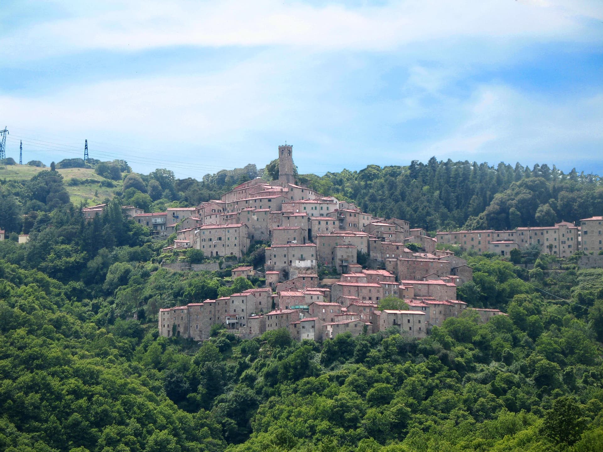
Massa Marittima
A medieval mining town in the Colline Metallifere, free commune from 1255 to 1337, whose cathedral holds the relics of San Cerbone.
Known for
ALBERO DELLA FECONDITÀ
Thirteenth-century fresco at the Fonti dell'Abbondanza, a tree hung with phalluses, rediscovered in 2000 and unique in medieval Italian art.
SAN CERBONE
The patron saint, buried in the Duomo, whose marble shrine was carved by Goro di Gregorio in 1324.
BALESTRO DEL GIRIFALCO
Crossbow contest in fifteenth-century costume between the three terzieri of the town, run every May and August.
When to visit
Best · Apr–Oct
- J
- F
- M
- A
- M
- J
- J
- A
- S
- O
- N
- D
- Best
- Hot or crowded
- Quiet
- Mostly closed
The festa: Cerbone di Populonia, 10 October
Why come
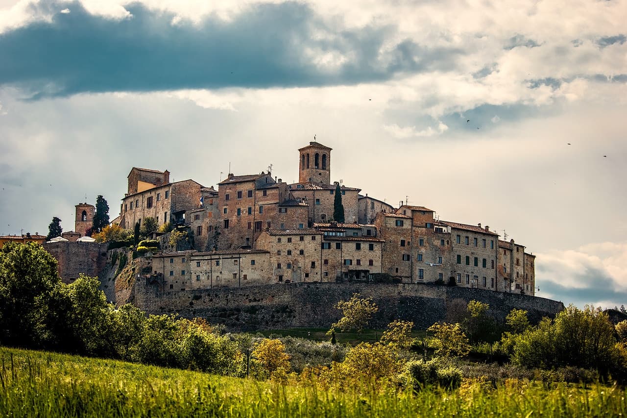
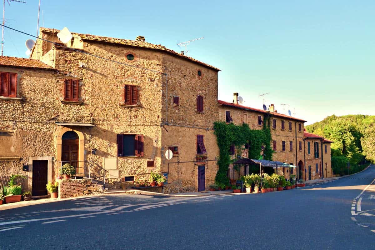
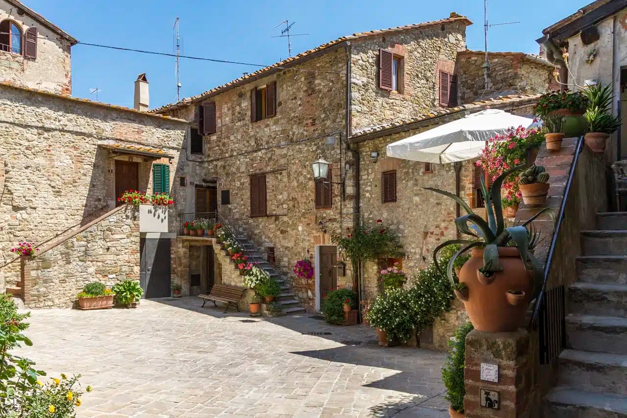
Massa Marittima sits on an isolated hill in the Colline Metallifere, the Tuscan hills that supplied copper and silver from Etruscan times. Despite the name, the sea is roughly twenty kilometers away. The town was a free commune from 1255 to 1337, and the buildings on Piazza Garibaldi still date from that century: the Duomo di San Cerbone in Pisan Romanesque, the Palazzo del Podestà, the Palazzo Comunale.
The Fonti dell'Abbondanza, the public fountains built in 1265, hold a thirteenth-century fresco of a tree hung with phalluses, the Albero della Fecondità, rediscovered in 2000 and now one of the most studied wall paintings of medieval Tuscany. The Balestro del Girifalco, a crossbow contest in fifteenth-century costume, runs twice a year between the three terzieri of the town. Mining gave way to tourism after the seams ran out; the centro storico kept its medieval grid intact.
The Sunday letter
We haven’t written Massa Marittima’s letter yet.
One town every Sunday, with the photo, the food, the festa. Be there when this one comes up. Free, by Peter & Sophia from Pietrasanta.
By subscribing you agree to Substack’s Terms of Use, our Privacy Policy and our Information collection notice.


What to see
Duomo di San Cerbone
Thirteenth-century Pisan Romanesque cathedral on Piazza Garibaldi, holding the relics of the saint and the Arca di San Cerbone by Goro di Gregorio.
Fonti dell'Abbondanza
Public fountains built in 1265 with the Albero della Fecondità fresco, a tree hung with phalluses, rediscovered in 2000.
Palazzo del Podestà
Thirteenth-century communal palace on Piazza Garibaldi, now seat of the Museo Archeologico with the Maestà by Ambrogio Lorenzetti.
Torre del Candeliere
Thirteenth-century watchtower above the Città Nuova, connected to the old walls by a flying arch, open for the panorama across the Maremma.
Museo della Miniera
Mining museum with reconstructed tunnels that document the extraction of copper, silver and pyrite from the Colline Metallifere.
The slow-trip planner
Building a trip? Find where Massa Marittima fits in a slow Italy circuit.
Answer five questions. We will shape a geographically coherent slow trip from the 1,000 Italian towns most travelers skip. Yours to save and share.
Living here
- Population 8,139
- In-betweeni
- Pharmacy in town
- High school within a 30-minute drive
- Train station in the comune
- Nearest airport Florence / Pisa, 1 h 48 min drive
- Regional capital Firenze, 2 h 18 min drive
Tags & datadesignations · numbers · sources
Recognised as
The numbers
- Elevation: 380 m
- Population: 8,139
- Surface area: 283.45 km²
These figures were compiled from public directories — ISTAT, OpenStreetMap, Wikidata — and from the official listings of the guides named on this page. Town details change; verify with official sources before you travel.
Close by
More towns near Massa Marittima
Castelnuovo di Val di Cecina
Province: Pisa
A copper and geothermal borgo at 576 meters in the Cecina valley, where natural steam vents and medieval towers sit on the same hill.
Campiglia Marittima
Province: Livorno
A walled hilltop borgo above the Val di Cornia, where the Rocca tower watches a mining landscape worked from the Etruscans to 1976.
Piombino
Province: Livorno
A promontory port facing Elba across the channel, founded by refugees from Etruscan Populonia and now the Tuscan archipelago's ferry capital.
Suvereto
Province: Livorno
A stone borgo at 127 meters above the Val di Cornia, named for the cork oaks of its forests and ruled from the Rocca Aldobrandesca since 973.
Grosseto
Province: Grosseto
The Maremma capital on the Ombrone river, ringed by hexagonal Medici walls of 1564 that now serve as the city's public park.
🟠 Bandiera Arancione
More Bandiera Arancione towns in Tuscany
Abetone Cutigliano
Province: Pistoia
The Apennine ski pass at 1,388 meters where the Granduca's two stone pyramids of 1778 mark the old Tuscan-Modenese border.
Anghiari
Province: Arezzo
A walled medieval town at 430 meters over the upper Tiber valley, where Florence beat Milan in 1440 and Leonardo started the fresco he never finished.
Barga
Province: Lucca
A medieval hilltop town at 410 meters in the Serchio valley between the Apuan Alps and the Apennines, where Giovanni Pascoli wrote his last poems and the August festival serves fish and chips.
Casale Marittimo
Province: Pisa
A concentric stone borgo at 214 meters above the Val di Cecina, built where a seventh-century BC Etruscan outpost of Volterra once stood.
Castelnuovo Berardenga
Province: Siena
A Chianti Classico commune at 351 meters between the Ombrone and the Crete Senesi, the last castle Siena built against Florence, in 1366.