
Tuscany · Grosseto
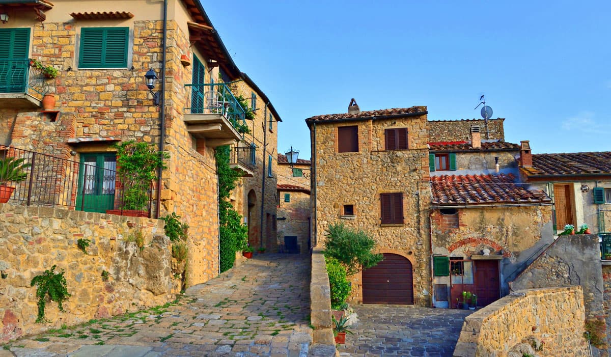
Grosseto
The Maremma capital on the Ombrone river, ringed by hexagonal Medici walls of 1564 that now serve as the city's public park.
Known for
MEDICI WALLS
Hexagonal bastioned circuit of 1564 commissioned by Cosimo I, four kilometers around, intact, now used as the city's public park.
MAREMMA
Capital of the historical region between Toscana and Lazio, anchor of the Parco Regionale della Maremma and the inland Uccellina hills.
BUTTERI
Maremma cowboys still herd longhorn cattle and wild horses in the park south of the city, descendants of a working tradition older than the American West.
When to visit
Best · May–Sep
- J
- F
- M
- A
- M
- J
- J
- A
- S
- O
- N
- D
- Best
- Hot or crowded
- Quiet
- Mostly closed
The festa: San Lorenzo, 10 August
Why come
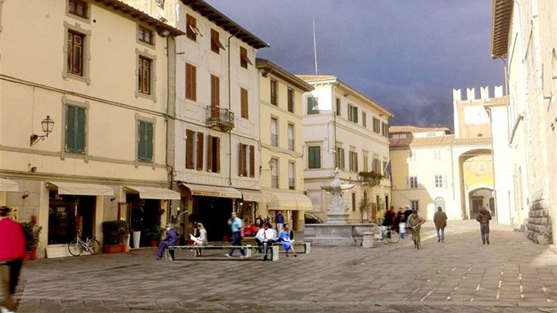
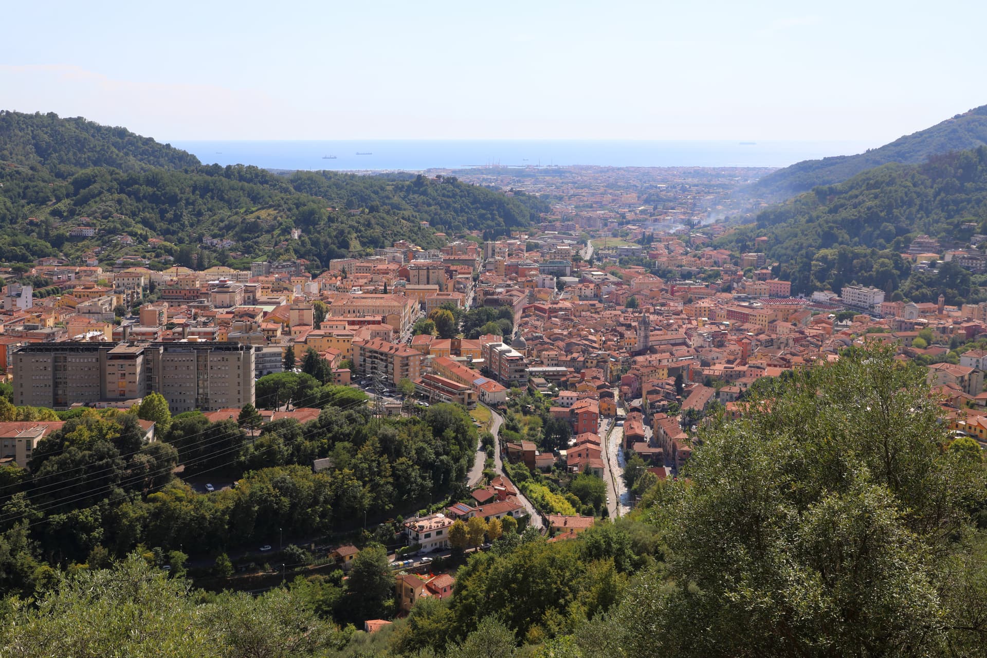
Grosseto sits on the right bank of the Ombrone, ten meters above sea level and twelve kilometers inland from the Tyrrhenian. The Roman city of Roselle was destroyed in 935 by Saracen pirates; refugees regrouped on the plain below and Grosseto inherited the bishopric. From 1336 it was Sienese; in 1559 it passed to the Medici after the battle of Montalcino.
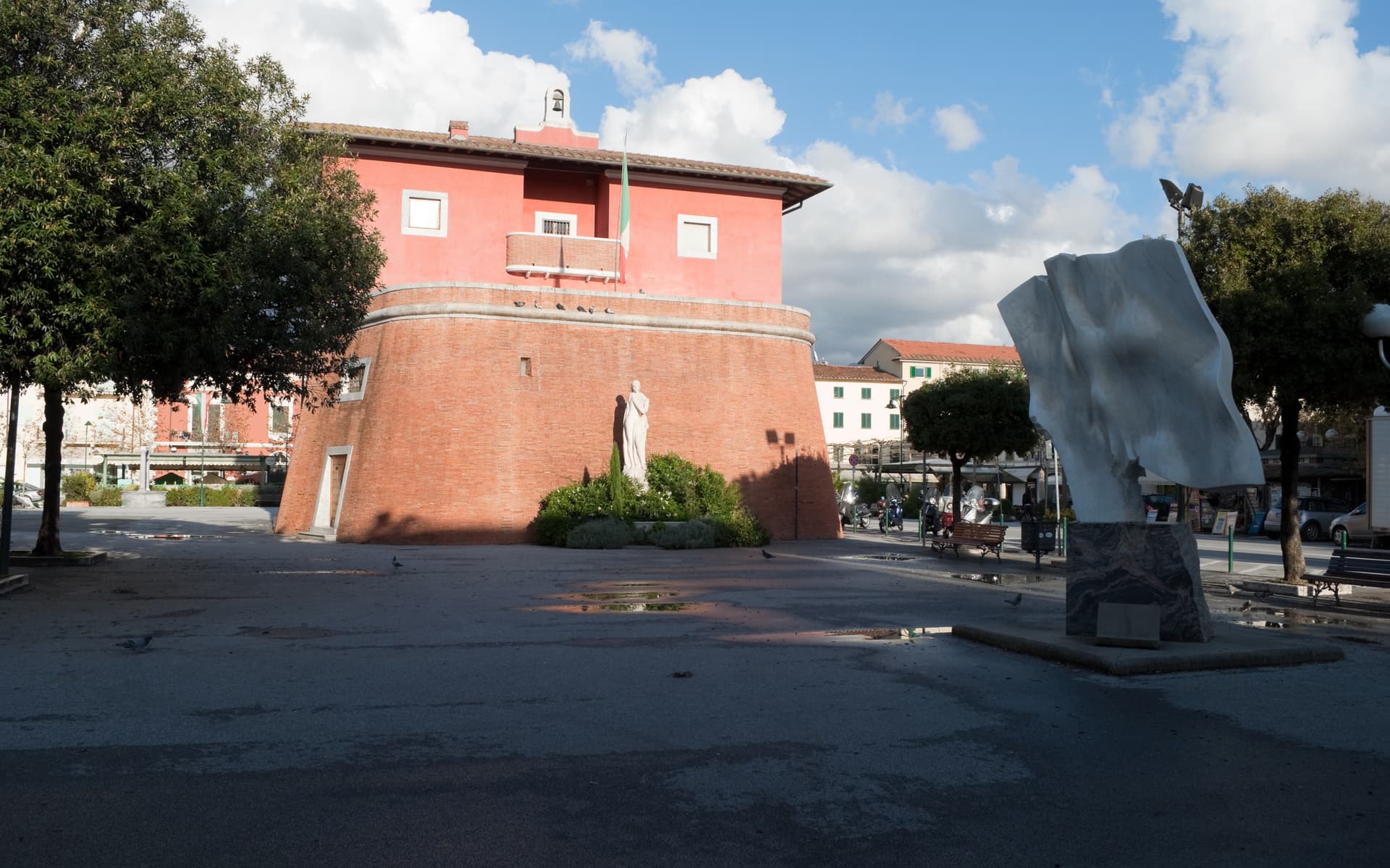
Cosimo I commissioned Baldassarre Lanci to replace the medieval walls with a hexagonal bastioned circuit, begun in 1565 and finished a decade later. The walls are intact. Six bastions, two main gates, a continuous earthwork four kilometers around, now planted and used as the city's promenade.
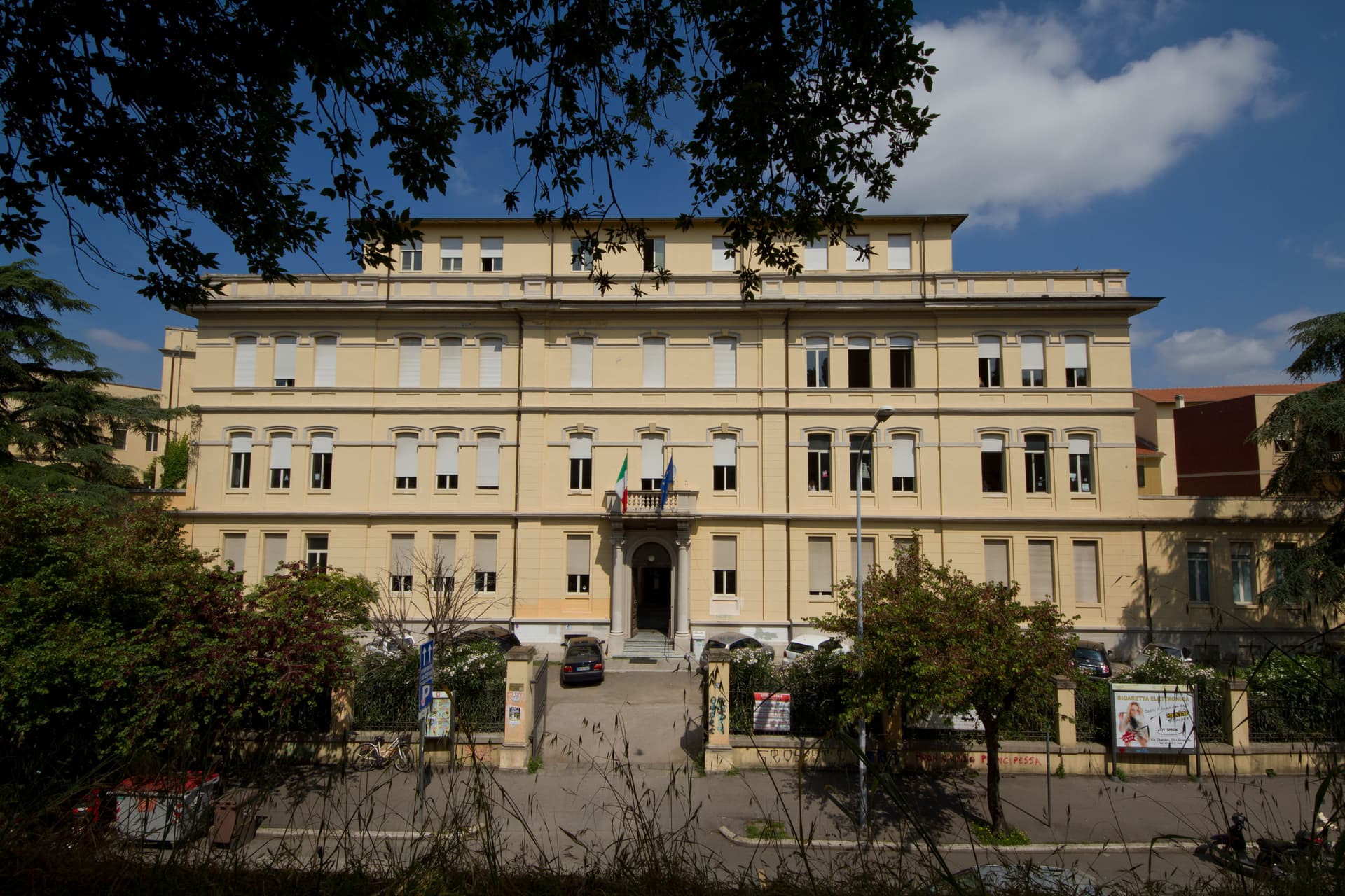
Inside, the Duomo di San Lorenzo holds a Romanesque-Gothic façade in alternating white and pink marble. The Cassero Senese, the Sienese fortress of 1345 swallowed into the later Medici walls, anchors the southeast corner. Grosseto is the largest city of southern Toscana and the working capital of the Maremma.

What to see
Mura Medicee
Hexagonal bastioned circuit commissioned by Cosimo I in 1564, designed by Baldassarre Lanci, intact and walkable for the full four kilometers.
Duomo di San Lorenzo
Thirteenth-century cathedral with a façade in alternating white and pink marble, Latin-cross plan, semicircular apse over the nave.
Cassero Senese
Travertine-clad Sienese fortress completed in 1345, incorporated into the southeast corner of the Medici walls, now used for exhibitions.
Museo Archeologico e d'Arte della Maremma
Provincial museum on Piazza Baccarini collecting Etruscan and Roman finds from Roselle, Vetulonia and the Maremma.
Chiesa di San Francesco
Thirteenth-century Franciscan church near the northwest bastion, with a crucifix attributed to Duccio di Buoninsegna above the high altar.
Parco Regionale della Maremma
Coastal park south of the city covering the Ombrone mouth and the Uccellina hills, with wild horses, longhorn cattle and umbrella pines.
The slow-trip planner
Building a trip? Find where Grosseto fits in a slow Italy circuit.
Answer five questions. We will shape a geographically coherent slow trip from the 1,000 Italian towns most travelers skip. Yours to save and share.
We recommend
Where to eat and stay
Not our picks, but places the guides put their name to — a Michelin star, a Gambero Rosso fork, a Slow Food snail, a Michelin Key for the hotels. Worth a table, a counter, or a night when you pass through.
CanaponeRistorante
Canapone has two Gambero Rosso forks (81/100) and a spot in the Michelin Guide.
L'Uva e il MaltoTrattoria
L'Uva e il Malto holds two Gambero Rosso prawns and a spot in the Michelin Guide.
Gabbiano 3.0Ristorante
Gabbiano 3.0 holds two Gambero Rosso forks (83/100).
Oste ScuroRistorante
A Slow Food snail, at Oste Scuro.
The Sunday letter
Grosseto got its letter. One town every Sunday, free — the photo, the food, the festa.
By subscribing you agree to Substack’s Terms of Use, our Privacy Policy and our Information collection notice.
Living here
- Population 81,321
- A local hubi
- Pharmacy in town
- High school within a 30-minute drive
- Train station in the comune
- Nearest airport Florence / Pisa, 2 h 3 min drive
- Regional capital Firenze, 2 h 15 min drive
Thermal baths in town: Terme di Roselle.
Tags & datadesignations · numbers · sources
The numbers
- Elevation: 10 m
- Population: 81,321
- Surface area: 473.55 km²
These figures were compiled from public directories — ISTAT, OpenStreetMap, Wikidata — and from the official listings of the guides named on this page. Town details change; verify with official sources before you travel.
Close by
More towns near Grosseto
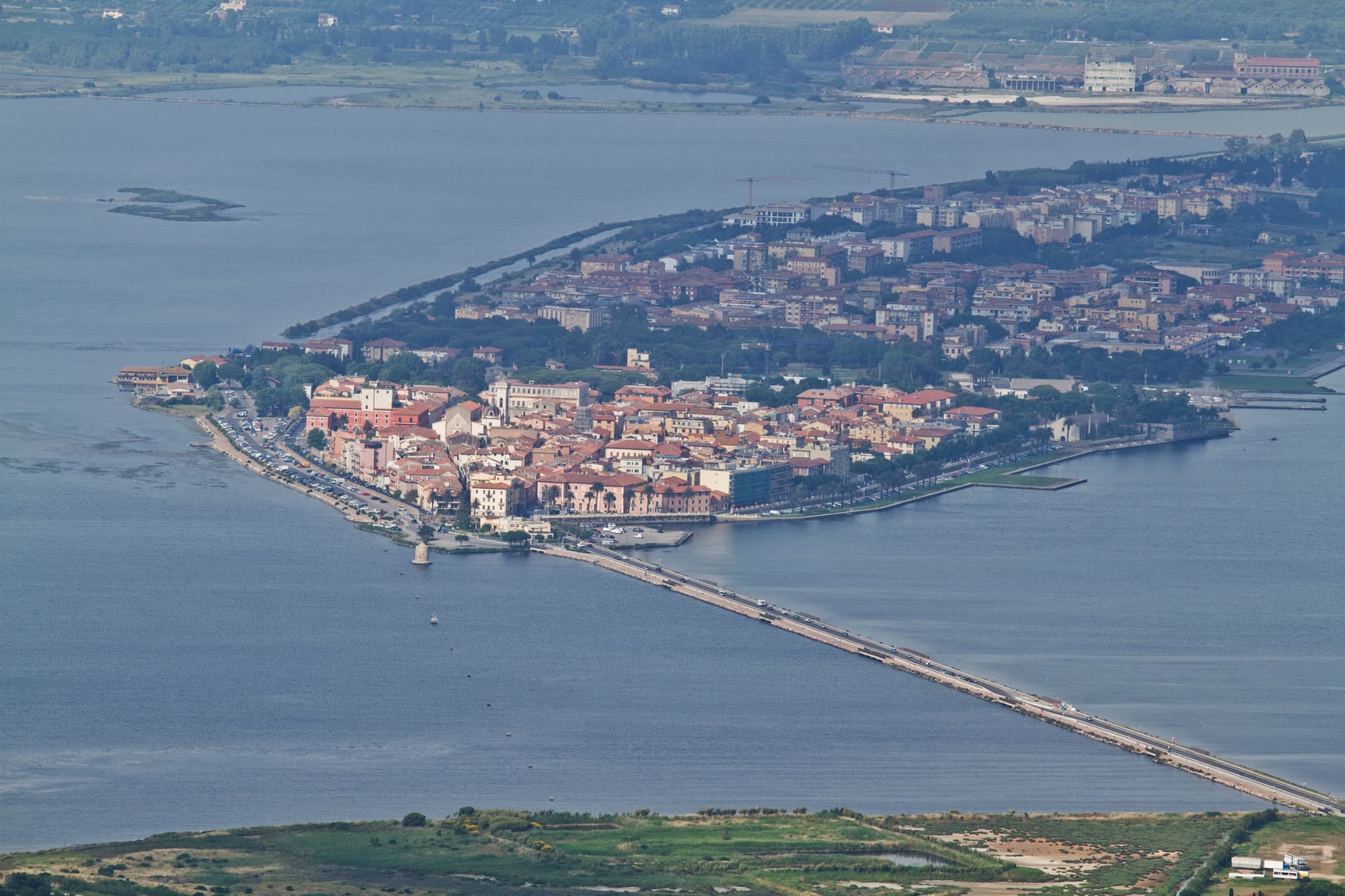
Orbetello
Province: Grosseto
A town on a narrow isthmus at the center of its own lagoon, fortified by Spain in 1557 and tied to Monte Argentario by two tombolos.
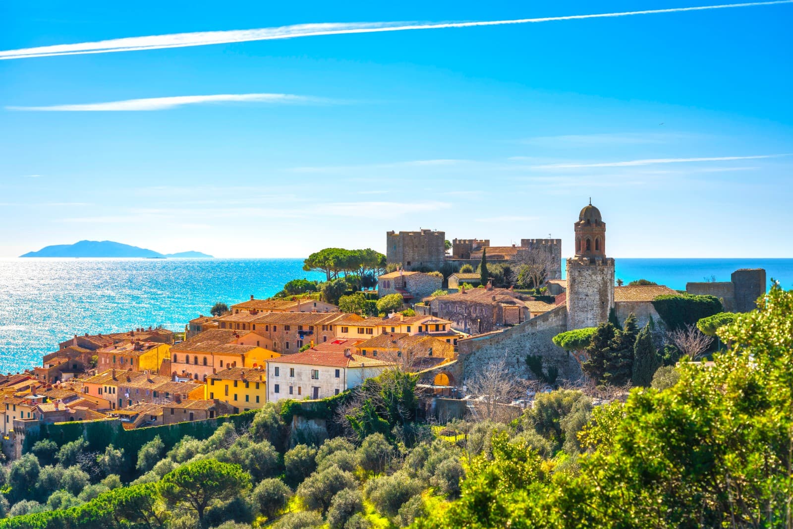
Castiglione della Pescaia
Province: Grosseto
A Maremma seaside town under an Aragonese castle, with the Vetulonia necropolis behind it, the Diaccia Botrona wetland beside it, and Italo Calvino buried on the hill.

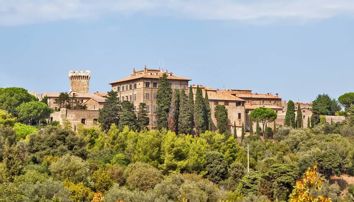
Massa Marittima
Province: Grosseto
A medieval mining town at 380 meters in the Colline Metallifere, free commune from 1255 to 1337, whose cathedral holds the relics of San Cerbone.
Campiglia Marittima
Province: Livorno
A walled hilltop borgo above the Val di Cornia, where the Rocca tower watches a mining landscape worked from the Etruscans to 1976.
Piombino
Province: Livorno
A promontory port facing Elba across the channel, founded by refugees from Etruscan Populonia and now the Tuscan archipelago's ferry capital.
🟦 Bandiera Blu
More Bandiera Blu towns in Tuscany
Bibbona
Province: Livorno
An Etruscan-origin hill village above the Costa degli Etruschi, with a Romanesque parish church and a Lorraine-built coastal fort eight kilometers down the road at Marina di Bibbona.
Camaiore
Province: Lucca
The Versilia commune that runs from the Apuan Alps to the sea, a Roman Campus Maior on the Via Francigena with a beach at its western end.
Carrara
Province: Massa-Carrara
The marble town at the foot of the Apuan Alps, with over 650 quarry sites in the valleys above and the stone that built the Pantheon, the Pietà and Michelangelo's David.

Castagneto Carducci
Province: Livorno
A hilltop borgo at 194 meters above the Costa degli Etruschi, renamed for the poet Carducci in 1907 and the home of Bolgheri and Sassicaia.
Forte dei Marmi
Province: Lucca
The Versilia luxury beach built around an eighteenth-century marble-loading fort, with 99 bagni concessions and a Wednesday market that draws Milan.