
Basilicata · Potenza
Acerenza
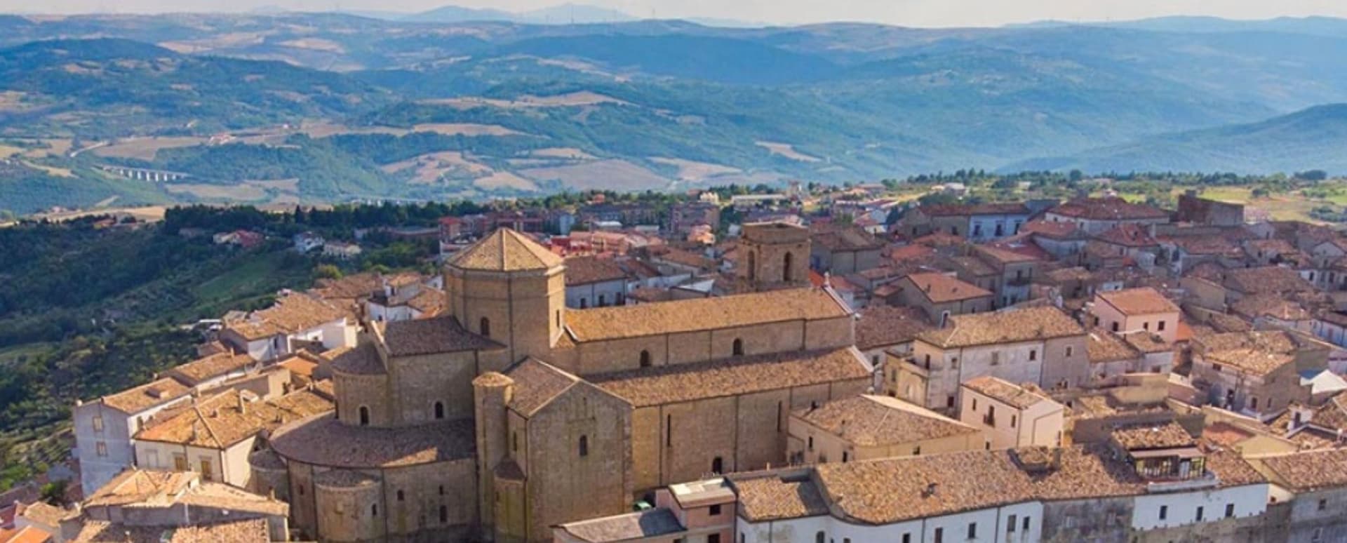
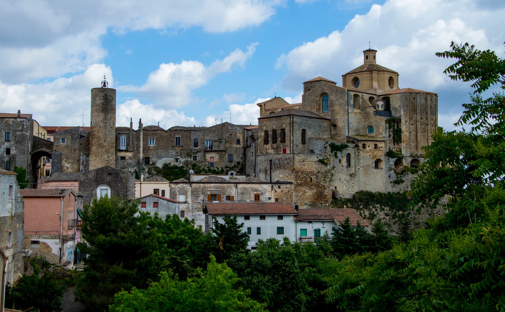
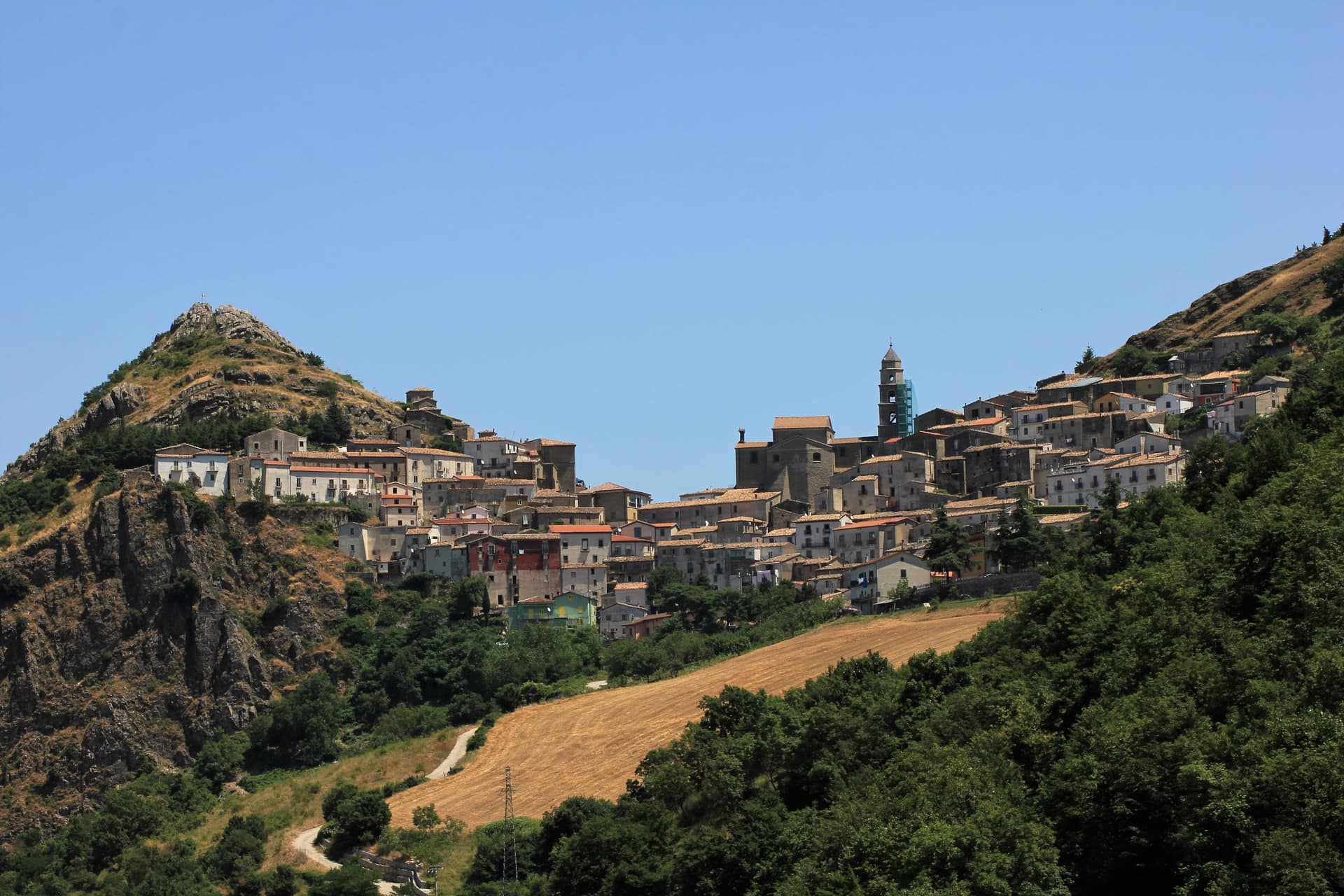
A walled ridge town at 833 meters in the north Lucanian hills, archbishopric since 1068 under a Romanesque cathedral begun in 1080.
Known for
CATHEDRAL
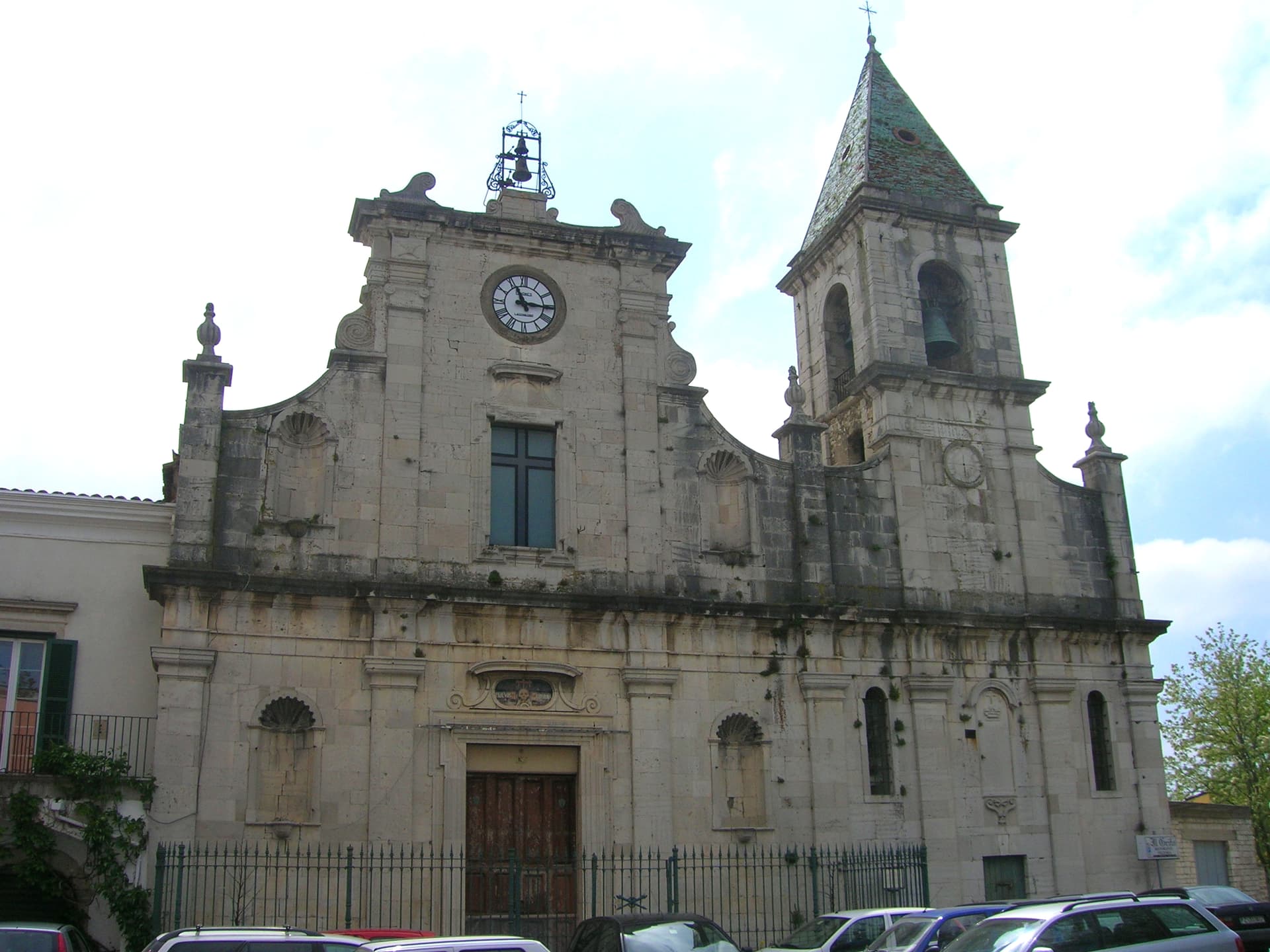
Romanesque-Gothic cathedral begun in 1080, archbishopric since 1068, with a 1524 Renaissance crypt and a marble bust of Julian the Apostate.
AGLIANICO
Vineyards on the surrounding hills feed Basilicata's Aglianico del Vulture DOCG; the comune is a member of Città del Vino.
RIDGE FORTRESS
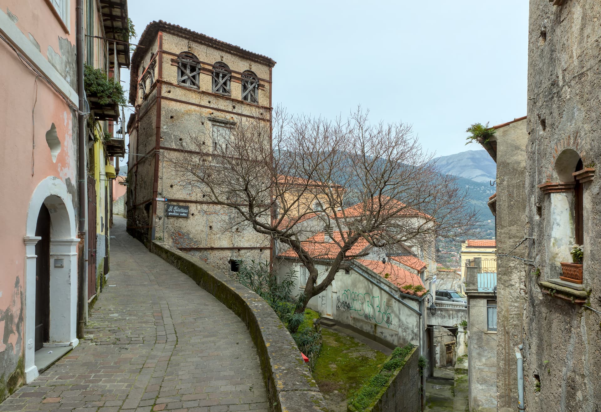
Walled town at 833 meters, fortified by Lombards, ringed by intact medieval walls and gates that survived centuries of invasion.
When to visit
Best · May–Oct
- J
- F
- M
- A
- M
- J
- J
- A
- S
- O
- N
- D
- Best
- Hot or crowded
- Quiet
- Mostly closed
The festa: Canio di Atella, 25 May
Why come
Acerenza sits at 833 meters on a sandstone ridge in the north of the Potenza province, a hundred kilometers inland from Salerno and twenty-two from Venosa. The Romans took it from the Lucanians in 318 BC as Aceruntia; the Ostrogoths and then the Lombards fortified it. It has been the seat of a bishop since at least 499 and an archbishop since 1068.
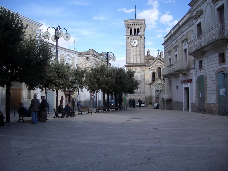
The Cattedrale di Santa Maria Assunta e San Canio was begun under archbishop Arnaldo of Cluny in 1080 in Romanesque-Gothic style, with a nave and two aisles, sixteenth-century canvases, and a Renaissance crypt consecrated in 1524 known as the Cappella Ferrillo. The cathedral holds a marble bust traditionally identified as Julian the Apostate. The medieval layout, walls and gates remain intact. Vineyards on the surrounding slopes feed the Aglianico del Vulture DOCG produced across the area, and the comune carries Città del Vino and Città dell'Olio designations alongside its Borghi più belli membership.
The Sunday letter
We haven’t written Acerenza’s letter yet.
One town every Sunday, with the photo, the food, the festa. Be there when this one comes up. Free, by Peter & Sophia from Pietrasanta.
By subscribing you agree to Substack’s Terms of Use, our Privacy Policy and our Information collection notice.

What to see
Cattedrale di Santa Maria Assunta e San Canio
Romanesque-Gothic cathedral begun in 1080 under archbishop Arnaldo of Cluny, with a Renaissance crypt of 1524 and a marble bust identified as Julian the Apostate.
Centro storico medievale
Walled medieval ridge town with original gates and the typical concentric plan of a fortified borgo, sacked repeatedly through the early Middle Ages.
Cripta del Ferrillo
Renaissance crypt under the cathedral, consecrated in 1524, decorated with frescoes, columns and bas-reliefs, used as the chapel of the Ferrillo family.
Piazza Glinni
Main square in front of the cathedral, the high point of the ridge and the gathering place for the September wine festival.
The slow-trip planner
Building a trip? Find where Acerenza fits in a slow Italy circuit.
Answer five questions. We will shape a geographically coherent slow trip from the 1,000 Italian towns most travelers skip. Yours to save and share.
Living here
- Population 2,090
- Off the beaten pathi
- Pharmacy: none mapped
- High school within a 30-minute drive
- Train station in the comune
- Nearest airport Bari / Brindisi, 1 h 52 min drive
- Regional capital Potenza, 40 min drive
Tags & datadesignations · numbers · sources
The numbers
- Elevation: 833 m
- Population: 2,090
- Surface area: 77.64 km²
These figures were compiled from public directories — ISTAT, OpenStreetMap, Wikidata — and from the official listings of the guides named on this page. Town details change; verify with official sources before you travel.
Close by
More towns near Acerenza
Venosa
Province: Potenza
Founded as Roman Venusia in 291 BC, birthplace of Horace, with an unfinished abbey built from amphitheater stones and a 1470 Aragonese castle.
Irsina
Province: Matera
Called Montepeloso until 1895, a 548-meter Bradano-valley hill town whose cathedral holds the only surviving polychrome sculpture attributed to Andrea Mantegna.
San Fele
Province: Potenza
A stone village at 872 meters between Monte Toretta and Castello, anchored by Otto I's 969 fortress and ten waterfalls down the Bradano.
Minervino Murge
Province: Barletta-Andria-Trani
The Balcone di Puglia at 445 meters on the Alta Murgia, between the Ofanto valley and Monte Vulture, inside the national park.
Poggiorsini
Province: Bari
The smallest commune in metropolitan Bari, an Orsini estate of 1609 that became an independent town only in 1957.
🎨 Borghi più belli d'Italia
More Borghi più belli d'Italia towns in Basilicata
Castelmezzano
Province: Potenza
A medieval village at 750 meters wedged into the Dolomiti Lucane sandstone teeth, linked to Pietrapertosa by a 1,452-meter zipline since 2007.
Guardia Perticara
Province: Potenza
The stone village at 678 meters above the Sauro valley, rebuilt block by block in Gorgoglione sandstone after the 1980 earthquake.
Maratea
Province: Potenza
Basilicata's only commune on the Tyrrhenian, thirty-two kilometers of rocky coast under a twenty-one meter marble Christ raised over Monte San Biagio in 1965.
Miglionico
Province: Matera
A hilltop borgo at 461 meters above the Bradano, the seven-tower castle that gave the 1485 Conspiracy of the Barons its hall.
Pietrapertosa
Province: Potenza
Basilicata's highest commune at 1,088 meters, built into the Lucanian Dolomites with a Saracen rock-cut fortress and a 1,400-meter zipline to Castelmezzano.