
Basilicata · Potenza
Castelmezzano
A medieval village at 750 meters wedged into the Dolomiti Lucane sandstone teeth, linked to Pietrapertosa by a 1,452-meter zipline since 2007.
Known for
VOLO DELL'ANGELO
Twin zipline to Pietrapertosa across the Dolomiti Lucane, opened 2007, up to 1,452 meters long and 120 km/h, summer-only operation.
DOLOMITI LUCANE
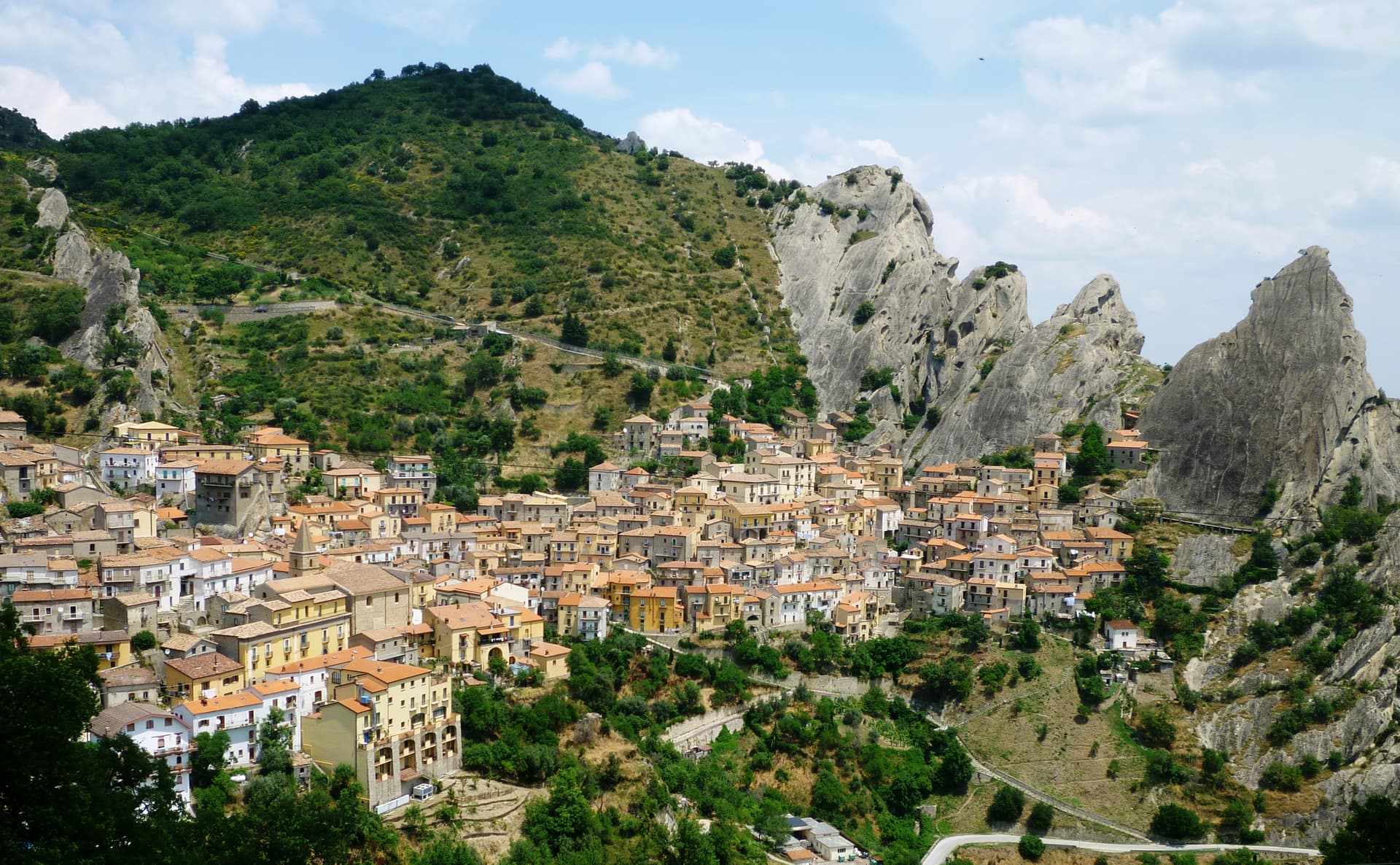
Sandstone range from the middle Miocene with named rock formations, shared with Pietrapertosa, anchor of the regional Gallipoli Cognato park.
GRADINATA NORMANNA
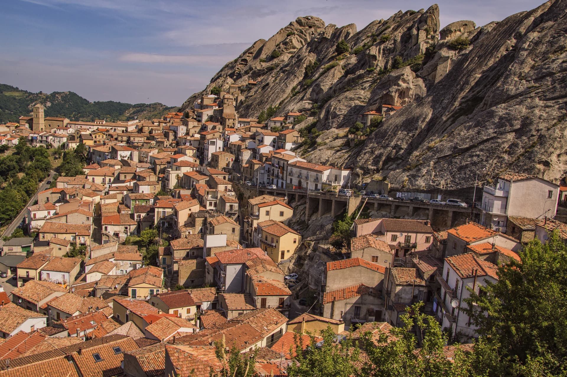
Fifty-four steps carved into a single sandstone block, the climb to the Norman watchtower and the village's signature image.
When to visit
Best · May–Oct
- J
- F
- M
- A
- M
- J
- J
- A
- S
- O
- N
- D
- Best
- Hot or crowded
- Quiet
- Mostly closed
Why come
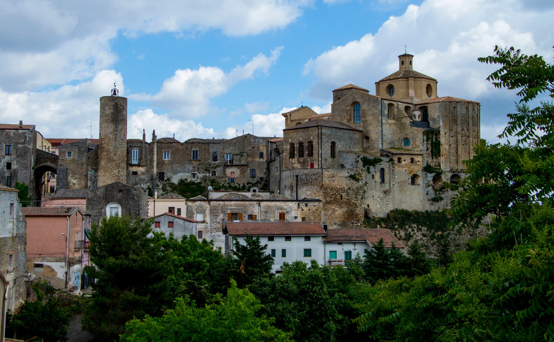
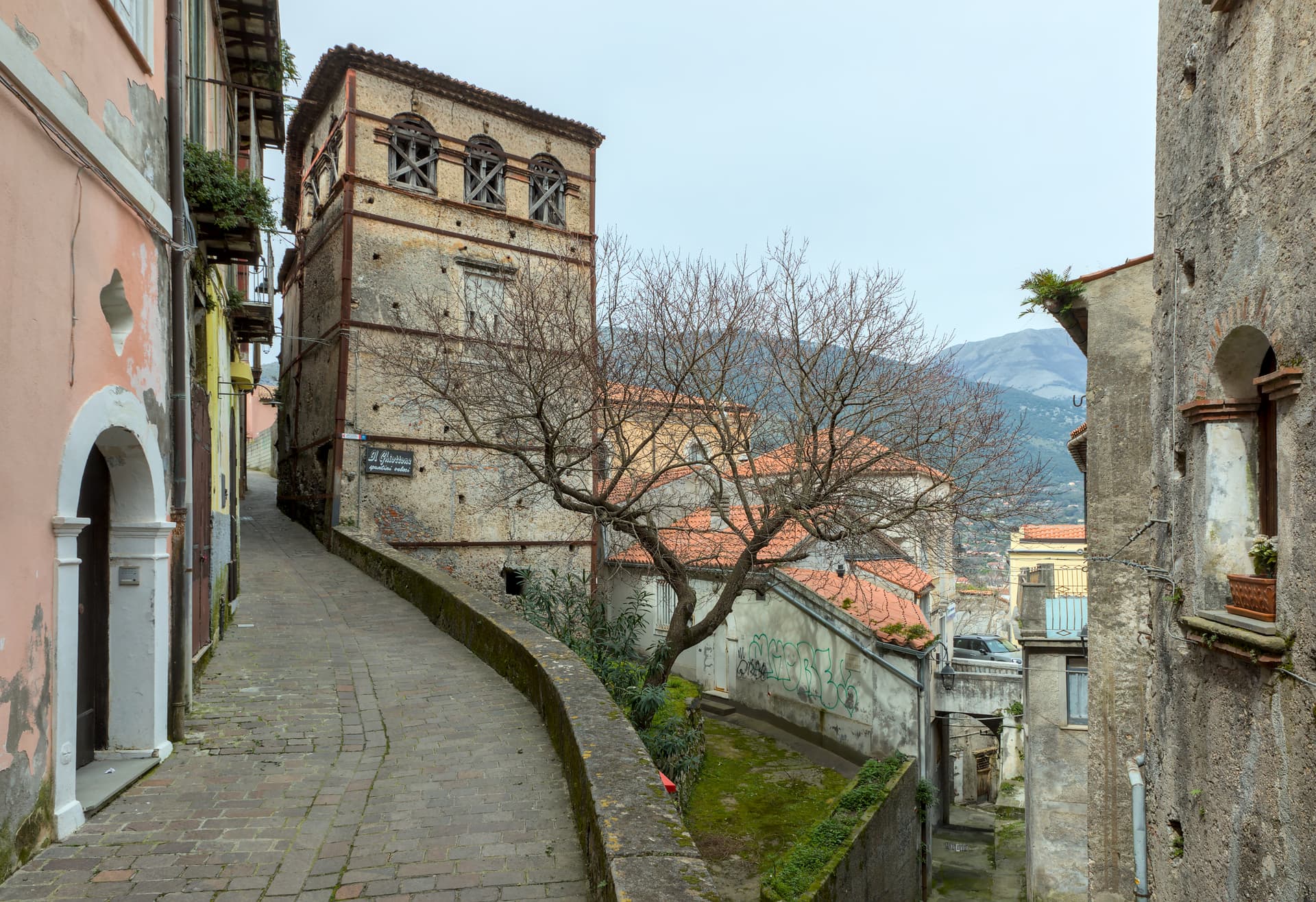
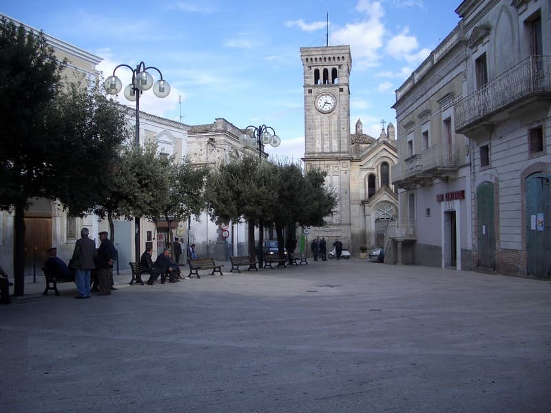
Castelmezzano sits at 750 meters in a rocky basin inside the Dolomiti Lucane, the sandstone range whose teeth date to the middle Miocene and form some of the most distinctive geology in the south. The village is built into the rock; houses sit beneath overhangs, lanes climb in stairs cut from sandstone, and the Gradinata Normanna, fifty-four steps carved into a single monolith, climbs to what was once a Norman watchtower. The population is seven hundred and ten.
Since 2007 the Volo dell'Angelo zipline has connected Castelmezzano to Pietrapertosa on the opposite ridge: two cables run in either direction across the gorge, the longer 1,452 meters at speeds reaching one hundred and twenty kilometers per hour. The two villages share the Parco Regionale Gallipoli Cognato Piccole Dolomiti Lucane. Castelmezzano carries Borghi più belli and Bandiera Arancione, two of the four highest institutional signals an Italian commune can hold.
The Sunday letter
We haven’t written Castelmezzano’s letter yet.
One town every Sunday, with the photo, the food, the festa. Be there when this one comes up. Free, by Peter & Sophia from Pietrasanta.
By subscribing you agree to Substack’s Terms of Use, our Privacy Policy and our Information collection notice.

What to see
Dolomiti Lucane
Sandstone range with names like the Eagle's Beak and the Lion's Mouth, dating to the middle Miocene, forming the dramatic basin around the village.
Gradinata Normanna
Fifty-four steps carved into a single sandstone monolith, the access to a Norman watchtower above the village, the most photographed feature of Castelmezzano.
Volo dell'Angelo
Twin zipline cables between Castelmezzano and Pietrapertosa, the Peschiere line running 1,452 meters at up to 120 km/h, opened 2007.
Chiesa Madre di Santa Maria dell'Olmo
Mother church at the heart of the village, with a fourteenth-century portal and the seasonal Madonna dell'Olmo procession.
Centro storico
Concentric cluster of houses with sandstone-slab roofs built into the rocky basin, steep lanes connecting the church, the piazza and the Gradinata Normanna.
The slow-trip planner
Building a trip? Find where Castelmezzano fits in a slow Italy circuit.
Answer five questions. We will shape a geographically coherent slow trip from the 1,000 Italian towns most travelers skip. Yours to save and share.
Living here
- Population 710
- In-betweeni
- Pharmacy in town
- Nearest high school over ~30 minutes away
- Nearest airport Bari / Brindisi, 2 h 18 min drive
- Regional capital Potenza, 43 min drive
Tags & datadesignations · numbers · sources
The numbers
- Elevation: 750 m
- Population: 710
- Surface area: 33.91 km²
These figures were compiled from public directories — ISTAT, OpenStreetMap, Wikidata — and from the official listings of the guides named on this page. Town details change; verify with official sources before you travel.
Close by
More towns near Castelmezzano
Pietrapertosa
Province: Potenza
Basilicata's highest commune at 1,088 meters, built into the Lucanian Dolomites with a Saracen rock-cut fortress and a 1,400-meter zipline to Castelmezzano.
Accettura
Province: Matera
A 770-meter village in the Gallipoli Cognato park where, each Pentecost, a Turkey oak is married to a holly tree.
Guardia Perticara
Province: Potenza
The stone village at 678 meters above the Sauro valley, rebuilt block by block in Gorgoglione sandstone after the 1980 earthquake.
Viggiano
Province: Potenza
A 975-meter Val d'Agri ridge town, home of the Black Madonna of Lucania and the Italian folk harp, on Europe's largest onshore oil field.
Acerenza
Province: Potenza
A walled ridge town at 833 meters in the north Lucanian hills, archbishopric since 1068 under a Romanesque cathedral begun in 1080.
🎨 Borghi più belli d'Italia
More Borghi più belli d'Italia towns in Basilicata
Irsina
Province: Matera
Called Montepeloso until 1895, a 548-meter Bradano-valley hill town whose cathedral holds the only surviving polychrome sculpture attributed to Andrea Mantegna.
Maratea
Province: Potenza
Basilicata's only commune on the Tyrrhenian, thirty-two kilometers of rocky coast under a twenty-one meter marble Christ raised over Monte San Biagio in 1965.
Miglionico
Province: Matera
A hilltop borgo at 461 meters above the Bradano, the seven-tower castle that gave the 1485 Conspiracy of the Barons its hall.