
Basilicata · Potenza
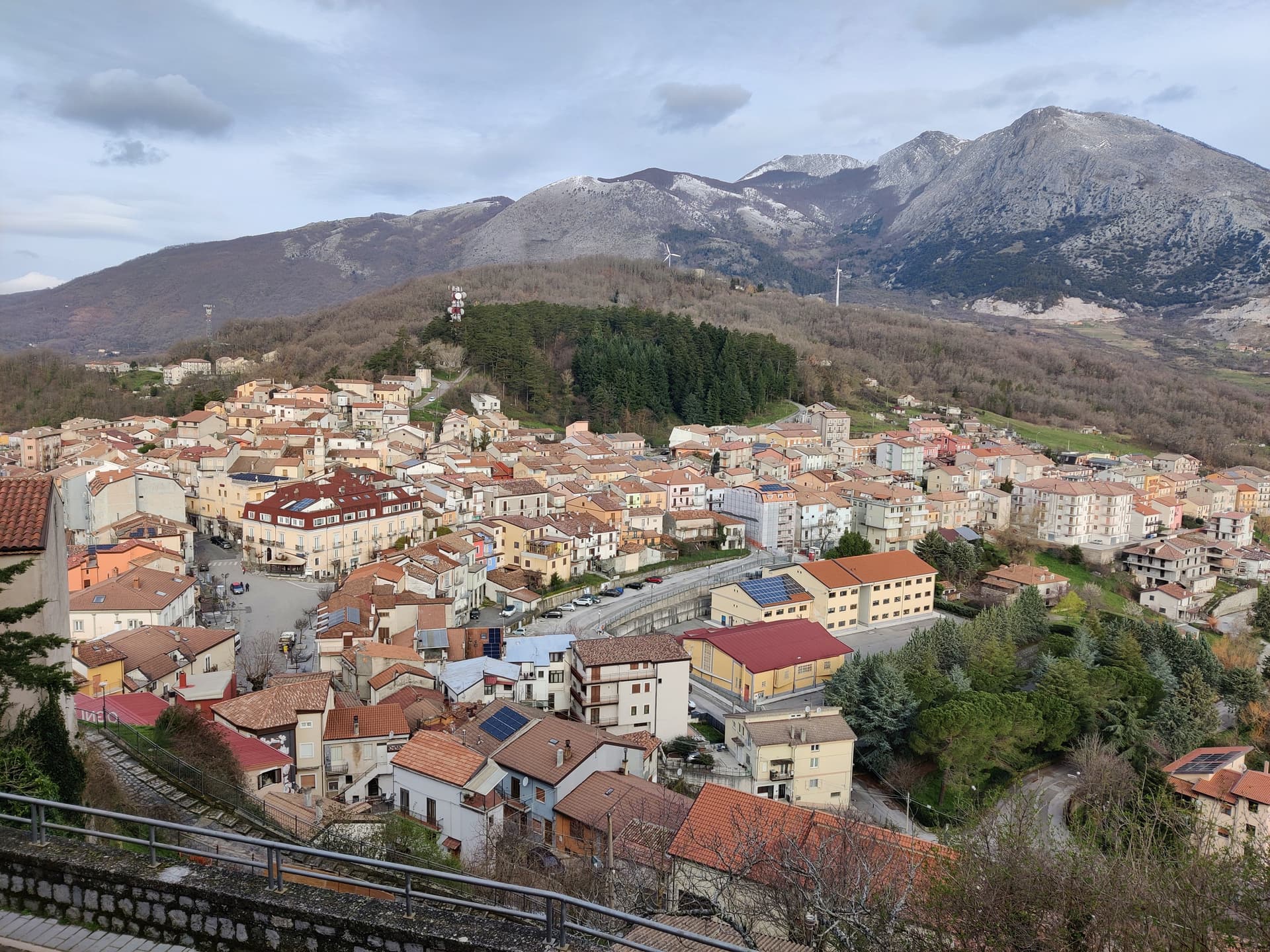
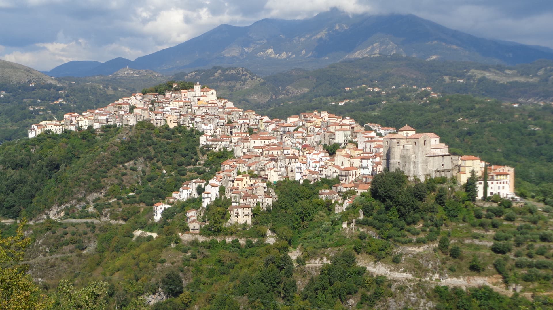
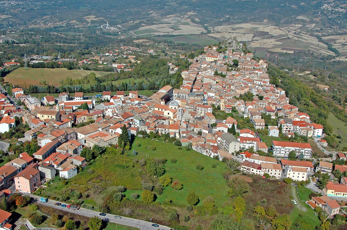
Viggiano
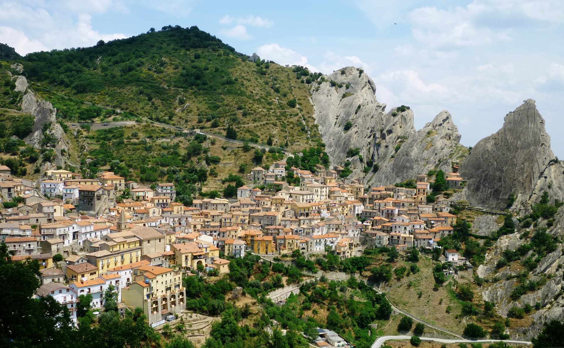
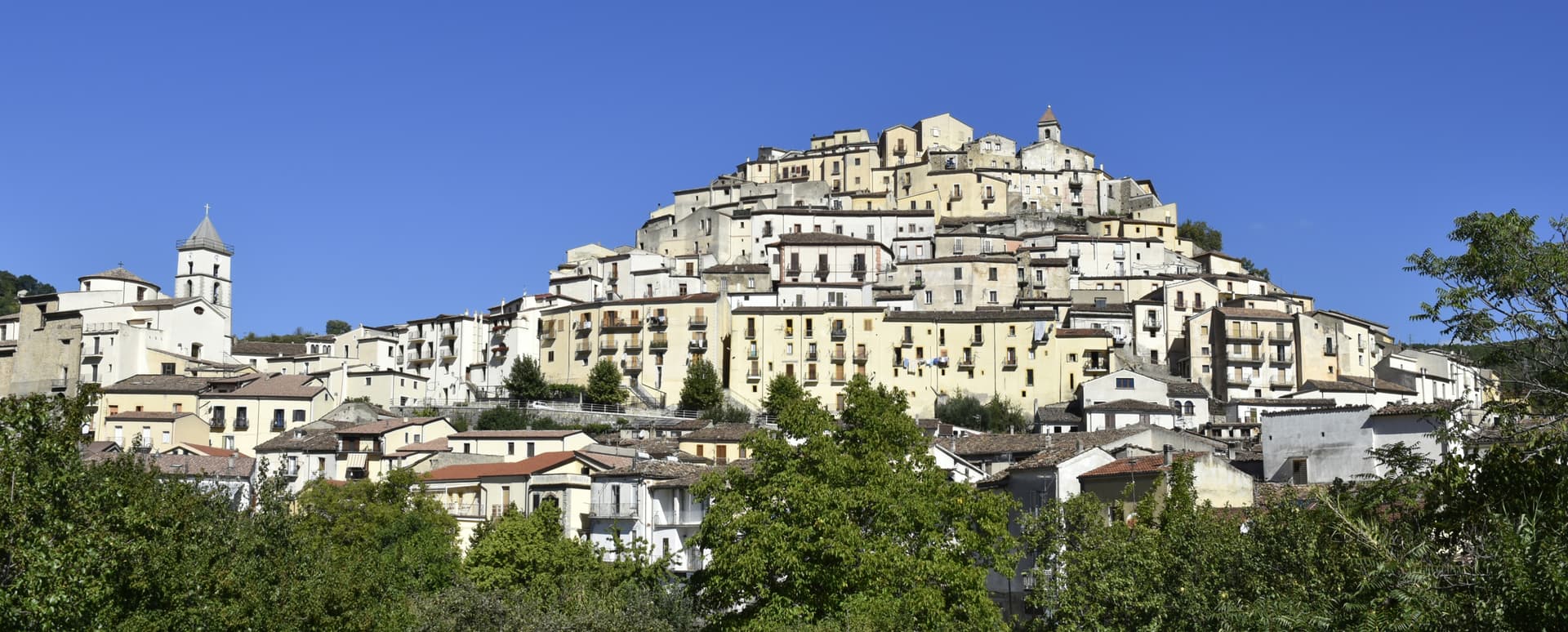
A 975-meter Val d'Agri ridge town, home of the Black Madonna of Lucania and the Italian folk harp, on Europe's largest onshore oil field.
Known for
MADONNA NERA
Black Madonna statue, patron of Lucania, carried to her 1,725-meter sanctuary the first Sunday of May and back to Viggiano the first Sunday of September.
ITALIAN HARP
Historic centre of Italian folk harp-making and the arpisti viggianesi who carried Lucanian music across Europe and the Americas.
VAL D'AGRI OIL
Europe's largest onshore oil field sits under the valley floor, operated by Eni at the Centro Olio, producer of most Italian domestic crude.
When to visit
Best · May–Oct
- J
- F
- M
- A
- M
- J
- J
- A
- S
- O
- N
- D
- Best
- Hot or crowded
- Quiet
- Mostly closed
The festa: Madonna del Sacro Monte di Viggiano (Black Madonna), 4 September
Why come
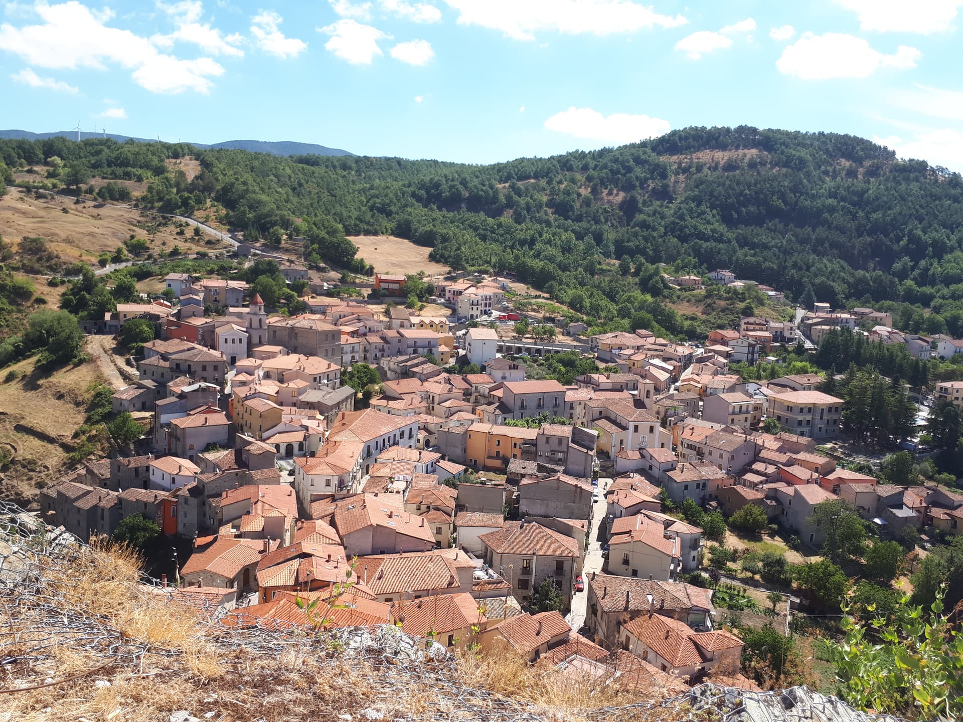
Viggiano sits at 975 meters on a ridge in the Alta Val d'Agri, in the national park. The Santuario della Madonna Nera del Sacro Monte stands at 1,725 meters on the summit above the town: a dark wooden statue of the enthroned Virgin in Byzantine Nikopoia style, the patron saint of Lucania, carried up to the sanctuary on the first Sunday of May and back down to Viggiano on the first Sunday of September. The procession is the largest religious event in the region.
Viggiano is also the historic centre of Italian harp-making and of the arpisti viggianesi, the itinerant harpist musicians who carried Lucanian folk music across Europe and the Americas in the nineteenth century. The Museo dell'Arpa Vittoria continues the tradition. Beneath the valley floor sits Europe's largest onshore oil field, operated by Eni at the Centro Olio Val d'Agri, producing the majority of Italy's domestic crude.
The Sunday letter
We haven’t written Viggiano’s letter yet.
One town every Sunday, with the photo, the food, the festa. Be there when this one comes up. Free, by Peter & Sophia from Pietrasanta.
By subscribing you agree to Substack’s Terms of Use, our Privacy Policy and our Information collection notice.

What to see
Santuario della Madonna Nera del Sacro Monte
Sanctuary at 1,725 meters on the summit above town, housing the Byzantine-style Black Madonna statue, patron saint of Lucania.
Museo dell'Arpa Vittoria
Museum dedicated to the Viggiano harp tradition, the Italian folk harp and the itinerant arpisti viggianesi musicians of the nineteenth century.
Chiesa Madre Santa Maria Assunta
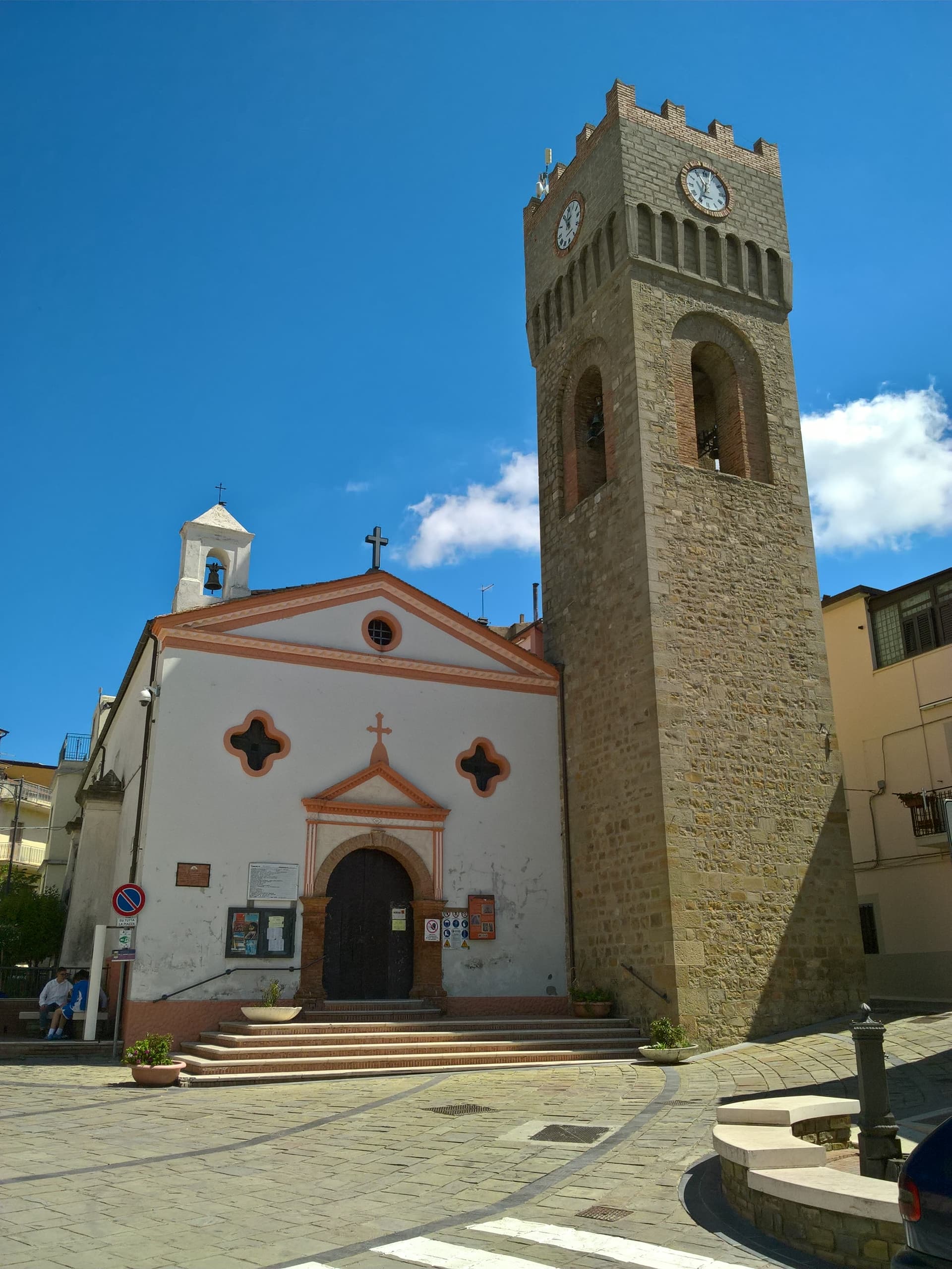
Mother church of the village in the centro storico, the year-round home of the Black Madonna statue between her two annual processions.
Centro storico
Stone-built medieval ridge village at 975 meters, narrow lanes climbing toward the upper viewpoints over the Alta Val d'Agri.
Sacro Monte di Viggiano
1,725-meter summit above town, walked by pilgrims on the May and September feast days, also the Viggiano ski terrain in winter.
The slow-trip planner
Building a trip? Find where Viggiano fits in a slow Italy circuit.
Answer five questions. We will shape a geographically coherent slow trip from the 1,000 Italian towns most travelers skip. Yours to save and share.
Living here
- Population 3,248
- Off the beaten pathi
- Pharmacy in town
- High school within a 30-minute drive
- Nearest airport Naples / Salerno, 2 h 24 min drive
- Regional capital Potenza, 1 h 10 min drive
Tags & datadesignations · numbers · sources
Recognised as
The numbers
- Elevation: 975 m
- Population: 3,248
- Surface area: 89.7 km²
These figures were compiled from public directories — ISTAT, OpenStreetMap, Wikidata — and from the official listings of the guides named on this page. Town details change; verify with official sources before you travel.
Close by
More towns near Viggiano
Sasso di Castalda
Province: Potenza
A 949-meter village in the Lucanian Apennines whose emigrants produced the engineer who launched Apollo 11, now crossed by a 300-meter Tibetan footbridge.
Guardia Perticara
Province: Potenza
The stone village at 678 meters above the Sauro valley, rebuilt block by block in Gorgoglione sandstone after the 1980 earthquake.
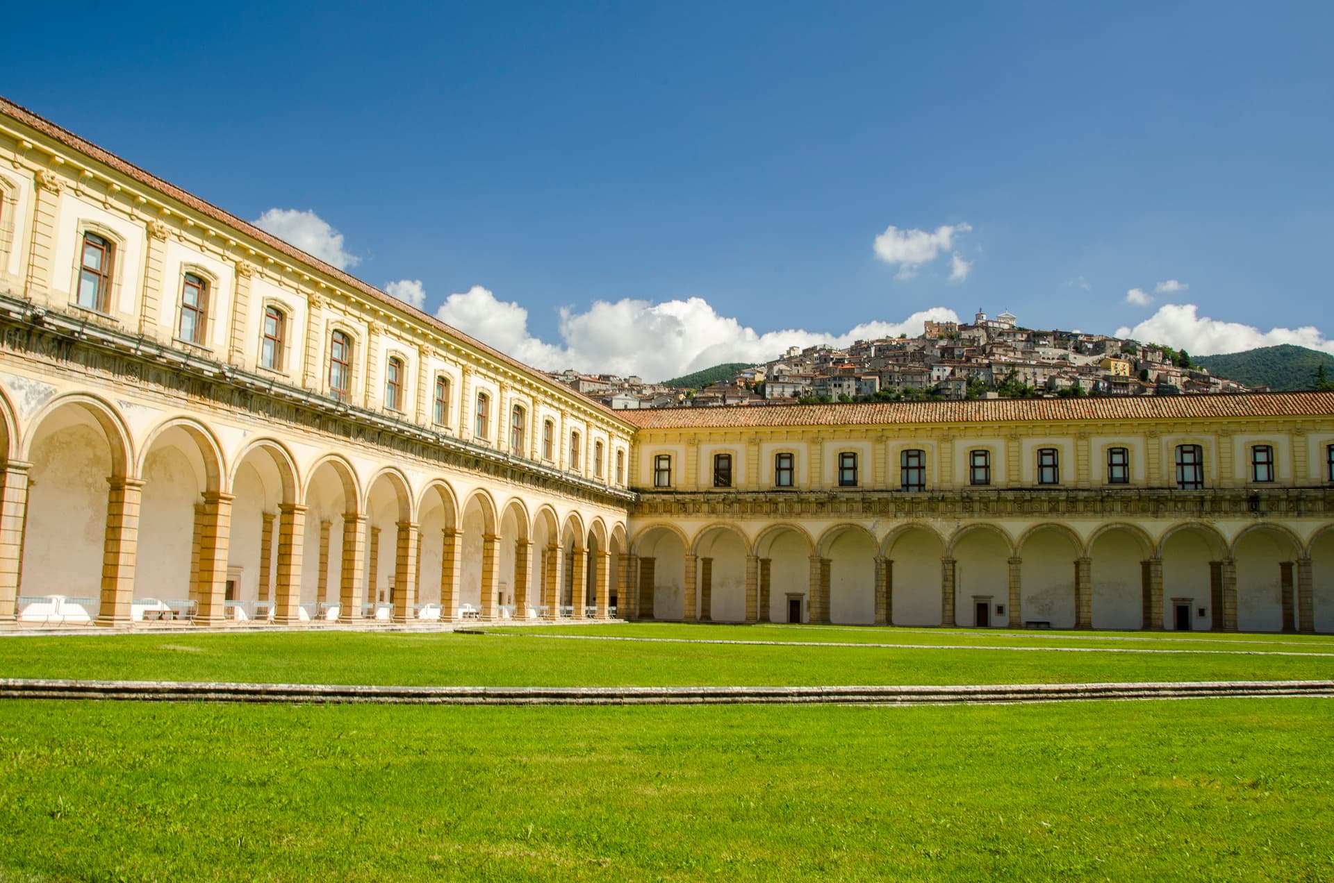
Padula
Province: Salerno
A hill town at 699 meters above the Vallo di Diano, holding the Certosa di San Lorenzo and the world's largest cloister.
Aliano
Province: Matera
The clay-hill village at 555 meters above the Agri valley where Carlo Levi served his 1935 exile and is buried in the cemetery.
Castelmezzano
Province: Potenza
A medieval village at 750 meters wedged into the Dolomiti Lucane sandstone teeth, linked to Pietrapertosa by a 1,452-meter zipline since 2007.
🌲 Parco Nazionale
More Parco Nazionale towns in Basilicata
Calvello
Province: Potenza
A 730-meter ceramic town at the foot of Monte Venturino, working clay since 1200 when Benedictines from Faenza brought the wheel south.
Lagonegro
Province: Potenza
A 666-meter Valle del Noce town founded by Byzantine monks, where local legend places the burial of Lisa del Giocondo, Leonardo's Mona Lisa.
Latronico
Province: Potenza
A mountain town at 888 meters on the northern edge of the Pollino, with two prehistoric thermal springs at the Calda hamlet below.
Rivello
Province: Potenza
A 479-meter ridge above the Noce valley where Lombards and Byzantines lived side by side, holding Latin and Greek rites until the seventeenth century.
Rotonda
Province: Potenza
The Pollino park's Lucanian gateway — a 3,171-resident borgo at 626m on the Basilicata/Calabria border, headquartered HQ for the Parco Nazionale del Pollino (Italy's largest national park), with the Fagiolo Bianco Poverello + Melanzana Rossa di Rotonda DOP slow-food products, the Borgo Autentico mark, and the Loricato pine forests immediately above town.