
Basilicata · Potenza
Sasso di Castalda
A 949-meter village in the Lucanian Apennines whose emigrants produced the engineer who launched Apollo 11, now crossed by a 300-meter Tibetan footbridge.
Known for
PONTE ALLA LUNA
300-meter Tibetan footbridge 102 meters above the gorge, the tallest of its kind in Italy, built 2014.
ROCCO PETRONE
Son of Sasso emigrants, NASA launch director for the Saturn V and head of the Apollo program at the 1969 moon landing.
BANDIERA ARANCIONE
TCI award for inland tourism quality, held by the village for its conservation work and pedestrian centro storico.
When to visit
Best · May–Oct
- J
- F
- M
- A
- M
- J
- J
- A
- S
- O
- N
- D
- Best
- Hot or crowded
- Quiet
- Mostly closed
The festa: San Rocco, 16 August
Why come
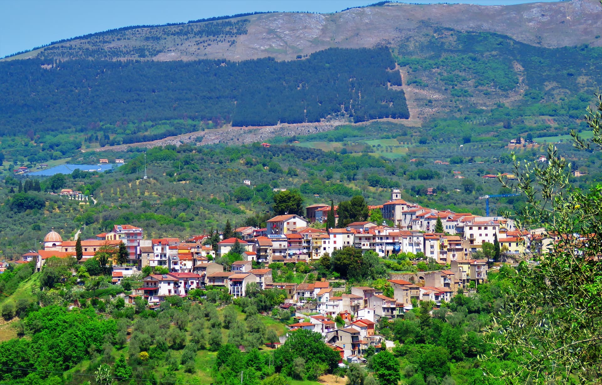
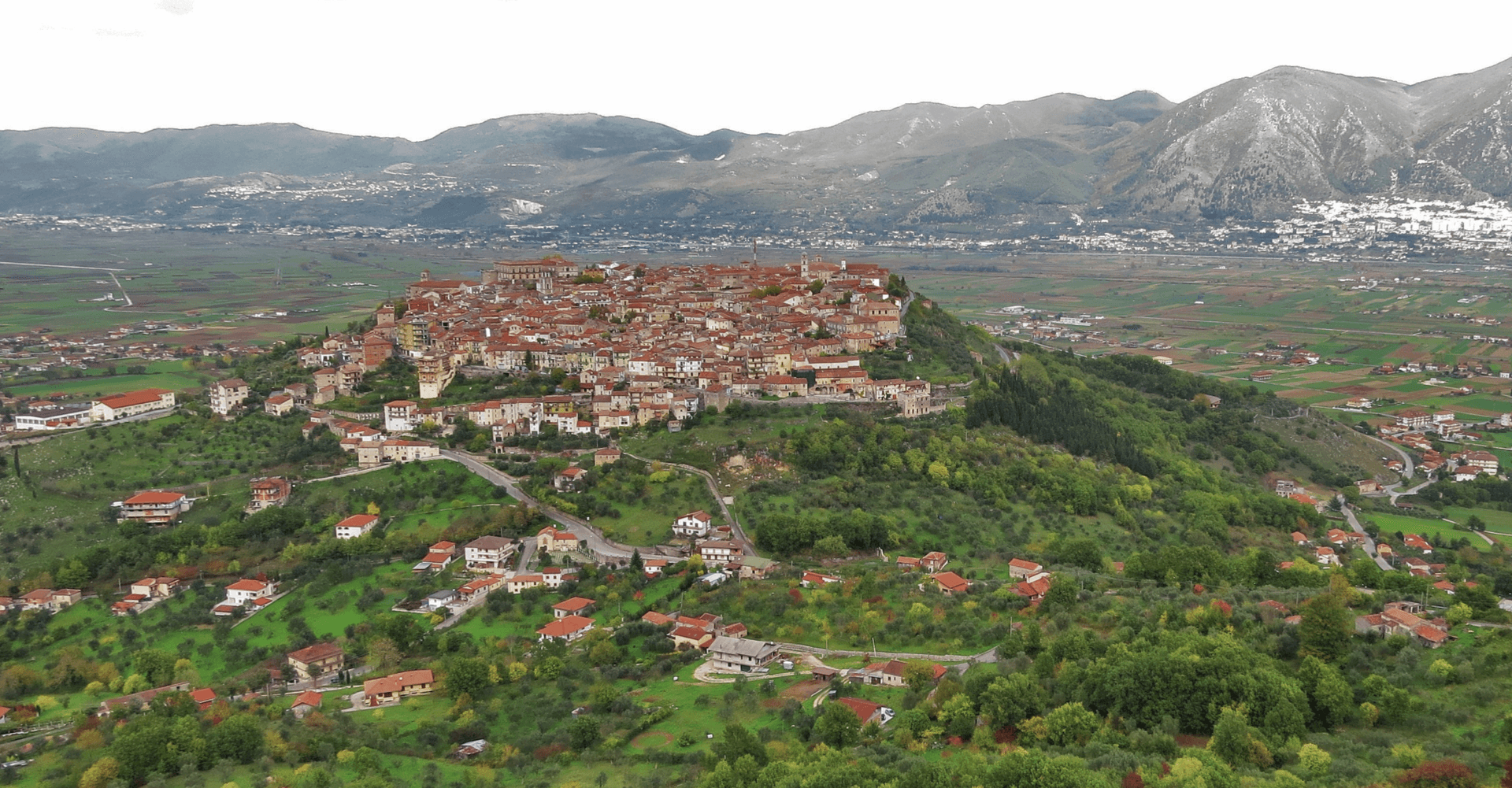
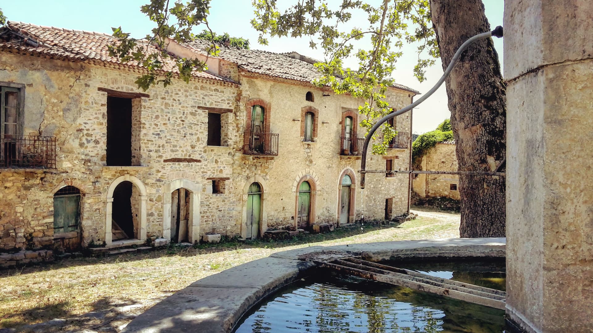
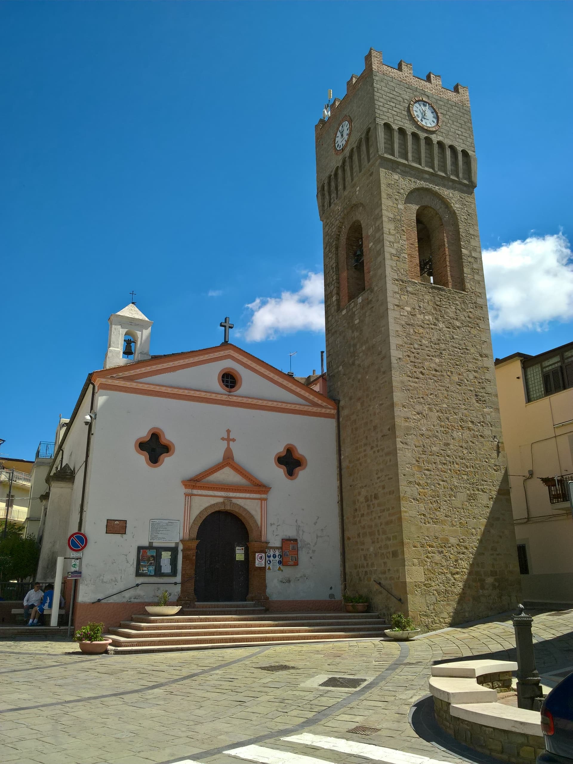
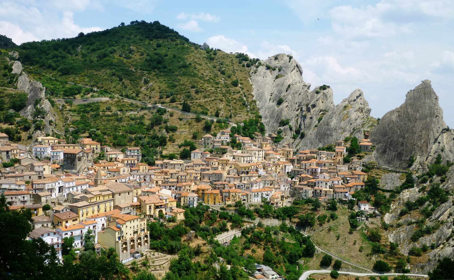
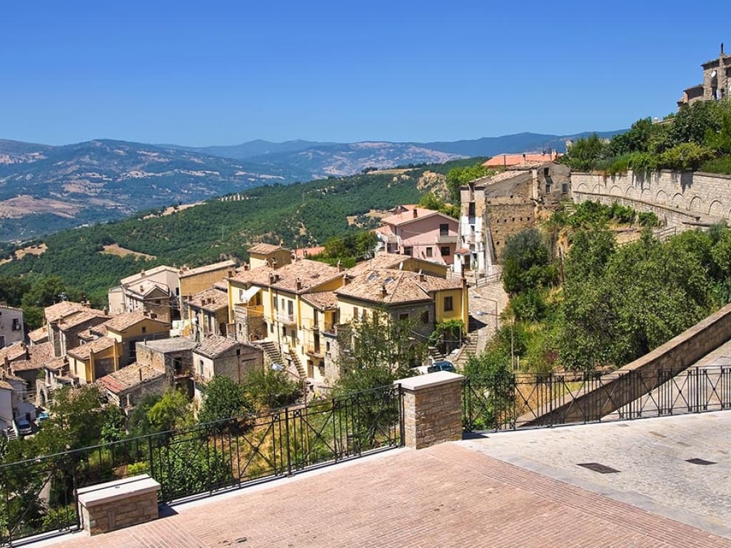
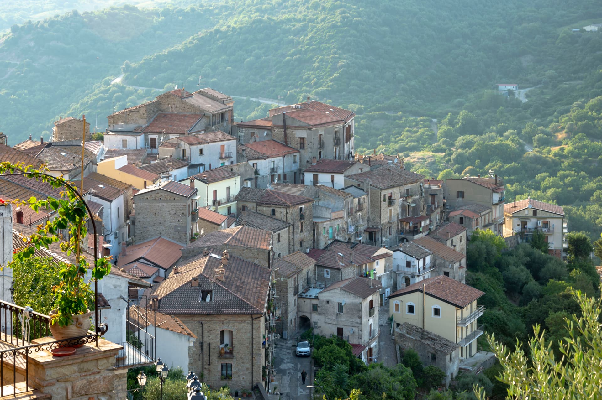
Sasso di Castalda sits at 949 meters in the Appennino Lucano Val d'Agri Lagonegrese National Park, on a rock spur above the Arenazzo torrent. Seven hundred and thirty people live in the medieval core that climbs toward the ruins of the Norman castello. The village's modern claim is the Ponte alla Luna, a Tibetan-style suspension footbridge installed in 2014: a single span of 300 meters, 102 meters above the gorge, paired with a shorter second crossing in a circuit walked annually by more than 30,000 visitors.
The name reaches back further. Rocco Petrone, born in New York in 1926 to emigrants from Sasso, became NASA's launch director for the Saturn V and ran the Apollo program through the first moon landing in 1969. The bridge points at the connection. The old town below holds the Chiesa Madre, San Rocco and San Nicola, walked in twenty minutes end to end.
The Sunday letter
We haven’t written Sasso di Castalda’s letter yet.
One town every Sunday, with the photo, the food, the festa. Be there when this one comes up. Free, by Peter & Sophia from Pietrasanta.
By subscribing you agree to Substack’s Terms of Use, our Privacy Policy and our Information collection notice.


What to see
Ponte alla Luna
Tibetan suspension footbridge of 300 meters at 102 meters above the Arenazzo torrent, named for emigrant Rocco Petrone who launched Apollo 11.
Castello
Norman fortress ruins crowning the rock spur above the village, the historic defensive anchor of the Lucanian Apennine valley.
Chiesa Madre
Mother church in the centro storico, the principal religious building of the upper village around the castle rock.
Chiesa di San Rocco
Small votive church of the patron saint, traditionally invoked against plague in the historic stone-built core.
Parco Nazionale Appennino Lucano
National park territory of mixed forest and pasture surrounding the village, with marked walking circuits including the Cammino delle Emozioni.
The slow-trip planner
Building a trip? Find where Sasso di Castalda fits in a slow Italy circuit.
Answer five questions. We will shape a geographically coherent slow trip from the 1,000 Italian towns most travelers skip. Yours to save and share.
Living here
- Population 733
- In-betweeni
- Pharmacy: none mapped
- High school within a 30-minute drive
- Nearest airport Naples / Salerno, 1 h 58 min drive
- Regional capital Potenza, 38 min drive
Tags & datadesignations · numbers · sources
Recognised as
The numbers
- Elevation: 949 m
- Population: 733
- Surface area: 45.43 km²
These figures were compiled from public directories — ISTAT, OpenStreetMap, Wikidata — and from the official listings of the guides named on this page. Town details change; verify with official sources before you travel.
Close by
More towns near Sasso di Castalda
Auletta
Province: Salerno
A Tanagro hill town above the Cilento-Vallo di Diano park, fortified by 1000 AD, scene of an 1861 anti-Piedmont massacre and an 1857 earthquake.
Teggiano
Province: Salerno
A ridge town at 635 meters above the Vallo di Diano, the ancient Tegianum that named the valley, held by the Sanseverino for three centuries.
Viggiano
Province: Potenza
A 975-meter Val d'Agri ridge town, home of the Black Madonna of Lucania and the Italian folk harp, on Europe's largest onshore oil field.
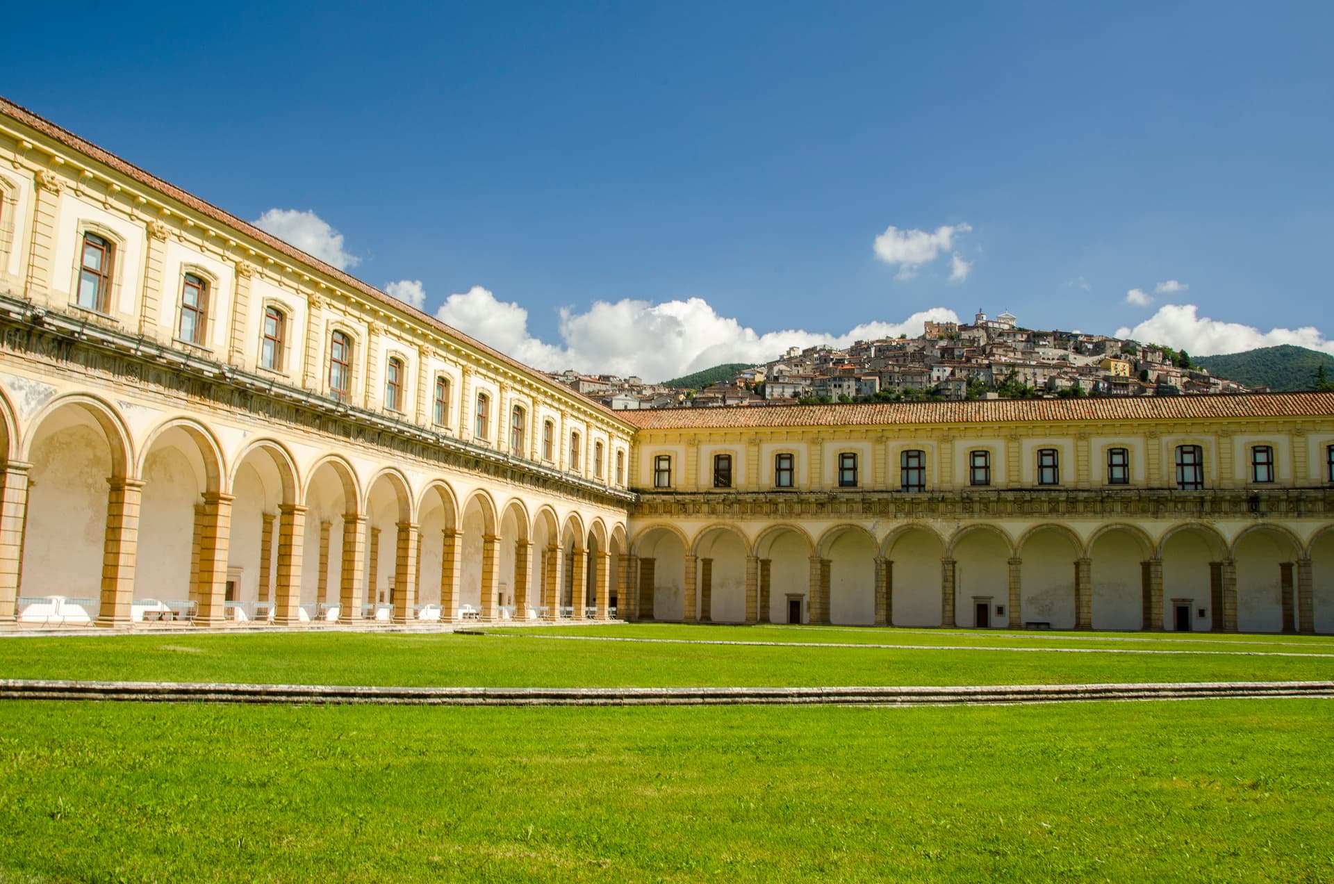
Padula
Province: Salerno
A hill town at 699 meters above the Vallo di Diano, holding the Certosa di San Lorenzo and the world's largest cloister.
Roscigno
Province: Salerno
A Cilento ghost town at 570 meters, emptied by a 1902 landslide and known as the Pompeii of the twentieth century.
🟠 Bandiera Arancione
More Bandiera Arancione towns in Basilicata
Aliano
Province: Matera
The clay-hill village at 555 meters above the Agri valley where Carlo Levi served his 1935 exile and is buried in the cemetery.
Castelmezzano
Province: Potenza
A medieval village at 750 meters wedged into the Dolomiti Lucane sandstone teeth, linked to Pietrapertosa by a 1,452-meter zipline since 2007.
Guardia Perticara
Province: Potenza
The stone village at 678 meters above the Sauro valley, rebuilt block by block in Gorgoglione sandstone after the 1980 earthquake.
Valsinni
Province: Matera
Isabella Morra's tragic castle — a 1,344-resident Lucanian borgo on a hilltop above the Sinni river, with the 11th-c Castello Morra where the 16th-c Renaissance poet Isabella Morra was murdered by her brothers in 1545, a Touring Club Bandiera Arancione + Pollino park signal, and the annual Parco Letterario festival reading her poems in the rooms where she wrote them.