
Campania · Salerno
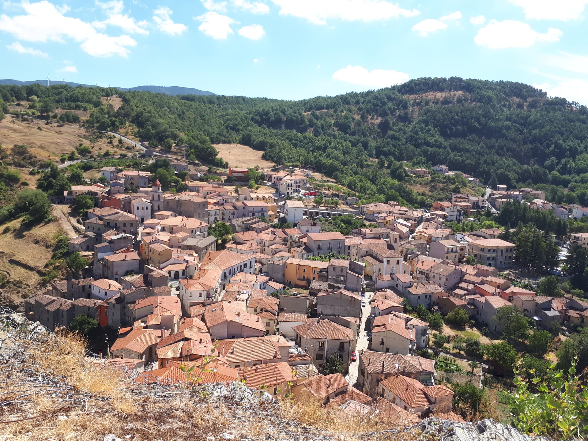
Auletta
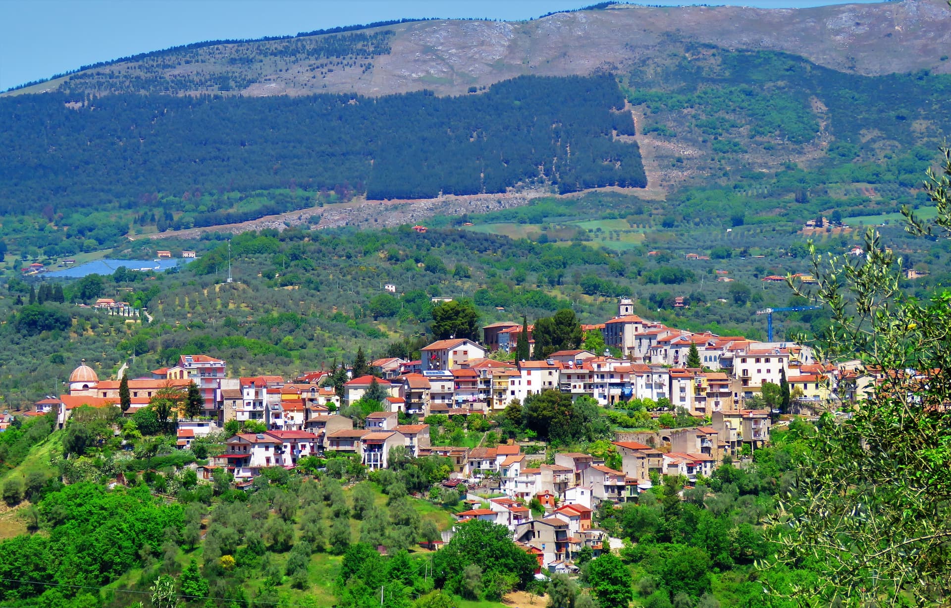
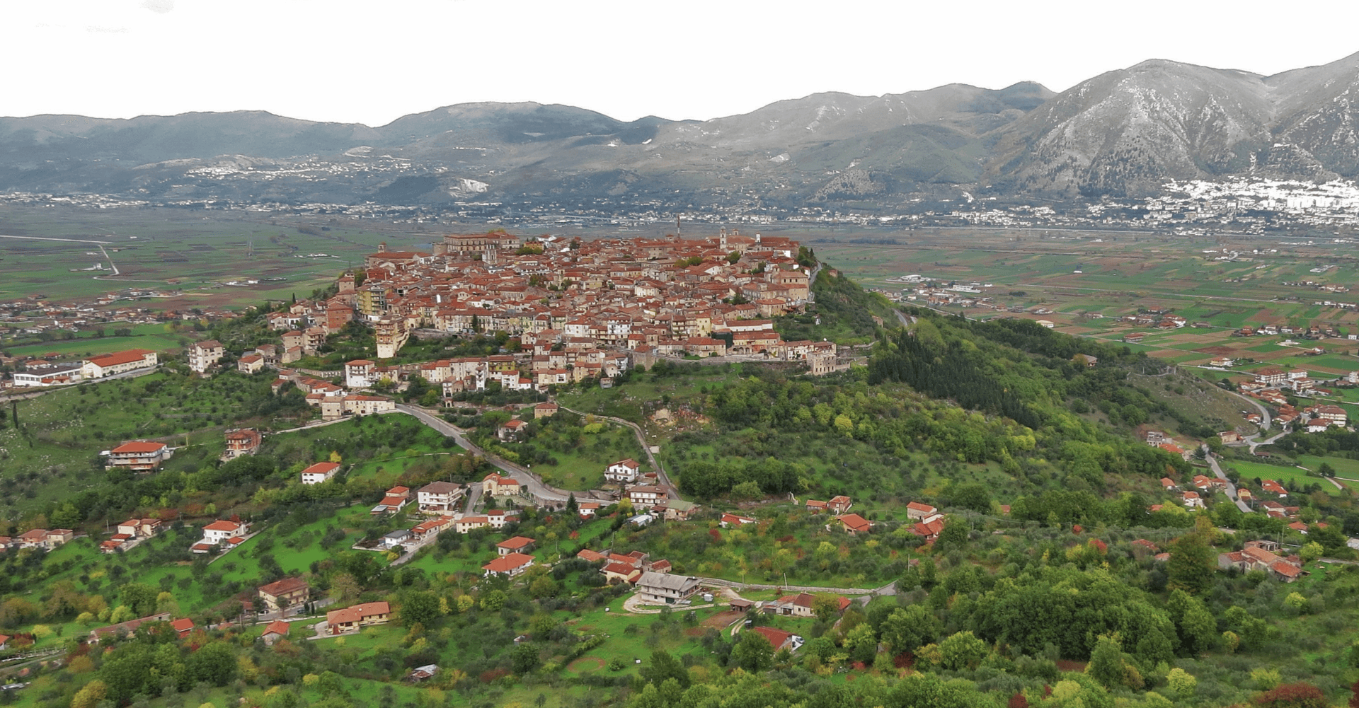
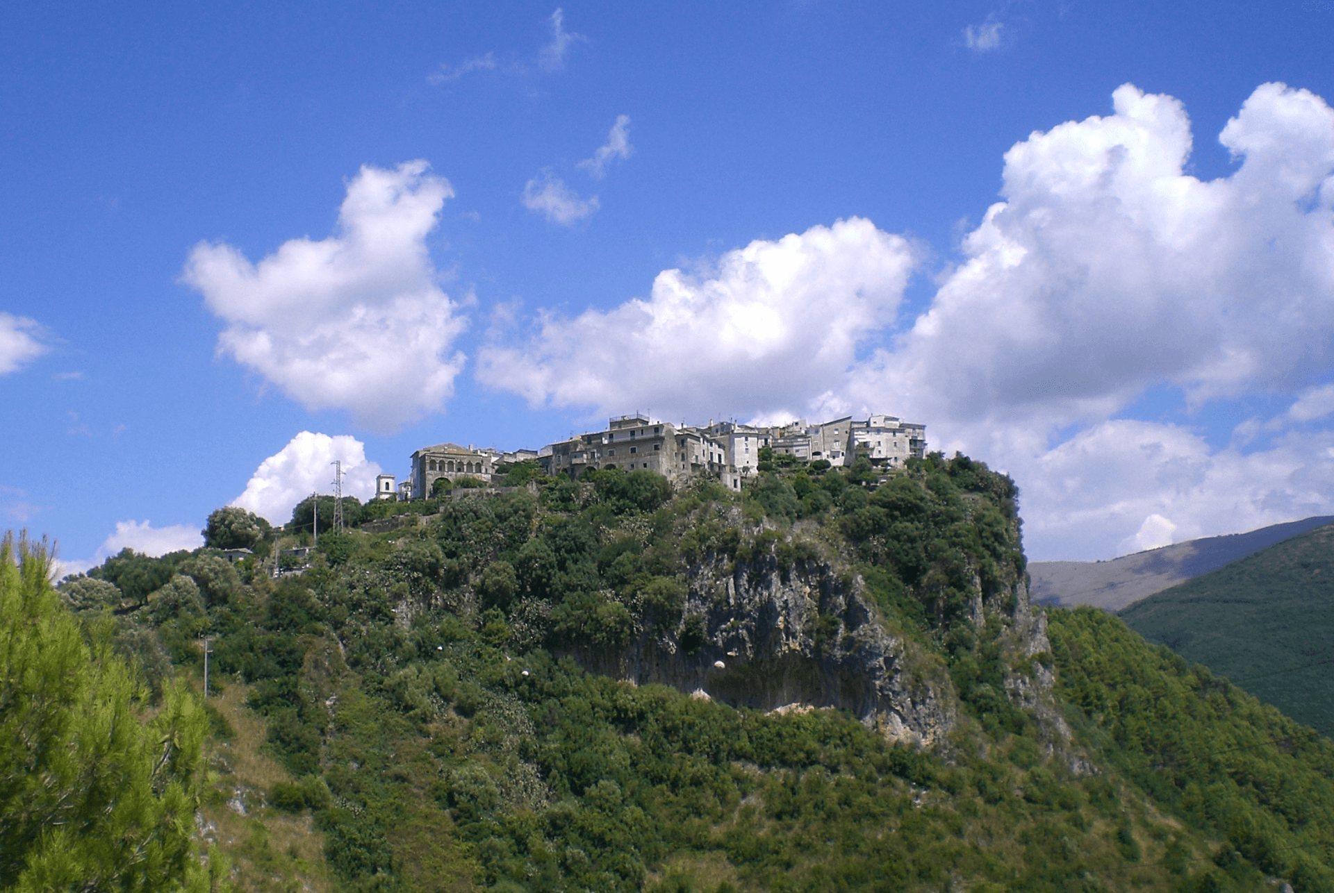
A Tanagro hill town above the Cilento-Vallo di Diano park, fortified by 1000 AD, scene of an 1861 anti-Piedmont massacre and an 1857 earthquake.
Known for
CASTELLO MARCHESALE
Twelfth-century Norman fortress at the high point of the centro storico, reshaped in the fifteenth century with three gates still standing.
MALLET EARTHQUAKE
Robert Mallet's 1857 study of the Great Neapolitan earthquake damage at Auletta is considered the first scientific post-quake survey ever made.
PIZZA CHIENA
Easter savoury pie filled with egg, toma and other soft cheeses, often with local white artichoke, a signature of Auletta's gastronomy.
When to visit
Best · Apr–Oct
- J
- F
- M
- A
- M
- J
- J
- A
- S
- O
- N
- D
- Best
- Hot or crowded
- Quiet
- Mostly closed
The festa: Donato da Ripacandida, 17 August
Why come
Auletta sits on a hill on the right bank of the Tanagro river, at the northern edge of the Vallo di Diano, inside the Cilento, Vallo di Diano and Alburni National Park. The town was fortified by the year 1000 and is mentioned as Olibola in 1095, possibly from olea, Latin for oil. The medieval core is reached through three gates, Porta Castello, Porta del Fiume and Porta Rivellino.
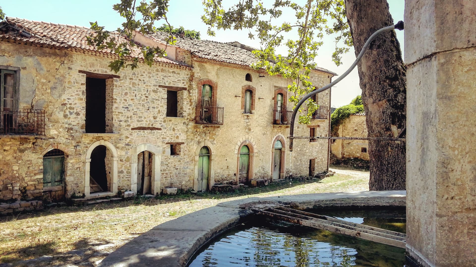
The Castello Marchesale, twelfth century in origin, took its current shape in the fifteenth, when defensive systems were added; it is privately owned by the Maioli Castriota Scanderbech family. The 1857 Great Neapolitan earthquake destroyed much of the town and was documented by the Irish seismologist Robert Mallet, in the first systematic post-earthquake survey ever attempted. In 1861, immediately after Unification, locals rose against the Piedmontese army and 45 were killed in what is remembered as the Auletta Massacre. The town is now a Città delle Grotte for its proximity to the Pertosa-Auletta caves.
The Sunday letter
We haven’t written Auletta’s letter yet.
One town every Sunday, with the photo, the food, the festa. Be there when this one comes up. Free, by Peter & Sophia from Pietrasanta.
By subscribing you agree to Substack’s Terms of Use, our Privacy Policy and our Information collection notice.

What to see
Castello Marchesale
Twelfth-century fortress in the highest part of the centro storico, reshaped in the fifteenth century with defensive walls and now privately held.
Chiesa di San Nicola di Mira
Parish church inside the medieval walls, holds a relic of San Donato di Ripacandida, the town's patron saint.
Borgo dei Mestieri
Restored part of the centro storico turned into a living museum of traditional Cilento crafts, with workshops on stone, iron and clay.
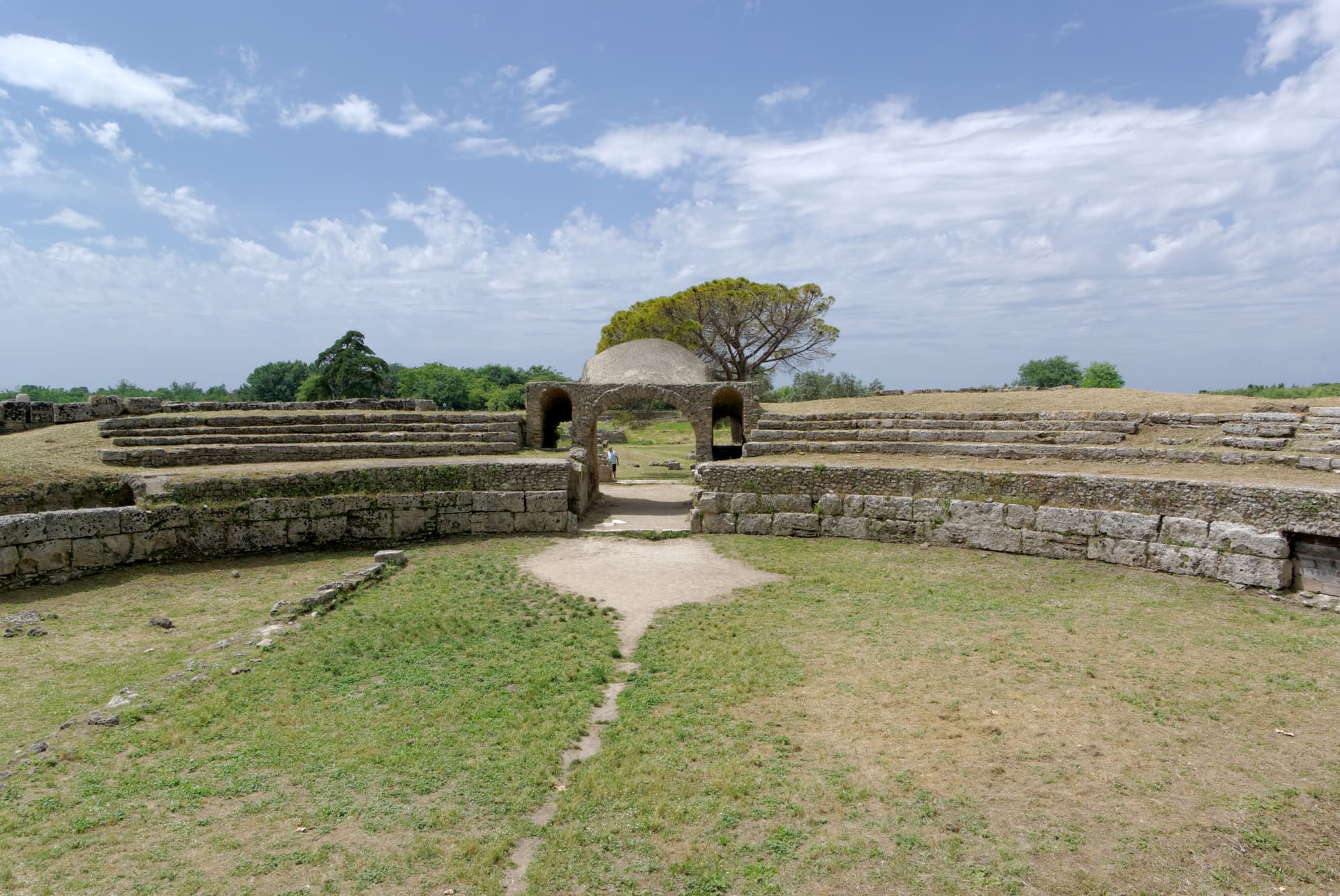
Grotte di Pertosa-Auletta
Karst cave system on the adjacent commune, visited partly by boat on an underground river, an important archaeological site.
Parco Nazionale del Cilento
Auletta is a gateway commune of the National Park and UNESCO Biosphere Reserve, with hiking trails along the Tanagro and into the Alburni.
The slow-trip planner
Building a trip? Find where Auletta fits in a slow Italy circuit.
Answer five questions. We will shape a geographically coherent slow trip from the 1,000 Italian towns most travelers skip. Yours to save and share.
Living here
- Population 2,124
- In-betweeni
- Pharmacy: none mapped
- High school within a 30-minute drive
- Train station in the comune
- Nearest airport Naples / Salerno, 1 h 32 min drive
- Regional capital Napoli, 1 h 33 min drive
Tags & datadesignations · numbers · sources
Recognised as
The numbers
- Elevation: 280 m
- Population: 2,124
- Surface area: 35.68 km²
These figures were compiled from public directories — ISTAT, OpenStreetMap, Wikidata — and from the official listings of the guides named on this page. Town details change; verify with official sources before you travel.
Close by
More towns near Auletta
Teggiano
Province: Salerno
A ridge town at 635 meters above the Vallo di Diano, the ancient Tegianum that named the valley, held by the Sanseverino for three centuries.
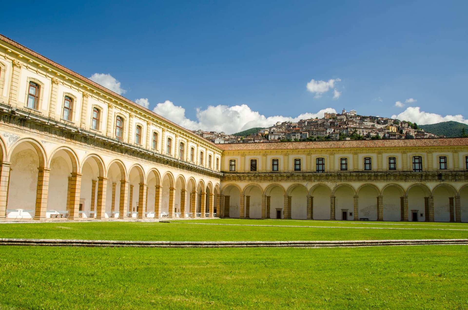
Padula
Province: Salerno
A hill town at 699 meters above the Vallo di Diano, holding the Certosa di San Lorenzo and the world's largest cloister.
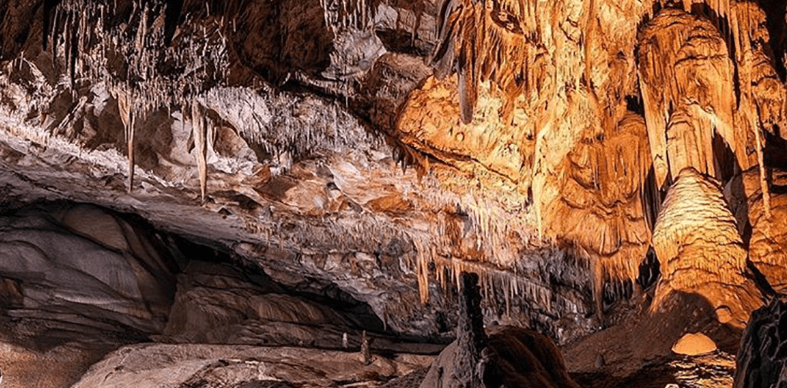
Castelcivita
Province: Salerno
A small Alburni hill town at 526 meters in the Cilento national park, the surface entrance to a 4,800-meter karst cave inhabited 40,000 years ago.
Sasso di Castalda
Province: Potenza
A 949-meter village in the Lucanian Apennines whose emigrants produced the engineer who launched Apollo 11, now crossed by a 300-meter Tibetan footbridge.
Roscigno
Province: Salerno
A Cilento ghost town at 570 meters, emptied by a 1902 landslide and known as the Pompeii of the twentieth century.
🌲 Parco Nazionale
More Parco Nazionale towns in Campania
Agropoli
Province: Salerno
The gateway commune of the Cilento, a Byzantine acropolis on a promontory taken by the Saracens in 882 as a base for raids on Salerno.
Alife
Province: Caserta
A Roman walled town at the foot of the Matese, founded as a 326 BC oppidum, with Italy's fourth-largest amphitheatre still half-buried.
Ascea
Province: Salerno
Two villages, a hilltown at 230 meters and a Cilento marina, with Parmenides and Zeno's Eleatic school in the ruins of Greek Velia below.
Camerota
Province: Salerno
A Cilento hill of 422 meters above the Costa degli Infreschi, with prehistoric caves documenting Neanderthal occupation along the southern Tyrrhenian.
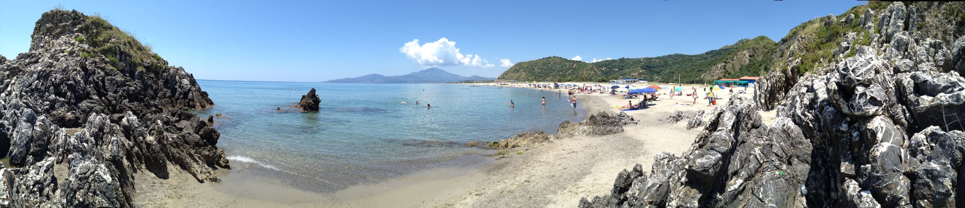
Capaccio Paestum
Province: Salerno
Three Doric temples of 550 to 450 BC on the Sele plain, with mozzarella di bufala DOP on the buffalo flats below Monte Calpazio.