
Campania · Salerno
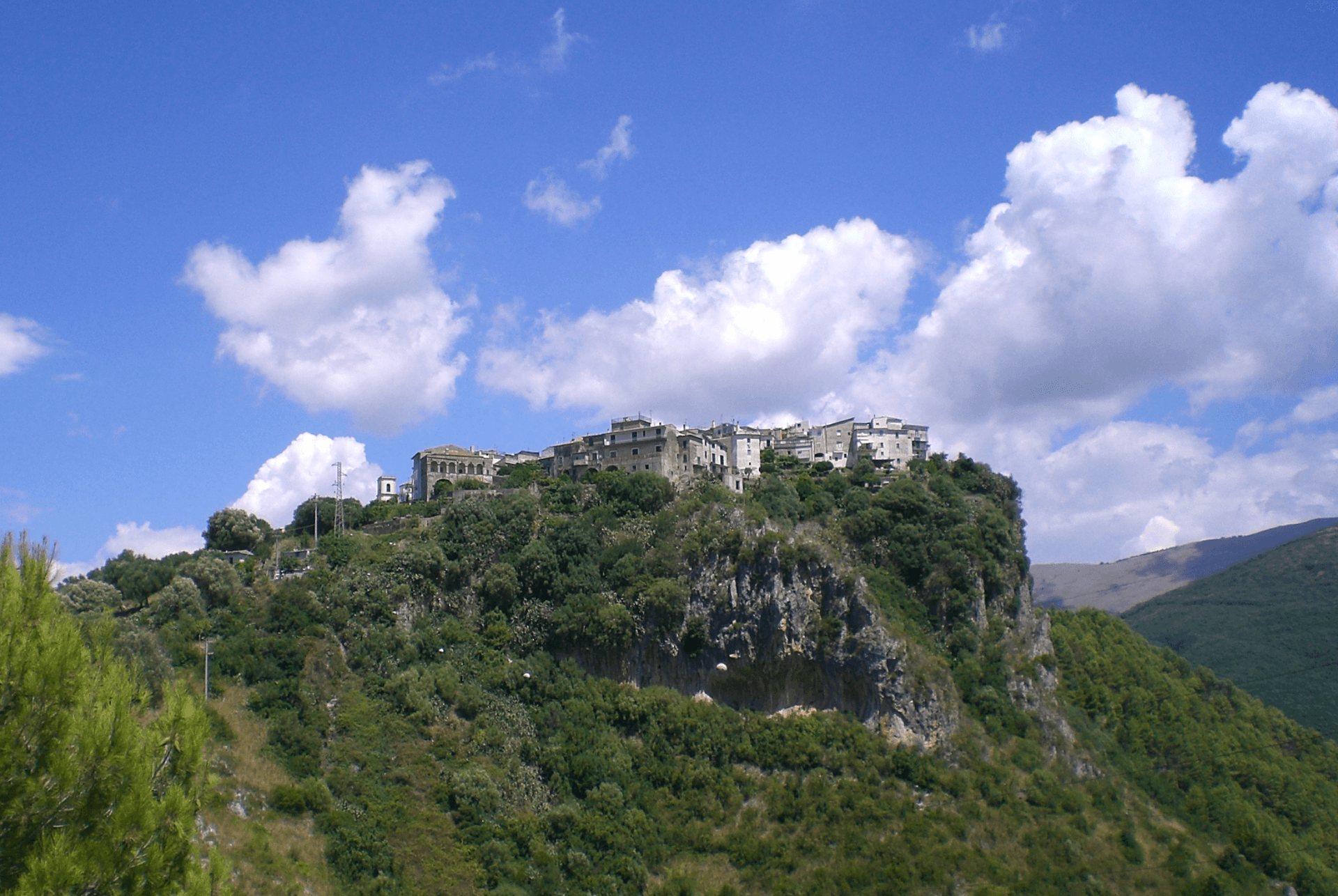
Castelcivita
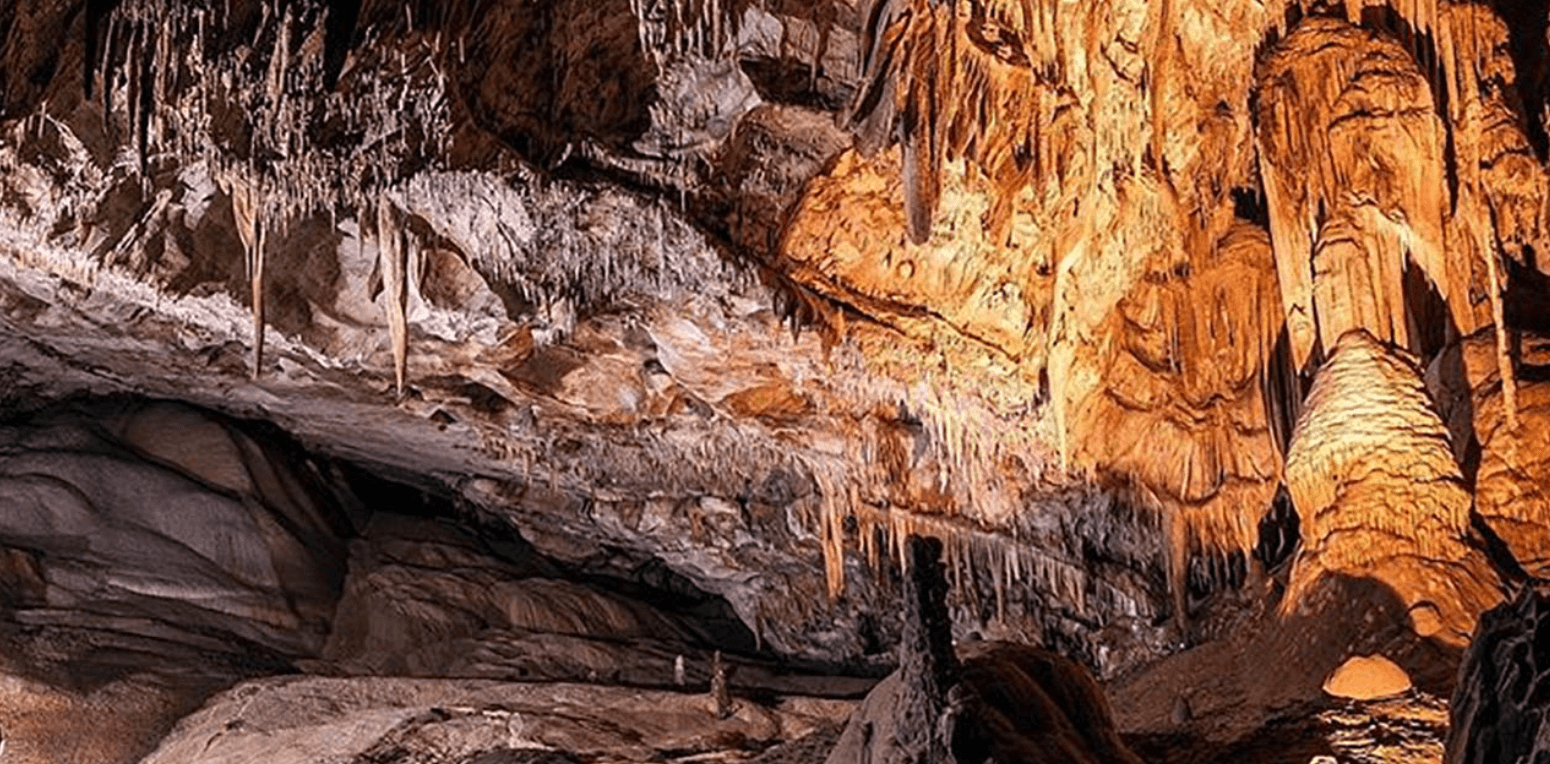
A small Alburni hill town at 526 meters in the Cilento national park, the surface entrance to a 4,800-meter karst cave inhabited 40,000 years ago.
Known for
THE GROTTE
Nearly 4,800 meters of karst caves with Paleolithic deposits dated to 40,000 years ago, open to the public since 1929 and lit since 1962.
PARCO NAZIONALE
Inside the Cilento, Vallo di Diano e Alburni National Park, a UNESCO biosphere reserve since 1997 covering 1,810 square kilometers.
TORRE ANGIOINA
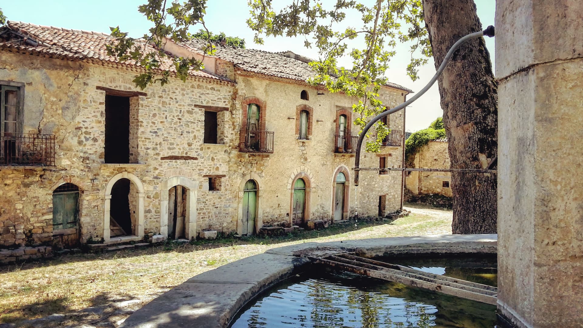
Thirteenth-century watchtower at the top of the borgo, now housing the Museo della Civiltà Contadina and Paleolithic finds from the caves.
When to visit
Best · Apr–Oct
- J
- F
- M
- A
- M
- J
- J
- A
- S
- O
- N
- D
- Best
- Hot or crowded
- Quiet
- Mostly closed
Why come
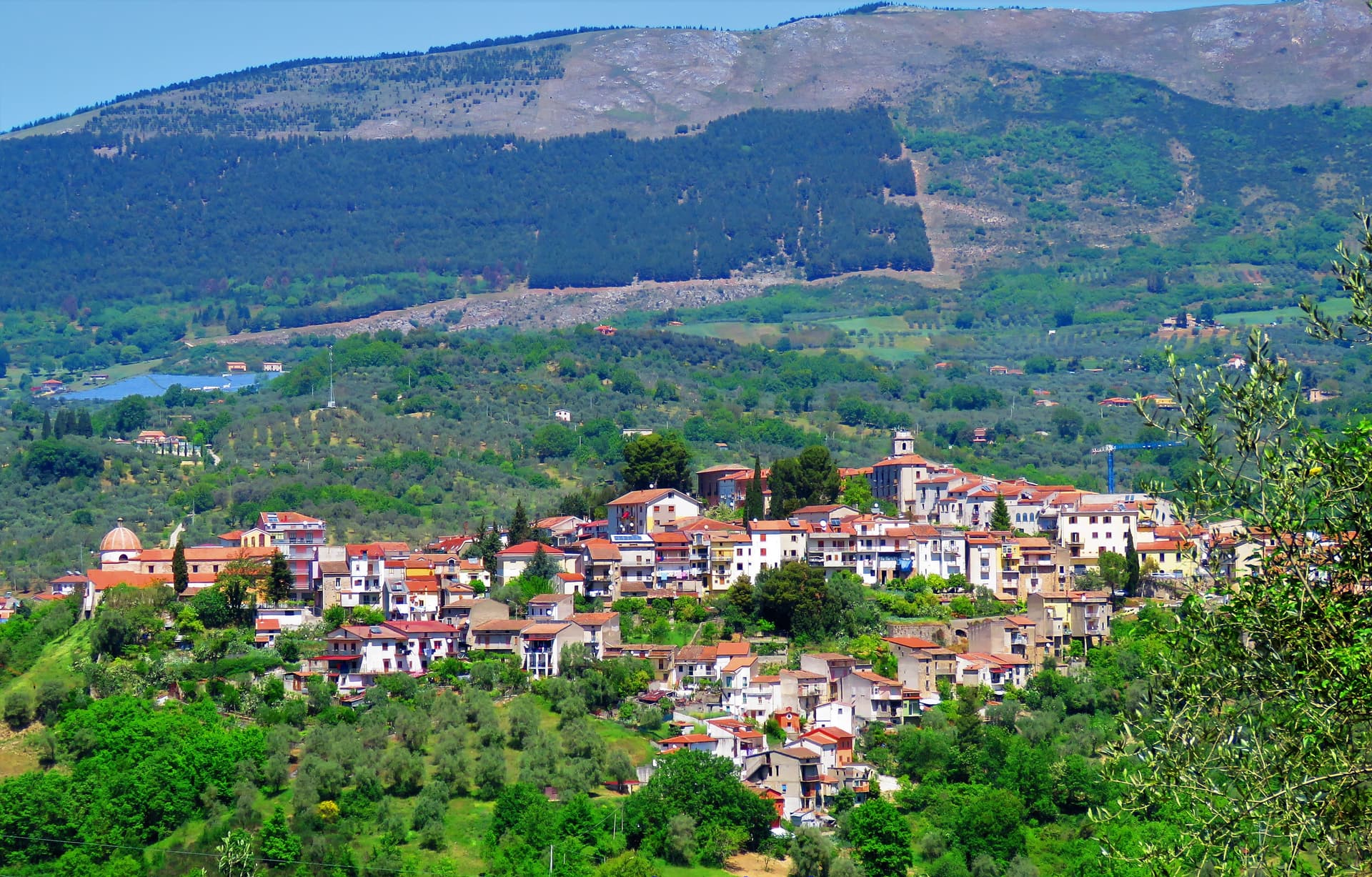
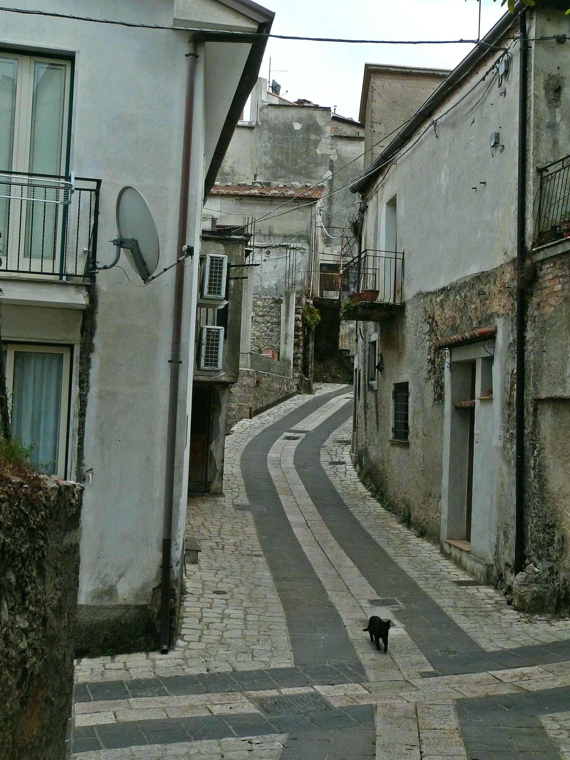
Castelcivita sits at 526 meters on the western flank of the Alburni mountains, in the Cilento, Vallo di Diano e Alburni National Park, forty-five kilometers inland from Salerno. The town has 1,441 residents and a medieval ridge plan around an Angevin tower, now the seat of the Museum of Rural Civilization. Most visitors come for the caves below the village, the Grotte di Castelcivita, a karst system that runs for nearly 4,800 meters along the Calore river and includes named halls of the Castle, the Crocodile and the Desert.
The cave mouth opens at ninety-four meters above sea level, 1. 5 kilometers from the town. In 1972 the Paleolithic deposits at the entrance turned the grotte into one of the most significant sites of early human presence in southern Italy, with stone tools and faunal remains dated to roughly 40,000 years ago.
The town above is quiet. The cave system is what brings school groups, speleologists and weekend visitors from Salerno.
The Sunday letter
We haven’t written Castelcivita’s letter yet.
One town every Sunday, with the photo, the food, the festa. Be there when this one comes up. Free, by Peter & Sophia from Pietrasanta.
By subscribing you agree to Substack’s Terms of Use, our Privacy Policy and our Information collection notice.

What to see
Grotte di Castelcivita
Karst cave system running nearly 4,800 meters along the Calore, with Paleolithic deposits from roughly 40,000 years ago and named halls of the Castle, the Crocodile and the Desert.
Torre Angioina
Thirteenth-century Angevin tower at the top of the centro storico, now the seat of the Museo della Civiltà Contadina with Paleolithic finds from the caves.
Centro storico medievale
Ridge-pattern village of stone houses and stepped lanes on the slope of the Alburni, with views east across the Calore valley.
Monti Alburni
Limestone massif rising directly behind the town, the western anchor of the Cilento national park, with hiking trails to Monte Panormo.
The slow-trip planner
Building a trip? Find where Castelcivita fits in a slow Italy circuit.
Answer five questions. We will shape a geographically coherent slow trip from the 1,000 Italian towns most travelers skip. Yours to save and share.
Living here
- Population 1,441
- Off the beaten pathi
- Pharmacy: none mapped
- High school within a 30-minute drive
- Nearest airport Naples / Salerno, 1 h 41 min drive
- Regional capital Napoli, 1 h 41 min drive
Tags & datadesignations · numbers · sources
Recognised as
The numbers
- Elevation: 526 m
- Population: 1,441
- Surface area: 57.64 km²
These figures were compiled from public directories — ISTAT, OpenStreetMap, Wikidata — and from the official listings of the guides named on this page. Town details change; verify with official sources before you travel.
Close by
More towns near Castelcivita
Auletta
Province: Salerno
A Tanagro hill town above the Cilento-Vallo di Diano park, fortified by 1000 AD, scene of an 1861 anti-Piedmont massacre and an 1857 earthquake.
Roscigno
Province: Salerno
A Cilento ghost town at 570 meters, emptied by a 1902 landslide and known as the Pompeii of the twentieth century.
Capaccio Paestum
Province: Salerno
Three Doric temples of 550 to 450 BC on the Sele plain, with mozzarella di bufala DOP on the buffalo flats below Monte Calpazio.
Trentinara
Province: Salerno
A Cilento balcony at 606 meters on the Cantenna cliff, called the Terrazza del Cilento, with a 1,500-meter zipline that drops 170 meters toward Paestum.
Agropoli
Province: Salerno
The gateway commune of the Cilento, a Byzantine acropolis on a promontory taken by the Saracens in 882 as a base for raids on Salerno.
🌲 Parco Nazionale
More Parco Nazionale towns in Campania
Alife
Province: Caserta
A Roman walled town at the foot of the Matese, founded as a 326 BC oppidum, with Italy's fourth-largest amphitheatre still half-buried.
Ascea
Province: Salerno
Two villages, a hilltown at 230 meters and a Cilento marina, with Parmenides and Zeno's Eleatic school in the ruins of Greek Velia below.
Camerota
Province: Salerno
A Cilento hill of 422 meters above the Costa degli Infreschi, with prehistoric caves documenting Neanderthal occupation along the southern Tyrrhenian.