Campania · Salerno
Agropoli
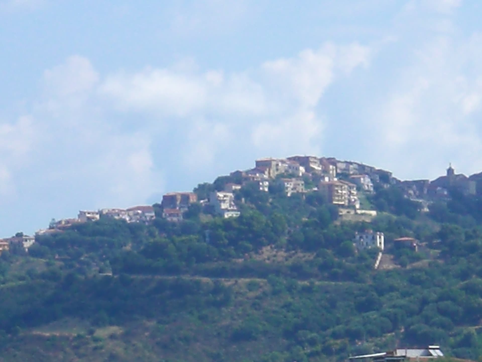
The gateway commune of the Cilento, a Byzantine acropolis on a promontory taken by the Saracens in 882 as a base for raids on Salerno.
Known for
ANGEVIN CASTLE
Triangular fortress with three circular towers on sixth-century Byzantine foundations, the postcard outline of the Cilento gateway.
SARACEN RABAT
Taken by the Saracens in 882 and turned into a trenched stronghold for raids on Salerno until they were driven from the Garigliano in 915.
BANDIERA BLU
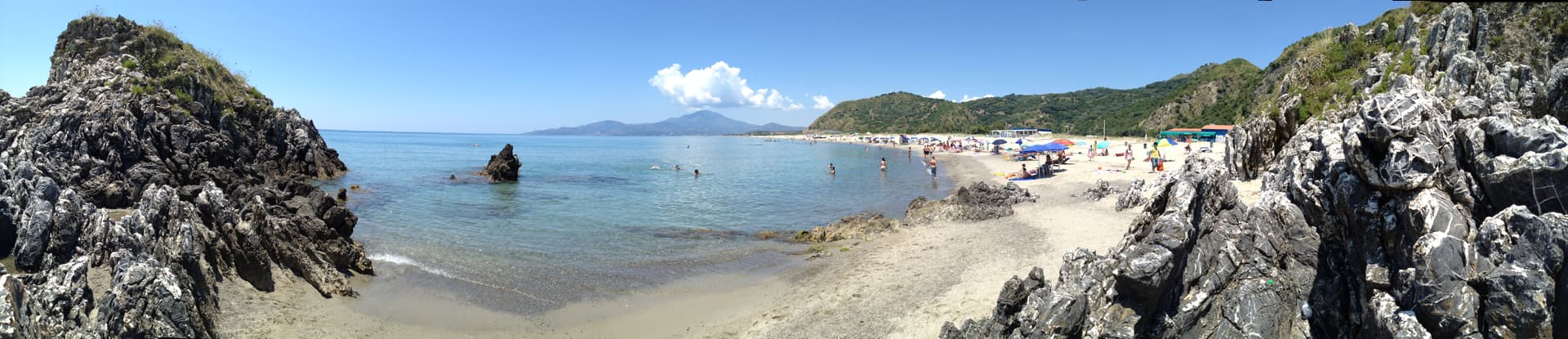
Blue Flag water quality, with Trentova beach south of the headland inside the Cilento marine protected area.
When to visit
Best · May–Sep
- J
- F
- M
- A
- M
- J
- J
- A
- S
- O
- N
- D
- Best
- Hot or crowded
- Quiet
- Mostly closed
Why come
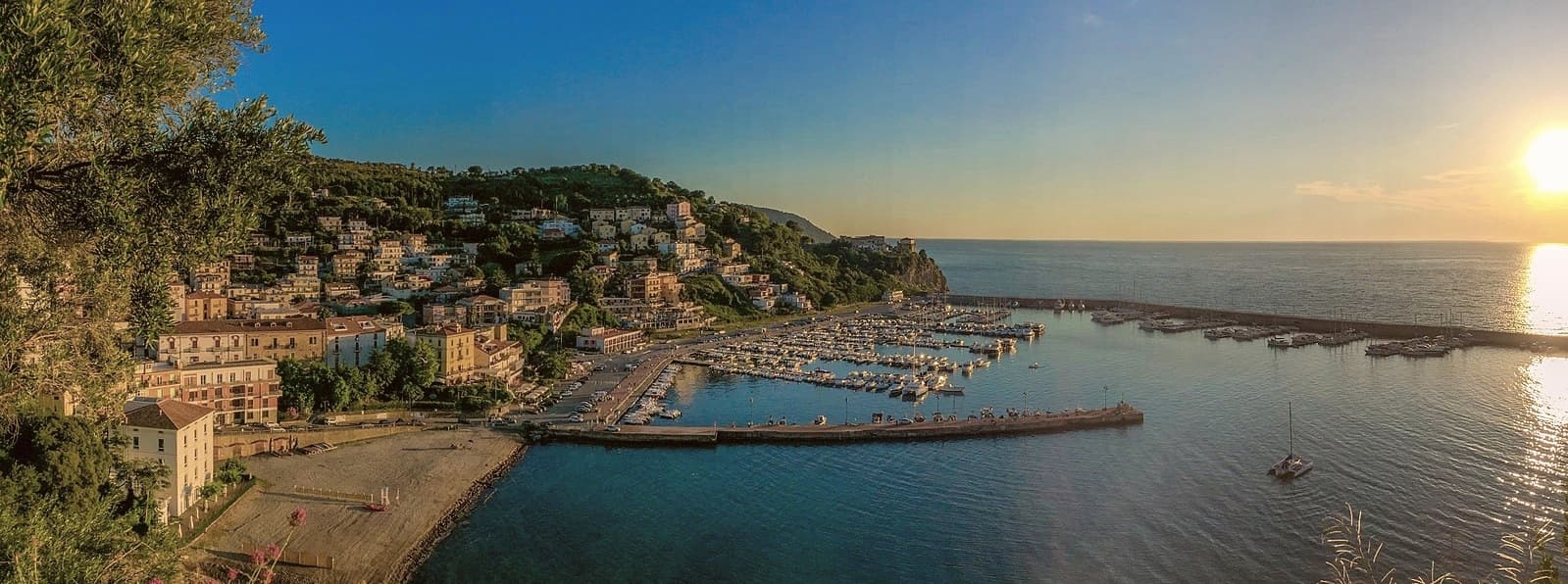
Agropoli is the northern gate of the Cilento coast, a promontory between two bays forty kilometres south of Salerno. The name itself, akropolis, was given by the Byzantines who fortified the high point during the Greco-Gothic war between 535 and 553. In 882 the Saracens took the town and turned it into a rabat, a trenched stronghold from which they raided as far as the walls of Salerno until they were dislodged from the Garigliano camp in 915.
The Angevin-Aragonese castle still stands on the highest point, a triangular plan with three circular towers and a moat, built on the original Byzantine foundations. Below the castle, the centro storico runs in stone stairways down to the small fishing port. Modern Agropoli has 21,000 residents, a Bandiera Blu beach, the Spighe Verdi mark for agro-environmental quality, and Cilento National Park status that links it inland to the Mediterranean Diet biosphere.
The Sunday letter
We haven’t written Agropoli’s letter yet.
One town every Sunday, with the photo, the food, the festa. Be there when this one comes up. Free, by Peter & Sophia from Pietrasanta.
By subscribing you agree to Substack’s Terms of Use, our Privacy Policy and our Information collection notice.

What to see
Castello Angioino-Aragonese
Triangular castle with three circular towers and a moat, built on sixth-century Byzantine foundations and remodelled by the Angevins and Aragonese.
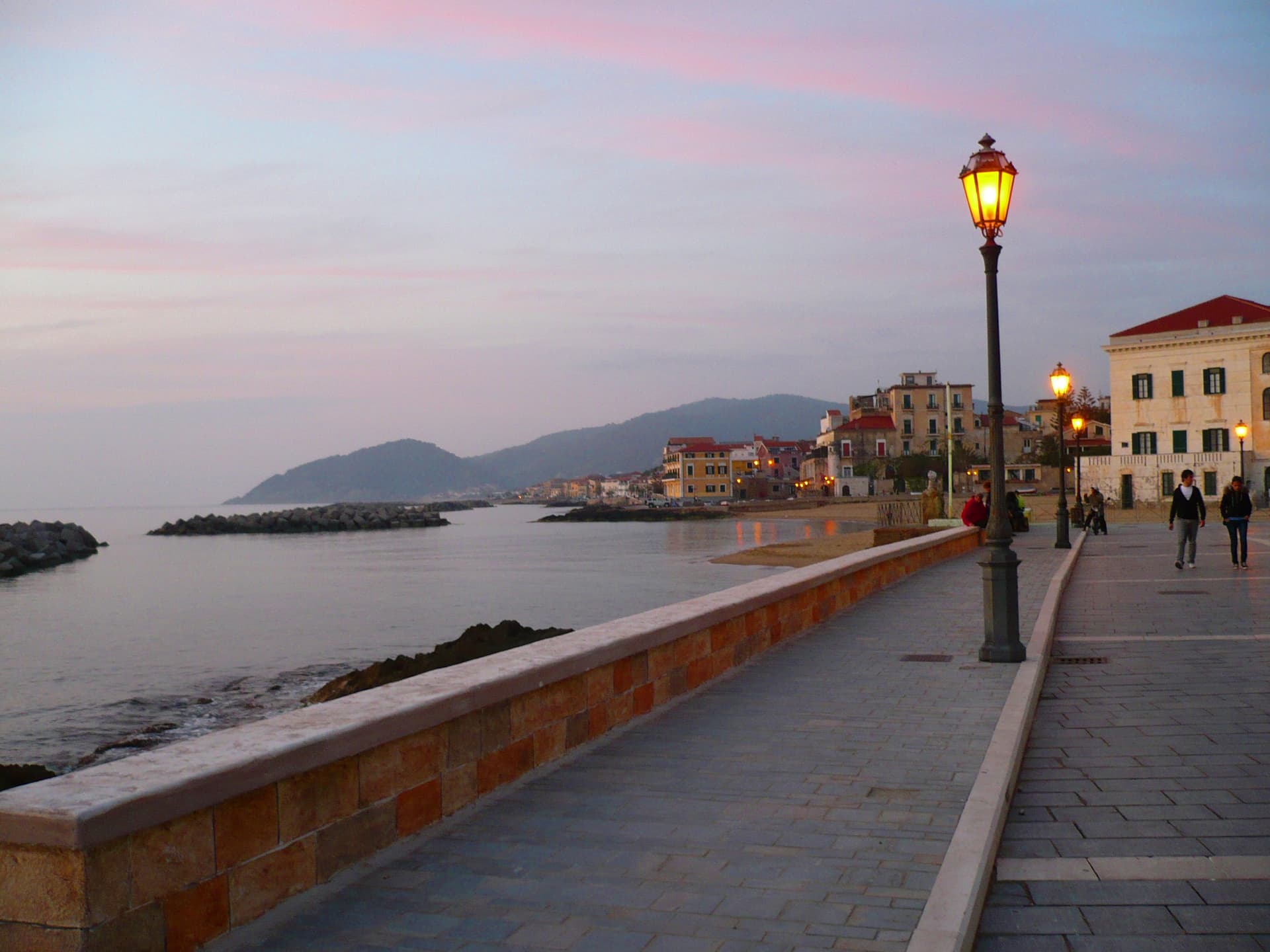
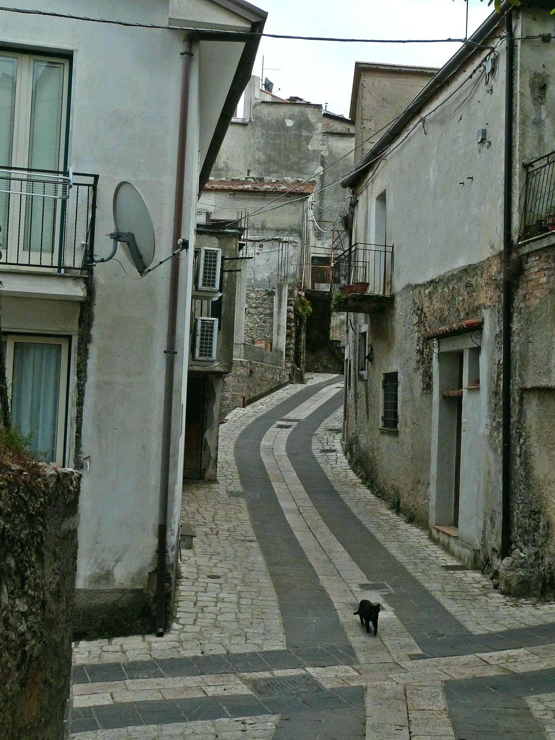
Centro storico sul promontorio
Old town on the headland, stone stairways from the castle down to the fishing port, with the seventeenth-century Porta arch and tight whitewashed alleys.
Chiesa dei Santi Pietro e Paolo
Sixteenth-century mother church inside the centro storico, rebuilt after war damage, dedicated to the patrons celebrated each 29 June.
Spiaggia di Trentova
Crescent of fine sand south of the headland, framed by macchia mediterranea cliffs, Bandiera Blu water and part of the Cilento marine protected area.
Cilento, Vallo di Diano e Alburni National Park
UNESCO Mediterranean Diet biosphere reserve linking the coast at Agropoli to the inland Alburni mountains and the Vallo di Diano interior.
The slow-trip planner
Building a trip? Find where Agropoli fits in a slow Italy circuit.
Answer five questions. We will shape a geographically coherent slow trip from the 1,000 Italian towns most travelers skip. Yours to save and share.
Living here
- Population 21,262
- Off the beaten pathi
- Pharmacy in town
- High school within a 30-minute drive
- Train station in the comune
- Nearest airport Naples / Salerno, 1 h 49 min drive
- Regional capital Napoli, 1 h 49 min drive
Tags & datadesignations · numbers · sources
Recognised as
The numbers
- Elevation: 24 m
- Population: 21,262
- Surface area: 32.77 km²
These figures were compiled from public directories — ISTAT, OpenStreetMap, Wikidata — and from the official listings of the guides named on this page. Town details change; verify with official sources before you travel.
Close by
More towns near Agropoli
Castellabate
Province: Salerno
A 1123 abbot's castle on a 280-meter Cilento ridge, with a Bandiera Blu beach below and the Benvenuti al Sud film.
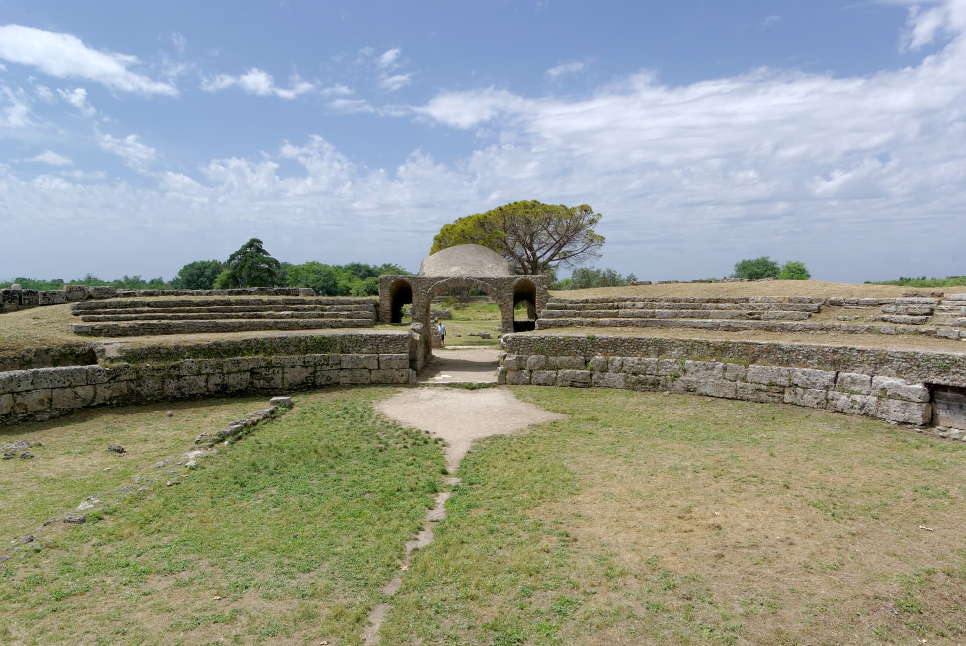
Capaccio Paestum
Province: Salerno
Three Doric temples of 550 to 450 BC on the Sele plain, with mozzarella di bufala DOP on the buffalo flats below Monte Calpazio.

Perito
Province: Salerno
A Cilento ridge town at 480 meters above the Alento valley, once a center of black-powder production for hunting, defense and brigands.
Trentinara
Province: Salerno
A Cilento balcony at 606 meters on the Cantenna cliff, called the Terrazza del Cilento, with a 1,500-meter zipline that drops 170 meters toward Paestum.
Ascea
Province: Salerno
Two villages, a hilltown at 230 meters and a Cilento marina, with Parmenides and Zeno's Eleatic school in the ruins of Greek Velia below.
🟦 Bandiera Blu
More Bandiera Blu towns in Campania
Anacapri
Province: Napoli
The upper half of Capri, 150 meters above its famous twin, where Axel Munthe built Villa San Michele on a Tiberian ruin.
Camerota
Province: Salerno
A Cilento hill of 422 meters above the Costa degli Infreschi, with prehistoric caves documenting Neanderthal occupation along the southern Tyrrhenian.
Centola
Province: Salerno
A Cilento hill village at 336 meters whose seaside frazione, Palinuro, carries the helmsman of Aeneas and a Bandiera Blu coastline.

Massa Lubrense
Province: Napoli
The Sorrentine Peninsula's largest commune by area, stretching from Sorrento across Punta Campanella to the Gulf of Salerno, Capri three miles offshore.