
Campania · Napoli
Massa Lubrense
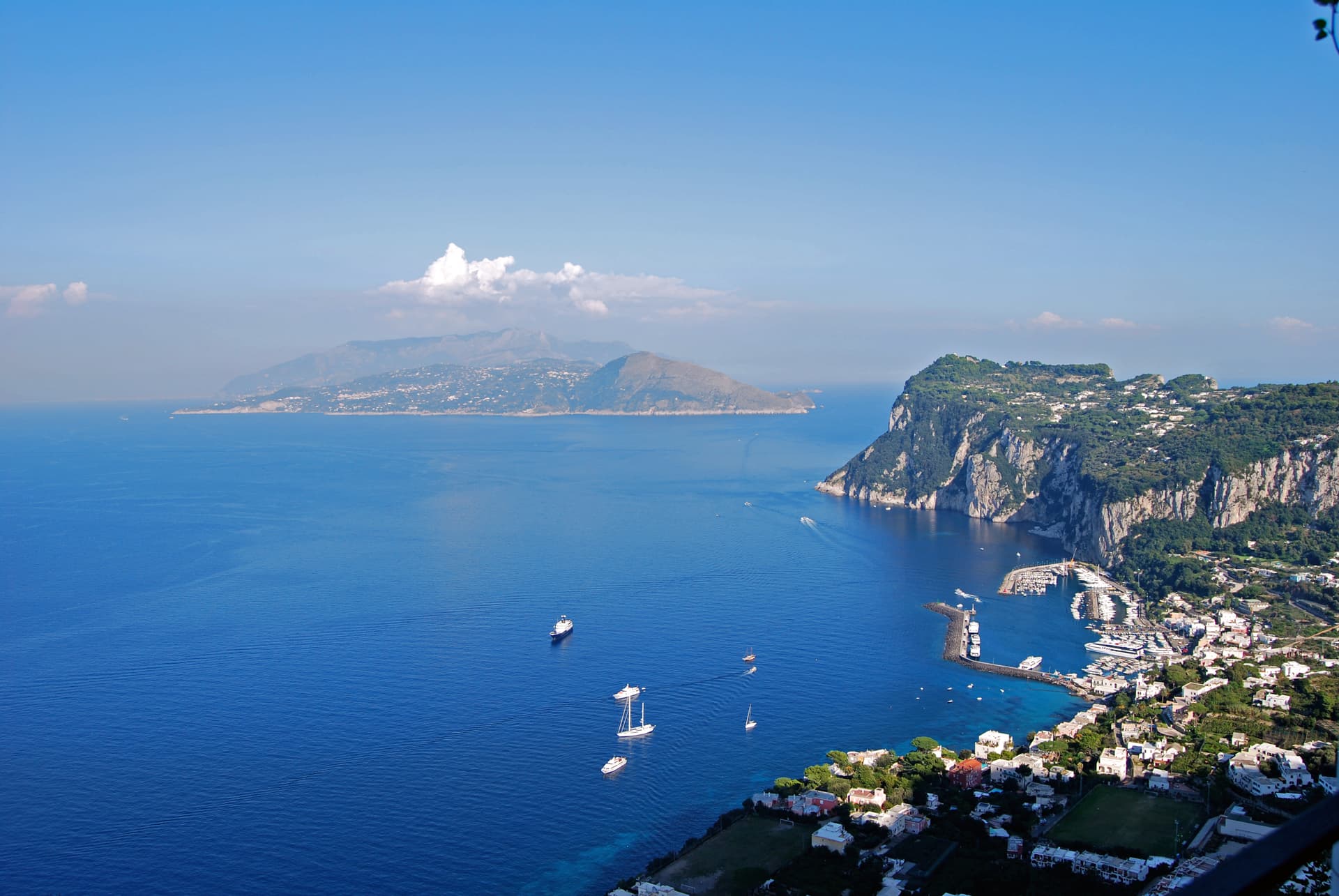
The Sorrentine Peninsula's largest commune by area, stretching from Sorrento across Punta Campanella to the Gulf of Salerno, Capri three miles offshore.
Known for
PUNTA CAMPANELLA
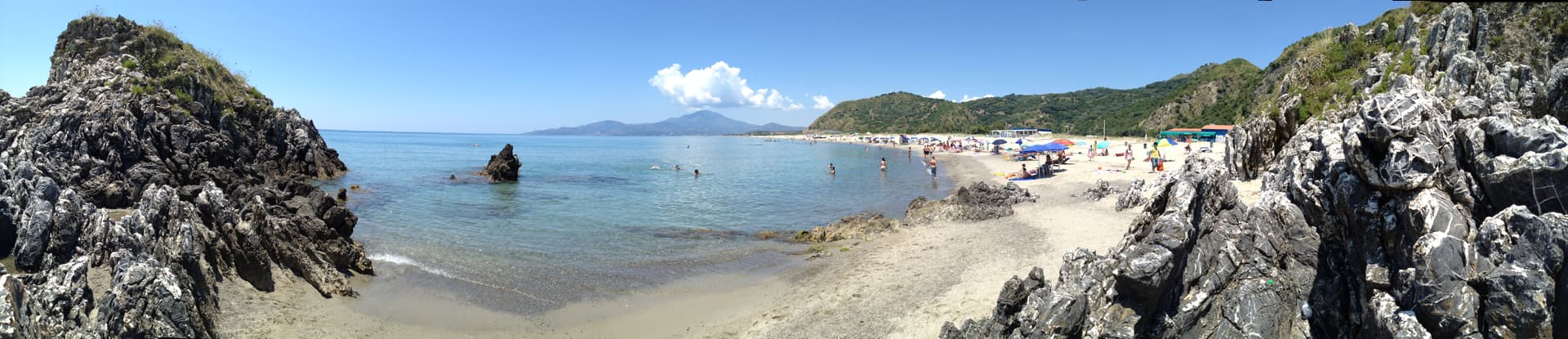
Cape with Roman sanctuary remains, Saracen-era watchtower, and a marine protected area covering forty square kilometers of Tyrrhenian sea.
SPAGHETTI ALLA NERANO
Courgette and provolone del Monaco pasta created in the kitchens of Nerano in the 1950s and now spread to Sorrentine menus worldwide.
OLIVE OIL
Penisola Sorrentina DOP groves climb the hills above eighteen frazioni; the commune holds Città dell'Olio and Spiga Verde status.
When to visit
Best · May–Sep
- J
- F
- M
- A
- M
- J
- J
- A
- S
- O
- N
- D
- Best
- Hot or crowded
- Quiet
- Mostly closed
The festa: San Cataldo, 10 May
Why come
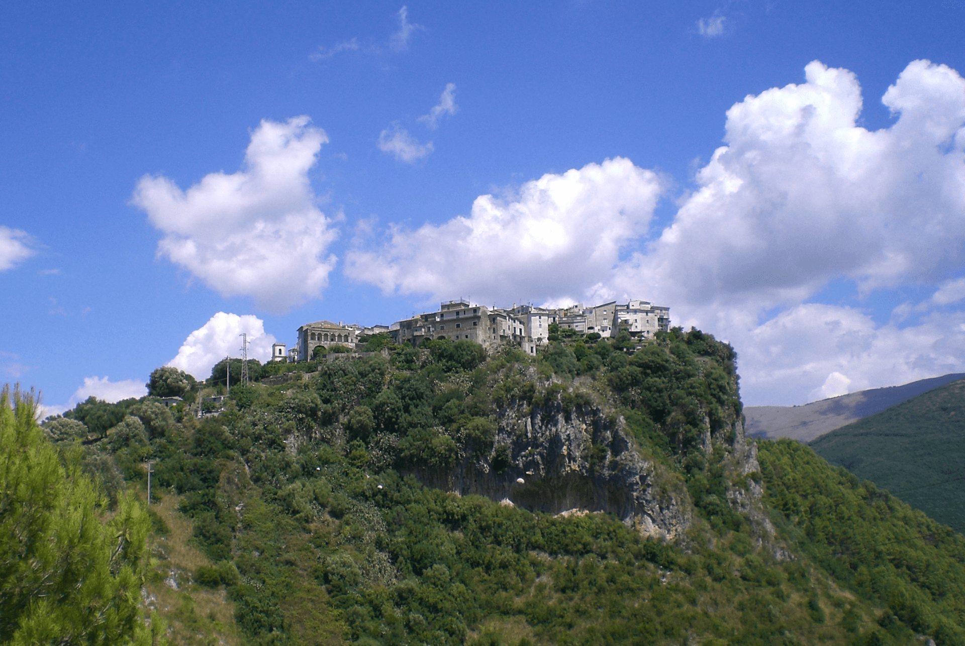
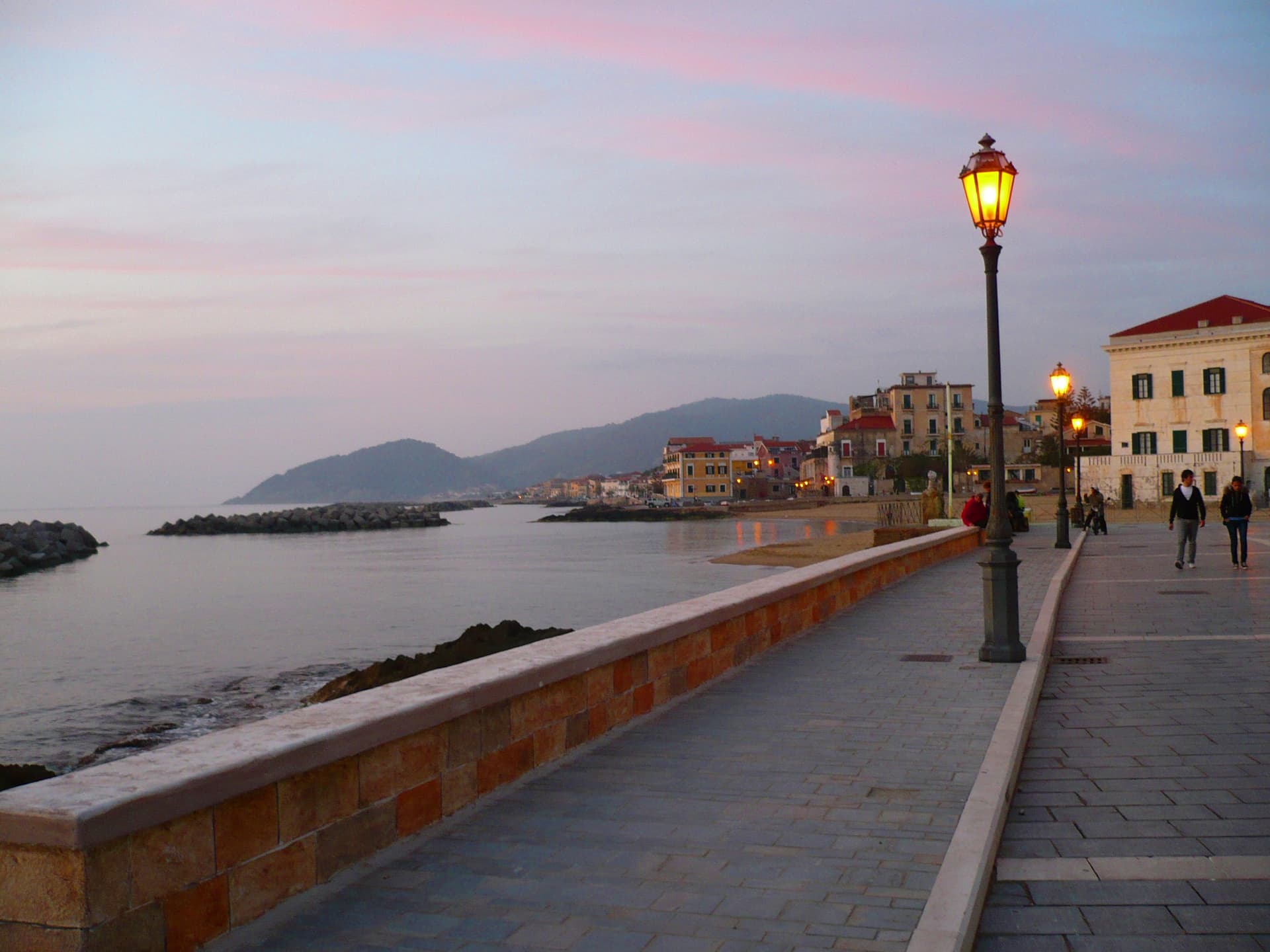
Massa Lubrense holds the western tip of the Sorrentine Peninsula, the largest municipal area on the peninsula and the closest land to Capri, three nautical miles across the Bocche di Capri. The hilltop centro sits ; the commune's eighteen frazioni spread between the Tyrrhenian and the Gulf of Salerno, including Termini, Nerano, Sant'Agata sui Due Golfi and the Marina della Lobra. Punta Campanella, the cape at the end, has the remains of a Roman sanctuary of Athena and a sixteenth-century watchtower against Saracen raids; the surrounding sea is a protected marine area established in 1997.
The commune holds a Bandiera Blu, a Spiga Verde, and Città dell'Olio status: the Penisola Sorrentina DOP olive groves climb the hills above the bays. Spaghetti alla Nerano, courgette and provolone del Monaco, is the dish that came out of these kitchens in the 1950s.
The Sunday letter
We haven’t written Massa Lubrense’s letter yet.
One town every Sunday, with the photo, the food, the festa. Be there when this one comes up. Free, by Peter & Sophia from Pietrasanta.
By subscribing you agree to Substack’s Terms of Use, our Privacy Policy and our Information collection notice.


What to see
Punta Campanella
Cape at the western tip of the peninsula, with the ruins of a Roman sanctuary of Athena, a watchtower, and the marine reserve established in 1997.
Marina del Cantone
Pebble bay at Nerano, Italy's largest pebble beach by some measures and the kitchen where spaghetti alla Nerano was created.
Chiesa di Santa Maria della Lobra
Sixteenth-century mother church above the small Marina della Lobra, with a wooden coffered ceiling and a former Franciscan convent attached.
Sant'Agata sui Due Golfi
Frazione at 391 meters above both gulfs, with views over Naples and Salerno bays and the kitchen of Don Alfonso 1890.
Sentiero di Punta Campanella
Footpath from Termini through olive groves to the cape, used since antiquity as the connection between Athena's sanctuary and the inhabited slope.
The slow-trip planner
Building a trip? Find where Massa Lubrense fits in a slow Italy circuit.
Answer five questions. We will shape a geographically coherent slow trip from the 1,000 Italian towns most travelers skip. Yours to save and share.
We recommend
Where to eat and stay
Not our picks, but places the guides put their name to — a Michelin star, a Gambero Rosso fork, a Slow Food snail, a Michelin Key for the hotels. Worth a table, a counter, or a night when you pass through.
Don Alfonso 1890Ristorante
Don Alfonso 1890 has one Michelin star, three Gambero Rosso forks (90/100) and a place in L'Espresso's Top 300, among other nods.
Quattro PassiRistorante
Quattro Passi carries three Michelin stars, three Gambero Rosso forks (93/100), plus a place in L'Espresso's Top 300, among other nods.
Lo StuzzichinoTrattoria
Lo Stuzzichino has a Michelin Bib Gourmand, three Gambero Rosso prawns and a Slow Food snail.
La Torre One FireRistorante
La Torre One Fire holds a Michelin Bib Gourmand and a Slow Food snail.
Ristorante Antico Francischiello da PeppinoRistorante
Ristorante Antico Francischiello da Peppino holds a place on Italy's historic-locali register and a Gambero Rosso listing.
Taverna del CapitanoRistorante
Taverna del Capitano holds one Michelin star and two Gambero Rosso forks (89/100).
Lo ScoglioRistorante
Lo Scoglio holds a Gambero Rosso listing.
Relais BluRistorante
Relais Blu holds one Michelin star.
Terrazza FiorellaRistorante
Terrazza Fiorella holds a spot in the Michelin Guide.
Boutique Hotel Don Alfonso 1890Hotel
Boutique Hotel Don Alfonso 1890 holds a place in the Michelin hotel guide.
Relais BluHotel
Relais Blu holds one Michelin Key.
Villa Fiorella Art HotelHotel
Villa Fiorella Art Hotel has one Michelin Key to its name.
Living here
- Population 14,141
- Off the beaten pathi
- Pharmacy in town
- High school within a 30-minute drive
- Nearest airport Naples / Salerno, 1 h 15 min drive
- Regional capital Napoli, 1 h 9 min drive
Tags & datadesignations · numbers · sources
The numbers
- Elevation: 121 m
- Population: 14,141
- Surface area: 19.84 km²
These figures were compiled from public directories — ISTAT, OpenStreetMap, Wikidata — and from the official listings of the guides named on this page. Town details change; verify with official sources before you travel.
Close by
More towns near Massa Lubrense

Piano di Sorrento
Province: Napoli
The quieter Sorrentine plain four kilometers from Sorrento, autonomous since 1808, with prehistoric Gaudo pottery and a black-sand marina at the foot of the cliff.

Sorrento
Province: Napoli
The Roman Surrentum on a tuff cliff above the Bay of Napoli, birthplace of Torquato Tasso, sacked by the Turks in 1558.
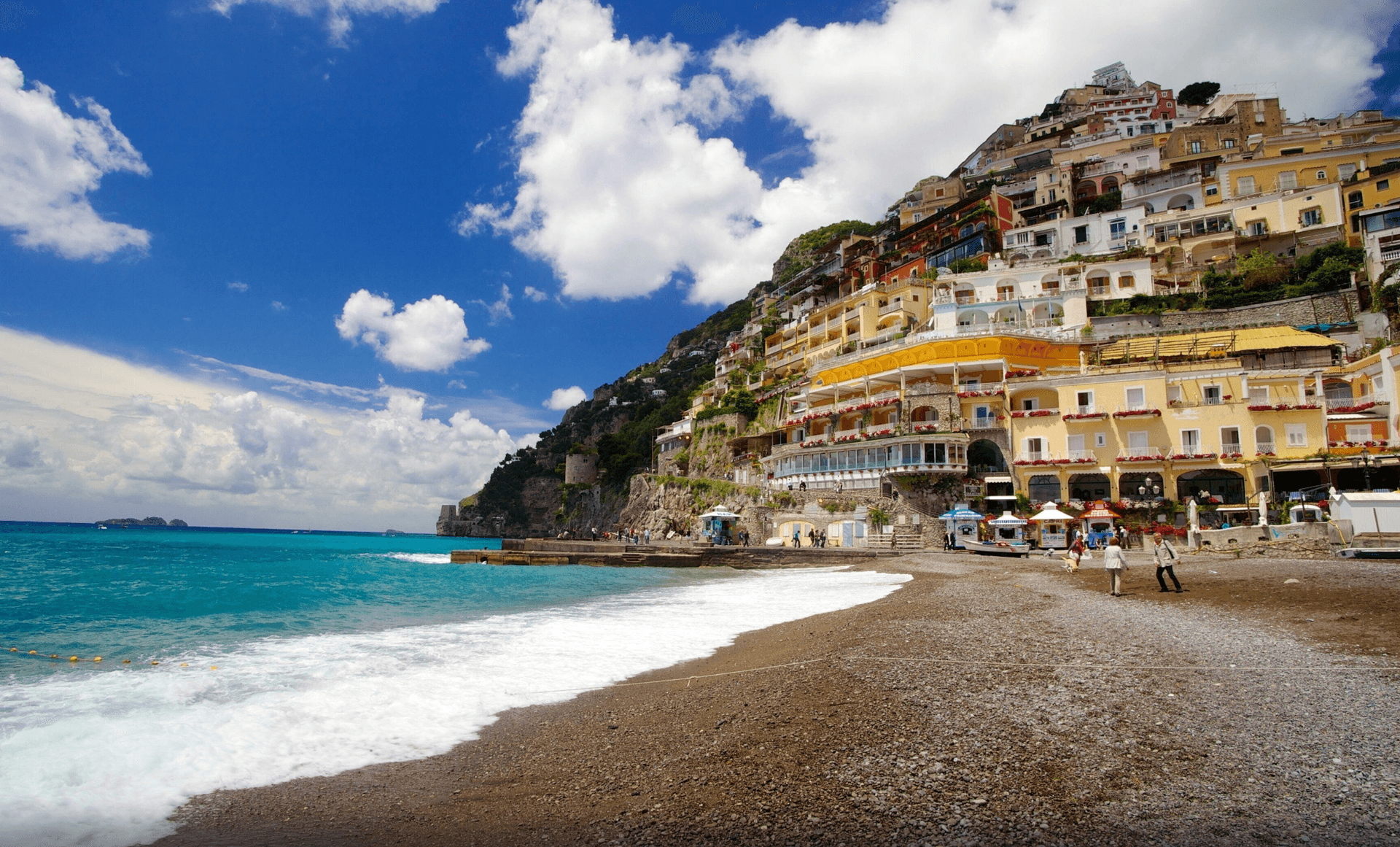
Positano
Province: Salerno
The vertical village of the Amalfi Coast, terraced houses climbing four hundred meters from Spiaggia Grande to the Lattari ridge under a tiled Byzantine dome.

Vico Equense
Province: Napoli
The northern gate of the Sorrento peninsula at 90 meters, the Roman Aequana, where Luigi Dell'Amura invented pizza al metro in 1930.
Praiano
Province: Salerno
The Amalfi commune between Positano and Amalfi where the doges of the maritime republic kept their summer residences and the Path of the Gods starts.
🟦 Bandiera Blu
More Bandiera Blu towns in Campania
Agropoli
Province: Salerno
The gateway commune of the Cilento, a Byzantine acropolis on a promontory taken by the Saracens in 882 as a base for raids on Salerno.
Anacapri
Province: Napoli
The upper half of Capri, 150 meters above its famous twin, where Axel Munthe built Villa San Michele on a Tiberian ruin.
Ascea
Province: Salerno
Two villages, a hilltown at 230 meters and a Cilento marina, with Parmenides and Zeno's Eleatic school in the ruins of Greek Velia below.
Camerota
Province: Salerno
A Cilento hill of 422 meters above the Costa degli Infreschi, with prehistoric caves documenting Neanderthal occupation along the southern Tyrrhenian.
Castellabate
Province: Salerno
A 1123 abbot's castle on a 280-meter Cilento ridge, with a Bandiera Blu beach below and the Benvenuti al Sud film.