
Umbria · Terni
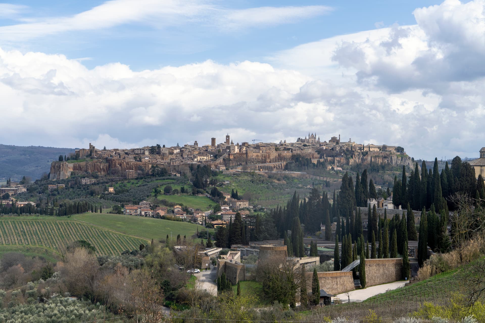
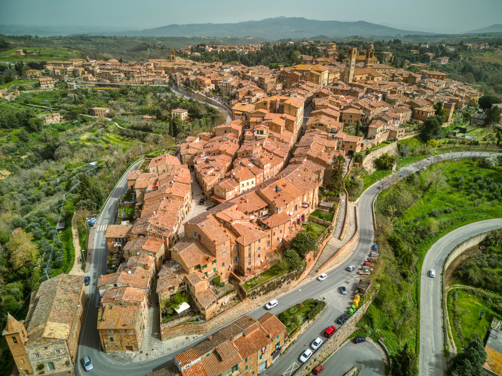
Orvieto
Etruscan Velzna on a 325-meter tufa butte, the medieval refuge of popes and the home of Italy's most decorated Gothic cathedral.
Known for
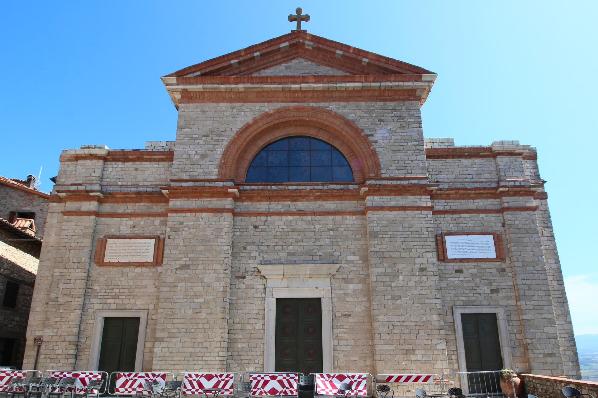
THE DUOMO
Gothic cathedral begun 1290, Maitani's polychrome façade and Signorelli's San Brizio Last Judgment of 1499-1504, the cycle Michelangelo studied.
POZZO DI SAN PATRIZIO
Double-helix well of 1527-1537 by Antonio da Sangallo the Younger, two spiral ramps so mules going up never met mules coming down.
ETRUSCAN VELZNA
Identified with the seat of the Fanum Voltumnae, federal sanctuary of the Etruscan League, destroyed by Rome in 264 BC.
When to visit
Best · Apr–Oct
- J
- F
- M
- A
- M
- J
- J
- A
- S
- O
- N
- D
- Best
- Hot or crowded
- Quiet
- Mostly closed
Why come
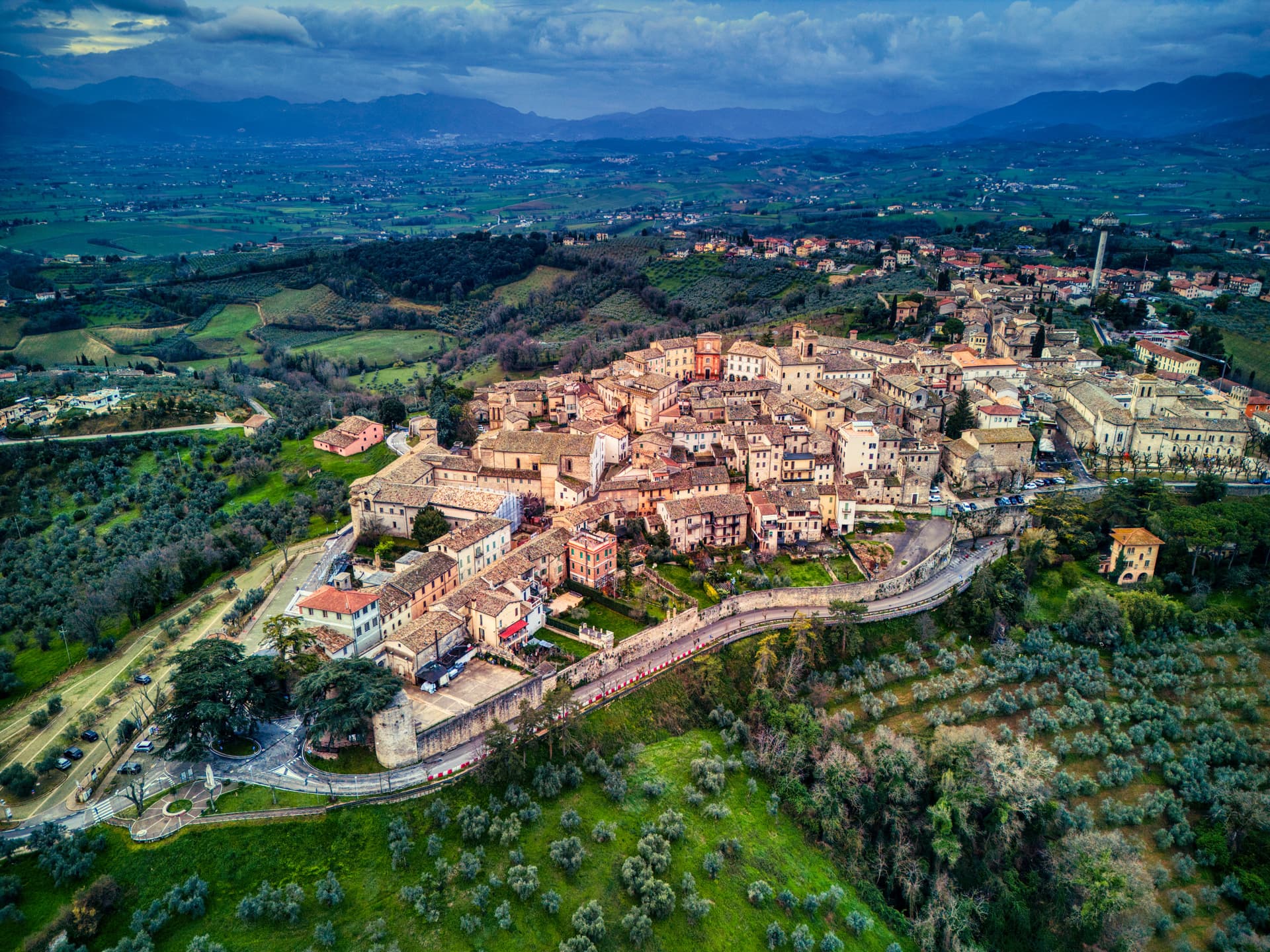
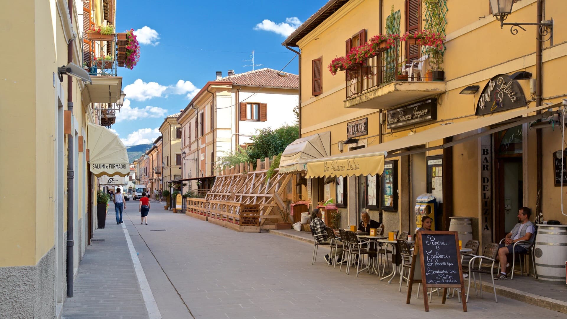
Orvieto sits on a flat-topped butte of volcanic tuff, the cliffs 195 meters above the surrounding plain. The town began as Velzna, a flourishing Etruscan metropolis and seat of the Fanum Voltumnae, the federal sanctuary of the Etruscan League. The Romans destroyed Velzna in 264 BC; the medieval town that replaced it became a papal refuge in the 13th century when popes left Rome for the safer plateau.
The Duomo was begun on 14 November 1290 by Pope Nicholas IV, designed by Arnolfo di Cambio and Fra Bevignate, then taken over from 1310 by Lorenzo Maitani, who gave it the polychrome marble façade considered the masterpiece of Italian decorative Gothic. Luca Signorelli frescoed the Cappella di San Brizio with the Last Judgment between 1499 and 1504, four years before Michelangelo started the Sistine Chapel. Below the tuff plateau, the Pozzo di San Patrizio was sunk between 1527 and 1537 by Antonio da Sangallo the Younger for Pope Clement VII, two helical ramps so the mules carrying water up never met the ones going down.
The Sunday letter
We haven’t written Orvieto’s letter yet.
One town every Sunday, with the photo, the food, the festa. Be there when this one comes up. Free, by Peter & Sophia from Pietrasanta.
By subscribing you agree to Substack’s Terms of Use, our Privacy Policy and our Information collection notice.

What to see
Duomo di Orvieto
Begun 1290, façade by Lorenzo Maitani from 1310, the masterpiece of Italian decorative Gothic in polychrome marble, mosaics and sculpture.
Cappella di San Brizio
Inside the Duomo, frescoed by Luca Signorelli 1499-1504 with the Last Judgment cycle, four years before Michelangelo began the Sistine ceiling.
Pozzo di San Patrizio
Helical well sunk 1527-1537 by Antonio da Sangallo the Younger for Pope Clement VII, two separate spiral ramps, 53 meters deep.
Orvieto Underground
Etruscan and medieval tunnels, cisterns and pigeon roosts cut into the tuff cliff below the town, over 1,200 cavities mapped to date.
Necropoli del Crocifisso del Tufo
Etruscan necropolis of the 6th century BC at the foot of the cliff, regular grid of stone tombs with inscriptions in Etruscan over the lintels.
Fortezza Albornoz
Papal fortress of 1364 at the edge of the cliff, restored as a public garden with sweeping views over the Paglia valley.
The slow-trip planner
Building a trip? Find where Orvieto fits in a slow Italy circuit.
Answer five questions. We will shape a geographically coherent slow trip from the 1,000 Italian towns most travelers skip. Yours to save and share.
We recommend
Where to eat and stay
Not our picks, but places the guides put their name to — a Michelin star, a Gambero Rosso fork, a Slow Food snail, a Michelin Key for the hotels. Worth a table, a counter, or a night when you pass through.
CoroRistorante
Coro has two Gambero Rosso forks (83/100), a place in L'Espresso's Top 300 and a spot in the Michelin Guide.
Da GregorioTrattoria
Da Gregorio carries a Michelin Bib Gourmand, plus two Gambero Rosso prawns.
I Sette ConsoliRistorante
I Sette Consoli has two Gambero Rosso forks (81/100) and a spot in the Michelin Guide.
La PalombaRistorante
La Palomba carries a Slow Food snail, plus a spot in the Michelin Guide.
ArsoRistorante
Arso carries two Gambero Rosso forks (80/100).
Sale e PepeBistrot
Sale e Pepe holds one Gambero Rosso table.
Trattoria Da CarloTrattoria
Trattoria Da Carlo holds two Gambero Rosso prawns.
Altarocca Wine ResortHotel
Altarocca Wine Resort has a place in the Michelin hotel guide to its name.
Locanda PalazzoneHotel
Locanda Palazzone holds a place in the Michelin hotel guide.
Palazzo PetrvsHotel
One Michelin Key, at Palazzo Petrvs.
Living here
- Population 19,461
- A local hubi
- Pharmacy in town
- High school within a 30-minute drive
- Train station in the comune
- Nearest airport Rome, 2 h 2 min drive
- Regional capital Perugia, 1 h 14 min drive
Tags & datadesignations · numbers · sources
The numbers
- Elevation: 325 m
- Population: 19,461
- Surface area: 281.27 km²
These figures were compiled from public directories — ISTAT, OpenStreetMap, Wikidata — and from the official listings of the guides named on this page. Town details change; verify with official sources before you travel.
Close by
More towns near Orvieto
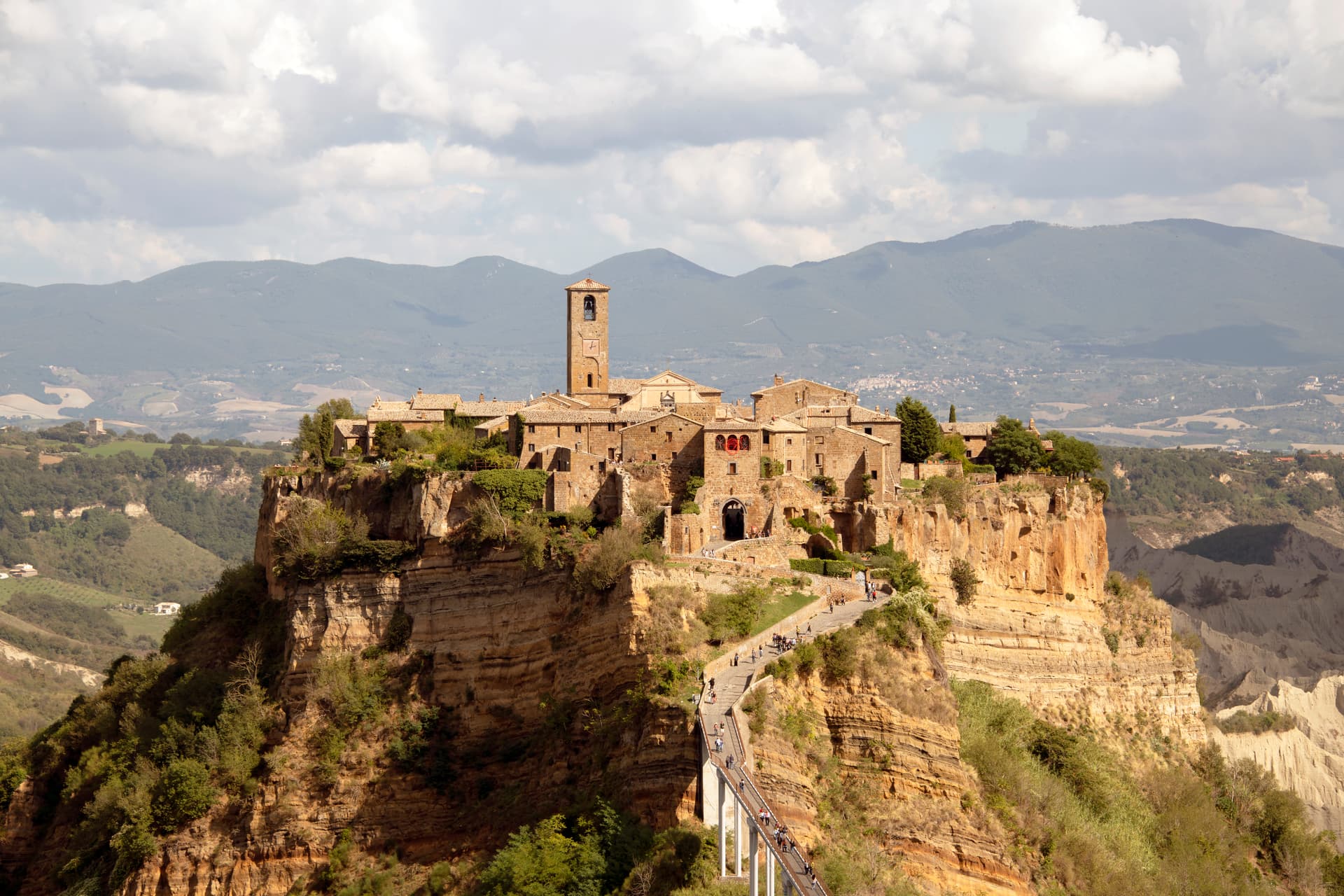
Bagnoregio
Province: Viterbo
The Etruscan-founded hill town in Tuscia whose frazione Civita di Bagnoregio sits on an eroding tuff plateau, reachable only by footbridge.
Allerona
Province: Terni
A stone borgo at 472 meters between the Paglia valley and the Valdichiana, an Orvieto outpost whose Monaldeschi castle fell to Charles V.

Montecchio
Province: Terni
A small hill commune at 377 meters above the Tiber, sitting on top of one of Umbria's largest Etruscan-tied necropolises.
Bolsena
Province: Viterbo
A medieval town at 350 meters on the eastern shore of Europe's largest volcanic lake, where a Bohemian priest reported a Eucharistic miracle in 1263.
Monte Castello di Vibio
Province: Perugia
A fifteenth-century walled village at 422 meters above the Tiber, home to the world's smallest all'italiana theatre with 99 seats.
🐌 Cittaslow
More Cittaslow towns in Umbria
Amelia
Province: Terni
A pre-Roman hilltown at 406 meters ringed by polygonal walls of the fourth century BC, with ten barrel-vaulted Roman cisterns under the main square.
Città della Pieve
Province: Perugia
A red-brick hill town at 508 meters above the Valdichiana, the birthplace of Perugino and the home of Italy's narrowest alley.
Montefalco
Province: Perugia
The hilltop wine capital of Umbria at 472 meters, where Sagrantino is grown almost nowhere else and Benozzo Gozzoli painted Francis in 1452.
Norcia
Province: Perugia
Birthplace of San Benedetto at 604 meters on a Sibillini plateau, leveled by the 2016 earthquake and rebuilt stone by stone.

Preci
Province: Perugia
A walled Valnerina village at 596 meters that ran Europe's leading school of surgery for three centuries until the 2016 quake brought the borgo down.