
Umbria · Terni
Allerona
A stone borgo between the Paglia valley and the Valdichiana, an Orvieto outpost whose Monaldeschi castle fell to Charles V.
Known for
MONALDESCHI CASTLE
Built 1275 as Orvieto's bulwark toward Chiusi, destroyed by Charles V at the end of the fifteenth century.
VIA CASSIA
Two Roman milestones and paved sections of the Cassia and Traiana Nova survive in the commune's fields.
BORGO INTATTO
Stone houses without plaster, two medieval gates, an urban grid that has held its shape since 1275.
When to visit
Best · Apr–Oct
- J
- F
- M
- A
- M
- J
- J
- A
- S
- O
- N
- D
- Best
- Hot or crowded
- Quiet
- Mostly closed
The festa: Ansano di Siena, 1 December
Why come
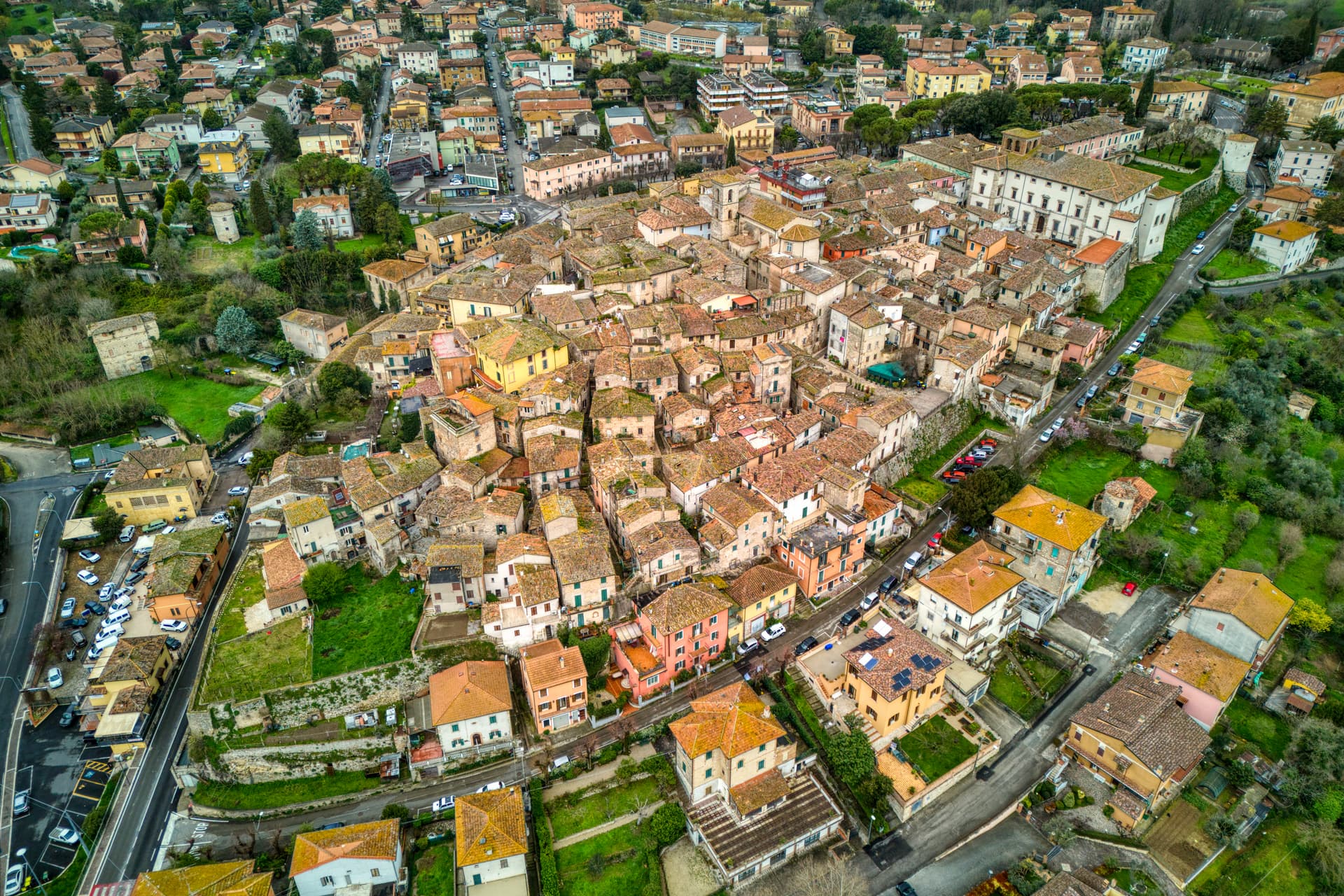
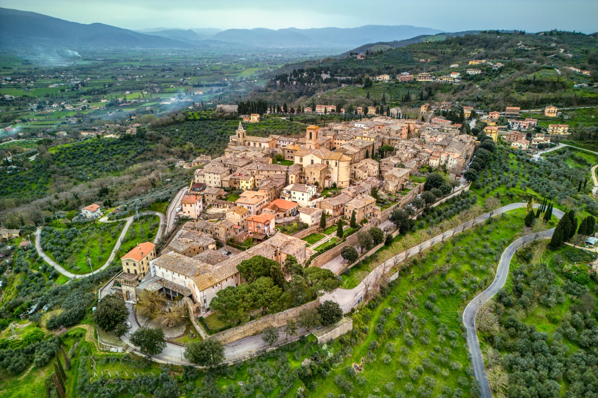
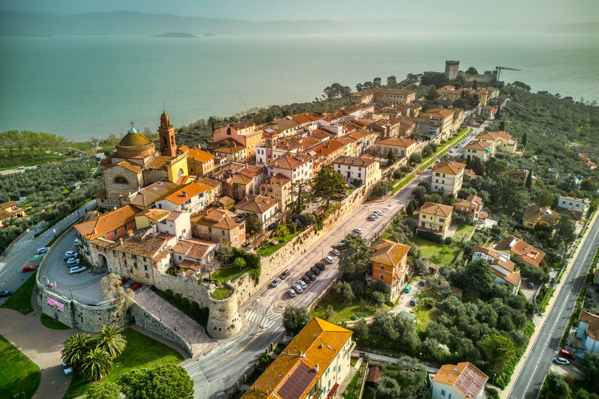
Allerona sits on a ridge between the Paglia valley and the Valdichiana, fifty kilometers southwest of Perugia and twenty north of Orvieto. The site was a Roman waystation called vicus Lerona, crossed by the Via Cassia and the Via Traiana Nova between Rome and Chiusi. Paved sections and two milestones still surface in the surrounding fields.
The medieval castle, built in 1275 by the Monaldeschi and Filippeschi families as Orvieto's northern bulwark, was destroyed at the end of the fifteenth century by Charles V and rebuilt afterward. In 1595 the community freed itself from Orvieto and the Monaldeschi rule and wrote its own statutes. The centro storico keeps its original urban fabric: stone houses without plaster, two surviving gates called Porta del Sole and Porta della Luna, and a small grid of lanes that has not changed shape in five hundred years.
The Sunday letter
We haven’t written Allerona’s letter yet.
One town every Sunday, with the photo, the food, the festa. Be there when this one comes up. Free, by Peter & Sophia from Pietrasanta.
By subscribing you agree to Substack’s Terms of Use, our Privacy Policy and our Information collection notice.


What to see
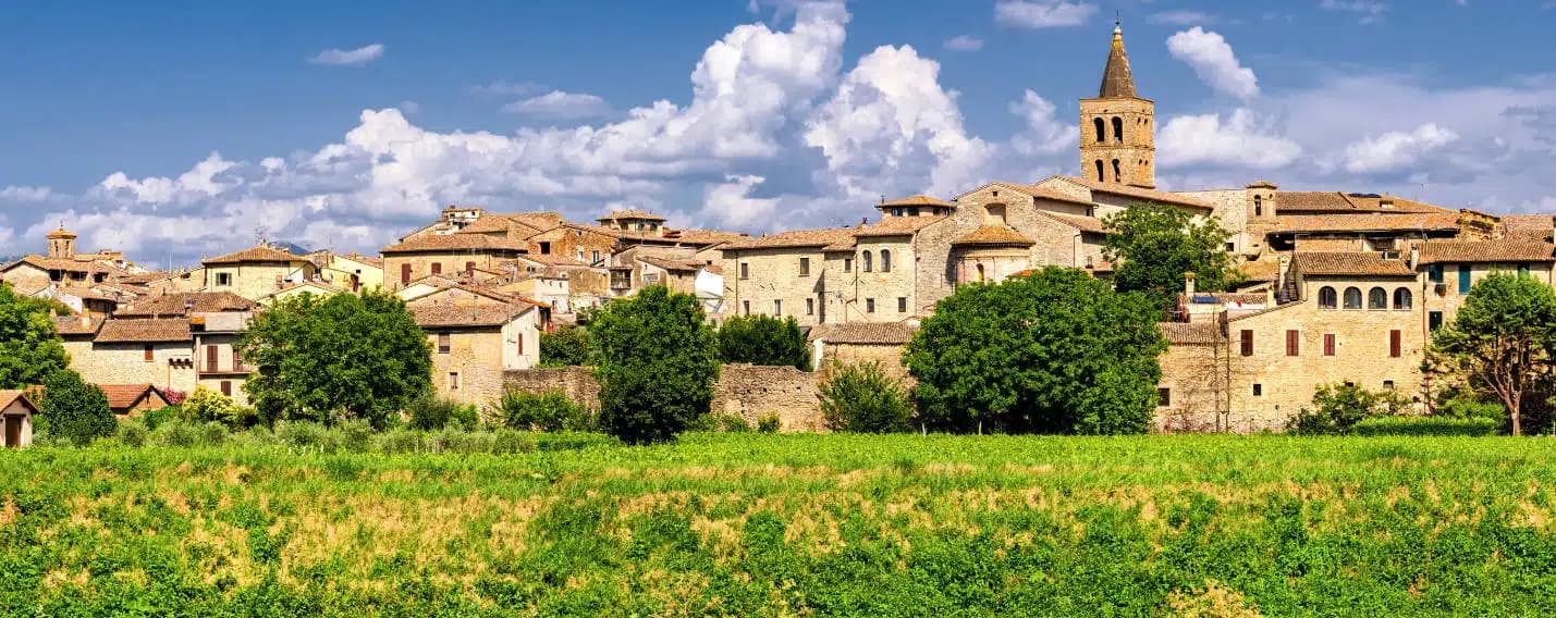
Chiesa di Santa Maria Assunta
Twelfth-century Romanesque church on the central square, renovated in neo-Gothic style 1892-1897 with terracotta pulpit and Viligiardi fresco cycle.
Chiesa di San Michele Arcangelo
Twelfth-century church, the second pole of the medieval religious layout alongside Santa Maria Assunta.
Borgo medievale
Unplastered stone houses, two surviving gates Porta del Sole and Porta della Luna, fragments of the 1275 Monaldeschi walls.
Chiesa della Madonna dell'Acqua
Small octagonal rural church from the early 1700s, built beside a spring once held to be miraculous.
Sito archeologico di Sant'Ansano
Remains of two stone and brick funerary monuments from the second century AD, on the line of the old Roman road.
The slow-trip planner
Building a trip? Find where Allerona fits in a slow Italy circuit.
Answer five questions. We will shape a geographically coherent slow trip from the 1,000 Italian towns most travelers skip. Yours to save and share.
Living here
- Population 1,688
- Commuter belti
- Pharmacy: none mapped
- High school within a 30-minute drive
- Nearest airport Rome, 2 h 21 min drive
- Regional capital Perugia, 1 h 21 min drive
Tags & datadesignations · numbers · sources
Recognised as
The numbers
- Elevation: 472 m
- Population: 1,688
- Surface area: 82.61 km²
These figures were compiled from public directories — ISTAT, OpenStreetMap, Wikidata — and from the official listings of the guides named on this page. Town details change; verify with official sources before you travel.
Close by
More towns near Allerona

San Casciano dei Bagni
Province: Siena
A hilltop borgo at 582 meters above 42 hot springs that produced the largest Etruscan bronze hoard of the last fifty years.
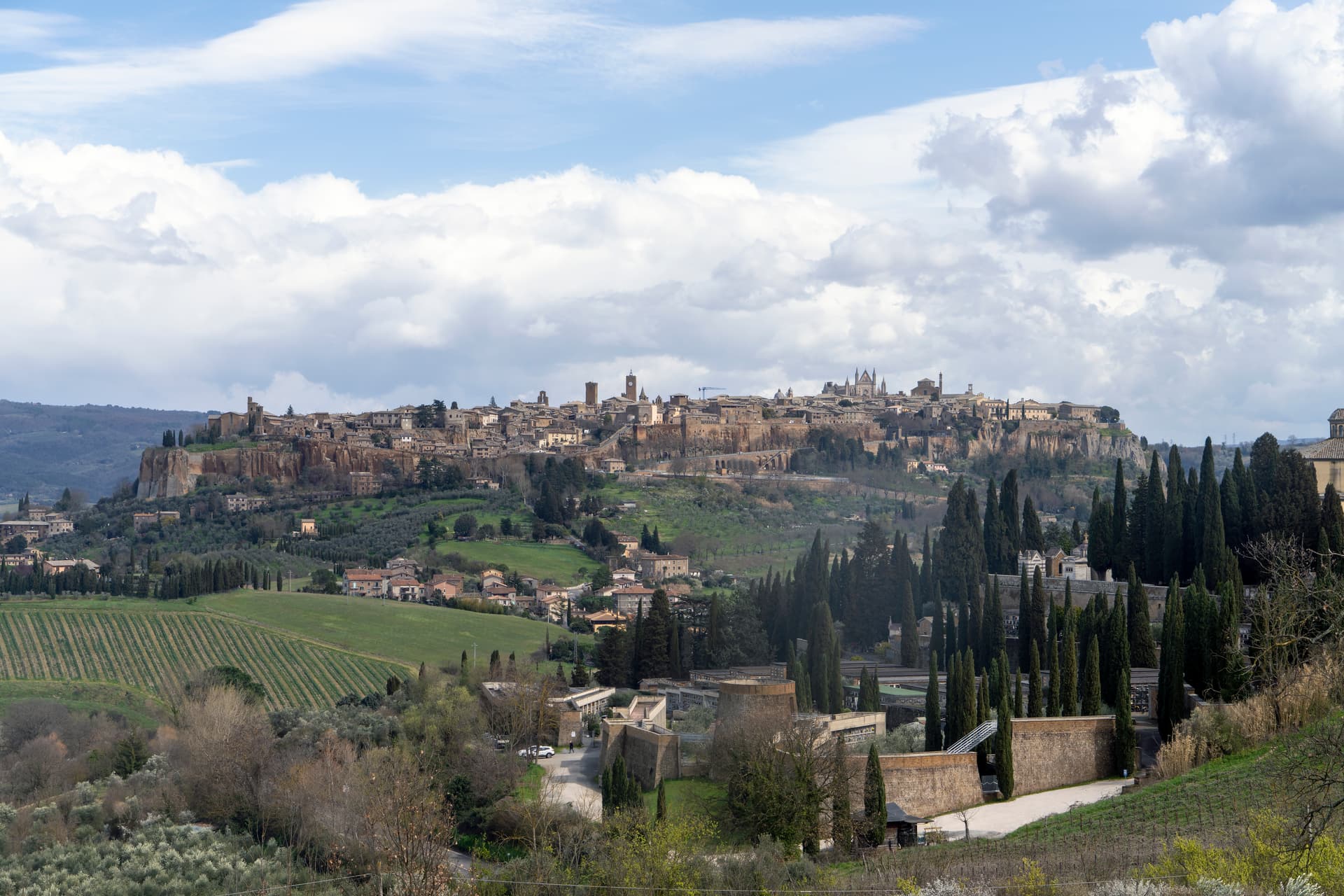
Orvieto
Province: Terni
Etruscan Velzna on a 325-meter tufa butte, the medieval refuge of popes and the home of Italy's most decorated Gothic cathedral.
Acquapendente
Province: Viterbo
The northernmost town in Lazio on the Via Francigena, at 420 meters above the Paglia, named in 964 for its waterfalls.
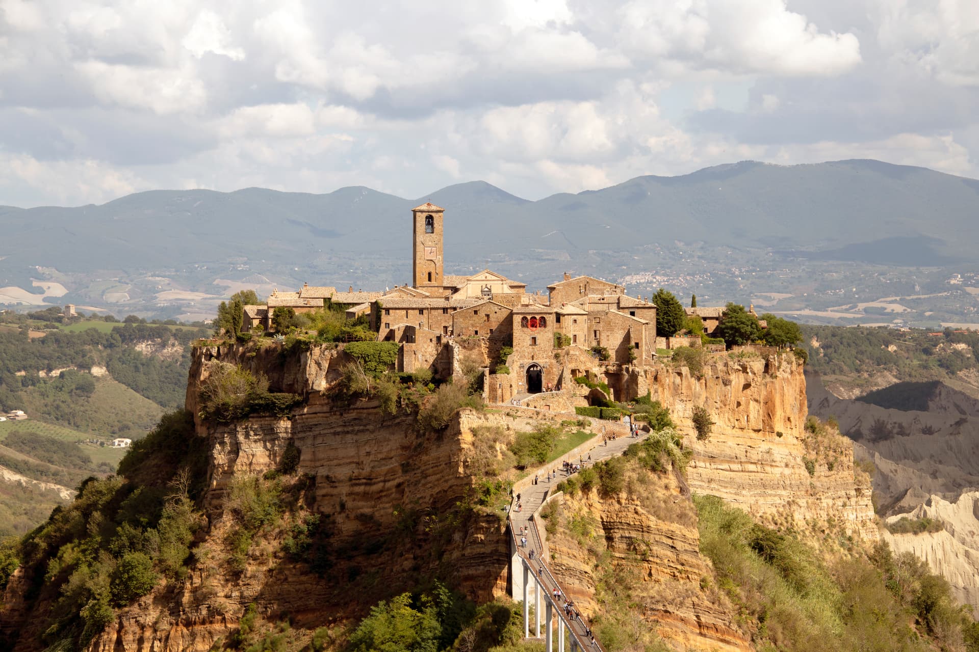
Bagnoregio
Province: Viterbo
The Etruscan-founded hill town in Tuscia whose frazione Civita di Bagnoregio sits on an eroding tuff plateau, reachable only by footbridge.
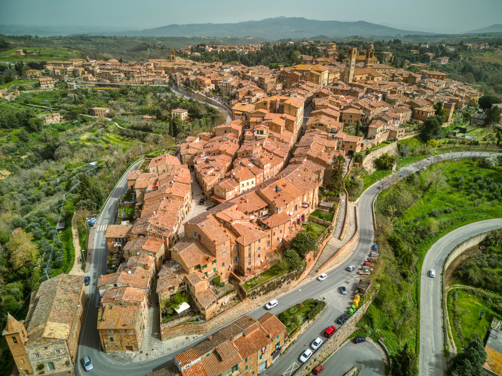
Città della Pieve
Province: Perugia
A red-brick hill town at 508 meters above the Valdichiana, the birthplace of Perugino and the home of Italy's narrowest alley.
🎨 Borghi più belli d'Italia
More Borghi più belli d'Italia towns in Umbria
Acquasparta
Province: Terni
A hill town at 350 meters above the Naia valley, where Federico Cesi convened the first Accademia dei Lincei in his Palazzo Cesi in 1603.
Arrone
Province: Terni
Medieval castle village on the left bank of the Nera at 243 meters, upstream from the largest man-made waterfall in the world.
Bettona
Province: Perugia
A hill town at 353 meters between the Topino and Chiascio rivers, the only Etruscan settlement ever built east of the Tiber.
Bevagna
Province: Perugia
Roman Mevania on the Umbrian plain at 225 meters, four medieval quarters that compete every June in a reconstructed market of the 13th century.
Castiglione del Lago
Province: Perugia
Trasimeno's western promontory, once the lake's fourth island, fortified by Federico II in 1247 and frescoed by Pomarancio for the Corgna marquises.