
Lazio · Viterbo
Bagnoregio
The Etruscan-founded hill town in Tuscia whose frazione Civita di Bagnoregio sits on an eroding tuff plateau, reachable only by footbridge.
Known for
CIVITA
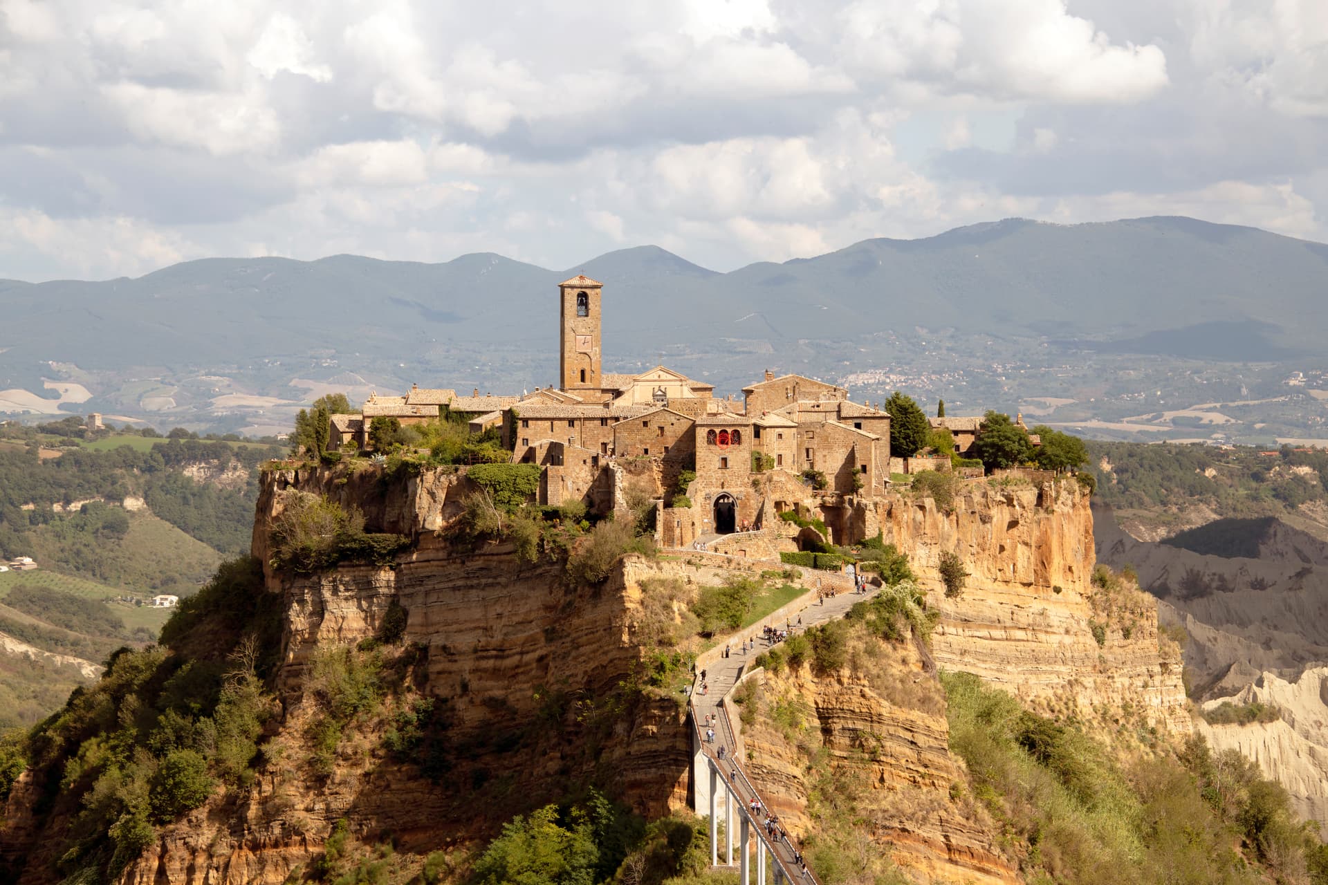
Eroding tuff-plateau frazione one kilometer east, sixteen residents, accessible only by a footbridge built in 1965.
LA CITTÀ CHE MUORE
The dying town. The plateau loses centimeters of edge each year to landslides; the 1695 earthquake started the modern collapse.
SAN BONAVENTURA
Franciscan theologian and biographer of Saint Francis, born Giovanni di Fidanza in Bagnoregio in 1221, named Doctor of the Church.
When to visit
Best · Apr–Oct
- J
- F
- M
- A
- M
- J
- J
- A
- S
- O
- N
- D
- Best
- Hot or crowded
- Quiet
- Mostly closed
The festa: Bonaventura da Bagnoregio, 15 July
Why come
Bagnoregio sits on a tuff ridge in northern Lazio, sixty kilometers from Perugia and a hundred north of Rome. The town itself is small and quiet, but it is famous for what comes next to it: Civita di Bagnoregio, the frazione one kilometer east, a separate Etruscan-founded village stranded on a tuff plateau that erodes a few centimeters every year. After the 1695 earthquake split Civita from the rest of the commune, the population emptied; today sixteen people live there year-round.
A reinforced pedestrian bridge built in 1965 is the only access. Civita is on the Borghi più belli d'Italia list and on most northern Lazio itineraries, and Bagnoregio, the larger and older town it grew out of, is where the bridge starts. Saint Bonaventure, the medieval Franciscan theologian and biographer of Saint Francis, was born here in 1221.
The Sunday letter
We haven’t written Bagnoregio’s letter yet.
One town every Sunday, with the photo, the food, the festa. Be there when this one comes up. Free, by Peter & Sophia from Pietrasanta.
By subscribing you agree to Substack’s Terms of Use, our Privacy Policy and our Information collection notice.

What to see
Ponte pedonale di Civita
Reinforced concrete pedestrian bridge built in 1965, replacing the donkey path that connected Civita to Bagnoregio after the 1695 earthquake.
Civita di Bagnoregio
Etruscan-founded frazione on an eroding tuff plateau, sixteen permanent residents, accessible only by the 1965 footbridge.
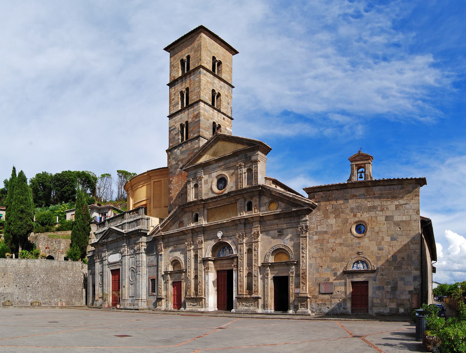
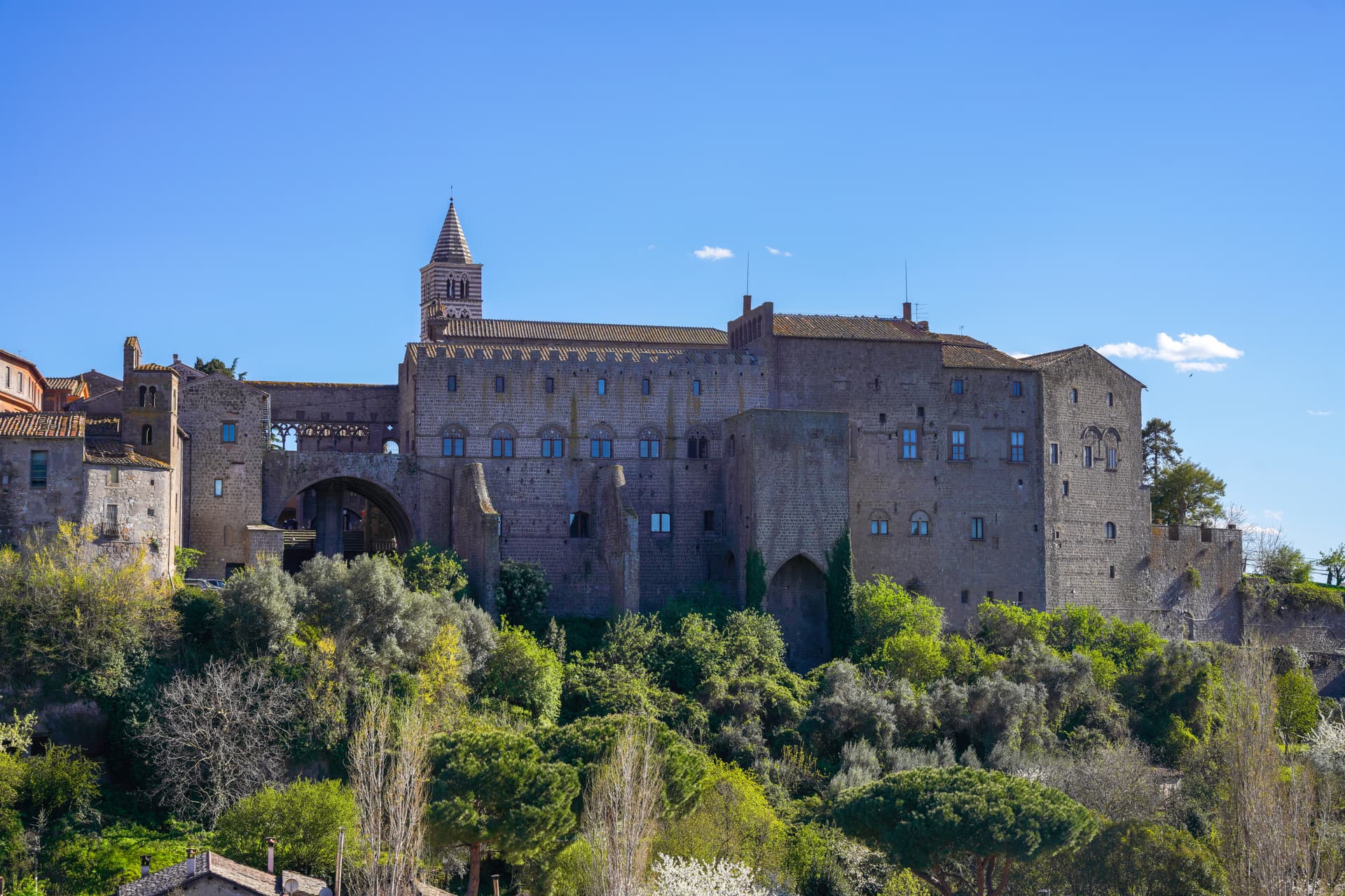
Cattedrale di San Donato (Bagnoregio)
Episcopal cathedral in the larger town, with works tied to the cult of Saint Bonaventure, born in Bagnoregio in 1221.
Valle dei Calanchi
Badland valley of eroded clay and tuff that surrounds Civita, the geological process that has been carving the plateau for two millennia.
Chiesa di San Donato (Civita)
Romanesque-Renaissance church on the small piazza of Civita, holding a fifteenth-century wooden crucifix attributed to the school of Donatello.
The slow-trip planner
Building a trip? Find where Bagnoregio fits in a slow Italy circuit.
Answer five questions. We will shape a geographically coherent slow trip from the 1,000 Italian towns most travelers skip. Yours to save and share.
Living here
- Population 3,364
- Commuter belti
- Pharmacy in town
- High school within a 30-minute drive
- Nearest airport Rome, 2 h 17 min drive
- Regional capital Roma, 1 h 42 min drive
Tags & datadesignations · numbers · sources
The numbers
- Elevation: 484 m
- Population: 3,364
- Surface area: 72.81 km²
These figures were compiled from public directories — ISTAT, OpenStreetMap, Wikidata — and from the official listings of the guides named on this page. Town details change; verify with official sources before you travel.
Close by
More towns near Bagnoregio
Bolsena
Province: Viterbo
A medieval town at 350 meters on the eastern shore of Europe's largest volcanic lake, where a Bohemian priest reported a Eucharistic miracle in 1263.
Montefiascone
Province: Viterbo
A 590-meter hill town on the southeastern rim of Lake Bolsena, the source of Est! Est!! Est!!! and a Via Francigena stop.
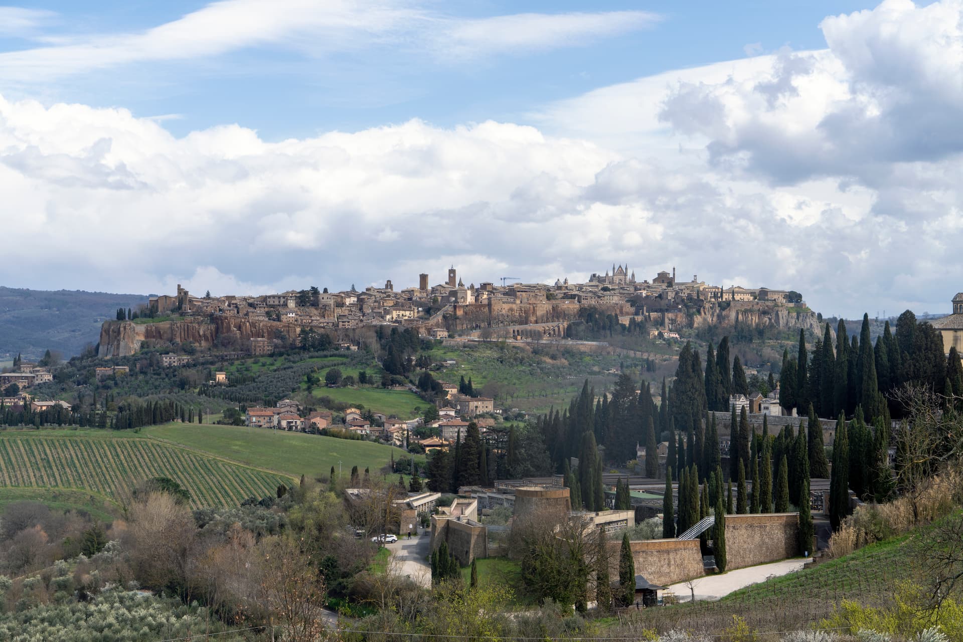
Orvieto
Province: Terni
Etruscan Velzna on a 325-meter tufa butte, the medieval refuge of popes and the home of Italy's most decorated Gothic cathedral.
Viterbo
Province: Viterbo
The medieval capital of the Tuscia, papal seat for five popes between 1257 and 1281 and home to the longest conclave in Church history.
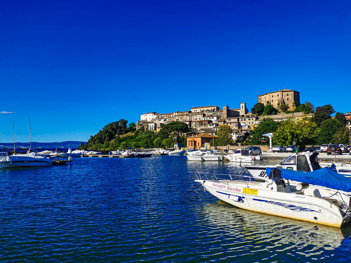
Capodimonte
Province: Viterbo
The lakefront Farnese stronghold on Lago di Bolsena — a small Tuscia borgo on a peninsula jutting into Europe's largest volcanic crater lake, with Antonio da Sangallo's octagonal Rocca Farnese, an extra-virgin olive oil tradition (Città dell'Olio), and views across the water to the inhabited Isola Bisentina.