
Umbria · Perugia
Norcia
Birthplace of San Benedetto at 604 meters on a Sibillini plateau, leveled by the 2016 earthquake and rebuilt stone by stone.
Known for
NORCINERIA
The Italian word for quality pork delicatessen comes from Norcia, after centuries of local butchers specializing in wild boar and pork curing.
SAN BENEDETTO
Born here in 480 with his twin sister Scholastica, founder of the Benedictine Order and the patron saint of Europe.
RECONSTRUCTION
Leveled by the 6.5 magnitude earthquake of 30 October 2016; the basilica reopened with original stones nine years to the day.
When to visit
Best · Apr–Oct
- J
- F
- M
- A
- M
- J
- J
- A
- S
- O
- N
- D
- Best
- Hot or crowded
- Quiet
- Mostly closed
The festa: Benedetto da Norcia, 21 March
Why come
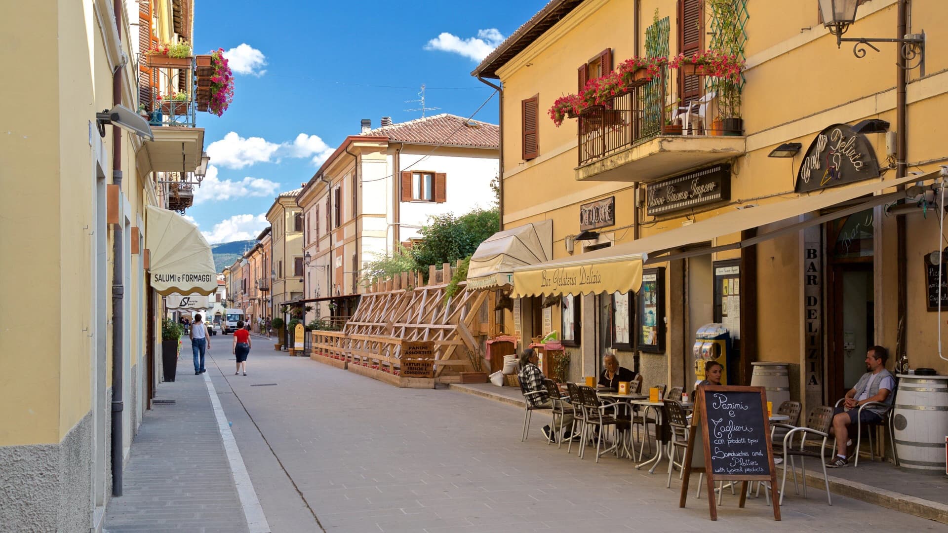
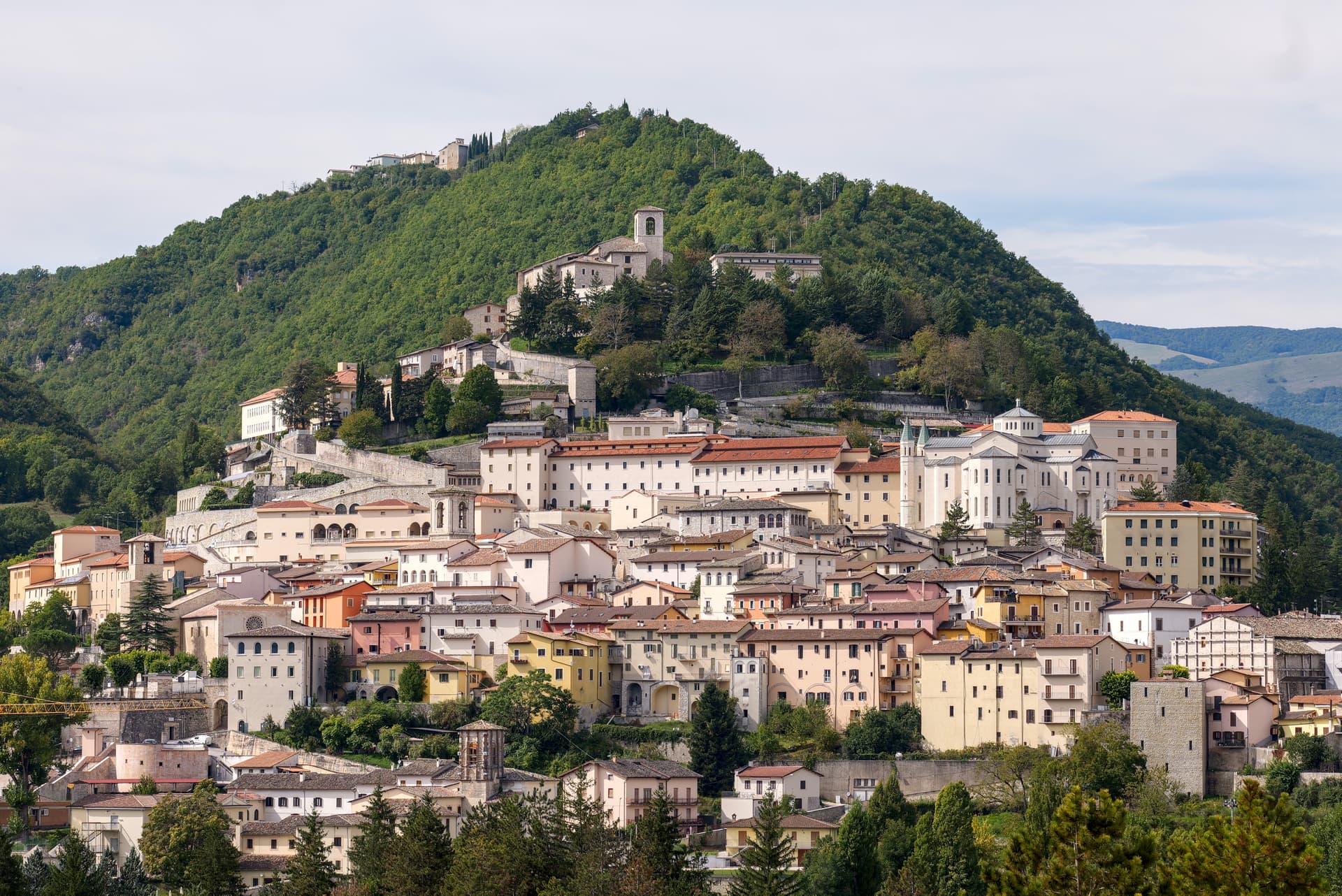
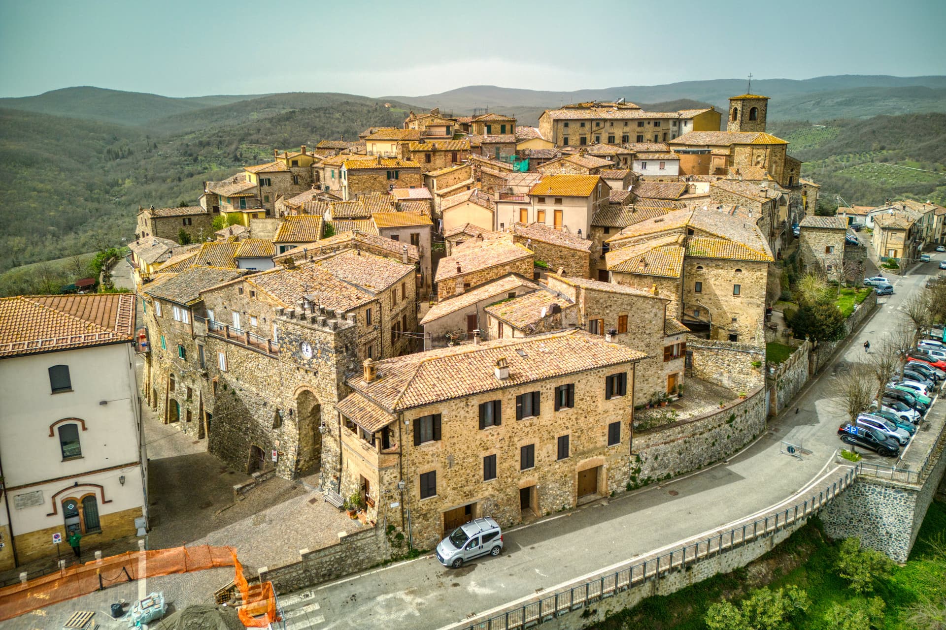
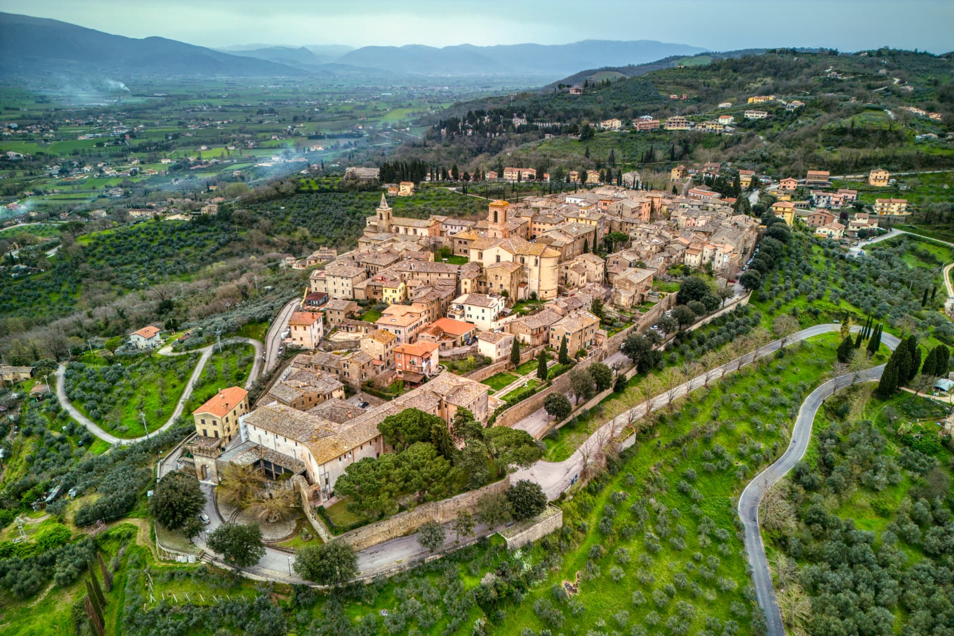
Norcia sits at 604 meters on a high plateau on the Umbrian side of the Monti Sibillini, ancient Nursia of the Sabines, fortified in the 3rd century BC by Rome. Saints Benedict and his twin sister Scholastica were born here in 480; the Benedictine Order and the Ora et Labora motto that shaped Western monasticism began on this piazza. The Basilica di San Benedetto rises on the traditional birthplace, built between 1290 and 1338 over a pre-existing crypt.
On 30 October 2016 a magnitude 6. 5 earthquake destroyed the nave; only the façade was left standing. Reconstruction completed on 30 October 2025, nine years to the day, with the original stones and earthquake-resistant technology.
The town gave its name to norcineria, the Italian word for quality pork delicatessen, after centuries of Norcia butchers specializing in wild boar and pork. Black truffle from the Valnerina, lentils from Castelluccio, and ricotta from the high pastures complete the table.
The Sunday letter
We haven’t written Norcia’s letter yet.
One town every Sunday, with the photo, the food, the festa. Be there when this one comes up. Free, by Peter & Sophia from Pietrasanta.
By subscribing you agree to Substack’s Terms of Use, our Privacy Policy and our Information collection notice.

What to see
Basilica di San Benedetto
Built 1290-1338 over the traditional birthplace of Saints Benedict and Scholastica, rebuilt with original stones after 2016, reopened 30 October 2025.
Castellina
Fortified papal stronghold designed by Jacopo Barozzi da Vignola in 1554, on Piazza San Benedetto, now the Museo Civico e Diocesano.
Piazza San Benedetto
Civic and religious heart of the centro storico, with the Palazzo Comunale, the basilica, the Castellina and the statue of Benedict at the center.
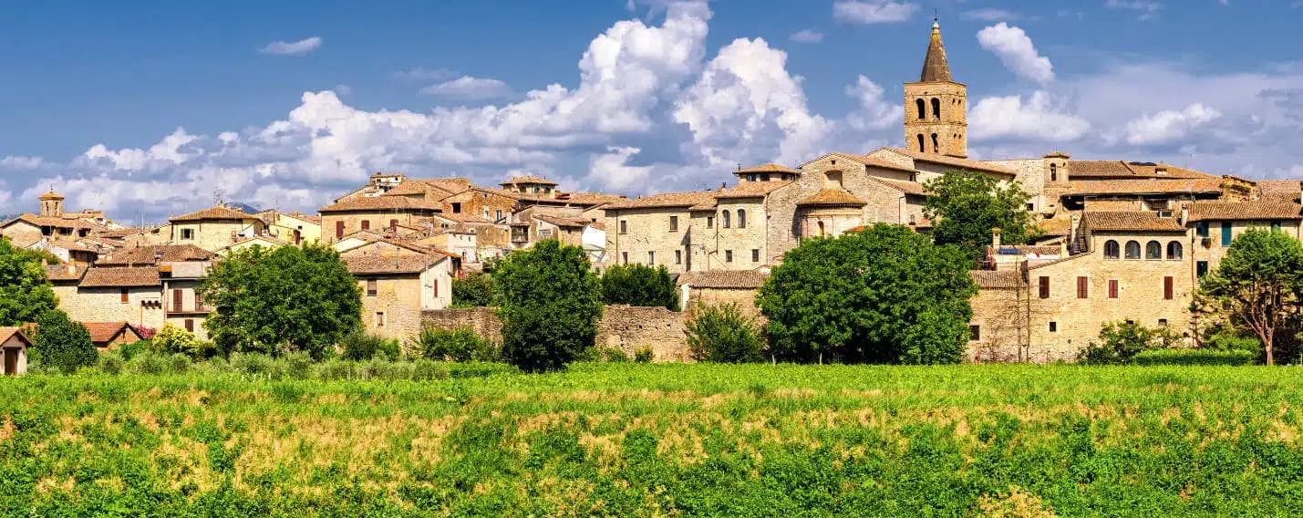
Concattedrale di Santa Maria Argentea
Sixteenth-century cathedral, severely damaged in 2016, set against the medieval city walls that still ring the centro storico.
Piana di Castelluccio
High plain at 1,452 meters in the Sibillini, frazione of Castelluccio, the lentil fields bloom red, yellow and blue from mid-June through mid-July.
Parco Nazionale dei Monti Sibillini
Norcia is a gateway commune to the national park, with hiking, transumanza pastures and the Piano Grande just east of town.
The slow-trip planner
Building a trip? Find where Norcia fits in a slow Italy circuit.
Answer five questions. We will shape a geographically coherent slow trip from the 1,000 Italian towns most travelers skip. Yours to save and share.
We recommend
Where to eat and stay
Not our picks, but places the guides put their name to — a Michelin star, a Gambero Rosso fork, a Slow Food snail, a Michelin Key for the hotels. Worth a table, a counter, or a night when you pass through.
Granaro del MonteRistorante
Granaro del Monte holds a Michelin Bib Gourmand and a place on Italy's historic-locali register.
VespasiaRistorante
Vespasia holds one Michelin star and two Gambero Rosso forks (84/100).
Casale nel ParcoAgriturismo
Casale nel Parco carries a Gambero Rosso listing.
Albergo Palazzo SenecaHotel
Albergo Palazzo Seneca holds a place on Italy's historic-locali register and a place in the Michelin hotel guide.
Signature product
Prosciutto di Norcia IGPIGP
Mountain ham cured at altitude in the Sibillini; Norcia is the namesake town and gave its name to the trade ('norcineria').
See every town in our catalogue producing Prosciutto di Norcia IGP.
Living here
- Population 4,544
- Off the beaten pathi
- Pharmacy in town
- High school within a 30-minute drive
- Nearest airport Ancona / Pescara, 2 h 17 min drive
- Regional capital Perugia, 1 h 44 min drive
Tags & datadesignations · numbers · sources
Recognised as
The numbers
- Elevation: 604 m
- Population: 4,544
- Surface area: 275.58 km²
These figures were compiled from public directories — ISTAT, OpenStreetMap, Wikidata — and from the official listings of the guides named on this page. Town details change; verify with official sources before you travel.
Close by
More towns near Norcia
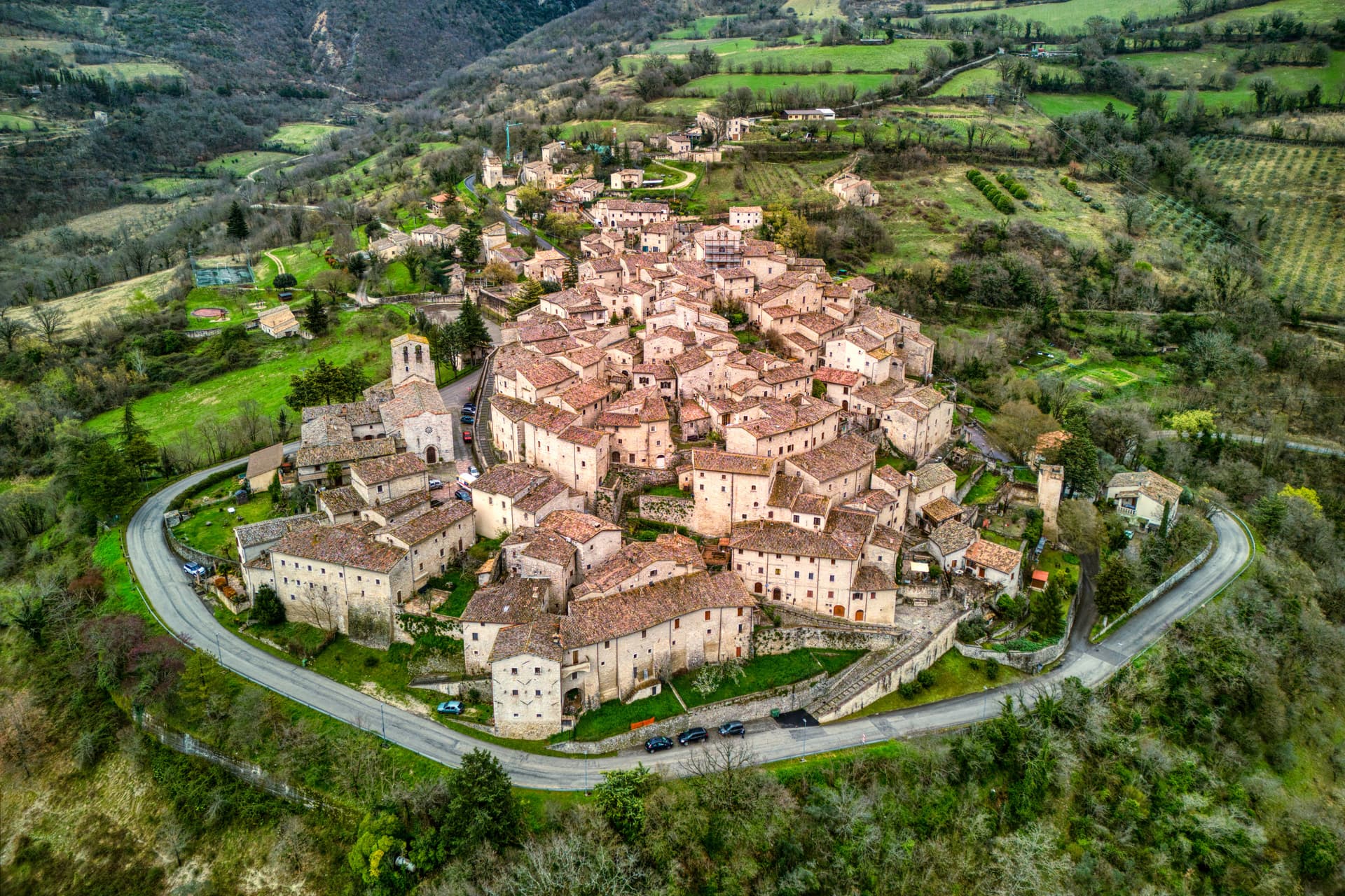
Cascia
Province: Perugia
Santa Rita's town at 653 meters in the upper Valnerina, in the seismic corner of Umbria that the 2016 earthquake reopened.

Preci
Province: Perugia
A walled Valnerina village at 596 meters that ran Europe's leading school of surgery for three centuries until the 2016 quake brought the borgo down.

Arquata del Tronto
Province: Ascoli Piceno
At 777 meters between two national parks, the Marche commune levelled by the 2016 earthquakes and still rebuilding nine years on.
Vallo di Nera
Province: Perugia
Castle village of 345 people at 467 meters in the upper Valnerina, granted by Spoleto in 1217 and barely changed since.

Monteleone di Spoleto
Province: Perugia
Where the 6th-century-BC Etruscan parade chariot now in the Met was found — a 555-resident Borghi più belli d'Italia borgo at 978m in the upper Nera valley, with a replica of the Monteleone Chariot (the original is in New York), the medieval Rocca dei Brancaleoni, and a stop on the Cammino di San Benedetto pilgrim route.
🎨 Borghi più belli d'Italia
More Borghi più belli d'Italia towns in Umbria
Acquasparta
Province: Terni
A hill town at 350 meters above the Naia valley, where Federico Cesi convened the first Accademia dei Lincei in his Palazzo Cesi in 1603.
Allerona
Province: Terni
A stone borgo at 472 meters between the Paglia valley and the Valdichiana, an Orvieto outpost whose Monaldeschi castle fell to Charles V.
Arrone
Province: Terni
Medieval castle village on the left bank of the Nera at 243 meters, upstream from the largest man-made waterfall in the world.
Bettona
Province: Perugia
A hill town at 353 meters between the Topino and Chiascio rivers, the only Etruscan settlement ever built east of the Tiber.
Bevagna
Province: Perugia
Roman Mevania on the Umbrian plain at 225 meters, four medieval quarters that compete every June in a reconstructed market of the 13th century.